About the Estels del Sud

country
Spain
length
60 km(37 mi)
Type of trail
Hut to hut, Long-distance
difficulty

Difficulty is highly personal. Be aware of the weather conditions as bad weather turns easier trails in difficult trails especially in the mountains.

Moderate
accommodation

Lodging means a mix of hotels, hostels or AirBnB’s.

Mountain huts
Elevation gain
1230 m(4035 ft)
terrain
Mountains, Forest, Hills
remoteness
Some of the time
Show more

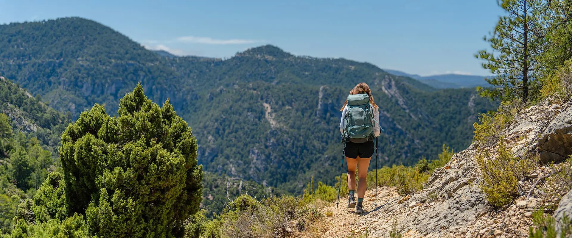
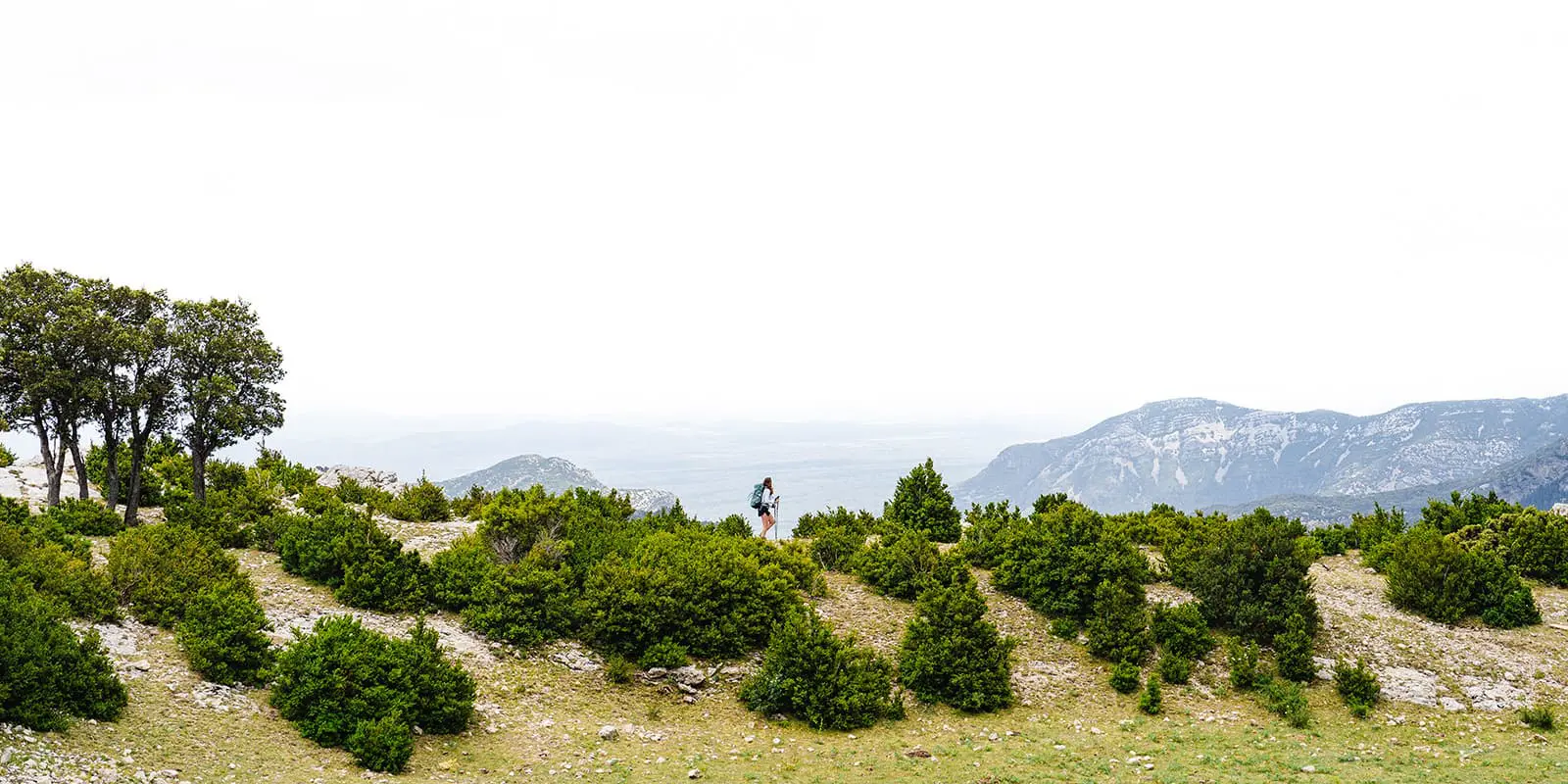
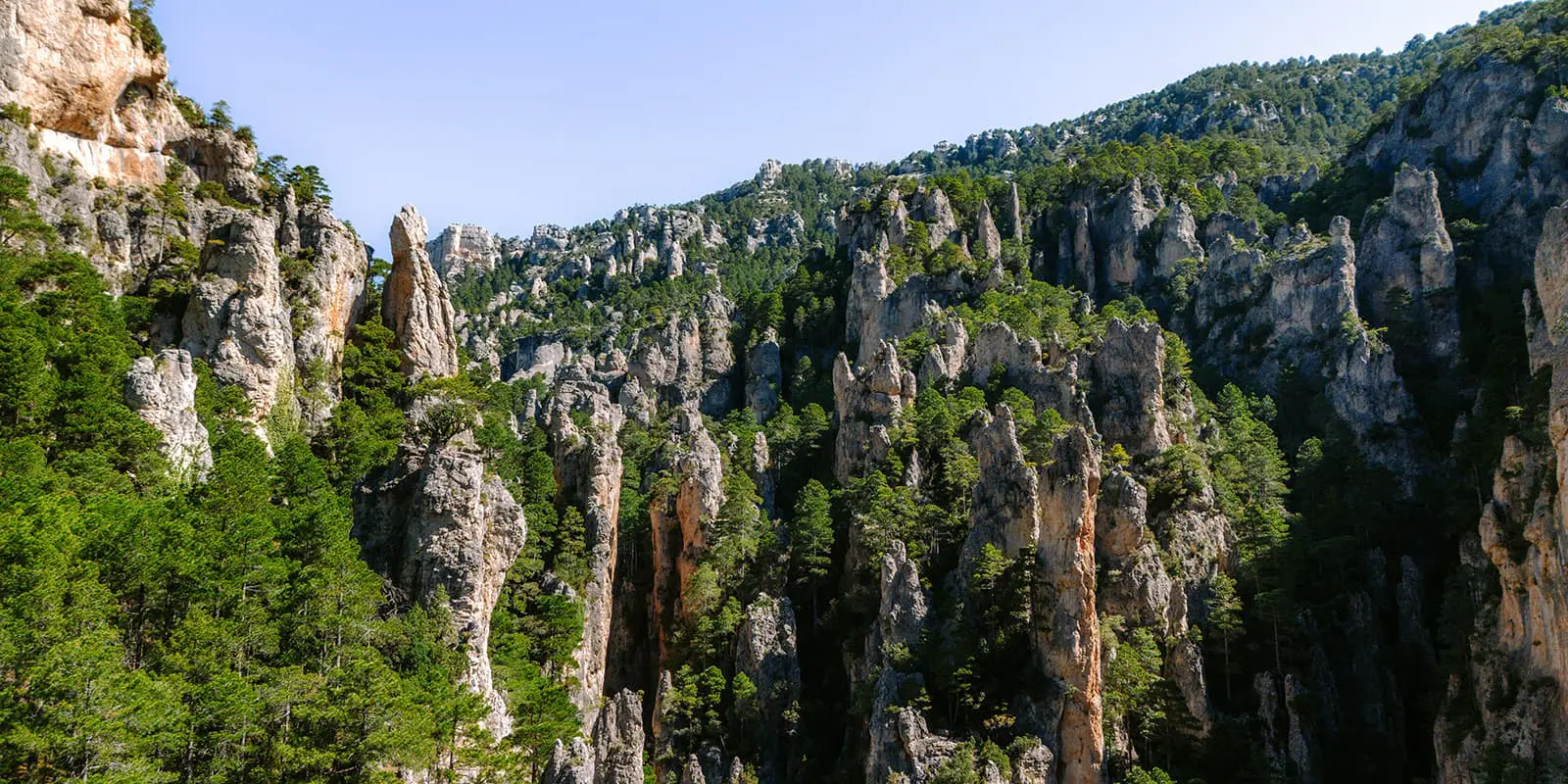
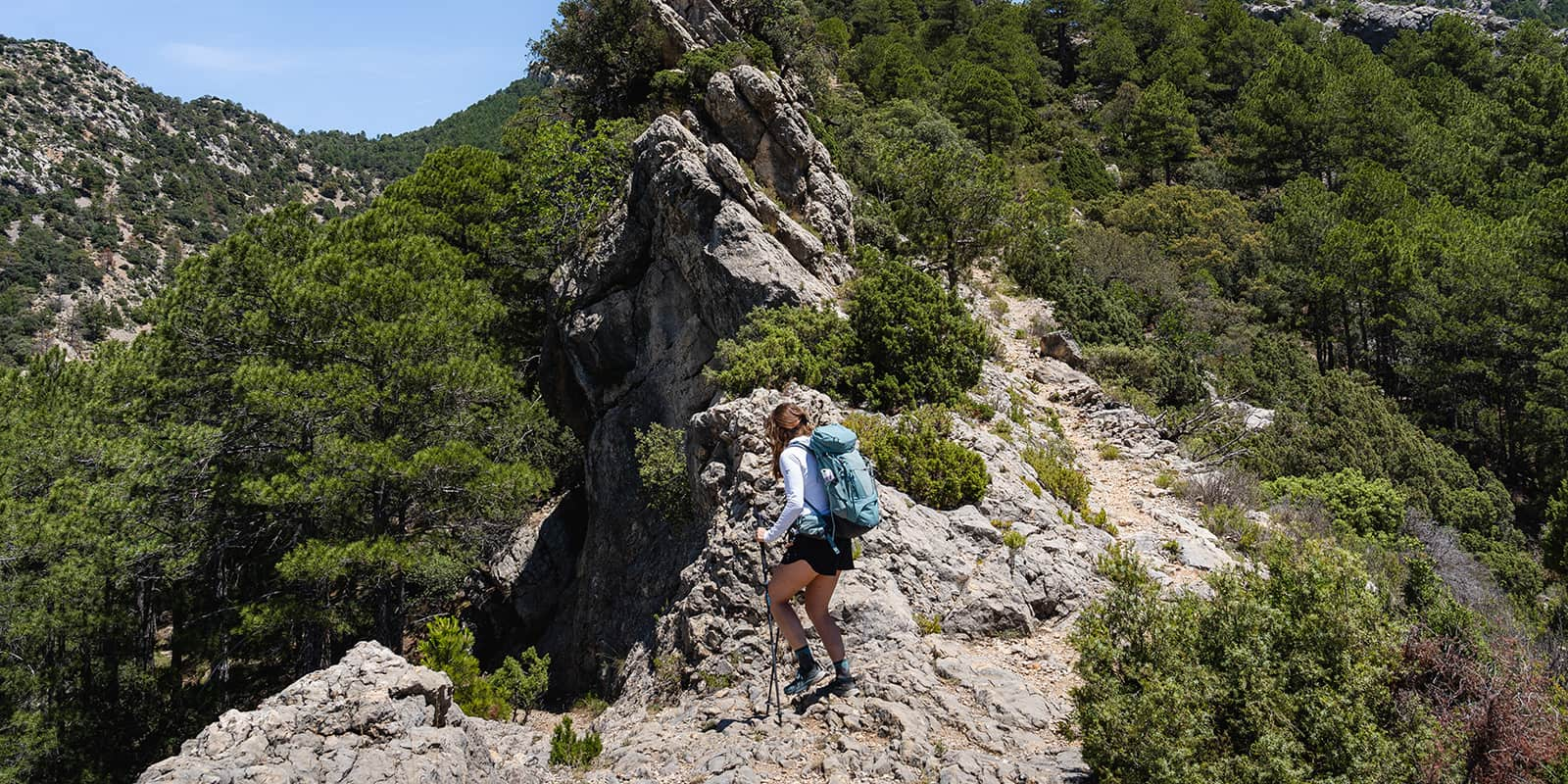
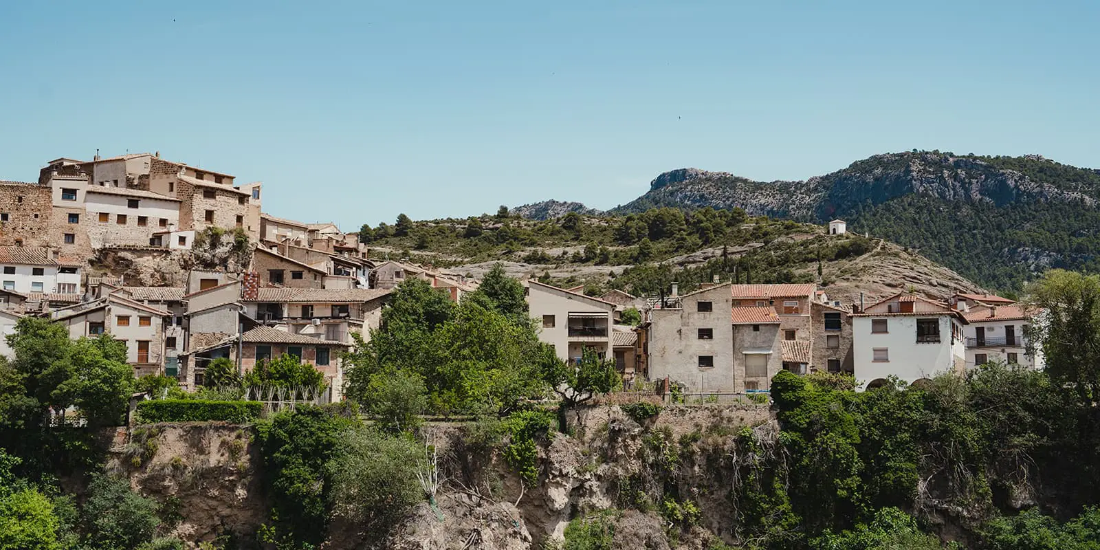
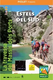
Are you looking for a real hidden gem? The Estels del Sud trail is an amazing hut-to-hut tour in ‘Massís dels Ports’ or in other words: Mountains of Els Ports. Discover one of Catalonia’s most wild and lesser-known hiking trails. The star-marked route reveals the massif’s rich scenic, natural, and cultural diversity, across different landscapes. With stages averaging 20 kilometers, this trail is challenging but really rewarding.

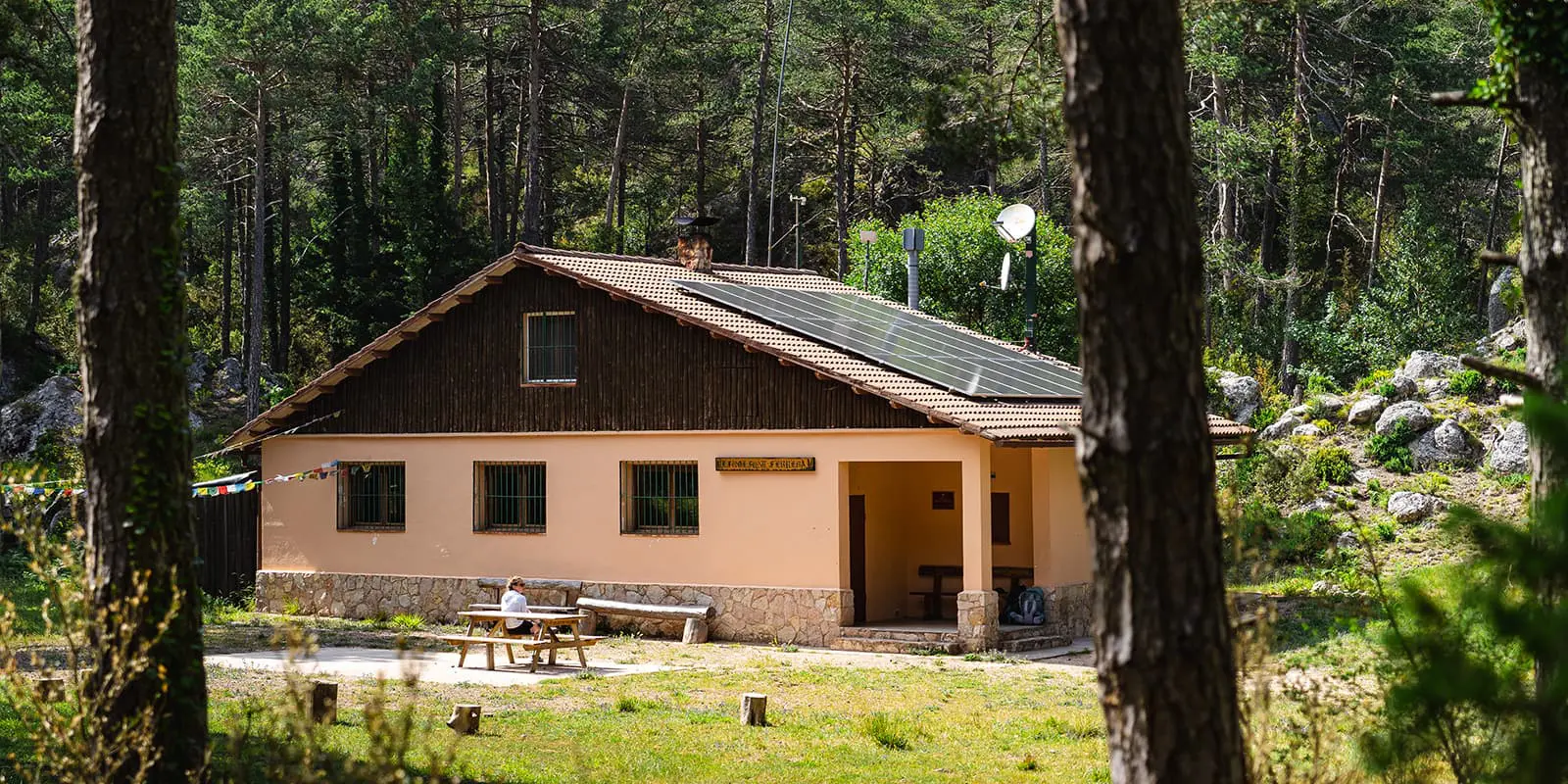
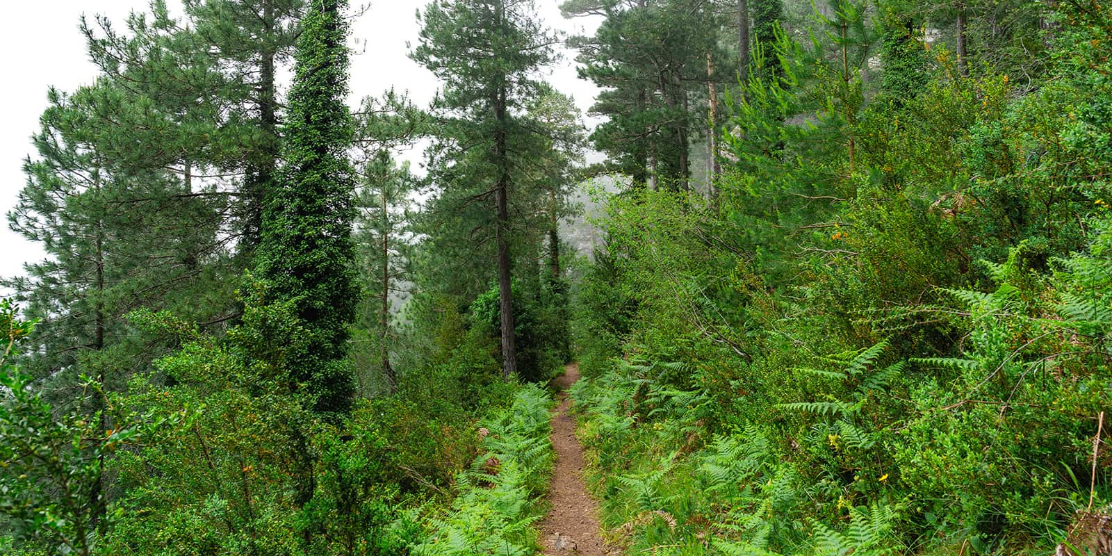
As you hike the Estels del Sud, the landscape shifts from rugged cliffs and forests to serene valleys and plateaus, offering stunning views and encounters with local wildlife like eagles and mountain goats. Each day ends at a cozy mountain hut, perfect for resting and soaking in the peaceful surroundings.

profile picture Joy Hadders
Author

Joy Hadders

Joy Hadders is a Dutchie who takes full advantage of her free days off of work to experience as much as possible in other countries. Like many others, she found her way in hiking during the lockdown and now she’s also hooked! She enjoys discovering hidden gems with her boyfriend and dreams of a fully pinned world map. You can follow Joy on Instagram @joyhadders.

View profile

The Trail

The first stage starts with a 5-kilometer walk to the entrance of El Parrizal. To enter the Ruta del Parrizal you have to pay a small fee, but it’s worth it! You will be amazed by waterfalls, crystal clear pools of water, beautiful trees and flowers, and a deep canyon. This is the most popular spot in the national park of Els Ports.

Where tourists turn around at the sign ‘end route,’ you will continue. This is the last time you’ll see (many) people during the trail. Make sure you have your GPX with you because, from this point onward, the blue star way-markers are sometimes faded or gone. Hiking poles are highly recommended for climbing some big rocks in this section. After that, you can expect a lot of dense forests and green landscapes. About 18 kilometers from Beceite, you’ll spot the hut Refugi Font Ferrera in the forest, completely remote. Moíses, the guard of the hut, will provide you with a delicious meal made from local products.

Stage two initially takes you through forested areas along a wide path. As you ascend, the terrain shifts to a mix of earth, small stones, and a lot of pine needles. You will be greeted by a lot of dangling caterpillars. There’s a point where you can summit El Negrell, but we chose to continue our route because of the long day ahead of us. This section alternates with a little climbing on mountain paths and through forests. Stunning views of many mountain tops are peaking through the trees throughout the trail.

Entering a wide area, the scenery transforms with cliff-like edges offering amazing views. If you’re really lucky, you may spot some mountain goats at the edges. After that, you will be treated to some climbs in a forest with some sub-tropical vibes. With fog, it looks a lot like Madeira. After all that climbing, the final kilometers to the hut are quite easy. Refugi Caro is beautifully located in the center of Els Ports. An extensive dinner featuring fresh soup, salads, and local dishes is the perfect end of the day. Plus, Maria is a great host.

When you leave Refugi Caro on the final day, the path is a little bit unclear. Please check your GPX or map. If you spot a path with white houses with big brown doors, you’re headed the right way. You hike through the forest, soon emerging into open areas with striking rock formations. The trail then leads through dense vegetation, where hiking poles will help navigate the ground. Ascending a ridge with charred trees and a steep, gravelly path, the landscape becomes eerily beautiful. The trail continues through a diverse mix of red sand patches and forested areas, offering glimpses of coastal-like scenery and large rock formations, like the well-known Roca Morena.

Descending through winding paths, the trail re-enters the familiar terrain of the natural park, ultimately leading back to this cute historical village of Beceite.

Stages

There are options to lengthen this trek to five days instead of the three that we’ve described here. Beyond that, there are alternative routes for as few as two days, or you can extend to four. This trek is very customizable!

Five-day alternative route:

  • Stage 1: Paüls – Arnes, 20.3 km | 12.6 mi
  • Stage 2: Arnes – Beceite, 21 km | 13 mi
  • Stage 3: Beceite – Refugi Font Ferrera, 18.3 km | 11.4 mi
  • Stage 4: Refugi Font Ferrera – Refugi Caro, 18 km | 11.2 mi
  • Stage 5: Refugi Caro – Paüls, 21.5 km | 13.4 mi

More alternatives for 2- 3- and 4-days: Refugi Caro

3-stage itinerary

Stage 1:

Beceite – Refugi Font Ferrera, 18.3 km | 11.4 mi

Stage 2:

Refugi Font Ferrera – Refugi Caro, 18.3 km | 11.4 mi

Stage 3:

Refugi Caro – Beceite, 23.4 km | 14.5 mi

Accommodations

You have to stay at mountain huts. The great thing about these stages is that all mountain huts are located on the trail. You can walk in both directions.

This trail is still, for the most part, only known among Spaniards and locals so the huts will not be fully booked quickly. It’s good to plan and book everything in advance, because for example Refugi Font Ferrera is sometimes closed on the weekend or when there’s not enough interest. Refugi Font Ferrera is completely remote and Refugi Caro is located in a little village with a hotel and restaurant next to it.

The mountain huts provide you with a nice dinner and breakfast, but bring enough of your own snacks or food on the go. You won’t encounter anything else.

Accommodations for the 5-day alternative:

Overnights for 3-day itinerary

Stage 2:

Refugi Caro

Best time of the year

The best time of the year to hike the Estels del Sud is from March through November. Keep in mind you’ll need to be prepared for multiple weather conditions. In the summertime, it can be very hot. Always check the trail conditions and weather forecasts.

Additionally, consider your hiking experience and skill level, as some parts of this trail are challenging. So bring the proper equipment with you, such as solid shoes and hiking poles.

Safety & Gear

You can reach the starting and finishing point by car. Sometimes you have to pay attention to the signs. Hiking with GPX is highly recommended. It’s possible to switch sometimes to a GR-path if necessary, the paths are doable and the signage is good.

The trail has some challenging parts, so you have to be in good condition and have some hiking experience. Hiking poles, a sun hoody, and sturdy shoes are recommended.

Good to know

You start in the small village of Beceite, which is accessible by car. You can park your car next to the tourist office for free.

There’s no clear starting point of the trail but Beceite is small and you will find the path to the Parrizal National Park easily.

You have to pay a fee to enter the Parrizal National Area. That’s important for the first stage (and beginning) of the trail. It’s best to buy a ticket in advance because there’s a possibility it’s fully booked that day. You can buy your ticket at the Beceite Town Council website.

During our trip, we didn’t encounter any other hikers, only in the second hut. In the huts, we were the only non-Spanish people. It really is a hidden gem – and that’s amazing! But that also requires the right preparation. For example: book the huts in advance, otherwise there’s a chance the hut Refugi Font Ferrera is closed.

There are only water points at the mountain huts, so prepare yourself each morning with enough water for the day.

Route
Circuit
Highest point
1220m (4002 ft)

Guidebooks

guidebook Estels del sud

Estels del Sud

View guidebook

Want to submit a trail or make this page more complete?

Comments

Be the first one to comment on this trail!

Reply to this trail

Your email address will not be published. Required fields are marked *

Reply to this trail

Log in to comment on this trail
Always read the disclaimer

Terms of Use: important to all visitors on this website. We strive to publish high quality content and information on this website. However it’s always possible that we’re missing out on some crucial information. In spite of the fact that this route, associated GPS track (GPX and maps) were prepared under diligent research by the specified contributor and/or contributors, the accuracy of such and judgement of the author is not guaranteed. Therefore, hiking-trails.com and contributors are in no way liable for personal injury, damage to personal property, or any other such situation that might happen to individuals hiking or following this route. Should you choose to hike this trail, this is always at your own risk. Check out our guidelines for safety hiking and Leave No Trace principles at the hiking 101 page.

Download GPX

Join the community!

Login or create a FREE account 😊

With an account you can:

Download GPX files

Pin trails to your wishlist

Mark trails as hiked by you

Rate hiking trails

Comment on trails, blogs and gear reviews

Happy trails!
Login

Don't have an account yet? Register here