About the Camin Reiau

Catalonia
country
Spain
length
120 km(75 mi)
Type of trail
Long-distance
difficulty

Difficulty is highly personal. Be aware of the weather conditions as bad weather turns easier trails in difficult trails especially in the mountains.

Easy
accommodation

Lodging means a mix of hotels, hostels or AirBnB’s.

Lodging, Mountain huts
Elevation gain
4491 m(14734 ft)
terrain
Mountains, Forest, Urban
remoteness
Some of the time
Show more

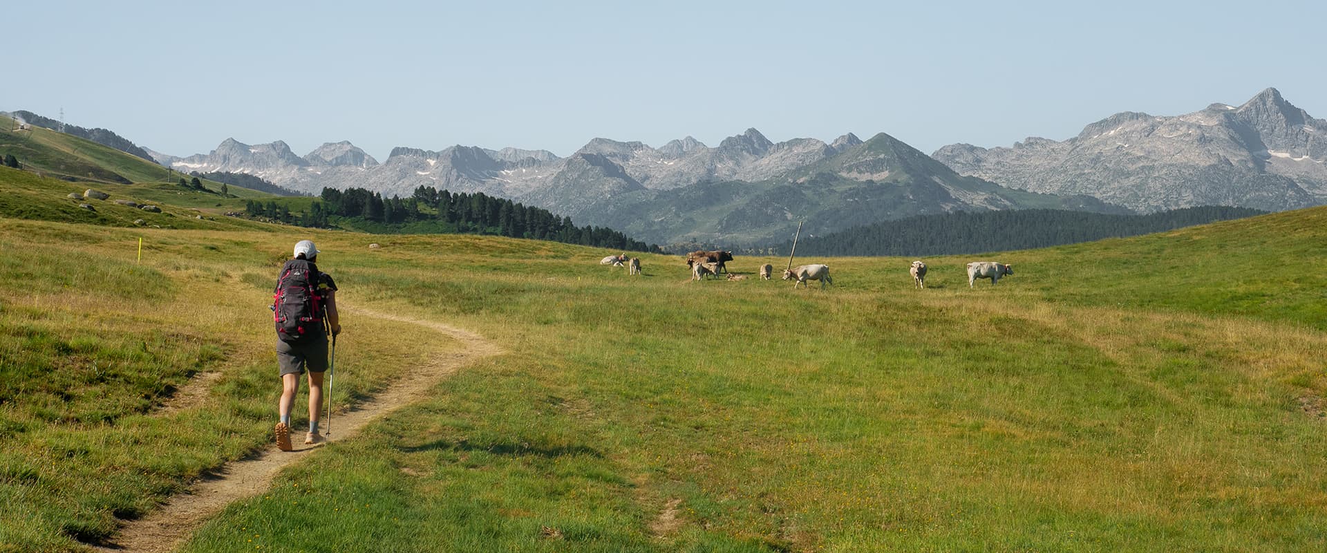
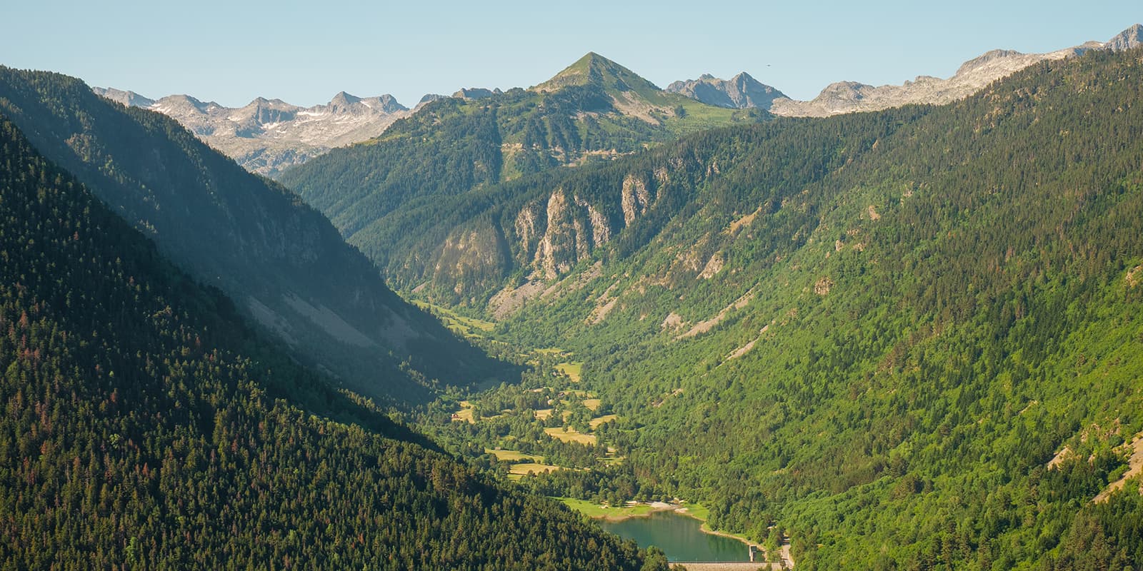
The Camin Reiau connects 33 villages over roughly 120 km of trail in the Val d’Aran region, tucked away in the Catalan Pyrenees. Following mountain paths, forest tracks, and footpaths that once linked the valley’s villages to each other, the route is a beautiful blend of nature, history, and culture.

Along the way, you’ll discover little Romanesque churches, colorful cemeteries, and traditional stone houses. Since the trail passes through 33 villages, you always have a terrace nearby for a cold drink, a restaurant for lunch, or a shop to pick up supplies, which means you don’t have to pack too much. And instead of carrying a tent, you’ll sleep in cozy hotels and mountain sanctuaries every night.

Marina Ollé Hurtado

Hey! I’m Marina, and I’m usually either out in the mountains or sharing what I’ve learned along the way.

I grew up spending loads of time in nature with my parents, so hiking has always been part of my life. Besides hiking, I’m into pretty much any excuse to be outside (rock climbing, skiing, mountain biking), which is exactly why I left Barcelona and now call Andorra home.

I didn’t do my first hut-to-hut hike until my sister talked me into Carros de Foc in 2018… and that was it! Since then, I’ve done at least one hut-to-hut hike every year, all in the Pyrenees. Even though it’s “just” one mountain range, it somehow keeps surprising me every single time. Some favourites so far have been Alta Ruta de los Perdidos and Coronallacs (I’m a huge fan of alpine lakes!), but I also love discovering quieter, lesser-known routes like Travessa dels 3 Refugis.

I already have three more hut-to-hut hikes planned in the Pyrenees for 2026… and who knows, maybe even one outside the range!

View profile

The Trail

Unlike many long-distance Pyrenean routes, the Camin Reiau is one of the most beginner-friendly multi-day hikes in the region. The stages are never too long and the terrain isn’t technical, so you’ll have plenty of time each day to explore villages and soak in the surroundings.

The first stage sets the tone for the entire route. You pass through four flower-filled villages with beautifully preserved Romanesque churches. In between the villages, the hike unwinds through hazel and spruce forests.

The second stage leaves the villages behind and heads into the mountains, just to head back to civilization in Stage 3. During this stage, you can enjoy breathtaking views over the entire valley, including the Aneto peak, the highest summit in the Pyrenees, and its glacier, the largest in the Pyrenees.

The fourth stage brings you back to Vielha, but this time following the trail on the other side of the river. Take the opportunity to stop for an ice cream or a drink before continuing through other smaller villages.

Stage 5 winds up and down through six villages, crossing meadows and dense oak forests along the way, while the sixth stage follows old miners’ paths and smugglers’ trails as the route edges closer to the French border.

Stage 7 is the longest and one of the most scenic of the entire route. You’ll discover Spain’s smallest cemetery and the Bòsc de Carlac, a breathtaking beech forest.

The eighth and final stage is a long one, bringing you back to Vielha, right where the adventure began.

Stages

There are 8 official stages on the Camin Reiau, but the shorter ones can be grouped together so you can do it in 6 days. The trail is a loop starting and ending in Vielha, the main town of Val d’Aran. If you want to extend your adventure, you can add two extra days to explore the Toran Valley, one of the wildest and less explored corners of the region.

Camin Reiau 8-stage itinerary

Stage 1:

Vielha – Salardú, 15.5 km | 9.6 mi +690 m, -410 m

Stage 2:

Salardú – Montgarri, 12.5 km | 7.7 mi +630 m, -240 m

Stage 3:

Montgarri – Arties, 16.5 km | 9 mi +290 m, -790 m

Stage 4:

Arties – Betlan, 14.4 km | 8.9 mi +380 m, -310 m

Stage 5:

Betlan – Vilamòs, 15.6 km | 9.6 mi +737 m, -689 m

Stage 6:

Vilamòs – Les, 12.2 km | 7.5 mi +186 m, -802 m

Stage 7:

Les – Bossòst, 18.3 km | 11.3 mi +966 m, -893 m

Stage 8:

Bossòst – Vielha, 18.8 km | 11.6 mi +585 m, -332 m

Accommodations

During Camin Reiau you stay mostly in hotels and B&Bs in the alpine villages along the trail. You sleep in private rooms and have your own bathroom too. All the accommodations offer half board, which means you can pack light and also taste the delicious cuisine of the region.

There is one day that you stay in a sanctuary dating back to 1119 that’s now a mountain hut. The historic sanctuary is located in the highest village of Val d’Aran, which is mostly in ruins today, giving the place a remarkably atmospheric feel. The rooms in the mountain hut are shared, as well as the bathrooms, and you sleep in bunk beds. But there is the option to request for a private room at an extra cost.

The accommodations we enjoyed the most were Hotel Tierras de Aran in Betlan (Stage 4, where we enjoyed a delicious dinner) and Hosteria Catalana in Bossòst (Stage 7, a cozy hotel with friendly staff and the best breakfast of the entire route).

Best time of the year

One of the unique advantages of the Camin Reiau is that you can hike it all year round, with some variations in winter (for example, certain paths may require adjustments due to snow). This means there is no tight seasonal window to plan around, unlike many higher-altitude mountain routes.

The best time to hike it though is from April to November. June is a particularly enjoyable time, with flowers in bloom throughout the villages, pleasant temperatures for hiking, and facilities like the public swimming pool in Salardú to cool off after Stage 1.

If you don’t like to hike in hot temperatures, avoid July and August. September and October are also excellent for quieter trails and beautiful autumn landscapes.

Safety & Gear

The Camin Reiau is not a technical trail and does not require specialist gear. Since you sleep in accommodation each night, you won’t need a tent or sleeping bag. A comfortable daypack (around 30–35L) is enough for most hikers.

That said, the mountain setting means weather can change quickly. Pack rain gear and a warm layer for cooler evenings, especially if hiking in spring or autumn. Hiking boots or trail runners with good grip are recommended for the forest and mountain paths, and walking poles are useful for the longer climbs and descents. Carry a basic first-aid kit including blister plasters and painkillers. If you’re hiking in summer, a hat or a cap and sunscreen are essential.

If you don’t want to carry your rucksack, you can organize luggage transport between stages with the trail organization.

Difficulty

This trail is one of the most beginner-friendly and most comfortable multi-day hikes in the Pyrenees. Daily distances range from 12 km to 19 km, and each day leaves enough time to explore the villages en route.

No alpine experience is required. The terrain isn’t technical, except for the additional stages to discover the Val de Toran. The ascent of this optional stage amounts to around 1000 meters in altitude and requires a good level of fitness and previous mountain experience.

There are some notable climbs along the hike. Stage 2 begins with a steady 5 km uphill from Salardú before easing off into a beautiful valley walk. Stage 5 features the toughest climb of the route: a steep ascent through a hazel forest to reach Vilamòs. Stage 7 is the longest stage and includes one big climb before the final descent into Bossòst. These are challenging stretches but not dangerous, and you’ll see that the rewards (views, forests, villages) more than make up for the effort.

Good to know

The Camin Reiau route starts and ends in Vielha, the main town of the Val d’Aran. Vielha is conveniently accessible by bus from Barcelona, making it easy to reach without a car.

Because it’s a circular route, you don’t need to arrange any return transport. You simply walk back to where you started.

Food

Because you’re never too far from a village, you can plan to eat out for most meals rather than cooking or carrying much food. There are supermarkets or small shops in the villages and towns along the way, often closing on Sundays and during midday.

Breakfasts in the accommodations are often very complete, with fruit, eggs, bread, cured meats, coffee, etc. and served between 8 and 10 am. You can eat lunch at a restaurant in the villages along the way (usually open from 1 to 3 pm) or buy something at a supermarket before starting the day’s hike. There are no shops in Montgarri, but the hut serves lunches and other food. Dinners are usually served at around 8 pm and restaurants are usually open from 8 to 10 pm.

Sometimes, the schedules on Google Maps are not up to date. You might find some restaurants or grocery shops closed even though it says they are open. This happens especially in the low season (spring and autumn), so it’s worth packing some snacks.

Extra activities

Because the stages are short, you’ll typically arrive in the overnight village during the afternoon, leaving you with plenty of time to stroll through the streets, visit a local church, sit on a terrace, or enjoy an activity before dinner. This is one of the things that makes the Camin Reiau feel like much more than just a hike.

Some of the things you can do:

  • Salardú (Stage 1): After the first day on the trail, the public swimming pool in Salardú is a great way to cool off and stretch out tired legs.
  • Les (Stage 6): Les is famous for its thermal waters. After a full day of hiking, you can treat yourself to a spa session here to relax before the final two stages.

Navigating

The Camin Reiau is well signposted. The route largely follows the GR 211, marked with the classic red and white stripes of the Gran Recorrido (long-distance trail) network.

In some sections, you’ll also encounter local PR (Pequeño Recorrido) trails, marked with yellow and white stripes or valley-specific signs.

At trail junctions and at the entrance to each of the 33 villages, you’ll find wooden signposts and information panels with directional markings, so it’s generally easy to stay on track.

Still, it’s always recommended to carry the GPX on your phone as a backup. Don’t forget to download it before setting off. While navigating, you can use flight mode or low-power mode to save battery.

Money

You don’t need much cash on the trail as most hotels, restaurants, and even the mountain hut accept bank cards.


route
circuit
highest point
1,878 m (6,161 ft)

Want to submit a trail or make this page more complete?

Always read the disclaimer

Terms of Use: important to all visitors on this website. We strive to publish high quality content and information on this website. However it’s always possible that we’re missing out on some crucial information. In spite of the fact that this route, associated GPS track (GPX and maps) were prepared under diligent research by the specified contributor and/or contributors, the accuracy of such and judgement of the author is not guaranteed. Therefore, hiking-trails.com and contributors are in no way liable for personal injury, damage to personal property, or any other such situation that might happen to individuals hiking or following this route. Should you choose to hike this trail, this is always at your own risk. Check out our guidelines for safety hiking and Leave No Trace principles at the hiking 101 page.

Download GPX

Join the community!

Login or create a FREE account 😊

With an account you can:

Download GPX files

Pin trails to your wishlist

Mark trails as hiked by you

Rate hiking trails

Comment on trails, blogs and gear reviews

Happy trails!
Login

Don't have an account yet? Register here