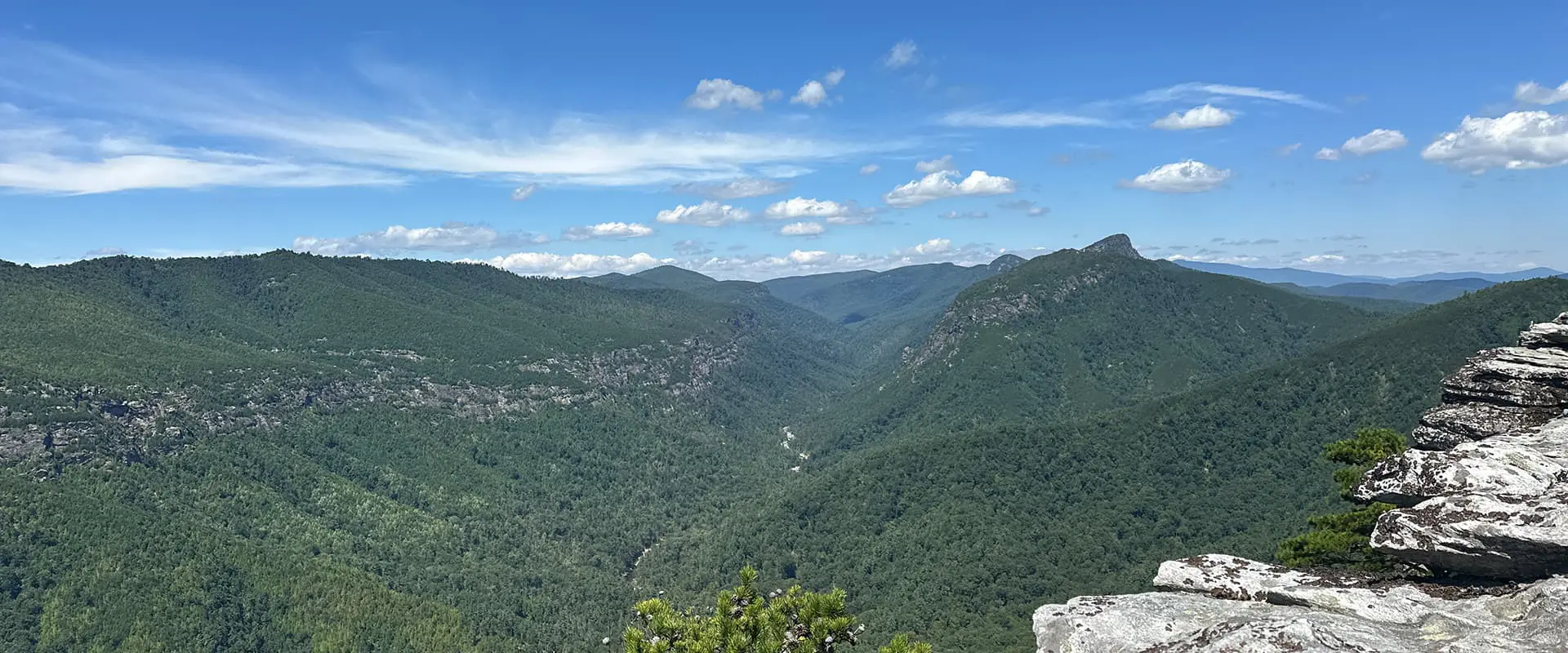
panoramic view of Linville Gorge Wilderness Area

Linville Gorge ITAYG

Is That All You Got?

About the Linville Gorge ITAYG

country
United States
length
36 km(22 mi)
Type of trail
Long-distance
difficulty

Difficulty is highly personal. Be aware of the weather conditions as bad weather turns easier trails in difficult trails especially in the mountains.

Difficult, Strenuous
accommodation

Lodging means a mix of hotels, hostels or AirBnB’s.

Wild camping
Elevation gain
1565 m(5135 ft)
terrain
Mountains, Forest
remoteness
All the time
Show more

Located in the Pisgah National Forest of western North Carolina, the Linville Gorge Wilderness is a rugged and wild area that draws the allure of hikers, rock climbers, fishermen, hunters and kayakers alike. 

Known as the “Grand Canyon of the East,” the Linville Gorge is one of the deepest gorges east of the Mississippi River at 2,000 feet deep (610m) and encompassing nearly 12,000 acres of virgin, old growth forest. Over millennia, the Linville River has carved through hard, quartzite rock leaving numerous rock formations, waterfalls and cliffs to explore. Nicknamed the ITAYG, or “Is That All You Got,” the trail highlights the beauty of the southern half of the gorge in a 22 mile loop.

Matthew Howard profile pic

Matthew Howard

Originally from North Carolina, Matthew “Tall Joe” Howard now lives in the Netherlands. He grew up car camping with his family in the mountains of North Carolina. Then in 2009 he purchased his first hiking backpack, a REI Flash 65, and from that day on was hooked. He has since gone on to hike over 8,000 miles completing thru-hikes of the Appalachian Trail (2012), Camino de Santiago (2017), Pacific Crest Trail (2017) and numerous “shorter” hikes from the TMB, AV1, WHW, Four Pass Loop, and multi-day hikes in the Grand Canyon.

“The best thing about long-distance hiking is the absolute freedom – the only things that really matter are where you’re going to sleep, where the next water source is, how many miles that day and where’s my next resupply.” These days he loves exploring classic European trails and staying connected to the hiking community through his blog and gear planning app.

@talljoehikes
talljoehikes.com
treklist.co

View profile

The Trail

You’ll begin at the Spence Ridge trailhead before descending towards the Linville River following the Spence Ridge trail. On your way down, you’ll pass a few forested campsites and creek crossings.

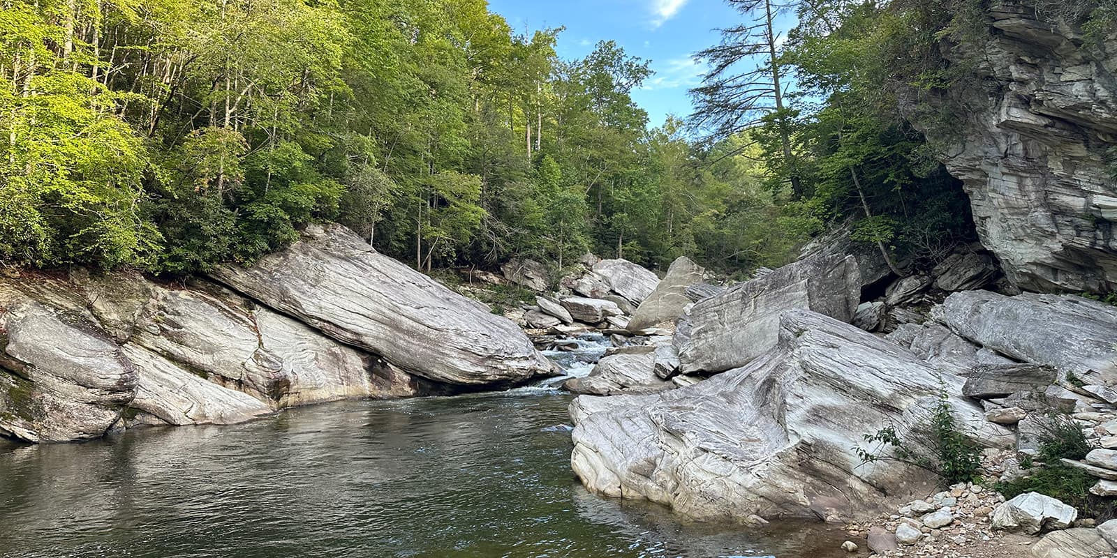
The river has numerous large boulders here, a nice area to take advantage of the sun above while cooling off in a swimming hole or enjoying lunch. Once there was a bridge here, but it was washed away in the spring of 2013 and there are no plans to rebuild it. Downstream from the 2 largest boulders, you may be able to rock hop across while the river is at lower flow. However, it is safer to remove your shoes, and wade through knee deep water for the first section before finishing the crossing along the remaining boulders.

Shoes back on, turn left (south) along the Linville Gorge Trail (LGT). Shortly, you will come to a view point of the 50 foot (15m) Cathedral Falls dropping from the east side of the gorge. Continuing on further, the trail varies from packed dirt, roots and rock scrambles. Along the LGT, you’ll pass numerous spur trails on your right, campsites along the river and streams to fill up your water bottles. As the ITAYG trail is a loop trail, the spur trails on the west rim are all possible starting points. However, keep in mind you’ll be adding bonus miles and a steep ascent to finish your hike if you choose to begin from any of them.

For the most part, this section of the trail is not too difficult as you slowly descend with the river occasionally leaving the banks before returning. Along the southern side at mile 7.5 (km 12) you’ll reach the Leadmine trail that climbs away from the river before crossing over the junction of the Pinnacle trail and joining the white circle blazed Mountains to Sea trail (MST).

You’ll continue through the forest with the occasional short and steep climb, a couple wooden bridges and a few rock hops over streams. If you haven’t already found your perfect campsite, there is a good one at mile 9.5 (km 15.3). It is a relatively large campsite that can accommodate a couple of tents on the right side of the trail. Directly across, a view through the trees of tomorrow’s challenge, the southern face of Shortoff Mountain. It is a dry camp so you’ll need to pack out water from your last stream crossing.

The next day, you’ll continue southward crossing a forest road as the trail turns east again towards the river. This river crossing is completely different from the first – a much wider and generally shallow crossing, although river events do change the landscape periodically. Again shoes off, look for the large white circle nailed to a tree on the other side. This is the continuation of the MST and your target as you cross the river.


On the other side, you’ll follow the MST along a ridgeline while ascending 1600 feet (468m) up. It’s a good idea to pack an extra liter of water as this ridge can be very hot in the summer. At the signed junction, head left towards Shortoff Mountain. After not too long, you’re given an optional side trail that flanks the edge of the cliffs known as the Olson Trail. This is a great variant, but do keep in mind that there are a few exposed sections with steep drop-offs. As you reconnect with the main trail, you’ll come to the Gully Pipe, a reliable piped spring worth topping off at.

As you reach the southern summit of Shortoff, there are ample camping opportunities, some of which are within feet of the rim. A nice but sometimes busier area to set up for the night due to its accessibility to the trailhead at Wolfpit road.

The next section of trail can feel exciting and monotonous at the same time. The trail is relatively flat with the occasional rock outcropping. You’ll pass a seasonal pond on your left and on your right a spur trail that leads to another spring known as Water Tree.

At the northern side of Shortoff, the trail drops into Chimney Gap, where a few opportunities for campsites can be found along with 2 springs on spur trails to the left. If you’ve made it this far on day 2, it’s worth topping up your bottles for the night and climbing up to the southern side of the Chimneys for some excellent campsites.

Atop the next climb there are a couple of spur trails to the left that drop down to the Amphitheater; it is a beautiful and unique view into the gorge. This vantage point really gives you the feeling of being “in” the gorge. These trails are however seasonally closed due to Peregrine Falcon nesting and will be marked as so. Please respect those closures.

The next morning, the trail finishes with what is considered the highlight of the route with a scramble across the rock outcroppings known as “The Chimneys,” offering 360 degree views into the Appalachian Mountains. Shortly before the (currently closed) Table Rock parking lot, there is another wide open space on the left with room for a lot of tents. After crossing the parking lot and continuing a bit further, you’ll arrive at the optional spur trail to summit Table Rock Mountain 3,940 feet (1,200 meters).

To finish up the loop, you can then descend on the Little Table Rock Gap trail back to the trailhead at Spence Ridge to complete the loop.

Stages

As the trail is a loop with multiple access points, you can customize this trip into any variation that you like. Most people will hike it in 3 days but some may want to take it slower and others have been known to do it as a day hike.

A popular starting point is also Wolfpit Road. However, the parking is limited, overcrowding occurs and part of the road is on private property. The local residents have had issues with disrespectful visitors. Distances are approximate.

Linville Gorge 3-stage itinerary

Stage 1:

Spence Ridge Trailhead – Campsite along Linville River, 15.3 km | 9.5 mi 

Stage 2:

Campsite along Linville River – Campsite south of the Chimneys, 15.8 km | 9.8 mi

Stage 3:

Campsite south of the Chimneys – Spence Ridge Trailhead, 5 km | 3 mi

Accommodations

The trail is for wild camping only as there are no established campsites, tent pads or facilities with the exception of the USFS maintained pit toilets at Table Rock parking lot.

Best time of the year

This trail can be hiked in all seasons, ranging from deep snow after a winter storm to the very hot months of July and August. Although it is possible to hike the trail any day of the year, the fall and spring tend to be the best. The air temperature is generally cooler, permits are not required for overnight camping and it is less crowded. In the fall, the beautiful tree colors rise while in the spring the fresh trees awaken and the popular daffodils at daffodil flats are in bloom.

Safety & Gear

The Linville Gorge is home to the Timber Rattlesnake and Copperhead. Both of which are venomous and can easily ruin your hike. Black bears are also present. Store your food in a Bear Vault container or properly hang it while camping. It’s advised not to leave your campsite unattended.

River crossings can be dangerous at higher levels. Check water levels before you head out and keep in mind that large storms will raise the level a day or two after the storm. Be especially cautious during high levels at the Spence Ridge crossing. The southern crossing can be avoided by continuing further south to the road and crossing the bridge there.

For navigation, a GPX device or downloaded maps on your phone are highly recommended as a lot of the trail is unmarked.

Trekking poles and water/camp shoes are very useful for crossing the river.

Difficulty

The ITAYG is a difficult trail. It involves significant elevation gain, two river crossings, optional steep cliffside hiking and is very remote especially within the gorge along the east rim. Hikers should be self sufficient and able to self rescue in the event of an emergency. Cell service especially deep in the gorge is non-existent.

Good to know

Permit is needed on weekends from May through October. Unless restrictions are in place, campfires are permitted. It is essential to completely put out the fire with ample water prior to leaving camp.

route
Loop
highest point
1198M (3930 FT) - Table Rock Summit

Want to submit a trail or make this page more complete?

Always read the disclaimer

Terms of Use: important to all visitors on this website. We strive to publish high quality content and information on this website. However it’s always possible that we’re missing out on some crucial information. In spite of the fact that this route, associated GPS track (GPX and maps) were prepared under diligent research by the specified contributor and/or contributors, the accuracy of such and judgement of the author is not guaranteed. Therefore, hiking-trails.com and contributors are in no way liable for personal injury, damage to personal property, or any other such situation that might happen to individuals hiking or following this route. Should you choose to hike this trail, this is always at your own risk. Check out our guidelines for safety hiking and Leave No Trace principles at the hiking 101 page.

Download GPX

Join the community!

Login or create a FREE account 😊

With an account you can:

Download GPX files

Pin trails to your wishlist

Mark trails as hiked by you

Rate hiking trails

Comment on trails, blogs and gear reviews

Happy trails!
Login

Don't have an account yet? Register here