About the Nomia Trail

country
Greece
length
62 km(39 mi)
Type of trail
Long-distance
difficulty

Difficulty is highly personal. Be aware of the weather conditions as bad weather turns easier trails in difficult trails especially in the mountains.

Moderate, Difficult
accommodation

Lodging means a mix of hotels, hostels or AirBnB’s.

Lodging
Elevation gain
4310 m(14140 ft)
terrain
Mountains, Forest
remoteness
Some of the time
Show more

The Nomia Trail is a four-day hiking route crossing part of the Parnon Mountain Range in the eastern Peloponnese. The trail connects 7 traditional villages while moving through a variety of landscapes: streams and gorges, fir forests, old agricultural terraces, and higher alpine terrain along the ridge.

The route itself follows old paths that were traditionally used by shepherds and villagers moving between settlements and seasonal grazing areas. Many of these routes have been in use since ancient times. The mountains of Arcadia have long inspired Greek mythology and pastoral stories, and according to local tradition, Nomia was a mountain nymph associated with these landscapes. Walking the Nomia Trail means rediscovering these connections between villages, landscapes, and local culture.

Ofri Ben zvi profile picture

Ofri Ben Zvi

Ofri Ben Zvi has always felt at home in the outdoors, spending his free time hiking, climbing, trail running, and camping. With a degree in geophysics and years of experience in informal education, he brings together a love of nature, learning, and people. Today, he runs a travel company in Greece focused on creating meaningful experiences that connect nature, culture, and local communities. You are welcome to contact him at @Nomiaexperience

View profile

The Trail

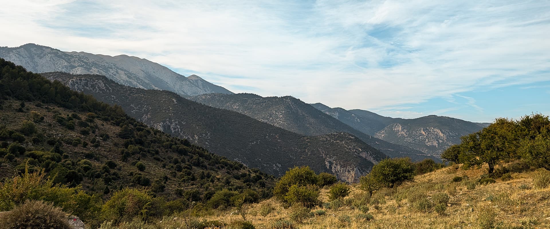
Mount Parnon (also known as Parnonas) is one of the most ecologically important mountain ranges in Greece. More than fifteen different habitat types exist there, supporting a large variety of plants and wildlife. Over eighty rare plant species have been recorded in the area, including several that are endemic to the Parnon. The forests are particularly diverse, with pine, fir, chestnut, oak, and plane trees. Much of the mountain is protected within the Natura 2000 network.

The first stage begins in the mountain village of Kosmas and follows old footpaths descending through small valleys and along seasonal streams. Sections of stone paving and old retaining walls show how these paths were once maintained and widely used. Along the way, the tower of Glyppia appears in the distance, standing out as a landmark in the landscape. The route alternates between shaded sections near water and more open terrain with views toward the surrounding mountains. The day ends in the village of Agios Vasilios, a small rural settlement surrounded by farmland and forested slopes.

The second stage begins with a walk through a dense Greek fir forest, typical of the higher parts of Parnon. The trail then reaches the historic village of Prastos, which once played an important role in the region as the capital of the Tsakonian region. From there, the route continues toward Mazia Gorge, a good place for a short rest before the final climb of the day.

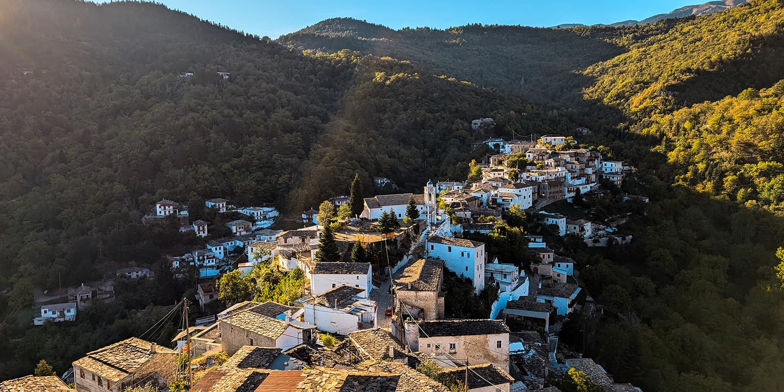
The ascent leads to Kastanitsa, one of the most distinctive villages in the area, where you will sleep. The houses are built from local stone, and many have the traditional slate roofs that characterize the village. Chestnut trees around the settlement reflect the long tradition of chestnut cultivation in the region.

The third day descends into a gorge that leads toward the Platanos stream. The terrain becomes steeper here, and in a few places, there will be ropes to help you pass rocky sections and dry waterfalls. Following the stream, the landscape becomes greener and more shaded. Large plane trees grow along the water, forming natural pools that can offer a refreshing break spot, especially on hotter days. The trail then gradually leaves the gorge and reaches the village of Platanos. The village is built around a natural spring and a small square, with narrow streets and traditional houses.

The final stage follows an old shepherd’s road as you climb toward the higher slopes of Parnon. The route first reaches the village of Sitena before continuing the ascent toward Megali Tourla (1934m). As the trail gains elevation, the landscape opens up above the fir forest, and you’ll see that alpine vegetation begins to appear. Views extend across the mountains of the Peloponnese and, in clear weather, toward the Aegean Sea. The route passes along the Monastery of St. Elias. From there, it continues to the summit of Megali Tourla, the highest point of the mountain and a rewarding final viewpoint for the trail.

Stages

Nomia Trail 4-stage itinerary

Stage 1:

Kosmas – Agios Vasili, 17.2 km | 10.7 mi

This stage can also be divided into two, with a small detour to the village of Paleochori.

Stage 2:

Agios Vasili – Kastanitsa, 16.25 km | 10.1 mi

This stage can also be divided into two, with a stop at the village of Prastos.

Stage 3:

Kastanitsa – Platanos, 14.4 km | 8.95 mi

Stage 4:

Platanos – Megali Tourla, 14.45 km | 9 mi

From the Monastery of Prophet Elias, hikers can either descend using a 4×4 service or go up to the peak of the Megali Tourla and continue along an additional 7.6 km extension of the trail back down to Sitena.

Accommodations

Along the Nomia Trail, hikers will stay in local mountain villages. In Kosmas, Kastanitsa, and Platanos, you will find small guesthouses and one or two taverns where you can enjoy authentic Greek and Tsakonian cuisine. Kosmas and Kastanitsa are known for local chestnut products, while Platanos is famous for its annual Cherry Festival.

During major local celebrations, such as Pascha (Easter) and the last weekend of October, accommodations may be fully booked, so planning ahead is recommended. The mountain villages are small, and options are limited, so many hikers choose to make their arrangements in Leonidio if arriving from Athens, or in Sparta if coming from Kalamata.

On the first night, in Agios Vasilios, accommodation will be a homestay. It is best to coordinate this in advance (info@nomianomad). Meals can be purchased either from the guesthouse or from the local tavern, so you can enjoy traditional dishes and support the community directly.

Accommodations per stage

Stage 1:

Agios Vasili – To coordinate home stay, email info@nomianomad.com

Stage 2:

Kastanitsa – for groups: Antoniou Guesthouse. For 1-6 people: A Tsella mi.

Best time of the year

The ideal times to hike the Nomia Trail are March to the end of May and mid-September to November. In spring (March–May), the mountain streams are flowing, the temperatures on the high slopes are cool but comfortable, and in March, there may even be some snow at the peaks. This is a beautiful time for wildflowers and fresh greenery.

In autumn (mid-September–November), the trail is full of stunning fall colors as chestnut and plane trees turn vibrant shades of orange and gold. The weather is generally pleasant during these periods, but it’s important to check forecasts in advance. March and November can be rainy, and parts of the trail pass through steep or slippery terrain that can become dangerous in wet conditions.

Safety & Gear

The Nomia Trail connects several mountain villages, so you usually only need to carry the essential equipment for a day hike. If necessary, extra gear can be transported between villages with prior coordination.

Some sections of the trail pass through remote areas where there is no mobile network coverage. In these areas, carrying a satellite phone or satellite communication device is recommended in case you need to make contact. Because some trails in Greece, like this one, do not see a lot of traffic, it is also advisable to stay in contact with a local organization or guide who knows the area and can be aware of your route and progress along the trail.

Certain parts of the route, especially along the river sections, can be slippery or technical. A short rope can sometimes be useful for additional safety. However, this can often be avoided if you are in contact with a local organization that is familiar with the current condition and maintenance status of the trail.

Apart from these considerations, you should carry the standard equipment for a mountain hike: sturdy hiking boots, layered clothing suitable for changing weather, rain protection, water, food for the day, a basic first-aid kit, and a map and the downloaded GPX on your device. Trekking poles are also recommended for stability on steep or uneven terrain.

Difficulty

The Nomia Trail is a moderate-to-difficult hike. Although the daily distances are not very long, the trail is a hidden gem and is rarely visited, meaning the paths are often less obvious. This means you will need to have the GPX with you to stay on trail at times. The route passes along mountain slopes, with daily elevation gains and losses ranging from 670 meters up to 1,800 meters, which can make it challenging for inexperienced hikers. Sections along the river can also be technical, requiring the use of ladders, iron steps, and ropes installed to help navigate steeper or slippery areas.

Good to know

The Nomia Trail follows ancient paths, but the route has only recently been reopened and maintained. As more hikers come to explore it, the trail is evolving, so it is important to stay updated on current conditions before starting your hike.

The villages along the trail remain authentic and are not used to mass tourism. Accommodation options can therefore be limited, and it is recommended to book in advance to ensure availability.

Public transportation can take you as far as Leonidio or Sparta, but reaching the starting points of the trail usually requires a short ride by local taxi. Prices are generally reasonable, and taxis can often be arranged locally.

In some villages, both accommodation and food options may be simple and basic, reflecting the traditional rural character of the area. However, this is also part of the experience of visiting these small mountain communities.

route
point-to-point
highest point
1934m (6345 ft)

Want to submit a trail or make this page more complete?

Always read the disclaimer

Terms of Use: important to all visitors on this website. We strive to publish high quality content and information on this website. However it’s always possible that we’re missing out on some crucial information. In spite of the fact that this route, associated GPS track (GPX and maps) were prepared under diligent research by the specified contributor and/or contributors, the accuracy of such and judgement of the author is not guaranteed. Therefore, hiking-trails.com and contributors are in no way liable for personal injury, damage to personal property, or any other such situation that might happen to individuals hiking or following this route. Should you choose to hike this trail, this is always at your own risk. Check out our guidelines for safety hiking and Leave No Trace principles at the hiking 101 page.

Download GPX

Join the community!

Login or create a FREE account 😊

With an account you can:

Download GPX files

Pin trails to your wishlist

Mark trails as hiked by you

Rate hiking trails

Comment on trails, blogs and gear reviews

Happy trails!
Login

Don't have an account yet? Register here