About the Karhunkierros

country
Finland
length
82 km(51 mi)
Type of trail
Long-distance, Hut to hut
difficulty

Difficulty is highly personal. Be aware of the weather conditions as bad weather turns easier trails in difficult trails especially in the mountains.

Moderate
accommodation

Lodging means a mix of hotels, hostels or AirBnB’s.

Mountain huts, Camping, Wild camping
Elevation gain
1575 m(5167 ft)
terrain
Forest, Hills
Show more

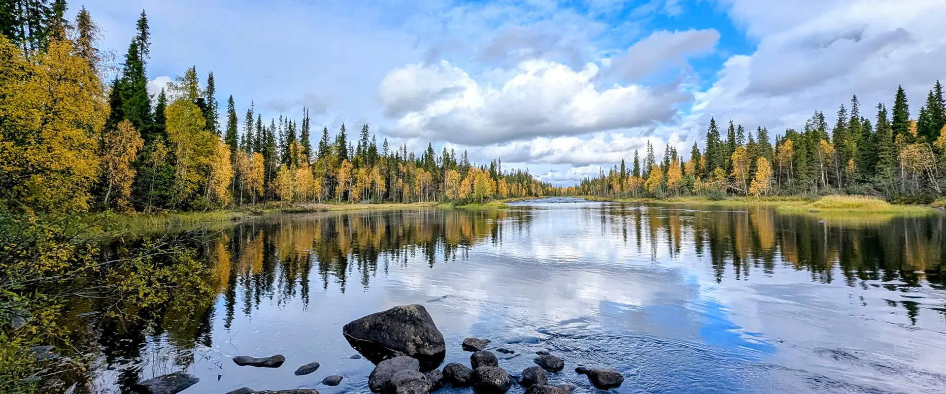
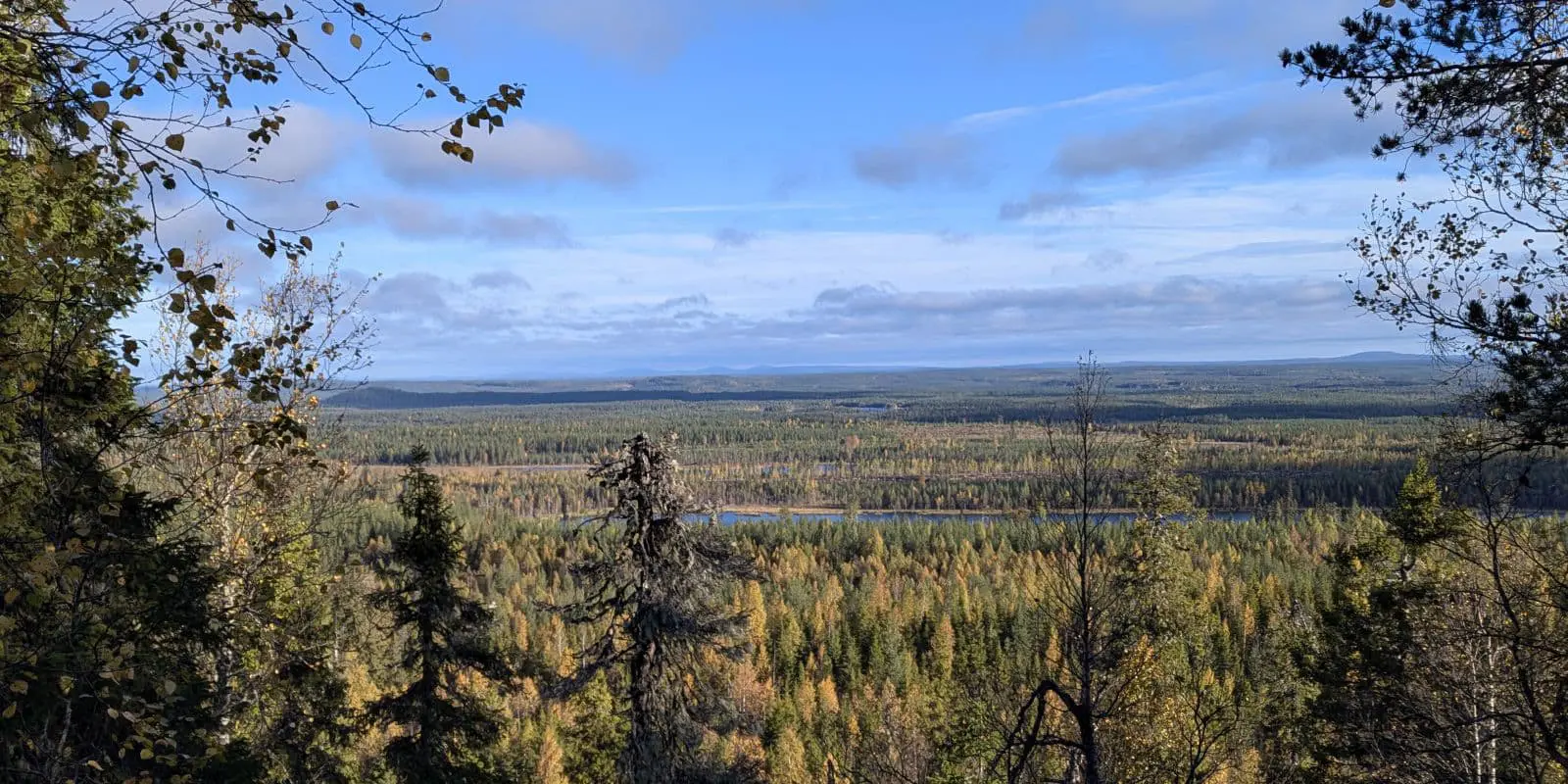
The Karhunkierros is known as the most famous trail of Finland, and for good reason. The trail follows roughly the Savinajoki, Oulankajoki, and Kitkajoki rivers with their spectacular rapids and canyons. Combined with pristine forests, panoramic views, and some lakes, the trail has an impressive variety of scenery as you go. Some sections have total silence: soft forest floor, no human-made sounds, no birds, nothing. Excellent infrastructure makes the trail a pleasure to hike: open wilderness huts, campsites, boardwalks, nine swingbridges, and clear trail markers.

The trail is 82 kilometers, mainly through Oulanka National Park. You can hike from north to south or the other way around. The southern end features a few steep hills, so you can choose whether to start or finish with them. Most people go from N to S. Despite the trail’s name, encounters with bears are extremely rare. They are far more likely to spot you first and quietly hide. Other wildlife, such as reindeer and birds like the Siberian jay, are much easier to see.

Pepijn photo for bio

Pepijn

Pepijn is an ecologist who fell in love with tramping while exploring New Zealand. Living and working in the Netherlands, he tries to spend as much time outdoors as possible. Multi-day hikes are his favorite way to discover new landscapes and habitats. He especially enjoys island trails and the thrill of crossing swingbridges.

View profile

The Trail

The trail starts in Hautajärvi, at a small cafe and visitor center. The first five easy kilometers are outside the National park and go through managed forests. After entering the National Park, the forest changes, becoming more varied in both species and age. Keep an eye out for the large ant hills; some are over a meter tall.  After a while, the first shelter makes a beautiful first stop, with a good view over the Savinajoki river, which you will follow all the way to the Savilampi hut. A short side trail brings you to Rupakivi Rock, one of the special sights along the route. From the Savilampi hut, there are some short side trails on both sides of the Oulanka canyon. Highly recommended for their spectacular views.

Soon, you will arrive at the historic Taivalköngäs hut (built in 1900) and its nearby campsite, where the trail crosses the Oulankajoki river via three swingbridges over the rapids, with beautiful views guaranteed. After another eight kilometers, you’ll reach the Oulanka Visitor Center. If it’s open, it’s well worth a visit: there you’ll find informative displays about the park, as well as a café serving coffee and lunch. From here, a busy, broad trail brings you to the next highlight: Kiutaköngäs rapids carved in red rocks. Slowly, the river will change its character: not carving in rock but meandering in thick layers of sand. It is very visible at the next hut: Ansakämppä hut.

From here, the trail leaves the river and heads toward the halfway point, just before the Jussinkämppä hut, which is nicely situated at the shores of a lake. After another 5 kilometers, you will reach the third river: Kitkajoki. The trail follows it upstream through a sometimes narrow valley just next to the river. Soon, you’ll arrive at the popular day-hike section known as the Pieni Karhunkierros (“Small Bear Trail”). A long swingbridge brings you to the other side of the river, followed by a climb high above the canyon, rewarding you with some good views. The Siilastupa hut is at the shore of the river with a great view of the Jyrävâ waterfall.

After one kilometer from the Siilastupa hut, there is a side trail to the beautiful Myllykoski water mill and rapids. Beyond this point, the trail leaves the National Park. The next seven kilometers are the dullest of all and will bring you to the Porontimajoki hut. Fortunately, the old-growth forest returns after this hut. From here, you begin the ascent of the first of four hills: Vattuvaara, Iso Kumpuvaara, Kontainen, and Valtavaara. Valtavaara is the highest point and is above the treeline. Here, a totally different landscape shows itself with panoramic views if you’re lucky with the weather, green forests, and lakes as far as you can see. Also, the endpoint comes into view, including the ski slopes and the Ruka tower. Perhaps it’s best to forget those last few “ugly” kilometers and hold onto the memories of the other 80 km of old-grown forest and rivers.

Stages

Along the Karhunkierros are six open wilderness huts, three day-use huts and several lean to shelters. That makes it possible to customise the trail, split up the total distance in more or less stages, longer or shorter. See the list of options under accommodation.

Suggested 5-day Karhunkierros Itinerary

Stage 1:

Hautajärvi – Savilampi hut, 16.4 km | 10.2 mi

Stage 2:

Savilampi hut – Ansakämppä hut, 19.1 km | 11.9 mi

Stage 3:

Ansakämppä hut – Jussinkämppä hut, 15.5 km | 9.6 mi

Stage 4:

Jussinkämppä hut – Porontimajoki hut, 13.9 km | 8.6 mi

Stage 5:

Porontimajoki hut – Ruka, 17.5 km | 10.9 mi

Accommodations

Along the Karhunkierros are six open wilderness huts, three day-use huts, and several lean-to shelters. In the section within the Oulanka National Park and the Valtavaara Nature reserve, it is only allowed to camp at designated campsites. Outside these, everyman’s right applies. It is not possible to make reservations for ‘open’ wilderness huts. The open wilderness huts come with long drop toilets, gas cookers, heaters, and firewood. The day-hut and shelters have fireplaces, wood, and a long drop toilet. At most shelters, it is allowed to camp, or there is a nearby campsite.

Best time of the year

The only time of the year you can hike the Karhunkierros is during the snow-free period between the end of May and October. Snow melt can inundate parts of the trail from the end of April into May. After mid-August, the number of mosquitoes decreases considerably. A very special and beautiful time is during autumn, when the trees are changing color, approximately mid-September.

Safety & Gear

The Karhunkierros trail is extremely well signposted. Every kilometer has a metal sign with both the kilometers done and to go and the coordinates. In addition to these new signs, there are also the older orange dots on the trees and signs at crossings. For fans of printed maps, Calazo has an excellent map on Tyvek.

Bring a tent and be prepared to sleep in a tent, as the open wilderness on this trail can be busy. The huts have space for 10 to 20 people, and the half-open shelters offer even less space. You should also bring food for the entire trail, as these huts do not offer meals, and don’t even have running water.

Difficulty

It’s an easy-to-moderate hike. The tracks are well-maintained and clearly signposted, with boardwalks across marshes and swingbridges over rivers. Some sections have plenty of tree roots and/or boulders that require a bit of attention. The most serious parts are the four hills on the southern side, with some steep sections. Don’t underestimate this otherwise easy trail: the long stretches of boulder-hopping and numerous short ascents can add up. However, if you have basic fitness and hiking endurance, this trail should be suitable for more people.

Good to know

Oulanka National Park is a popular destination. There are plenty of short day hikes, partly on the same tracks as the Karhunkierros. This means that the day huts and shelters can be busy during the day. Some side trails offer ways to shorten the trail.

At kilometer 28, you will pass the visitor center of Oulanka National Park, which includes a small restaurant (be sure to plan around the opening hours).

The many huts and shelters make it very easy to customize the Karhunkierros according to your wishes.

Transport between Ruka and Hautajärvi varies from year to year and depends on the season. There are taxi services and bus services. It is wise to book your ticket in advance to prevent a full bus or no bus show.

route
Point-to-point
highest point
490m (1600 ft)

Want to submit a trail or make this page more complete?

Always read the disclaimer

Terms of Use: important to all visitors on this website. We strive to publish high quality content and information on this website. However it’s always possible that we’re missing out on some crucial information. In spite of the fact that this route, associated GPS track (GPX and maps) were prepared under diligent research by the specified contributor and/or contributors, the accuracy of such and judgement of the author is not guaranteed. Therefore, hiking-trails.com and contributors are in no way liable for personal injury, damage to personal property, or any other such situation that might happen to individuals hiking or following this route. Should you choose to hike this trail, this is always at your own risk. Check out our guidelines for safety hiking and Leave No Trace principles at the hiking 101 page.

Download GPX

Join the community!

Login or create a FREE account 😊

With an account you can:

Download GPX files

Pin trails to your wishlist

Mark trails as hiked by you

Rate hiking trails

Comment on trails, blogs and gear reviews

Happy trails!
Login

Don't have an account yet? Register here