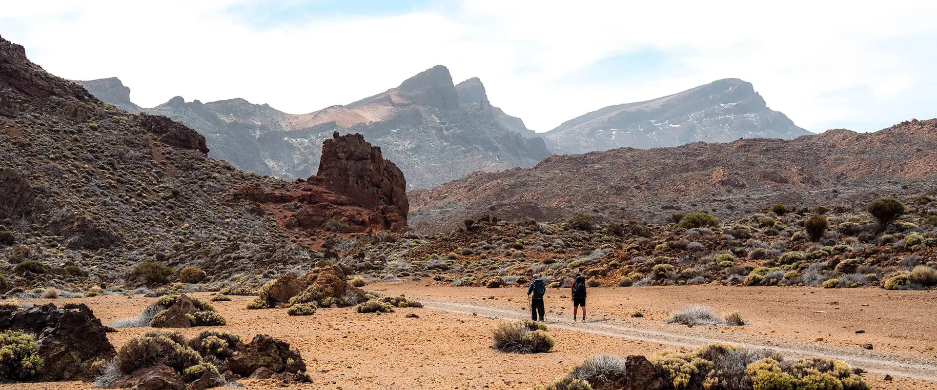
The next day, you will cross the road from the visitors center and continue your hike. You may see a few day hikers here, as you’ve just entered the El Teide National Park, but otherwise you will, once again, be on your own. Now hiking through the park, you will be surrounded by high cliffs with views of El Teide and amazing rock structures. This will continue, mostly flat, for about 3-4 hours, depending on your pace. At this point, you are at roughly 2000 meters high, and it feels like it! The sun is just a bit hotter, the air is dryer, the wind feels stronger, and the nights are definitely colder. There are lots of boulders in the sandy basin that you will be hiking in, and thus lots of places to sit and have a break. If it is a hot day, this section can be a bit difficult, so be sure to bring enough water!
At about kilometer 55, you will reach the base of the Guajara mountain. The GR 131 goes up the first section of the ascent, and then flattens out to follow the side of the mountain in the direction of Vilaflor. It is possible to register online for a permit to bivouac here, and we highly recommend it. You will need the permit for the Montaña Guajara bivouac. On a clear night, you will see El Teide’s silhouette against the sky, among thousands of stars. Be careful, though, as it can be very windy and cold! It is also possible to summit the peak as an addition to the route.
The GR 131 will be an easy descent toward town on this stage, with easy paths that take you through the rocky high desert that makes up this region, and eventually also through loose black volcanic gravel. This is a very special section, as the trail is outlined by stones that keep you going on the loose, black, gravel, volcanic rock. With views of El Teide only hours before, it feels very clear just how active this volcano is. Within a few hours, you will arrive in Vilaflor. Here, there are plenty of accommodations, markets, and restaurants. And because of this, many more people than you will have seen in the previous days!
From Vilaflor, the final stage will take you down to Arona over 18 kilometers. The trail is gentle throughout, with a few climbs and mostly easy descents, as you make your way down. The trail goes through pine forests and over fantastic ridges, will bring you into town on a cliffside path where you look over beautiful canyons, and will deposit you right into the center of town. As you hike, you will pass a restaurant at the 79-kilometer marker, where you can buy water and have a snack if you’d like. However, be aware that it is closed on the weekends. Once you arrive in Arona, you can celebrate with a nice coffee and then take the bus to wherever you need to go.