About the Via Calda

Catalonia
country
Spain
length
80 km(50 mi)
Type of trail
Long-distance
difficulty

Difficulty is highly personal. Be aware of the weather conditions as bad weather turns easier trails in difficult trails especially in the mountains.

Easy
accommodation

Lodging means a mix of hotels, hostels or AirBnB’s.

Lodging, Mountain huts
Elevation gain
2130 m(6988 ft)
terrain
Forest, Hills, Mountains, Urban
remoteness
Some of the time
Show more

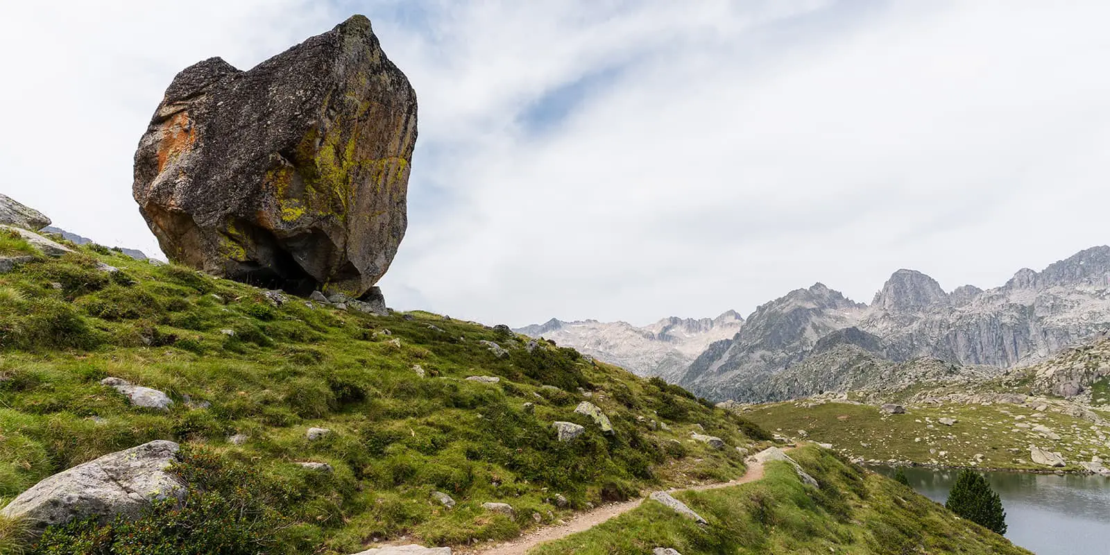
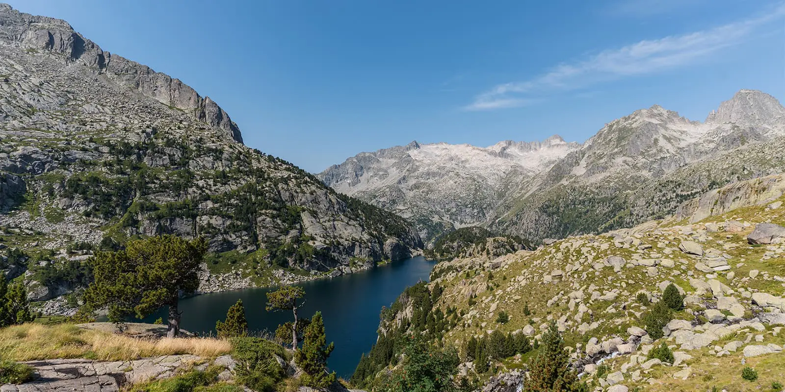
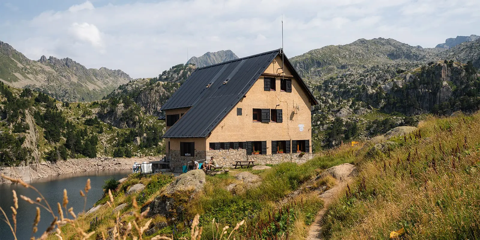
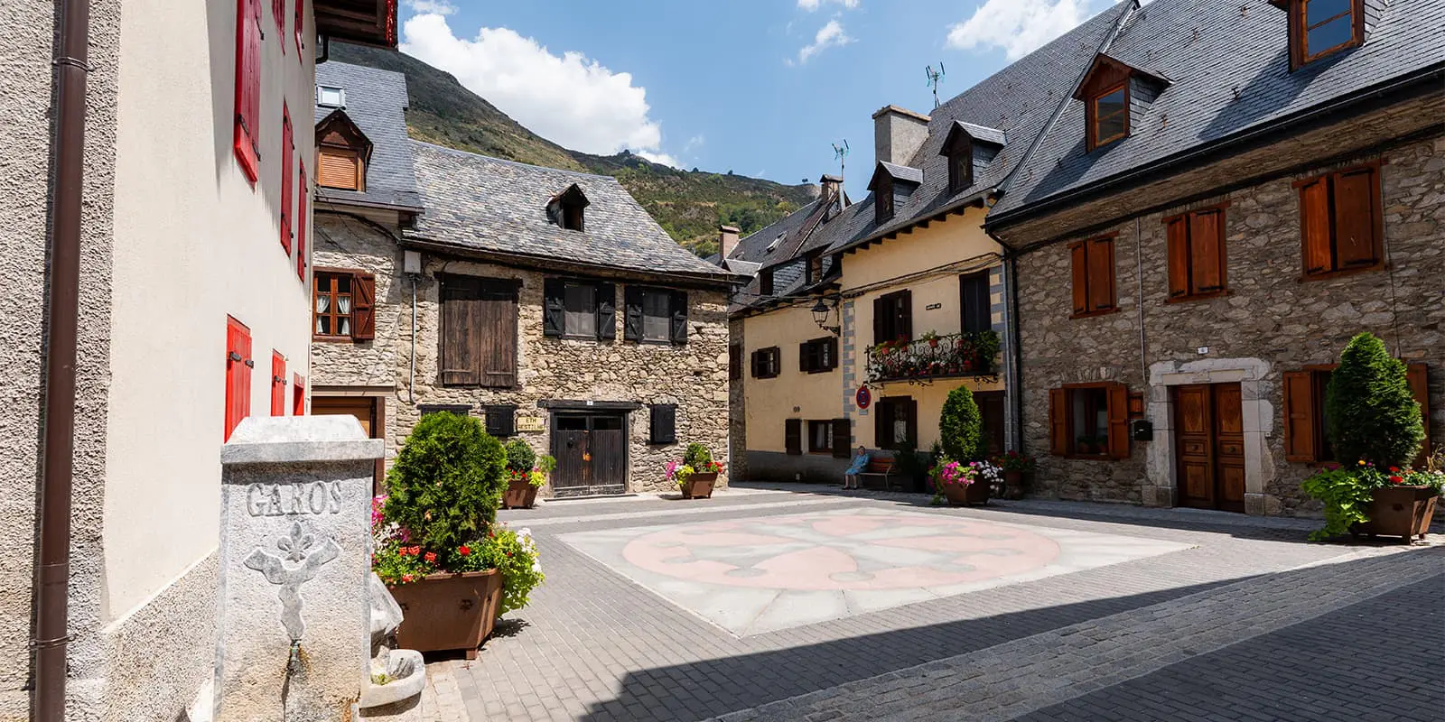
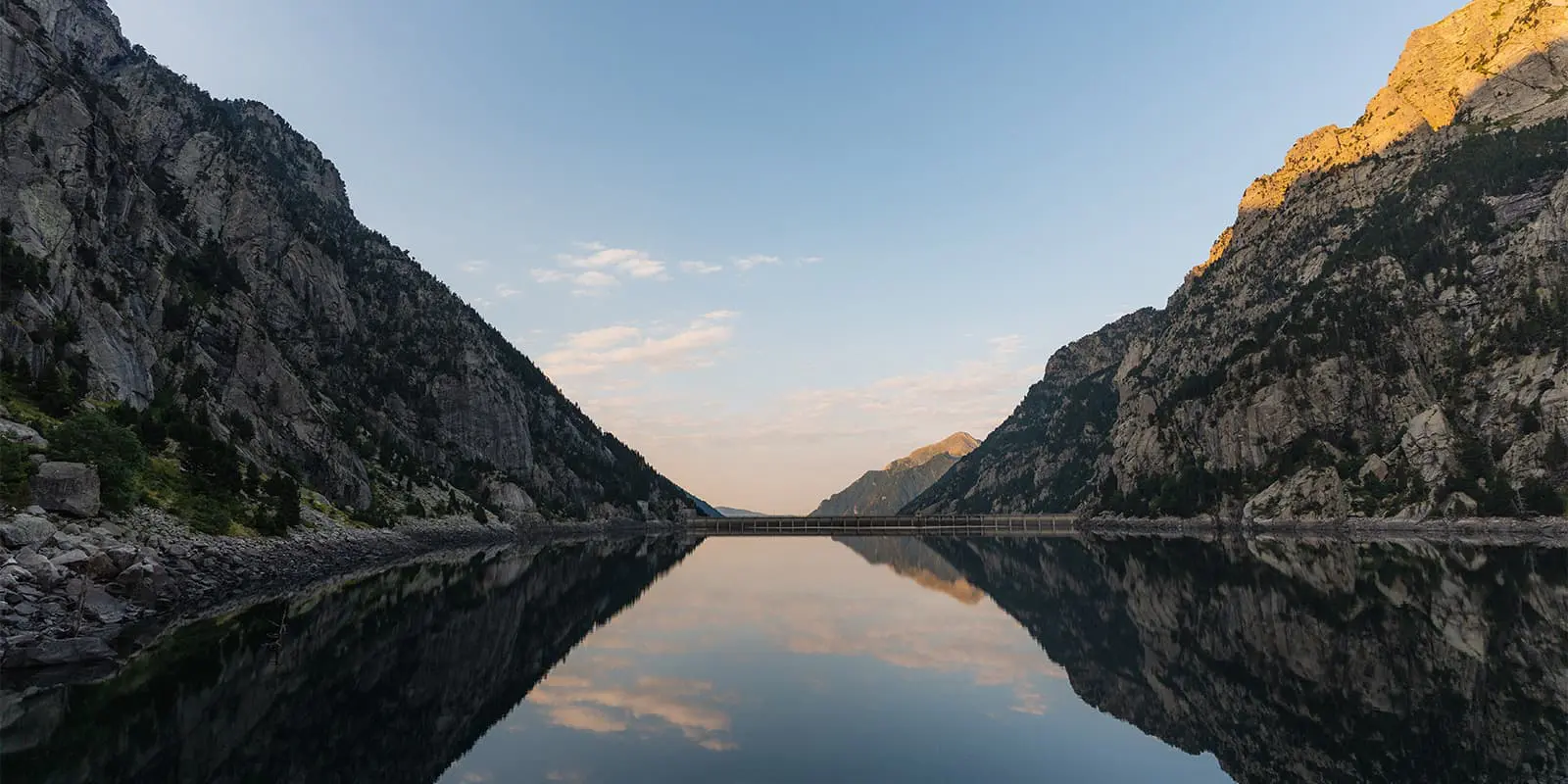
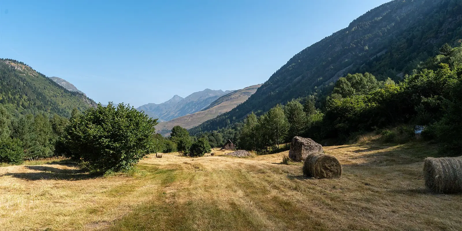
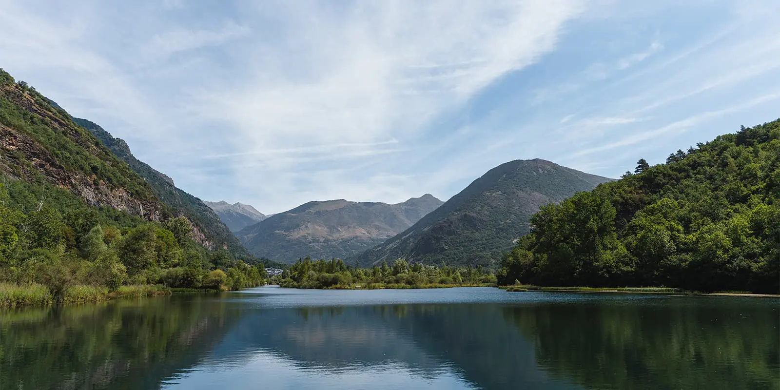
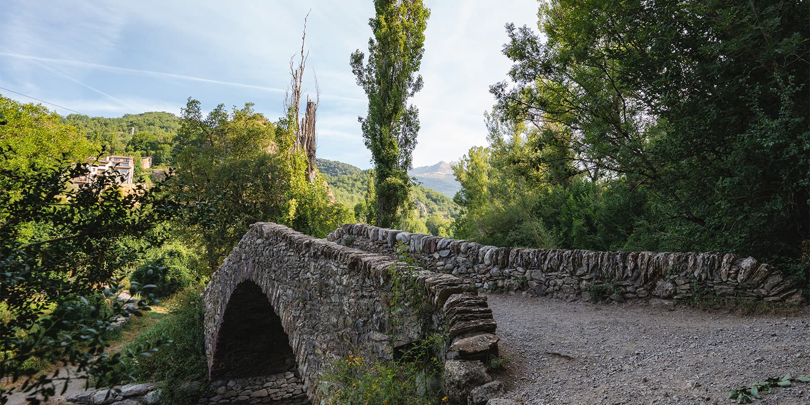
The Via Calda is a long distance trail in the Catalan Pyrenees, combining mountain landscapes with a strong focus on culture, thermal waters and history. This trail links together the Aigüestortes National Park and the Aran Valley in northern Catalonia. In five stages you hike around 80 km passing through beautiful nature and traditional spa towns.

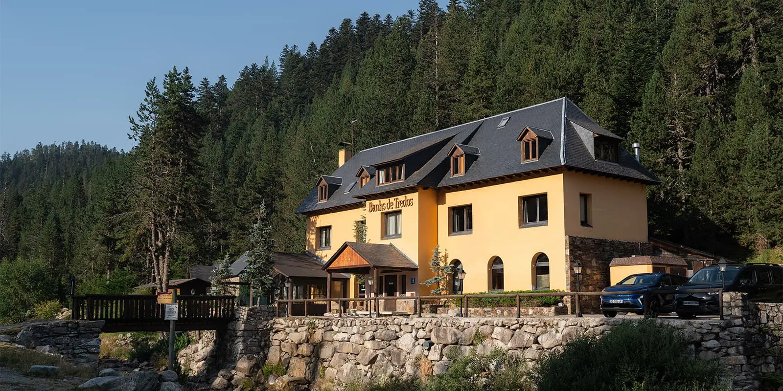
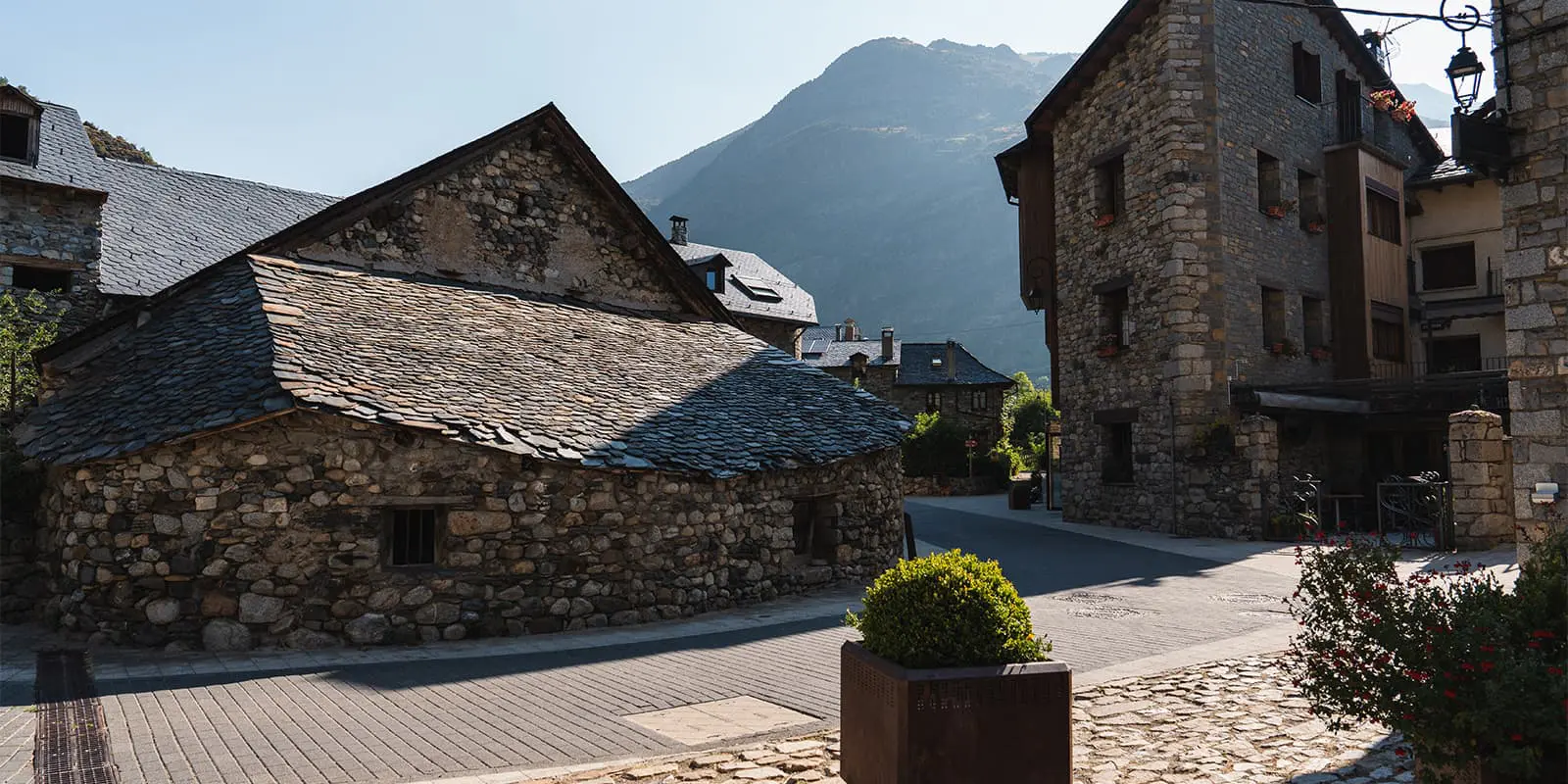
Unlike many long distance trails that emphasize only high mountain terrain, the Via Calda highlights the connection between Pyrenean culture and natural thermal waters. Towns such as Caldes de Boí and Bahns de Tredòs are known for their historic spas, where natural hot springs have been used for centuries. The trail is quite easy with some ascents and descents, but nothing extreme. Because you hike through multiple small villages you have multiple options for accommodation. It’s recommended for beginners or hikers who don’t want high alpine adventures but more cultural and historical experiences.

profile picture Joy Hadders
Author

Joy Hadders

Joy Hadders is a Dutchie who takes full advantage of her free days off of work to experience as much as possible in other countries. Like many others, she found her way in hiking during the lockdown and now she’s also hooked! She enjoys discovering hidden gems with her boyfriend and dreams of a fully pinned world map. You can follow Joy on Instagram @joyhadders.

View profile

The Trail

You start in El Pont du Suert, a really small village in the Ribagorza region. It’s the southern gateway to the Pyrenees. The trail heads north, following the Noguera de Tor river. You steadily climb towards the Boí Valley. Along the way, the scenery changes from pine forests to wider landscapes and traditional villages. Before reaching Boí after 19 km, you pass several small settlements. Boí is known for its UNESCO-listed Romanesque church Sant Joan de Boí. This cultural vibe of this stage shows a lot of history.

The second stage is the shortest of all, a big contrast with the kilometres of the other days. The path continues further into the valley, surrounded by the peaks of the Aigüestortes National Park. The route climbs gently through forests before reaching Caldes de Boí, famous for its thermal springs and historic spa complex. Here, you find one of the highest concentrations of mineral-rich hot springs in Europe. For centuries, the waters have been used for their healing properties. This stage shows the wellness traditions of the Pyrenees.

Stage number three crosses the heart of the Pyrenees. The trail climbs gradually through Aigüestortes i Estany de Sant Maurici National Park, a beautiful area known for its mountain peaks and glacial lakes. This stage is the most scenic one of the Via Calda, with true high-mountain vibes. For example, you can take a break at Refugi Ventosa where you can enjoy the best views of the peaking mountains and lake. Also, at this stage you reach the highest point of the trail (2.550m). After this, you descend into the Aran Valley and hike along small rivers. After a long day you finish at Bahns de Tredòs (or you skip the last hour of hiking and use the taxi service 30 minutes from Refugi de Colomèrs).

If you’re looking for an even more challenging adventure in this same park, consider the Carros de Foc, a multi-day hut-to-hut trek that connects several mountain refuges. It’s a much tougher route than the Via Calda, but it rewards you with the true beauty of this national park.

The fourth stage is 20 km but easy. Leaving Bahns de Tredòs, the path descends steadily along the valley of the Garona river, surrounded by forests. This stage has a more pastoral atmosphere compared to the previous one, with villages, farmhouses and cultural landmarks. You end this day in Vielha, the main town of the Aran Valley. It’s a cultural hub of the region where you can find multiple restaurants, hotels and shops.

The final stretch follows the Garona river downstream, tracing old paths that historically connected villages in the Aran Valley. Unlike the more rugged earlier stages, this stretch has a more accessible profile, with gentle terrain through forests, riversides and meadows. The distance is still long, but the overall gradient is easier. Eventually, after around 20 km you finish at Bossòst, a small village near the French border. Bossòst is known for its Romanesque church of Era Assumpcion de Maria. You don’t have many options for accommodations, so you must book on time.

Stages

This trail is normally hiked in 5 days. There are some options for customizing the trail, with longer or shorter sections.

Via Calda 5-stage itinerary

Stage 1:

El Pont du Suert – Boì, 19 km | 11.8 mi

Stage 2:

Boì – Caldes de Boì, 5 km | 3 mi 

Stage 3:

Caldes de Boì – Banhs de Tredòs, 16 km | 10 mi

Stage 4:

Banhs de Tredòs – Vielha, 20 km | 12.4 mi

Stage 5:

Vielha – Bossóst, 20 km | 12.4 mi

Accommodations

When hiking the Via Calda, you’ll mainly stay in one of the mountain huts or hotels alongside the trail. Most of the time you end up in a small village with multiple options to stay the night.

Based on the described stages above, here are our accommodations:

Accommodations per stage

Stage 4:

Hotel Blu Aran

Stage 5:

Hotel Garona

Best time of the year

The best time of the year to hike the Via Calda is from June to (early) September. As you’re hiking in the mountains, be aware that there might be snowfields in early summer and there might be early snowfalls in late summer and early autumn.

Keep in mind that the weather in the high mountains can change rapidly, and it’s important to be prepared for all conditions, including rain or snow. Always check trail conditions and local weather forecasts before starting a high-alpine hike.

Safety & Gear

It’s necessary to prepare yourself properly. You have to be experienced in hiking long distances and you need a good fitness level.

A lightweight backpack (30 – 40 liters) is ideal for carrying all your supplies, including snacks, water and extra clothing. There will be enough water resources during the trail, but it’s recommended to bring enough water with you (at least 2 liters). Because of the distances and possible temperature changes.

Essential gear includes sturdy hiking boots with good grip, a detailed map or GPS device and weather-appropriate clothing.

Check the weather forecast daily. Bring a waterproof jacket and layers for different temperatures. Hiking poles can help with balance on steep or uneven terrain.

Difficulty

This trail is easy. One day is in Aigüestortes National Park with some elevation, mountain paths and rocky sections. It’s not a high-altitude trail, so without steep ascents or exposed ridges. Four out of five days you’ll walk in forests or easy (asphalt) paths with little elevation.

Good to know

  • There are some options for customizing the trail, with longer or shorter sections. For example, you can walk from Boì to Caldes de Boì via the short 6.5 km route or the longer 15.6 km route. There are also several alternatives to Tredòs Banhs, including a taxi service. We would recommend to extend stage 2 with a part of stage 3 and stay the night at a mountain (for example: Ventosa).
  • If you want to shorten the trail, we would recommend to skip the last stage, so you’ll finish at Vielha.
  • Enough water points in the villages and hotels at the start and finish of each stage. Along the way, you’ll find not many options. Always plan ahead, as some stages may have longer stretches without reliable water access.
  • From Refugi de Colomèrs you can walk in 30 minutes to a taxi service. It’s a short ride for €5 to Bahns de Tredòs. The taxis are driving each 15 minutes until 6:00 PM.
  • It’s a 3-4 hour drive from Barcelona Airport to El Pont du Suert and from Bossòst to Barcelona Airport.
route
point-to-point
highest point
2.550m (8.366 ft)

Want to submit a trail or make this page more complete?

Always read the disclaimer

Terms of Use: important to all visitors on this website. We strive to publish high quality content and information on this website. However it’s always possible that we’re missing out on some crucial information. In spite of the fact that this route, associated GPS track (GPX and maps) were prepared under diligent research by the specified contributor and/or contributors, the accuracy of such and judgement of the author is not guaranteed. Therefore, hiking-trails.com and contributors are in no way liable for personal injury, damage to personal property, or any other such situation that might happen to individuals hiking or following this route. Should you choose to hike this trail, this is always at your own risk. Check out our guidelines for safety hiking and Leave No Trace principles at the hiking 101 page.

Download GPX

Join the community!

Login or create a FREE account 😊

With an account you can:

Download GPX files

Pin trails to your wishlist

Mark trails as hiked by you

Rate hiking trails

Comment on trails, blogs and gear reviews

Happy trails!
Login

Don't have an account yet? Register here