About the The LOOP

country
Poland
length
225 km(140 mi)
Type of trail
Long-distance
difficulty

Difficulty is highly personal. Be aware of the weather conditions as bad weather turns easier trails in difficult trails especially in the mountains.

Moderate
accommodation

Lodging means a mix of hotels, hostels or AirBnB’s.

Lodging, Camping, Mountain huts
Elevation gain
11394 m(37382 ft)
terrain
Mountains, Forest, Hills
remoteness
Some of the time
Show more

The Loop is a circular long-distance trail in the Beskidy Region in southern Silesia, Poland. It is simply a connection of many routes that have been well known for years and therefore the infrastructure along the way is already perfect for hikers. Many mountain huts invite you for the best Polish cuisine and beers and offer you dorm and/or private rooms as well as a place to camp. The trail leads mainly through forests and across hills, and occasionally it becomes mountainous. 

man holding baby goat
Author

Chris Gaida

Hey everybody, My name is Chris, 32, I was born and raised in eastern Austria, lived in Vienna for more then 10 years, and since 2020 I am travelling the world with a bunch of stops for work, as hiking and travelling doesn’t pay the bills 😉

I did my first Trail in 2016, which was the at this time not soooo famous Fishermans Trail in Portugal. I hiked it in January and enjoyed the solitude I had during those impressive hikes. Since then I did around 10 Trails all over Europe, but mainly in the south as I really prefer the Mediterranean climate.
I have a quite big knowledge about flora and fauna, and really enjoy to share it while exploring new places and learning new things.

I also document my journey and hikes on my Youtube Channel. Have a look if you like.

View profile

The Trail

The best way to reach the trail is from the town of Bielsko Biala. It is reachable by train and bus from various cities in and around Poland. The official start of the tour is at the upper cable car station, where you can take the obligatory picture with the LOOP emblem before you start. After only 15 minutes you will reach the first hut where you can get your first stamp. These stamps will fill your little booklet (you can order it at the website, or print it yourself) which will document your journey and, if you get at least 15 stamps along the way, qualify you to get a badge for completing the LOOP.

This part of the trail can be quite busy as the trails are not hard and there are plenty of huts and also the cable car of course. After hiking mostly flat through open landscapes and meadows paired with some shade-giving woods, you will reach the 3rd hut. While here, don’t forget the stamps and a refreshing drink. Then the descent to Brenna follows. This town offers a campsite and some other accommodations as well as supermarkets and restaurants.

Now you walk through a beech forest, which can be full of mushrooms when you hike it in the right season. After the first ascent, you reach a road on which you will pass some more huts and restaurants before you cross the river Wisla. What follows next is a very steep way up a ski slope. This is a not-so-fun part of the trail, but luckily is the only section like this. At the top, you will find another cable car and various places where you can get food or drinks. From here you have to descend for about an hour to reach Schronisko Soszow.

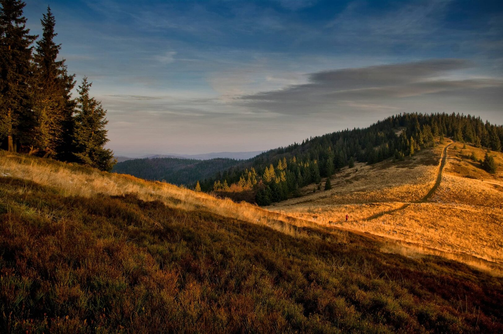
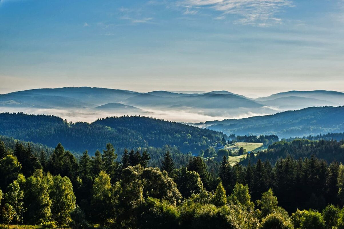
Within the next 10km or so, there is not much shade, it is rather an open trail, which gives views of the surrounding hills and mountains. This is a great place to spot some birds of prey as well. On this day we observed not only birds but a variety of amphibians, insects, squirrels, and also found tracks of badgers. The biodiversity in flora and fauna is something I also really enjoyed along this trail. As many parts are not that frequented, you can see a lot of animals if you are quiet and have an eye for your surroundings.

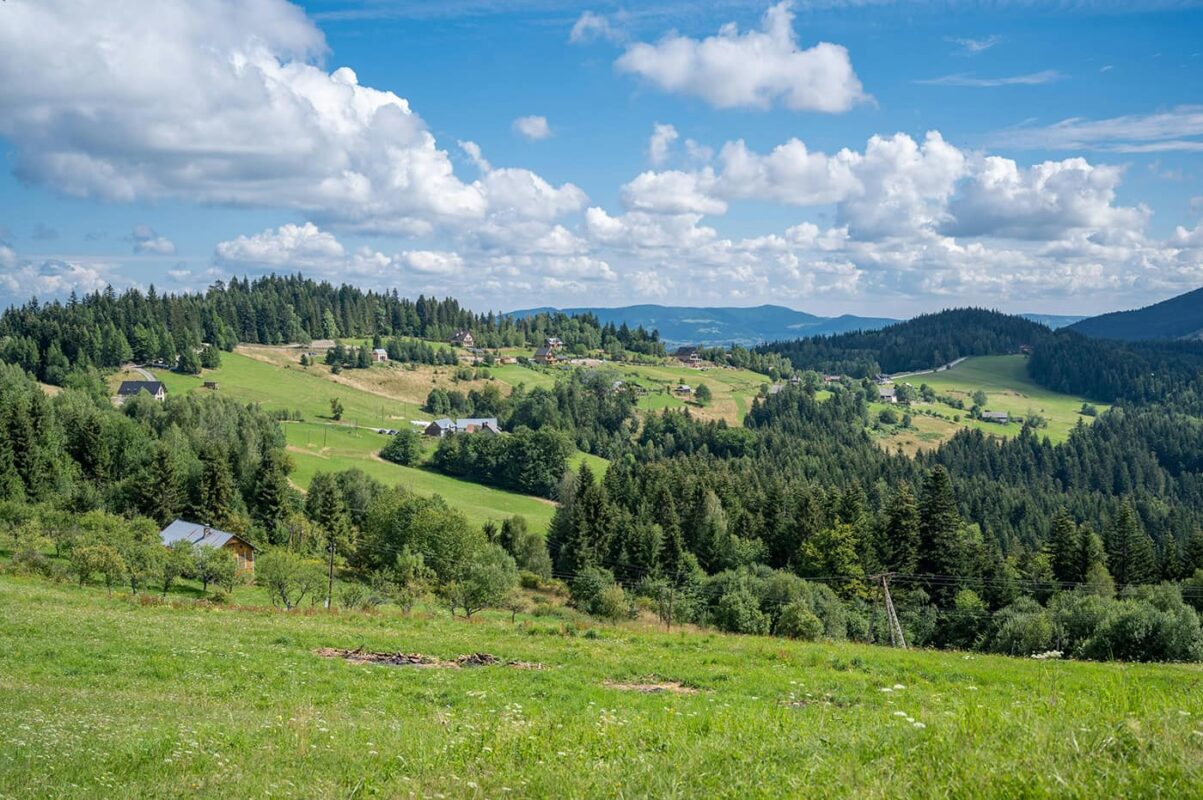
You will then reach another town with some food options and also pass the wooden church before you have another ascent. At the top, you will reach a very big mountain hut with many accommodation options.
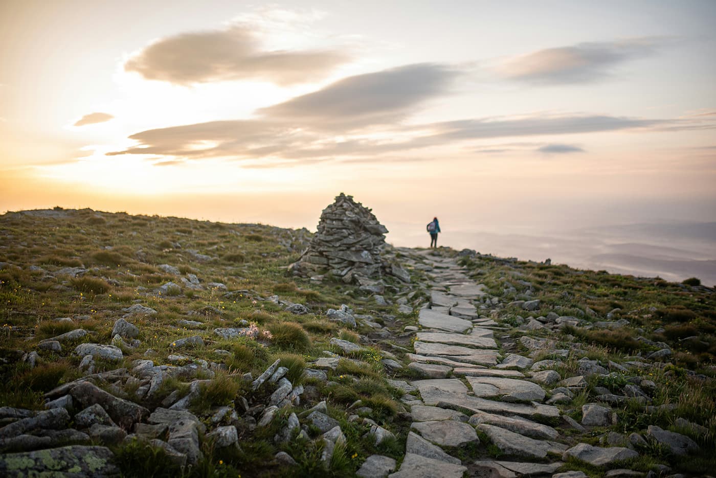
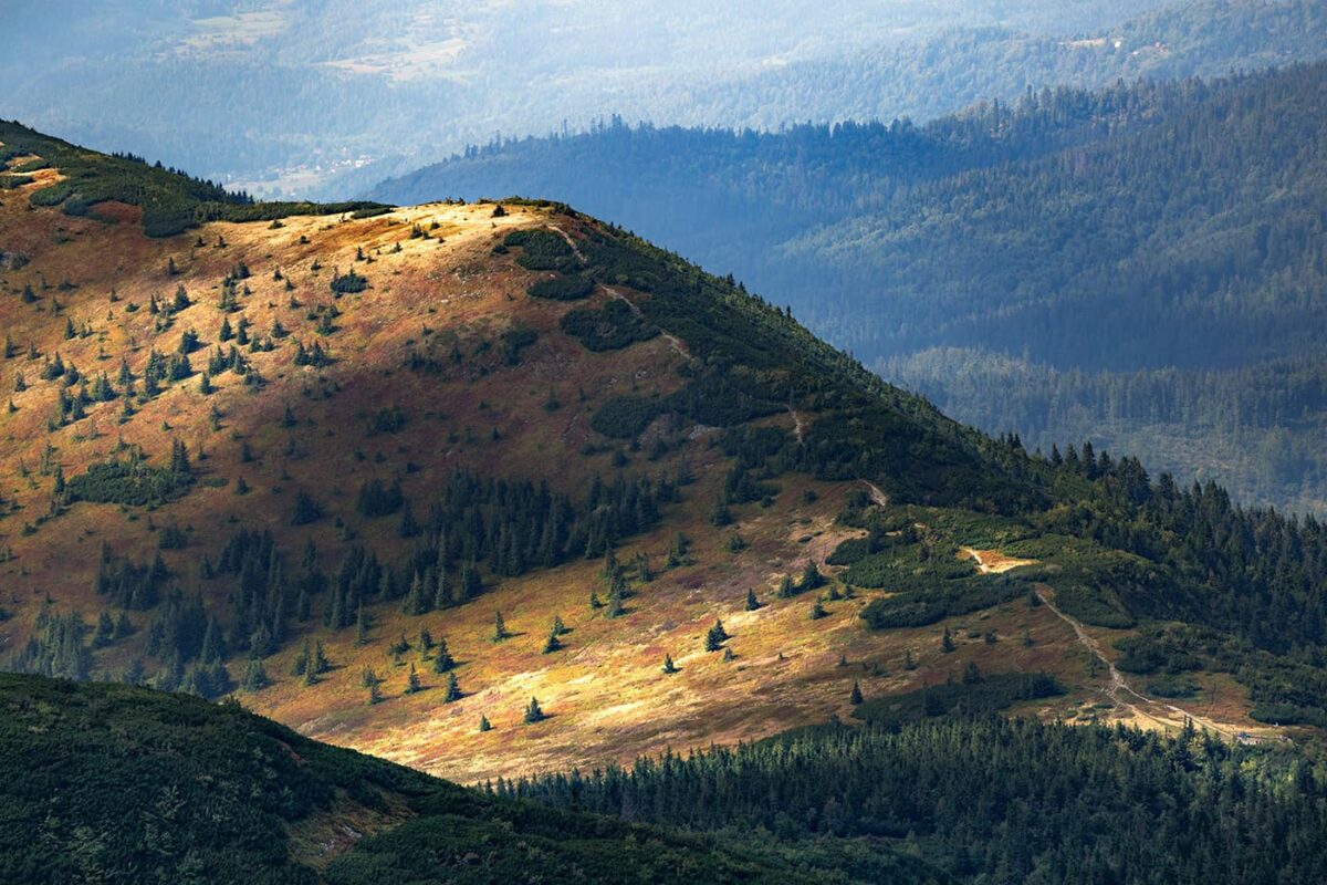
Soon after the hut you reach the often windy peak of Wierch Wiselka and have a great view of the surroundings. You are now in an area where there are wolves and lynx. While you will often find the tracks and scat of wolves, lynx are like a shadow and are very rarely seen by humans. Anyway, no need to be nervous, both species will usually avoid interaction with humans and are no danger at all.

What now follows is a very long but enjoyable descent until you reach the town of Wegierska Gorka which is a great place for a resupply. We opted for a stay in the Abrahamov Shelter about an hour after the town and I highly recommend staying there. They offer affordable private rooms, fair-priced and very delicious food, and local beers. In addition, the family owning the hut is incredibly friendly and made our stay one of the highlights on the trail.

The next 15 kilometers lead you through woodland and the paths can often be very muddy after rainy days. This part of the hike is not too hard and is actually very enjoyable. It gives you time to enjoy the forests, wildlife, and here and there a beer in one of the huts or towns you pass on your way.
Some days will pass like this until you reach one of the highlights of the trail, the Babiogorsky National Park. Keep in mind that you must stay at the hut within the park, it is forbidden to camp. From the Schronisko Markowe Szczawiny, you can conquer the highest peak of the trail, Babia Gorska, which is 1723m. Again this part of the trail excites with a huge biodiversity of plants and mushrooms and beautiful landscapes, so take your time while walking through it.

Now you will have to conquer partly steep descents and ascents but still walk through mainly beautiful forests. After conquering the Jalowiec peak at 1111m, you descend through the beech and spruce forest until you reach the Chatka pod Solneskiem (Adamy). This is another place I want to point out, we were welcomed with incredible hospitality and kindness, you can either put up your tent or sleep in one of the dorm rooms there, use the kitchen, and have some tea. Check in advance if this place is open as they close during the colder months.

In the town of Slemien, you will pass an ethnographical museum before you hike up the Giebasow Wierch. Here is another hut which only offers some hot drinks and a place to set up your tent.
From there it is a sometimes challenging path until you reach Międzybrodzie Żywieckie, a rather big town with all you need, but a lack of budget accommodations.

From this town, it is only about 26km with not too many ascents and descents until you reach the LOOP emblem again and can enjoy a drink of your choice to celebrate. Make sure you visit the Beskidy tourism travel office in Bielsko Biala to collect your badge.

Stages

There are no determined stages. The initiators of the trail want to challenge and also give the hiker the freedom to choose their own stages. You can plan your trail the best way with the interactive map on the LOOP website.

Accommodations

Something I love about the LOOP trail is, that you can walk it completely while camping, but still getting all the luxuriates of mountain huts. For a small fee, you can put up your tent in designated areas next to the hut and use all their facilities like toilets, showers, and sometimes even a kitchen, or have a meal in their restaurant. And because you can sleep in a dorm or private room in a mountain hut every night, or even at hotels or B&Bs in the towns, this flexibility makes this trail perfect for many different preferences and also budgets!

Best time of the year

This trail is meant to be hiked year-round! Most huts are open 365 days, just some campsites and small huts close during winter (check in advance!). However, during winter months, you should be prepared for a snowy hike, so bring the right equipment. In summer, the days can get really hot, but due to the trail leading through many woods, you are often protected from direct sun.

Safety & Gear

Because there are no official stages, make sure to tell someone about your hiking plans. Let them know when you’re starting when you think you’ll finish, and who to contact if something goes wrong.

Don’t forget to check the weather before you head out. Stay in and enjoy a cozy day if there are thunderstorms, heavy rain, or extreme heat on the forecast because those conditions can be dangerous. You can check the weather using a radar app or by talking to locals or the wardens of the mountain huts.

Bring plenty of water and snacks. Pack at least two liters of water for each day and some high-energy snacks to keep yourself hydrated and fueled.

Wear the right gear. Get yourself some good shoes and proper clothing, like warm layers and a rain jacket. Hiking poles, a comfy backpack, and essentials like maps, a GPS device with the right GPX loaded, and a first-aid kit are also important. Check out our gear list for more ideas.

Lastly, follow Leave No Trace principles. Stick to the trails, pack out all your trash, and respect wildlife and natural spots.

Good to know

If you are planning on walking the LOOP trail during the summer months, maybe it would be good to book some of the huts in advance. The best thing to do is to call, in nearly every hut there is someone who speaks perfect English. Some, but not all huts offer an online booking portal as well. If you are hiking in the off-season, just make sure to check if your preferred accommodation is open in advance, booking for camping as well as rooms is usually not necessary.

Route
Circuit
Highest point
1723m (5653 ft) Babia Gorska
Water resources
Refill in huts or towns

Want to submit a trail or make this page more complete?

Comments

Be the first one to comment on this trail!

Reply to this trail

Your email address will not be published. Required fields are marked *

Reply to this trail

Log in to comment on this trail
Always read the disclaimer

Terms of Use: important to all visitors on this website. We strive to publish high quality content and information on this website. However it’s always possible that we’re missing out on some crucial information. In spite of the fact that this route, associated GPS track (GPX and maps) were prepared under diligent research by the specified contributor and/or contributors, the accuracy of such and judgement of the author is not guaranteed. Therefore, hiking-trails.com and contributors are in no way liable for personal injury, damage to personal property, or any other such situation that might happen to individuals hiking or following this route. Should you choose to hike this trail, this is always at your own risk. Check out our guidelines for safety hiking and Leave No Trace principles at the hiking 101 page.

Download GPX

Join the community!

Login or create a FREE account 😊

With an account you can:

Download GPX files

Pin trails to your wishlist

Mark trails as hiked by you

Rate hiking trails

Comment on trails, blogs and gear reviews

Happy trails!
Login

Don't have an account yet? Register here