Slí Árann Mhór Trail
Wild Atlantic Way

Slí Árann Mhór Trail

About the Slí Árann Mhór Trail

country
Ireland
length
18 km(11 mi)
Type of trail
Day hike
difficulty

Difficulty is highly personal. Be aware of the weather conditions as bad weather turns easier trails in difficult trails especially in the mountains.

Easy
accommodation

Lodging means a mix of hotels, hostels or AirBnB’s.

Lodging
Elevation gain
400 m(1312 ft)
terrain
Coastal, Flat, Hills
remoteness
Some of the time
Show more

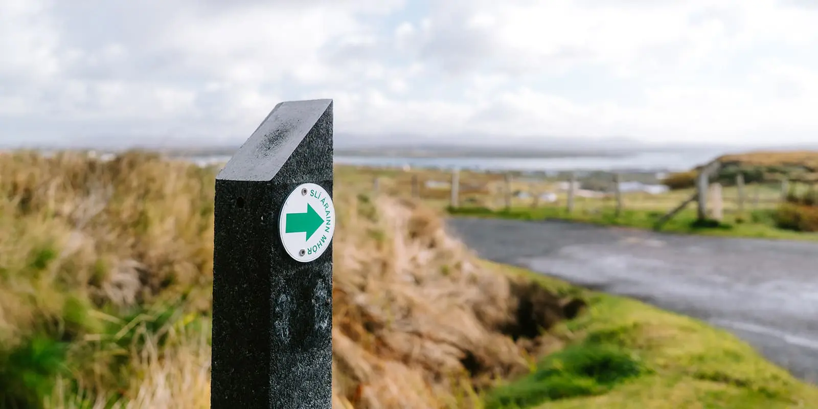
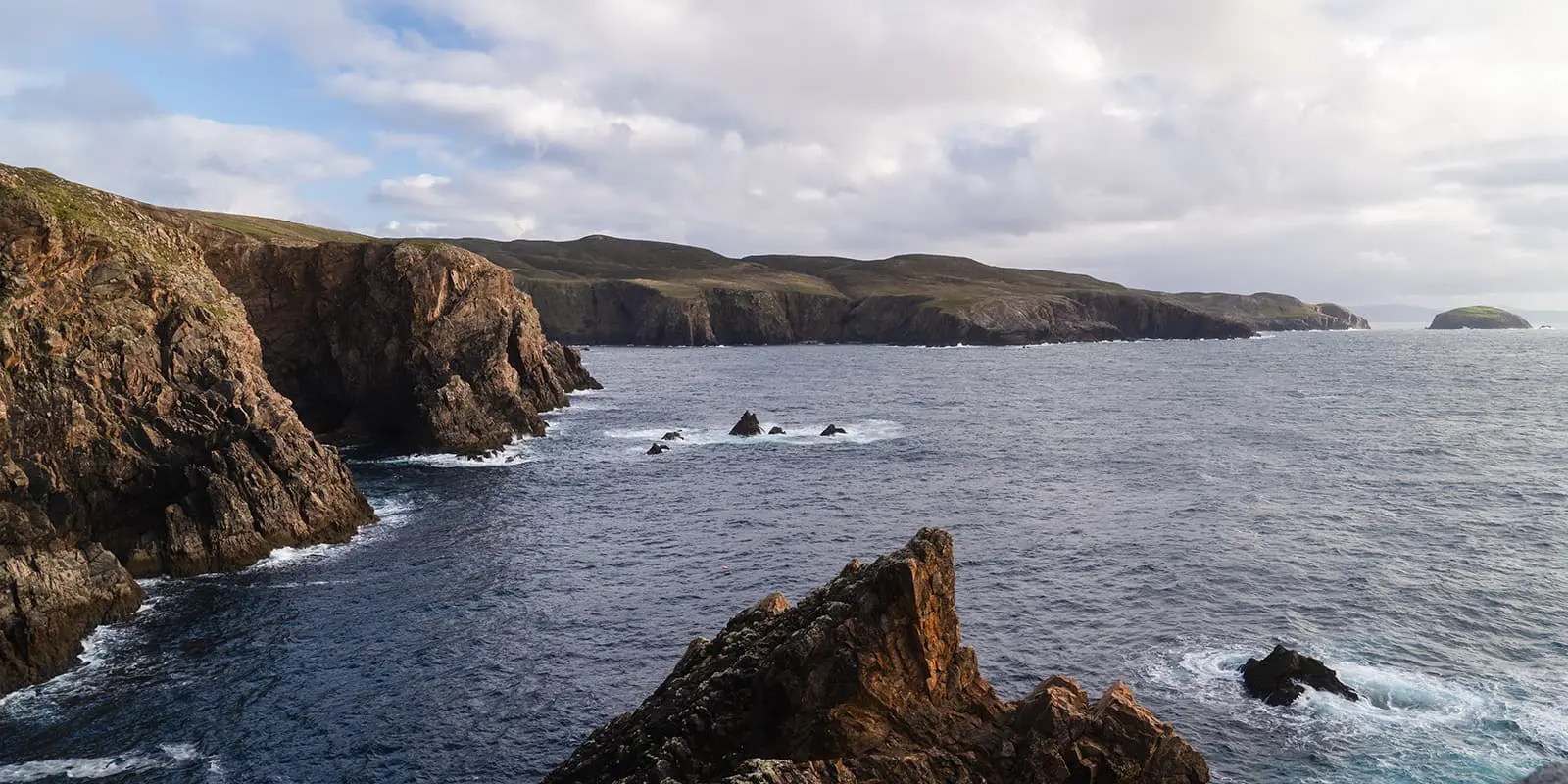
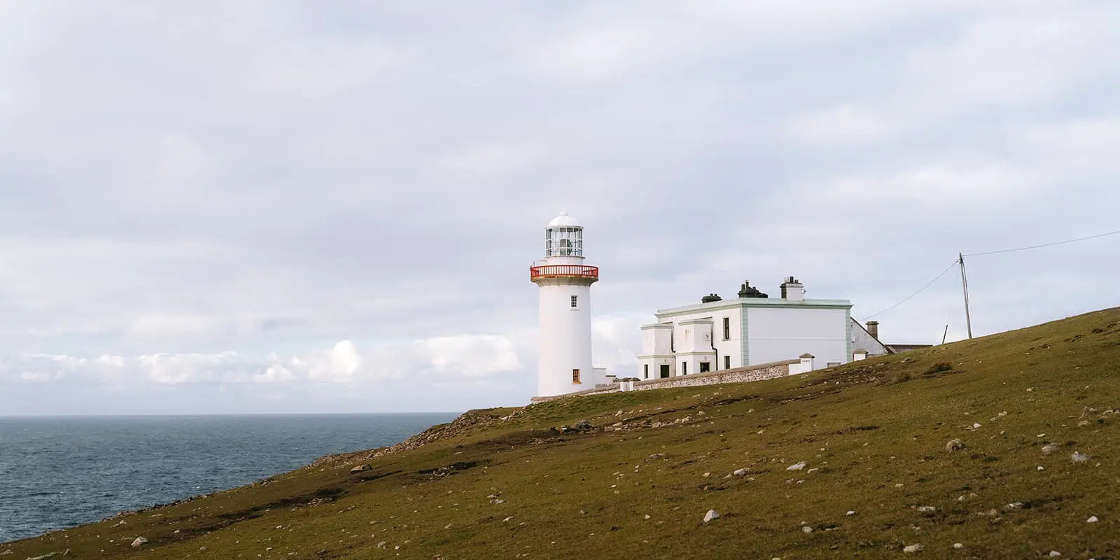
The Slí Árann Mhór Trail is a stunning 18 km loop that takes you on a scenic hike around the rugged beauty of Arranmore Island, located off the coast of County Donegal, Ireland. This moderate trail offers a mix of coastal views and historical landmarks, where you get a taste of the local Irish culture. 

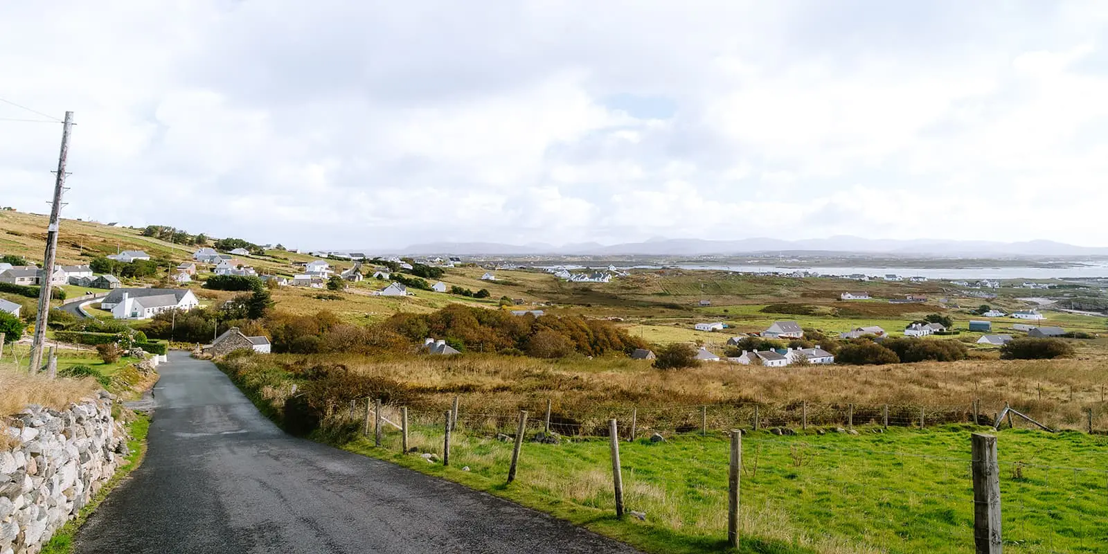
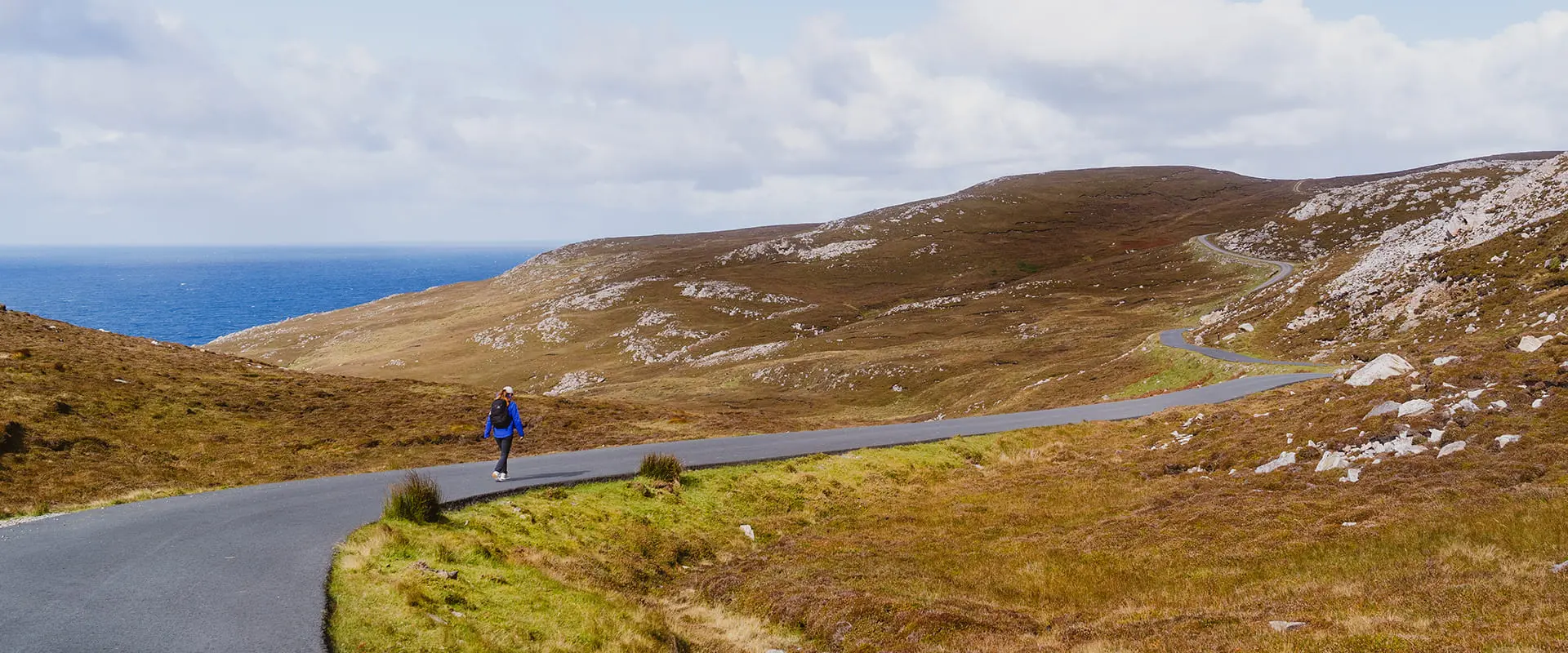
You have to take the ferry from Burtonport to Arranmore Island. In 20 minutes you’ll arrive at the small harbor of Leabgarrow, which is also your starting point. Here you can stock up on some snacks in the little shop. The trail leads you away from the island’s main village, with immediate views of the Atlantic Ocean. As you ascend the gentle hills, you’ll pass by small traditional cottages and occasional grazing sheep. The hike is mainly on a narrow asphalt road, but there is almost no traffic. You may spot a local here and there. This trail is also one of the many highlights on the Wild Atlantic Way.

profile picture Joy Hadders
Author

Joy Hadders

Joy Hadders is a Dutchie who takes full advantage of her free days off of work to experience as much as possible in other countries. Like many others, she found her way in hiking during the lockdown and now she’s also hooked! She enjoys discovering hidden gems with her boyfriend and dreams of a fully pinned world map. You can follow Joy on Instagram @joyhadders.

View profile

The Trail

As you walk along the Slí Árann Mhór Trail, you’ll get to the dramatic cliffs along the northern coastline. It’s just one road with green and brown hills on the right and sea cliffs with crashing waves on the left. Every corner offers a more spectacular view. Then, the trail meanders through the island’s boglands. Along this section, you’ll pass by several small lakes, including Lough Shore, which is a great spot to take a break. A major plus: at various points there are picnic tables or seats which have been strategically placed to enjoy the amazing views.

If you’re doing the whole loop, you’ll walk further on Lighthouse Road, which leads to the Arranmore Lighthouse. The lighthouse offers breathtaking panoramic views, including glimpses of Donegal’s mainland on clear days. The historical Lighthouse Steps will take you down between the cliffs, a must-see highlight.

The final stage takes you back along the southern coastline, where sheltered coves and sandy beaches provide a serene setting. Along the walk, there are a number of information stands giving interesting facts about the island and its history. As the loop completes, you’ll find yourself back in Leabgarrow.

The Slí Árann Mhór Trail combines stunning coastal views with traditional island culture. The hike is easy and can be done by every level hiker. It’s not a real challenging hike, but it’s definitely a rewarding hiking experience. Especially when you’re doing (a part of) the Wild Atlantic Way.

Accommodations

Arranmore Island offers a couple of accommodation options: cozy B&B’s, self-catering cottages and guesthouses. For a unique experience, there are also glamping pods available with coastal views. Because it’s not an extensive offer, it’s recommended to book something in advance.

It’s also possible to take the ferry in the morning and take the ferry back to the mainland in the afternoon.

Best time of the year

The best time to hike on Arranmore Island is during the late spring to early autumn months, specifically from May to September. During this period, the weather is generally milder, with longer daylight hours.

Summer brings vibrant wildflowers and a lively atmosphere, while the stunning sunsets add a magical touch to your hikes. However, always be prepared for sudden changes in weather, as conditions can be unpredictable in Ireland.

Safety & Gear

The weather can change quickly and that can impact visibility. It’s essential to check the weather forecast before starting your hike and be prepared for a chance of rain, wind and/or fog.

Make sure to wear sturdy hiking boots with good traction, preferably waterproof. Dress in layers to adapt to shifting temperatures and bring waterproof clothing to stay dry in case of unexpected rain.

Good to know

  • You have to take the ferry to Arranmore Island. You can book your tickets here. It’s also possible to take the car with you. You can park your car for free at a parking space next to Arranmore Beach.
  • The 18 km is the whole loop, but there are points where you can make your trail shorter.
  • It’s recommended to bring your own snacks, drinks and lunch on the trail. There are a couple of cafes and bars, but mostly located near the starting and finishing point at the harbor – and not during the trail. You can stock up on food and drinks at the local Phil Bán’s Store. Or bring some from the mainland.
  • There are no other water resources during the trail, so you have to bring enough water.
Route
Circuit
Highest point
200m (656 ft)

Want to submit a trail or make this page more complete?

Comments

Be the first one to comment on this trail!

Reply to this trail

Your email address will not be published. Required fields are marked *

Reply to this trail

Log in to comment on this trail
Always read the disclaimer

Terms of Use: important to all visitors on this website. We strive to publish high quality content and information on this website. However it’s always possible that we’re missing out on some crucial information. In spite of the fact that this route, associated GPS track (GPX and maps) were prepared under diligent research by the specified contributor and/or contributors, the accuracy of such and judgement of the author is not guaranteed. Therefore, hiking-trails.com and contributors are in no way liable for personal injury, damage to personal property, or any other such situation that might happen to individuals hiking or following this route. Should you choose to hike this trail, this is always at your own risk. Check out our guidelines for safety hiking and Leave No Trace principles at the hiking 101 page.

Download GPX

Join the community!

Login or create a FREE account 😊

With an account you can:

Download GPX files

Pin trails to your wishlist

Mark trails as hiked by you

Rate hiking trails

Comment on trails, blogs and gear reviews

Happy trails!
Login

Don't have an account yet? Register here