About the Pfunderer Höhenweg

Alps
country
Italy
length
71 km(44 mi)
Type of trail
Hut to hut, Long-distance
difficulty

Difficulty is highly personal. Be aware of the weather conditions as bad weather turns easier trails in difficult trails especially in the mountains.

Difficult
accommodation

Lodging means a mix of hotels, hostels or AirBnB’s.

Mountain huts
Elevation gain
5770 m(18930 ft)
terrain
Mountains, Forest, Hills
remoteness
Some of the time
Show more

Do you want to go for a beautiful hut-to-hut tour in the South Tyrolean Alps of Italy? The Pfunderer Höhenweg is really recommended then. With approximately 71 kilometers and almost 5900 meters of elevation, this five-day trek takes you through remote alpine landscapes. You discover mountain lakes and you cross high mountain passes. Unlike many well-known hut-to-hut routes, this trail remains pretty quiet and remote.

South Tyrol is the northernmost province of Italy, part of the region of Trentino-South Tyrol. This area offers a variety of beautiful landscapes. The scenery at The Pfunderer Höhenweg changes with each stage. When you’re lucky, you’ll witness wildlife, from ibex and marmots to golden eagles soaring overhead.

profile picture Joy Hadders
Author

Joy Hadders

Joy Hadders is a Dutchie who takes full advantage of her free days off of work to experience as much as possible in other countries. Like many others, she found her way in hiking during the lockdown and now she’s also hooked! She enjoys discovering hidden gems with her boyfriend and dreams of a fully pinned world map. You can follow Joy on Instagram @joyhadders.

View profile

The Trail

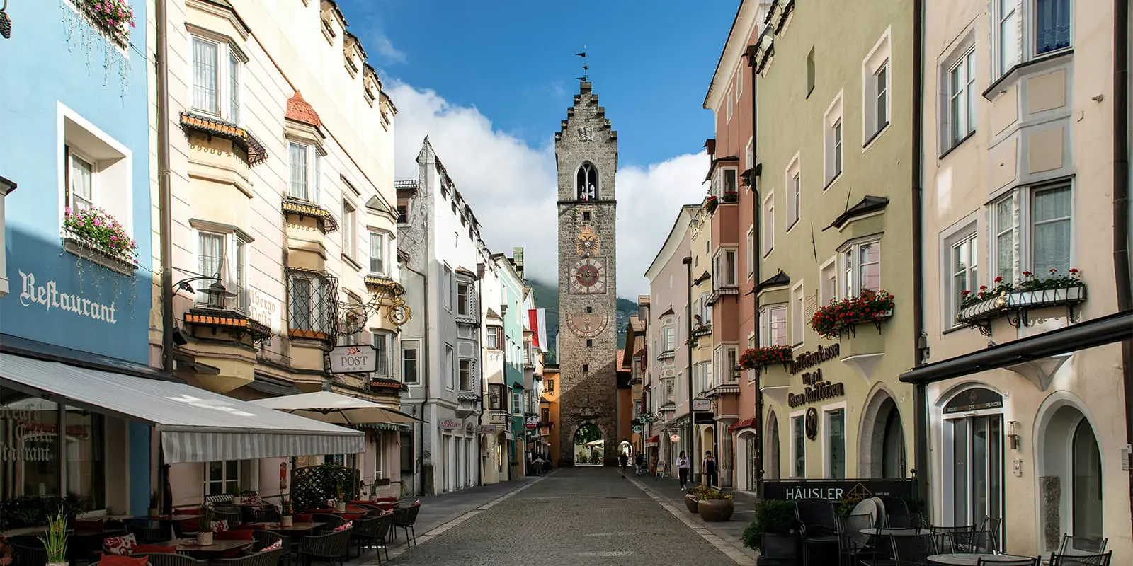
This trail starts in the lovely village of Sterzing (Vipiteno) at the train station. A forested path is the beginning of the first stage before you gradually go into alpine meadows where you get beautiful views of the Eisack Valley. After a green meadow, you reach the Gschließegg viewpoint (1,671m). Hiking further, the elevation increases. Also, you’ll experience a more rugged terrain where the peaks of the Zillertal Alps start to dominate the horizon.

From here you’ll ascend to the ridge northeast of the Höllenkragen. With slight ascents and descents, you’ll pass a narrow meadow ridge with a wooden cross. From the ridge, you will descend steeply in several hairpin turns. After 14 kilometers, the stage finishes at Simile-Mahd-Alm.

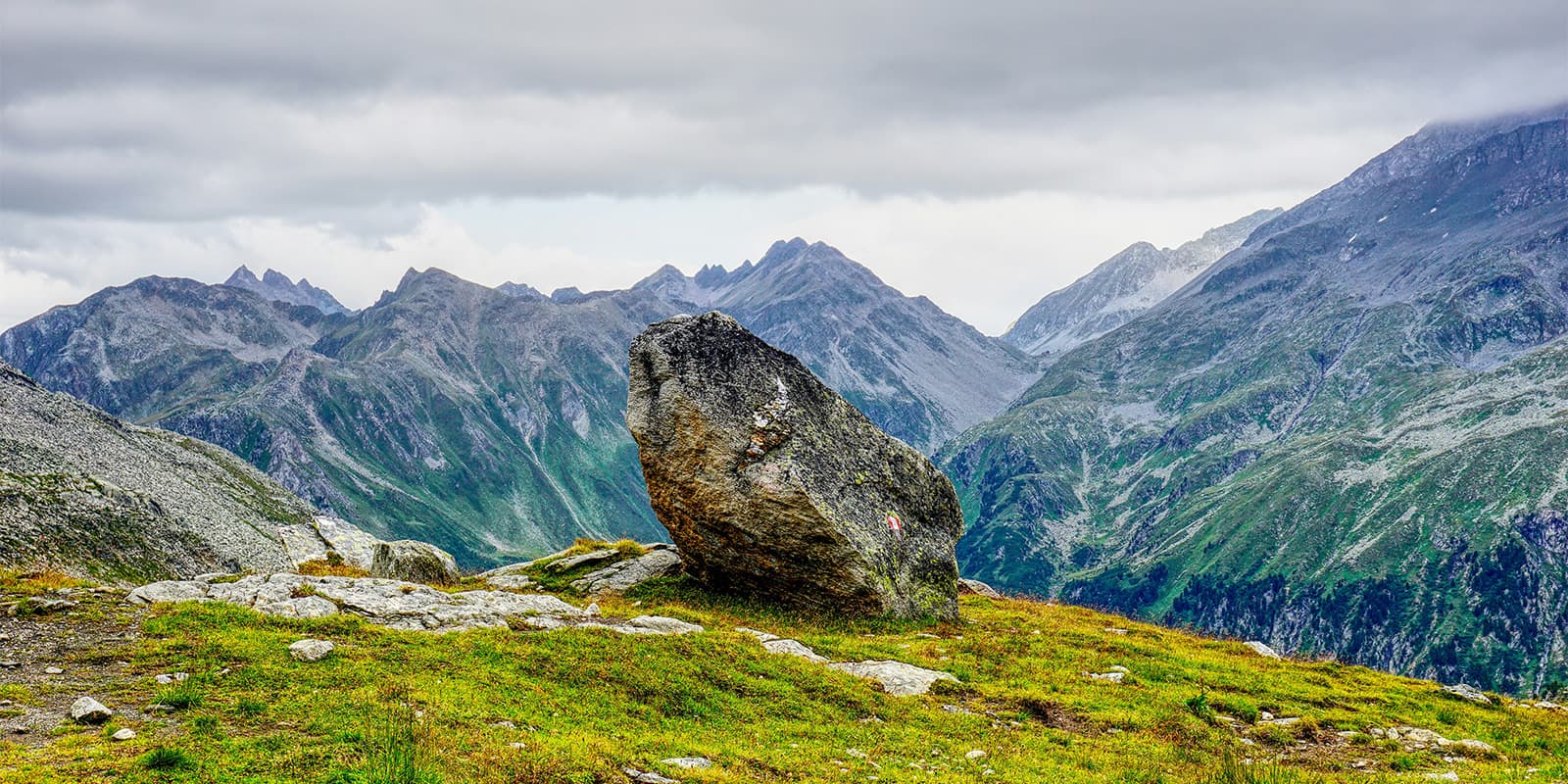
At the second stage, also the shortest of all five, you’ll experience one of the highlights of the trail. Not many kilometers this day, but a lot of ascending. After a steep climb, you will reach a couple of striking boulders. After that, you will see the impressive glacial lake Wilde See. When there is a calm atmosphere, you can clearly see the surrounding peaks in the reflection of the water.

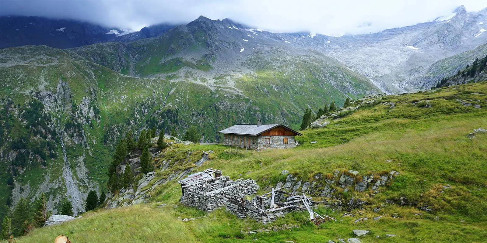
Then, you’ll ascend steeply toward the highest peak in the Pfunderer mountain range: the Wilde Kreuzspitze (3,132m). Amazing panoramic views of the Dolomites and Austrian Alps are your reward here. If you want to avoid the tough climb over the scree and the small climb under the summit cross, it’s better to climb directly from the Rauhtaljoch. As you descend over scree you will see remnants of the glacier. Once in the valley, and a short climb later, you will reach the meadows of the Pfannealm and finally the Brixnerhütte.

Stage number three is both the longest and most demanding. That’s why this section is also known as the ‘queen stage’ of the Pfunderer Höhenweg. You’ll cross several mountain passes and rocky paths. After an hour or so, you’ll reach Steinkarscharte (2,608m). Here, you have amazing views of the impressive mountain landscape around the Weitenbergalm. From the mountain ridge, you will descend in several bends to the Weitenbergbach.

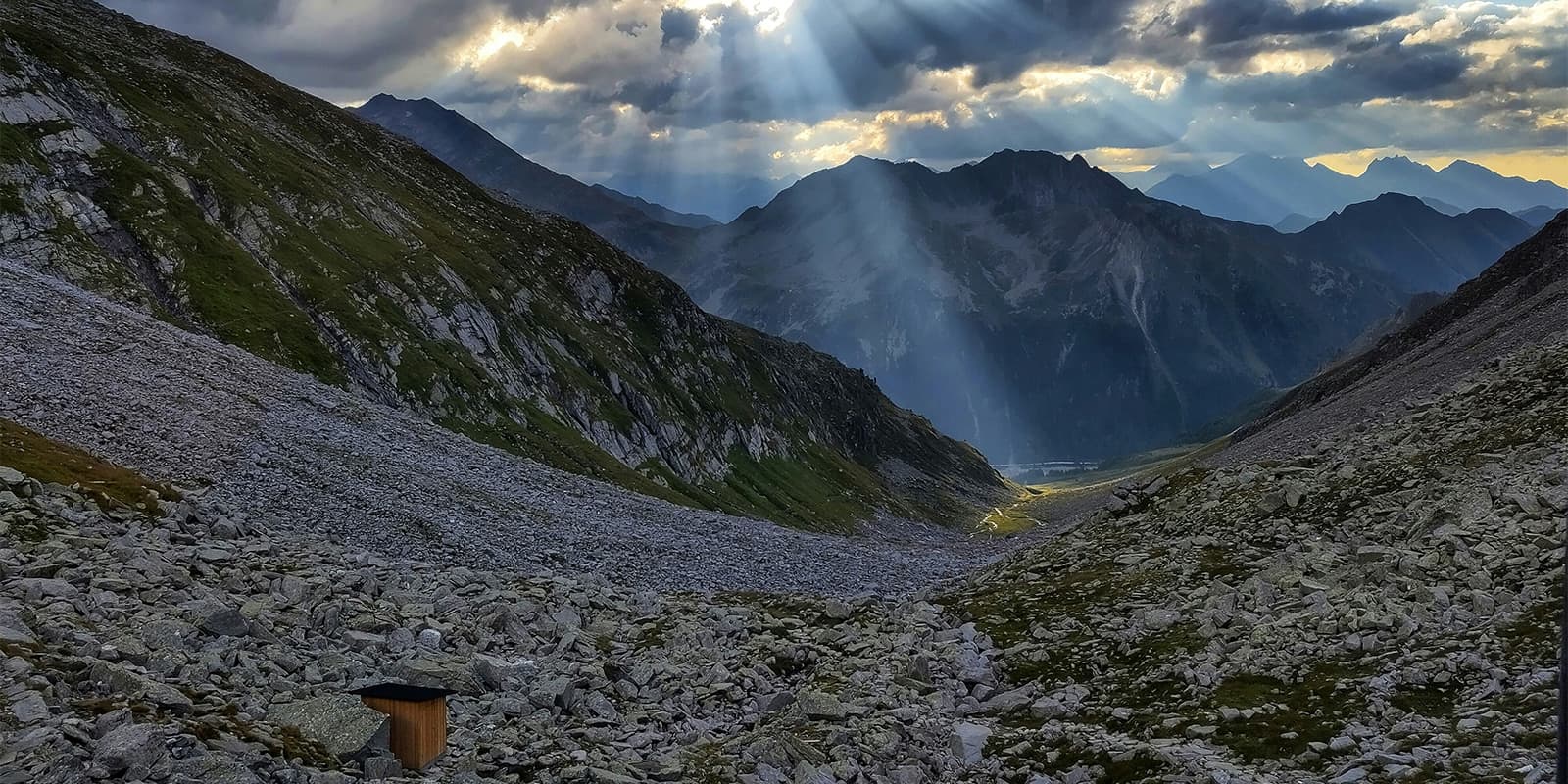
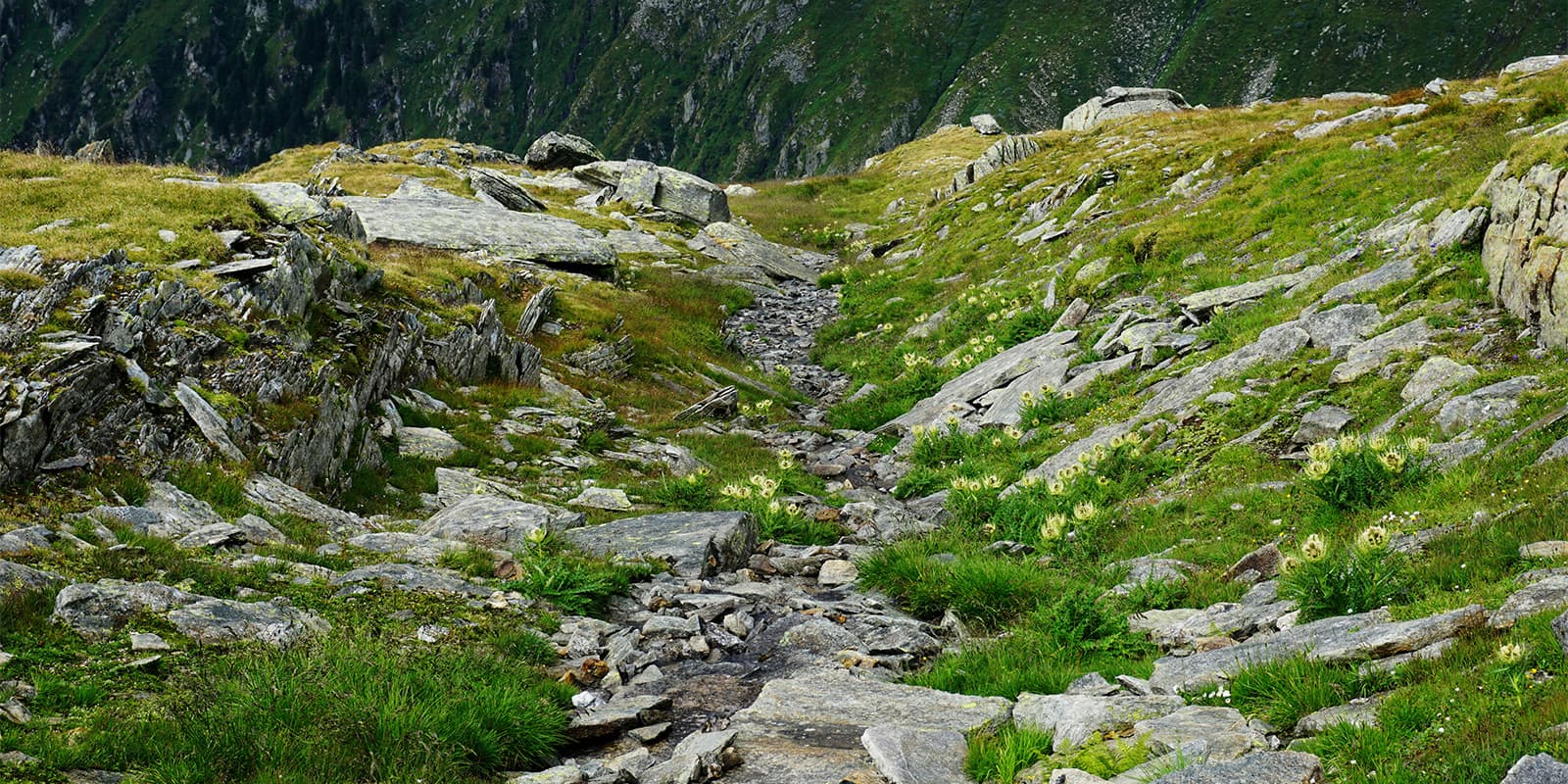
Later on, you will reach a grassy ridge, littered with boulders. After that, an unpleasant trek over grass and rubble in undulating terrain is next. It’s partly secured with ropes. If you want to have a break (or want to do this section in two stages), it’s possible to do that at the Walter Brenninger Biwak, a small shelter.

Dramatic ridgelines and deep valleys will follow. Here, you get the real alpine experience. You’ll have to go through the narrow rock gorge of the Gaisscharte where you’ll hop on a via ferrata, secured with an iron chain and footholds, that will lead you about 30 meters vertically into the depths. Then, you will climb over a rock field and pass a small lake. You’ll find yourself at the upper edge of the Eisbruggdal. Eventually, the day ends after approximately 14 kilometers at the Edelrauthütte.

The fourth stage will take you to the Tiefrastenhütte in about 14.5 kilometers. The rugged terrain from before will change into grassy ridges and rustic alpine lakes and you will go towards Eisbruggsee. When you reach Gruipaalm, you will walk over rolling grassy slopes and see the view of the Eidechsspitze and the Dolomites. After that, you get to the Passenjoch (2,407m) with stunning views of the Zillertal hills.

One of the most beautiful mountain lakes you’ll see on this trail is The Tiefrastensee. What makes it so unique is that the location of the hut is close to this lake.

At the final stage, you’ll be treated to a lot of long-distance views. When you reach Kleines Tor (2,374m), the view over the Mühlwaldertal opens up. The wide summit plateau of the Zwölferspitz will follow. After that, you’ll reach the highest point of this stage: Bärentaler Spitze (2,450m).

At Windeck, you will climb over some blocks and go right along the blocky ridge. Here, you will follow a ridgeline between the Mühlwalder Valley and Pustertal Valley. The high alpine landscape will transform more and more into forests and civilization, where you’ll see more traditional alpine farms. Finally, descending to St. Georgen near Bruneck is steep but really rewarding.

Stages

The Pfunderer Höhehweg is normally a 5-day trail, but you can do it in 6 days. If you find the stage from the Brixnerhütte to the Edelrauthütte too long, you can spend the night at the Walter Brenninger Biwak, so that you divide the third stage over two days.

Pfunderer Höhenweg 5-stage itinerary

Stage 1:

Sterzing – Simile-Mahd-Alm, 14 km | 8.7 mi

Stage 2:

Simile-Mahd-Alm – Brixner-Hütte, 9 km | 5.6 mi

Stage 3:

Brixner-Hütte – Edelrauthütte, 14.5 km | 9 mi

Stage 4:

Edelrauthütte – Tiefrastenhütte, 14.5 km | 9 mi

Stage 5:

Tiefrastenhütte – St. Georgen, 19 km | 11.8 mi

Accommodations

When hiking this trail, you’ll mainly stay in one of the mountain huts alongside the trail. If you want to do section three in two stages, you can spend the night at the small shelter Walter-Brenninger-Biwak.

Staying in huts is a rewarding experience of its own, but not without some preparation! Make sure to book your reservation a few months in advance and bring the right gear to have a comfortable stay. Mountain huts require that you bring a sleeping bag liner, and you’ll likely also want to bring earplugs and an eye mask for your time sleeping in the dormitory-style rooms.

Mountain huts per stage

Stage 1:

Simile-Mahd-Alm

Stage 2:

Brixner-Hütte

Stage 3:

Edelrauthütte

Stage 4:

Tiefrastenhütte

Best time of the year

The best time of the year to hike The Pfunderer Höhenweg is from June to (early) October. As you’re hiking in the mountains, be aware that there might be snowfields in early summer and there might be early snowfalls in late summer and early autumn. Generally, the hiking season in the European Alps is limited to the summer months when the weather is milder and the snow has melted, making the trails accessible.

Keep in mind that the weather in the high mountains can change rapidly, and it’s important to be prepared for all conditions, including rain or snow. Always check trail conditions and local weather forecasts before starting a high-alpine hike. Additionally, consider your hiking experience and skill level, as some trails in the high Alps can be challenging and require proper equipment and experience.

Safety & Gear

Because it’s a high-altitude trail, it’s necessary to prepare yourself properly. You have to be experienced in hiking long distances, you have to deal with altitudes, and you need a good fitness level.

A lightweight backpack (30 – 40 liters) is ideal for carrying all your supplies, including snacks, water and extra clothing. There will be enough water resources during the trail, but it’s recommended to bring enough water with you (at least 2 liters). Because of the distances, elevation meters, and possible temperature changes, you will also want to bring some electrolytes and snacks.

Essential gear includes sturdy hiking boots with good grip, a detailed map or GPS device, and weather-appropriate clothing. You will also need to make sure you have the most current GPX downloaded to your device offline.

In this area, you can expect rapid weather changes (sunshine can quickly turn into rain or fog), so first of all: check the forecast daily with the hut wardens, and ahead of your trek for the longer forecast. Second: bring a waterproof jacket and layers for different temperatures. Hiking poles can help with balance on steep or uneven terrain. Check out our full gear list on hut-to-hut hikes here!

Difficulty

This hut-to-hut hike is great if you’re experienced with a good level of fitness. It involves several demanding ascents, technical rocky terrain, and long hiking days. A via ferrata set can be helpful for those who want extra security on exposed sections.

You should also be prepared for changing weather conditions, as high-altitude storms can develop quickly. It’s highly recommended to plan hut reservations in advance and check conditions before setting out.

Good to know

The trail is accessible by train or car. The Pfunderer Höhenweg is ideal for public transport. Take the train from Munich via Rosenheim and Innsbruck to Brenner station. From Brenner, you can take the regional train to Sterzing.

Are you going by car? Take the Munich – Innsbruck – Brenner motorway to the Sterzing exit. After the exit, turn right at the roundabout and right again at the next roundabout. At the next opportunity, turn left towards Sterzing and Wiesen stations, drive under the railway, and drive to Wiesen. In Wiesen, park your car in the car park opposite the church.

It’s possible to do this trail in six stages if you want to split the third stage into two days. Then, you have to spend the night at the small emergency shelter Walter-Brenninger-Biwak, where there are only places for six people.

route
point-to-point
highest point
3132m (10,275 ft)

Want to submit a trail or make this page more complete?

Always read the disclaimer

Terms of Use: important to all visitors on this website. We strive to publish high quality content and information on this website. However it’s always possible that we’re missing out on some crucial information. In spite of the fact that this route, associated GPS track (GPX and maps) were prepared under diligent research by the specified contributor and/or contributors, the accuracy of such and judgement of the author is not guaranteed. Therefore, hiking-trails.com and contributors are in no way liable for personal injury, damage to personal property, or any other such situation that might happen to individuals hiking or following this route. Should you choose to hike this trail, this is always at your own risk. Check out our guidelines for safety hiking and Leave No Trace principles at the hiking 101 page.

Download GPX

Join the community!

Login or create a FREE account 😊

With an account you can:

Download GPX files

Pin trails to your wishlist

Mark trails as hiked by you

Rate hiking trails

Comment on trails, blogs and gear reviews

Happy trails!
Login

Don't have an account yet? Register here