About the Lynx Trail

Alps
country
Austria
length
220 km(137 mi)
Type of trail
Long-distance, Hut to hut
difficulty

Difficulty is highly personal. Be aware of the weather conditions as bad weather turns easier trails in difficult trails especially in the mountains.

Moderate
accommodation

Lodging means a mix of hotels, hostels or AirBnB’s.

Lodging, Mountain huts
Elevation gain
12000 m(39370 ft)
terrain
Mountains, Countryside, Forest, Hills
remoteness
Some of the time
Show more

Hiking where the lynx live. A new long-distance hiking trail connects three internationally recognized nature protection areas in Austria on eleven stages: the Kalkalpen National Park, the Gesäuse National Park, and the Dürrenstein-Lassingtal wilderness area. This means that the Luchs Trail not only leads through three federal states but also through the largest contiguous forest area in the country – the home of the lynx. After the shy forest cat was almost wiped out in Europe, it was able to regain a foothold – or paw – here.

The Lynx Trail is a declaration of love. To near-natural forests, to biodiversity, to wilderness. The impressive beech forests of the protected areas were therefore declared Austria’s first World Heritage Site by UNESCO. The tail is also a declaration of love for strong calves. Because over 12,000 meters in altitude and 220 kilometers have to be covered on a total of eleven daily stages.

Phillip Eilmer profile photo
Author

Philipp Eilmer

Philipp Eilmer was born in Austria, a country known for the breathtaking landscapes of the Alps and unspoiled nature. He thrives in the outdoors and his curiosity leads him to explore the wonders of nature by foot. He loves the untamed trails of North America and finds solace under the beauty of star-covered skies, whether sleeping in his tent or embracing the rugged simplicity of cowboy camping. You can follow Philipp on Instagram @phips_snowcat

View profile

The Trail

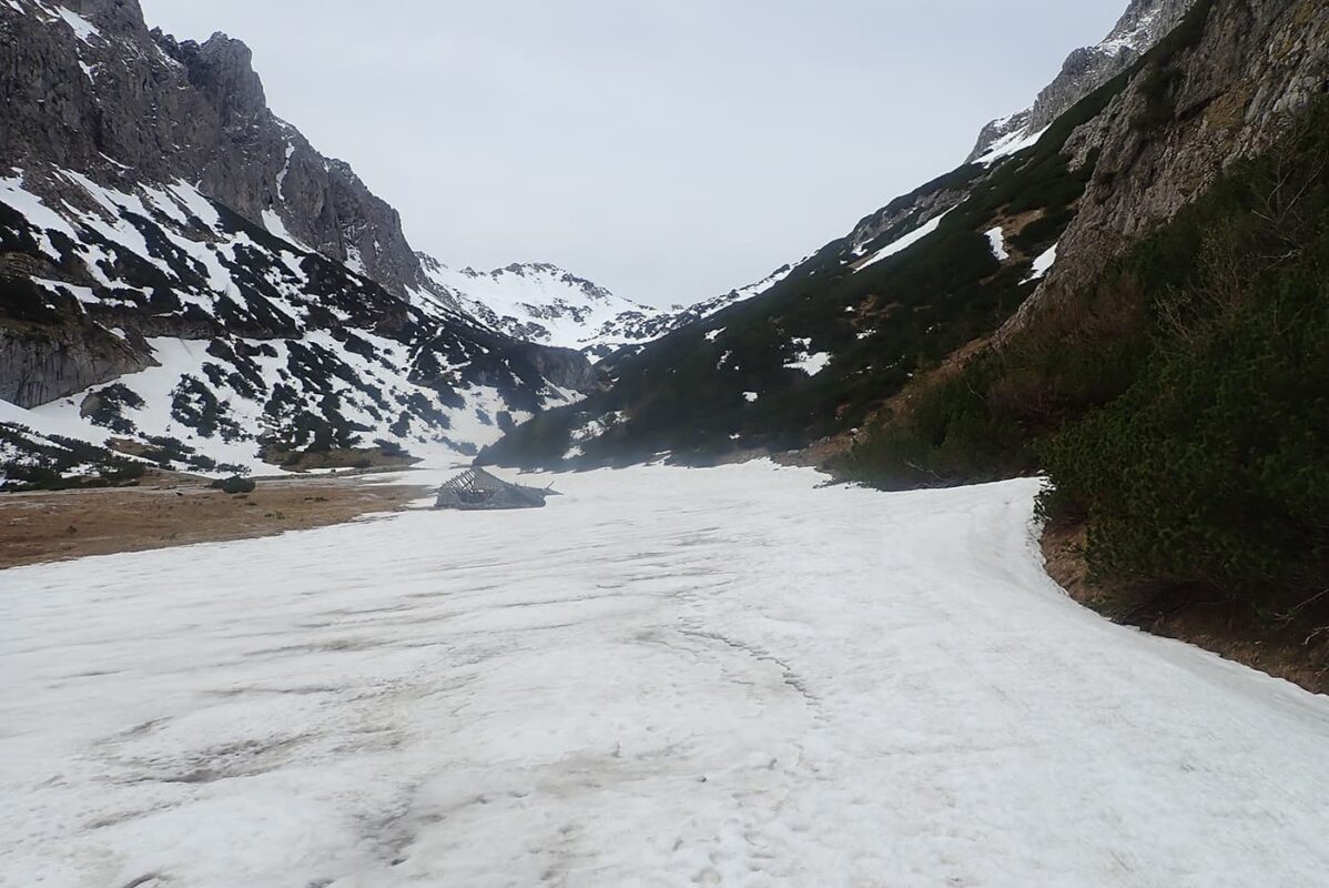
The Lynx Trail leads from the Kalkalpen National Park to the Gesäuse National Park and from there on to the Dürrenstein-Lassingtal wilderness area.

Kalkalpen (Limestone Alps) National Park

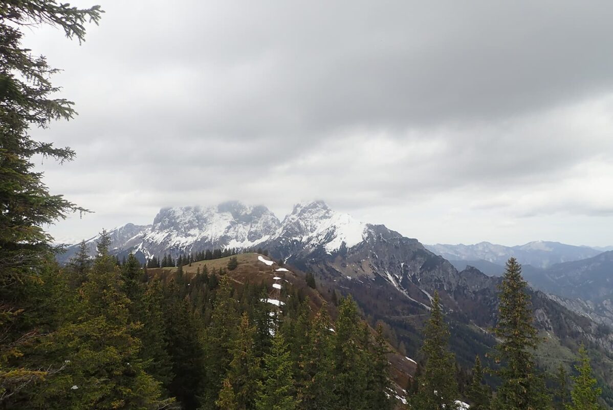
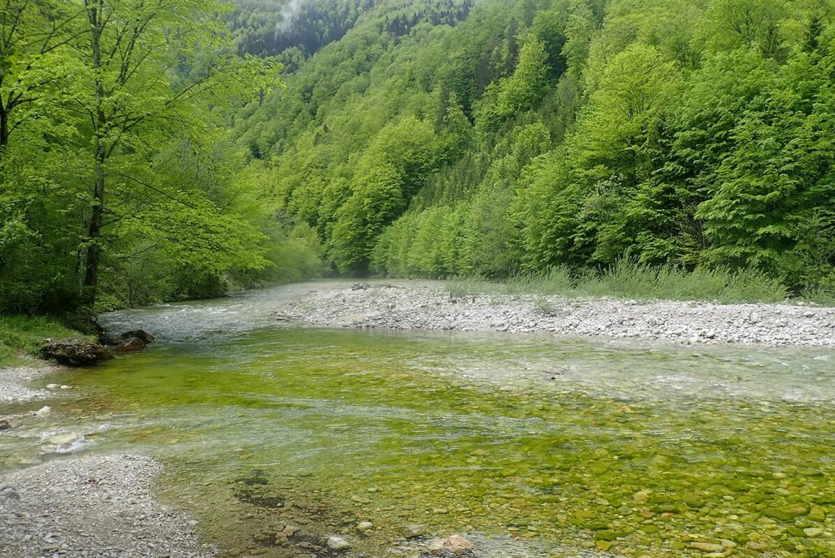
The trail starts in the Kalkalpen National Park. It is located in the Upper Austrian pre-alps and covers an area of over 20,000 hectares. This makes it the second-largest national park in Austria. The protected area in the Limestone Alps extends over two mountain ranges, the Sengsen and Reichraminger Hintergebirge, whose highest point is the Hoher Nock at 1,963 meters.

The national park was established in 1997 and was internationally recognized by the IUCN (International Union for Conservation of Nature) the following year.

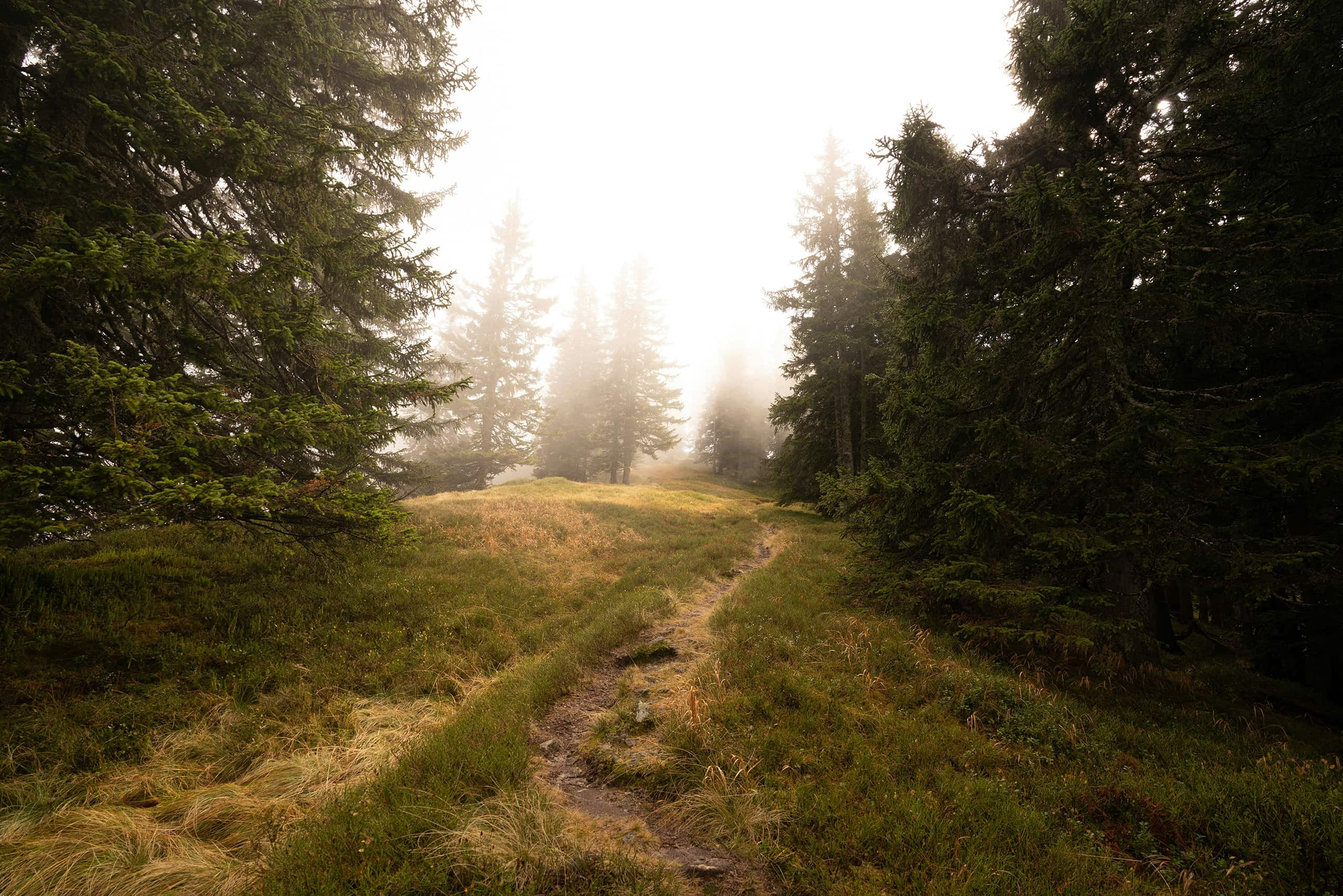
It is not without reason that the protected area is considered Austria’s national forest park. Over 80% of the national park area in the Limestone Alps consists of forest, making it the largest contiguous forest area in the country. While natural beech forests have been pushed back to a few areas in Europe – and are mostly restricted to small areas – beech dominates the forest landscape of the Limestone Alps

Gesäuse National Park

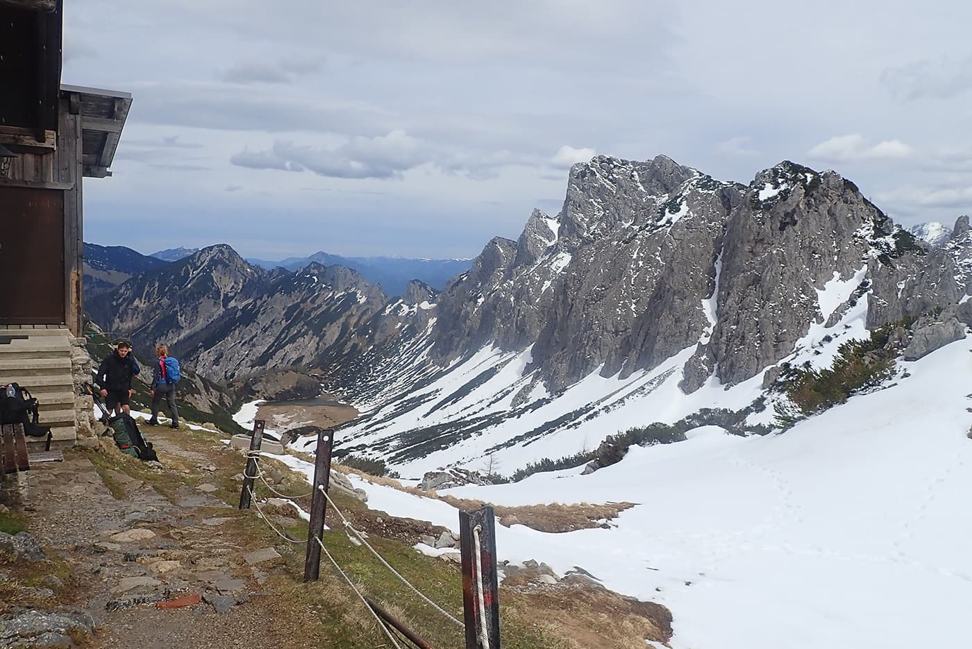
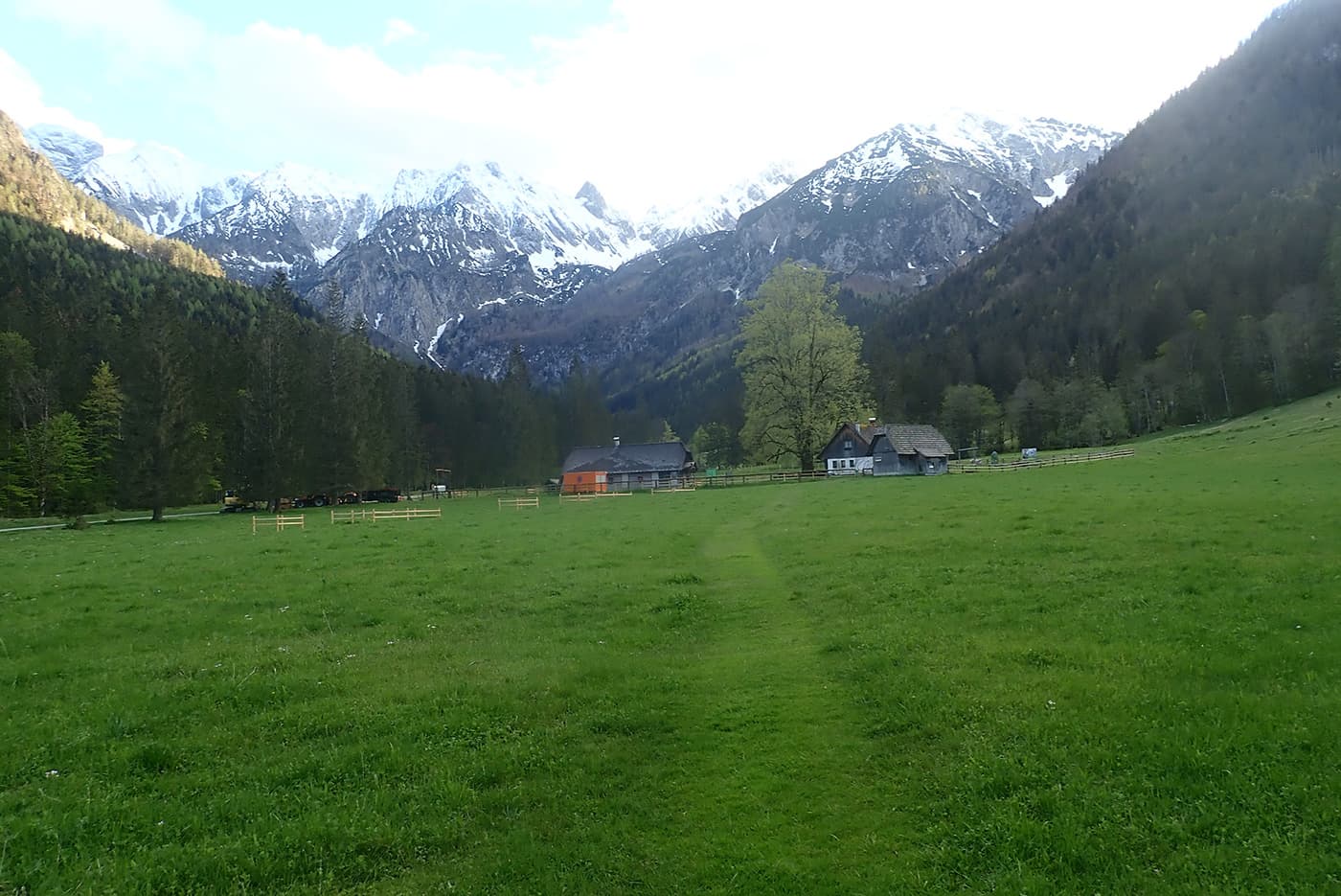
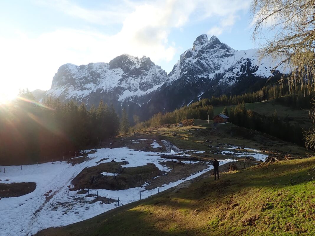
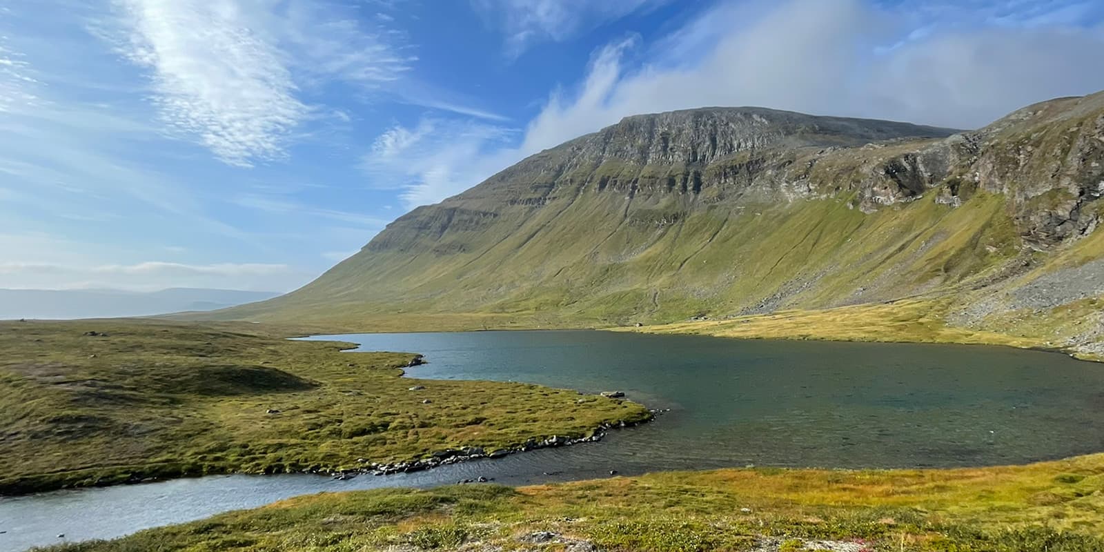
The Gesäuse National Park is the second protected area that you enter along the Lynx Trail and subsequently hike through. Crossing the Haller Mauern, you cross the border from Upper Austria into Styria and enter the Ennstal Alps. Like the mountains of the Kalkalpen National Park, they belong to the Northern Limestone Alps. At 12,000 hectares, the Gesäuse National Park is the third-largest national park in Austria, with its highest peak at 2,370 meters. The Hochtor is therefore also the highest point in the Ennstal Alps. The Gesäuse is also Austria’s youngest national park. It was founded in 2002 and recognized by the IUCN as a Category II national park the following year.

And although the Gesäuse is located in Upper Styria: Some people think they are in Tyrol because the mountains are so impressive. They have steep rock faces that look as if laid out with a ruler. Walls that can easily compete with the Dolomites. It is this impressive alpine terrain that has always fascinated explorers and was already captured by the spirit of alpinism at the turn of the century. Alpine history was written here.

Dürrenstein-Lassingtal Wilderness Area

The Kalkalpen National Park has forest, the Gesäuse has rock and water. The third, and last, protected area along the Luchs Trail can keep up despite its steep competition. And how? The Dürrenstein-Lassingtal wilderness area has the Rothwald, the largest primeval forest in Central Europe. It is located partly in southwest Lower Austria, in the Mostviertel region, and partly in Styria, in the Salza and Lassingtal valleys. When you think of the Mostviertel, you might initially think of leisurely walks, gently rolling hills, and, of course, fruit and cider. But it also has an alpine side. Gorges and caves, rocks and primeval forests. All of this can be found in the wilderness area, which covers 7,000 hectares. Around half of this is made up of old mixed beech forests and is a UNESCO World Heritage Site.

The wilderness area is subject to the strictest protection and a road ban to preserve these old forests. It was officially declared in 2002, recognized by the IUCN as a Category I wilderness area in 2003, and expanded by 3,500 hectares in Styria in 2020 to a total of 7,000 hectares.

Stages

When you’re walking the Luchs Trail from Kalkalpen National Park through Gesäuse National Park to Dürrenstein-Lassingtal Wilderness-Area you can hike on the 11 official stages of the Lynx Trail.

Stage 1:

Reichraming – Anlaufalm, 23 km | 14.2 miles

Stage 2:

Anlaufalm – Laussabaueralm, 21 km | 13 miles

Stage 3:

Laussabaueralm – Admont, 19 km | 11.8 miles

Stage 4:

Admont – Klinkenhütte, 9 km | 5.6 miles

Stage 5:

Klinkenhütte – Johnsbach, 14,4 km | 9 miles

Stage 6:

Johnsbach – Ennstalerhütte, 17,6 km | 11 miles

Stage 7:

Ennstalerhütte – Mooslandl, 11,1 km | 6.8 miles

Stage 8:

Mooslandl – Palfau, 24 km | 15 miles

Stage 9:

Palfau – Lassing, 21,9 km | 13.7 miles

Stage 10:

Lassing – Hochreit, 22,5 km | 14 miles

Stage 11:

Hochreit – Lunz am See, 32,7 km | 20.3 miles

Accommodations

When hiking this trail, you´ll mostly stay in hotels or mountain huts since you pass through many towns on the way. There you can regain energy for the next stages ahead of you. Since the Austrians like to stay in the mountain huts during the season (July & August!) it is necessary to book them in advance to secure a spot. The hotels can be less busy but it is also highly recommended to book a room in advance.

At the start of the trail you can find the following accommodations: Gasghof Orbauerngut, Gasthof Stangl, Landgasthof Kirchenwirt, Lehnerhof.

Overnights per stage

Stage 1:

Anlaufalm

Stage 2:

Laussabaueralm, Zickerreith, Hengstpasshütte, Villa Sonnwend

Stage 3:

Hotel Spirodom, Hotel die Traube, Gasthof Zeiser, Landgasthof Admonterhof, Landgasthof Buchner, Jufa Hotel, Schloss Röthelstein

Stage 4:

Klinkehütte

Stage 5:

Gasthof Ödsteinblick, Gasthof zum Donner, Gasthof Köblwirt

Stage 6:

Ennstaler Hütte

Stage 7:

Hotel Moosiwrt

Stage 8:

Gasthof Stiegenwirt, Rafting Camp Palfau

Stage 9:

Hotel Fahrnberger

Stage 10:

Gasthof Ablaß, Hotel Gasthof Mandel-Scheiblechner, Bauernhof Klein Schöntal, Hotel zum goldenem Hirsch

Stage 11:

Landhotel Zellerhof, Das Haus am See, Astrid Eseltzbichler

Best time of the year

The best time of the year to hike the Lynx Trail is summer. You can already start earlier in May and hike through October. However, if you start early or end late, you have to be aware that there still can be snowfields that have to be crossed or even snowfall. Since you are in a mountain area you also have to be prepared for quick weather changes, heavy rain, and sometimes snowfall. Be prepared for every condition. Check the local weather forecast before attempting the stages and make sure to have proper equipment. Some of the stages are also very long and have a lot of elevation gain, be sure that you are in the right condition to master them.

Safety & Gear

Be sure to send your family or friends your hiking plans, including details such as your anticipated start and end times, selected trail route, and emergency contact information. This is an essential safety measure in case of emergencies.

Stay updated on weather conditions in the area you plan to hike. Avoid starting your hike during severe weather events such as thunderstorms, heavy rain, or extreme heat, which could jeopardize your safety.

Bring at least two liters of water and plenty of energy-rich snacks to maintain your energy and prevent dehydration and exhaustion.

Familiarize yourself with trail and carry a map and compass or download the GPX onto your mobile. If you go the mobile route, be sure to bring a power bank!

Invest in appropriate hiking gear, which should include comfortable, supportive footwear; proper clothing such as warm base layers and a hardshell rain jacket; hiking poles; a well-fitted backpack; and essential equipment like maps, a GPS device (if necessary), and a first-aid kit. For a detailed gear list suitable for long-distance trails, we put together a gear guide!

Follow the principles of Leave No Trace to minimize your environmental impact. Stay on designated trails, pack out all trash, and show respect for wildlife and natural habitats.

Good to know

Make sure you book the mountain huts a couple of weeks in advance to secure a sleeping place during the night. Most huts can be booked by sending them an email or calling them. Also, be aware that some huts might not have cashless payment options, so always carry cash with you! Have a light sleeping bag made of silk or cotton for your comfort and for reasons of hygiene, which is even compulsory in the huts of the Austrian Alpine Association!

Finally, an official booking center has been set up for the Lynx Trail to offer hikers an unforgettable hiking experience with top services and donates €10 to the national parks for every booking. This money is used for monitoring and protecting the animals!

Route
Point to point
Highest point
1875m (6152 ft)

Want to submit a trail or make this page more complete?

Comments

Be the first one to comment on this trail!

Reply to this trail

Your email address will not be published. Required fields are marked *

Reply to this trail

Log in to comment on this trail
Always read the disclaimer

Terms of Use: important to all visitors on this website. We strive to publish high quality content and information on this website. However it’s always possible that we’re missing out on some crucial information. In spite of the fact that this route, associated GPS track (GPX and maps) were prepared under diligent research by the specified contributor and/or contributors, the accuracy of such and judgement of the author is not guaranteed. Therefore, hiking-trails.com and contributors are in no way liable for personal injury, damage to personal property, or any other such situation that might happen to individuals hiking or following this route. Should you choose to hike this trail, this is always at your own risk. Check out our guidelines for safety hiking and Leave No Trace principles at the hiking 101 page.

Download GPX

Join the community!

Login or create a FREE account 😊

With an account you can:

Download GPX files

Pin trails to your wishlist

Mark trails as hiked by you

Rate hiking trails

Comment on trails, blogs and gear reviews

Happy trails!
Login

Don't have an account yet? Register here