About the Lee Trail

country
Luxembourg
length
54 km(34 mi)
Type of trail
Long-distance
difficulty

Difficulty is highly personal. Be aware of the weather conditions as bad weather turns easier trails in difficult trails especially in the mountains.

Moderate
accommodation

Lodging means a mix of hotels, hostels or AirBnB’s.

Camping, Lodging
Elevation gain
2061 m(6762 ft)
terrain
Forest
remoteness
Some of the time
Show more

The Lee Trail is a beautiful 3-day trail in the Éislek region in Luxembourg and is a part of the Escapardenne Trail. The translation of Lee is ‘Lei’ in Luxembourgish and that defines the rocky ridges you’ll discover multiple times during the trail. In 53 kilometers, you hike from Kautenbach to Ettelbruck or the other way around. It’s possible to do it in both directions. With 2000m of elevation gain, 30+ outstanding viewpoints, and more than 60% of the trail in a natural state, it makes sense that it’s qualified as one of the ‘Leading Quality Trails – Best of Europe.’

The trail is a perfect way to escape into nature for a long weekend of camping with a touch of history. Recently established in 2018, the trail connects viewpoints and fascinating Napoleon and WWII history as you walk along.

Joy Hadders
Author

Joy Hadders

Joy Hadders is a Dutchie who takes full advantage of her free days off of work to experience as much as possible in other countries. Like many others, she found her way in hiking during the lockdown and now she’s also hooked! She enjoys discovering hidden gems with her boyfriend and dreams of a fully pinned world map. You can follow Joy on Instagram @joyhadders.

View profile

The Trail

When you start in Kautenbach, you immediately are treated with a climb. After that, you hike through the forest and can go up to a viewpoint that shows you the directions of all the villages nearby. Next up you’ll be challenged with some technical and steep paths. You’ll see that there are a lot more mountain hiking paths than you may expect. You get many views of high hills with a lot of different kinds of trees. After that, you hike to Molberlee, a fascinating rocky ridge that offers a beautiful view of the Schlindertal. Because of its unique biodiversity, it’s designated as a natural monument. After a few climbs and hiking through the small village of Hoscheid, you’ll get to the first campsite in Goebelsmühle after a 22-kilometer day.

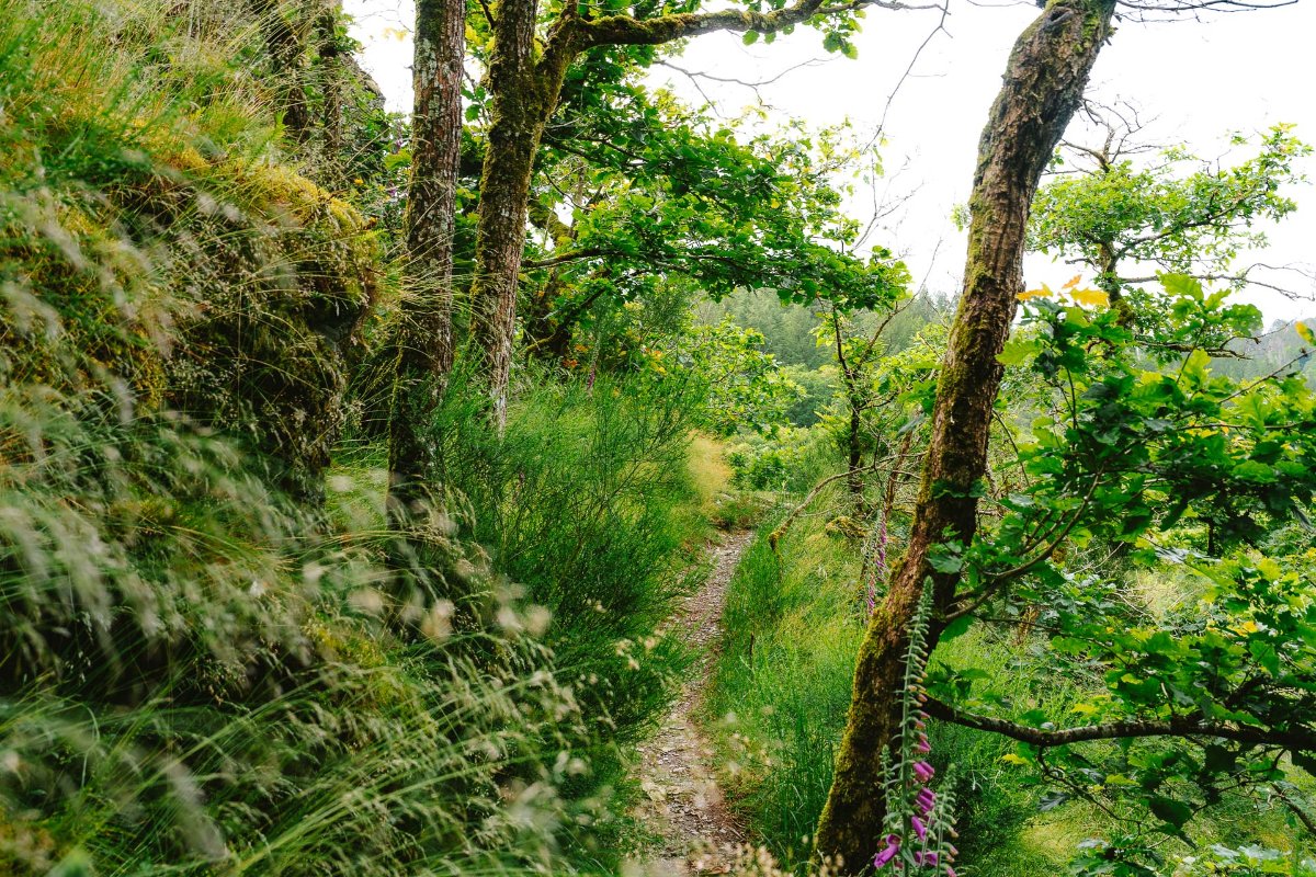
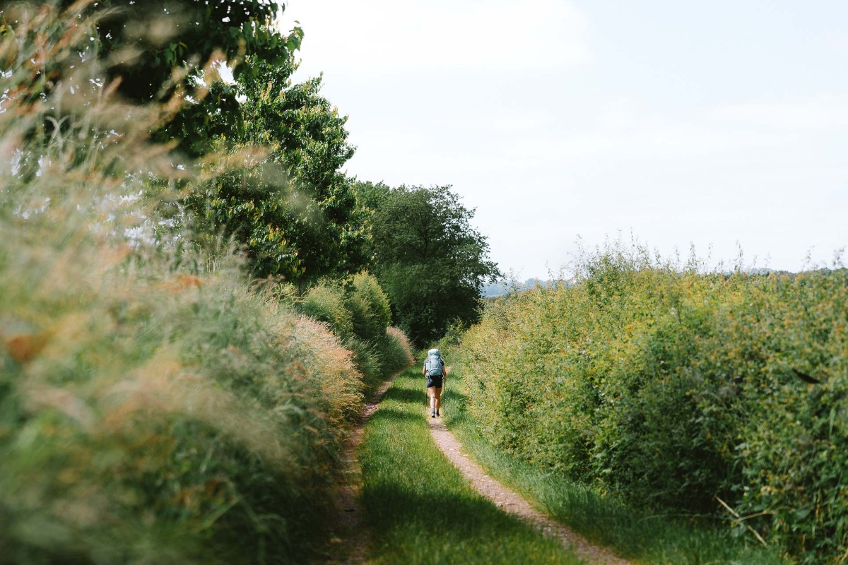
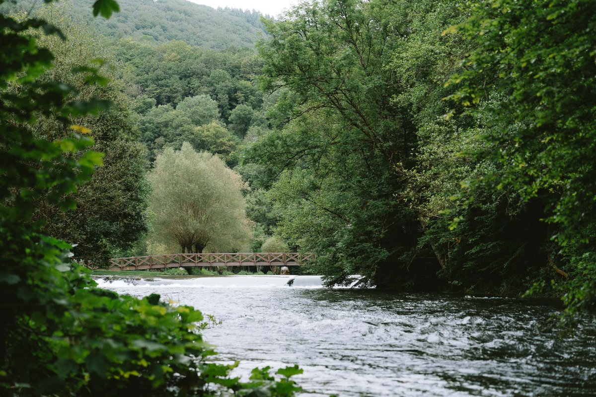
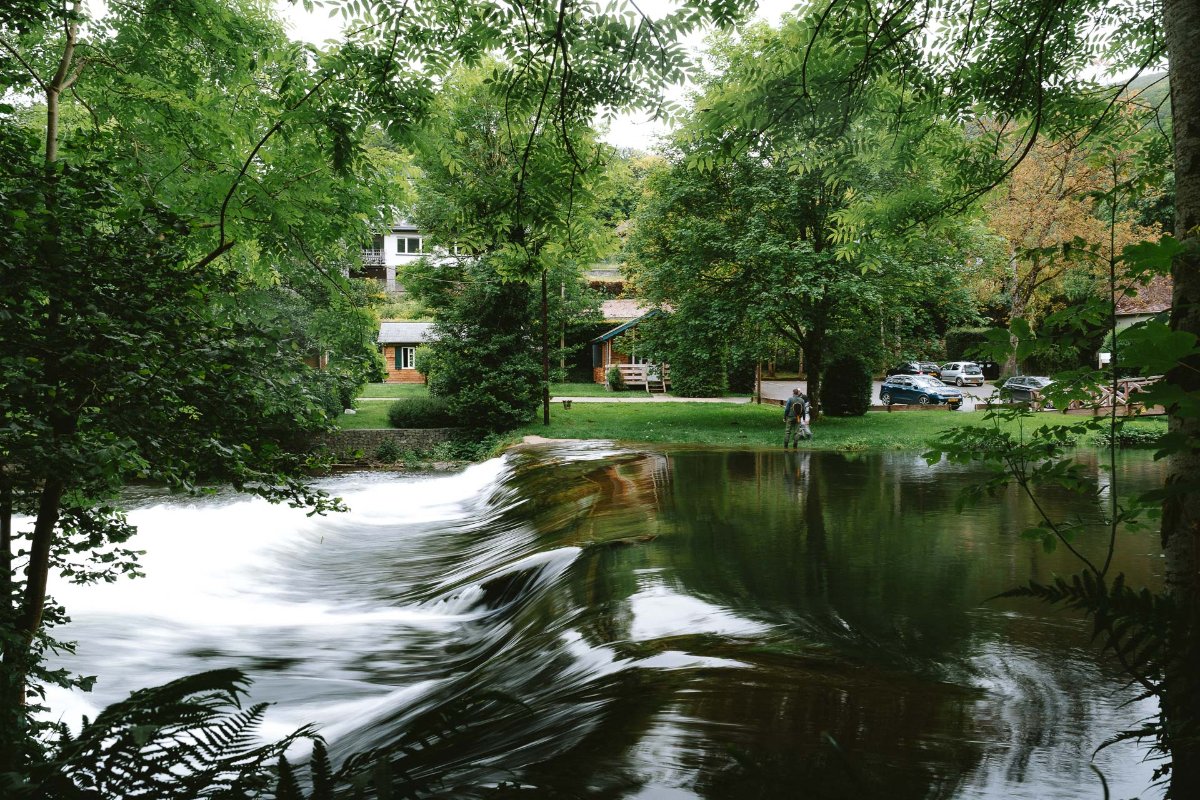
The second stage will take you 14 kilometers to Bourscheid-Moulin. If you stayed the night at the campsite, you cross the road and immediately rise considerably into a forest. There are a lot of small paths with high grass (please make sure to check regularly for ticks!). After climbing a lot you descend to a little cafe next to a waterfall. The perfect time and place for a coffee break. There’s a big chance you’ll see multiple fishermen, even in the waterfall itself. After your refuel, you will alternate walking through nature and along the road next to big cane fields. At the highest point of this stretch, there is a big old tree that was planted in 1811 in honor of the birth of Napoleon’s son. Next up there are nice parts to descend. If the water level is really high, you’ll get to a path near the campsite that’s fully underwater. You can either choose wet feet or climb a little through the side of the hill, but that’s at your own risk. The last part is just hiking along the river and train tracks.

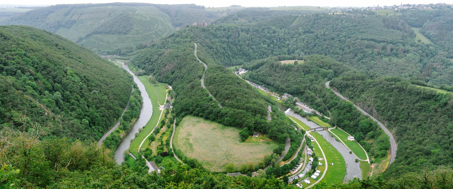
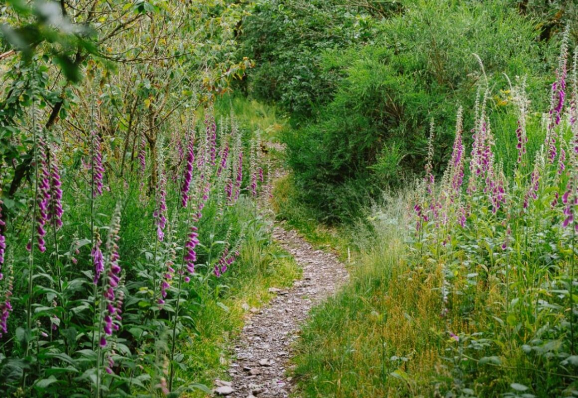
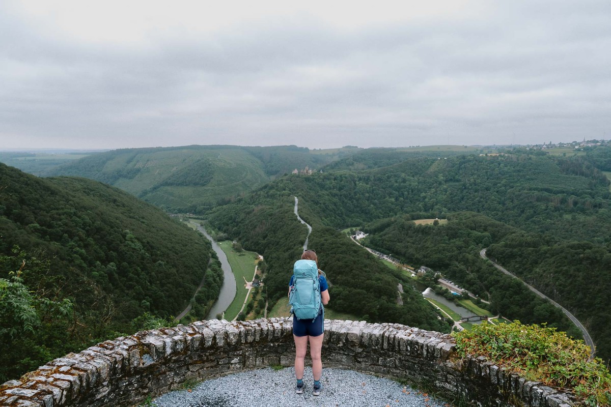
The third and final stage starts with a long climb to the well-known viewpoint, Gringlee. Waking up early and seeing the sunrise here is highly recommended. Here you get a fantastic panoramic view of the valley and can spot the castle of Bourscheid. After that, you hike through small forest paths with some varied increasing and decreasing parts. During the whole trail, you walk along purple lupin plants, but here you’ll find an abundance. It almost feels like you’re walking in a garden uphill. After a stretch through the countryside, you walk through the small village of Michelau. Over the last couple of kilometers, you hike through a forest with a lot of spruce trees and cross the Sauer River.

Finally, you’ll arrive in Ettelbruck. After a quite remote trail, you end up in the city with the train station and the city center with a couple of shops and cafes.

Stages

While the Lee Trail is only 54 kilometers, it is usually hiked in 3 stages. This is best for slowing down and enjoying each day!

Lee Trail in 3 stages

Stage 1:

Kautenbach – Goebelsmühle, 22.6 km | 14 mi

Stage 2:

Goebelsmühle – Bourscheid-Moulin, 14 km | 8.7 mi

Stage 3:

Bourscheid-Moulin – Ettelbruck, 17.3 km | 10.7 mi

Accommodations

It’s best to stay at campsites for this trail. The great thing about these stages is that all campsites are located on the trail. At every campsite, you can book a beautiful spot for your tent next to the river. When the water in the rivers is higher than normal, you still get a nice place for your tent. But if you want a guaranteed dry stay, then book a pod or chalet at the same campsite.

Make sure you are at Camping du Nord before 5 PM, because you can still order pizza until then. If you arrive at 4:50 PM (as we did), the pizza tastes even better. But that’s the only food you can get there besides snacks in the shop. They really must like pizza in Luxembourg, because that’s also the only option at the second campsite Camping du Moulin Bourscheid. That’s why we chose to eat in the local pub Am Keller, a 5-minute walk away (a reservation in advance by phone is recommended).

At every campsite, you have the option of a sandwich service or to stock up on snacks. You won’t encounter anything else, so make sure you bring enough of your own breakfast and snacks.

Overnight for each stage

Stage 1:

Camping du Nord

Best time of the year

The best time of the year to hike the Lee Trail is from the end of May through early September. Even though it’s not extremely hot during summertime, keep in mind you’ll need to be prepared for multiple weather conditions. Always check the trail conditions and weather forecasts.

Because it can rain very much and the water level can be higher than normal, you sometimes have to make a detour (or get your feet wet).

Additionally, consider your hiking experience and skill level, as some parts of this trail are challenging. So bring the proper equipment with you, such as solid shoes and hiking poles.

Safety & Gear

You can reach the starting and finishing point quite easily because of the great connection of the train network. There are plenty of signs during this long-distance trail, in both directions.

The trail has some challenging parts, so you have to be in good condition and have some hiking experience. Hiking poles, weatherproof clothing, and sturdy shoes are recommended.

Good to know

Are you going by car? Then it’s recommended to start in Kautenbach where you can park for free at the train station. That’s also the starting point of the trail.

There are not many hotels at the stages, so it’s best to stay at the campsites. Also, there are not many food options (unless you bring your own or want to have a pizza party).

Public transportation in Luxembourg is free. Every 30 minutes you can take the train from Kautenbach to Ettelbruck (or the other way around) and it’s just a 13-minute ride.

Route
Point to point
Highest Point
505M (1657 FT)

Want to submit a trail or make this page more complete?

Comments

Be the first one to comment on this trail!

Reply to this trail

Your email address will not be published. Required fields are marked *

Reply to this trail

Log in to comment on this trail
Always read the disclaimer

Terms of Use: important to all visitors on this website. We strive to publish high quality content and information on this website. However it’s always possible that we’re missing out on some crucial information. In spite of the fact that this route, associated GPS track (GPX and maps) were prepared under diligent research by the specified contributor and/or contributors, the accuracy of such and judgement of the author is not guaranteed. Therefore, hiking-trails.com and contributors are in no way liable for personal injury, damage to personal property, or any other such situation that might happen to individuals hiking or following this route. Should you choose to hike this trail, this is always at your own risk. Check out our guidelines for safety hiking and Leave No Trace principles at the hiking 101 page.

Download GPX

Join the community!

Login or create a FREE account 😊

With an account you can:

Download GPX files

Pin trails to your wishlist

Mark trails as hiked by you

Rate hiking trails

Comment on trails, blogs and gear reviews

Happy trails!
Login

Don't have an account yet? Register here