panoramic view of mountain range in Picos de Europa on the El Anillo de Picos hiking trail

El Anillo de Picos

The Ring of Peaks

About the El Anillo de Picos

country
Spain
length
110 km(68 mi)
Type of trail
Long-distance, Hut to hut
difficulty

Difficulty is highly personal. Be aware of the weather conditions as bad weather turns easier trails in difficult trails especially in the mountains.

Strenuous
accommodation

Lodging means a mix of hotels, hostels or AirBnB’s.

Mountain huts
Elevation gain
9350 m(30676 ft)
terrain
Mountains
remoteness
Most of the time
Show more

El Anillo de Picos, otherwise known as the Ring of the Peaks or the Circular Route, in Picos de Europa, is a 7 to 9-day trek that passes over 3 massifs in the region. There are actually three routes you can take: the Vindio Ring, the Extreme Ring, and the Three Massifs Ring. This description covers the longest ring, the Three Massifs which crosses 9 mountain huts on the way.

The Three Massifs Ring of El Anillo de Picos is a very strenuous trail that should only be attempted by experienced and strong hikers. This area in the Vindios Mountains is special because it was a stronghold and refuge for the Cantabrian tribe when they fought off the Romans so many centuries ago. You will see much of the history recorded and celebrated in the nine mountain huts that you pass through on the trail.

Elmar profile picture
Editor

Elmar Teegelbeckers

Passionate hiker Elmar spends months of his time on the trail. He’s usually on the lookout for hidden gems in one of his favourite countries such as Slovenia, Switzerland and Japan. He founded hiking-trails.com in need for a community and detailed information about the trails. Before this, he worked for the Alpine asscociation in the Netherlands[ (NKBV) but lost his heart to the trails.

Not long ago, Elmar published the book (in Dutch) Hiking Trails – best long-distance trails in Europe. With this book, website and socials, he hopes to inspire and shape an inclusive community for hikers all over world. No matter your speed, experience or level, you can get out there to enjoy the trails and connect with the heartwarming hiking community. Life is so much better outside and he hopes to inspire hikers to take their first, or next, step on the trail.

You can reach Elmar at info@hiking-trails.com.

View profile

The Trail

As a loop trail, you can start El Anillo de Picos in Poncebos, Cangas, Sajambre, Valdeón, Liébana, Sotres, or Cabrales. However, the most common and convenient starting point is Poncebos. The included GPX begins in Posada de Valdeón, but we recommend that you begin in Poncebos for easier access with public transportation via Las Arenas.

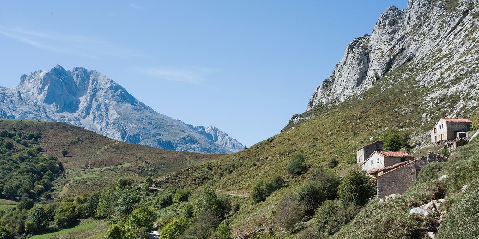
From Poncebos, you will walk 14 km to Refugio de Ario on the first day. This is partly over one of the most renowned trails in the Picos de Europa: Ruta del Cares. It’s an amazing start to this long-distance trail. While it isn’t many kilometers, the initial climb out of the valley will remind you of why you chose this challenge. Be aware that this is a trailless route, so you will need to rely on cairns and your GPX to find the way. There are also occasional yellow and white trail markers to confirm you’re on the right path.

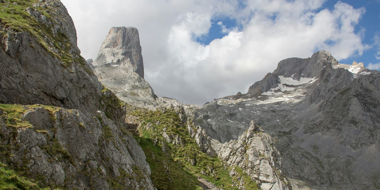
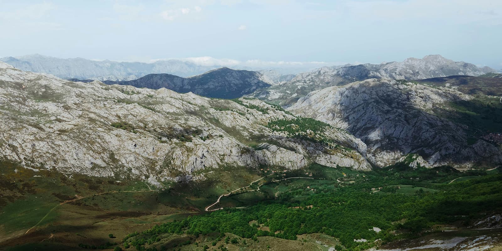
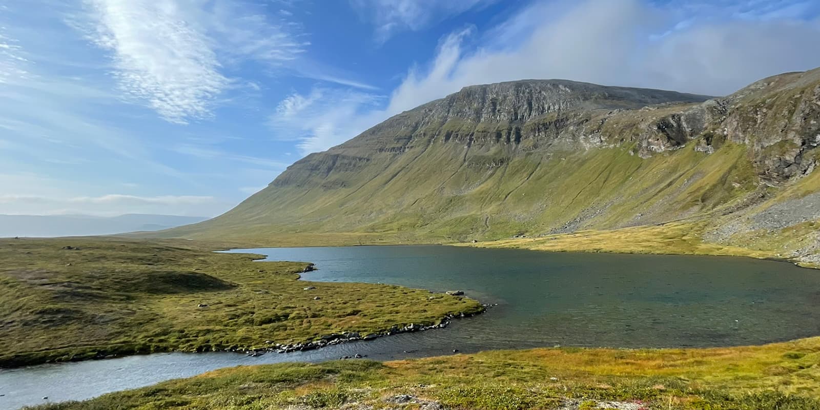
From Refugio de Ario, you will then continue 15.5 km to Refugio Vegarredonda. The trail moves through grazing areas in the high plateaus, where you will see lots of limestone towers and have some shorter descents and climbs than the day before. These are still on scree fields and have a high difficulty, though. You’ll cross open ground with few trees and follow clear mountain paths toward the next hut. Refugio Vegarredonda sits in a higher basin surrounded by peaks.

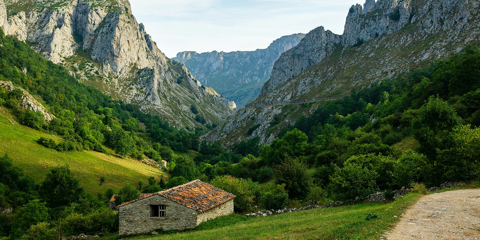
Stage 3 is about 17 kilometers from Vegarredonda to Refugio Vegabaño. You begin on rocky ground and then gradually drop toward the beech forests of the area. The terrain changes a lot, and you’ll hike on exposed ridges, through wooded sections, and on old shepherd paths. You will also spend some time on scree fields, so be extra careful with your balance and concentration. There is a great spring, the Fuenta Prieta, on the trail this day, so you can refill your water. If it is overcast or rainy, it’s recommended that you hike near the lakes, which should have better visibility. You finish the day at Vegabaño, set below the cliffs on the edge of the central massif and situated in the beech forest, which creates a great contrast.

Stage 4 is one of the longer days of the trail, 19.2 kilometers, and goes from Vegabaño to Refugio Collado Jermoso. After a descent in the morning, you will climb for the rest of the day, crossing passes and moving into much steeper and more mountainous terrain. Expect a full day on your feet (and hands). The scree slopes of the second half of the day are very steep and will require you to use your hands as well as your feet to keep your balance and climb up to the hut.

After the longer day, stage 5 is luckily only 5 kilometers. This can be a semi-rest day for you, as the path is much more gentle and you won’t climb as much as in the previous stages. However, the path does still follow narrow high-mountain trails, with sections of scree and sharp limestone. You’ll see that in those 5 kilometers, the terrain changes to feel almost like a moon landscape up near the Refugio Cabaña Verónica, where you will sleep this night.

After your almost-rest day, stage 6 is one of the longer distances: 20 km from Cabaña Verónica to Refugio Casetón de Andara. You begin by descending into a different valley system and spend much of the day on easier slopes. You’ll cross meadows, rocky tracks, and old mining paths. You’ll pass Cabrales where you can buy snacks and stop for a refreshing drink. But the day doesn’t end here and you will then hike up another 1100 meters before descending about 400 meters to the Refugio Casetón de Andara. Make sure to pack plenty of snacks for this day!

The second-to-last stage from Casetón de Andara to Refugio Vega de Urriellu is about 15 kilometers and will begin the ascent to the Pandébano Pass. The day starts in the forest, then rises again into open pastures and finally to a big push to the hut. The final stretch brings you directly below the famous Naranjo de Bulnes (Urriellu), where the refuge sits at the base of the peak. It’s a special place in the mountains of Picos de Europa.

Finally, the last stage is 16.3 km from Refugio Vega de Urriellu back to Poncebos. You will immediately leave the high mountains behind and descend steadily. However tired you may be, it is still important to stay sharp for this descent, as it is very steep and can be tricky on your body. The path will change from the mixed rocky paths that you’ve been on for days to forested sections and finally move downhill toward the valley. You finish the loop where you started in Poncebos.

Stages

El Anillo de Picos has three possible routes depending on your schedule and comfort level in the mountains. This is the itinerary for the Three Massifs Ring. However, you can also hike the Vindio Ring (63 kilometers) or the Extreme Ring (82 kilometers) if you have less time.

Suggested Three Massifs Ring El Anillo de Picos Itinerary

Stage 1:

Poncebos – Refugio de Ario, 14 km | 8.7 mi 

Stage 2:

Refugio de Ario – Refugio Vegarredonda, 15.5 km | 9.6 mi

Stage 3:

Refugio Vegarredonda – Refugio Vegabaño, 16.8 km | 10.4 mi

Stage 4:

Refugio Vegabaño – Refugio Collado Jermoso, 19.2 km | 11.9 mi

Stage 5:

Refugio Collado Jermoso – Refugio Cabaña Verónica, 5 km | 3.1 mi

Stage 6:

Refugio Cabaña Verónica – Refugio Casetón de Andara, 20 km | 12.5 mi

Stage 7:

Refugio Casetón de Andara – Refugio Vega de Urriellu, 15 km | 9.3 mi

Stage 8:

Refugio Vega de Urriellu – Poncebos, 16.3 km | 10.1 mi

Accommodations

On El Anillo de Picos, you sleep in refugios, or mountain huts, along the entire way. The shelters in this part of the Picos de Europa are a special preservation of the history of the area, and you will see that reflected in the care taken of the huts by the wardens.

It is important that you reserve your night at each shelter far ahead of time, as they book up quickly. This area is becoming more and more popular, so make sure to call or email a few months ahead of time to secure your spot.

When sleeping in a mountain hut, make sure to bring a sleeping bag liner, a headlamp, earplugs, and a good book for the hours after you arrive. Refugios are a great way to stay high in the alpine without needing to go down to the valley between each stage. However, that also means that resources can be limited, and it will be a more primitive stay than at a hotel. Expect to sleep in a bunk room with other people, to have an early wake-up, and a fixed menu for each meal.

Mountain huts per stage

Stage 1:

Refugio de Ario

Best time of the year

The best time of year to hike El Anillo de Picos is between June and September. The weather in Picos de Europa is mild from early summer until mid-fall, and you will have the quietest trails in June and September. Be aware that July and August are very busy, as these are the months for holidays, and it can get very hot. Because of this, if you are booking your huts last minute, you may have more luck reserving for June and September. Always check the snow conditions on the trail before you set out.

Safety & Gear

El Anillo de Picos is a strenuous trail that you need to prepare for adequately. Aside from packing the normal gear for a hut-to-hut tour, you should also prepare yourself mentally and physically for this challenge. Hiking 1300+/- meters each day is a challenge that can be tough on the body for just one day, but this trail requires that you do  it for a week. You can prepare for this by training before your hike and working on balance, strength, and cardio. It’s important that you train with weights as well, to mimic the extra load you’ll carry with your full backpack and water. Additionally, balance exercises will make the descents much easier on your body, and cardio training will help with your endurance as you climb for hours each day. This is a spectacular trail, and being properly prepared will make it all the better when you’re there.

Aside from physical preparation, you should also prepare mentally for long days in the mountains, with sometimes shifting weather. Even when it is raining, you will still need to hike! However, of course, if there is a storm, you should seek shelter and wait it out.

Additionally, you should download the GPX offline for the trail and bring a map of the region, as cell service can be spotty and should not be relied on. Finally, it is always good practice to bring a small first aid kit that is properly stocked with basic care items and electrolytes, and to know how to use it.

Difficulty

The Three Massifs Ring of El Anillo de Picos is a very strenuous trail. You should only attempt this loop if you have previous experience in the mountains and are comfortable with climbing over 1000 meters each day for a week straight. The trail averages about 1300 meters of climbing per day, so you need a sturdy cardio and strength foundation. Oftentimes, there are no trail markings, and you will have to rely on your GPX and map for wayfinding. Additionally, the trail is very slippery and steep on the descents, which can be extremely dangerous in bad weather or for inexperienced hikers.

Because the trail is a loop, you can enter and exit at Poncebos, Cangas, Sajambre, Valdeón, Liébana, Sotres, or Cabrales. This is especially helpful if you have an emergency and need to go down to the valley before finishing the loop.

If this is too much of a sustained difficulty for you, but you still want to spend time in the area, you can attempt the Vindio Ring, which has much less elevation change (3,900 meters) and can be completed in roughly 3 days.

Good to know

The most common and convenient starting point for El Anillo de Picos is in Poncebos. You can easily reach Poncebos by public transportation from Las Arenas, which is possible to reach from the larger hubs in the region.

There will be enough water points at the mountain huts, but you will not find much water that you can filter on the trail. Be sure to fill up enough for the full day before leaving in the morning.

El Anillo de Picos is a strenuous trail and should only be attempted if you’ve spent prolonged amounts of time in the alpine and are comfortable with difficult hiking for multiple days in a row with subpar recovery each night.

It is also important that you book the huts far in advance. They can book up quickly, as this is a popular park and a common destination for holiday-goers in the summer. You can check the availability here. Additionally, you should always check snow conditions if you plan to hike early or late in the season. If you are unsure of how the trail is, you can always reach out to the huts in the days before and they will have an immediate report for you.

route
Circuit
highest point
2.367m (7.765 ft)

Want to submit a trail or make this page more complete?

Always read the disclaimer

Terms of Use: important to all visitors on this website. We strive to publish high quality content and information on this website. However it’s always possible that we’re missing out on some crucial information. In spite of the fact that this route, associated GPS track (GPX and maps) were prepared under diligent research by the specified contributor and/or contributors, the accuracy of such and judgement of the author is not guaranteed. Therefore, hiking-trails.com and contributors are in no way liable for personal injury, damage to personal property, or any other such situation that might happen to individuals hiking or following this route. Should you choose to hike this trail, this is always at your own risk. Check out our guidelines for safety hiking and Leave No Trace principles at the hiking 101 page.

Download GPX

Join the community!

Login or create a FREE account 😊

With an account you can:

Download GPX files

Pin trails to your wishlist

Mark trails as hiked by you

Rate hiking trails

Comment on trails, blogs and gear reviews

Happy trails!
Login

Don't have an account yet? Register here