Malin head Ireland
Wild Atlantic Way

Malin Head Circular Walk

About the Malin Head Circular Walk

country
Ireland
length
4.5 km(3 mi)
Type of trail
Day hike
difficulty

Difficulty is highly personal. Be aware of the weather conditions as bad weather turns easier trails in difficult trails especially in the mountains.

Easy
accommodation

Lodging means a mix of hotels, hostels or AirBnB’s.

Lodging
Elevation gain
60 m(197 ft)
terrain
Coastal, Flat, Hills
remoteness
Some of the time
Show more

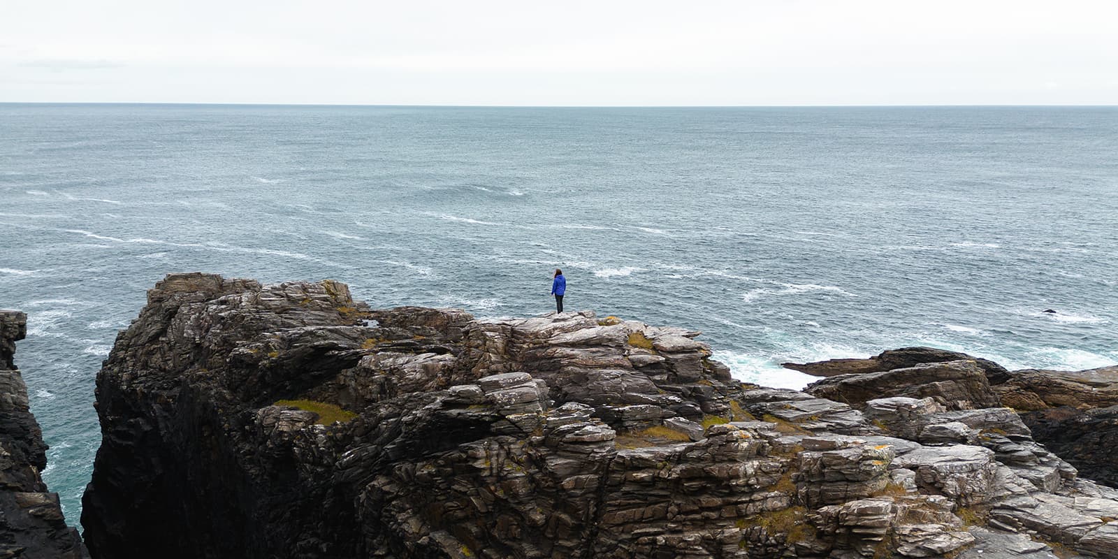
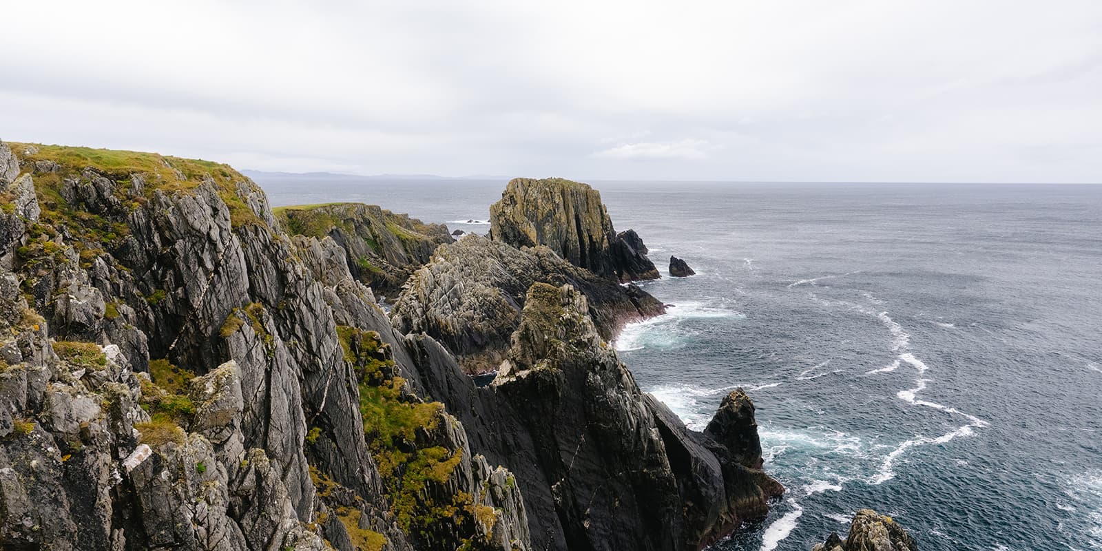
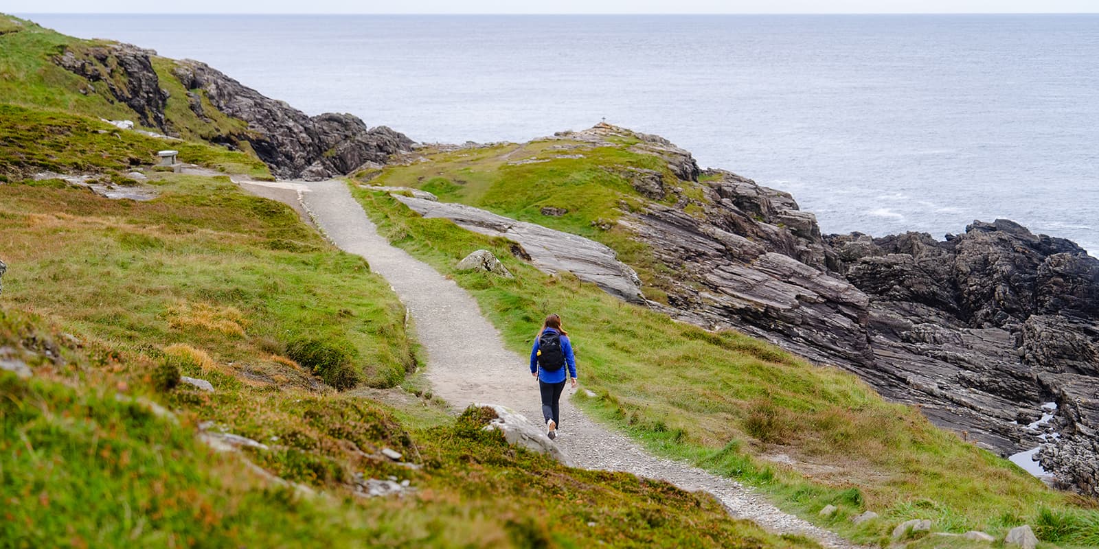
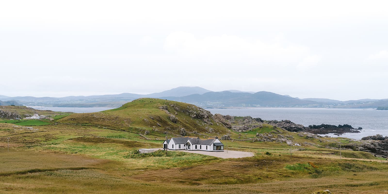
The Malin Head Circular Walk is a 4.5 km loop with loads of rugged beauty at Ireland’s northernmost point. The trail takes you along dramatic sea cliffs with expansive views of the Atlantic Ocean and is a must-do when you’re in County Donegal.

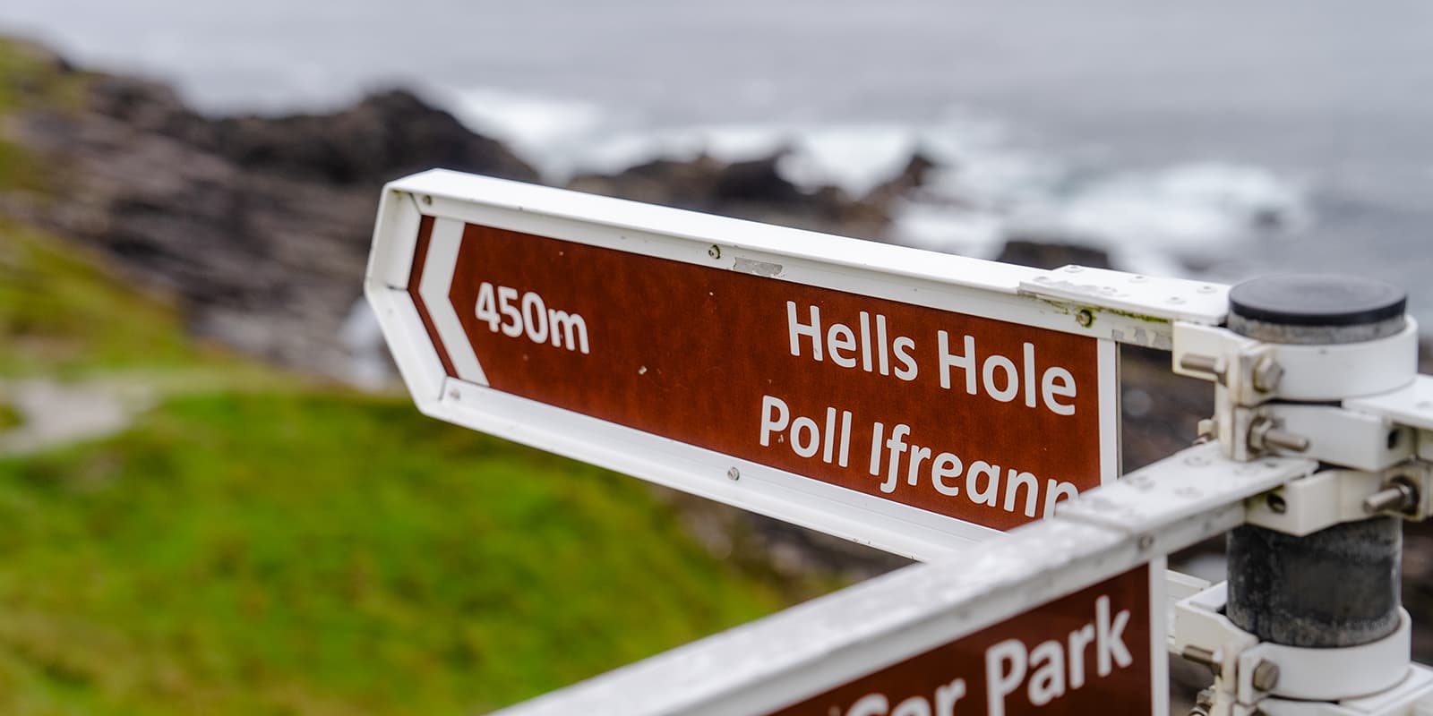
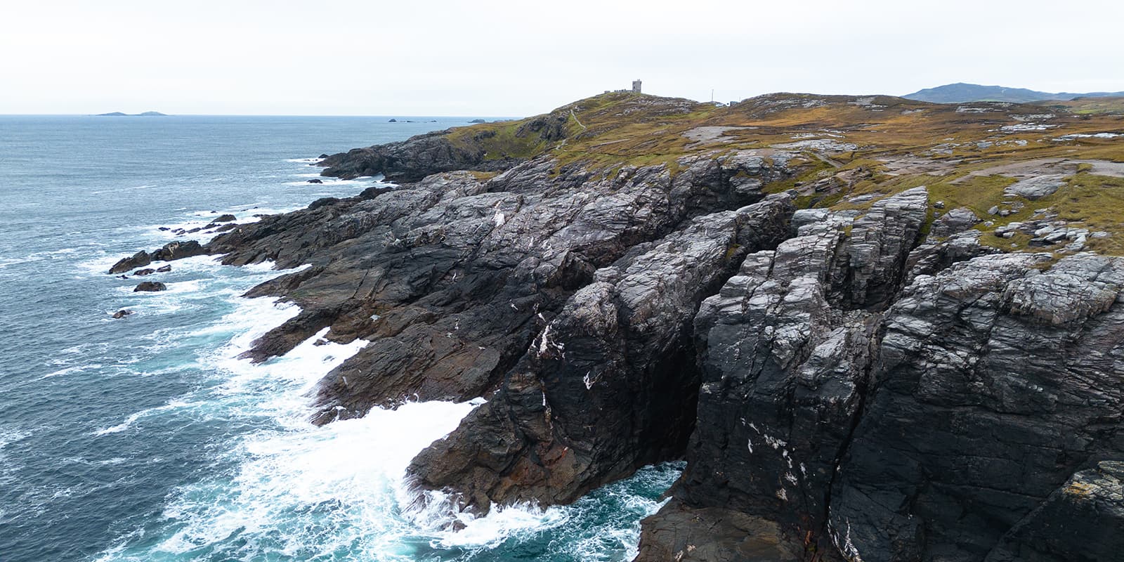
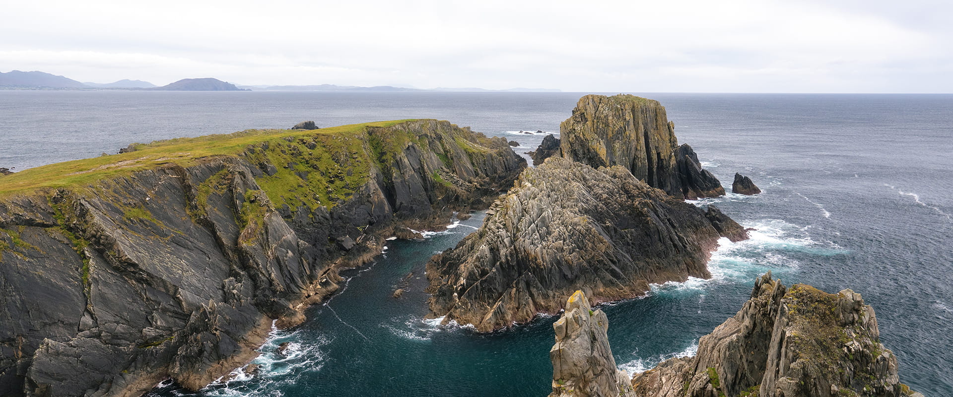
Starting at the small car park, you’ll pass historic and natural highlights, such as the large stone “Eire” sign. This was used during WWII to mark Ireland’s neutrality. When you walk further, you’ll encounter Hell’s Hole. You’ll be amazed by this impressive 30-meter deep chasm carved by the ocean’s force. A unique geological location. Mailin Head is also the beginning or the end of the incredible Wild Atlantic Way. Find out more about this scenic coastal drive with many hikes along the way on our Wild Atlantic Way page.

profile picture Joy Hadders
Author

Joy Hadders

Joy Hadders is a Dutchie who takes full advantage of her free days off of work to experience as much as possible in other countries. Like many others, she found her way in hiking during the lockdown and now she’s also hooked! She enjoys discovering hidden gems with her boyfriend and dreams of a fully pinned world map. You can follow Joy on Instagram @joyhadders.

View profile

The Trail

At first, you’ll get to Tower Hill, which offers amazing panoramic views across Malin Head. On a clear day you can glimpse the hills of Scotland.

The route continues to Ballyhillin Beach that is known for its collection of round colorful stones left by Ice Age glaciers. The beach is a beautiful spot for a little break, especially with the sound of crashing waves around you. When you’re lucky, you may spot some dolphins in the waters offshore.

The walk’s terrain is easy to moderate, making it accessible for every hiker. It takes 4.5 km which you can complete in around 1.5 to 2 hours. The path is well-marked, though sturdy footwear is recommended as parts of the trail can be uneven. The loop brings you back to the starting point.

Stages

Malin Head offers several walking routes that provide different levels of difficulty.

Stage 1:

Malin Head Walk: 2.0 km | 1.2 mi

Stage 2:

Malin Head Coastal Walk: 3.2 km | 2 mi

Stage 3:

Malin Head Circular Walk: 4.5 km | 2.8 mi

Accommodations

In the area of Mt. Errigal you’ll find a variety of accommodation options for different preferences and budgets. Cozy guesthouses and B&B’s in Dunlewey offer warm Irish hospitality and a chance to experience local culture, but there are also hotels and lodges nearby.

Best time of the year

The best time to hike along the cliffs of Malin Head is during the late spring to early autumn months, specifically from May to September. During this period, the weather is generally milder.

Summer brings vibrant wildflowers and a lively atmosphere, while the stunning sunsets add a magical touch to your hikes. However, always be prepared for sudden changes in weather, as conditions can be unpredictable in Ireland.

Safety & Gear

Malin Head is known for being windy, so it’s recommended to wear warm and waterproof clothing. Dress in layers to adapt to shifting temperatures and bring waterproof clothing to stay dry in case of unexpected rain.

Also make sure to wear sturdy hiking boots with good traction, preferably waterproof.

Good to know

  • You can park your car for free at the Malin Head Car Park. It’s very small, so during busy seasons it’s possible you have to park your car along the side of the road.
  • It’s best to visit by car. There is no direct bus between Donegal and Malin Head. If you want to take the bus, you have the option to travel by bus to Letterkenny or Derry and then rent a car from there.
  • There are no water resources during the trail, so you have to bring your own water. At the car park is a small bathroom with water.
Route
Circuit
Highest point
50m (164 ft)

Want to submit a trail or make this page more complete?

Comments

Be the first one to comment on this trail!

Reply to this trail

Your email address will not be published. Required fields are marked *

Reply to this trail

Log in to comment on this trail

Join the community!

Login or create a FREE account 😊

With an account you can:

Download GPX files

Pin trails to your wishlist

Mark trails as hiked by you

Rate hiking trails

Comment on trails, blogs and gear reviews

Happy trails!
Login

Don't have an account yet? Register here