Aerial photo Mount Errigal in Ireland
Wild Atlantic Way

Mt. Errigal Loop Walk

About the Mt. Errigal Loop Walk

country
Ireland
length
7 km(4 mi)
Type of trail
Day hike
difficulty

Difficulty is highly personal. Be aware of the weather conditions as bad weather turns easier trails in difficult trails especially in the mountains.

Easy
accommodation

Lodging means a mix of hotels, hostels or AirBnB’s.

Lodging
Elevation gain
664 m(2178 ft)
terrain
Mountains, Hills
remoteness
None of the time
Show more

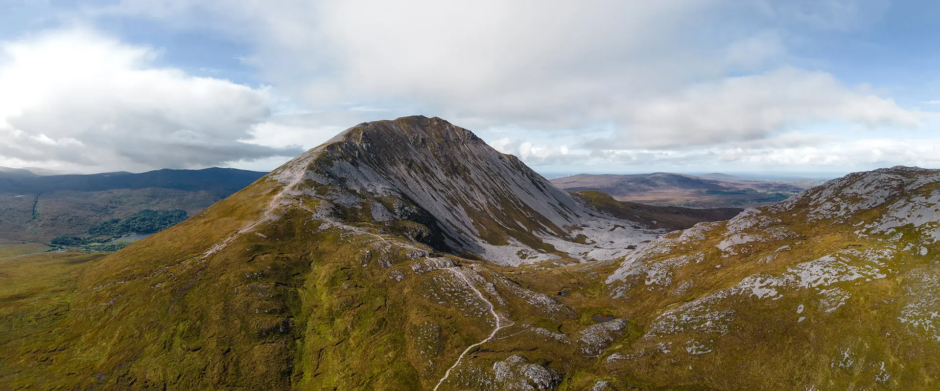
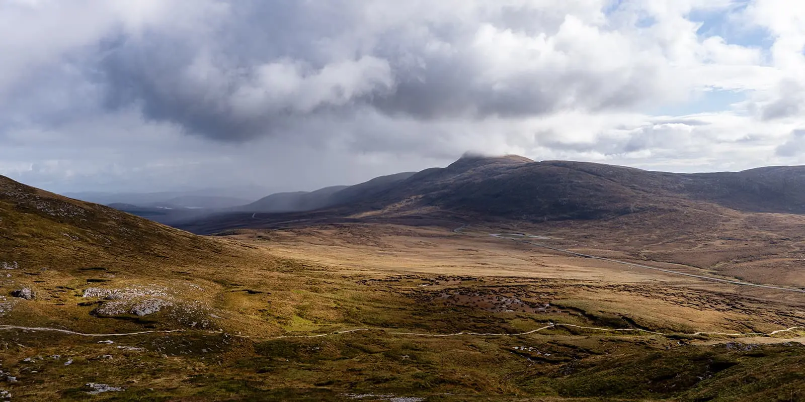
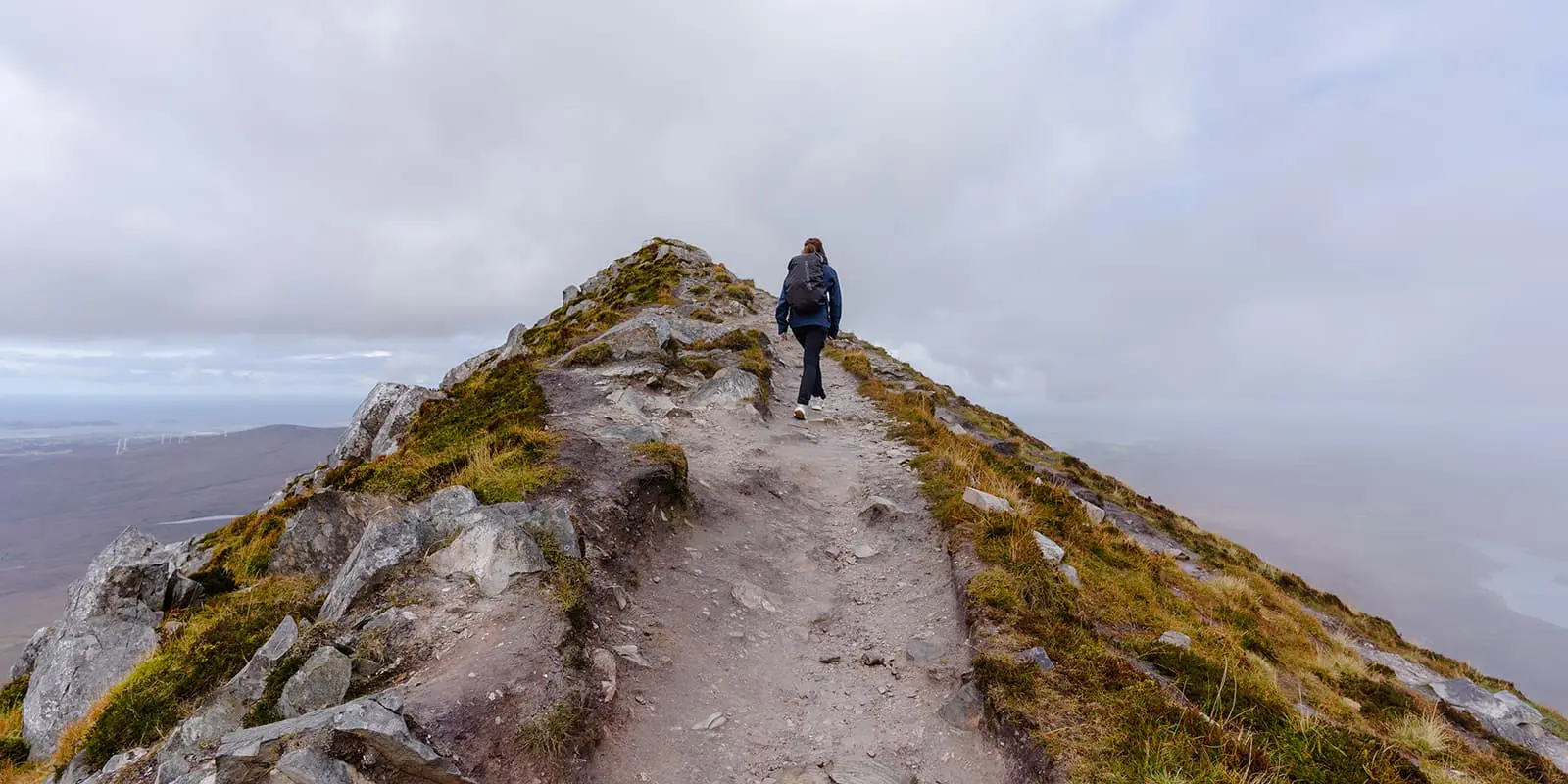
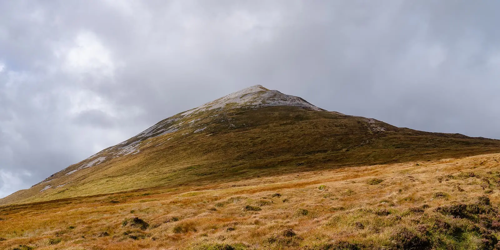
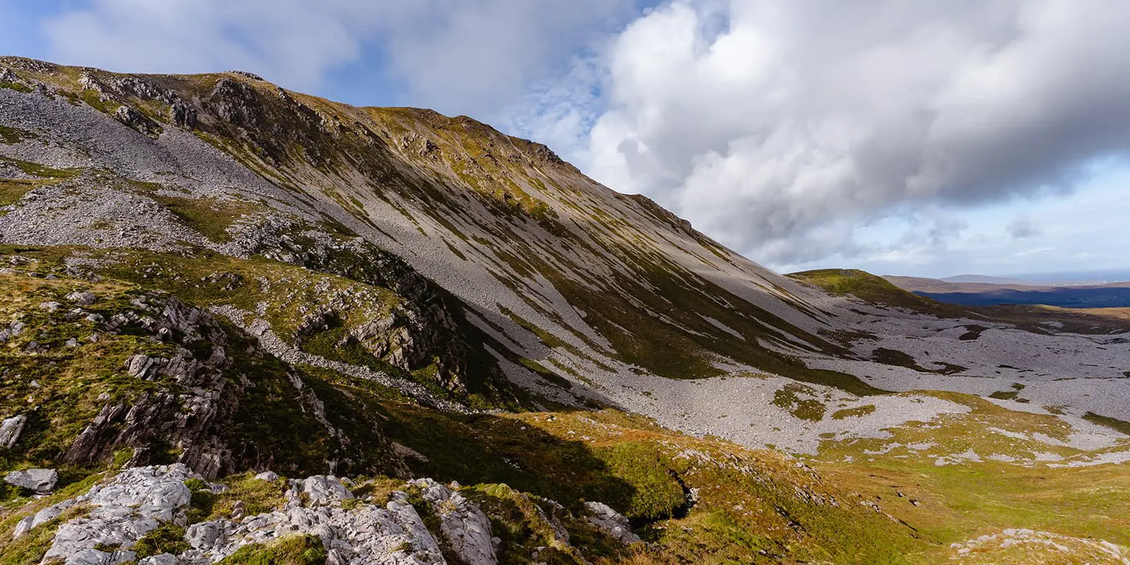
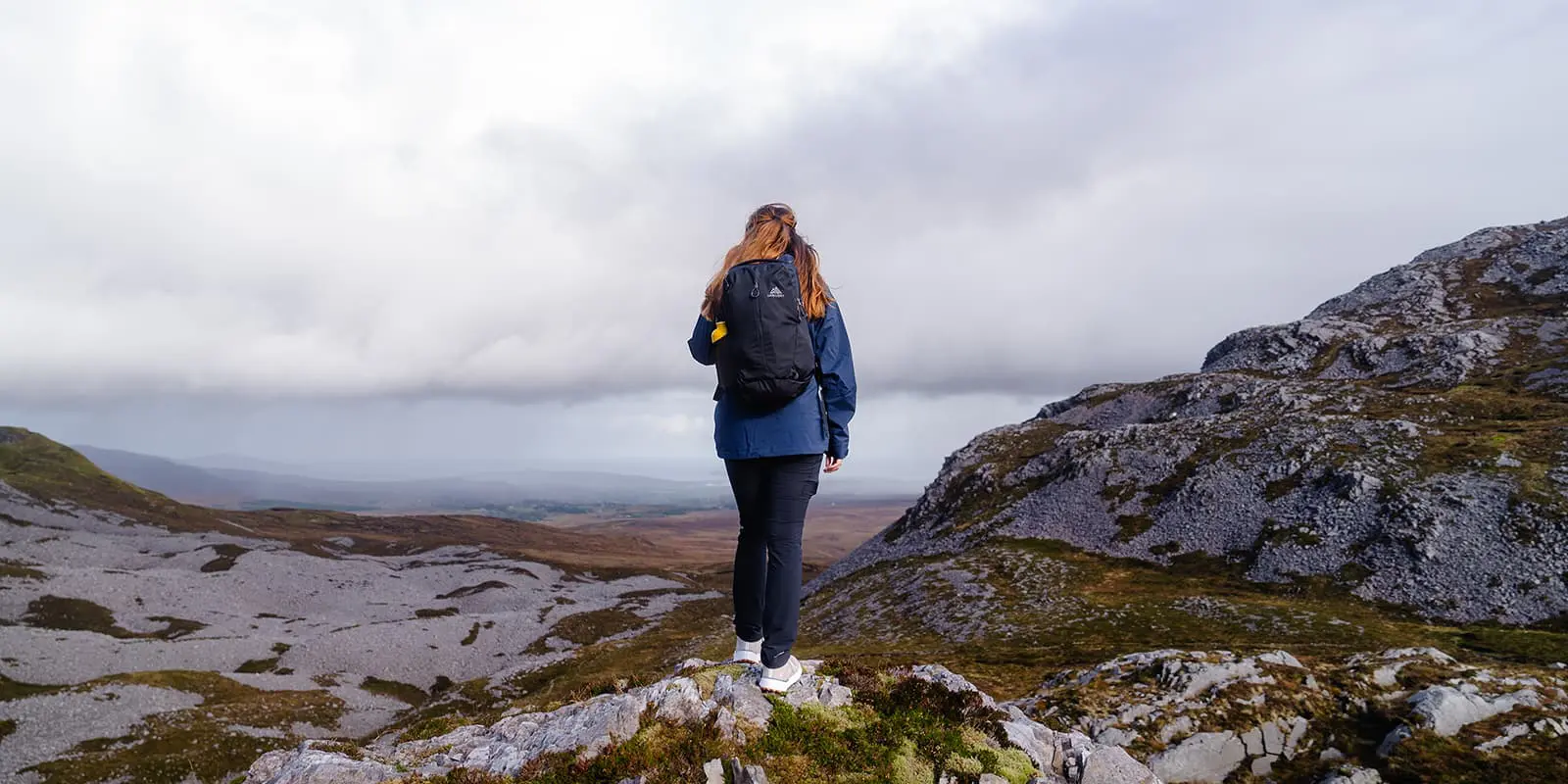
Nestled in the heart of County Donegal, the Mt. Errigal Loop Walk offers breathtaking views of the Irish countryside. During the loop you’ll get challenged a little bit, but it’s worth the experience and views at the top of the highest peak in Donegal. I’ts an unique way to discover the magic of Ireland’s west coast.

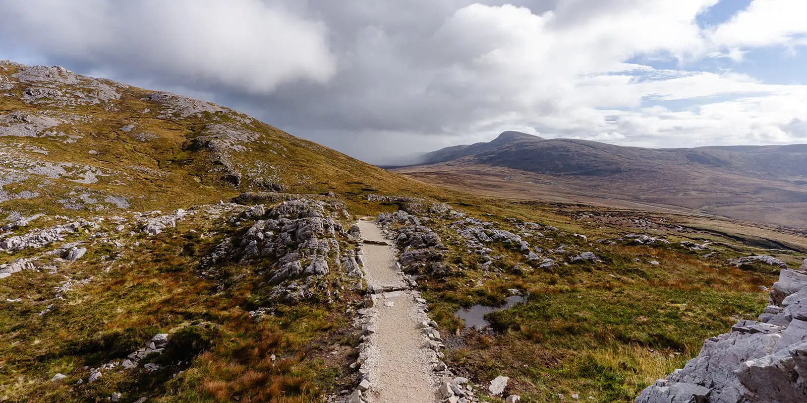
The trailhead is located in Dunlewey and you’ll start at the Errigal Mountain Hike Parking Base Camp. It’s a popular hiking area, so you’ll encounter other people during this trail. The well-marked path leads you gently uphill. As you ascend, the outline of Mt. Errigal dominates the skyline. This is a hike along the Wild Atlantic Way. Find out more about how to get there on our dedictated Wild Atlantic Way page.

profile picture Joy Hadders
Author

Joy Hadders

Joy Hadders is a Dutchie who takes full advantage of her free days off of work to experience as much as possible in other countries. Like many others, she found her way in hiking during the lockdown and now she’s also hooked! She enjoys discovering hidden gems with her boyfriend and dreams of a fully pinned world map. You can follow Joy on Instagram @joyhadders.

View profile

The Trail

The first part of the loop is quite easy and takes you through green fields with wildflowers. As you gain altitude, the trail becomes steeper and the path becomes more rocky. You can use the big rocky stones as a staircase, that makes it easier to ascend.

When you reach the summit of Mt. Errigal, at 751 meters, you’ll be awarded with amazing views. The rugged terrain of the Derryveagh Mountains unfolds beneath you. Take your time to soak in the beautiful nature around you. When the sky is really clear, the views will extend to the Atlantic Ocean.

Continuing along the loop, the descent offers a different perspective where you’ll see big valleys and sparkling lakes. There are places with loose gravel, so you have to pay attention on the way down. As you approach the end of the loop, the landscape gradually opens up, bringing you back to the starting point.

The Mt. Errigal & Mackoght Loop Walk is one of Ireland’s most stunning hikes. Whether you’re an experienced hiker or just starting, this trail promises unforgettable views and a chance to see the wild beauty of Donegal. A good level of fitness is recommended.

Accommodations

In the area of Mt. Errigal you’ll find a variety of accommodation options to suit different preferences and budgets. Cozy guesthouses and B&B’s in Dunlewey offer warm hospitality and a chance to experience local culture, while self-catering cottages provide a home-like atmosphere for families or groups.

For those seeking a more upscale experience, nearby hotels and lodges feature comfortable stays.

Best time of the year

The best time to hike on Arranmore Island is during the late spring to early autumn months, specifically from May to September. During this period, the weather is generally milder, with longer daylight hours.

Summer brings vibrant wildflowers and a lively atmosphere, while the stunning sunsets add a magical touch to your hikes. However, always be prepared for sudden changes in weather, as conditions can be unpredictable in Ireland.

Safety & Gear

The weather can change quickly and that can impact visibility. It’s essential to check the weather forecast before starting your hike and be prepared for a chance of rain, wind and/or fog.

Make sure to wear sturdy hiking boots with good traction, preferably waterproof. Dress in layers to adapt to shifting temperatures and bring waterproof clothing to stay dry in case of unexpected rain. Hiking poles are not a must, but can be more comfortable.

Good to know

  • You can park your car for free at the starting point: Errigal Mountain Hike Parking Base Camp.
  • You can do this trail with a guide.
  • The trail is well-marked and it’s just one way up and down, so you won’t need a GPS.
  • There are no water resources during the trail, so you have to bring your own water.
Route
Circuit
Highest point
751m (2.464 ft)

Want to submit a trail or make this page more complete?

Comments

Be the first one to comment on this trail!

Reply to this trail

Your email address will not be published. Required fields are marked *

Reply to this trail

Log in to comment on this trail
Always read the disclaimer

Terms of Use: important to all visitors on this website. We strive to publish high quality content and information on this website. However it’s always possible that we’re missing out on some crucial information. In spite of the fact that this route, associated GPS track (GPX and maps) were prepared under diligent research by the specified contributor and/or contributors, the accuracy of such and judgement of the author is not guaranteed. Therefore, hiking-trails.com and contributors are in no way liable for personal injury, damage to personal property, or any other such situation that might happen to individuals hiking or following this route. Should you choose to hike this trail, this is always at your own risk. Check out our guidelines for safety hiking and Leave No Trace principles at the hiking 101 page.

Download GPX

Join the community!

Login or create a FREE account 😊

With an account you can:

Download GPX files

Pin trails to your wishlist

Mark trails as hiked by you

Rate hiking trails

Comment on trails, blogs and gear reviews

Happy trails!
Login

Don't have an account yet? Register here