About the Zoldo Valley Ring

Dolomites
country
Italy
length
90 km(56 mi)
Type of trail
Hut to hut
difficulty

Difficulty is highly personal. Be aware of the weather conditions as bad weather turns easier trails in difficult trails especially in the mountains.

Moderate
accommodation

Lodging means a mix of hotels, hostels or AirBnB’s.

Mountain huts
Elevation gain
4000 m(13123 ft)
terrain
Mountains, Forest, Hills
remoteness
Most of the time
Show more

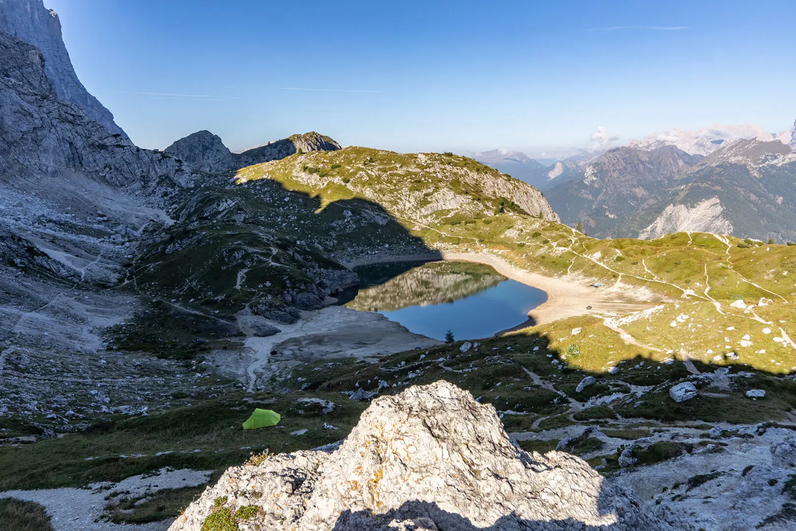
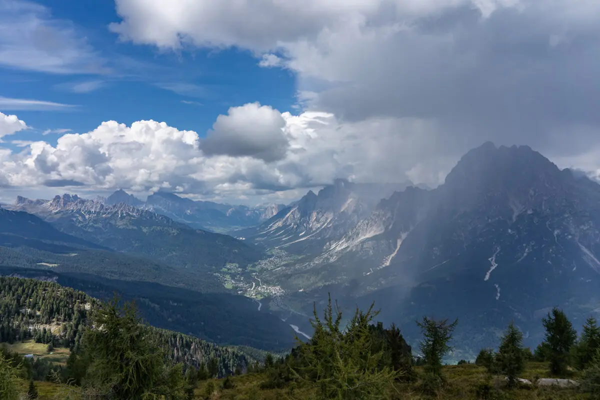
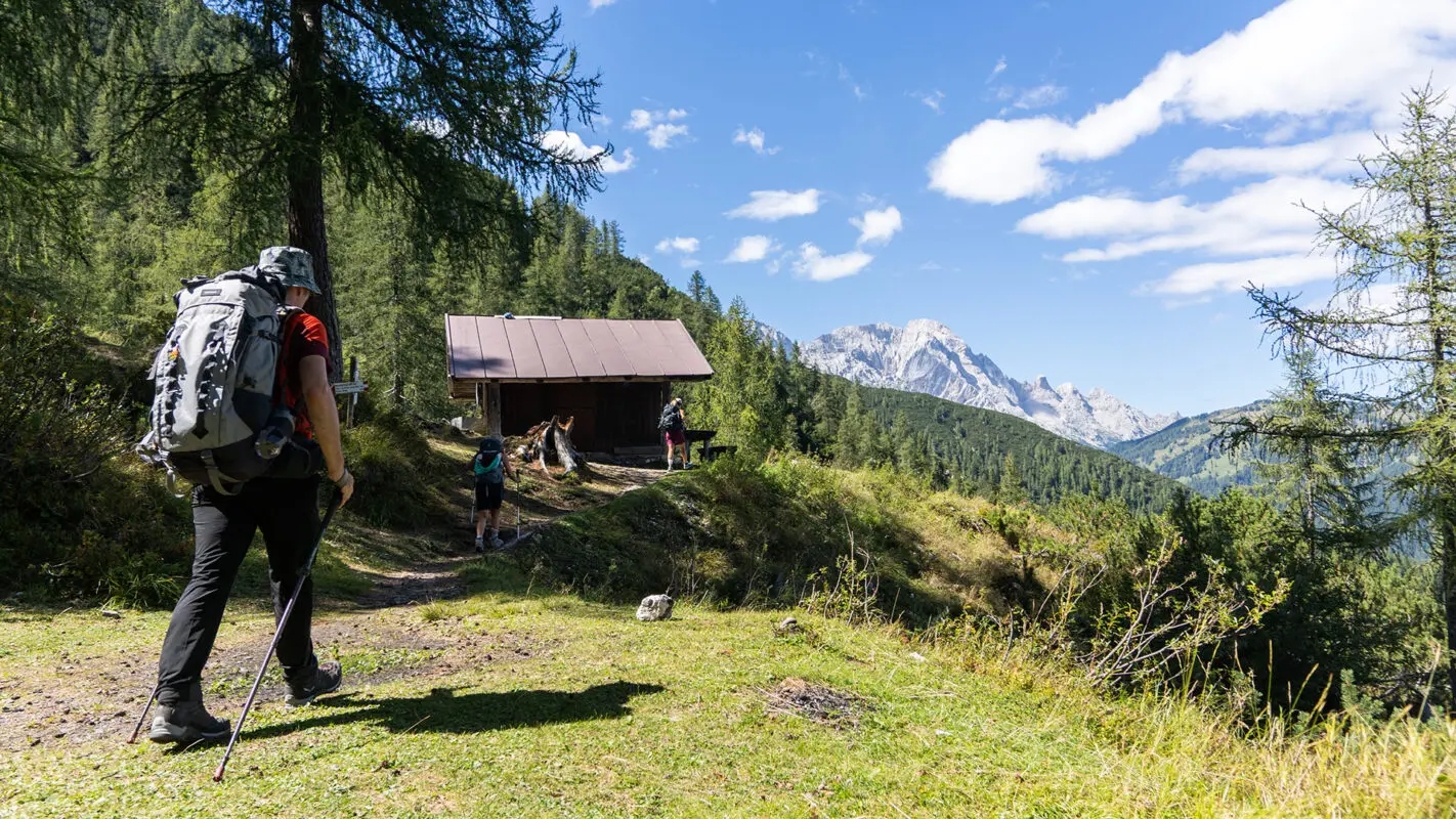
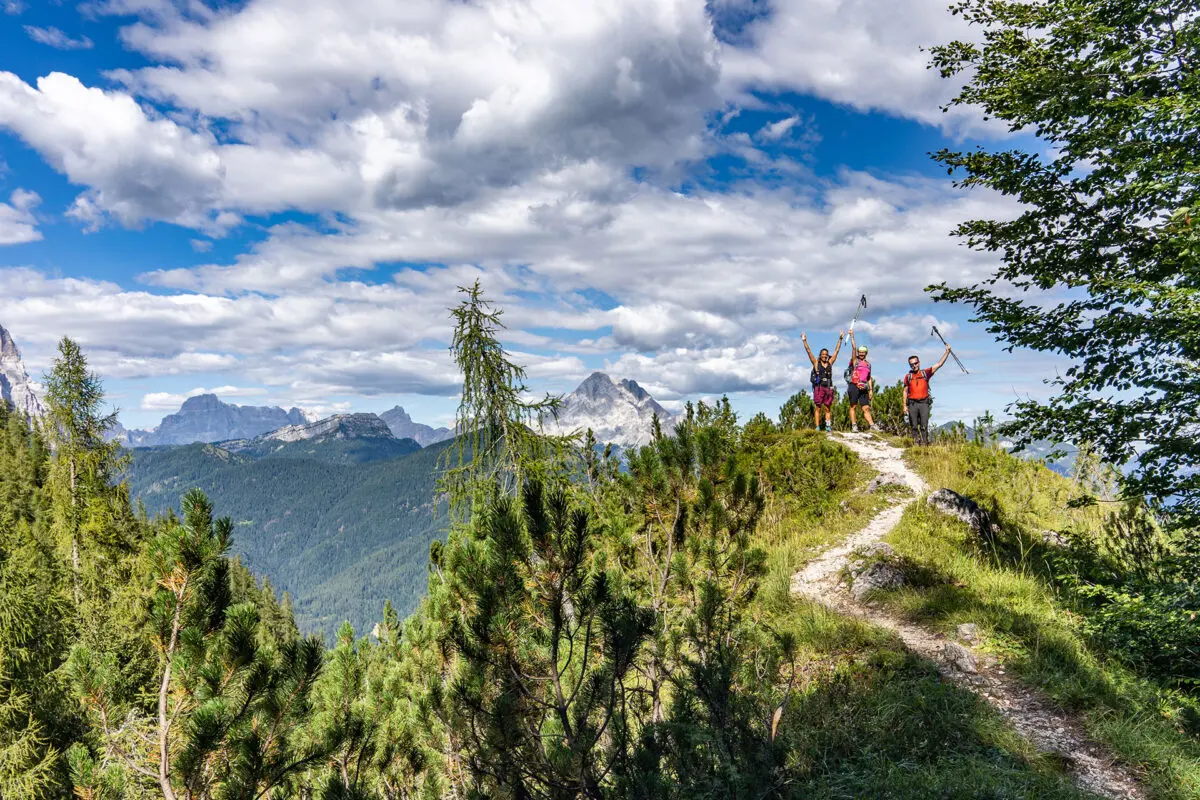
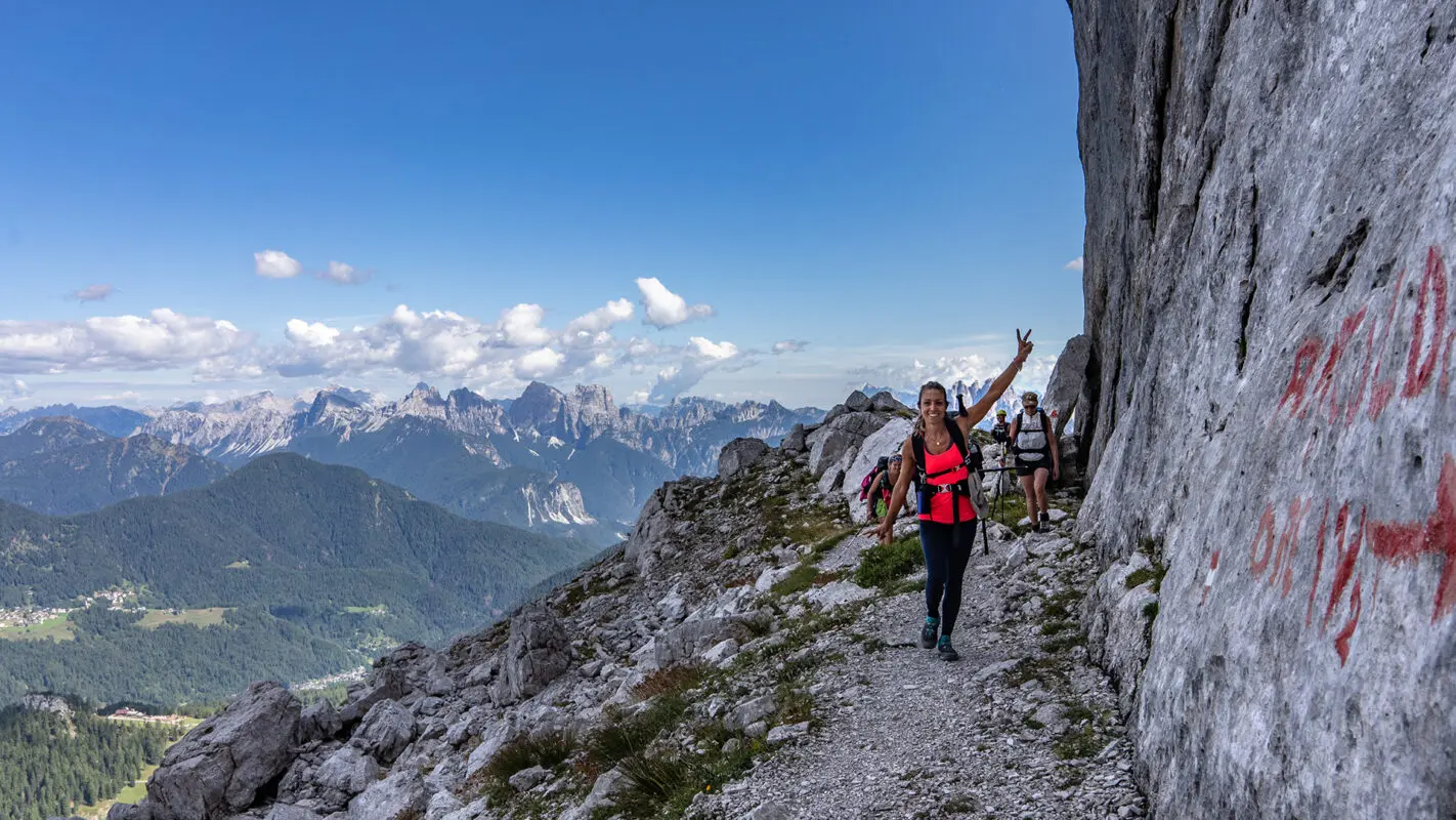
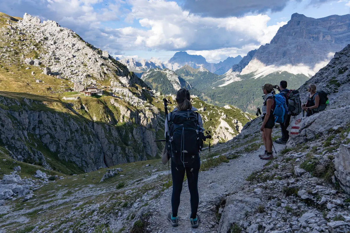
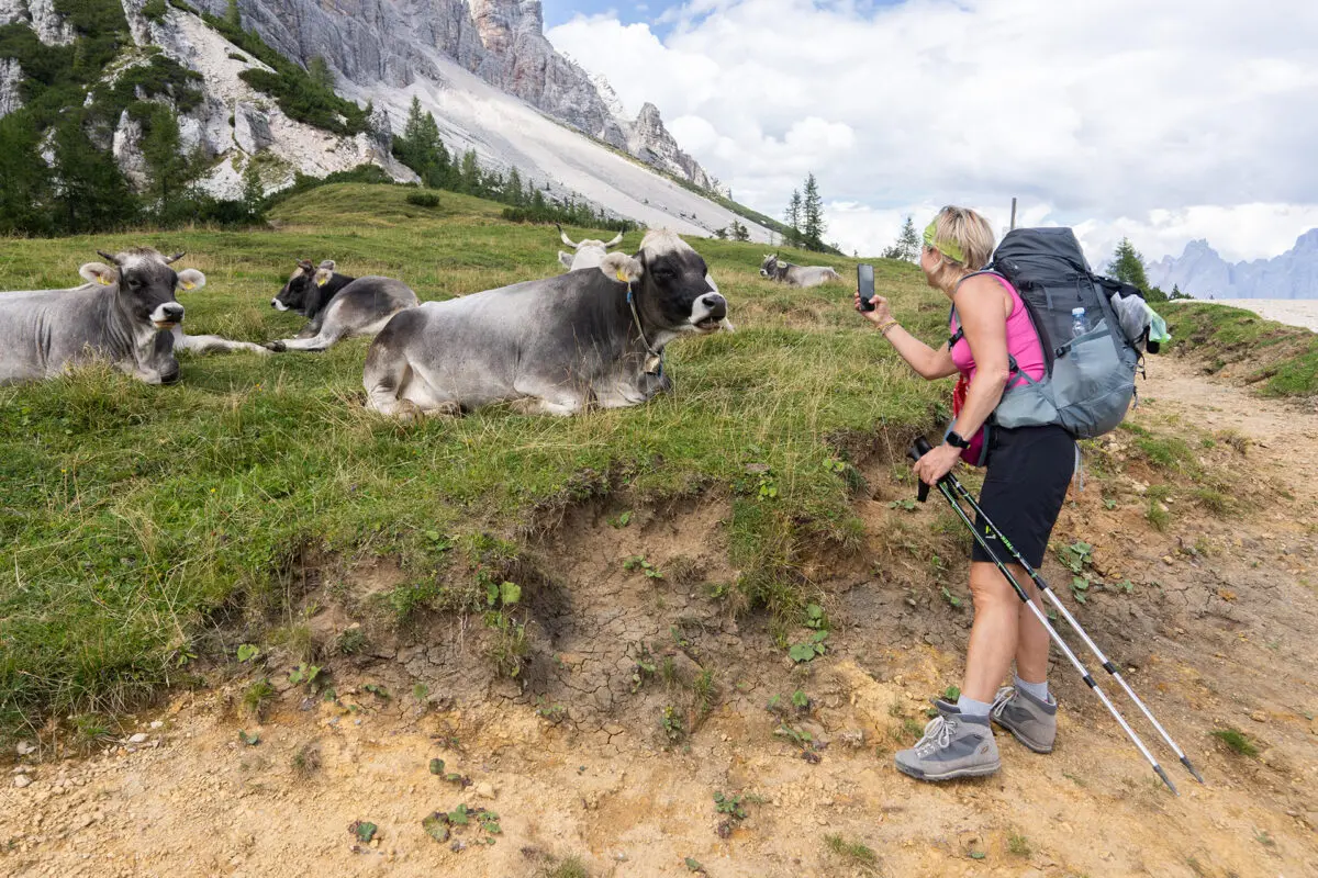
Val di Zoldo, or Zoldo Valley Ring, lies in the heart of the Dolomites, surrounded by beautiful peaks that are part of the UNESCO World Heritage Site. Yet this beautiful valley often remains neglected by visitors, forgotten by the mass tourism that populates the surrounding valleys. What keeps it in the shadows is certainly not the lack of grandiose views, but perhaps the roughness and difficulty of its trails. This loop, which encompasses the valley in six days, accompanies the hiker through silent forests, rugged scree, and airy gorges.

You will hardly meet anyone for several days! A demanding trail, with some points reserved for experienced hikers (but also always flanked by an easier alternative), it will give satisfaction and joy to those seeking unspoiled places, grandiose views, and a bit of a challenge with themselves.

Elisa, profile picture
Author

Elisa

Born in the city, I was always annoyed by the streets crowded with cars, the buildings that hid the sky, and the rush of people. I soon realized that my place was no longer in Padova but in the white rocks of the Dolomites. So I used to spend the week at the University of Forest Sciences, and the weekend exploring the trails of the Wight Mountains because I wanted to get to know them in all their nuances.

It was my parents who took me to the mountains from an early age. They took me to Val di Zoldo, in the winter with skis on my feet and in the summer to walk, but… I hated it! I was annoyed, all I did was ask, “How much longer?” But then I grew up, and I discovered that walking is essential for me. Scouting then taught me about the outdoors and the satisfaction of long treks in tents. The Italian Alpine Club made me discover mountaineering and the world outside Val di Zoldo. But walking was never enough for me, I was hungry for trails, views, and adventures. So I accumulated experience and kilometers, and in 2021 I realized a dream I had cradled for years: in 3 months I crossed the Alps on foot, from Finale Ligure to Trieste, alone and sleeping in a tent!

On this trip, I searched for my way in these mountains, until I realized that there is nothing that gives me greater joy than bringing people up here and watching their astonished expressions in front of so much beauty. So at the end of the trip, I took the course to become an Environmental Hiking Guide, and now I bring people up here, where falling in love is easy.

View profile

The Trail

Five mountain groups (Mezzodì, San Sebastiano, Moiazza-Civetta, Pelmo, and Bosconero), each with a different aspect and character, define in a circular sequence the basin catchment area of the Zoldo Valley. All the most typical aspects of the Dolomite region can be seen in the five groups that define the valley, from the high-altitude pastures (Prampèr, Le Mandre) to the solitary glacial cirques (Vant di Moiazza and di Moiazzetta), from the valleys that deeply cut into the bases of the minor groups (Canaloni Nord di Mezzo and Sud del Mezzodì) to the great extensions of conifers and beech woods (Val Malisia, Fagarè, La Mont) and, lastly, the great rocky walls (Pelmo, Moiazza-Civetta, Bosconero).
rock faces (Pelmo, Civetta, Bosconero). These mountain groups were recognized in 2009 by UNESCO as World Heritage Sites for their geomorphological characteristics.

The presence of the two best-known ‘3000’ Dolomite peaks, the Pelmo and the Civetta, in the Zoldo mountains would be enough to place Zoldo among the most beautiful Dolomite valleys of all. A beauty that would however be much less rich if it lacked the charm of the Bosconero groups, Mezzodì-Prampèr and Tàmer-San Sebastiano, the latter included in part in the National Park Belluno Dolomites, which has its access in the upper Val Prampèr.

To make the journey even more enjoyable, a typical refuge awaits you at the end of each stage. These facilities offer the hiker rest, friendship, and advice. You can always count on the friendliness of the managers, who will be able to indicate the most suitable trails for you and update you on their condition. You will be able to find other hikers with whom to share a pleasant evening of conversation. The food is always simple and tasty. There is nothing better after a day’s walking than a good dinner in the warmth of the fire.

Stages

This trail is 90 kilometers and is typically hiked in 6 stages. They are pretty static, as they depend on the refuge you end at each night, so there isn’t much room to modify the trail.

Stages of the Zoldo Valley Ring

Stage 1:

Forno di Zoldo – Rifugio Sora el Sass, 12 km | 7.5 mi (5.3h)

Stage 2:

Rifugio Sora el Sass – Passo Duran, 16.2 km | 10.1 mi (7h)

Stage 3:

Passo Duran – Rifugio Coldai, 15.2 km | 9.4 mi (7h)

Stage 4:

Rifugio Coldai – Rifugi Venezia, 15.4 km | 9.6 mi (4.5h)

Stage 5:

Rifugi Venezia – Passo Cibiana, 20.8 km | 12.9 mi (5h)

Stage 6:

Passo Cibiana – Forno di Zoldo, 13.2 km | 8.2 mi (5.5h)

Accommodations

During this hike, you will spend the night in typical Alpine ‘refuges.’ A hut is a structure for hikers, offering rest and refreshments to those who tackle long hikes. Do not expect luxury hotels! They are spartan facilities, but the hospitality of the managers, the beautiful views, and the good food will make you love your break.

The rooms are shared, as are the bathrooms. Showers are not always available, water is a precious commodity. You must bring a sheet bag for the night, and slippers. The average cost is 65 to 75 euros per night, including the overnight stay, dinner, and breakfast. Don’t forget, before you leave take a sandwich with you for lunch!

Reservations are compulsory, and best made in advance.

The food is simple but tasty, don’t forget to try the typical pastin and grilled cheese! Val di Zoldo is also famous for its ice cream, at the end of the trip, don’t forget to try it!

Overnights in the mountain huts/accommodations per stage:

Stage 1:

Rifugio Sora el Sass

Stage 2:

Rifugio Tomè or Rifugio San Sebastiano

Stage 3:

Rifugio Coldai

Stage 4:

Rifugio Venezia

Stage 5:

Rifugio Remauro

Best time of the year

The best time of the year to hike the Zoldo Ring is undoubtedly in summer and early September. As you’re hiking in the mountains be aware that there might be snowfields in early summer and there might be early snowfalls in late summer and early autumn. Generally, the hiking season in the European Alps is limited to the summer months when the weather is milder and the snow has melted, making the trails accessible.

Keep in mind that the weather in the high mountains can change rapidly, and it’s essential to be prepared for various conditions, including sudden rain or snow showers. Always check trail conditions, and local weather forecasts before embarking on a high-alpine hike. Additionally, consider your hiking experience and skill level, as some trails in the high Dolomites can be challenging and require proper equipment and experience.

Rifugios are usually open from mid-June to mid-September.

Safety & Gear

As you prepare for the hike, take your physical preparation into mind. The trek is fairly moderate, so it’s good to train at least a little bit before you begin.

Share your hiking plans with someone you trust, including your itinerary and any emergency contact info they should have.

Stay informed about the weather conditions in the area where you intend to hike. You can check this using a weather radar app or by talking with people in the refugios. Avoid heading out during severe weather conditions, including thunderstorms, heavy rainfall, or extreme heat.

Fill up on at least two liters of water each day and bring snacks to maintain your energy. Familiarize yourself with the trail map and carry navigation tools such as a compass or GPX device to avoid getting lost.

Invest in the right hiking gear, including comfortable, supportive footwear, proper hiking clothing, such as warm base layers and a hardshell rain jacket, hiking poles, a well-fitted backpack, and essential equipment like a map (or GPX) and a first-aid kit. Check out our comprehensive gear list for long-distance trails like this.

Respect the principles of Leave No Trace by minimizing your impact on the environment. Stick to designated trails, pack out all trash, and show respect for wildlife and natural habitats.

Good to know

The Dolomites are a very popular destination among hikers all over the world. Make sure you book the mountain huts a few months in advance so you secure a sleeping place during the night. Most huts can be booked by sending them an email or applying on their website.

Water is available at the mountain huts, rivers, and springs on the way.

Route
Circuit
Highest point
2350m (7709 ft)

Want to submit a trail or make this page more complete?

Comments

Be the first one to comment on this trail!

Reply to this trail

Your email address will not be published. Required fields are marked *

Reply to this trail

Log in to comment on this trail
Always read the disclaimer

Terms of Use: important to all visitors on this website. We strive to publish high quality content and information on this website. However it’s always possible that we’re missing out on some crucial information. In spite of the fact that this route, associated GPS track (GPX and maps) were prepared under diligent research by the specified contributor and/or contributors, the accuracy of such and judgement of the author is not guaranteed. Therefore, hiking-trails.com and contributors are in no way liable for personal injury, damage to personal property, or any other such situation that might happen to individuals hiking or following this route. Should you choose to hike this trail, this is always at your own risk. Check out our guidelines for safety hiking and Leave No Trace principles at the hiking 101 page.

Download GPX

Join the community!

Login or create a FREE account 😊

With an account you can:

Download GPX files

Pin trails to your wishlist

Mark trails as hiked by you

Rate hiking trails

Comment on trails, blogs and gear reviews

Happy trails!
Login

Don't have an account yet? Register here