About the Wolf Trek

Alps
country
Italy, France
length
75 km(47 mi)
Type of trail
Hut to hut, Long-distance
difficulty

Difficulty is highly personal. Be aware of the weather conditions as bad weather turns easier trails in difficult trails especially in the mountains.

Moderate
accommodation

Lodging means a mix of hotels, hostels or AirBnB’s.

Mountain huts, Camping
Elevation gain
5000 m(16404 ft)
terrain
Mountains, Forest, Hills
remoteness
Some of the time
Show more

The Trekking del Lupo (Wolf Trek) crosses wild areas, full of wonderful charm and evocative beauty. It is a ring route in the stupendous mountains of the Maritime Alps that follows in the ‘footsteps of the wolf’ through two natural parks with intact ecosystems: the Natural Park of the Maritime Alps (in Piedmont) and the Mercantour National Park (in France), both of which have residential packs of wolves, which have returned to populate these areas after many years of absence.

A special feature of the itinerary is the possibility of visiting two wildlife centers, specialized in illustrating the life, behavior, and history of this magnificent animal.

Elisa, profile picture
Author

Elisa

Born in the city, I was always annoyed by the streets crowded with cars, the buildings that hid the sky, and the rush of people. I soon realized that my place was no longer in Padova but in the white rocks of the Dolomites. So I used to spend the week at the University of Forest Sciences, and the weekend exploring the trails of the Wight Mountains because I wanted to get to know them in all their nuances.

It was my parents who took me to the mountains from an early age. They took me to Val di Zoldo, in the winter with skis on my feet and in the summer to walk, but… I hated it! I was annoyed, all I did was ask, “How much longer?” But then I grew up, and I discovered that walking is essential for me. Scouting then taught me about the outdoors and the satisfaction of long treks in tents. The Italian Alpine Club made me discover mountaineering and the world outside Val di Zoldo. But walking was never enough for me, I was hungry for trails, views, and adventures. So I accumulated experience and kilometers, and in 2021 I realized a dream I had cradled for years: in 3 months I crossed the Alps on foot, from Finale Ligure to Trieste, alone and sleeping in a tent!

On this trip, I searched for my way in these mountains, until I realized that there is nothing that gives me greater joy than bringing people up here and watching their astonished expressions in front of so much beauty. So at the end of the trip, I took the course to become an Environmental Hiking Guide, and now I bring people up here, where falling in love is easy.

View profile

The Trail

The first stage (planned at the start of the itinerary) is the Men and Wolves Wildlife Center in Entracque where, in addition to the permanent interactive exhibition, it is possible to spot wolves, thanks to an elevated covered structure located in a large fenced area. The second, on French territory, is the Alpha Loup Wildlife Centre in Le Boréon. Here too, the center includes, in addition to a permanent exhibition, several observation posts for wolves in packs, in a large forest area.

The route has a total length of around 75 km, with a total ascent of almost 5,000 meters, and includes the passage over five spectacular hills over 2,400 meters above sea level, touching on the characteristic Royal Hunting Roads, built for King Victor Emmanuel II. The landscape traversed by the trek is grand and varied, with lakes, forests, and waterfalls; there is no shortage of opportunities to spot the most common wolf prey, such as chamois and ibex. In its total of seven days of walking, the Wolf Trek offers an experience worthy of the world’s great treks, just a stone’s throw away.

The route is subdivided into five stages, presented from hut to hut, but these are not to be considered as fixed and immutable, everyone can lengthen or shorten them as they wish according to their training and available time. In addition, it should be borne in mind that overnight stays in tents are permitted within the park area, as long as they run from sunset to sunrise, so it is possible to customize the route in any way.

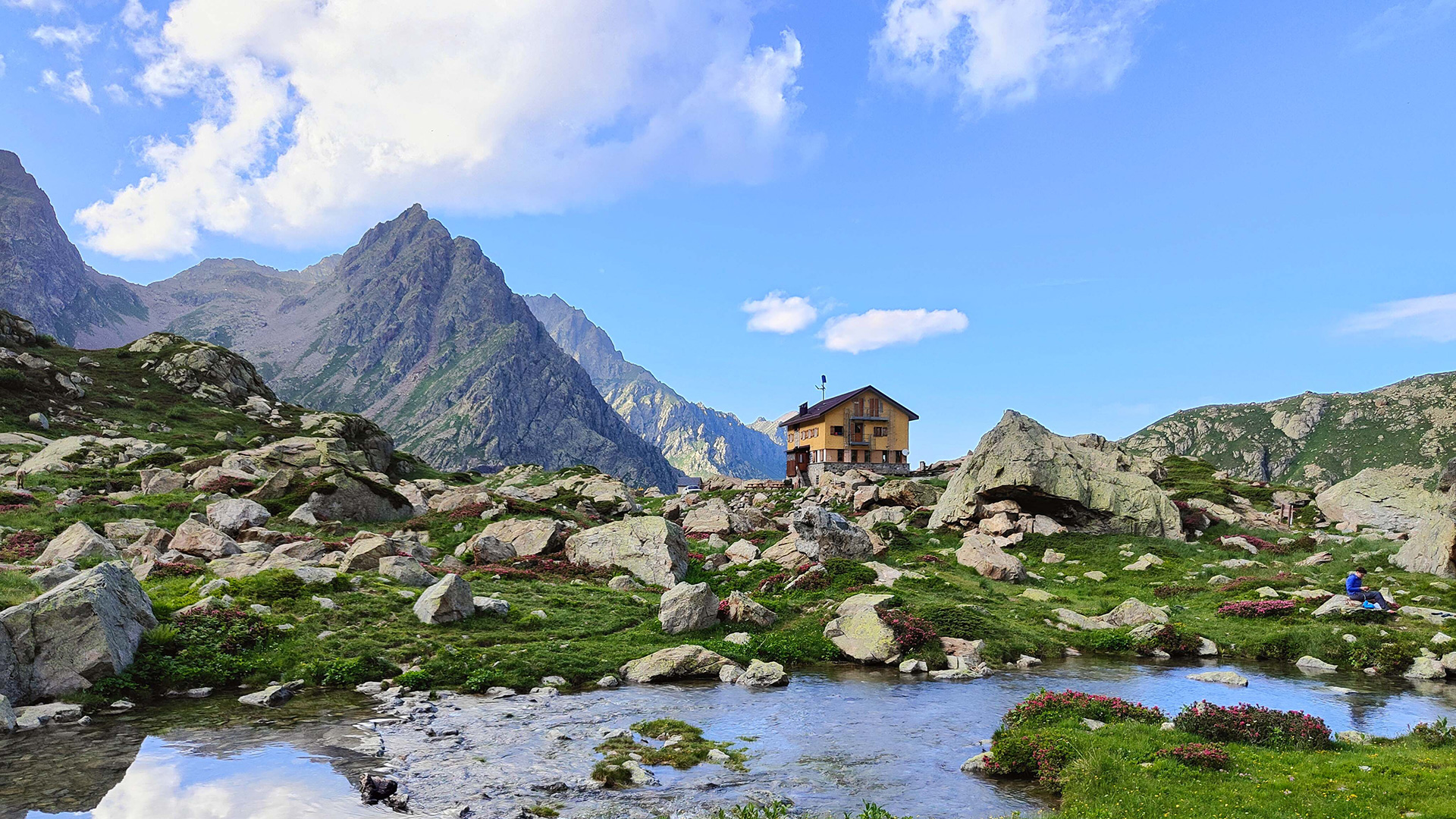
In summer, an on-demand minibus service connects Entracque to San Giacomo, to the Piano della Casa del Re (Rifugio Regina Elena), to Terme di Valdieri, and to Lago delle Rovine (Rifugio Genova-Figari). By taking advantage of this opportunity, it is therefore possible to shorten the trek. The days needed to do it range from a minimum of three (but without visiting the Alpha Loup Centre in Le Boréon) to a maximum of ten, taking your time and following the needs of the little ones. The most ‘balanced’ average is six to seven days, just enough to enjoy the unspoiled nature and visit the two wildlife centers.

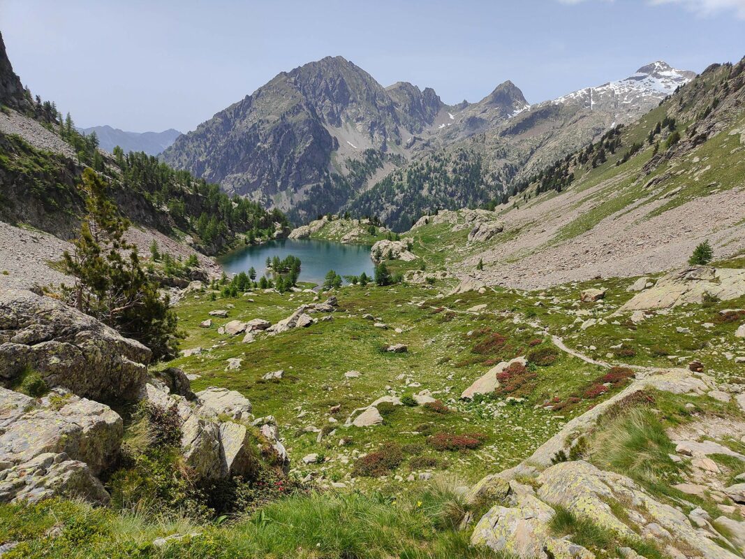
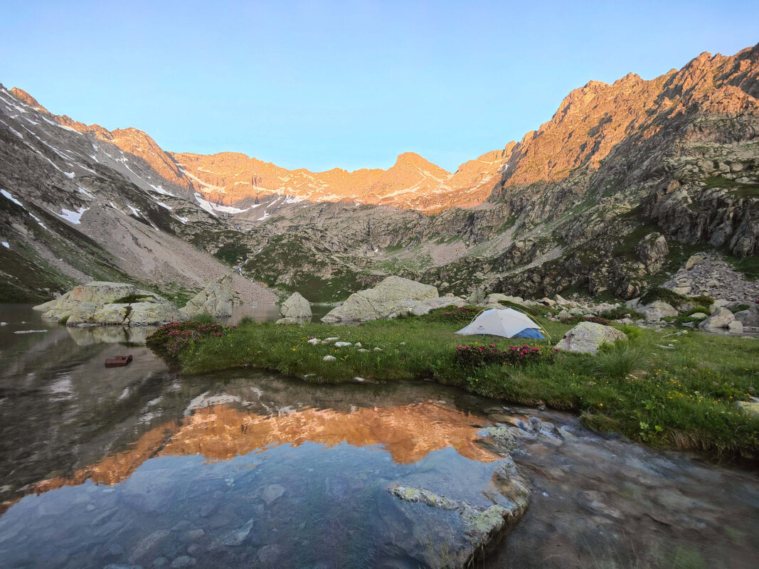
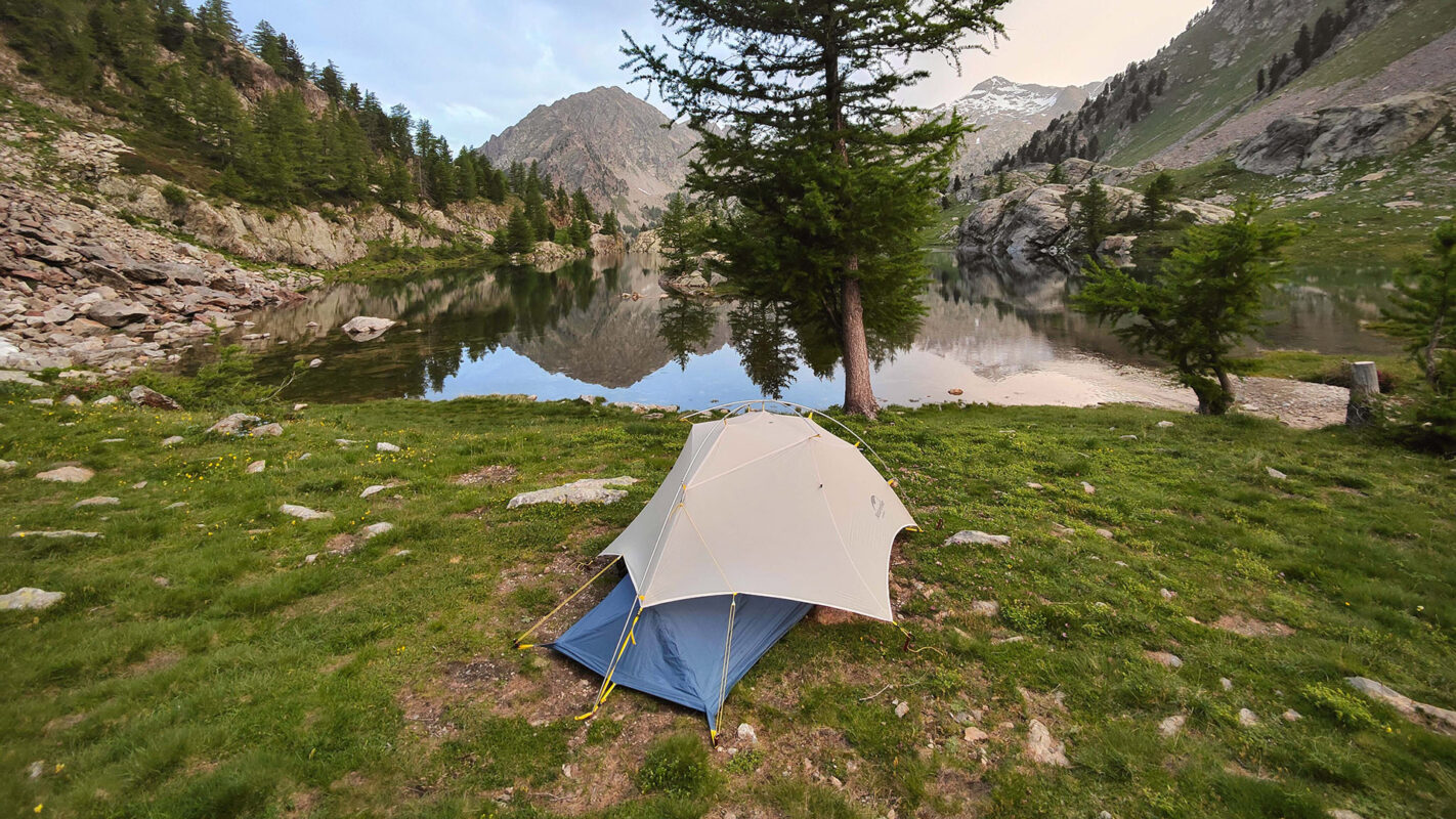
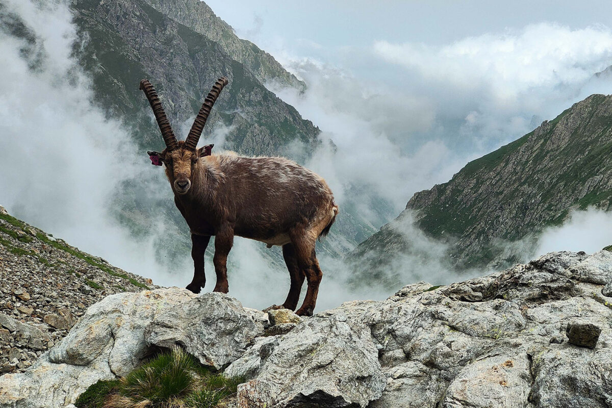
Devoid of mountaineering difficulties, the trek is on paths and on paved former royal hunting roads. Most of the passes will be over rocks and boulders, and this must be taken into account in the choice of footwear, which must not be too stiff-soled. Water is quite present in the form of small streams and creeks, but given the high presence of animals, it is better to stock up on it at the shelters or equip yourself with possible drinking water.

Unfortunately, there is no dedicated signposting, but the various points crossed are well signposted with red-white tracks and signs indicating the individual destinations (brown with white writing on the Italian side, yellow on the French side). The signpost indications are so precise that a map would not even be necessary, but we recommend having one anyway in case of sudden variations, in the need to change route or even just to get an overview of the area. It does not require mountaineering experience: you never have to help yourself with your hands and there are no dangerous spots.

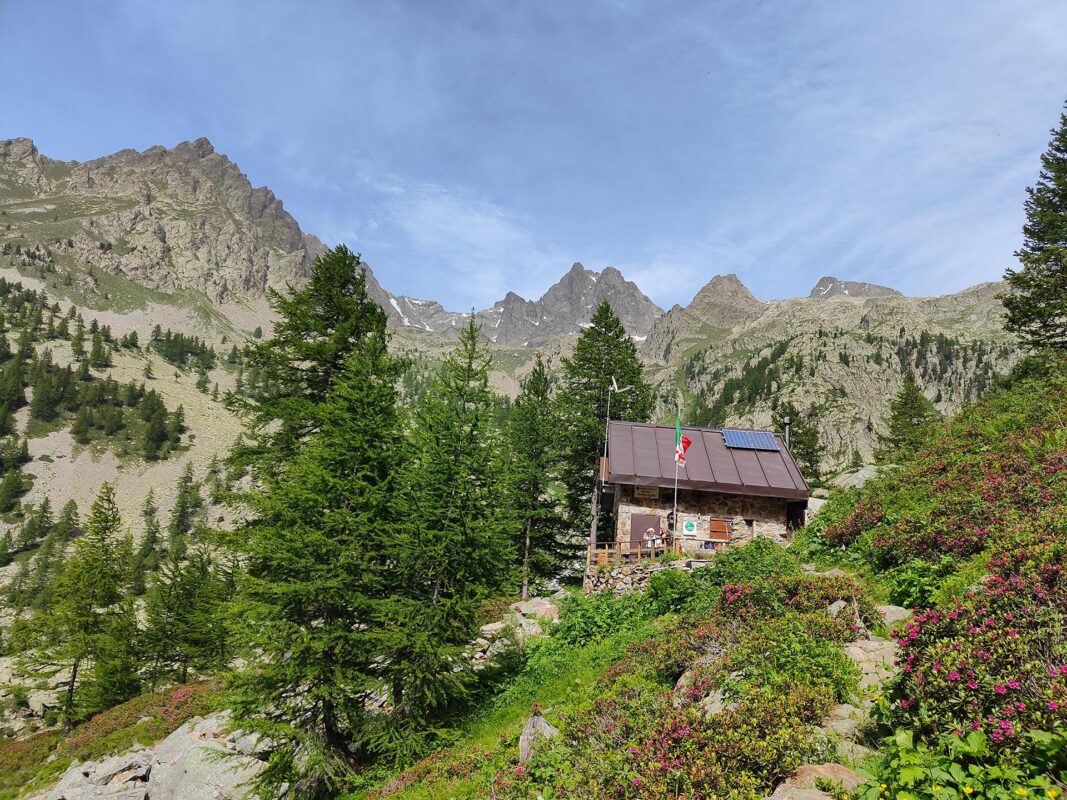
Don’t rely too much on mobile phones: we are in the mountains, and they don’t always pick up (in fact, almost never). However, in all refuges, you will find an active and secure telephone line to use in case of need, and to book or cancel overnight stays in the following refuges.

A small footnote that applies to any mountain excursion: one must avoid thinking of the telephone as a source of remedy for every inconvenience, it creates a false security that could lead one to do foolish or dangerous things with the mistaken thought ‘just in case I’m in trouble I’ll call the mountain rescue’ which, incidentally, already has a lot to do and should only be called for real emergencies. So, let’s always keep our brains switched on and avoid putting ourselves in dangerous situations. Then, of course, the sprain on the trail is always lurking, but, at least, we will have the knowledge that we didn’t ask for it.

Stages

The Wolf Trek is 75 kilometers long and can be divided into 5 stages. Below you’ll find our suggested itinerary.

Stages of the Wolf Trek

Stage 1:

San Giacomo Entracque – Refuge la Cougourde, 14 km | 8.6 mi

Stage 2:

Refuge la Cougourde – Rifugio regina Elena, 13 km | 8 mi

Stage 3:

Rifugio regina Elena – Rifugio Valasco, 12.5 km | 7.8 mi

Stage 4:

Rifugio Valasco – Rifugio Genova, 18 km | 11 mi

Stage 5:

Rifugio Genova – San Giacomo Entracque, 12 km | 7.5 mi

Accommodations

If you choose to stay overnight in refuges, remember to bring your own sleeping bag, but you can save the weight of your slippers because they are provided everywhere in the refuges. Bear in mind that very few huts accept debit cards or credit cards, so it is necessary to carry sufficient cash with you. The refuges here are alpine facilities at the service of hikers. If you are used to the luxurious chalets of the Aosta Valley or the Dolomites, forget them! Here, the refuges are spartan and simple, but in return, the kindness and welcome of the managers is definitely superior.

With the tent, bear in mind that the terrain is mainly rocky with the attendant difficulties in securing it. It is better to aim for lakes and lower-altitude terrain. The GPS track shows all the huts where you can stay overnight and the best tent sites.

You are walking inside two nature parks, so the rules here are quite strict. For example, dogs are not allowed beyond the Soria-Ellena Refuge to prevent them from disturbing the wildlife For the complete rules see the ‘regulations’ on the park website.

Accommodations per stage

Stage 1:

Refuge la Cougourde

Stage 2:

Rifugio regina Elena

Stage 3:

Rifugio Valasco

Stage 4:

Rifugio Genova

Best time of the year

The best time of the year to hike the wolf trek is undoubtedly in summer and early September. As you’re hiking in the mountains be aware that there might be snowfields in early summer and there might be early snowfalls in late summer and early autumn. Generally, the hiking season in the European Alps is limited to the summer months when the weather is milder and the snow has melted, making the trails accessible. The best time is between the end of June and the beginning of July: many more animals, lots of flowers, streams and lakes full of water, and snow on the highest peaks.

Keep in mind that the weather in the high mountains can change rapidly, and it’s essential to be prepared for various conditions, including sudden rain or snow showers. Always check trail conditions, and local weather forecasts before embarking on a high-alpine hike.

Safety & Gear

Begin by researching the trail to familiarize yourself with the route, difficulty level, and points of interest. Download maps, and a guidebook, and check information from local authorities or experienced hikers to plan your trek if you have any questions. Additionally, you can consider hiking with a companion, especially in remote areas where assistance may be limited.

Check the weather forecast for the region and pack appropriate clothing and gear for mountainous terrain. The Dolomites are known for their shifting weather, so be prepared for sun, rain, and even snow, especially at higher elevations. Dress in layers to stay warm and dry, and wear sturdy hiking boots with good ankle support for traction on rocky trails.

Bring sufficient food and water for the trek, as well as snacks for energy along the way. Pack a first aid kit, emergency shelter, and communication devices such as a mobile phone or satellite communicator for safety.

Good to know

You can get water along the way at the refuges, so you won’t need to bring a filter. However, you’ll want to make sure you buy/fill up enough each morning! We suggest you bring at least 1.5-2L with you each day.

Route
Point to point
Highest point
Colle di Chiapous, 2526m (8287 ft)

Guidebooks

Wolf trek guidebook

Trekking del Lupo

View guidebook

Want to submit a trail or make this page more complete?

Comments

Be the first one to comment on this trail!

Reply to this trail

Your email address will not be published. Required fields are marked *

Reply to this trail

Log in to comment on this trail
Always read the disclaimer

Terms of Use: important to all visitors on this website. We strive to publish high quality content and information on this website. However it’s always possible that we’re missing out on some crucial information. In spite of the fact that this route, associated GPS track (GPX and maps) were prepared under diligent research by the specified contributor and/or contributors, the accuracy of such and judgement of the author is not guaranteed. Therefore, hiking-trails.com and contributors are in no way liable for personal injury, damage to personal property, or any other such situation that might happen to individuals hiking or following this route. Should you choose to hike this trail, this is always at your own risk. Check out our guidelines for safety hiking and Leave No Trace principles at the hiking 101 page.

Download GPX

Join the community!

Login or create a FREE account 😊

With an account you can:

Download GPX files

Pin trails to your wishlist

Mark trails as hiked by you

Rate hiking trails

Comment on trails, blogs and gear reviews

Happy trails!
Login

Don't have an account yet? Register here