About the Wicklow Way

country
Ireland
length
130 km(81 mi)
Type of trail
Long-distance
difficulty

Difficulty is highly personal. Be aware of the weather conditions as bad weather turns easier trails in difficult trails especially in the mountains.

Moderate
accommodation

Lodging means a mix of hotels, hostels or AirBnB’s.

Lodging
Elevation gain
3521 m(11552 ft)
terrain
Hills, Countryside, Forest
remoteness
Some of the time
Show more

Ireland is famous for its landscapes of green hills, glacial valleys, rugged coastline, and unique, protected bogland. In 1980, the Wicklow Way became Ireland’s first established long-distance walking trail and accredited National Waymarked Trail. When you walk this trail, you’re following in the historical footsteps of Irish hillwalking. 

Along the Wicklow Way, you’ll encounter a variety of scenic highlights, including the tranquil shores of Lough Tay, the ancient monastic site of Glendalough, and the panoramic views from the summit of Djouce Mountain. Whether you’re an experienced hiker or a casual walker, the Wicklow Way offers a diverse and enriching outdoor experience that showcases the natural and cultural heritage of Ireland.

headshot of Ellie Berry
Author

Ellie Berry

Ellie Berry is a long-distance walker and Irish mountain climber. Since 2017, she has walked over 4,000km of trails around Ireland with partner Carl Lange. In 2023, she set a new Irish record for the fastest known time for climbing all 275 mountains on the island of Ireland in a little over 50 days. You can find her adventures documented on toughsoles.ie, and follow her on Instagram @tough_soles.

View profile

The Trail

Starting in the lowlands of south Wicklow, the trail begins on tiny backroads known locally as boreens, switching back and forth with gravel forestry tracks. This start is gentle, and eases you into the many kilometres of walking ahead.

In this section, you’ll pass the Dying Cow, an iconic pub full of character and charm. It is a tiny old-fashioned bar where you can barely fit more than a handful of people inside, but they have lovely covered garden seats that provide a perfect resting spot for weary hikers. From here, the next town along the trail is Tinahely, and it will be the largest town you encounter on your journey.

Heading north of Tinahley is when you truly begin to enter the Wicklow Mountains and the first climbs of the route. It is from here that you will begin to cross in and out of the Wicklow Mountains National Park. At close to 23,000 hectares, this is both the largest National Park in Ireland and the only one located on the east coast. Wicklow is famous for this and its fast-flowing streams.

Once past Aughavannagh the trail becomes more remote, and you begin to experience the walking that the Wicklow Way is known for. You’ll experience the wide-open vistas, dark woodlands of Glenmalure and Mullacor.

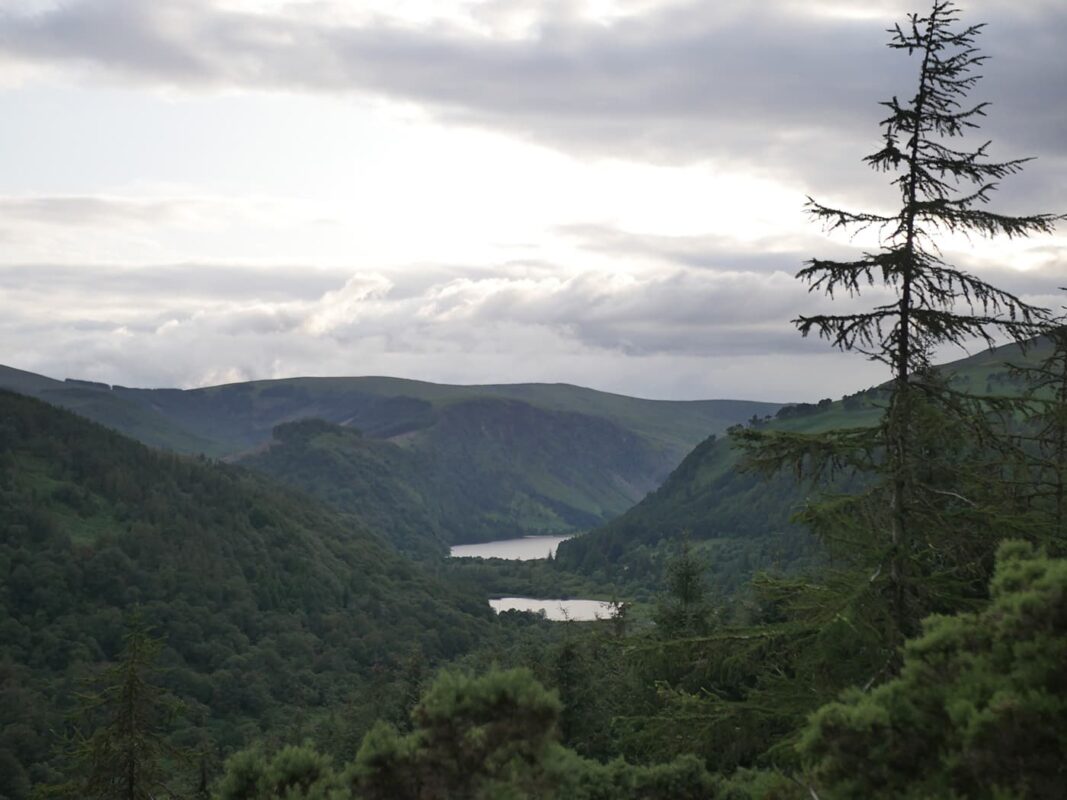
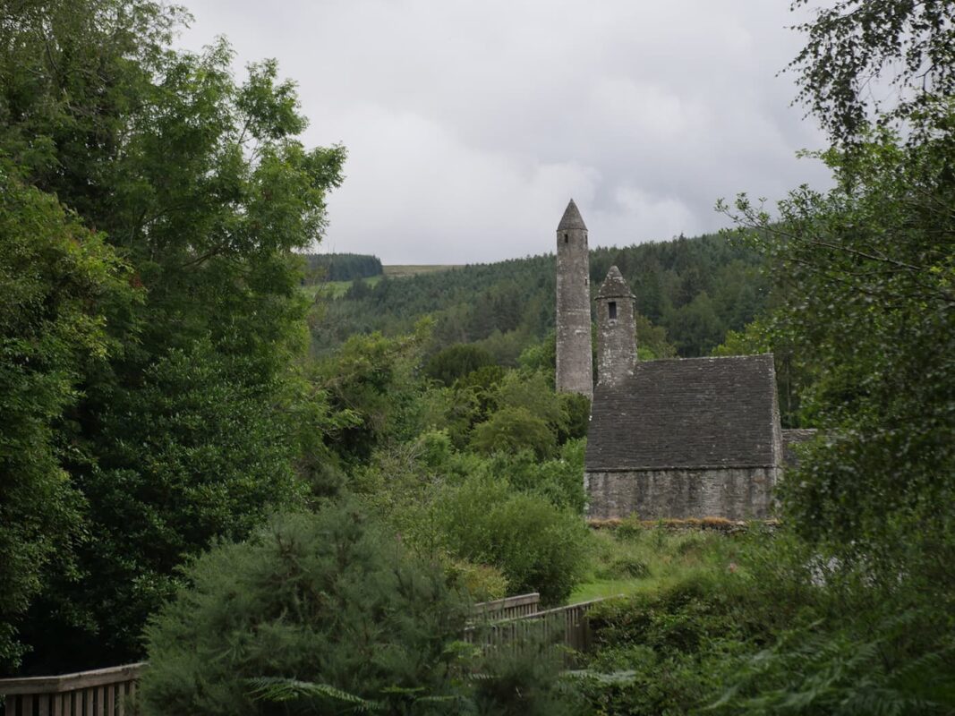
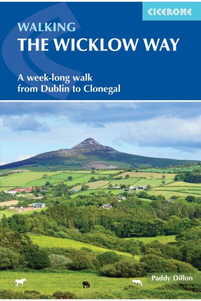
The crowning jewel of Wicklow is the Glendalough valley. Coming from the Irish Gleann Dá Loch, it translates to “valley of two lakes.” This is a section where it’s worth wandering from the trail and exploring the ancient monastic city, visitor center, and picnic spots along the water’s edge. To leave the main thoroughfare, the trail slips between two buildings and whisks you off into the forests again. Every now and again the tree cover breaks, and the views back towards the two lakes are beautiful.

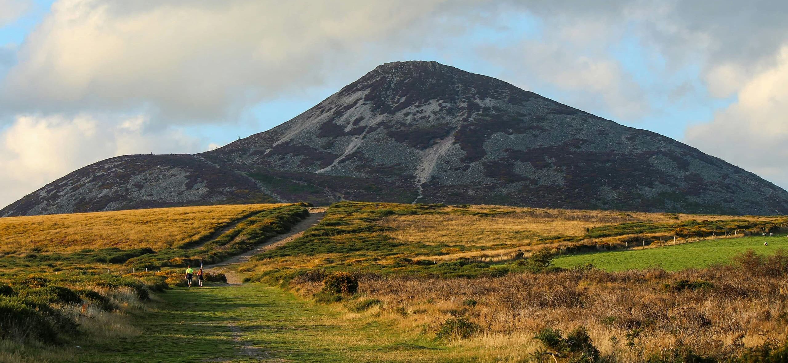
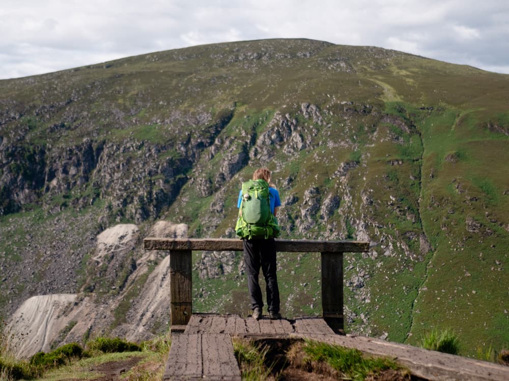
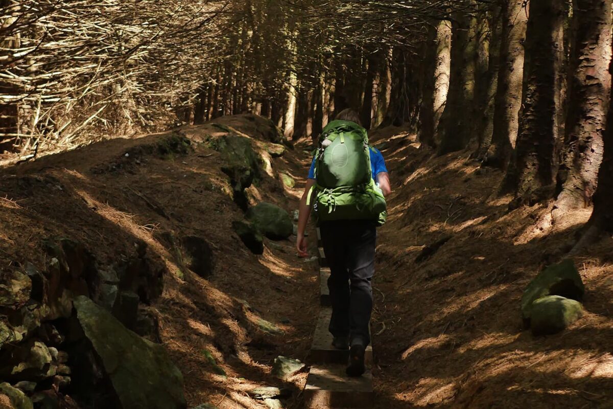
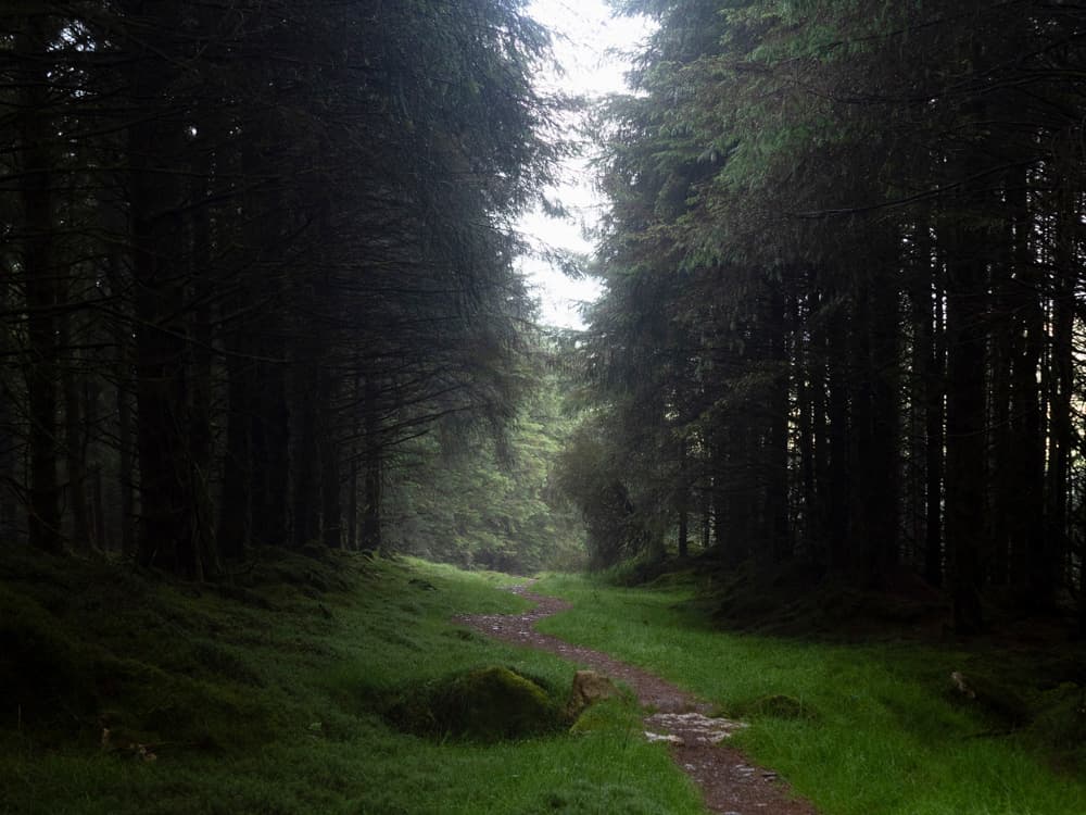
Passing through mixed woodlands of Scots pine, oak, ash, and gorse, the route does its best to avoid road walking where possible. The next major mountain sections are White Hill, Lough Tay, and Djouce Mountain. An exposed section, the wind here can be biting and wild, a quintessential mountain trail, with different wild heathers lining the way.

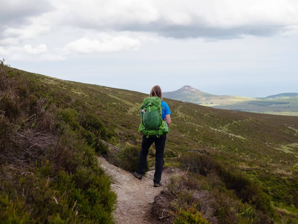
It’s around here where you will begin to get views of Dublin city, even though you’re still over a day from the end of the trail. Famous points along the next section include Powerscourt Waterfall (the highest waterfall in Ireland), Crone Wood, and glencree valley, where the trail twists and meanders along grassy river banks.

The final stage will have you climb up a peak known as Prince William’s Seat, and then into the Dublin Mountains, where strong trails crisscross the hillsides of Two Rock mountain and the Wicklow Way and Dublin Mountains Way briefly intertwine. The views out across Dublin city from here are the best you will find.

As you walk the final 5km, the transition from mountain to city happens surprisingly quickly, and you will suddenly find yourself walking through Marley Park. The final information board, and the true finish point of the trail, is beside Marlay House.

Stages

Besides the original stages listed below, there are some alternative routes:

Stage 3: Tinahely – Glenmalure, 31 km | 19.3 mi
Stage 4: Glenmalure – Laragh, 18 km | 11.2 mi
Stage 5: Laragh – Roundwood, 12 km | 7.5 mi

Original stages

Stage 1:

Clonegal – Shillelagh, 17 km | 10.6 mi

Stage 2:

Shillelagh – Tinahely, 15 km | 9.3 mi

Stage 3:

Tinahely – Aughavannagh, 20 km | 12.4 mi

Stage 4:

Aughavannagh – Glendalough, 26 km | 16 mi

Stage 5:

Glendalough – Roundwood, 11 km | 6.8 mi

Stage 6:

Roundwood – Knockree, 20 km | 12.4 mi

Stage 7:

Knockree – Marlay Park, 21 km | 13 mi

Accommodations

The Wicklow Way is one of Ireland’s most famous trails, and so all of the accommodation in the area knows of the route and can facilitate walkers in a variety of ways. It is recommended that you reserve your accommodation ahead of time, as this is one of Ireland’s most popular walking trails. Below are listed some of the popular indoor accommodation options en route.

Along this trail, there are also three camping huts or Adirondack shelters. These are located along the trail at Brusher’s Gap, Mucklagh, and Mullacor. Learn more about them here.

Stage 1:

ShillelaghCentral House

Note: The trail does not go through the village of Shillelagh, and so you will need to talk to your accommodation provider about collection, or alternative walking routes.

Stage 2:

TinahelyMadelines Accommodation

Located in the center of Tinahely town, this is the largest town on the trail until you reach Dublin. While the town isn’t directly along the trail, the detour into its center is waymarked.

Stage 3:

A: AughavannaghAghavannagh Barracks

B: GlenmalureCoolalingo B&B or The Glenmalure Lodge

Stage 4:

A: GlendaloughThe Glendalough Hotel

B: LaraghLynham’s Hotel

Stage 5:

RoundwoodWicklow Way Lodge or The Coach House

Stage 6:

KnockreeThe Enniskerry Inn

Knockree hostel has been one of the oldest and most famous stops on the trail. At the time of writing, this hostel is closed. Whenever you’re undertaking your Wicklow Adventure you can check if it has reopened.
The Enniskerry Inn is the closest alternative accommodation, but it will require organizing transport as it is off the trail.

Stage 7:

Marlay Park

On reaching Marlay Park you’re now in Dublin city! There are countless accommodation options!

Best time of the year

The best time of year to hike the Wicklow Way (and any trail in Ireland) is from May till September.

While Ireland has a temperate climate and doesn’t experience the more extreme weathers you’ll find around the world, it is harder to hike this trail in the off season. The tourism window in Ireland is from St. Patrick’s Day (March 17th) until late September, with some places stretching to Halloween at the end of October.

Outside of this window, most of Ireland’s tourism industry is closed for winter. It will be much harder to find accommodation, open restaurants, cafes, or tour operators during these winter months.

Even when hiking in the summer season, it’s important to be prepared for widely fluctuating temperatures and very changeable weather. There is a saying in Ireland that you can “experience all four seasons in one day” – and although I’m not one to be overly stereotypical, this phrase is accurate. Be prepared for torrential rain, and blistering sunshine.

Overnight temperatures can drop to 10°C during the summer months. Stay up-to-date with forecasts and weather warnings from Met Eireann, Ireland’s National Meteorological Service.

Safety & Gear

Hiking in Ireland is a relatively safe activity, however it is not without risk.

An important thing to know is that Ireland’s Countryside Code is the Leave No Trace Principles. The 7 Leave No Trace Principles in Ireland are slightly different from the international standard, as Ireland has some specific considerations that we all need to be aware of.

In Ireland, over 85% of the land is privately owned, and all our trails are permissive routes. This means that no fires are allowed along trails unless there is an approved, designated area by the landowner. This also means that all camping needs to follow a strict Leave No Trace mentality, and all livestock must be respected.

When heading out on a trail, always let someone know where you’re going, when you should be back, and when they should hear from you again. Mountain Rescue in Ireland is available 24/7 in Ireland through the emergency number 112 or 999. Please bare in mind that all mountain rescue teams in Ireland are 100% volunteer-run, and should only be called in an emergency.

Ireland is famously known as the “Emerald Isle” – and this is because of all the rain we get! No matter the time of year, it’s important to bring waterproof rain gear, and sturdy footwear that can withstand muddy tracks and trails. All Irish hiking shops will be able to let you know if your gear is suitable for the adventure you have planned, and are often a good place to stop before setting off.

Good to know

The Wicklow Way has existed since 1980, with very few route changes to this iconic trail. However, there is one route change I would recommend all walkers make.

In Stage 4 (Aughavannagh – Glendalough) you will be approaching Glendalough from the south, climbing up the shoulder of Mullacor onto the col between Mullacor and Lugduff. Once you’ve finished the climb, you will come to a trail crossroads. Officially, the Wicklow Way goes straight through this junction and into the forestry. However, if you follow the trail left, you will skirt around this forestry and join onto The Spinc Trail.

This stretch along The Spinc is one of the most iconic trails in all of Ireland and provides the best views of Glendalough. Following the Spinc Trail you will rejoin the Wicklow Way as you descend to the valley floor. The section of the official trail that you are detouring around is through Coillte plantation forestry, which provides you with none of these breath-taking views.

Route
Point to point
Highest point
625m (2050 ft)

Guidebooks

guidebook Wicklow way

The Wicklow Way

View guidebook
wicklow way guidebook

Wicklow Way Map (by Ordnance Survey Ireland)

View guidebook

Want to submit a trail or make this page more complete?

Comments

Be the first one to comment on this trail!

Reply to this trail

Your email address will not be published. Required fields are marked *

Reply to this trail

Log in to comment on this trail
Always read the disclaimer

Terms of Use: important to all visitors on this website. We strive to publish high quality content and information on this website. However it’s always possible that we’re missing out on some crucial information. In spite of the fact that this route, associated GPS track (GPX and maps) were prepared under diligent research by the specified contributor and/or contributors, the accuracy of such and judgement of the author is not guaranteed. Therefore, hiking-trails.com and contributors are in no way liable for personal injury, damage to personal property, or any other such situation that might happen to individuals hiking or following this route. Should you choose to hike this trail, this is always at your own risk. Check out our guidelines for safety hiking and Leave No Trace principles at the hiking 101 page.

Download GPX

Join the community!

Login or create a FREE account 😊

With an account you can:

Download GPX files

Pin trails to your wishlist

Mark trails as hiked by you

Rate hiking trails

Comment on trails, blogs and gear reviews

Happy trails!
Login

Don't have an account yet? Register here