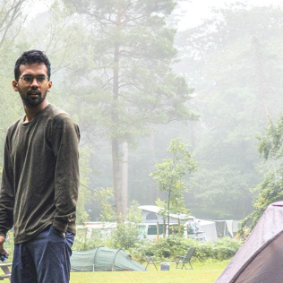
About the Way of the Gods

country
Italy
length
130 km(81 mi)
Type of trail
Pilgrimage, Long-distance
difficulty

Difficulty is highly personal. Be aware of the weather conditions as bad weather turns easier trails in difficult trails especially in the mountains.

Moderate
accommodation

Lodging means a mix of hotels, hostels or AirBnB’s.

Lodging
Elevation gain
5100 m(16732 ft)
terrain
Mountains, Forest, Hills
remoteness
Some of the time
Show more

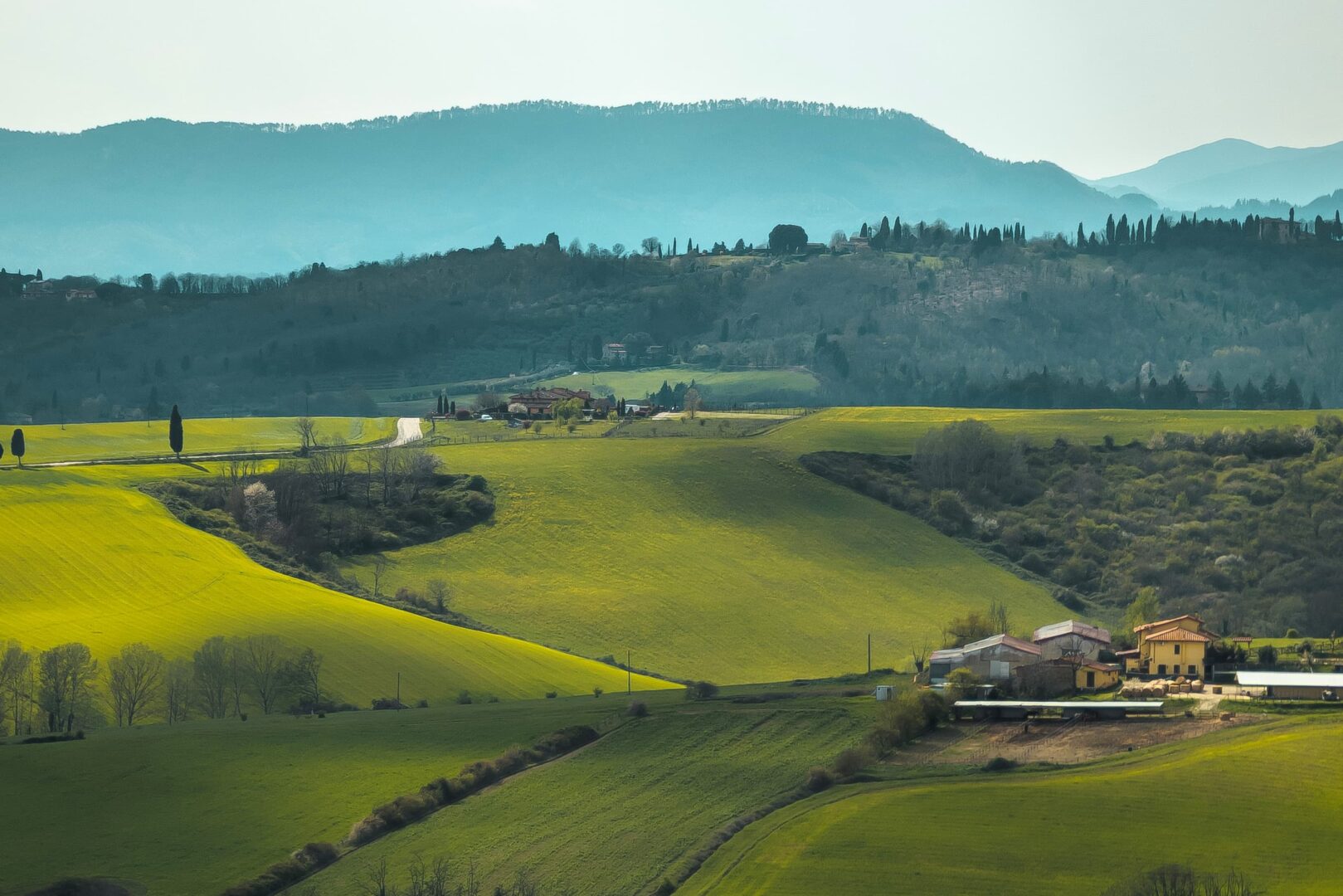
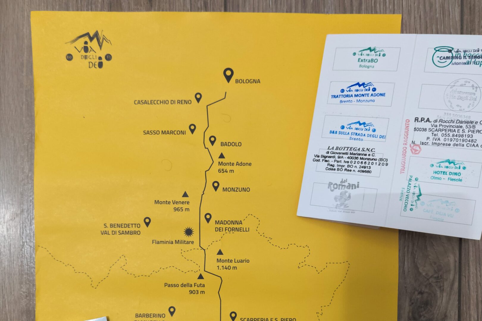
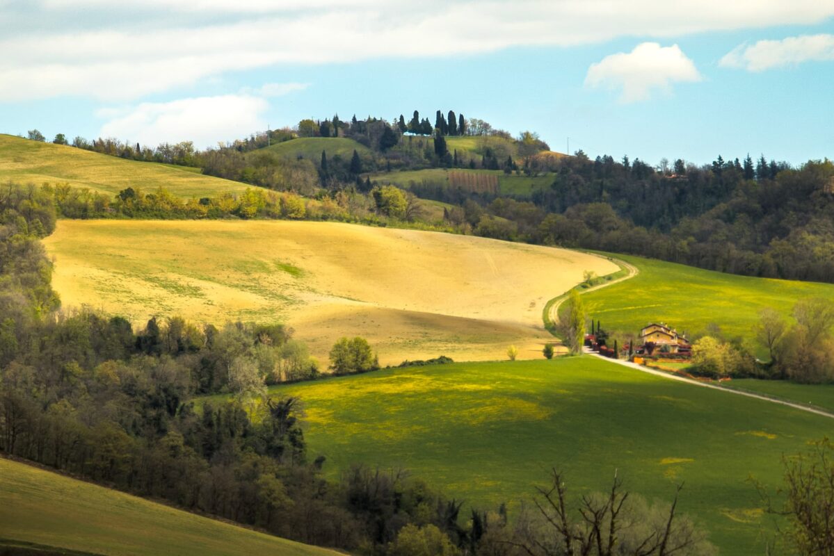
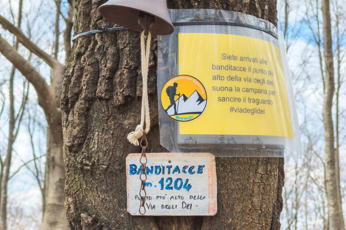
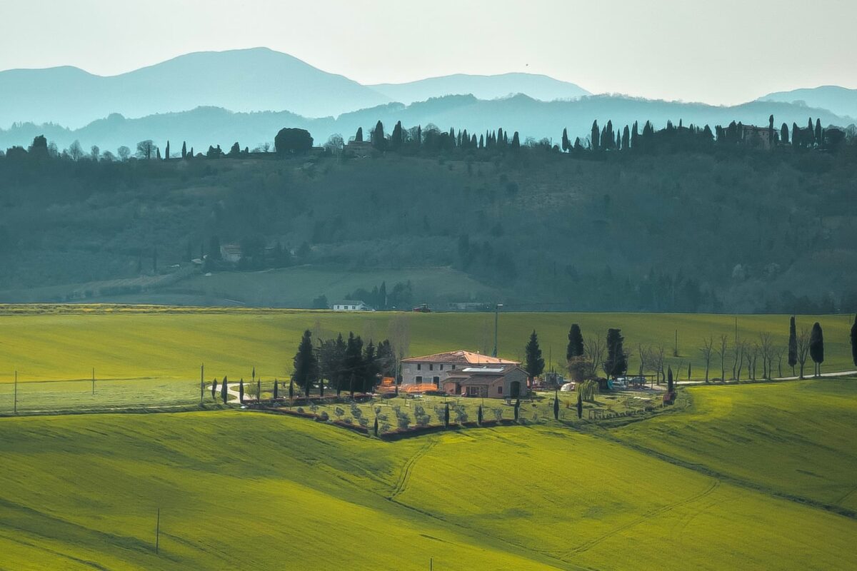
The Via degli Dei, or “Way of the Gods,” is a trail that goes over the Apennine Mountains in Italy, connecting the cities of Bologna and Florence. This ancient route has been used for centuries by pilgrims, traders, and travelers, offering stunning views of the Italian countryside and access to some of the region’s most charming villages and towns. The trail covers approximately 130 kilometers (about 80 miles) of varied terrain, including forests, hills, and mountain passes. It typically takes people around five to seven days to complete, depending on pace and the stops you make along the way.

The trail was officially marked as a hiking trail in recent years, with efforts to promote it as a recreational route gaining momentum in the late 20th and early 21st centuries.

Pradeep profile picture
Author

Pradeep Venkatachalam

Pradeep is a passionate solo hiker residing in Eindhoven, a vibrant city in the Netherlands. He enjoys traveling and shooting pictures of big rocks. When he’s not gallivanting through the wilderness, he’s often found contemplating unemploying himself and bringing dishonor to his Asian ancestors. You can follow Pradeep on Instagram @the.tipsy.professor.

View profile

The Trail

The Via degli Dei is rich in history and mythology, with its name reflecting the belief that it was once used by the Etruscans to travel to their sacred city of Fiesole. Over time, the route became associated with various religious pilgrimages, including those to the shrines of San Luca in Bologna and the Basilica di San Francesco in Florence.

Today, the trail attracts hikers from around the world who want to experience its nature, cultural heritage, and the hospitality of the communities along the route. With well-marked paths, designated accommodations, and plenty of opportunities to try local cuisine and wine, the Via degli Dei offers a memorable journey for anyone seeking adventure in the heart of Italy.

Stages

While the path is less than a week, you will cover a lot of ground over the 6 stages.

Stages of the Way of the Gods

Stage 1:

Bologna – Casalecchio di Reno – Sasso Marconi – Badolo, 21.3 km | 13.2 mi

Stage 2:

Badolo – Brento – Monzuno – Madonna dei Fornelli, 28 km | 17.3 mi

Stage 3:

Madonna dei Fornelli – Passo della Futa, 17.5 km | 10.8 mi

Stage 4:

Passo della Futa – Sant’Agata – San Piero a Sieve, 23.5 km | 14.6 mi

Stage 5:

San Piero a Sieve – Bivigliano – Vetta le Croci, 34 km | 21.1 mi

Stage 6:

Bivigliano/Vetta le Croci – Fiesole – Firenze, 17.6km | 10.9 mi

Accommodations

When embarking on the Via degli Dei trail, accommodations are usually small shared dormitories within B&Bs. It’s advisable to book all accommodations several months in advance, given the route’s popularity among hikers. Notably, in cities like Bologna and Florence, budget hostel options are limited. Many of the accommodations along the trail also provide the option of enjoying a home-cooked dinner, an experience highly recommended for both the delicious food and the opportunity to socialize with fellow hikers.

Best time of the year

The best time to hike the Via degli Dei depends on personal preferences and weather conditions. However, the optimal times generally fall in the spring and fall seasons.

It’s worth noting that summers in Italy can be hot, especially in July and August, which might make hiking challenging due to high temperatures. Additionally, some facilities along the trail may close or have limited availability during the winter months.

Ultimately, the best time to hike the Via degli Dei depends on individual preferences regarding weather, crowd levels, and personal schedules.

Safety & Gear

When preparing for a hike along the Via degli Dei, it’s vital to prioritize safety and thorough planning. This entails delving into comprehensive research about your chosen trail, acquainting yourself with the landscape, elevation changes, potential risks, and notable landmarks along the path. Securing accommodations in advance, particularly during peak seasons, is essential to guarantee a place to stay each night. Additionally, obtaining a physical map from outlets like ExtraBO in Bologna can complement your navigation resources and deepen your grasp of the trail’s layout.

Don’t hike during severe weather circumstances such as thunderstorms, heavy downpours, or extreme heat, all of which could jeopardize your safety. Furthermore, it’s crucial to be mindful of the possibility of flooding in specific areas along the trail.

Respecting the environment is also integral to a successful hike along the Via Degli Dei. Adhering to Leave No Trace principles by minimizing your ecological footprint is so important. This entails sticking to designated trails, packing out all waste, and demonstrating reverence for wildlife and natural habitats encountered along the route.

Good to know

There are enough water points in cities and small towns along the way, so you won’t need to filter your water or bring extra.

The Via degli Dei also has a balanced level of remoteness, with sections varying from moderately busy to tranquil solitude.

Route
Point to point
Highest point
La Banditacce, 1,200m (3937 ft)

Want to submit a trail or make this page more complete?

Comments

Be the first one to comment on this trail!

Reply to this trail

Your email address will not be published. Required fields are marked *

Reply to this trail

Log in to comment on this trail
Always read the disclaimer

Terms of Use: important to all visitors on this website. We strive to publish high quality content and information on this website. However it’s always possible that we’re missing out on some crucial information. In spite of the fact that this route, associated GPS track (GPX and maps) were prepared under diligent research by the specified contributor and/or contributors, the accuracy of such and judgement of the author is not guaranteed. Therefore, hiking-trails.com and contributors are in no way liable for personal injury, damage to personal property, or any other such situation that might happen to individuals hiking or following this route. Should you choose to hike this trail, this is always at your own risk. Check out our guidelines for safety hiking and Leave No Trace principles at the hiking 101 page.

Download GPX

Join the community!

Login or create a FREE account 😊

With an account you can:

Download GPX files

Pin trails to your wishlist

Mark trails as hiked by you

Rate hiking trails

Comment on trails, blogs and gear reviews

Happy trails!
Login

Don't have an account yet? Register here