About the Vier-Quellen-Weg

Alps
country
Switzerland
length
85 km(53 mi)
Type of trail
Long-distance, Day hike
difficulty

Difficulty is highly personal. Be aware of the weather conditions as bad weather turns easier trails in difficult trails especially in the mountains.

Moderate
accommodation

Lodging means a mix of hotels, hostels or AirBnB’s.

Mountain huts, Lodging
Elevation gain
6161 m(20213 ft)
terrain
Mountains, Flat, Forest, Hills
remoteness
None of the time
Show more

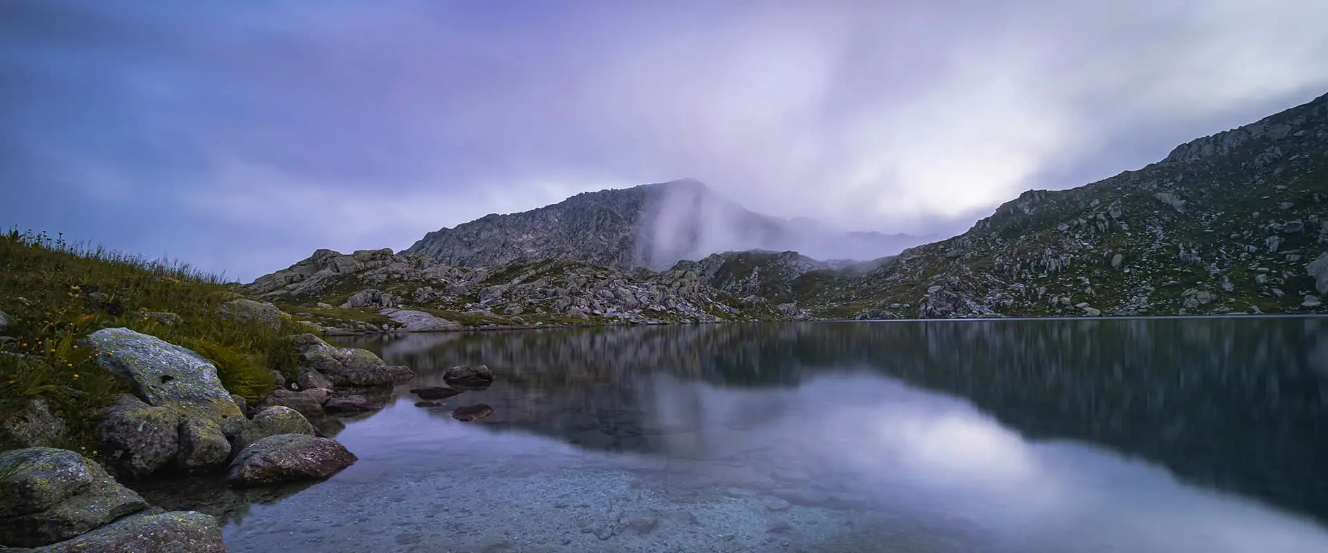
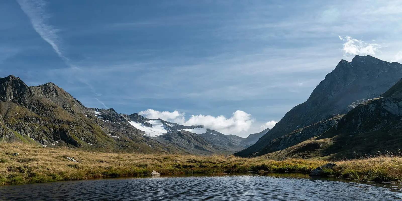
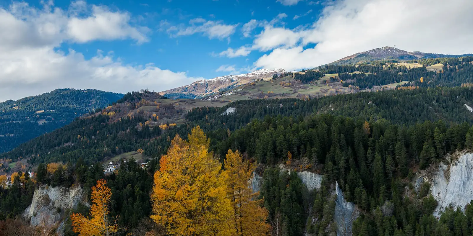
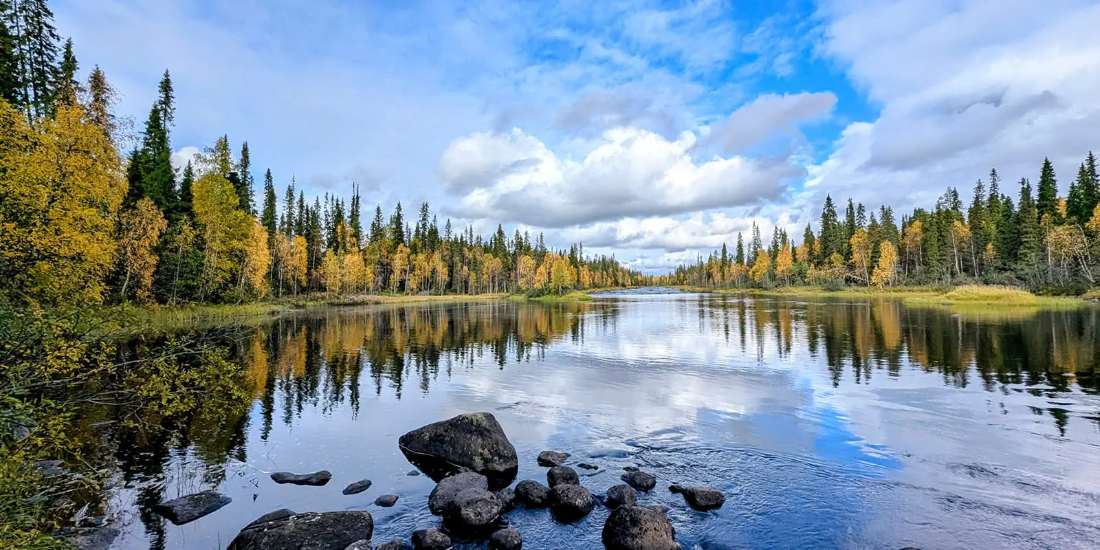
The Vier-Quellen-Weg (Four Headwaters Trail) in the Gotthard massif in Switzerland is an 85-kilometer (52.8 mi) hiking trail suitable for beginners and families. It owes its name to the four sources of the rivers Rhine, Reuss, Ticino, and Rhone, by which it passes.

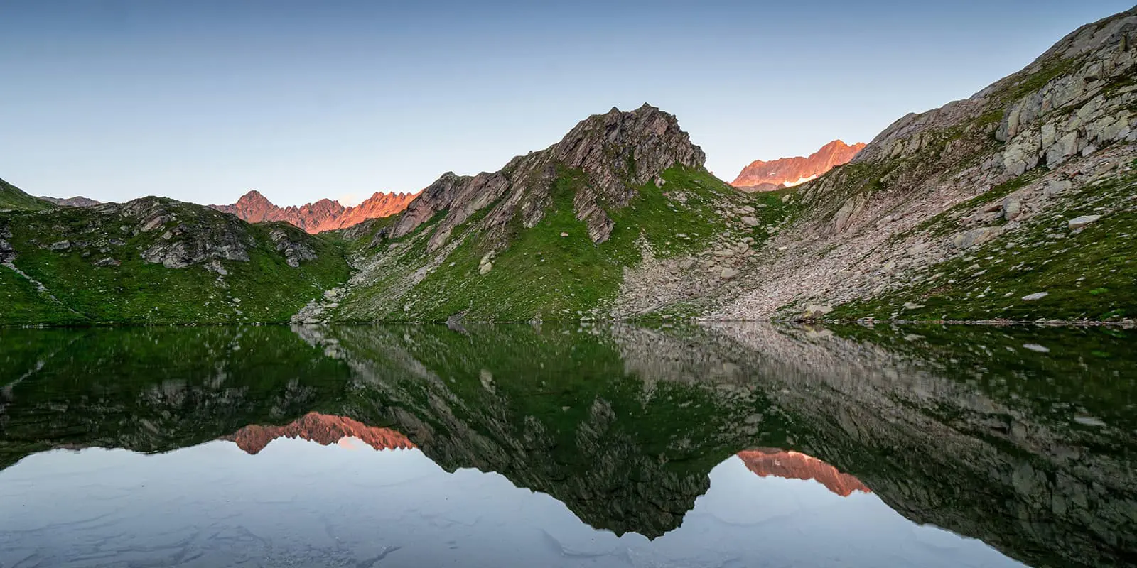
In five stages, it leads from the Oberalp Pass to the Rhone Glacier. The Vier-Quellen-Weg passes through an impressive mountain landscape characterized by alpine meadows, forests, wild streams, lakes, and moors. You’ll also see a rich variety of plants and animals.

Merle profile picture

Merle Wünderling

Merle is an outdoor enthusiast who’s passionate about hiking, rock climbing, mental health, and sustainability. Born in Germany but at home in the world, she’s hiked trails in New Zealand (Abel Tasman Coast Track, Kepler Track), Europe (Rota Vicentina/ Fishermen’s Trail, Tour du Mont Blanc, GR20 Corse, Kungsleden… ), and the Balkans (Peaks of the Balkans). Over the years she became a bit of a nerd, constantly improving her gear for upcoming hikes, such as GR11 Spain, Tour des Ecrins, Te Araroa, and the Transcaucasian Trail.

You can follow Merle on Instagram @merlewunderkind.

View profile

The Trail

The first stage leads from the Oberalp Pass to the source of the Rhine at Lake Toma. Here, you can choose between two routes: While the official Vier-Quellen-Weg leads towards Tschamut/Sedrun to Lake Toma, a more challenging and longer route goes via Pazolastock. Both trails have the same stage destination, the Vermigel hut.

The next day, the route leads over the 2776 meter (9107 ft) Piz Giübin, the highest point of the Vier-Quellen-Weg. The ascent is rewarded with a breathtaking view. The descent leads past the dam of Lake Sella to the Gotthard Pass.

The third day leads along the Gotthard Pass and Lago Lucendro to the source of the Reuss. Then, as you work your way to the Piansecco hut, you’ll have to conquer the Lucendro Pass. After this, though, you’ll feel so accomplished and ready for a beer at the Piansecco hut.

From the hut, the route continues to the headwaters of the Ticino below the Nufenen Pass. The route then continues over the Nufenen Pass and through the Ägenetal valley to Ulrichen/Obergesteln.

The fifth stage leads to the last of the four springs, the source of the Rhone. It goes from Obergesteln via Oberwald, Gletsch, and Muttbach up the Furka Pass. From there, you will have an impressive view of the Rhone Glacier and its source.

Stages

The individual stages can be covered as a day hike or as a five-day hike with overnight stays.

5-stage itinerary

Stage 1:

Oberalppass – Vermigel-Hütte, 14.5 km | 9 mi

Stage 2:

Vermigel-Hütte – Gotthardpass, 13 km | 8 mi

Stage 3:

Gotthardpass – Piansecco Hütte, 21.5 km | 13.4 mi

Stage 4:

Piansecco Hütte – Obergesteln, 20 km | 12.4 mi

Stage 5:

Obergesteln – Oberwald/Andermatt, 17 km | 10.6 mi

Accommodations

From mountain huts to hotels there are a variety of accommodation options along the Vier-Quellen-Weg. Make sure to book your accommodation in advance, especially during peak hiking season in July and August. If accomodations happen to be booked out already, you will find alternatives on the official website of Vier-Quellen-Weg.

Accommodations per stage

Stage 1:

Vermigel hut

Stage 3:

Piansecco hut

Stage 4:

Hotels in Ulrichen or Obergesteln

Stage 5:

Hotel Glacier du Rhone in Gletsch (alternatives in Andermatt or Grimselpass)

Best time of the year

Hiking the Vier-Quellen-Weg is possible all year long. But the best time of the year to hike the Vier-Quellen-Weg is from mid-June to mid-October, when there is no snow and accomodations are open.

The most convenient times are in late spring (June) or early autumn (September to October), when the temperatures are mild. Due to fewer tourists than in summer (July to August), these seasons are perfect if you want to avoid the crowds.

Safety & Gear

Take as little as possible and as much as necessary: Adapt your equipment to the tour. Wear layers, bring suitable footwear, and be prepared for rain and shine. Pack sufficient drinking water and snacks for the day. Also, remember to bring a first-aid kit and load the GPX on your device. The local hiking guide not only helps with orientation but also provides valuable information about the Gotthard region.

Before you start to hike, check the local weather forecast, as rain, wind, and cold increase the risk of accidents.

Difficulty

The Vier-Quellen-Weg is a beginner-friendly hiking trail for the whole family.

Good to know

Switzerland is very organized, so the Vier-Quellen-Weg can be reached easily by public transport. The start and end points are serviced by buses or trains. You can find the schedules here: www.sbb.ch. Additionally, this trail can be hiked as a series of day hikes from a central basecamp. You’ll be able to access the trailheads using the public transportation system.

The trail is well sign-posted and labeled as easy, but you should still prepare properly. Load the GPX on your device, tell someone your plan if you’re hiking alone, and carry a first aid kit.

You can fill up your water at the huts and hotels between the stages. Make sure to take enough drinking water for the day.

route
point-to-point
highest point
2776m (9107 ft)

Want to submit a trail or make this page more complete?

Always read the disclaimer

Terms of Use: important to all visitors on this website. We strive to publish high quality content and information on this website. However it’s always possible that we’re missing out on some crucial information. In spite of the fact that this route, associated GPS track (GPX and maps) were prepared under diligent research by the specified contributor and/or contributors, the accuracy of such and judgement of the author is not guaranteed. Therefore, hiking-trails.com and contributors are in no way liable for personal injury, damage to personal property, or any other such situation that might happen to individuals hiking or following this route. Should you choose to hike this trail, this is always at your own risk. Check out our guidelines for safety hiking and Leave No Trace principles at the hiking 101 page.

Download GPX

Join the community!

Login or create a FREE account 😊

With an account you can:

Download GPX files

Pin trails to your wishlist

Mark trails as hiked by you

Rate hiking trails

Comment on trails, blogs and gear reviews

Happy trails!
Login

Don't have an account yet? Register here