About the Via Dinarica White Trail

Balkan
country
Croatia, Albania, Bosnia and Herzegovina, Montenegro, Slovenia
length
1260 km(783 mi)
Type of trail
Thru-hike, Long-distance
difficulty

Difficulty is highly personal. Be aware of the weather conditions as bad weather turns easier trails in difficult trails especially in the mountains.

Difficult
accommodation

Lodging means a mix of hotels, hostels or AirBnB’s.

Mountain huts, Camping, Lodging, Shelters
Elevation gain
49579 m(162661 ft)
terrain
Mountains, Countryside, Forest, Hills
remoteness
Most of the time
Show more

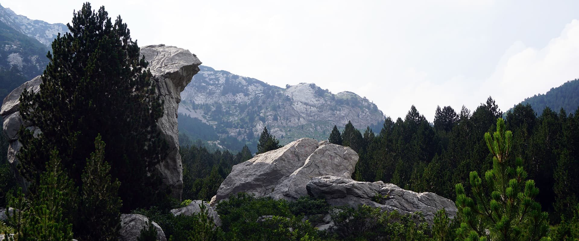
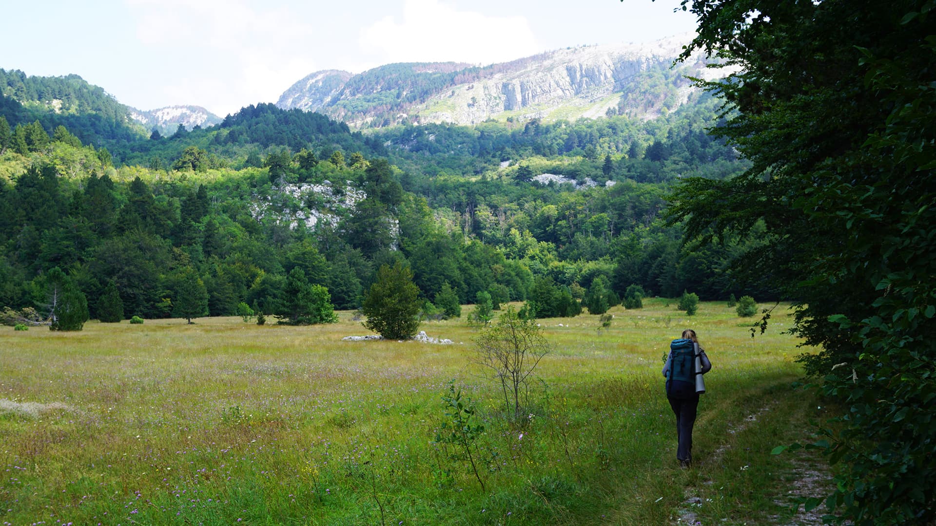
The Via Dinarica White Trail is probably the most defining thru-hike of the Dinaric Alps and the Balkans as a whole. On your journey along this epic trail, you’ll cross borders between Slovenia, Croatia, Bosnia-Herzegovina, Montenegro, and Albania. The trail is much more than just a collection of pre-existing trails however, as many see the formation of the Via Dinarica as an example of changing times, of healing wounds between nations that only too recently were bitterly divided by the fallout of a ruthless war.

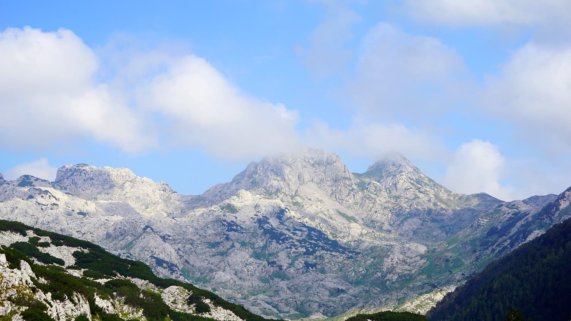
Part of a network of three trails that carry the name Via Dinarica, the White Trail was the first to be completed, and the only full mountain hiking route out of the three Via Dinarica trails. Where the Green Trail focuses more on lower altitude bike paths and the Blue Trail on kayaking sections, the White Trail brings you to the highest regions of the Dinaric Alps.

man standing in green landscape

Roel Zerner

Blessed with the blissful curse of wanderlust, Roel has built his life around adventurous travel since 2018. He can either be found roaming remote wilderness or on the outskirts of mass tourism, hunting for unique experiences among worn-out tourist trails. Over the years, his ambition to become a full-time travel writer has led him to explore trails and adventurous destinations all over the world. You can follow his adventures on Instagram @beatthetrail or via his website.

View profile

The Trail

The trail starts in Slovenia, in the mountain town of Razdrto. Winding its way through the southern reaches of the Julian Alps, you will cross alpine mountain scenery and pass by pleasant mountain villages on your way to the Croatian border. Once you cross into Croatia, the White Trail takes you into Risnjak National Park, the first of many nature preserves you will pass through. The trail continues southward along the Dinaric Alps, briefly following the Premužić Trail through Velebit National Park before continuing along the rugged karst mountain scenery into Paklenica National Park. This section is especially scenic, as the trail offers breathtaking views over the Adriatic Sea and plenty of opportunities to take a break from the trail in one of the many idyllic towns that dot the coastline below.

The Via Dinarica White Trail then leaves the coastline to veer inland on its way to Bosnia-Herzegovina. Here you will encounter some of the most challenging, but also some of the most rewarding sections of the entire trail. The Herzegovinian mountains form a region known for its dramatic views, challenging climbs, and welcoming hospitality. When you eventually approach the Montenegro border in Sutjeska National Park, a detour to the peak of Maglić mountain is highly recommended!

You will then visit the lush green landscape of the Prirode Piva and Durmitor national parks before hiking some relatively easy sections as you cross the Montenegrin countryside. Be sure to sample the local hospitality while passing the many villages in this section! Soon, the White Trail approaches the mountains again when it closes in on the Albanian border. It passes through Biogradska Gora and Prirode Komovi national parks before crossing the border, offering up some of the last serious challenges of the trail.

Once in Albania, the Via Dinarica White Trail mostly follows a series of valleys before finding its end near the town of Valbona. However, this might not be the official ending for much longer, as there is talk of expanding the trail through Albania into North Macedonia.

Accommodations

Although the White Trail is a relatively ‘young’ trail, you will find that there are plenty of locals who found a new income source through servicing the many hikers passing through the region. However, you should keep in mind that several sections will have few facilities or options for accommodation. Being self-sufficient is absolutely necessary if you plan on thru-hiking the White Trail in one go.

When passing through one of the many national parks along the Via Dinarica White Trail, you’ll encounter a variety of staffed huts, seasonal huts, and free, unmanned shelters. It is strongly recommended that you do your research beforehand, and check which huts will be open or available when you pass through the area.

If you speak the local language or are willing to make an effort to try, you’ll find that many locals will show you hospitality. Translation apps on your phone work wonders as well!

You’ll likely end up in many situations where there aren’t any accommodation options available. In these cases, it’s good to remember that while wild camping is officially forbidden in the Balkans, it is rarely ever enforced outside national parks. Just make sure to camp outside national park boundaries, not light any fires, and leave no trace!

Best time of the year

Due to the long distance involved, a complete thru-hike (or any section hike) will need to take place between June and October. The weather will be the warmest between these months, reaching the highest temperatures in July and August (around 30 Celcius or 86 Fahrenheit).

To avoid snow in the higher reaches of the Dinaric Alps, it’s best not to start your adventure until mid-June. Avoiding the hottest months is also recommended if you don’t hike well in the heat. June and September are therefore recommended if you prefer hiking in cooler weather.

Keep in mind that the weather in the high mountains can change rapidly, and it’s essential to be prepared for various conditions, including sudden rain or snow showers. Always check trail conditions, and local weather forecasts before embarking on a high-alpine hike. Additionally, consider your hiking experience and skill level, as some sections of the Via Dinarica White Trail can be challenging and require proper equipment and experience.

Safety & Gear

First things first, do your homework on the trail. Check out the details on factors like how tough it is, how long it’ll take, and what kind of terrain you’ll be tackling in which sections. Don’t just rely on HIKING-TRAILS.com; hit up guidebooks, chat with folks who’ve hit the trail, and tap into local hiking groups for insider tips.

Share your itinerary with people you trust—including your approximate start and end times, where you’re headed, and who to call in case things go wrong. Safety first, always!

Keep an eye on the weather, too. Please stay off the trails if you see or hear of extreme weather heading your way. Bring along plenty of water and some snacks to keep your energy levels up. In July and August, try to bring 4 liters each day.

Stick to marked trails, pack out your trash, and show some love to the critters and plants you come across by practicing Leave No Trace.

Good to know

The Dinaric Alps are full of free, unmanned shelters called sklonište. Ask locals to pinpoint these for you in the section ahead, and you’ll spend many nights in cheap, relative comfort! In return for the hospitality, put aside some firewood for the next visitor.

Water points can be found at mountain huts, restaurants, and villages along the way. Occasional water sources along the trail, but these often dry out during the hot summer months.

The trail is also very remote, so self-sufficiency is a must! Some sections are popular for shorter hikes and will be busier, especially during weekends.

Route
Point to point
Highest point
2692m (8832ft)

Want to submit a trail or make this page more complete?

Comments

Be the first one to comment on this trail!

Reply to this trail

Your email address will not be published. Required fields are marked *

Reply to this trail

Log in to comment on this trail
Always read the disclaimer

Terms of Use: important to all visitors on this website. We strive to publish high quality content and information on this website. However it’s always possible that we’re missing out on some crucial information. In spite of the fact that this route, associated GPS track (GPX and maps) were prepared under diligent research by the specified contributor and/or contributors, the accuracy of such and judgement of the author is not guaranteed. Therefore, hiking-trails.com and contributors are in no way liable for personal injury, damage to personal property, or any other such situation that might happen to individuals hiking or following this route. Should you choose to hike this trail, this is always at your own risk. Check out our guidelines for safety hiking and Leave No Trace principles at the hiking 101 page.

Download GPX

Join the community!

Login or create a FREE account 😊

With an account you can:

Download GPX files

Pin trails to your wishlist

Mark trails as hiked by you

Rate hiking trails

Comment on trails, blogs and gear reviews

Happy trails!
Login

Don't have an account yet? Register here