trail log via alpina 1

About the Via Alpina 1

Alps
country
Switzerland
length
390 km(242 mi)
Type of trail
Thru-hike, Long-distance
difficulty

Difficulty is highly personal. Be aware of the weather conditions as bad weather turns easier trails in difficult trails especially in the mountains.

Moderate
accommodation

Lodging means a mix of hotels, hostels or AirBnB’s.

Lodging, Mountain huts
Elevation gain
23500 m(77100 ft)
terrain
Mountains
remoteness
Some of the time
Show more

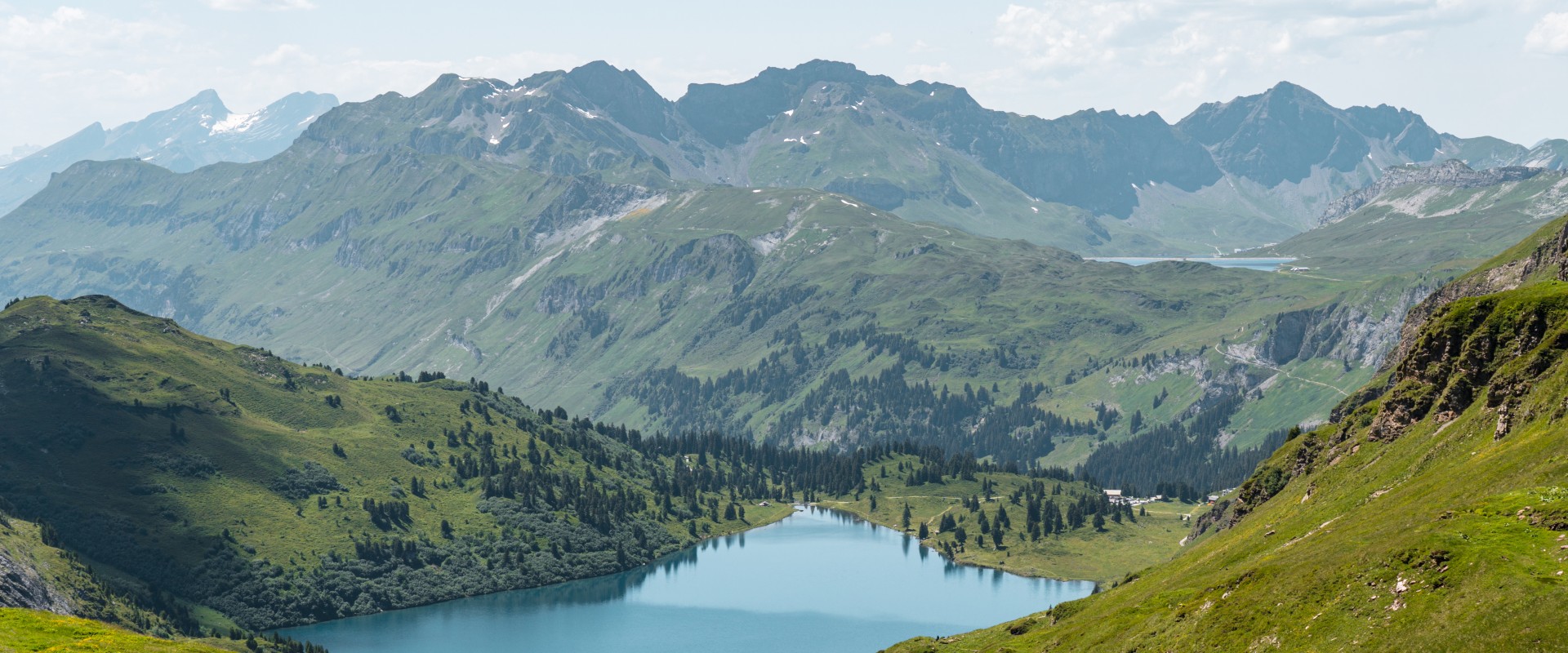
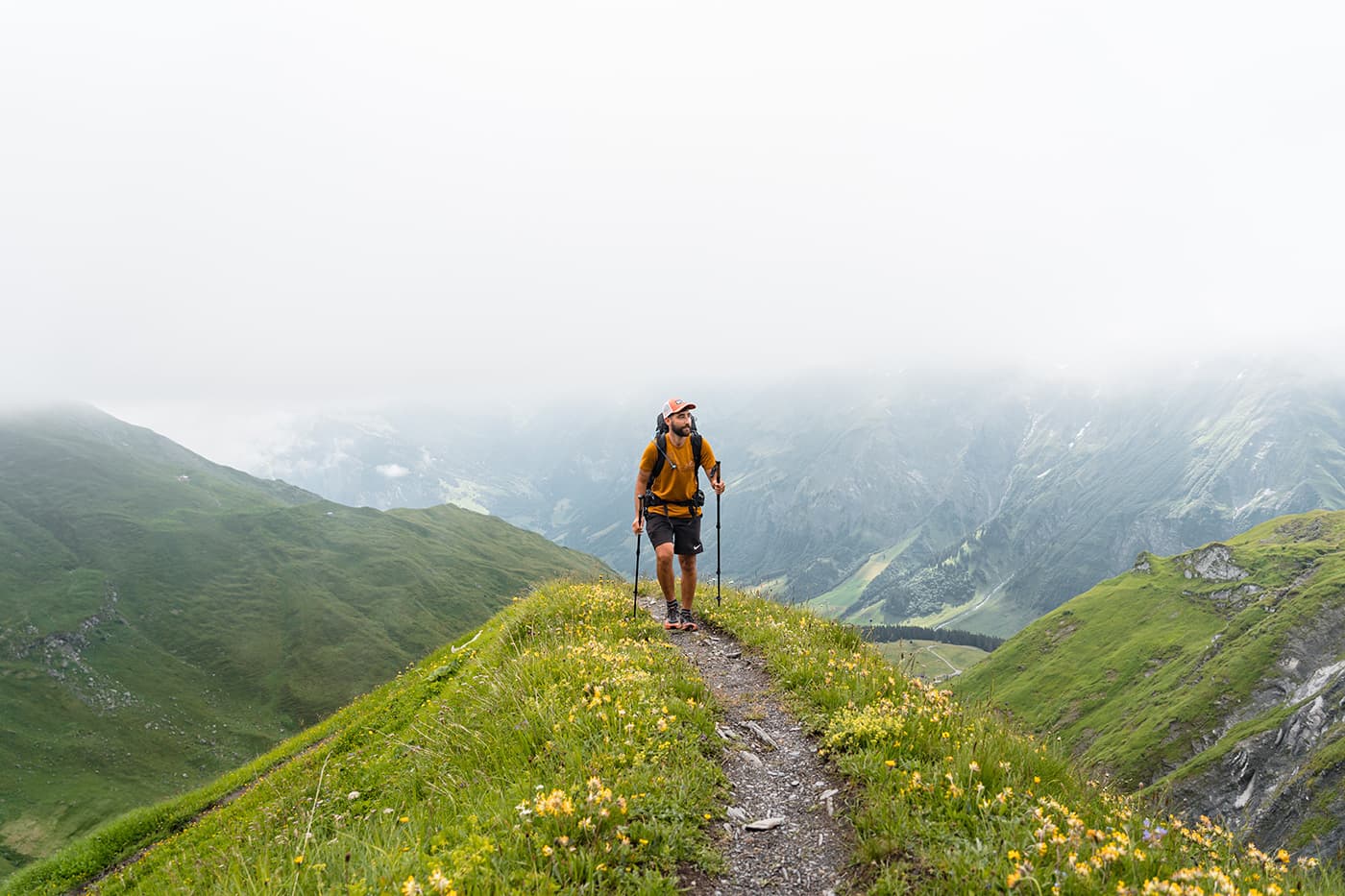
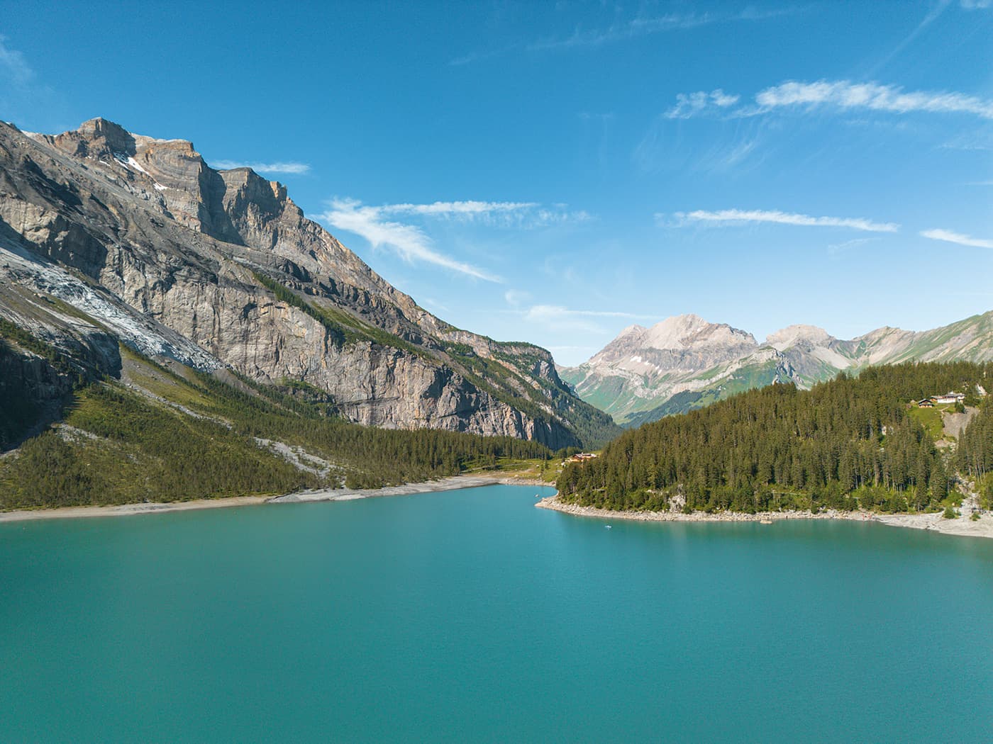
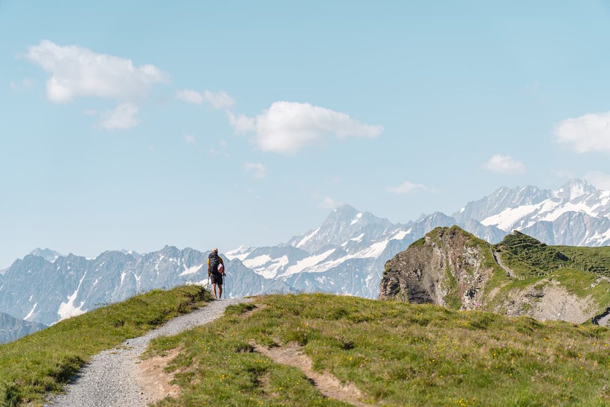
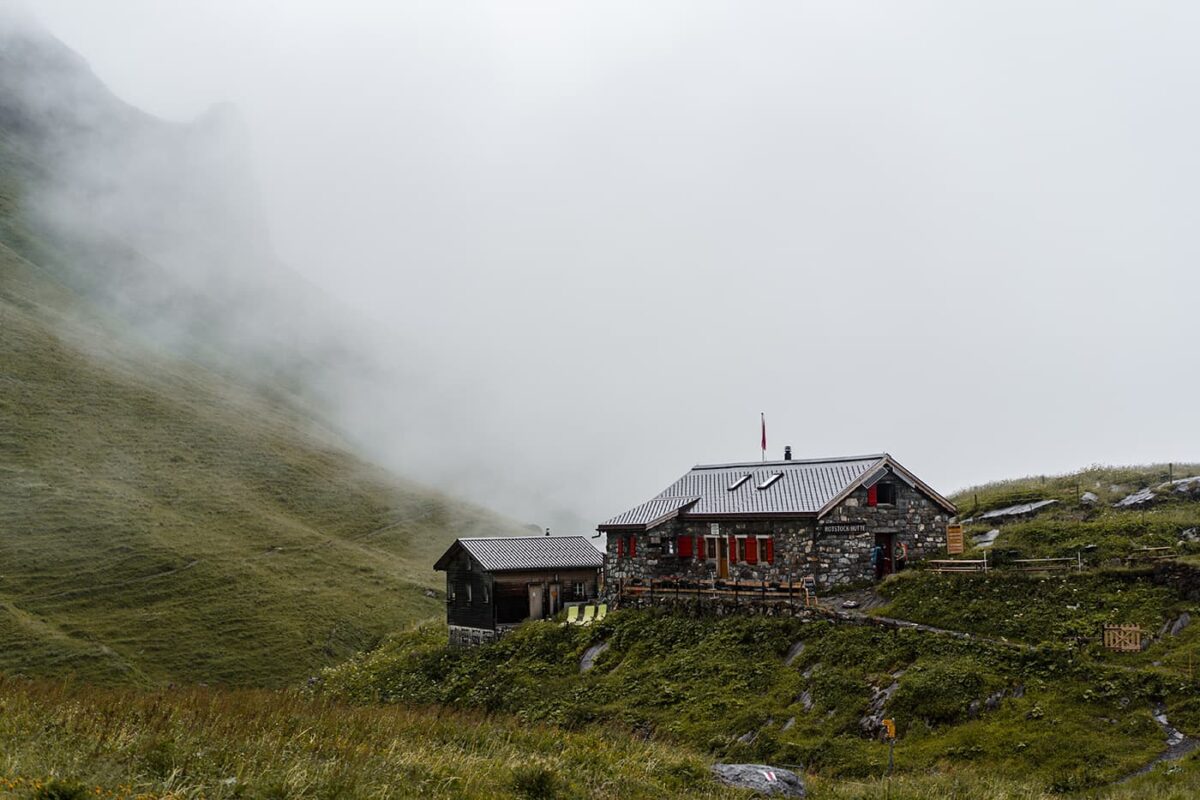
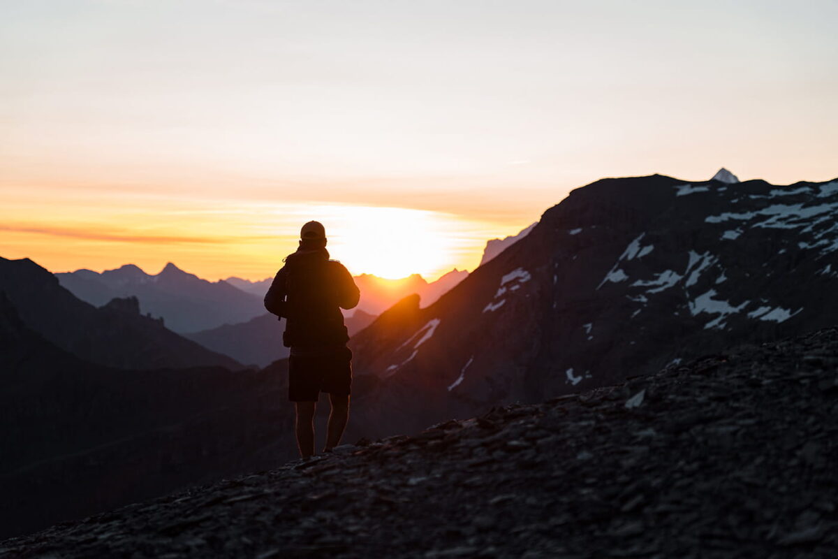
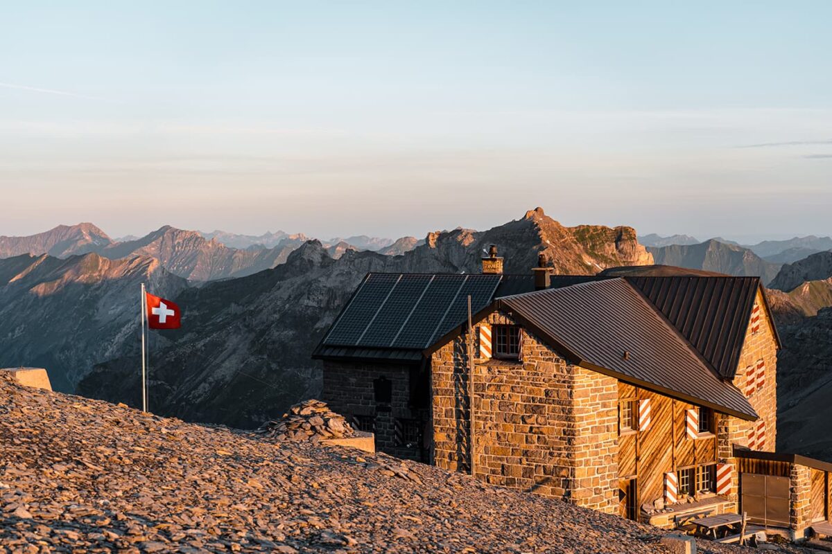
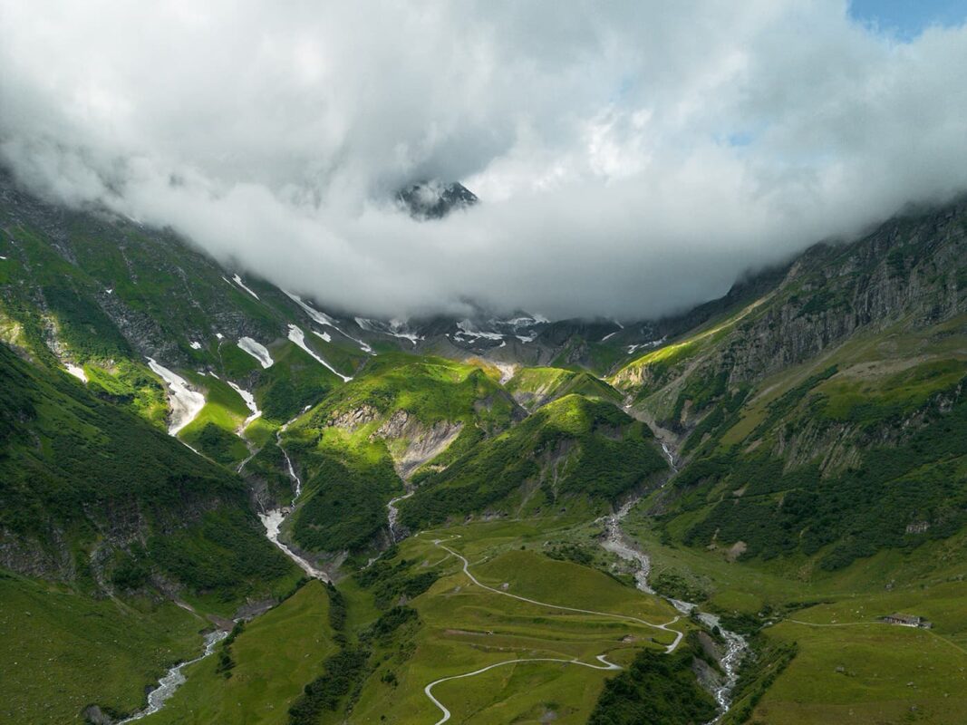
Trek along the Via Alpina 1 for almost 400 kilometers from east to west, right through the Swiss Alps. The trail, which gains over 1000 meters in altitude every day, is a true physical and mental challenge. But if you accept the challenge, you will be rewarded with paths along the mighty four-thousanders of the Bernese Oberland, beautiful alpine mountain lakes, flower-filled alpine meadows, and high mountain huts offering Swiss mountain panoramas every day. At the end of the day, you can unwind with a cheese fondue or a hearty meal in the mountain hut.

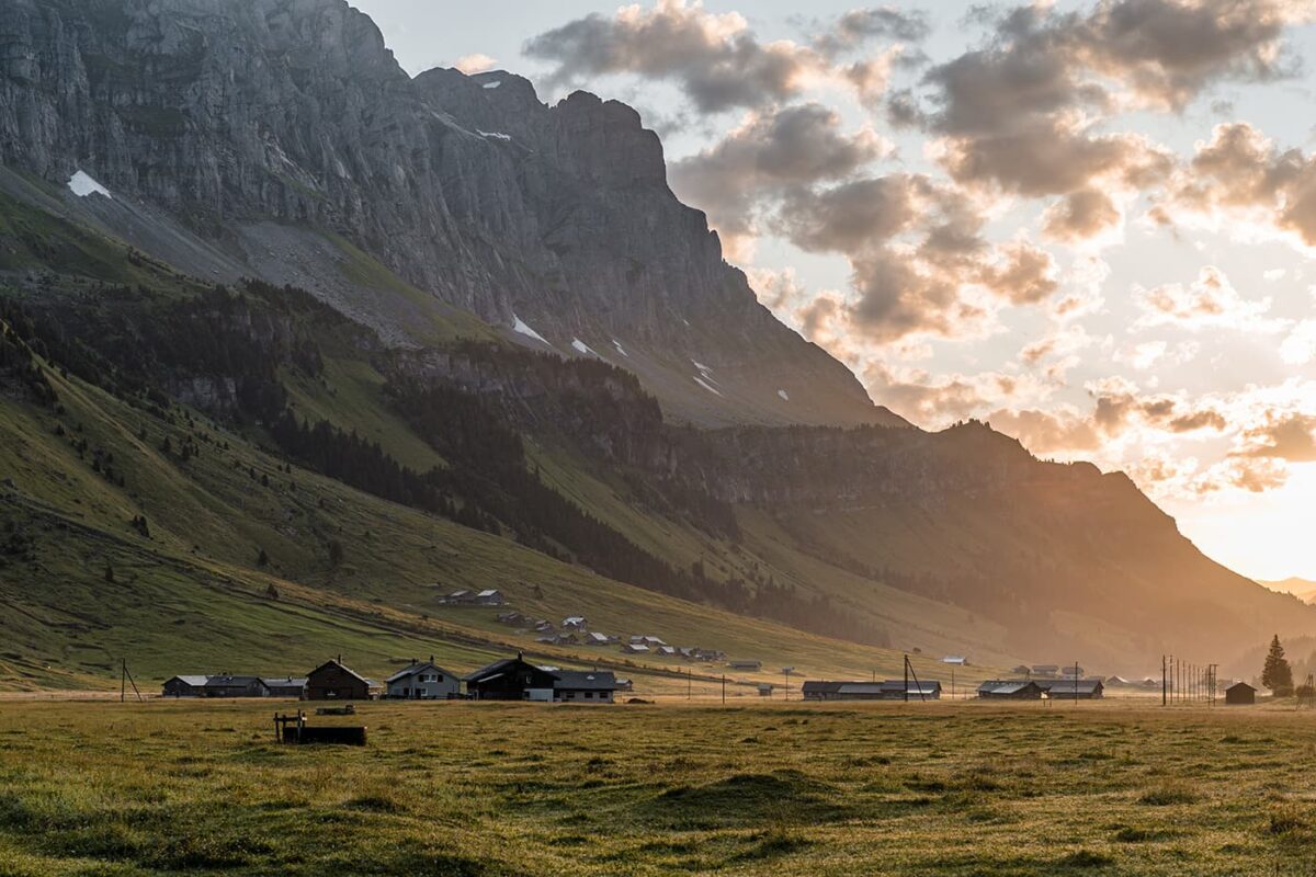
The Via Alpina 1 is a very well-marked trail from  mountain village to mountain village, allowing you to fully enjoy the Swiss mountain world. On this trail, you’ll cross the whole country. So.. thru-hike Switzerland!

Editor

Elmar Teegelbeckers

Passionate hiker Elmar spends months of his time on the trail. He’s usually on the lookout for hidden gems in one of his favourite countries such as Slovenia, Switzerland and Japan. He founded hiking-trails.com in need for a community and detailed information about the trails. Before this, he worked for the Alpine asscociation in the Netherlands[ (NKBV) but lost his heart to the trails.

With this website and socials, he hopes to shape an inclusive community for hikers all over world. No matter your speed, experience or level, you can get out there to enjoy the trails and connect with the heartwarming hiking community. Life is so much better outside and he hopes to inspire hikers to take their first, or next, step on the trail.

View profile

The Trail

The Via Alpina 1 is one of the 7 ´National Routes´ in Switzerland that offers a great journey through the Swiss Alps. This trail and thru-hike is part of a larger network of five trails of the Via Alpina that traverse eight Alpine countries, an exploration of the Alpine region’s natural beauty and cultural diversity.

Spanning approximately 390 kilometers, the Via Alpina 1 winds through 14 of the best Alpine passes, showcasing a vast array of cultures, geological features, and topographies across seven Swiss cantons. The trail is well known for its breathtaking scenery, which includes wide roads that give way to high ridge trails, offering hikers panoramic views of the surrounding landscapes.

One of the most popular parts of the Via Alpina 1 lies in the Bernese Oberland. The stages in this Swiss canton will give you a lot of elevation gain as you pass through Switzerland’s most famous mountain villages and peaks. You walk through Grindelwald, Lauterbrunnen, and Mürren along the mighty 4000m mountain peaks Jungfrau, Eiger, and Mönch. These three are the most famous peaks in the Jungfrau Region.

The trail is challenging, especially on the so-called king’s stage, the most beautiful and hardest day of the Via Alpina towards Kandersteg. But when you spend the night in the Blümlisalp hut at 2840m after a long day, it’s all worth it. The idyllically located mountain hut next to the glacier is almost touching. It is easy to feel insignificant among all those mighty mountain giants and the unique mountain world. The next day the trail leads you to the famous alpine bright blue lake: Oeschinensee, another highlight. These stages are also a part of the Bärentrek, a shorter trail, basically stages 10 to 15 from the Via Alpina 1, if you only want to hike a part of the trail.

The Via Alpina 1 is classified as a medium difficult mountain hiking trail. While it never gets really technical on the trail, with so much elevation gain, the trail is a physical and mental challenge. Please remember that you’re hiking for a great amount of time above the 2000m line in the Alps and that the weather can change fast.

Stages

The Via Alpina 1 can be hiked in 20 stages. Of course, you can choose to add rest days or divide some longer stages in two. It’s all up to you and there’s no need to rush it!

Stage 1:

Gaflei, FL – Sargans, 28 km | 17 mi

Stage 2:

Sargans – Weisstannen, 13 km | 8 mi

Stage 3:

Weisstannen – Elm, 22 km | 14 mi

Stage 4:

Elm – Linthal, 25 km | 16 mi

Stage 5:

Linthal – Urner Boden, 16 km | 10 mi

Stage 6:

Urner Boden – Altdorf, 27 km | 17 mi

Stage 7:

Altdorf – Engelberg, 29 km | 18 mi

Stage 8:

Engelberg – Engstlenalp, 12 km | 7 mi

Stage 9:

Engstlenalp – Meiringen, 22 km | 14 mi

Stage 10:

Meiringen – Grindelwald, 23 km | 14 mi

Stage 11:

Grindelwald – Lauterbrunnen, 20 km | 12 mi

Stage 12:

Lauterbrunnen – Griesalp, 22 km | 14 mi

Stage 13:

Griesalp – Kandersteg, 17 km | 11 mi

Stage 14:

Kandersteg – Adelboden, 16 km | 10 mi

Stage 15:

Adelboden – Lenk, 14 km | 9 mi

Stage 16:

Lenk – Gstaad, 22 km | 14 mi

Stage 17:

Gstaad – L’Etivaz, 16 km | 10 mi

Stage 18:

L’Etivaz – Rossinière, 14 km | 9 mi

Stage 19:

Rossinière – Rochers de Naye, 19 km | 12 mi

Stage 20:

Rochers de Naye – Montreux, 13 km | 8 mi

Accommodations

When hiking the Via Alpina, you can choose from many accommodations every day, from luxury stays to the more basic accommodations. The stages end almost always in a mountain village where you’ll find hotels, B&Bs, and hostels. Sometimes you find a Swiss Youth Hostel and sometimes you can also choose to sleep in some mountain huts along the way. Especially on stages 12 and 13, it’s a great idea to sleep in the Rotstockhütte and Blümlisalphütte. Make sure you book the accommodations in advance. These will not be available to book only a few days in advance when you’re hiking the trail. It might be a bit pricier but there will always be accommodation for you. However, for the mountain huts, you should book at least three months in advance.

Best time of the year

The best time of the year to hike the Via Alpina 1 is generally from late spring June to early autumn in September. These periods typically offer a better balance of better weather in the mountains, longer daylight hours, and less chance of snow-packed trails. When you go hiking earlier in the season you may find snowfields on your way or if you go later you might end up in a snowstorm. Also, not all accommodations are open off-season.

Safety & Gear

Safety

The Via Alpina 1 demands an understanding of the environment. The Alps are known for their unpredictable weather, where sunny skies can swiftly turn into rain or thunderstorms, especially at higher altitudes.

Detailed planning is key for a successful hike. The official Switzerland Mobility website provides comprehensive resources, including detailed route descriptions, maps, and practical tips. Whether you’re planning your daily mileage or looking for accommodation options along the trail, these resources are invaluable for ensuring a smooth and enjoyable trek.

Gear

Of course, you will bring your hiking shoes with good grip, but the key to staying comfortable on the high-altitude mountain trails lies in adaptable clothing. Layering allows you to adjust to changing temperatures and conditions seamlessly. Start with a base layer to wick sweat, followed by an insulating layer for warmth, and top it off with a waterproof and windproof hardshell to fend off the elements. Pack your down jacket for the cool mornings and chilly evenings.

Good to know

The Via Alpina 1 is a physically demanding hike. The trails aren’t too technical. However, you often walk in alpine terrain, frequently above the tree line, and nearly every day you cross a mountain pass. Prepare physically by walking a lot with a backpack and be alert to rapidly changing weather conditions in the mountains by keeping an eye on the weather forecast.

Route
Point to point
Highest point
2778m (9114 ft)

Guidebooks

Cover guidebook Via alpina 1

Via Alpina 1

View guidebook

Want to submit a trail or make this page more complete?

Comments

Be the first one to comment on this trail!

Reply to this trail

Your email address will not be published. Required fields are marked *

Reply to this trail

Log in to comment on this trail
Always read the disclaimer

Terms of Use: important to all visitors on this website. We strive to publish high quality content and information on this website. However it’s always possible that we’re missing out on some crucial information. In spite of the fact that this route, associated GPS track (GPX and maps) were prepared under diligent research by the specified contributor and/or contributors, the accuracy of such and judgement of the author is not guaranteed. Therefore, hiking-trails.com and contributors are in no way liable for personal injury, damage to personal property, or any other such situation that might happen to individuals hiking or following this route. Should you choose to hike this trail, this is always at your own risk. Check out our guidelines for safety hiking and Leave No Trace principles at the hiking 101 page.

Download GPX

Join the community!

Login or create a FREE account 😊

With an account you can:

Download GPX files

Pin trails to your wishlist

Mark trails as hiked by you

Rate hiking trails

Comment on trails, blogs and gear reviews

Happy trails!
Login

Don't have an account yet? Register here