About the Via Adriatica

country
Croatia
length
1100 km(684 mi)
Type of trail
Thru-hike, Long-distance
difficulty

Difficulty is highly personal. Be aware of the weather conditions as bad weather turns easier trails in difficult trails especially in the mountains.

Moderate, Difficult
accommodation

Lodging means a mix of hotels, hostels or AirBnB’s.

Mountain huts, Camping, Lodging, Shelters
Elevation gain
41000 m(134514 ft)
terrain
Mountains, Coastal, Forest
remoteness
Most of the time
Show more

The Via Adriatica Trail is a unique long-distance hiking experience across the Adriatic part of Croatia. This self-guided hike is a combination of beautiful coastal routes, demanding mountain paths, hidden natural gems, lots of cultural heritage, and the famous traditional Balkan hospitality, which make this trail an epic, once-in-a-lifetime adventure.

The scenic 1100 kilometers of the Via Adriatica include 14 mountains and 23 peaks over 1000+m, two lakes, nine rivers, three national parks, three nature parks, and many protected areas. The trail starts at Kap Kamenjak in Istria and ends at Peninsula Prevlaka close to the border to Montenegro.

Kathrin Rust profile pictue

Kathrin Rust

Kathrin Rust is a long-term world traveler from Germany. Through walking her first Camino de Santiago in Spain, she experienced the joy of exploring our beautiful planet on foot. Followed by a remote solo adventure in Greenland and hiking in the Nepalese Himalayas, she completely gave her heart to long-distance hikes and wild nature.

The GR10, Tour du Mont Blanc, Peaks of the Balkans, Lykia Yolu, and more, as well as bikepacking in Alaska and Iceland; the outdoors is her favorite place to be. Kathrin truly believes in ‘Trail Magic’ and that hiking is the purest form of exploring life. You can follow her at @walk_with_kat on Instagram and contact her for any questions. Happy trails!

View profile

The Trail

The Via Adriatica has over 41,000m of elevation difference, so you’ll have an extended experience of Croatia’s beautiful mountain scenery. You’ll walk on the ancient Premužić-Trail in Velebit, climb Dinara, the highest peak of Croatia, and challenge yourself through the rocky Biokovo mountain range. Divided into 13 sections this trail can be done as thru-hike, but also offers a great opportunity for single or multiple section hikes.

Natural beauty, remote wilderness, and cultural encounters are a significant part of Via Adriatica, but the heart of the trail is its people. ‘Trails are people’ – that’s the essence of the Via Adriatica Trail. An amazing group of trail angels and former hikers happily and passionately share their (necessary) knowledge and tips and actively support your journey. You may start your hike alone, but very soon you will be part of an amazing hiking community, which makes that trail a wonderful life event.

Istria

The trail officially starts at the beautiful, wild, and rugged coastline of Kap Kamenjak, the southernmost cape of Istria. For the first kilometers of the trail, you walk along the seaside, through forests, on flat paths mostly. When you reach Učka Nature Park, you will get into your first uphill climb. Rewarded with some amazing views from the stone tower of Vojak Peak (1401m) to Istria, you continue to mountain pass Poklon, the end of stage one. At the Poklon Visitor Center, you can learn more about the natural, cultural, and historical values of Učka Nature Park.

Gorski Kotar

Gorski Kotar means ‘mountain district’ and that is pretty much what you do in that section – mountain hiking. Great views await you from Obruč (1376m), Snježnik (1505m), Risnjak (1528m), and Tuhobić (1109m). As a Via Adriatica hiker, you are very welcome at any mountain house, such as Planinarski dom Platak. Its great hosts provide everything you need to be optimally prepared for the upcoming days: a comfy bed, a warm shower, some proper food, and useful trail information.

Vinodol-Senj Hinterland

In this stage, you will smoothly hike at altitudes between 600m and 1200m through typical Croatian green and rocky mountain landscapes with views of the sea and its islands. The closer you get to Senj, the more you will see natural indications of Bura, the famous, strong wind in areas near the Adriatic Sea. You can leave the trail near Vratnik down to Senj, which is recommended to explore this charming city and take some rest days and supply food. The small town in the historical landscape of the Senj-Lika region on the foot of the Velebit Mountains has 2000 years of history and offers plenty of things to see and discover, like Nehaj Castle, Senj Cathedral, and the Uskok museum.

Northern and Mid-Velebit 

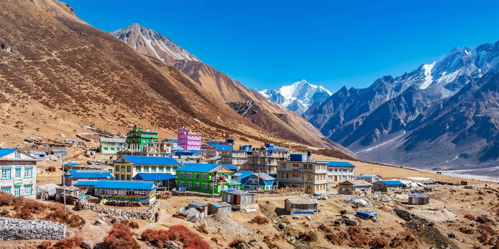
This protected area of Velebit is filled with mountains, valleys, and grassland, and is mostly covered by forest. From the Zavisan hut (1594m) to Baške Oštarije, you will hike on the 57-kilometer-long Premužić-Trail, a handcrafted mountain path by just placing loose stones together, winding through fascinating karst formations with a beautiful view to the Adriatic Sea and therefore one of the most scenic trails in Croatia. This shorter stage has several sleeping options at mountain houses and shelters. In Baške Oštarije, you should stay at Kamp Velebit, a little oasis, and fuel yourself with some comfort food at the hostel. Note: Get food supplied here, as throughout the next 150km across the Velebit mountain range, until Knin, there aren’t any options. Either you will need to organize in advance and send yourself a food packet or hitchhike to the next bigger town Gospić.

Southern Velebit 1

Great trails, pure nature, magnificent rock formations, and amazing views – this section goes through the heart of Velebit. Be prepared for some remote hiking days. When you hike up to Vaganski Vhr (1757m) and Sveto Brdo (1751m), you’ll cross the highest and second-highest mountain of Velebit located in Paklenica National Park. This section has plenty of great shelters and cabins with nearby water sources. Another highlight is clearly Tulove Grede, an impressive rock formation of limestone. The steep way up to 1120m might be challenging but will reward you with every step you take with its magical and powerful appearance. The spectacular scenery of Tulove Grede was the film location of the popular Western film series Winnetou. When you arrive on the other side, you’ll start a beautiful and calm descent within fields and flowers.

Southern Velebit 2

As you leave the higher altitude, you’ll walk on easier trails between grassland and forests. The green colors and sound of nature in the Valley of Krupa River will be a completely different experience than the last days. Relax by the waterfall or walk over the Kudin Most Bridge, a protected monument from the 18th century. When you follow the river, you will reach a tiny part where you’ll need to climb along a rock wall on iron stairs right above the water. It is possible without climbing equipment and even with a big backpack; just be careful. You can easily skip that part by walking on the upper path, which also leads you to Krupa Monastery. At the end of the stage, you will arrive in Knin where you’ll finally get a well-deserved shower, a good meal, and any desired service after those adventurous days in the wild.

Dinara

After Velebit, you’ll hike through another popular Croatian mountain area, the Dinaric Alps. Starting from Knin, where you will need to up your food supply for the next days, you will find yourself immediately on the ancient Dinara Peak, also known as Sinjal, which stands at 1830m, making it the highest point in Croatia. The climb of approx. 1600m uphill in a bleak landscape with a wide view seems hard on the map but is actually pretty pleasant to walk.

Continuing the trail, you’ll pass a hidden gem in Croatia: The Spring of Cetina River, which is also called The Eye of the Earth. This freshwater reservoir will amaze you with its magical green and blue colors. Please do not swim here; it’s a freshwater source. Same as in Velebit, the Dianra section has plenty of amazing mountain shelters in very remote surroundings. For example, Planinarski sklonište Grubac has the best toilet view of the entire Via Adriatica, at Planinarski sklonište Rupe curious horses may check out on you; and from Planinarski sklonište Pume you have an amazing view to Perucko Lake. All shelters are without service and water sources are nearby. When the red and white trail signs appear much more frequently you are near the Border to Bosnia. Keep following the trail markers and stay on the trail. This area is a designated mine area, but no need to panic at all; it’s safe to walk, just stay on the trail.

Zagora

Not far from the stage beginning, you will pass Planinarski dom Orlove Stine, a mountain refugio with service that’s very kind to Via Adritica thru-hikers. After Orlove Stine, you’ll follow an obvious trail for a while until you start to ask yourself if you are still on the right path; you are. The terrain doesn’t really look like a trail, you’ll barely spot waymarkers, and you may fight through some little bushes as you go. Keep checking your GPS or trail map to stay on the path. When you eventually arrive at Malačka, the mountain pass of Kozjak mountain range and its mountain hut, you will have a great view of Kastela Bay and finish section 8. Now that you are walking in the Dalmatia region, you’ll get more and more into its Mediterranean climate.

Kozjak, Perun, Omiska Dinara 

Considered a bit more of a challenging route, this section has exciting paths and stunning views but requires some surefootness and concentration. Starting from Malačka mountain pass, you’ll hike on the Kozjak mountain ridge with a beautiful view of the sea and Split. The historic and second-largest City of Croatia is definitely worth leaving the trail for an extra stop. Back on the trail, make sure your shoes are tightly laced, you have enough water and you are sun protected. Until Brela, you will walk over mountain ridges and on rocky paths without any shade. The trail gets to be a bit tough here. On sunny days, it can get quite hot and a part of climbing over bigger stones might need all your attention. The reward for that strenuous journey: an amazing view of the Adriatic Sea. When you arrive in Brela, on the beautiful Riviera of Makarska, you can relax at pebbled beaches, take a swim in crystal clear water, and enjoy a vacation atmosphere.

Biokovo

Some call Biokovo ‘the brutal beauty.’ Nature Park Biokovo is beautiful – the route, the rocks, the views. But hiking Biokovo can be demanding, especially at the beginning of the section with a lot of elevation gain and loss and rocks, a lot of rocks. Heat, snow, and other weather conditions have to be considered to hike safely. From Brela and sea level, it’s a heart-pumping 10km walk up to Šćirovac mountain (1610m). The ridge walk on Biokovo makes a hiker’s heart very happy, and the view of the Adriatic Sea and the mountains is just breathtaking. Ringing the bell at Sveti Ilija (1640m) and hiking up to Sveti Jure (1762m) complete your Biokovo adventure part one. The second and longer part is at less altitude, on gravel paths, through olive groves, and across another Sveti Ilija mountain (773m) until you reach Baćina lakes, a group of 7 lakes perfect for water sports, swimming, and relaxing. Please note: The Biokovo section has two trail options. One is described above and another one goes near the Adriatic Sea at a lower altitude; for more information check the map or ask the VA community.

Pelješac

After that adventurous hike in the Biokovo mountains, you are now pleased with some more relaxing trail days on less technical paths through pine woods and vineyards in the idyllic landscape of Pelješac. A ferry will bring you from Ploče to Trapanj. The climb up to Sveti Ilija (961m) will reward you with stunning views of Pelješac and other islands. Pelješac is also known for some of Croatia’s finest wines; have a stop at one of its cozy wineries. Ston, with its fortress and Croatian version of the Great Chinese Wall, is where section 11 finishes.

Dubrovnik coast

The whole pleasant-to-walk way from Ston to Srđ offers constant beautiful views of the Adriatic Sea and its coastal towns. Clearly, the best view of Dubrovnik is from its backyard mountain Srđ (412m). Here, Mediterranean flair meets medieval history – don’t miss out on going on a stroll through Dubrovnik Old Town.

Konavle

Section 13 goes from Srđ hill 74 kilometers to Prevlaka. A broad and rocky path goes slightly uphill and leads you up to the peak of Snjezica mountain (‘Ilijin vrh’, 1234m), the last summit of the trail. Enjoy one more time the wonderful wide view over the green, rugged Croatian mountains. Heading down and flat afterward, you are on your final kilometers to Prevlaka and Cape Ostra, the most southern point of Croatia and where your beautiful Via Adriatica adventure ends.

Stages

The Via Adriatica is a long thru-hike of Croatia and thus has a lot of flexibility in how you want to break up your hike. Below are the sections of the hike. Many people hike the trail as a thru-hike, while others hike it as a section hike or even as a series of day hikes.

Via Adriatica 13-sections

Stage 1:

Istria – Kamenjak to Poklon, 115km | 71.5 mi

Stage 2:

Gorski Kotar – Poklon to Plase, 92km | 57.2 mi

Stage 3:

Vinodol-Senj Hinterland – Plase to Oltari, 76km | 47.2 mi

Stage 4:

Northern and Mid-Velebit – Oltari to Baške Oštarije, 58km | 36 mi

Stage 5:

Southern Velebit 1 – Baške Oštarije  to Prezid, 107km | 66.5 mi

Stage 6:

Southern Velebit 2 – Prezid to Knin, 66km | 41 mi

Stage 7:

Dinara – Knin to Peruća, 101km | 62.8 mi

Stage 8:

Zagora – Peruća  to Malačka, 65km | 40.4 mi

Stage 9:

Kozjak, Perun, Omiska Dinara – Malačka to Brela, 80km | 50 mi

Stage 10:

Biokovo – Brela to Ploče, 109km | 67.7 mi

Stage 11:

Pelješac  – Ploče to Ston, 110km | 68.4 mi

Stage 12:

Dubrovnik coast – Ston to Srđ, 68km | 42.3 mi

Stage 13:

Konavle – Srđ to Prevlaka, 74km | 46 mi

Accommodations

Due to the length of the trail, you will find yourself sleeping in various places, conditions, and surroundings. Most of the time you can rest very well in Croatia’s great mountain houses and shelters. The mountain houses are called Planinarski Dom and have service, electricity, and water. Planinarsko sklonište are mountain shelters, open anytime for anyone and without service. They are usually equipped with sleeping areas and/or a communal area, table, bench, stove, sometimes even a sink, and (rain) water to provide safety and a place to sleep. The shelters are provided and built by the national and local mountaineer clubs in support of volunteers and passionate hikers.

Behave accordingly: keep the shelter clean and tidy and leave no food or trash behind. In more civilized areas, you will have plenty of options to book a private room, hostel, or whatever you desire. Wild camping is prohibited in Croatia. However, as a thru-hiker, you will have to wild camp here and there. In the mountains and remote areas, it’s no problem to spend a night in the wilderness. Choose your place thoughtfully and follow the leave it by no trace principles.

Best time of the year

Spring and autumn months are the best choices for hiking Via Adriatic as a thru-hike. Although, this trail can be walked all year round with additional gear and preparation. Remember that summer can be very hot in Croatia, and water is an important factor on the trail. Whatever time of the year you go, be prepared for all weather conditions; we all know that weather in the mountains changes quickly.

Safety & Gear

Besides your physical preparation, you should also prepare yourself mentally when you plan a Via Adriatica thru-hike. Make sure you understand its length and conditions like weather, terrain, mountains, water, and food, as well as timing.

Pack light but be prepared for all contingencies, such as weather, camping, and nutrition. Check the available and possible water supply for the upcoming day(s) in case there is a need to carry some extra water. Bring a water filter for uncertain water sources. A few stages require taking food for up to 5 days; inform yourself of these to be prepared. You’ll also want to plan your resupply points ahead of time to be certain you’ll always have food.

Always keep an eye on the weather, especially when you are going through longer remote parts and mountains. Bears, snakes, and other animal encounters are possible. You are hiking in an animal’s natural habitat; behave accordingly and be precautionary.

In case you will hike alone, update someone about your location frequently. The best option for all thru-hikers is to join the VA Facebook group. Introduce yourself shortly when you start the hike. That way people know of your presence on the trail, and it’s easier to provide you with helpful information and tips.

Good to know

Via Adriatica is a self-organized hike, partly demanding but generally walkable and manageable for any moderately experienced hiker. The most important and useful trail facts you will get from the amazing community you will find on the VA Facebook group. People quickly respond to any kind of question you have, before and on the trail. For the GPX file, visit the Via Adriatica website and download the track. If you plan to hike the Via Adriatica, take some time before to get at least an overview of the trail itself, stages, and areas. There is no need to plan in detail because things on the trail might change for different reasons and circumstances. Allow yourself some extra time to discover places and meet people.

The wonderful humans you exchange with and meet along the trail make this hike a very unique and special hiking experience; the trail would be much harder without them on your side. The trail itself is not constantly marked by the white and blue VA signs, but you will find them in regular intervals from the beginning to the end. Mostly, you will orientate yourself on regular trail makers – white and red. A very few short connecting parts of Via Adritica and other trails are a bit tricky to find and walk, which is when the offline GPX file on your device will come in handy.

route
point-to-point
highest point
1830m (6004 ft)

Want to submit a trail or make this page more complete?

Always read the disclaimer

Terms of Use: important to all visitors on this website. We strive to publish high quality content and information on this website. However it’s always possible that we’re missing out on some crucial information. In spite of the fact that this route, associated GPS track (GPX and maps) were prepared under diligent research by the specified contributor and/or contributors, the accuracy of such and judgement of the author is not guaranteed. Therefore, hiking-trails.com and contributors are in no way liable for personal injury, damage to personal property, or any other such situation that might happen to individuals hiking or following this route. Should you choose to hike this trail, this is always at your own risk. Check out our guidelines for safety hiking and Leave No Trace principles at the hiking 101 page.

Download GPX

Join the community!

Login or create a FREE account 😊

With an account you can:

Download GPX files

Pin trails to your wishlist

Mark trails as hiked by you

Rate hiking trails

Comment on trails, blogs and gear reviews

Happy trails!
Login

Don't have an account yet? Register here