Logo Aletsch Arena

About the UNESCO High-Altitude Alpine Trail

Aletsch Arena
country
Switzerland
length
3 km(2 mi)
Type of trail
Day hike
difficulty

Difficulty is highly personal. Be aware of the weather conditions as bad weather turns easier trails in difficult trails especially in the mountains.

Difficult
accommodation

Lodging means a mix of hotels, hostels or AirBnB’s.

Lodging
Elevation gain
374 m(1227 ft)
terrain
Mountains
remoteness
Most of the time
Show more

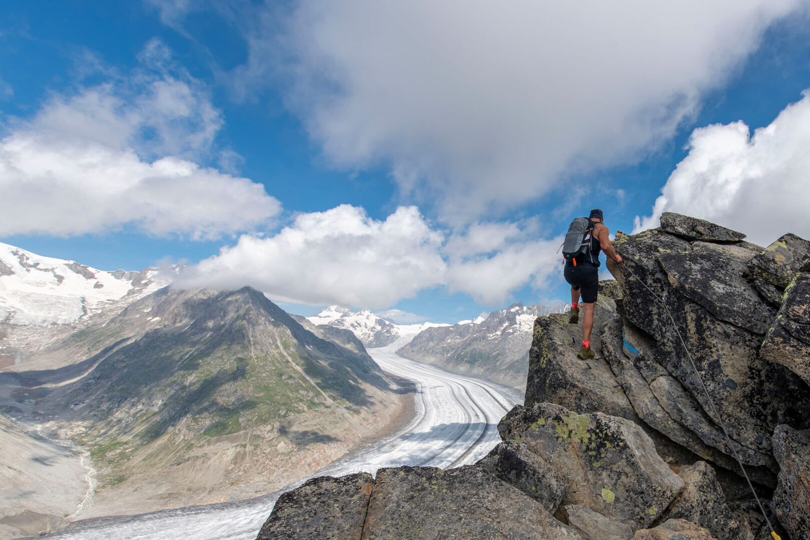
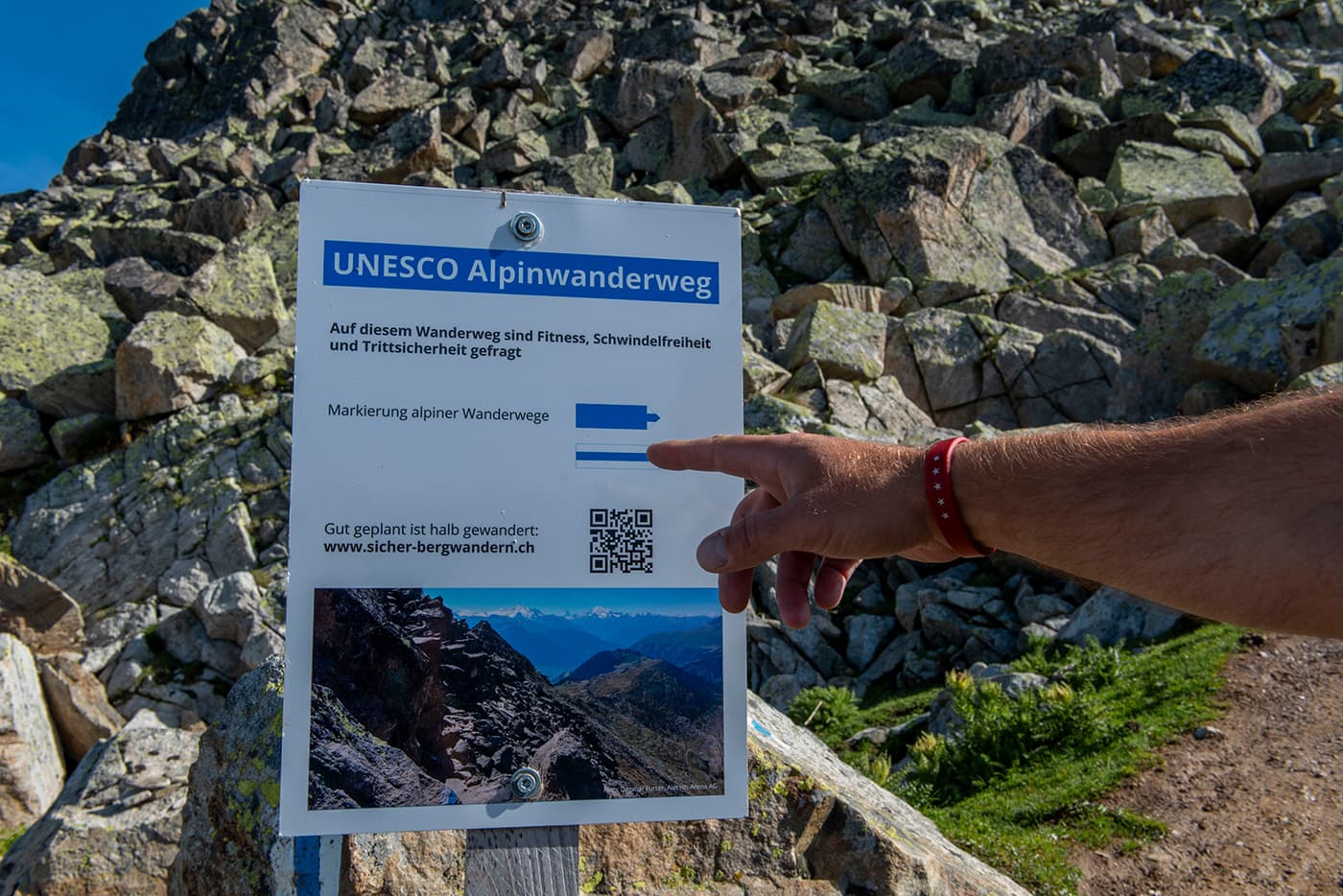
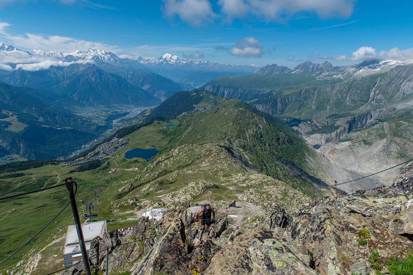
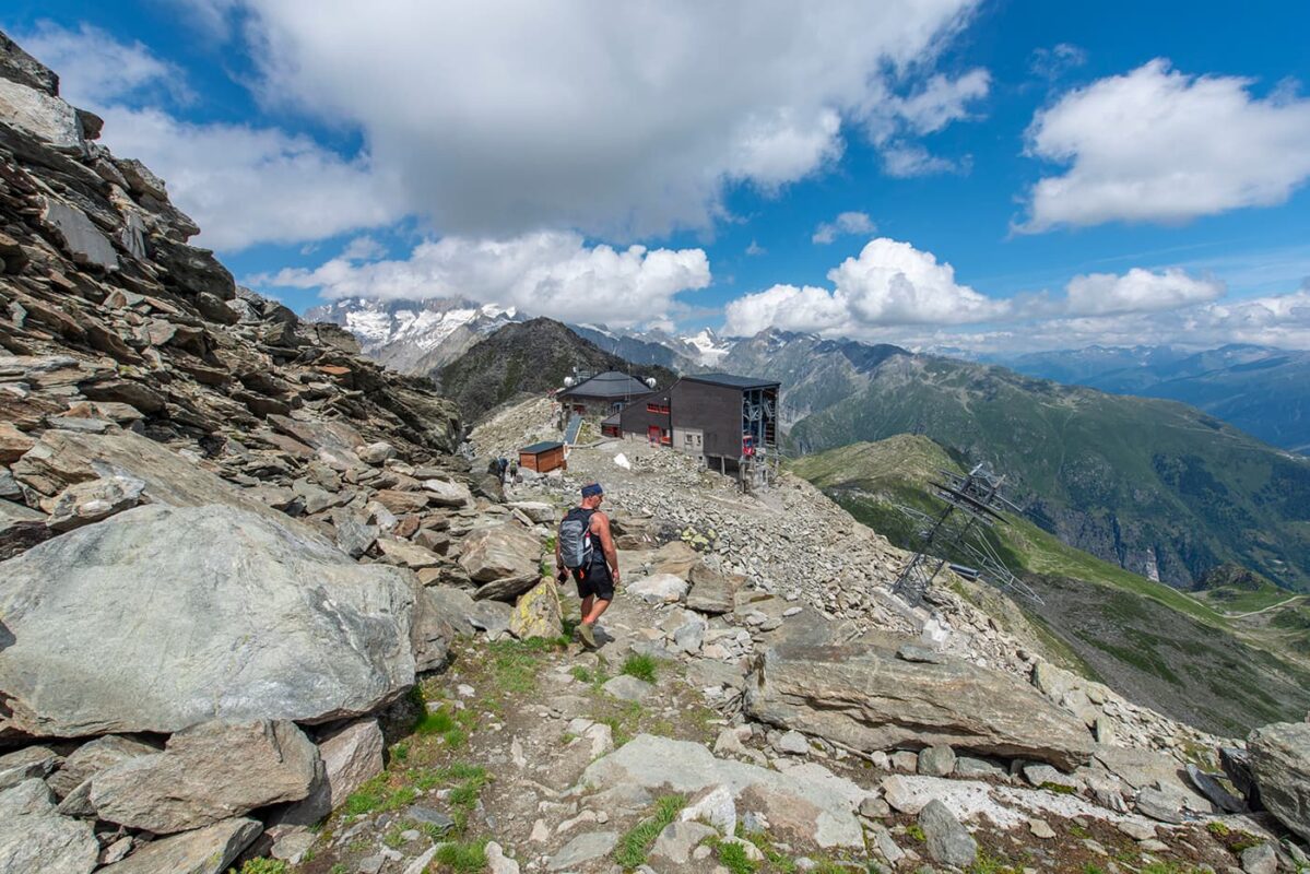
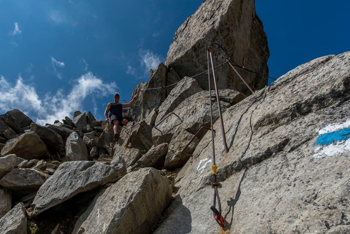
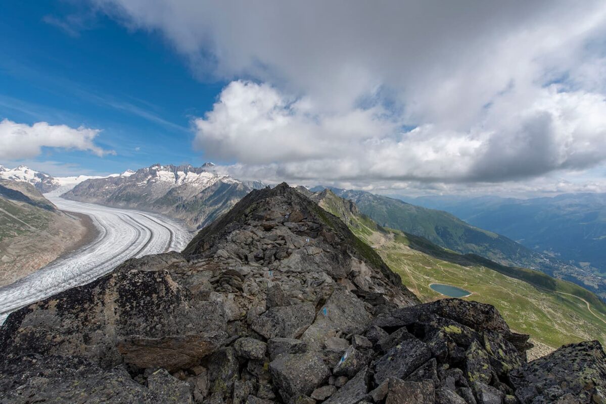
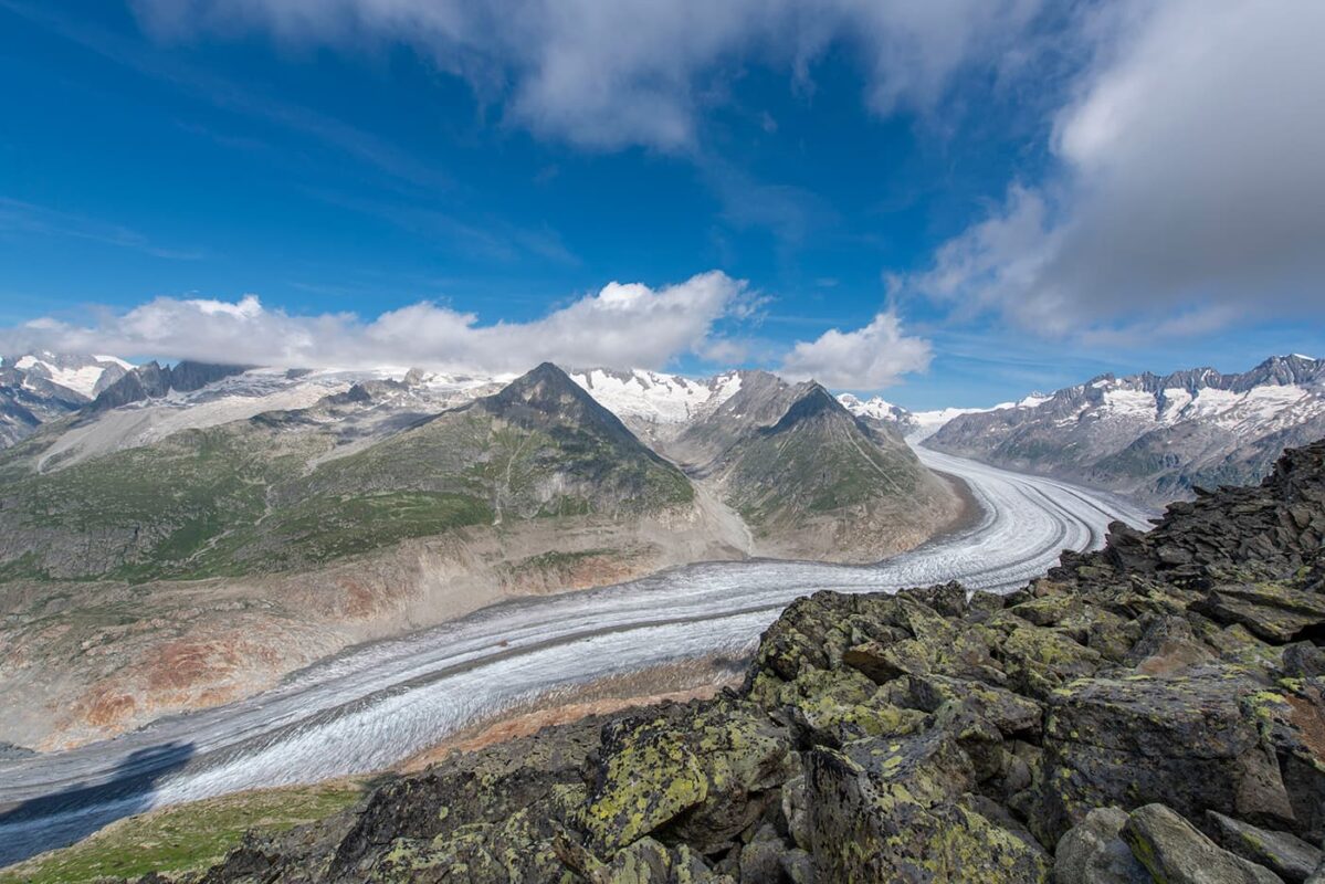
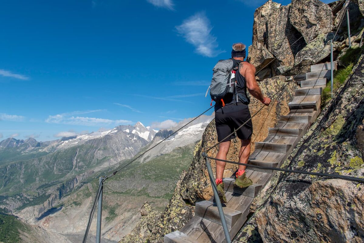
Are you up for a more challenging trail in the Aletsch Arena, a UNESCO world heritage site, offering the best views on the longest glacier of the Alps: the Aletsch Glacier? The UNESCO High-Altitude Alpine Trail from Bettmerhorn to Eggishorn is all you’re looking for and gives you a magical experience on this short but challenging day-hiking trail. But beware, it is only for sure-footed hikers with trail experience and, very importantly, no fear of heights.

The UNESCO High-Altitude Alpine Trail is truly an experience and a must-do for experienced hikers. This short trail packs a punch: rocky trails, climbs, views, the Aletsch Arena in the heart of the Swiss Alps, and part of the larger region Valais all make this a paradise for hikers.

Editor

Elmar Teegelbeckers

Passionate hiker Elmar spends months of his time on the trail. He’s usually on the lookout for hidden gems in one of his favourite countries such as Slovenia, Switzerland and Japan. He founded hiking-trails.com in need for a community and detailed information about the trails. Before this, he worked for the Alpine asscociation in the Netherlands[ (NKBV) but lost his heart to the trails.

With this website and socials, he hopes to shape an inclusive community for hikers all over world. No matter your speed, experience or level, you can get out there to enjoy the trails and connect with the heartwarming hiking community. Life is so much better outside and he hopes to inspire hikers to take their first, or next, step on the trail.

View profile

The Trail

The alpine trail begins at the mountain station of the Bettmeralp cable car. It takes approximately 30 minutes to ascend to the summit of Bettmerhorn, which stands at 2,647 meters, using a well-secured fixed rope route. After reaching the summit, the route continues along a ridge trail that is partly exposed but securely equipped with safety features, extending for about 1.5 kilometers. This leads to a steep descent to Elselicka, where steel cables are installed for added safety.

This trail is classified as an Alpine Route and is recommended only for hikers who are steady on their feet and comfortable with heights. Make sure you follow the marked trails with the white and blue signs.

From Elselicka, the trail progresses up a well-maintained path to the mountain station of the Eggishorn cable car at 2,869 meters, the end of the UNESCO high-altitude trail in the Aletsch Arena.

The Aletsch Arena, part of the Swiss Alps Jungfrau-Aletsch UNESCO World Heritage Site, has over 300 kilometers of trails ranging from high-altitude technical trails to hiking trails for families.

Accommodations

You can choose from a variety of accommodations in the car-free villages in the Aletsch Arena to start this day hike. Riederalp, Fiescheralp, and Bettmeralp are perfect basecamp locations for discovering the area day by day. Bettmeralp is the closest village to the trailhead of the UNESCO High-Altitude Alpine Trail.

Best time of the year

The best time to hike the UNESCO High-Altitude Alpine Trail and overall in the Aletsch Arena is undoubtedly from July to late September. This period is when the weather is the most stable with the longest daylight hours. During this time, the high-altitude meadows bloom with colorful alpine flowers, and the trails are mostly snow-free. In June there might be some snow on the trails but by July it should be melted. However, always check the trail conditions before you go!

Safety & Gear

Before setting out, check the weather forecast and be aware of the trail conditions, such as snow, depending on when you go. Ensure your fitness level is good enough for hiking this trail.

Bring a map with you and put the GPX on your mobile for navigation. Start with a fully charged mobile phone, and bring a power bank if you think you’ll need it. Dress in layers and always pack a hardshell and warmer (down) jacket for the ever-changing weather. Choose hiking shoes with a good grip. A few other essentials we recommend you bring include a first-aid kit, extra food, and water.

Mountain weather in general can change fast. Be prepared for sudden drops in temperature and unexpected rainfall. Start your day early to avoid being caught by afternoon thunderstorms that are common in mountainous regions. Stay on marked trails to minimize environmental impact and reduce the risk of getting lost. Say hi to other hikers and respect wildlife. Leave no trace by packing out all the trash.

Good to know

Hiking in the Aletsch Arena is a unique experience. This trail goes over varied terrain including high altitude trails and rocky paths. Make sure you have experience hiking alpine trails as this trail is difficult! We highly recommend that you only hike this trail if you have a steady foot and no fear of heights.

Route
Point to point
Highest point
2869m (9413 ft)

Guidebooks

Logo Aletsch Arena

Aletsch Arena Downloads

View guidebook

Want to submit a trail or make this page more complete?

Comments

Be the first one to comment on this trail!

Reply to this trail

Your email address will not be published. Required fields are marked *

Reply to this trail

Log in to comment on this trail
Always read the disclaimer

Terms of Use: important to all visitors on this website. We strive to publish high quality content and information on this website. However it’s always possible that we’re missing out on some crucial information. In spite of the fact that this route, associated GPS track (GPX and maps) were prepared under diligent research by the specified contributor and/or contributors, the accuracy of such and judgement of the author is not guaranteed. Therefore, hiking-trails.com and contributors are in no way liable for personal injury, damage to personal property, or any other such situation that might happen to individuals hiking or following this route. Should you choose to hike this trail, this is always at your own risk. Check out our guidelines for safety hiking and Leave No Trace principles at the hiking 101 page.

Download GPX

Join the community!

Login or create a FREE account 😊

With an account you can:

Download GPX files

Pin trails to your wishlist

Mark trails as hiked by you

Rate hiking trails

Comment on trails, blogs and gear reviews

Happy trails!
Login

Don't have an account yet? Register here