three persons standing on mountain peak with sunrise on the trekking dei Laghetti

Trekking dei Laghetti

Via Alte Vallemaggia

About the Trekking dei Laghetti

Alps
country
Switzerland
length
63 km(39 mi)
Type of trail
Hut to hut, Long-distance
difficulty

Difficulty is highly personal. Be aware of the weather conditions as bad weather turns easier trails in difficult trails especially in the mountains.

Difficult
accommodation

Lodging means a mix of hotels, hostels or AirBnB’s.

Mountain huts
Elevation gain
5020 m(16470 ft)
terrain
Mountains
remoteness
Most of the time
Show more

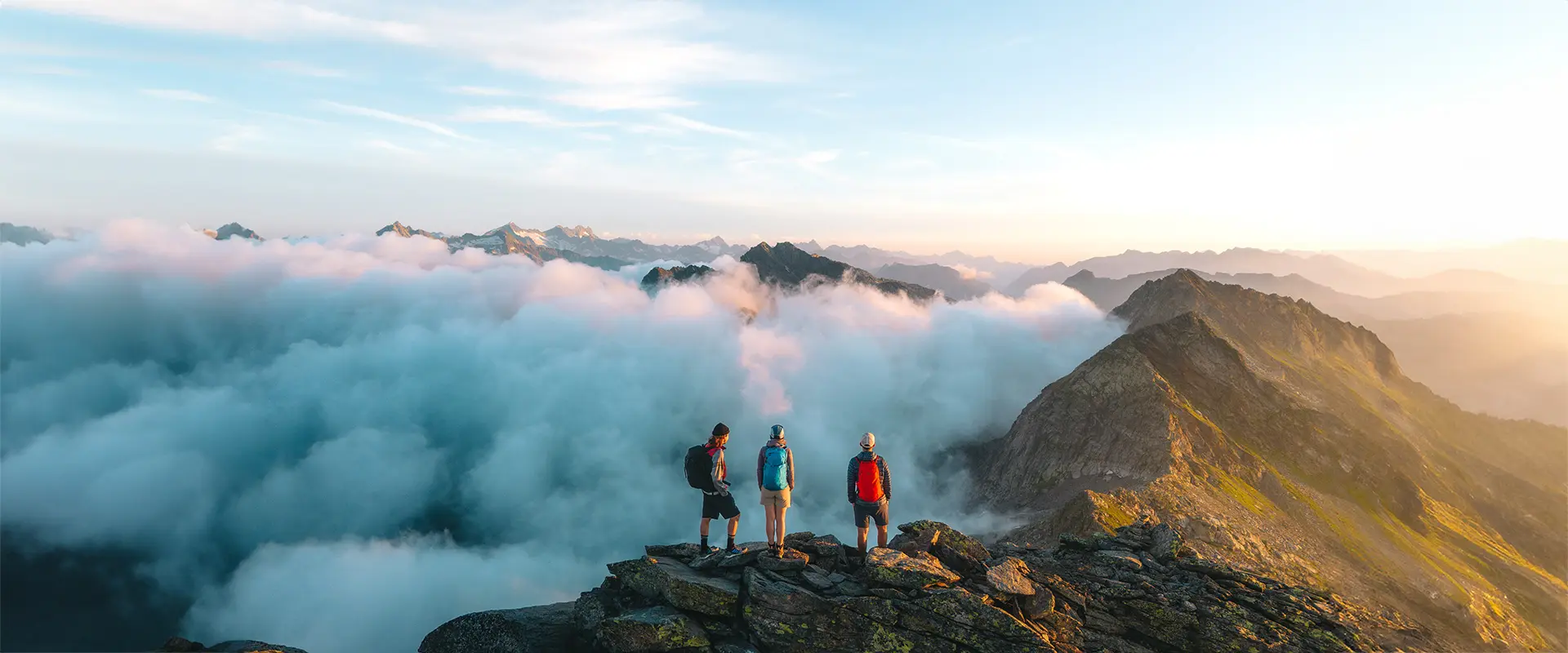
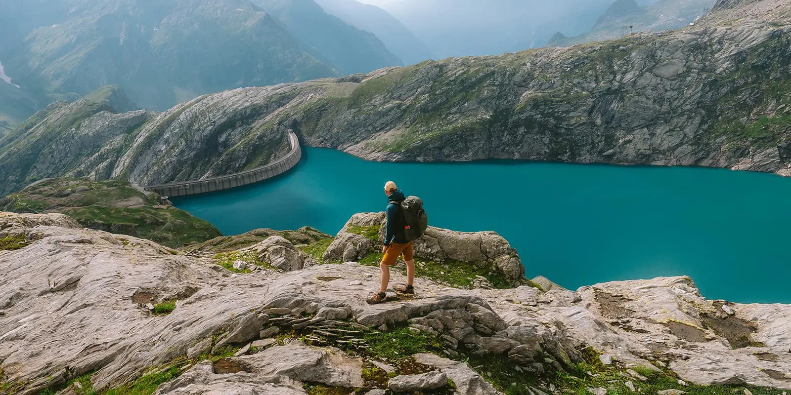
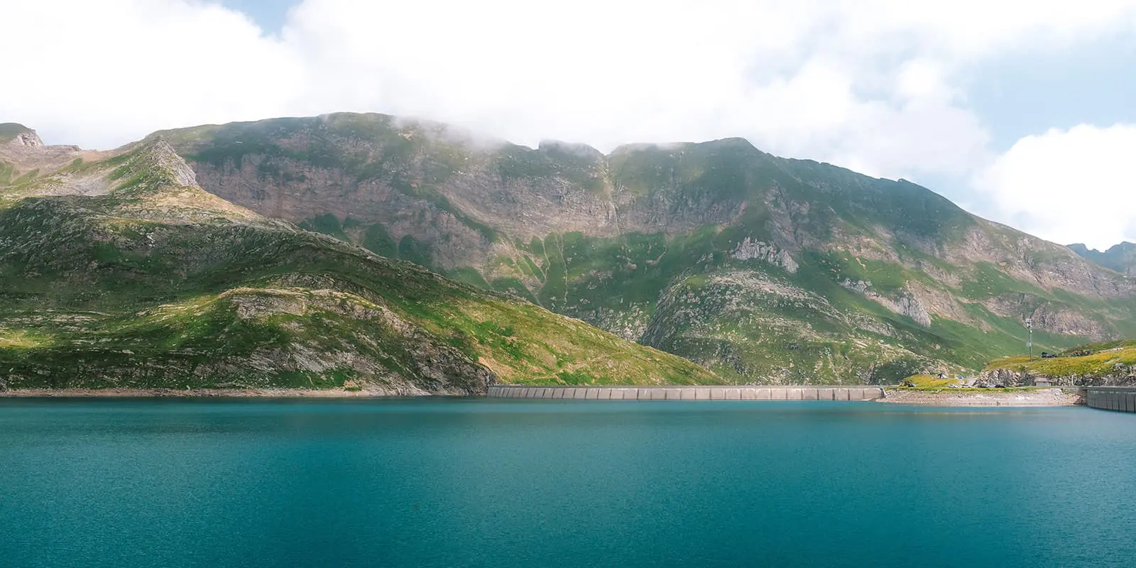
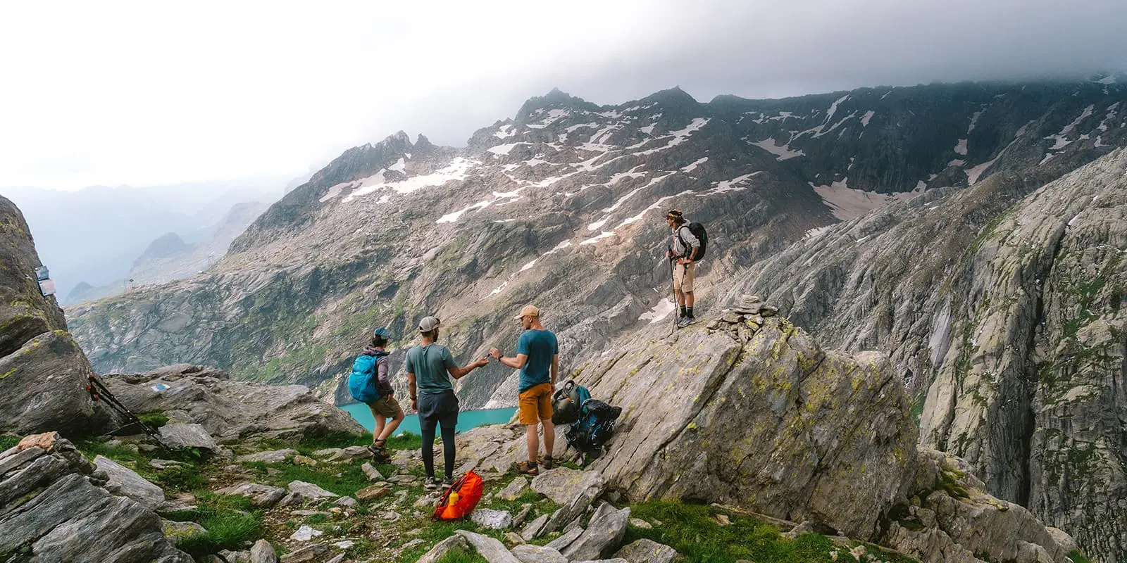
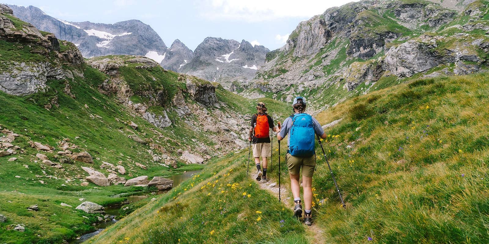
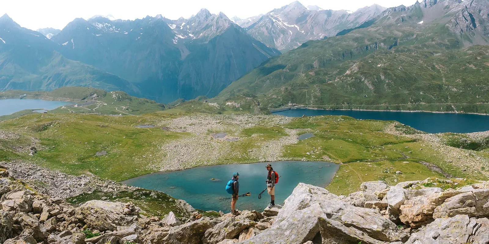
The Trekking dei Laghetti in Ticino is a beautiful hut-to-hut hike in the stunning Valle Maggia region of Switzerland. It’s an ideal combination of natural beauty and hiking as this multi-day trek begins in the small alpine village of Fusio at the end of the valley and guides hikers through a variety of scenic alpine landscapes, from mountain trails to the calm, reflective waters of alpine mountain lakes, known as “laghetti.” The trail offers well-marked paths, though challenging trails, making it accessible to moderately experienced hikers who are looking for an adventure in this lesser known part of the Swiss Alps.

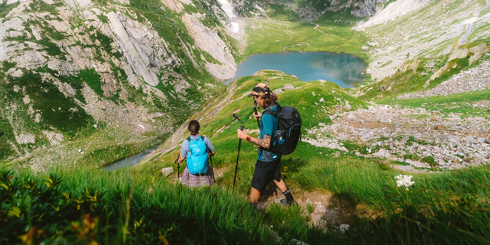
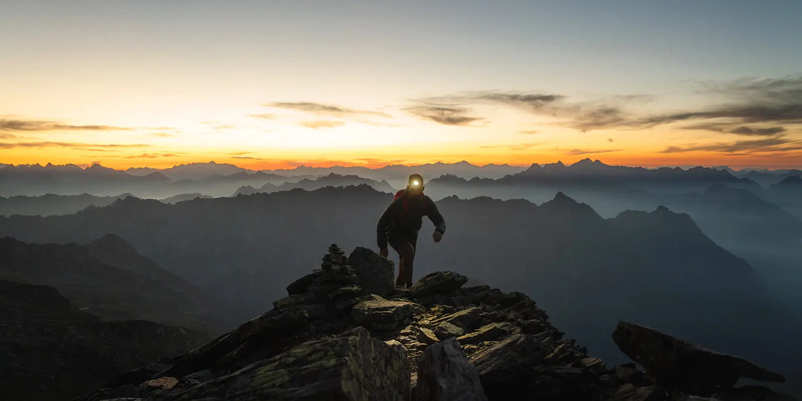
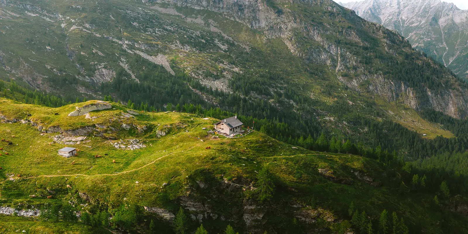
Hikers on the Trekking dei Laghetti can expect a challenge, with manageable distances covered each day but sometimes a scramble on the big boulders of Ticino on the alpine paths. The route typically takes five days to complete, with overnight stays at traditional mountain huts, or rifugi, where you can rest and enjoy local Ticinese cuisine. These huts provide simple, comfortable accommodations with most of the time even a shower. This trail is a part of the Via Alta Vallemaggia which is a long-distance trail of 17 stages in the Valle Magia region. It’s an amazing experience!

Editor

Elmar Teegelbeckers

Passionate hiker Elmar spends months of his time on the trail. He’s usually on the lookout for hidden gems in one of his favourite countries such as Slovenia, Switzerland and Japan. He founded hiking-trails.com in need for a community and detailed information about the trails. Before this, he worked for the Alpine asscociation in the Netherlands[ (NKBV) but lost his heart to the trails.

Not long ago, Elmar published the book (in Dutch) Hiking Trails – best long-distance trails in Europe. With this book, website and socials, he hopes to inspire and shape an inclusive community for hikers all over world. No matter your speed, experience or level, you can get out there to enjoy the trails and connect with the heartwarming hiking community. Life is so much better outside and he hopes to inspire hikers to take their first, or next, step on the trail.

You can reach Elmar at info@hiking-trails.com.

View profile

The Trail

The Trekking dei Laghetti in Ticino is a five-stage hut-to-hut trek through the scenic Valle Maggia region and a part of the Via Alta Vallemagia, offering a mix of alpine landscapes, mountain lakes, and traditional Swiss-Italian hospitality. Here’s a breakdown of the route. Most hikers hike this trail in five days from hut to hut.

The trek starts in Fusio, a small alpine village, and heads towards Capanna Poncione di Braga a small cute mountain hut with scenic views. This first stage will introduce you to the alpine rocky terrain of Ticino, with a steady ascent through meadows and forests. The trail is well-marked, and the distance allows for a manageable start to the journey altough it’s way up today.

The second stage takes you from Capanna Poncione di Braga to Robièi / Capanna Basodino, a section known for its beautiful alpine lakes, or laghetti, that give this trek its name. You can choose to climb the Poncione di Braga peak which lies directly next to the trail and is quite remarkable. The path offers a moderate descent, and the changing landscapes towards the dam and lake of Robièi. The owners of Capanna Basadino are amazing and will provide you with fresh bread, pasta and other home made pastures. A perfect stay along this multi-day trek in Switzerland.

From Robièi, the third stage leads to Rifugio Maria Luisa. This section crosses the Swiss-Italian border, and you will pass by more of the region’s iconic mountain lakes. The ascent becomes steeper in places, but the route is manageable for experienced hikers. Rifugio Maria Luisa offers basic but comfortable accommodation and traditional meals, making it a welcoming stop after a challenging day.

Stage four goes from Rifugio Maria Luisa back into Switzerland with a steep ascend en descend towards Capanna Cristallina. This section features stunning alpine views, including alpine lakes and rocky terrain. The climb is more demanding, but the well-maintained path ensures a steady ascent. Capanna Cristallina is an amazing modern hut, totally different from the other mountain huts on this trek.

The final stage leads from Capanna Cristallina back to Fusio, completing the loop. The descent is gradual, with paths winding through forests and valleys. This last day provides a pleasant and scenic end to the Trekking dei Laghetti, with the return to Fusio where you can stay at the amazing Antica Osteria Dazio, a small family runned Bed and Breakfast with amazing local cuisine.

This five day hut-to-hut trek in Switzerland, Ticino is a special tour for moderate to experienced hikers. The trail goes a lot over rocky and uneven terrain and sometimes you’ll face steep ascents and descents. The rewards are amazing with the beautiful alpine lakes, cozy mountain huts and rugged mountain views. It’s a great option and alternative to avoid the crowds on other popular hiking trails such as the Tour du Mont Blanc and the Alta Via 1.

Stages

5-day itinerary

Stage 1:

Fusio – Capanna Poncione di Braga, 12 km | 7 mi (7h)

Stage 2:

Capanna Poncione di Braga – Capanna Basodino, 10 km | 6 mi (5h)

Stage 3:

Capanna Basodino – Rifugio Maria Luisa, 10 km | 6 mi (4h)

Stage 4:

Rifugio Maria Luisa – Capanna Cristallina, 15 km | 9 mi (6h)

Stage 5:

Capanna Cristallina – Fusio, 19 km | 12 mi (7h)

Accommodations

On the Trekking dei Laghetti you stay in the Ticinese mountain huts also called Rifugi’s. These huts are comforatable stays where you can enjoy the local food and a cozy night, mostly in a dormitory room. As this trek is a bit more unknonw you’ll likely have space in the huts but it’s always wise to book in advance and the hut warden will love that. You can easily make a booking on the official website of this trek and the website of the huts. This multi-day hut-to-hut hike is a part of the Via Alte Vallemagia.

Mountain huts per stage

Stage 2:

Capanna Basodino

Best time of the year

The best time to hike the Trekking dei Laghetti in Ticino is between late June and mid-September. During this period, the snow from the higher altitudes has melted most likely and the trails are fully accessible. Be aware that there might be some snowfields in June and the beginning of July and sometimes even later in the season, which could affect the difficulty and accessibility of the route. The weather tends to be more stable in these months, with warmer temperatures and clear skies, making it ideal for hiking a hut-to-hut tour.

July and August are the most popular months due to the warmer temperatures, but they can also be the busiest. If you’re looking to avoid the main season, early September is a great option as the weather is still pleasant, and the trails are less crowded. It’s recommended to check local conditions before starting your hike, as weather in alpine regions can be unpredictable and change rapidly.

Safety & Gear

Alpine weather can change quickly, so it’s important to check the forecast before starting each stage. Be prepared for sudden temperature changes, rain, or even snow at higher altitudes. The trails are well-marked, but it’s crucial to follow them closely and always know how to navigate with GPS and a map, especially in areas with limited visibility or rugged terrain. While the trek doesn’t reach extreme altitudes, the terrain can be demanding and you’ll hike on alpine trails, so it’s important to be in good physical condition and accustomed to multi-day hikes.

In terms of gear, sturdy, hiking shoes are essential for navigating rocky and uneven terrain in the mountains of Ticino. Layered clothing is also important, as temperatures can vary greatly throughout the day. Pack layers, a warm fleece, and a waterproof jacket. A comfortable backpack with a rain cover and trekking poles are helpful for maintaining balance and reducing strain on your knees during ascents and descents. Be well-prepared with the right gear and enough water and food and stay informed about weather and trail conditions and enjoy the hut-to-hut hike of the Trekking dei Laghetti.

Good to know

The Trekking dei Laghetti is a moderate to challenging multi-day hike that takes about 5 days to complete. Each stage varies in difficulty, with some steep ascents and descents, particularly at higher altitudes. It’s an alpine trail and the most difficult paths are rated by T4 which means alpine trails. These T4 paths are blue white marked and known for more difficult hiking trails in the Alps. This trails involves a lot of rocky terrain to cross every day.

The huts can get busy, especially in peak season (July and August), it’s essential to make reservations in advance when you’re hiking in these months and enjoy the beautiful Valle Magia region in Ticino, Switzerland.

Route
Circuit
Highest point
2698m (8852 ft)

Want to submit a trail or make this page more complete?

Comments

Be the first one to comment on this trail!

Reply to this trail

Your email address will not be published. Required fields are marked *

Reply to this trail

Log in to comment on this trail
Always read the disclaimer

Terms of Use: important to all visitors on this website. We strive to publish high quality content and information on this website. However it’s always possible that we’re missing out on some crucial information. In spite of the fact that this route, associated GPS track (GPX and maps) were prepared under diligent research by the specified contributor and/or contributors, the accuracy of such and judgement of the author is not guaranteed. Therefore, hiking-trails.com and contributors are in no way liable for personal injury, damage to personal property, or any other such situation that might happen to individuals hiking or following this route. Should you choose to hike this trail, this is always at your own risk. Check out our guidelines for safety hiking and Leave No Trace principles at the hiking 101 page.

Download GPX

Join the community!

Login or create a FREE account 😊

With an account you can:

Download GPX files

Pin trails to your wishlist

Mark trails as hiked by you

Rate hiking trails

Comment on trails, blogs and gear reviews

Happy trails!
Login

Don't have an account yet? Register here