Trail logo trans swiss trail

About the Trans Swiss Trail

country
Switzerland
length
488 km(303 mi)
Type of trail
Long-distance, Thru-hike
difficulty

Difficulty is highly personal. Be aware of the weather conditions as bad weather turns easier trails in difficult trails especially in the mountains.

Moderate
accommodation

Lodging means a mix of hotels, hostels or AirBnB’s.

Lodging
Elevation gain
17600 m(57743 ft)
terrain
Mountains, Countryside, Forest, Hills
remoteness
Some of the time
Show more

The Trans Swiss Trail passes through the whole of Switzerland, stretching from the Northwest in Porrentruy to the southernmost point in Mendrisio. It is signposted with trail number 2 by Wanderland Schweiz and is one of the 7 official national hiking routes of Switzerland. The trail stands out as one of Switzerland’s most diverse long-distance hiking routes.

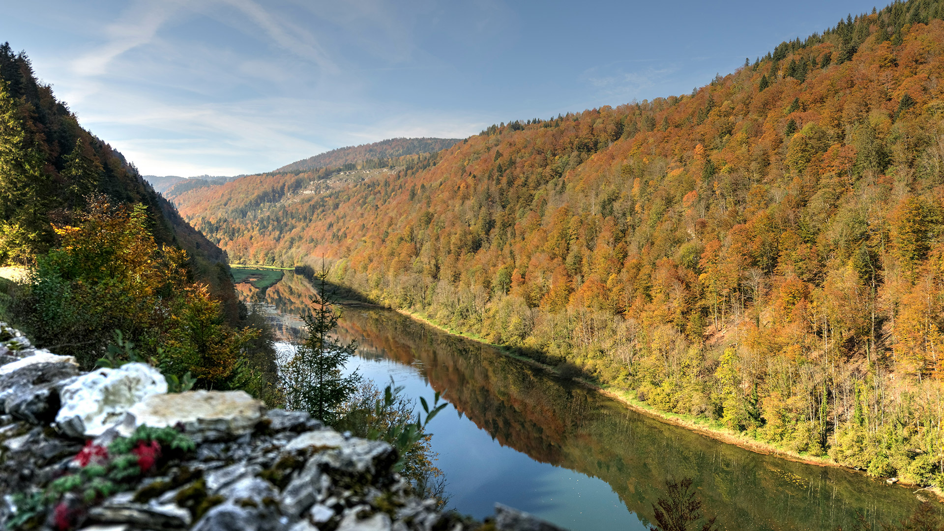
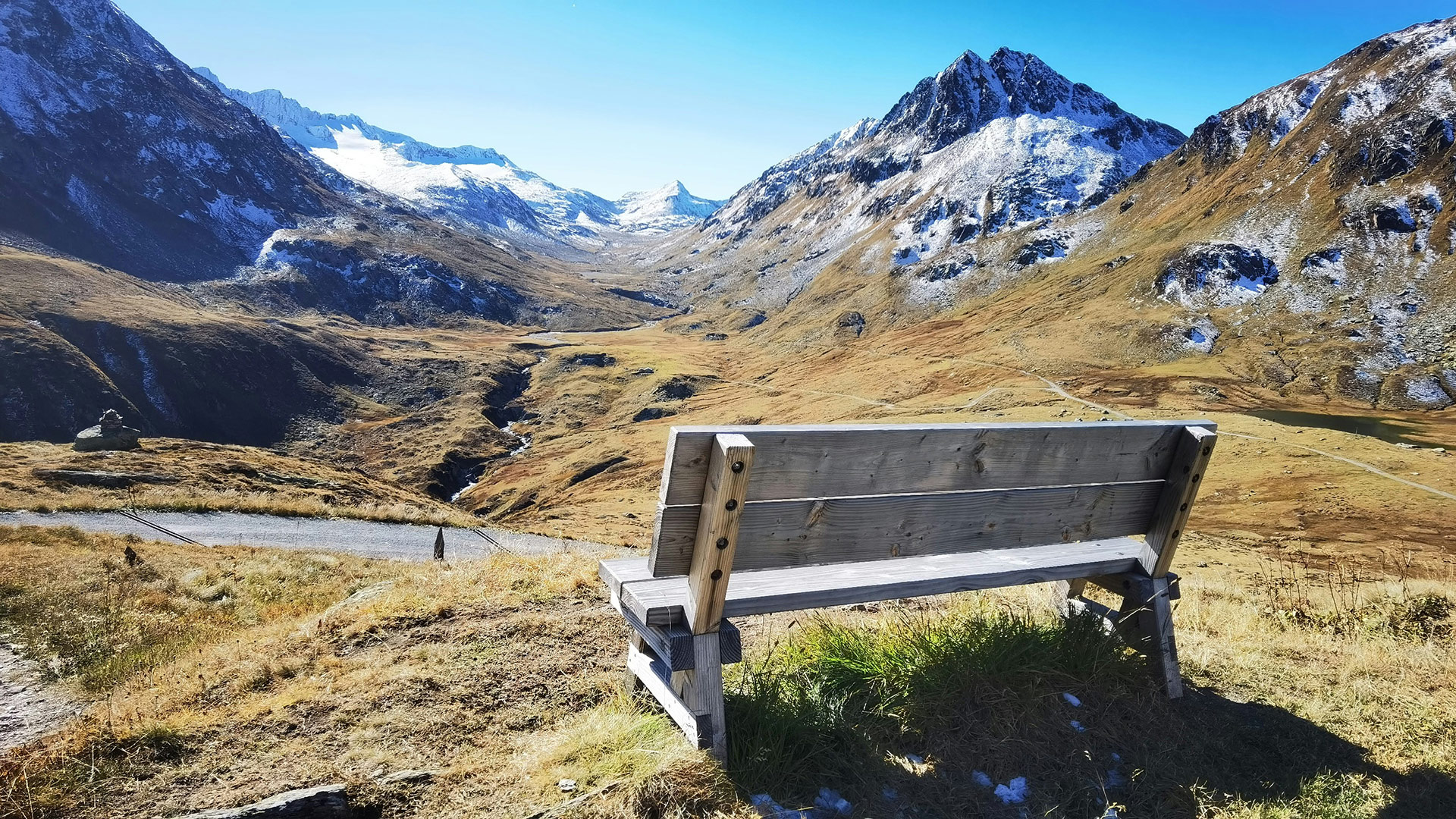
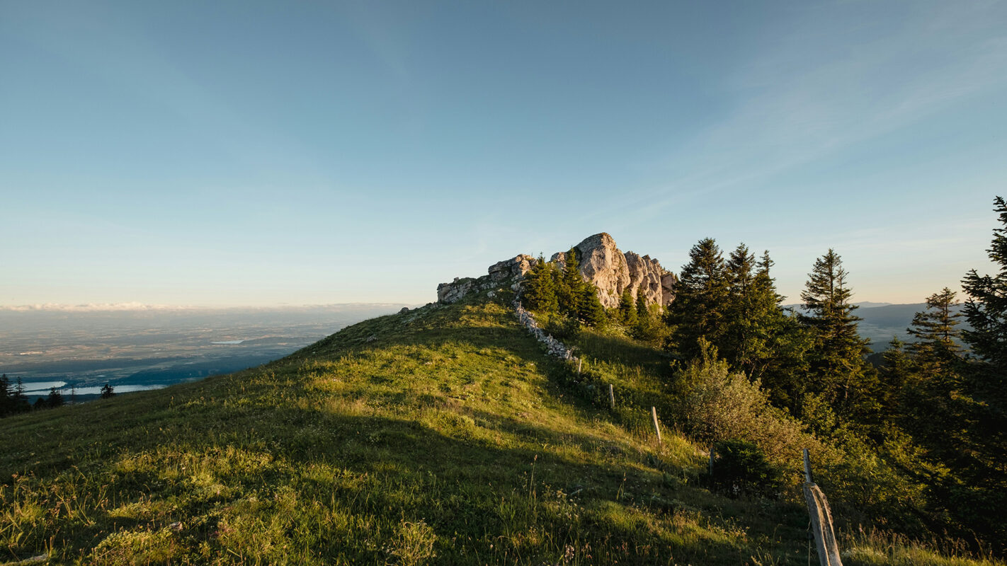
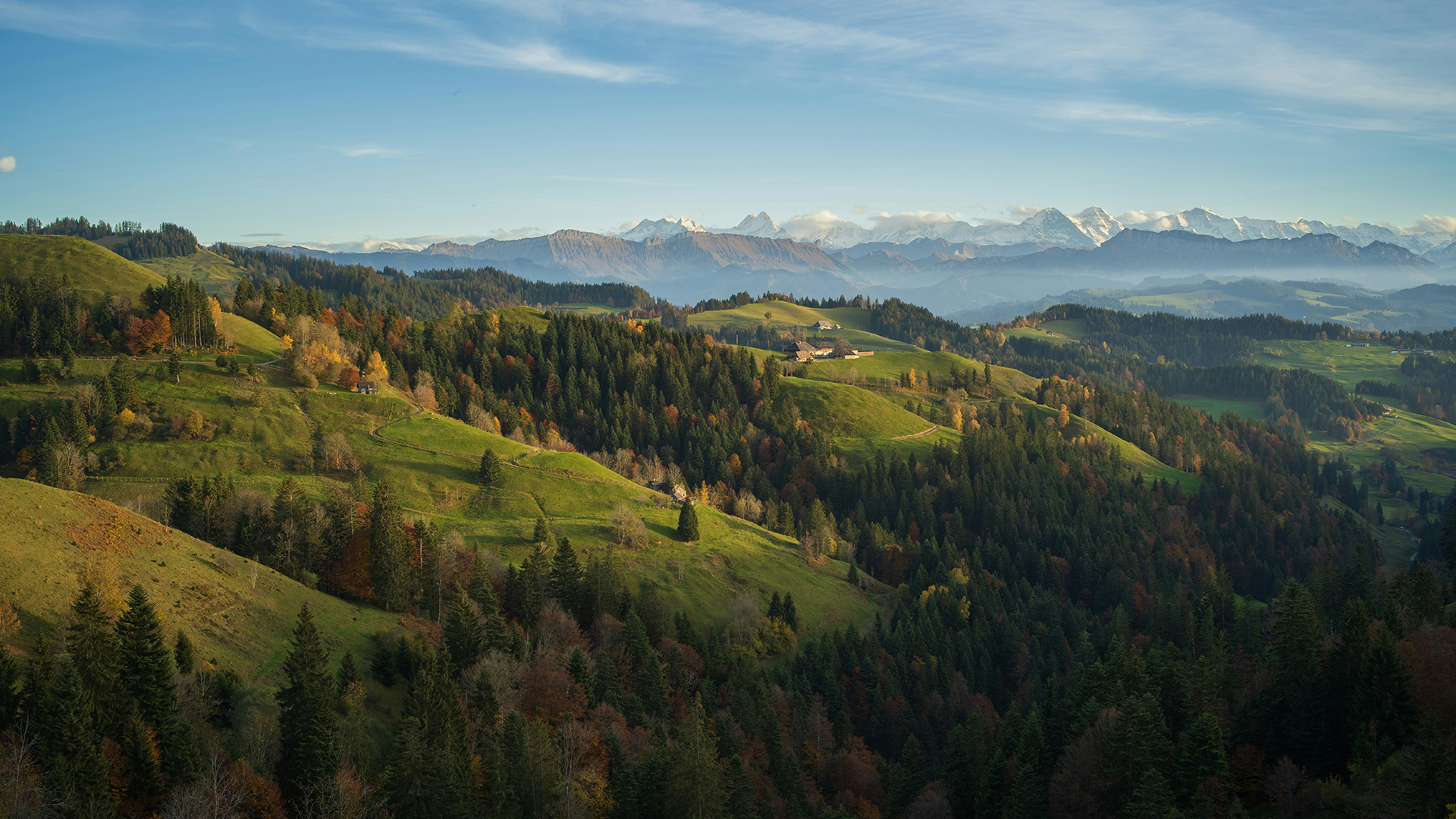
The hike leads you through all geographical regions of Switzerland like Jura, Mittelland, and the Alps. A lot of the stages go along some of the numerous Swiss rivers. The highlight of the trail is the crossing of the famous Gotthard Pass, which is also the highest point of the hike.
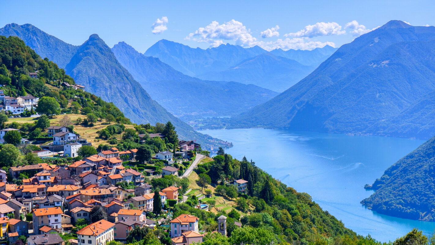
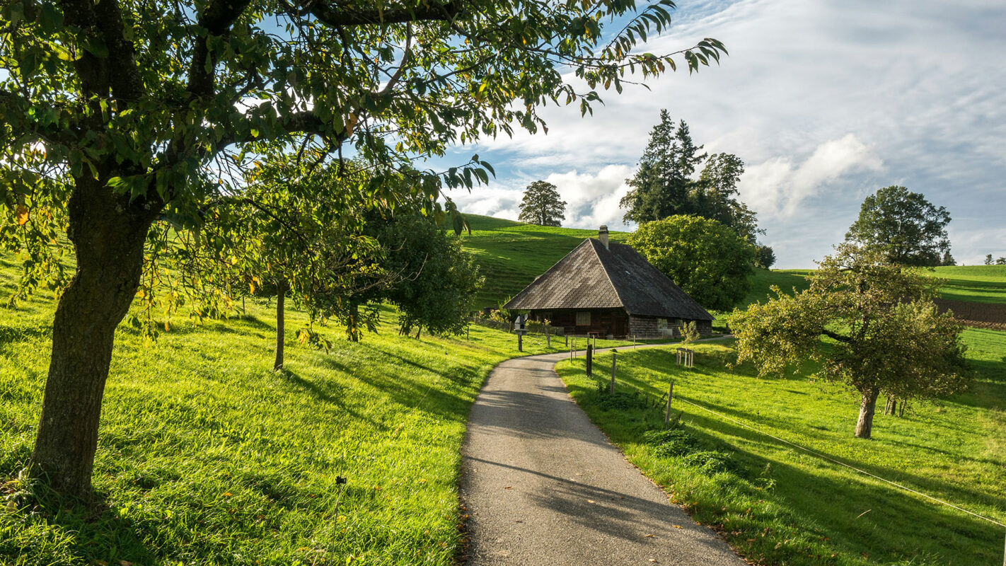
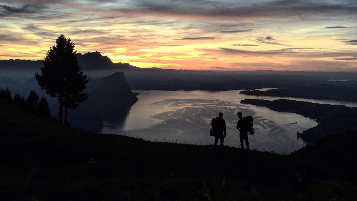
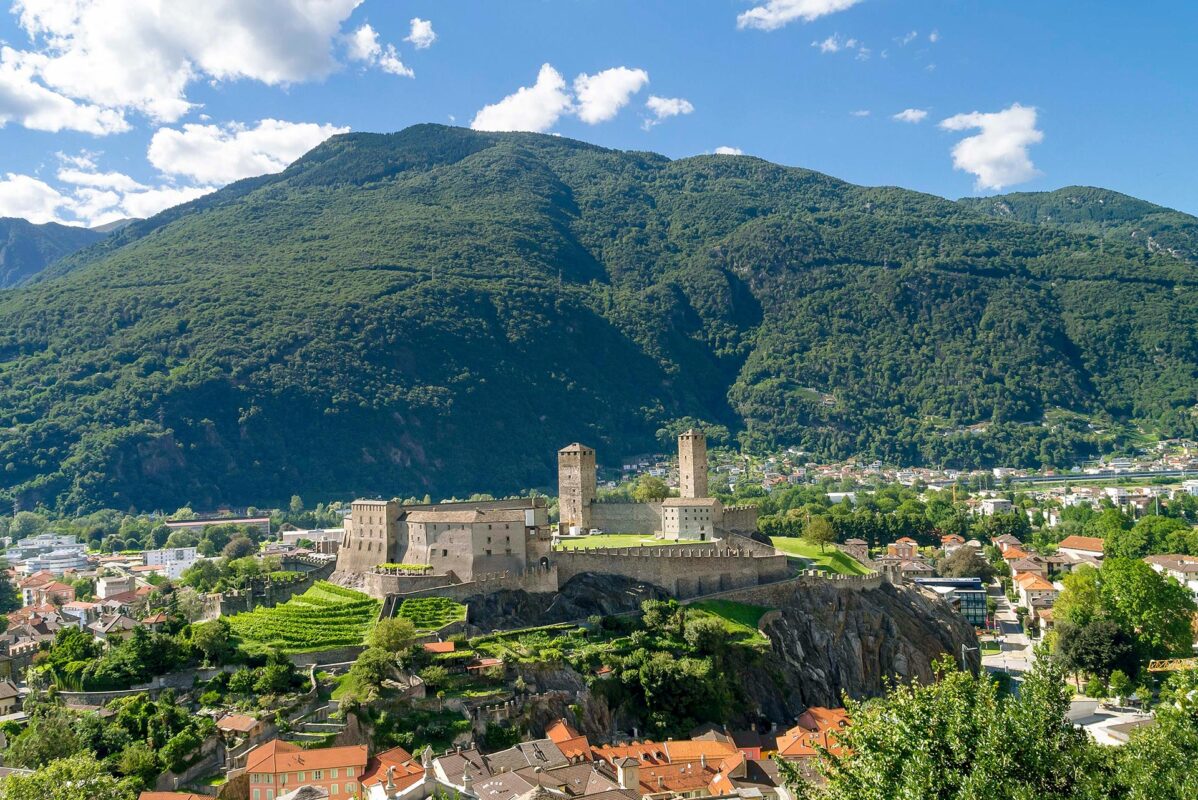
You’ll traverse picturesque landscapes, immerse yourself in the country’s various cultures, and encounter historical landmarks. Along the way, you’ll encounter stunning lakes and majestic peaks, charming villages, and impressive world-class cities. Across 32 official stages covering 488 kilometers, you’ll experience Switzerland at its finest.

women climbing mountain
Author

Silvie Asler

Silvie Asler was born in Berlin with no mountains far and wide. However, as soon as she moved to Switzerland for a job, she immediately fell in love with the country and its mountains. She spends her free time  in the Alps or the Dolomites, whenever possible with her family. She particularly likes multi-day hut-to-hut hikes and her life goal is to visit every of the official SAC mountain huts in Switzerland. You can follow Silvie on her blog, on Facebook or on Instagram.

View profile

The Trail

As you journey, you’ll cross through three distinct language regions, transitioning from French to German and then to the Italian-speaking part of Switzerland. This diversity is also reflected in the architecture and culinary offerings. Beginning in the quaint town of Porrentruy, the trail leads you through the rolling hills of the Jura Mountains and the lake region near Bern. Next, you’ll stroll through the idyllic Emmental and reach the breathtaking Lake Lucerne. Following historic mule tracks, you’ll reach the Gotthard Pass, the highest point of the Trans Swiss Trail. On the southern side of the massif, you’ll notice a change in landscape and climate, with Italian influences evident in the charming villages and Mediterranean vegetation. Passing through the chic city of Lugano, the route continues to impressive viewpoints overlooking Lake Lugano. Finally, you’ll reach your destination in Mendrisio, renowned for its historical buildings.

Each stage concludes in towns or cities with a good selection of accommodations. During the peak season, it’s advisable to book your overnight stay in advance. Thanks to the well-developed public transportation network, you can shorten or extend most sections by taking a bus or train. Both the starting point and endpoint of the Trans Swiss Trail have railway stations.

The majority of the stages are easy, long-distance hikes, so most of the trail is suitable for all fitness levels. Thanks to the dense public transportation network, shortcuts and switching to train, bus, or ship are possible anytime. A comprehensive range of hotel accommodations also makes the staging of the journey easier. It is very easy to adjust the length of each stage or combine 2 stages. You can also get accommodation in a specific region and do day trips from there to reduce the weight of your backpack.

It is advisable to do the hike over several stages or even years to be able to enjoy the difference of each region. Otherwise, parts of the hike can become quite monotonous since some stages are flat long-distance hikes along rivers without many changes in the scenery.

Stages

You can hike the Trans Swiss Trail from Porrentruy to Mendrisio along the 32 stages of the 488 kilometer long-distance trail.

Stage 1:

Porrentruy – St. Ursanne, 17km | 10.6 mi

Stage 2:

St. Ursanne – Soubey, 15km | 9.3 mi

Stage 3:

Soubey – Saignelégier, 12km | 7.5 mi

Stage 4:

Saignelégier – St-Imier, 20km | 12.4 mi

Stage 5:

St-Imier – Chézard-St-Martin, 15km | 9.3 mi

Stage 6:

Chézard-St-Martin – Neuchâtel, 11km | 6.8 mi

Stage 7:

Neuchâtel – Murten, 19km | 11.8 mi

Stage 8:

Murten – Laupen, 15km | 9.3 mi

Stage 9:

Laupen – Bern, 22km | 13.7 mi

Stage 10:

Bern – Worb, 16km | 9.9 mi

Stage 11:

Worb – Lützelflüh, 18km | 11.2 mi

Stage 12:

Lützelflüh – Langnau i.E., 13km | 8 miles

Stage 13:

Langnau i.E. – Eggiwil, 12km | 7.5 mi

Stage 14:

Eggiwil – Schangnau, 13km | 8 mi

Stage 15:

Schangnau – Sörenberg, 19km | 11.8 mi

Stage 16:

Sörenberg – Giswil, 19km | 11.8 mi

Stage 17:

Giswil – Flüeli-Ranft, 10km | 6.2 mi

Stage 18:

Flüeli-Ranft – Stans, 17km | 10.6 mi

Stage 19:

Stans – Seelisberg, 20km | 12.4 mi

Stage 20:

Seelisberg – Erstfeld, 24km | 14.9 mi

Stage 21:

Erstfeld – Wassen, 19km | 11.8 mi

Stage 22:

Wassen – Andermatt, 10km | 6.2 mi

Stage 23:

Andermatt – Passo del S. Gottardo, 13km | 8 miles

Stage 24:

Passo del S. Gottardo – Airolo, 7km | 4.3 mi

Stage 25:

Airolo – Osco, 18km | 11.1 mi

Stage 26:

Osco – Anzonico, 12km | 7.5 mi

Stage 27:

Anzonico – Biasca, 18km | 11.2 mi

Stage 28:

Biasca – Bellinzona, 25km | 15.5 mi

Stage 29:

Bellinzona – Tesserete, 24km | 14.9 mi

Stage 30:

Tesserete – Lugano (Comano), 5km | 3.1 mi

Stage 31:

Lugano (Paradiso) – Morcote, 12km | 7.5 mi

Stage 32:

Morcote – Mendrisio, 12km | 7.5 mi

Accommodations

Each stage starts and finishes in a village or town, so you can easily find accommodation along the route. Due to the dense public transportation network, you can also shorten or extend a stage to meet your requirements or to find accommodation. In the high season in the summer, it is advisable to book ahead. In the off-season make sure to check if accommodation is still available. You can also base yourself in one region for several days, leave your luggage there, and do day trips from this point.

Best time of the year

The majority of the stages can be done throughout the entire year. Crossing mountain ranges or passes like the Gotthard can only be done between July – October without any snow, so it is advisable to plan those stages during the snow-free summer months. Keep in mind that you will also find snow in Ticino.

If you have trouble with one of the stages due to snow, you can also take alternative routes or take public transport to the next stages, which is no problem for any of the stages.

Safety & Gear

How you prepare for this hike will depend on your itinerary and how much of the trail you plan to tackle. If you’re planning to thru-hike the Trans Swiss Trail, you’ll need to prepare with the goal of carrying your life on your back for a long time. However, if you plan to section hike the trail, like most people do, then you have more flexibility. We have packing lists on the site for all types of hike to help you prepare!

Either way, you’ll need to train properly both your physical and mental skills for being in the mountains for so long. Bring lots of water (at least 2 liters a day) and snacks to keep your energy up.

You’ll also want to share your itinerary with someone you trust and include the day you think you’ll finish. If something changes, be sure to update them on the new plan.

Good to know

Most stages of the hike are not very challenging when it comes to terrain. However, they can stretch for quite a bit and are therefore mentally challenging. Make sure to check what is along the route to not miss some interesting museums or sights. Most of the villages and cities you pass through have a beautiful center and interesting architecture, so make sure you plan some time for sightseeing. Those towns are also the perfect opportunity for a rest day and particularly Bern and Lugano are great candidates for rest days!

There are almost always enough water resources everywhere in Switzerland. Lots of public fountains along the route and always carry 1.5L with you to be on the safe side.

Route
Point to point
Highest point
2090M (6856 FT)
Waterpoints
Enough

Want to submit a trail or make this page more complete?

Comments

Be the first one to comment on this trail!

Reply to this trail

Your email address will not be published. Required fields are marked *

Reply to this trail

Log in to comment on this trail
Always read the disclaimer

Terms of Use: important to all visitors on this website. We strive to publish high quality content and information on this website. However it’s always possible that we’re missing out on some crucial information. In spite of the fact that this route, associated GPS track (GPX and maps) were prepared under diligent research by the specified contributor and/or contributors, the accuracy of such and judgement of the author is not guaranteed. Therefore, hiking-trails.com and contributors are in no way liable for personal injury, damage to personal property, or any other such situation that might happen to individuals hiking or following this route. Should you choose to hike this trail, this is always at your own risk. Check out our guidelines for safety hiking and Leave No Trace principles at the hiking 101 page.

Download GPX

Join the community!

Login or create a FREE account 😊

With an account you can:

Download GPX files

Pin trails to your wishlist

Mark trails as hiked by you

Rate hiking trails

Comment on trails, blogs and gear reviews

Happy trails!
Login

Don't have an account yet? Register here