About the Trans-Catalina Trail

country
United States
length
62 km(39 mi)
Type of trail
Long-distance, Thru-hike
difficulty

Difficulty is highly personal. Be aware of the weather conditions as bad weather turns easier trails in difficult trails especially in the mountains.

Moderate
accommodation

Lodging means a mix of hotels, hostels or AirBnB’s.

Camping
Elevation gain
2220 m(7283 ft)
terrain
Desert, Coastal, Hills
remoteness
Most of the time
Show more

The Trans-Catalina Trail is a thru-hike across Santa Catalina Island, off the coast of Southern California. The island is known for its Hollywood history and yacht parties but has an incredible hiking culture to explore as well. While it’s only four days, the hike will take you across the island, even completing a loop at one end. You’ll see the ecosystems shift as you move from inland to the coast and even the subtle differences between the northern and southern tips of the island.

Plus, the Trans-Catalina Trail is a wildlife-lover’s dream. You’ll see bison (left there from a movie set in 1924), dolphins, seals, whales, foxes, and birds native to the island. As well as palm trees, sandy beaches, and campgrounds watching the sunset over the water. This is the perfect trail for escaping a cold winter for some serious sun.

women in blue smiling at camera
Editor

Katie Mitchell

After a whirlwind of 8 years on the road (and trail!), Katie has hiked the Camino Frances, the Peaks of the Balkans, the Fisherman’s Trail, and extensively in the United States. She is an avid trail runner and now lives in Colorado where she plays in the mountains in her free time. You can follow her adventures on Instagram.

View profile

The Trail

Most people start the trail from Avalon, although you also have the option to start in Two Harbors, as there are ferries to both hubs. However, Avalon will be a better place to stock up before you start hiking. Plus, there are fun restaurants and bars there that will give you a sense of what most people experience when they go to the island. But not you! You’ll see the quieter, more peaceful side of the area. Even though there will likely be many hikers on the trail at the same time as you, you’ll likely only see them at the campsites. With shorter distances each day, people tend to spread out – choosing to start and end their days at their own pace.

From Avalon, you’ll hike to Blackjack. This is the most monotonous day, as you’ll be hiking inland for the majority of it, climbing up into the hills. But don’t be discouraged! Once you’re up at 500 meters, that’s when the fun begins. The campground has running water and pit toilets. From Blackjack, you’ll get to hike back toward the coast, but not without a little treat first. The Airport in the Sky is a private plane hangar that also has a shop and restaurant – definitely not to be missed. You can grab breakfast, lunch, or dinner here (mostly burgers and wraps), as well as grab a cold beverage or some ice cream to keep the morale high.

Once you fill up there, you’ll continue down to Little Harbor, which will look like a paradise after the golden hills you’ll be in for most of the day. The hill hiking will show you insane ridgelines and if you’re lucky, you’ll hopefully see some bison and foxes this day. Once you reach Little Harbor, dump your gear at your site and head to the beach! The beach itself is sand, but walking into the water is fairly rocky – water shoes will be helpful here. The palm trees above you and hearing the waves lull in the background is the perfect way to end the day. Pro-tip: Campsite #1 is great for privacy, but doesn’t have beach views. Campsite #10, however, has the best water views but will be surrounded by other campers.

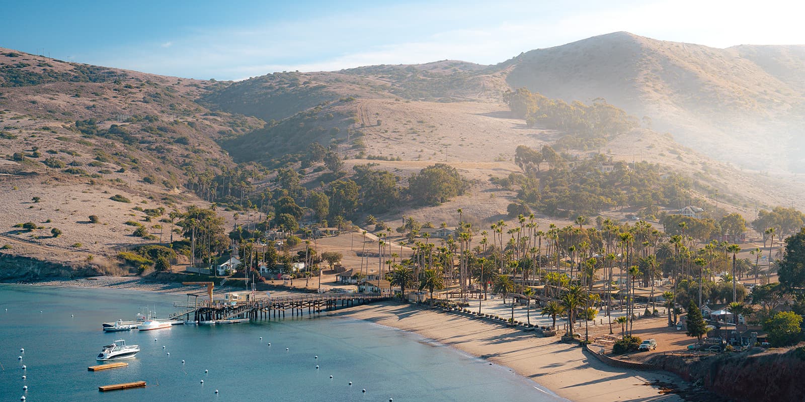
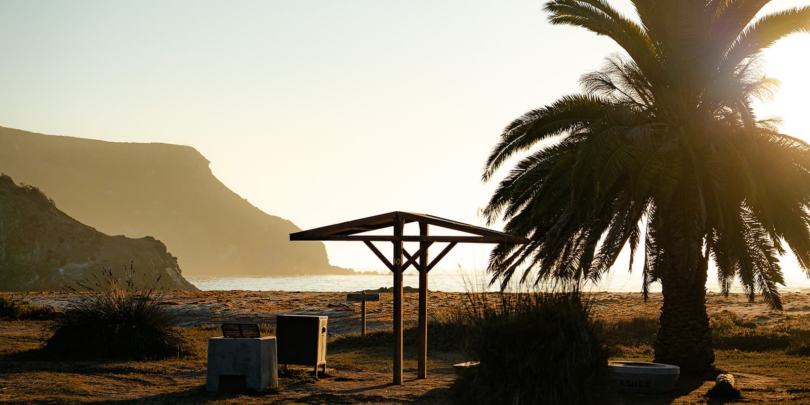
From Little Harbor, you’ll have a longer day to Parson’s Landing. The best way to break it up is to get a little funky with the gpx route. You’ll hike first to Two Harbors, conquering a massive hill (also with great views, though), and arrive in town. It’s mainly a restaurant and general store on the beach, but truly, that’s all you’ll want or need at this point. There are public restrooms next to the water, and it’s worth grabbing some lunch and taking a nap by the water if you have the time. You’ll also want to check in with the trail organization at their booth on the pier. This is where you’ll pick up your permit for Parson’s Landing with your locker number and code (if you reserved one). This is very necessary, or else you will not be able to access the water and wood set aside for you at the campground.

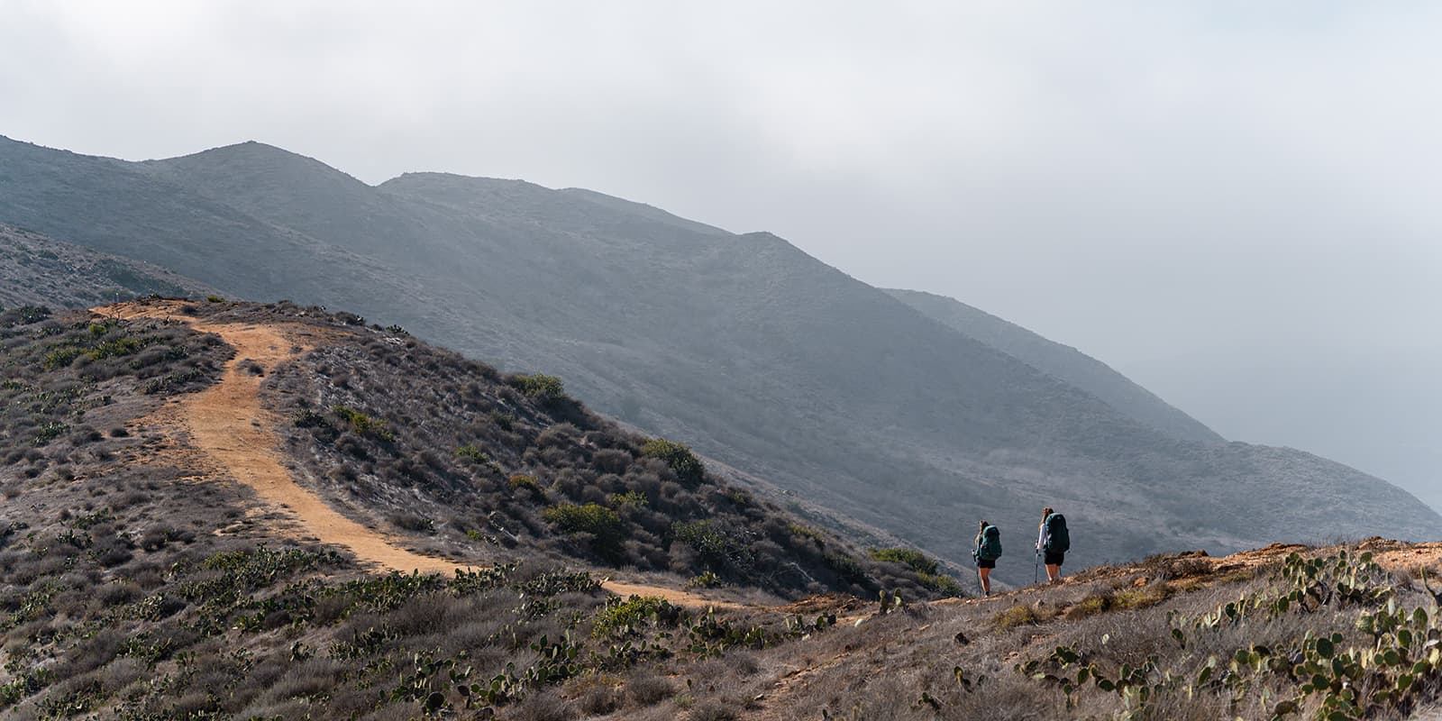
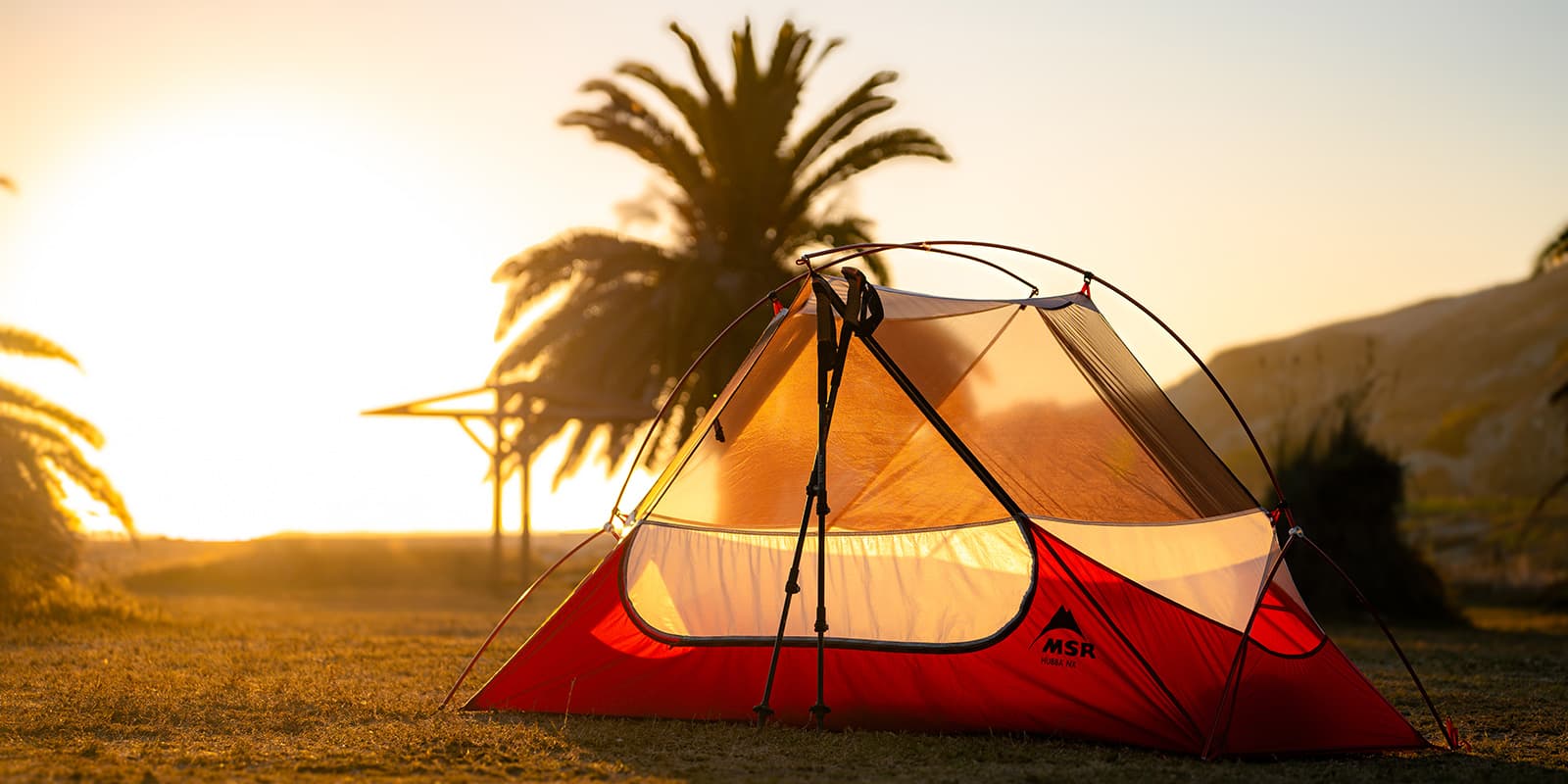
Once you’re ready to get going again, I recommend hiking the Parson’s Landing loop counter-clockwise. This means that you’ll hike to the campground along a flat, sandy road along the coast. While that sounds a bit boring, it means you don’t have to hike the looming 500-meter (strenuous) hills after already climbing some tough ones in the morning. The road walk will take about 2.5-3 hours, so settle in and find someone to chat with! Once you arrive at Parson’s, find your locker, settle into your campsite, and enjoy watching the waves. A quick note about this: because you’re so close to the water, most everything you leave out at night will be soaked through when you wake up. Make sure to take anything important into your tent or stash it in the critter box!

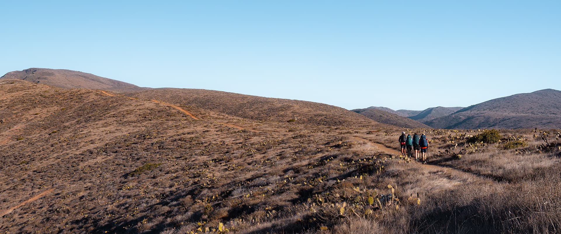
Finally, you’ll hike from Parson’s Landing to Two Harbors on your final day. This is one last tough climb. You’ll hike up about 500 meters on extremely strenuous hills. While the terrain is clear and you should have an easy grip, you will need trekking poles for these hills. However, it’s only 10 kilometers in total for this section, so once you hit the top of the hills, you’ll coast along some ridgelines and then descend back into Two Harbors to wait for your ferry.

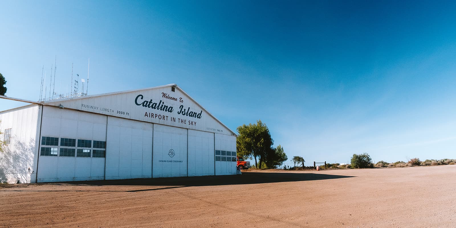
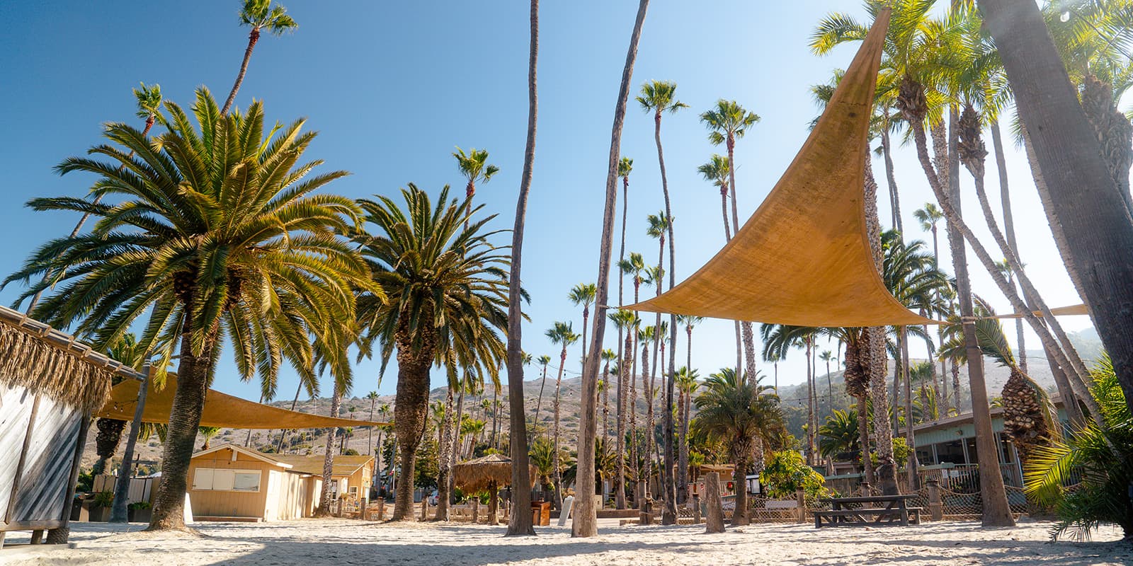
This is a great place to hang out and wait, so if you booked the later ferry, don’t fret, as you’ll be able to nap on the beach or go to the restaurant nearby, which opens at 3 PM. From Two Harbors, you’ll take a ferry back to Los Angeles and return home (or head onto more adventures!).

Stages

The trail can be started from either Avalon or Two Harbors. This itinerary reflects an Avalon start point, although you can be flexible. Additionally, it’s entirely possible to combine the final loop around Parson’s Landing, although we argue that may be the best campsite of the trip, so it’s worth taking an extra day to enjoy it.

4-day itinerary

Stage 1:

Avalon – Blackjack Campground, 16.5 km | 10.3 mi

Stage 2:

Blackjack Campground – Little Harbor, 14 km | 8.7 mi

Stage 3:

Little Harbor – Parson’s Landing, 21.5 km | 13.4 mi

Stage 4:

Parson’s Landing – Two Harbors, 10 km | 6.2 mi

Accommodations

The Trans-Catalina Trail is a trail that can be entirely completed by camping. You do have an option to sleep in Two Harbors instead of Little Harbor, where there are other lodging options as well.

Campsite reservations open one month in advance, and you can reserve your spot either online or by phone call. Be aware, however, that you’re not just reserving one site for your whole group, you will be charged per person who will be sleeping there.

You will also have the option to add a firewood bundle at Little Harbor or Two Harbors, and the chance to pay for a locker at Parson’s Landing. This is very helpful for colder nights when you want to curl up and be cozy as you feel the ocean breeze! Additionally, Parson’s Landing does not have any running water, so they will include about 7.5 liters of water along with firewood for you in the locker you reserve.

Accommodations per stage

Stage 1:

Lodging in Avalon

Stage 2:

Blackjack Campground

Stage 3:

Little Harbor Campground (option for Two Harbors instead)

Stage 4:

Parson’s Landing Campground

Best time of the year

The best time of the year to hike the Trans-Catalina Trail is from November through March. This Southern California island is prone to scorching hot temperatures in the late spring, summer, and early fall, which means that winter will be the best time to hike. There’s almost no shade on the trail, so you’ll be exposed to the California sun all day. This is a great thing, however, when you’re looking for a warm hiking getaway in the throws of a cold winter.

Safety & Gear

The Trans-Catalina Trail is not terribly difficult and doesn’t have major safety concerns. That being said, there are still elements to be cautious about when hiking on the island.

First, the wildlife. Catalina Island bison are not native to the area and were left there after the filming of a movie in 1924. The herd has about 150 bison right now, and they tend to stick to themselves. However, these are massive, dangerous creatures that you need to be aware of. If they display aggressive behavior, find an escape route or hiding place. Do not try to pet the bison, and keep a wide distance. Additionally, there are rattlesnakes and poison oak on the island. Use caution when you’re walking and be aware of your surroundings.

Second, the sun. California heat is no joke, which is why this trail should only be attempted in the late fall through early spring when it’s cooler. The temperatures will still be very warm, and you’ll need to bring sun protection as well as lots of water. Remember to download the GPX on your phone as the trail is not always marked.

Difficulty

The trail is rated as moderate because the trail conditions themselves are easy – the way is well-marked, the trail is clean, and has easy footing. However, there are strenuous climbs scattered throughout the trail, which moves the rating to a higher difficulty. Make sure you can handle the heat, even in winter and bring enough water. There are some water points along the trail but bring at least two and a half  liters or when it’s really hot even more. Don’t forget to bring your sun hoody, I was really happy with it on the trail.

Good to know

The ferries to and from the island have a few options from different companies and will take you to either Avalon or Two Harbors (and vice versa). There are two mainland ports that the ferries operate out of: Long Beach and San Pedro. They’re only about a 10-minute drive from one another, but there’s no public transportation between them. So you’ll likely need to hire an Uber or rideshare when you return to take you back to your car if you’ve parked at the other one.

The best place to park in the area is at the Long Beach Port, where it (as of 2024) costs about $25 per day. This is one of the few lots in the city that allows long-term parking for longer than 72 hours. Plus, it’s covered and has security, which means a higher likelihood of your car being safe.

There is not much cell service on the island once you get outside of Avalon. This is a great chance to unplug, but if you need to connect, you’ll be able to log onto the public wifi in Two Harbors if you stop for a break there.

You do not need specific permits to hike the Trans-Catalina Trail. Booking your campsites across the island will count as your permit, so there’s no need to register for anything additional. The only permit you’ll need to carry is for Parson’s Landing which you’ll pick up in Two Harbors.

Route
point-to-point
Highest point
510m (1673 ft)
Water points
along the trail, except for Parson’s Landing

Want to submit a trail or make this page more complete?

Always read the disclaimer

Terms of Use: important to all visitors on this website. We strive to publish high quality content and information on this website. However it’s always possible that we’re missing out on some crucial information. In spite of the fact that this route, associated GPS track (GPX and maps) were prepared under diligent research by the specified contributor and/or contributors, the accuracy of such and judgement of the author is not guaranteed. Therefore, hiking-trails.com and contributors are in no way liable for personal injury, damage to personal property, or any other such situation that might happen to individuals hiking or following this route. Should you choose to hike this trail, this is always at your own risk. Check out our guidelines for safety hiking and Leave No Trace principles at the hiking 101 page.

Download GPX

Join the community!

Login or create a FREE account 😊

With an account you can:

Download GPX files

Pin trails to your wishlist

Mark trails as hiked by you

Rate hiking trails

Comment on trails, blogs and gear reviews

Happy trails!
Login

Don't have an account yet? Register here