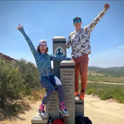
About the Trans Catalina Trail

country
United States
length
62 km(39 mi)
Type of trail
Long-distance, Thru-hike
difficulty

Difficulty is highly personal. Be aware of the weather conditions as bad weather turns easier trails in difficult trails especially in the mountains.

Moderate
accommodation

Lodging means a mix of hotels, hostels or AirBnB’s.

Camping
Elevation gain
2560 m(8399 ft)
terrain
Coastal, Desert, Mountains
remoteness
Most of the time
Show more

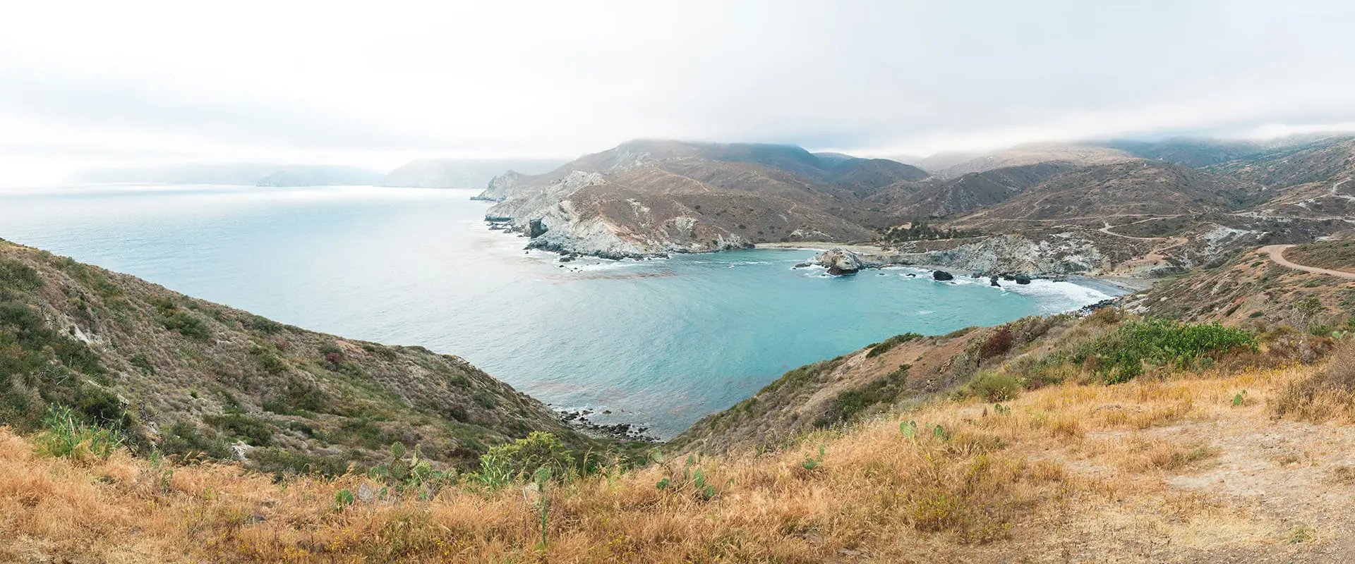
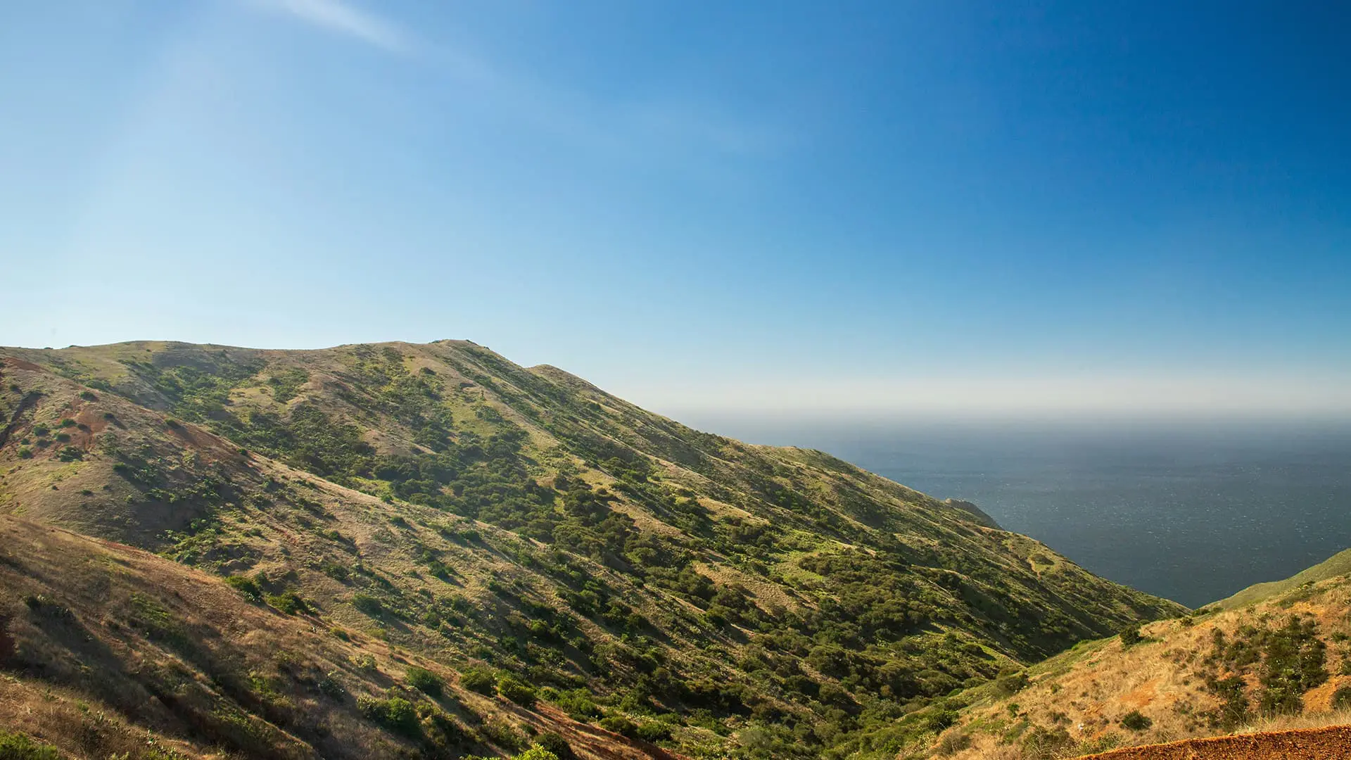
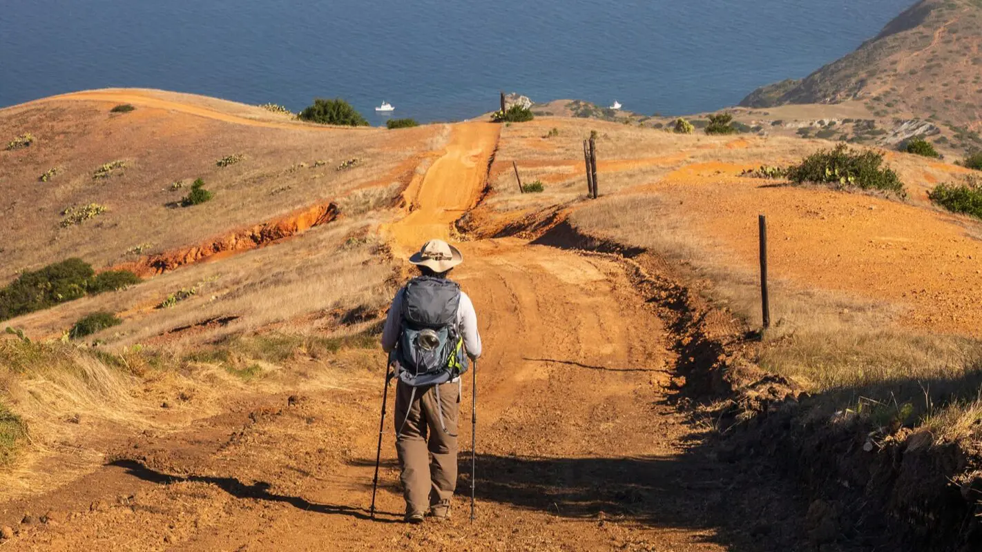
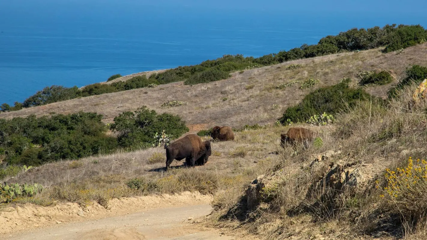
Santa Catalina Island is a beautiful gem of gentle hills and stark cliffs with wild bison just off the coast of Los Angeles. After taking the 1 hour and 15-minute ferry from the mainland, you’ll arrive in Avalon, the touristy center of the island. The trail climbs up the steep hills, with breathtaking views of the ocean in all directions. The island has very few trees and shade is rare, so be prepared for long periods of exposure to the elements.

Santa Catalina Island, often just called Catalina Island, is located about 35 kilometers off the coast of Southern California. It has a long history, going back thousands of years. Originally, the island was inhabited by the Tongva people, who called it Pimu. They lived on the island for at least 7,000 years before European contact.

Brian Walsh profile picture
Author

Brian Walsh

Brian grew up in New England hiking the White Mountains of NH. He thru-hiked the 2,200-mile Appalachian Trail with his now-fiance in 2021 and they have been avid long-distance backpackers ever since, completing the Trans Catalina Trail, Tahoe Rim Trail, and John Muir Trail. In 2024 they will be thru-hiking from Mexico to Canada on the Pacific Crest Trail.

You can follow them on Instagram @trekking_thru

View profile

The Trail

The island was conquered by the Spanish in 1542, passing between many hands until modern history when it was developed as a tourism destination in the 19th century. Today, Catalina Island is known for its clear water, abundant marine life, and hiking like the Trans Catalina Trail.

The Trans Catalina Trail (TCT) was established in 2009 and goes approximately 62 kilometers from Avalon in the east to Starlight Beach on the west coast. The trail offers a mix of coastal views, rugged interior landscapes, and diverse wildlife.

You’ll begin in Avalon, where you’ll hike to Blackjack campground, nestled deep in the mountains of the island. From there you hike to Little Harbor, a cute campground on the beach. The next day you’ll hike another 8 kilometers to Two Harbors, a small town at the center of the island where you can pick some more food for your last night. You can also have a nice dinner and glass of wine looking over the water here if you’re getting tired of camp food!

The final section of the trail takes you to another remote beach campground, Parson’s Landing. This last part of the trail is a loop, so you can either go over the highest peak on the island or walk the dirt road along the coast. The loop takes you back to Two Harbors where the trail ends and you will catch a ferry back to LA. You can find more information about each stage below.

Stages

5-stage itinerary

Stage 1:

Avalon – Blackjack Campground, 16.9 km | 10.5 mi

Stage 2:

Blackjack Campground – Little Harbor, 13.7 km | 8.5 mi

Stage 3:

Little Harbor – Two Harbors, 11.3 km | 7 mi

Stage 4:

Two Harbors – Parsons Landing, 11.3 km | 7 mi

Stage 5:

Parsons Landing – Two Harbors, 12 km| 7.5 mi

Accommodations

The first step in hiking the TCT is booking your ferry ride to the island. You can leave from either Long Beach or San Pedro, but only the San Pedro ferry returns directly from Two Harbors, so I recommend going from that port. There are only a few ferry times each day and they do usually sell out, so make sure and get them plenty in advance of your trip!

Once you are on the island you can start your adventure! You are required to camp in the established campgrounds and reservations are required in advance to stay. These campgrounds fill up quickly and far in advance, so make sure and book them as early as you can.

Parson’s Landing is the smallest and sells out the quickest, so when you’re booking campgrounds try to find a date for Parson’s that works for you and work backward from there.

Campgrounds

  • Hermit Gulch: This campground is just outside of Avalon before the start of the trail. This would be a good place to stay if you were taking the late ferry into Avalon to start the next day.
  • Blackjack: This is the only option for camping your first night unless you push another 8 miles (13 km)  to Little Harbor.
  • Little Harbor & Shark Harbor: Nestled into a rocky harbor, this campground is right on the water facing the sunset. There is dirt road access to the campground, so you can rent kayaks and arrange for supplies or food to be dropped off here!
  • Two Harbors: There is a campground in Two Harbors if you decide to push past Little Harbor to get here. I’d recommend staying at Little Harbor though, it’s a highlight of the trail!
  • Paron’s Landing: On the remote northern tip of the island, Parson’s Landing is a small campground right on the sand. The waves can get rough out here, and there is no water source. When booking your campground, you have to buy a 2-gallon (7.5L) water cache that will be there when you arrive.

All of these campgrounds normally have a 2-night minimum stay during the summer. However, if you say you are thru-hiking the entire trail, that requirement is waived.

Best time of the year

The Trans Catalina Trail is doable year-round, however, the cooler temperatures in the fall, winter, and early spring make the exposure to the sun, lack of shade, and few water sources more manageable.

Safety & Gear

The Trans Catalina Trail is almost totally exposed, so it is very important to wear layers to protect yourself from the sun. The island can also be battered by strong winds and rainstorms, so be prepared with the appropriate layers.

Research the weather conditions for the week you’re there. If there are severe weather conditions, including thunderstorms, heavy rainfall, or extreme heat, postpone your trip. California has had severe weather problems in the past few years, and you don’t want to put yourself in danger.

The trail can be very hot, and there are almost no water sources along the way. So, be sure to fill up 2L minimum of water for each day at your campsite spigots.

Familiarize yourself with the trail map and carry navigation tools such as a compass or GPS device to stay oriented and avoid getting lost.

Invest in the right hiking gear, including comfortable, supportive footwear, proper hiking clothing, such as warm base layers and a hardshell rain jacket, hiking poles, a well-fitted backpack, and essential equipment like maps, GPS devices (when needed), and a first-aid kit. Check out our comprehensive gear list for long-distance trails like this.

Respect the principles of Leave No Trace by minimizing your impact on the environment. Stick to designated trails, pack out all trash, and show respect for wildlife and natural habitats.

Good to know

In 1924, several bison were brought to the island for a movie and left there. Today there is a herd of around 100 roaming freely on the island, under the careful maintenance and protection of the Catalina Island Conservancy.

A few miles past Blackjack Campground going towards Little Harbor is the Airport in the Sky, which is a great spot to grab a delicious breakfast or lunch as you walk by!

Route
Point to point
Highest point
532m (1,748 ft)

Want to submit a trail or make this page more complete?

Comments

Be the first one to comment on this trail!

Reply to this trail

Your email address will not be published. Required fields are marked *

Reply to this trail

Log in to comment on this trail
Always read the disclaimer

Terms of Use: important to all visitors on this website. We strive to publish high quality content and information on this website. However it’s always possible that we’re missing out on some crucial information. In spite of the fact that this route, associated GPS track (GPX and maps) were prepared under diligent research by the specified contributor and/or contributors, the accuracy of such and judgement of the author is not guaranteed. Therefore, hiking-trails.com and contributors are in no way liable for personal injury, damage to personal property, or any other such situation that might happen to individuals hiking or following this route. Should you choose to hike this trail, this is always at your own risk. Check out our guidelines for safety hiking and Leave No Trace principles at the hiking 101 page.

Download GPX

Join the community!

Login or create a FREE account 😊

With an account you can:

Download GPX files

Pin trails to your wishlist

Mark trails as hiked by you

Rate hiking trails

Comment on trails, blogs and gear reviews

Happy trails!
Login

Don't have an account yet? Register here