About the Tour du Queyras

Alps
country
France
length
109 km(68 mi)
Type of trail
Hut to hut, Long-distance
difficulty

Difficulty is highly personal. Be aware of the weather conditions as bad weather turns easier trails in difficult trails especially in the mountains.

Moderate
accommodation

Lodging means a mix of hotels, hostels or AirBnB’s.

Mountain huts, Lodging
Elevation gain
8524 m(27966 ft)
terrain
Mountains
remoteness
Most of the time
Show more

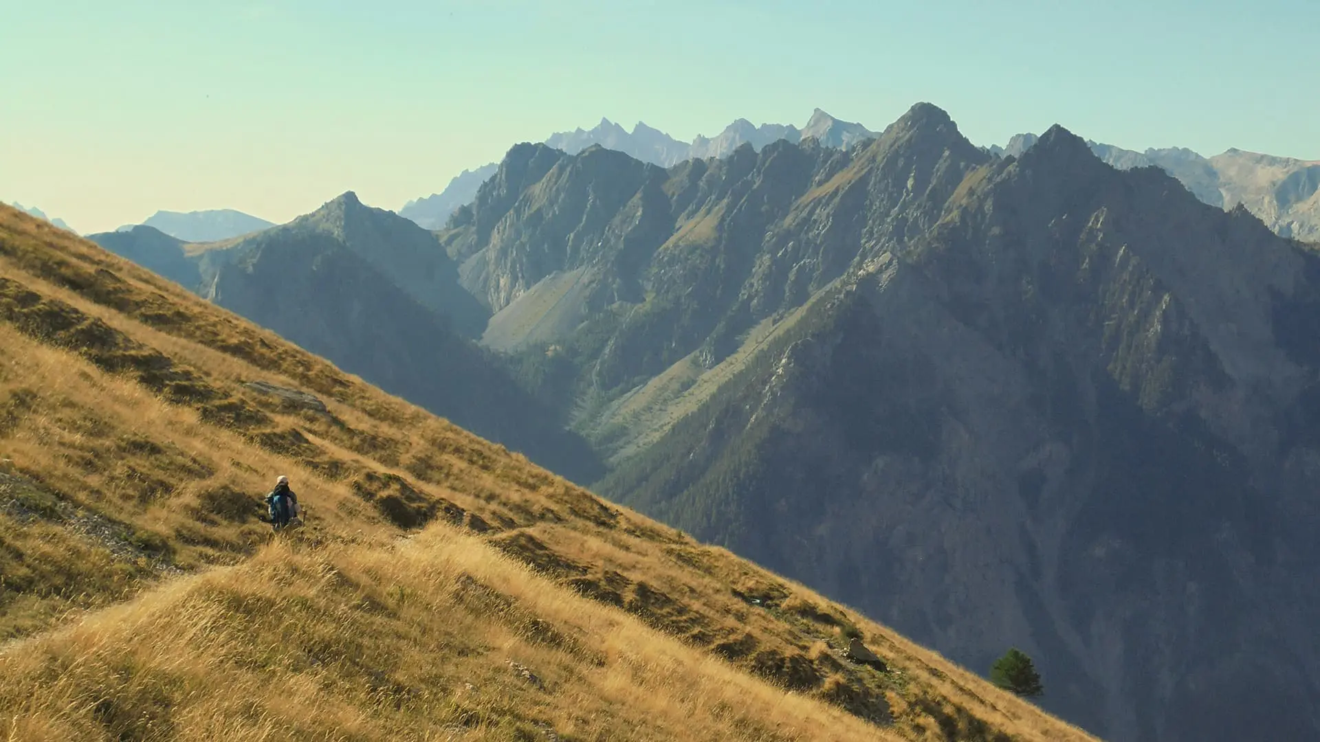
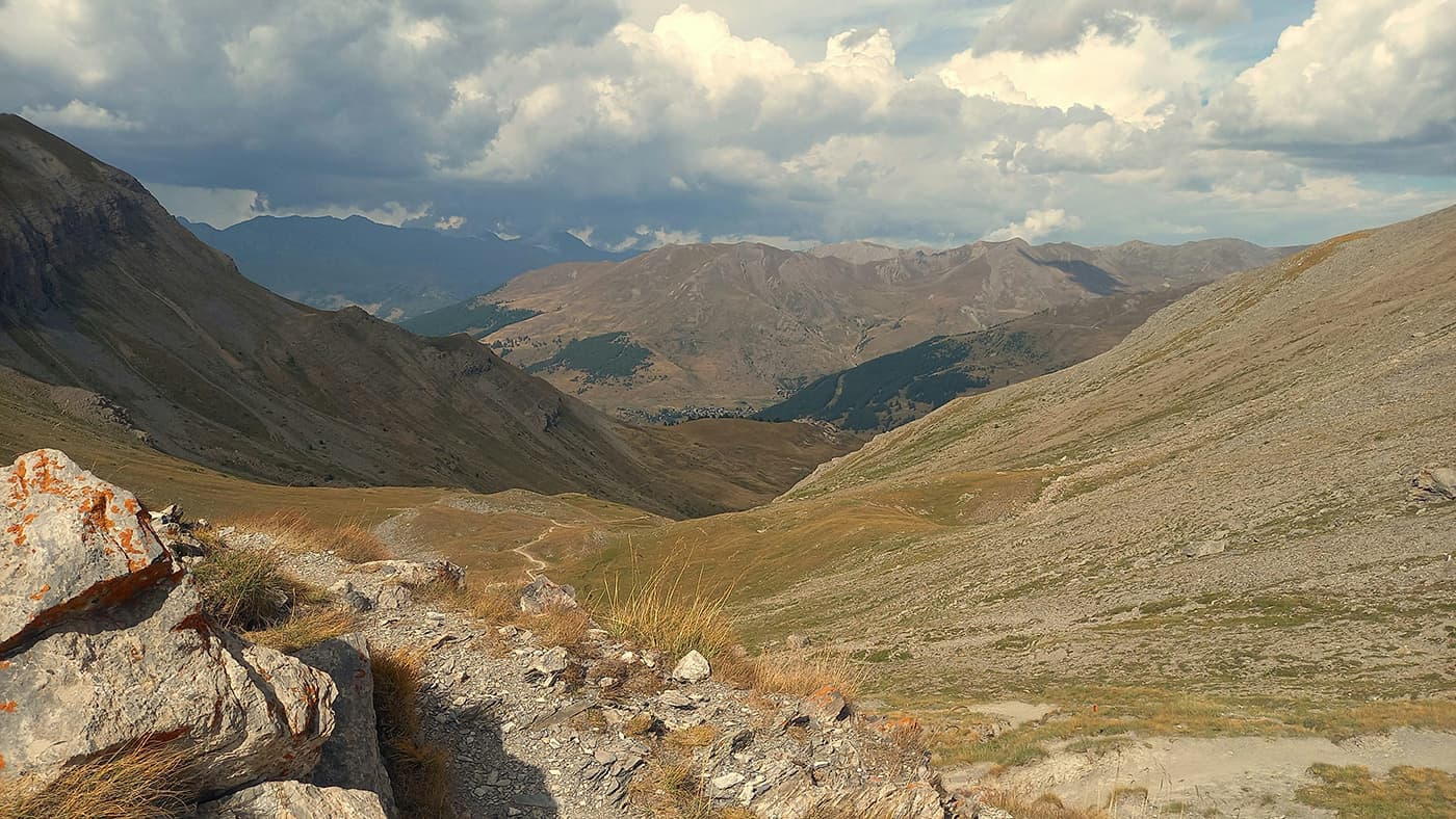
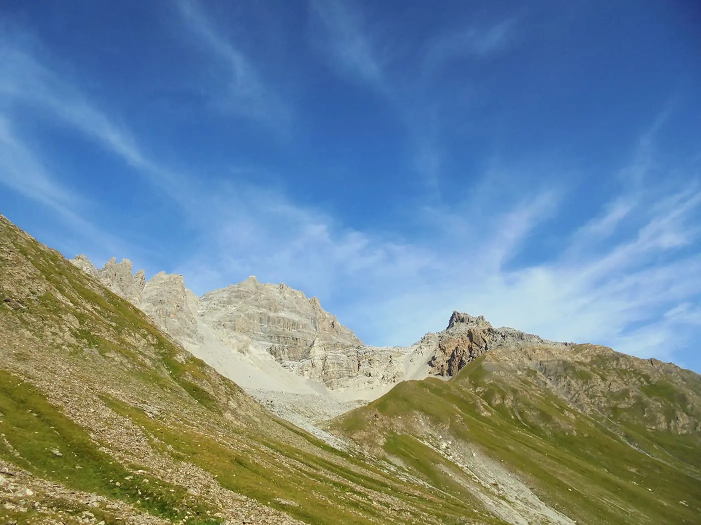
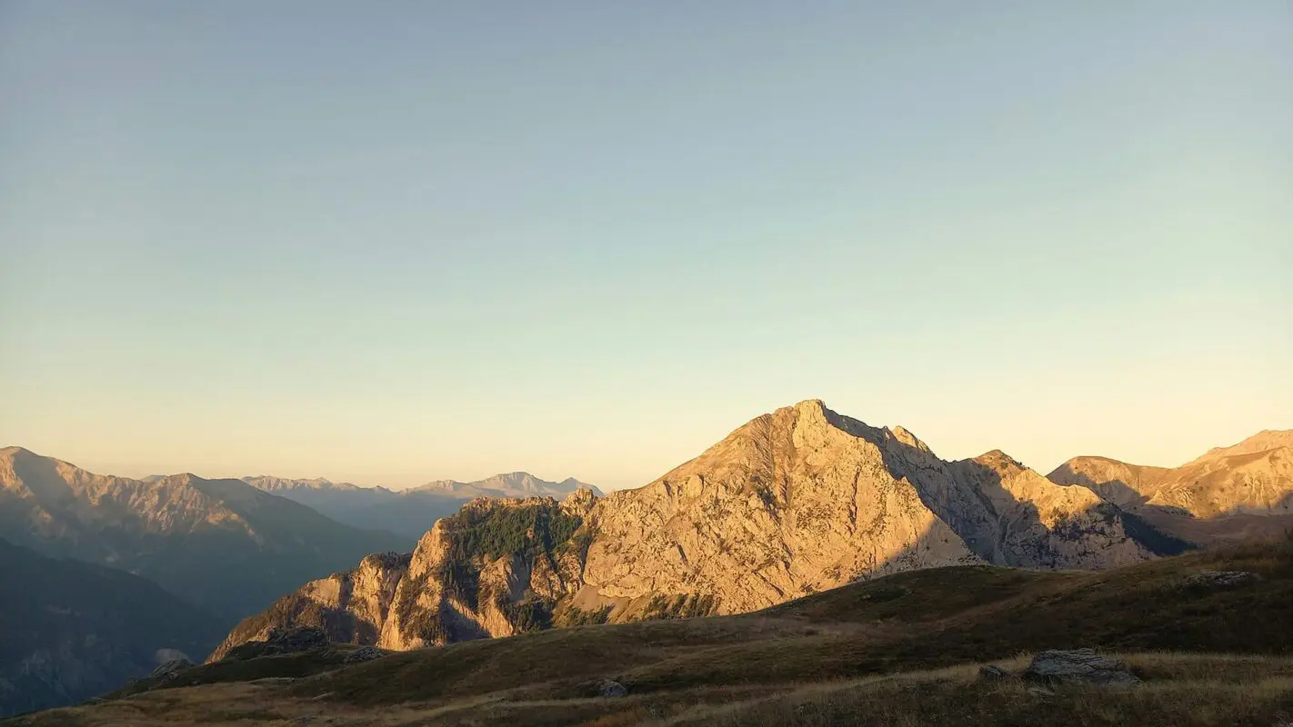
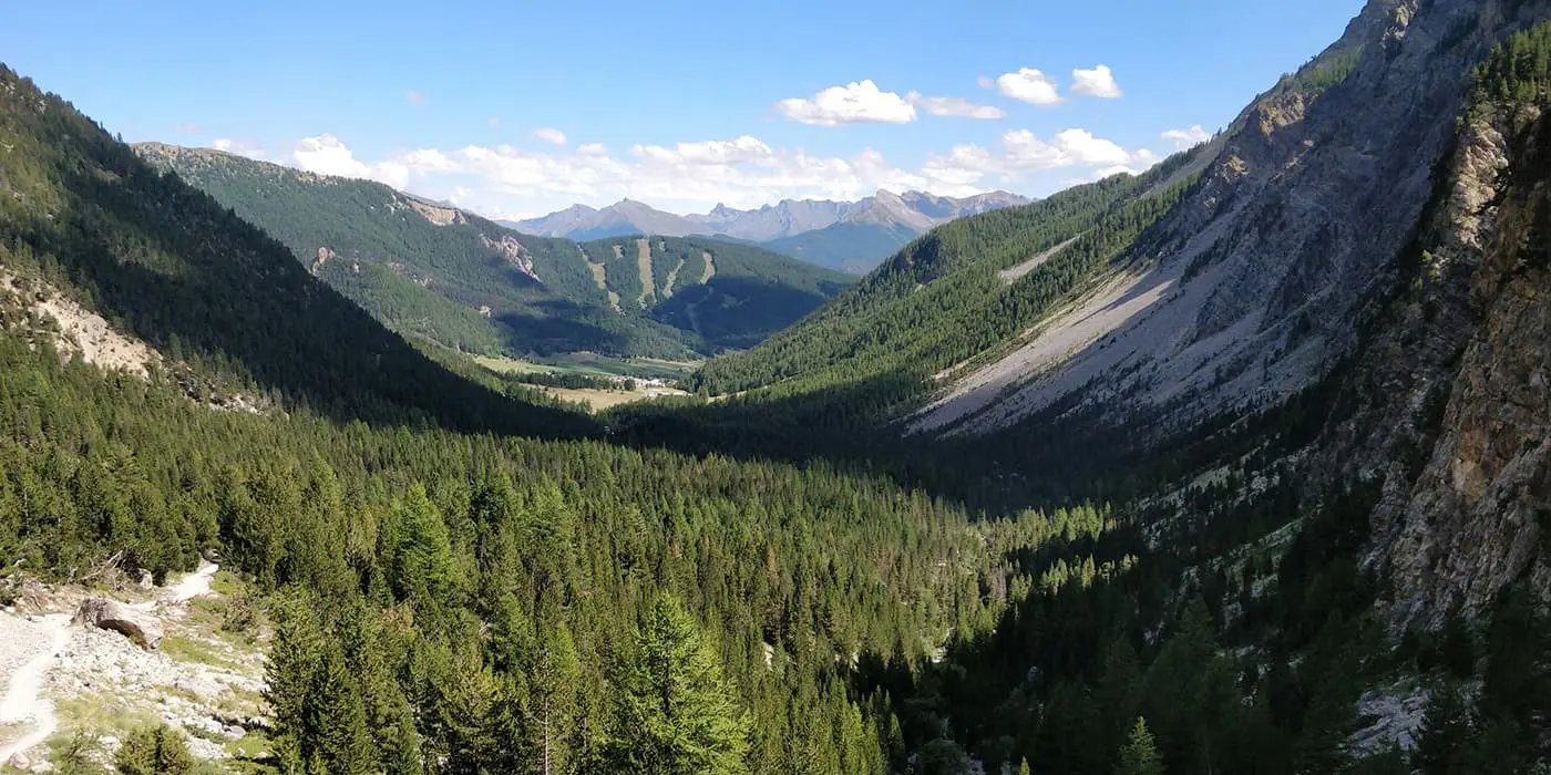
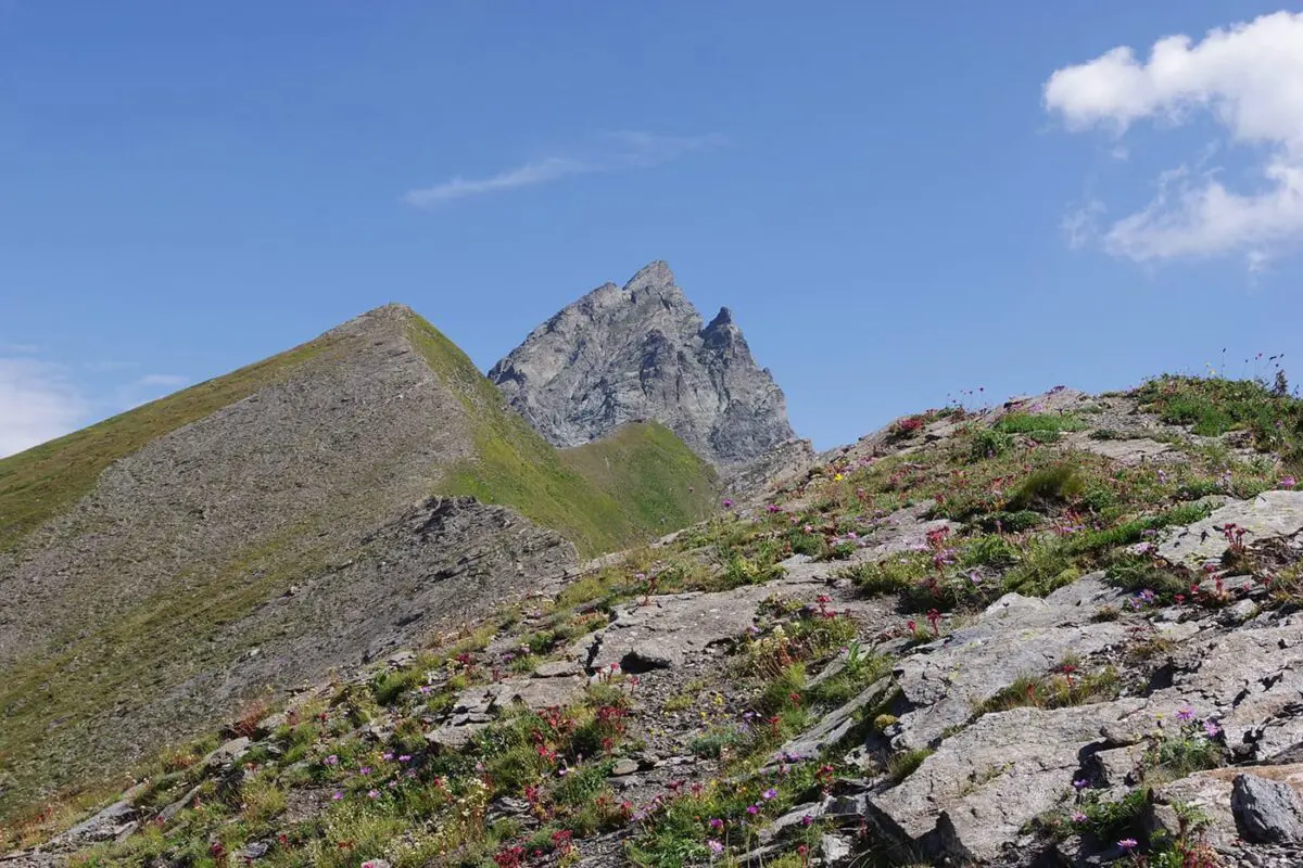
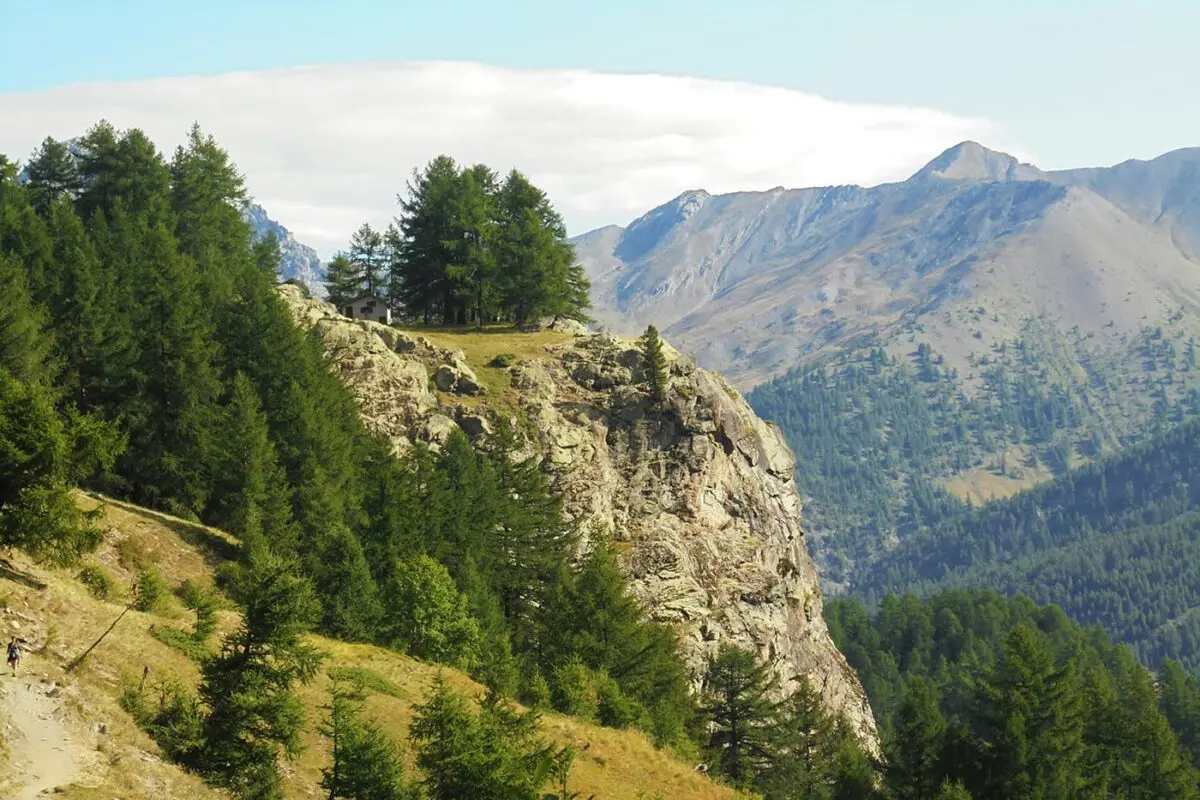
The Tour du Queyras, also known as the GR58, is an ideal trek for long-distance hikers who seek a more serene mountain experience than the more famous hiking trails in France like the Tour du Mont Blanc. The Queyras Valley, a small gem in the French Hautes-Alpes on the Italian border, is a beautiful regional natural park.

The Queyras Valley is a paradise for hikers seeking quietness in nature and adventure. This valley, known for its rugged terrain and diverse ecosystems, is surrounded by some of the highest peaks in the Alps.

It offers trails that range from gentle walks through forests and alpine meadows to challenging treks up steep mountain passes. Its hiking trails will lead you through scenic landscapes with stunning views, glacial lakes, and rich biodiversity. The GR58 is the highlight of this region, circling the entire valley.

Editor

Elmar Teegelbeckers

Passionate hiker Elmar spends months of his time on the trail. He’s usually on the lookout for hidden gems in one of his favourite countries such as Slovenia, Switzerland and Japan. He founded hiking-trails.com in need for a community and detailed information about the trails. Before this, he worked for the Alpine asscociation in the Netherlands[ (NKBV) but lost his heart to the trails.

With this website and socials, he hopes to shape an inclusive community for hikers all over world. No matter your speed, experience or level, you can get out there to enjoy the trails and connect with the heartwarming hiking community. Life is so much better outside and he hopes to inspire hikers to take their first, or next, step on the trail.

View profile

The Trail

The wild Southern French Alps offer a great hut-to-hut tour in the Queyras where you’ll sleep in one of the many refuges on the way. This offers a unique hiking experience on less crowded paths traversing varied alpine landscapes with mountain lakes, alpine meadows, and forests, as well as spectacular views of the snow-capped mountain peaks along the Italian border and the Ecrins massif to the west. In good weather, you can see the mountain range that forms the border ridge with Italy, including peaks such as Pic de Caramantran, Rocca Bianca, and TĂȘte des ToilliĂ©s; all above 3000 meters, as well as Barre des Écrins at 4102 meters. The Queyria Mountains also receive less rain than the popular Ecrins. The trek involves a lot of elevation gain, with several passes above 2800 meters.

The classic route runs from Abries, making a circular route in 8 to 10 days to Abries again. But this hut-to-hut tour can be tailored to different levels of experience and fitness, with options for shorter days or more challenging longer stages. On this helpful website, you can even book the different options. Along the way, hikers can stay in refuges and gĂźtes. The Tour du Queyras is a perfect trail for anyone who wants to start with hiking hut-to-hut tours in the Alps.

Stages

The Tour du Queyras can be completed in 9 sections, not including rest (or ZERO) days. Below is our itinerary that ends at a mountain hut each night.

9-day tour stages

Stage 1:

Abriùs – Refuge de la Montana, 13 km | 8 mi

Stage 2:

Refuge de la Montana – Refuge Agnel, 12 km | 7 mi

Stage 3:

Refuge Agnel – Saint VĂ©ran, 12 km | 7 mi

Stage 4:

Saint VĂ©ran – Ceillac, 13 km | 8 mi

Stage 5:

Ceillac – Bramousse, 10 km | 6 mi

Stage 6:

Bramousse – Refuge de Furfande, 17 km | 11 mi

Stage 7:

Refuge de Furfande – Brunissard, 13 km | 8 mi

Stage 8:

Brunissard – Refuge Les Fonts, 17 km | 11 mi

Stage 9:

Refuge Les Fonts – Abriùs, 14 km | 9 mi

Accommodations

While hiking this hut-to-hut tour, you’ll enjoy the beautiful and cozy mountain huts or refuges alongside the Tour du Queyras. These refuges are traditional mountain shelters offering basic accommodations, usually with dormitory sleeping arrangements. They provide a communal dining area where meals are served, including breakfast and dinner, often featuring local cuisine. While it’s a basic stay, most people love to stay in the mountain huts together with like-minded people. Booking in advance is highly recommended, especially in the high season, as these huts are popular, especially during the weekend days.

Overnights per stage

Stage 1:

Refuge de la Montana

Stage 2:

Refuge Agnel

Stage 3:

Saint VĂ©ran

Stage 4:

Ceillac

Stage 5:

Bramousse

Stage 6:

Refuge de Furfande

Stage 7:

Brunissard

Stage 8:

Refuge Les Fonts

Best time of the year

The best time to hike the Tour du Queyras is typically from late June to mid-September. During these months, the weather is the best, with warmer temperatures and less likelihood of snow on the higher trails, making the paths more accessible and enjoyable. The summer months also bring the valley to life, with wildflowers in bloom and wildlife more visible. Early September is delightful, with fewer crowds then and the landscape will begin to showcase the first autumnal color and cooler temperatures for hiking.

Safety & Gear

Hiking in the mountains, such as this hut-to-hut tour, always requires careful planning and preparation to ensure safety. Layer up for mountain conditions with a baselayer, mid-layer, and hardshell (rain jacket). Carry a detailed map of the area and a smartphone with a hiking app. Check our extensive gear list for hut-to-hut tours here.

Good to know

As the mountain huts don’t have much space, it’s always wise to book your stay in advance. If you can’t make it for whatever reason to the hut, always let them know so they can use your spot for another hiker. You can find water in the mountain huts and always bring two liters of water with you and some high-energy snacks. Happy trails!

Route
Circuit
Highest point
2899m (8658 ft)

Want to submit a trail or make this page more complete?

Comments

Be the first one to comment on this trail!

Reply to this trail

Your email address will not be published. Required fields are marked *

Reply to this trail

Log in to comment on this trail
Always read the disclaimer

Terms of Use: important to all visitors on this website. We strive to publish high quality content and information on this website. However it’s always possible that we’re missing out on some crucial information. In spite of the fact that this route, associated GPS track (GPX and maps) were prepared under diligent research by the specified contributor and/or contributors, the accuracy of such and judgement of the author is not guaranteed. Therefore, hiking-trails.com and contributors are in no way liable for personal injury, damage to personal property, or any other such situation that might happen to individuals hiking or following this route. Should you choose to hike this trail, this is always at your own risk. Check out our guidelines for safety hiking and Leave No Trace principles at the hiking 101 page.

Download GPX

Join the community!

Login or create a FREE account 😊

With an account you can:

Download GPX files

Pin trails to your wishlist

Mark trails as hiked by you

Rate hiking trails

Comment on trails, blogs and gear reviews

Happy trails!
Login

Don't have an account yet? Register here