About the Tour del Aneto

Catalonia
country
Spain, France
length
115 km(71 mi)
Type of trail
Long-distance, Hut to hut
difficulty

Difficulty is highly personal. Be aware of the weather conditions as bad weather turns easier trails in difficult trails especially in the mountains.

Moderate, Difficult
accommodation

Lodging means a mix of hotels, hostels or AirBnB’s.

Mountain huts, Camping, Lodging
Elevation gain
11332 m(37178 ft)
terrain
Mountains, Forest, Hills
remoteness
Some of the time
Show more

The Tour del Aneto is a 115-kilometer (71.5 mi) hut-to-hut hiking trail through the heart of the Pyrenees, crossing the Posets-Maladeta Natural Park. You’ll walk through Spain (Aragón, Cataluña, Valle de Arán) as well as France on this beautiful trail.

The whole hike includes 5 valleys and 6 mountain passes. You’ll also see that the Tour del Aneto offers a great variety of landscapes full of natural and cultural heritage, as well as a chance to enjoy some yummy food at the end of each day.


Merle profile picture

Merle Wünderling

Merle is an outdoor enthusiast who’s passionate about hiking, rock climbing, mental health, and sustainability. Born in Germany but at home in the world, she’s hiked trails in New Zealand (Abel Tasman Coast Track, Kepler Track), Europe (Rota Vicentina/ Fishermen’s Trail, Tour du Mont Blanc, GR20 Corse, Kungsleden… ), and the Balkans (Peaks of the Balkans). Over the years she became a bit of a nerd, constantly improving her gear for upcoming hikes, such as GR11 Spain, Tour des Ecrins, Te Araroa, and the Transcaucasian Trail.

You can follow Merle on Instagram @merlewunderkind.

View profile

The Trail

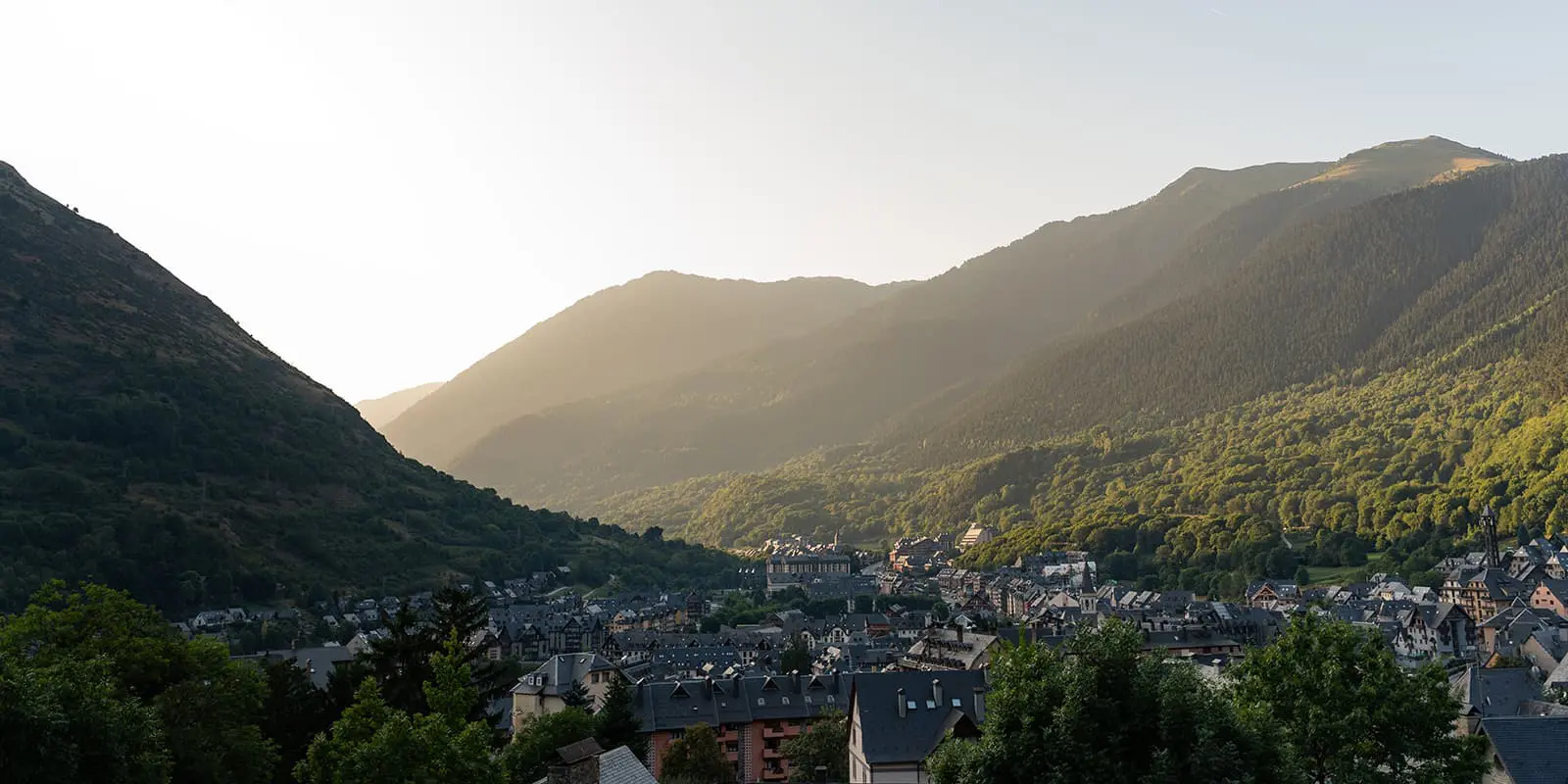
The trail starts in the mountain village of Vielha. Close to the church of Gausac, the PR115 ascends to the Bassa d’Oles Lake in a forest at the foot of Montcorbison. From there, it continues to the Roca Sacòsta, where horses graze on the meadows. You will get to enjoy views over the valley and of the Tuc dera Entecada here. Next to Eth Santet, a picnic area invites you for a break, much deserved already. Afterward, the path descends into the Artiga de Lin Valley and reaches the Hermitage of the Mair de Dieu dera Artiga. You’ll hike past a stunning waterfall and over a bridge before the next ascent takes you over log steps through a forest. A stone gate marks the entrance to the Plan dera Artiga de Lin and onward to the mountain hut with the same name: Refugi dera Artiga de Lin.

The second stage takes you from Spain to France. When leaving the Refugi dera Artiga de Lin, the patch leads up the Pomero channel to the Collado del Infern. The ascent is followed by a descent over alpine meadows down to the Col de la Montjoia, with views over the Luchon Valley. This stage ends at the Hospice de France.

On the way from the Hospice de France to the Hospice de Benasque, you will pass the Puerto de Benasque, which connects France with Aragon. An ascent then leads down to the Boum Lakes. From here, you’ll have a stunning preview of the winding path ahead of you, which leads up to the next mountain pass with a view over the Aneto-Maladetas massif. The following descent then leads through a forest and over meadows to the Hospital de Benasque, a spa hotel in the park.

The fourth stage takes you all the way down into the valley to its capital, Benasque. Benasque has quite a lot to offer, from the Benasque Baths, an ancient establishment of thermal waters over the old town, to its town hall, to impressive stately homes. The path continues along a road, which used to connect Zaragoza and Toulouse and ends in the ski area Cerler.

From Cerler, you can either shorten the route and take a cab service to Ampriu or stick to the official route. The official route will lead you through the  Ampriu Valley and up another mountain pass, where the landscape changes.

While the southern part of the massif is sunny with alpine meadows, the north of the valley is closed by the Sierra Negra. You’ll find that down in the valley flows the Baliera River. The trail then takes you through the villages of Fonchanina and Castanesa before it reaches Ca de Graus in the village of Castanesa.

From the village of Castanesa to the village of Aneto, the trail leads along a long hill of meadows to the Comadelo. From the Comadelo it descends to the pass of Salinas and further down to the village of Aneto.

The seventh and last stage leads from the village of Aneto to the village of Senet. Past the Noguera Ribagorzana River, the path ascends until the Hospital of Vielha. Along the way, you will get to see some remains from the past, such as bunkers of the war and remains of the old paved road for horses. Just before the pass, it is possible to see all the Aneto massif with its glaciers to the west. And just after the pass, a long descent will take you first through a mountain cirque and then through a forest all the way back to Vielha.

Stages

The Tour del Aneto clásico is usually hiked in seven stages. As the trail is a circuit, it can be hiked clockwise or counterclockwise.

Tour del Aneto 7-day itinerary

Stage 1:

Vielha – Refugio Artiga de Lin, 14.9 km | 9.3 mi

Stage 2:

Refugio Artiga de Lin – Hospice de France, 10.1 km |  6.3 mi

Stage 3:

Hospice de France – Hospice de Benasque, 10.4 km |  6.5 mi

Stage 4:

Hospice de Benasque – Cerler, 17.7 km | 11 mi

Stage 5:

Cerler – Castanesa, 22.2 km | 13.8 mi

Stage 6:

Castanesa – Aneto Pueblo, 18.5 km | 11.5 mi

Stage 7:

Aneto Pueblo – Vielha, 23.6 km | 14.7 mi

Accommodations

There are different kinds of accommodation, from mountain huts to lodging (campsites, hostels, guesthouses, hotels) in the villages, along the way. Just be sure to book your accommodations in advance, especially during the high season (July and August).

Accommodations per stage

Stage 4:

Cerler (guesthouses, hotels)

Stage 5:

Ca de Graus in Castanesa

Stage 6:

Casa Moline in Aneto Pueblo

Stage 7:

Vielha (campsites, hostels, guesthouses, hotels)

Best time of the year

The best time to hike the Tour del Aneto is from June through October when the high mountain passes are free from snow and the mountain huts are open. This trail is open much later than most mountain trails in Europe, through October. Because of this, it can be a great option for an end-of-season hike, or just to enjoy cooler weather. If you’ve been seeing storms on the forecast though, be sure to reach out and talk with the hut wardens or other folks who have hiked the trail in the same season. They’ll be able to give you insights on how to best prepare and what the trail conditions are like in real time.

Safety & Gear

Being in the mountains for a week can be a lot of fun, especially when you’ve prepared properly. If you walk by yourself, be sure to share your plans with somebody else for your own safety. Make sure to also update them if you switch the plans around last minute.

Weather in the high mountains can change very quickly, which means you need to have the right gear and a plan in place. Bring clothing that will handle different challenges – from cold to rain to wind, you’ll want to have gear that will keep you comfortable. We have a complete packing list for hut-to-hut tours here.

Difficulty

The Tour del Aneto is graded as a moderate hiking trail. It is challenging because of the distance and elevation gain, but not very difficult from a technical point of view. The length of the tour can also present a difficulty, but can easily be trained for ahead of time. Taking test hikes and walks can help you understand your physical limitations and fitness levels before heading into the mountains for a week. Shakeout trips are also a great chance to try your gear and break in your shoes before you begin the real hike.

Good to know

You can reach the start of the trail in Vielha by public transport from Barcelona, Madrid, or Lleida. If you travel by car, there is a free parking lot in front of the Hotel or a few minutes from the Hotel.

Additionally, you can fill up your water at the mountain huts and villages between the stages. Make sure to take enough drinking water for the day and top up your water supply whenever possible. Especially in remote sections or near livestock grazing areas, it is recommended to use a water filter or purification tablets.

route
circuit
highest point
3.404m (11.167 ft)

Want to submit a trail or make this page more complete?

Always read the disclaimer

Terms of Use: important to all visitors on this website. We strive to publish high quality content and information on this website. However it’s always possible that we’re missing out on some crucial information. In spite of the fact that this route, associated GPS track (GPX and maps) were prepared under diligent research by the specified contributor and/or contributors, the accuracy of such and judgement of the author is not guaranteed. Therefore, hiking-trails.com and contributors are in no way liable for personal injury, damage to personal property, or any other such situation that might happen to individuals hiking or following this route. Should you choose to hike this trail, this is always at your own risk. Check out our guidelines for safety hiking and Leave No Trace principles at the hiking 101 page.

Download GPX

Join the community!

Login or create a FREE account 😊

With an account you can:

Download GPX files

Pin trails to your wishlist

Mark trails as hiked by you

Rate hiking trails

Comment on trails, blogs and gear reviews

Happy trails!
Login

Don't have an account yet? Register here