Panoramic view of grassy mountains with body of water in the background

The Premužić Trail

Premužićeva Staza

About the The Premužić Trail

country
Croatia
length
57 km(35 mi)
Type of trail
Long-distance
difficulty

Difficulty is highly personal. Be aware of the weather conditions as bad weather turns easier trails in difficult trails especially in the mountains.

Easy
accommodation

Lodging means a mix of hotels, hostels or AirBnB’s.

Mountain huts, Shelters
Elevation gain
1752 m(5748 ft)
terrain
Mountains, Coastal, Forest
remoteness
Some of the time
Show more

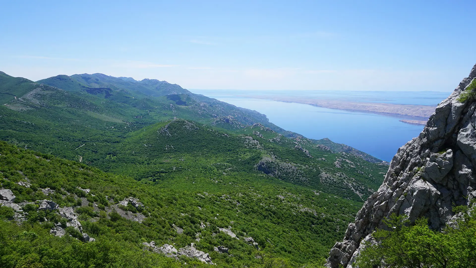
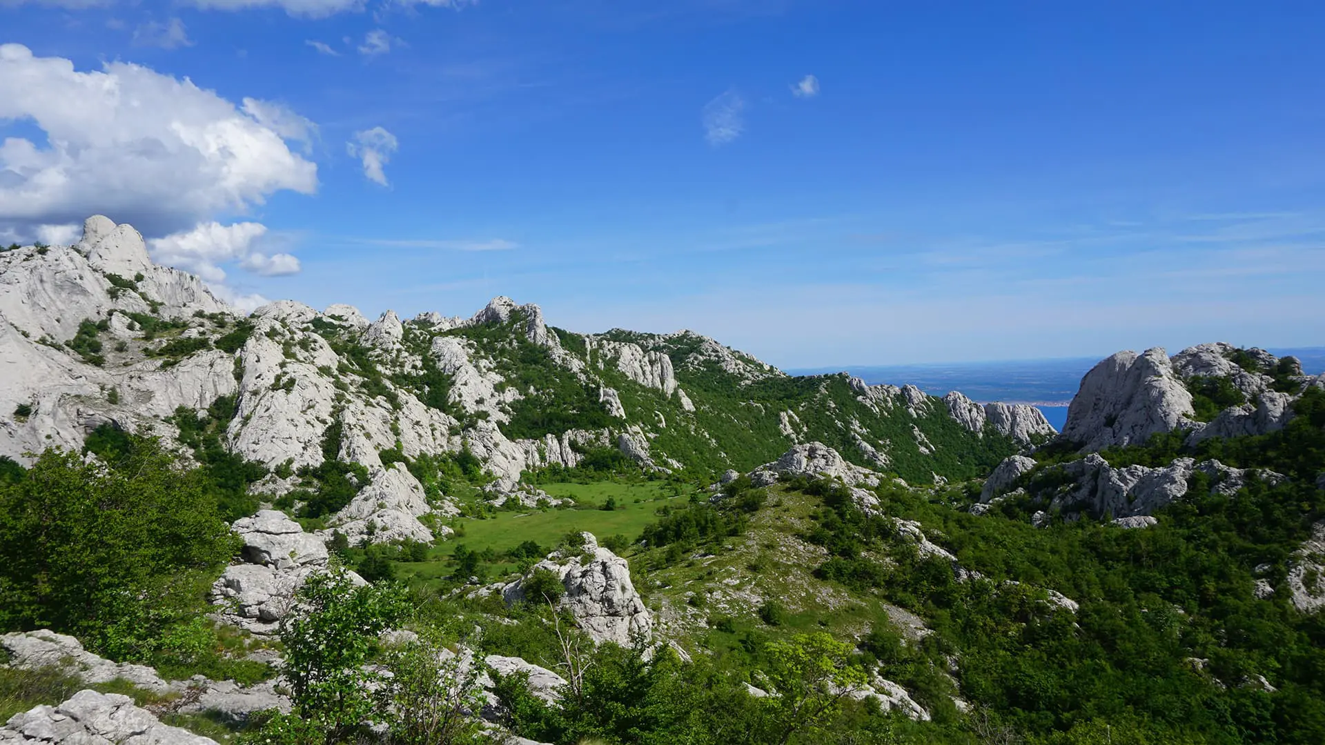
Along Croatia’s coastline, the Velebit mountain range looms above rocky beaches and seaside towns filled with tourists. These mountains were inaccessible for ages, making it impossible to access until recent history.

That is, until mountaineer and engineer Ante Premužić started construction on a trail that would cross this karst wilderness. After three years of intense labor, the trail was finally finished in 1933. It became known as the Premužić Trail, and it still serves as the only way to cross the higher peaks of Velebit National Park on foot.

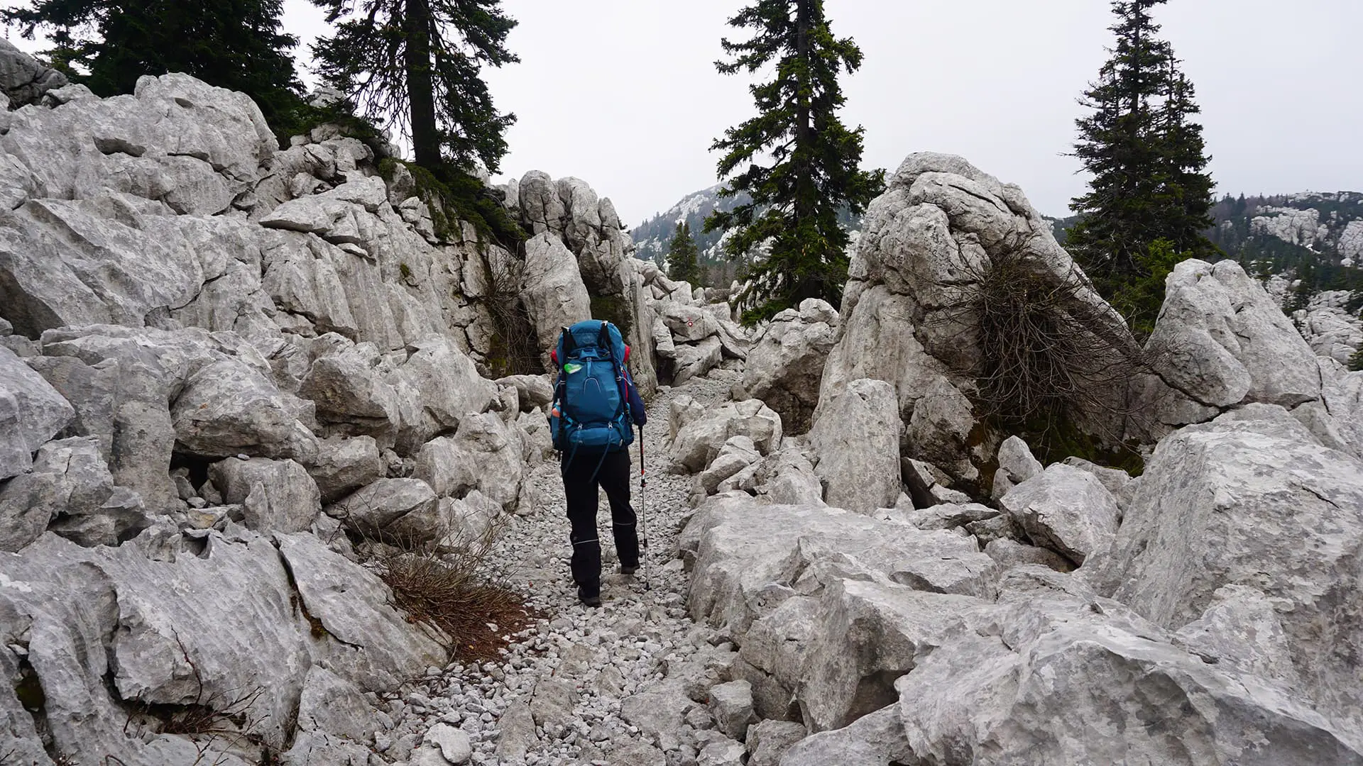
One of the most notable features of the Premužić Trail is the way it is constructed. Built with what is called the ‘drystone technique’, the trail is built out of carefully placed stones that create a solid footpath through even the roughest terrain.

man standing in green landscape

Roel Zerner

Blessed with the blissful curse of wanderlust, Roel has built his life around adventurous travel since 2018. He can either be found roaming remote wilderness or on the outskirts of mass tourism, hunting for unique experiences among worn-out tourist trails. Over the years, his ambition to become a full-time travel writer has led him to explore trails and adventurous destinations all over the world. You can follow his adventures on Instagram @beatthetrail or via his website.

View profile

The Trail

This also means that you can walk the Premužić Trail even if you are new to mountain hiking; no mountaineering skills are necessary to hike this well-maintained footpath.

The trail winds its way through the impressive karst and sandstone formations of Velebit National Park, where birds of prey soar high above deep crevasses and forested valleys. If you’re really lucky, you might even spot a bear or wolf, although they usually stay in the more remote parts of the park. There are plenty of chamois goat-antelope to be seen, and if you pay attention you might spot the occasional lizard or fox.

But the main attraction of the Premužić Trail is its views: from jagged rocky formations to panoramas of the Adriatic Sea and the coastline far below. You will cross high meadows blooming with mountain flowers before descending into green valleys where only the occasional ruin will remind you of the mountain villages that used to exist in the area.

Along the way, you’ll encounter many free shelters where you can hide from bad weather. The relatively short sections of the trail mean there are plenty of opportunities to take a break in one of these shelters without sacrificing too much valuable daylight. And if you can put in a little extra effort to climb one of the many peaks along the way, you’ll find short detours marked with signs to guide you there and back.

On the final stage of the Premužić Trail, you’ll make your way through gentle terrain, toward the village of Baške Oštarije. Here you’ll find plenty of options to spend the night or continue along the Velebit hiking trail that continues southwards. From Baške Oštarije you can also find public transport options to take you towards Zadar or back to Senj.

Stages

The trail is relatively short, with only 3 stages, but you can add variations like extending to the Velebit hiking trail that continues southwards. Otherwise, you can use public transportation to take you back to the city.

3 stages of the Premužić Trail

Stage 1:

Zavižan mountain hut – Alan hut, 16 km | 10 mi

Stage 2:

Alan hut – Scorpovac shelter, 20 km | 12.4 mi

Stage 3:

Scorpovac shelter – Baške Oštarije, 14 km | 8.7 mi

Accommodations

As the Premužić Trail is located within Velebit National Park, it is strictly forbidden to camp or light a fire along the trail. Luckily, the trail is well provided with accommodation options, from full-service mountain huts to more primitive free shelters.

The trail starts at the Zavižan mountain hut, which is a fully staffed hut that provides rooms and cooked meals. From here, you can also go on guided excursions into the surrounding area. It is recommended to book a stay beforehand, especially in July, August, and on weekends.

A little down the trail, Rossijeva shelter perches on a rocky cliff to provide a suitable roof above your head for a lunch break or emergency sleepover.

At the end of the first section, Alan Mountain Hut provides a comfortable way to spend the night in a staffed facility with hot-cooked meals. Again, calling ahead for bookings is recommended. In case the hut is closed or full, it is possible to camp in the surrounding area. Be sure to ask the staff before you pitch, though!

Halfway down the second section of the trail, Ograđenica shelter provides stunning views of the sea and the surrounding peaks. The trail then continues towards Skorpovac shelter, which is located among the ruins of an old mountain settlement. This free shelter has a fully equipped kitchen, but you’ll need to bring food and fuel.

The final section has you walk towards the village of Baške Oštarije. Here you’ll find numerous accommodation options and a campsite located east down the main road.

Overnight stays

Stage 1:

Alan mountain hut

Stage 2:

Skorpovac shelter

Stage 3:

Baške Oštarije village (multiple options)

Best time of the year

Up in the Velebit mountains, the climate is much cooler in the hot summer months, due to a fresh breeze blowing in from the Adriatic Sea. In winter, the trail is all but inaccessible because of heavy snow, so the best time to walk the Premužić Trail is from early June to late September.

Most locals will walk the trail in early June or late September, to avoid the hot temperatures in July and August. In the hot summer months, most springs and water sources will dry up, so it is strongly recommended to bring at least four liters of water with you when walking in July and August.

Safety & Gear

When planning your hike, make sure to research details like difficulty, length, and terrain to prepare yourself. Use multiple sources for information, including guidebooks and local organizations.

Other simple ways to stay safe include sharing your hiking plans with people you trust, checking the weather forecast for extreme weather, and packing enough water and snacks. Finally, familiarize yourself with the trail map!

Good to know

The approach to the trailhead starts at the village of Oltari. You can take a bus from Senj twice a day, and you can stay at the Oltari hut in the village if necessary. From Oltari it is a 3-4 hour walk to the Zavizan hut and the start of the Premužić trail.

The Premužić trail is part of the larger Velebit hiking trail, you can find more info here.

Refill your water at mountain huts because you’ll only find occasional water sources along the trail. In summer, make sure to carry an extra liter of water as the heat dries out many water sources.

Route
Point to point
Highest point
1630m (5347ft)

Guidebooks

Guidebook cover

Walks and Treks in Croatia

View guidebook

Want to submit a trail or make this page more complete?

Comments

Be the first one to comment on this trail!

Reply to this trail

Your email address will not be published. Required fields are marked *

Reply to this trail

Log in to comment on this trail
Always read the disclaimer

Terms of Use: important to all visitors on this website. We strive to publish high quality content and information on this website. However it’s always possible that we’re missing out on some crucial information. In spite of the fact that this route, associated GPS track (GPX and maps) were prepared under diligent research by the specified contributor and/or contributors, the accuracy of such and judgement of the author is not guaranteed. Therefore, hiking-trails.com and contributors are in no way liable for personal injury, damage to personal property, or any other such situation that might happen to individuals hiking or following this route. Should you choose to hike this trail, this is always at your own risk. Check out our guidelines for safety hiking and Leave No Trace principles at the hiking 101 page.

Download GPX

Join the community!

Login or create a FREE account 😊

With an account you can:

Download GPX files

Pin trails to your wishlist

Mark trails as hiked by you

Rate hiking trails

Comment on trails, blogs and gear reviews

Happy trails!
Login

Don't have an account yet? Register here