About the The Bishorn Climb

Alps
country
Switzerland
length
18.2 km(11 mi)
Type of trail
Hut to hut, Long-distance
difficulty

Difficulty is highly personal. Be aware of the weather conditions as bad weather turns easier trails in difficult trails especially in the mountains.

Difficult
accommodation

Lodging means a mix of hotels, hostels or AirBnB’s.

Mountain huts, Lodging
Elevation gain
2553 m(8376 ft)
terrain
Mountains
remoteness
Most of the time
Show more

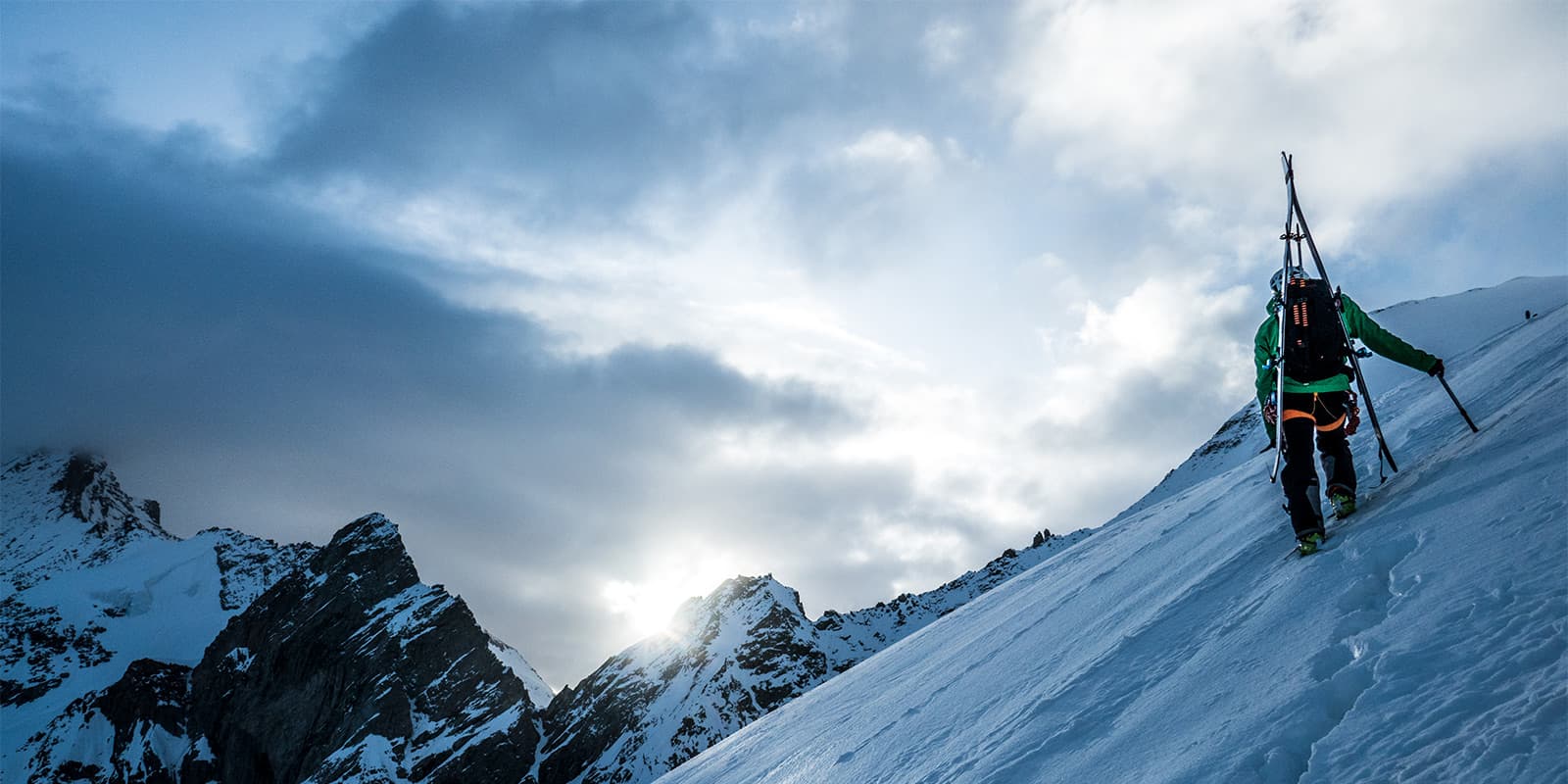
The Bishorn is one of the 82 iconic ‘4000ers’ of the Alps. While its ascent is relatively accessible, proper acclimatization and solid training are essential to fully enjoy the experience. Reaching the summit feels like standing on top of the world, with a 360° panorama over some of the most magnificent peaks in the Alps, including the Weisshorn, Obergabelhorn, and Zinalrothorn.

The hike is best done with a guide, as the peak is glacial and has crevasses to navigate. If you’re looking for an overnight adventure, this is a truly unforgettable climb into the heart of high-altitude grandeur.

Elmar profile picture
Editor

Elmar Teegelbeckers

Passionate hiker Elmar spends months of his time on the trail. He’s usually on the lookout for hidden gems in one of his favourite countries such as Slovenia, Switzerland and Japan. He founded hiking-trails.com in need for a community and detailed information about the trails. Before this, he worked for the Alpine asscociation in the Netherlands[ (NKBV) but lost his heart to the trails.

Not long ago, Elmar published the book (in Dutch) Hiking Trails – best long-distance trails in Europe. With this book, website and socials, he hopes to inspire and shape an inclusive community for hikers all over world. No matter your speed, experience or level, you can get out there to enjoy the trails and connect with the heartwarming hiking community. Life is so much better outside and he hopes to inspire hikers to take their first, or next, step on the trail.

You can reach Elmar at info@hiking-trails.com.

View profile

The Trail

The first day is a good warm-up, as you need to climb 1600m to reach the hut. It’s best to start early since dinner at the hut is served at 6 PM. The initial section leads through a forest, which is left behind around 2000m after crossing the Tracuit stream. From there, the valley gradually fades below as you ascend via long switchbacks. The slope becomes steeper until you pass a visible waterfall. After this point, the trail eases slightly and continues on an open path.

There is only one route, so navigation is straightforward. Further along, the path passes by the ruins of an old barn, which is a good spot for a lunch break. The final section consists of a long moraine crossing, where it is crucial to follow the white-red-white trail markings. A short passage with a fixed chain leads to the ridge at the pass between the Anniviers and Turtmann valleys, where the hut (3256m) is located. The view from the hut is spectacular, featuring the Bishorn, Weisshorn, Zinalrothorn, Dent Blanche, and the Anniviers Valley.

The hut wardens wake climbers at 5 AM (or at 2 AM for those heading to the Weisshorn). After a solid breakfast, the Bishorn ascent begins. From the hut, head east to a small cross (less than 100m away), then traverse the Turtmann Glacier eastward to a first col, or immediately step onto the glacier near the hut. Most of the time, it’s enough to follow the existing track and roped parties. Initially, the route winds through crevasses, which may be quite open depending on the season.

Gradually, the slope steepens towards the saddle between the Bishorn’s two summits. The final section leads to the right-hand summit, where a relatively steep (35-40°) snow slope must be climbed to reach the top, crossing a large crevasse just before the summit. The descent follows the same route. However, it is a long and demanding return, as you must descend the full 2500m gained over the two days in one go.

Stages

The hike is usually done in two days. You’ll climb to the Tractuit Hut on the first day, and then summit Bishorn and descend back to Zinal on the second day. It’s helpful to spend time acclimatizing to the elevation before starting a hike like this, so some people also book two nights at the hut and spend a full day there doing smaller hikes in the area before climbing Bishorn on the third day.

2-day itinerary of the Bishorn Climb

Stage 1:

Zinal – Cabane de Tracuit, 8.4 km | 5.2 mi (+1656m)

Stage 2:

Cabane de Tracuit – Top of the Bishorn – Zinal, 16.4 km | 10.2 mi (+897m -2553m)

Accommodations

There are a few options for where to stay in Zinal on either side of the trek, as it’s a town with many accommodations. You’ll likely want to sleep there the night you finish the trek, as the Bishorn summit and descent to Zinal can take between 12 and 14 hours. Below are a few recommendations. Additionally, you’ll need to book the Cabane de Tracuit for the overnight before you climb Bishorn. Be sure to book it far in advance to confirm they’ll have space for you!

Accommodation in Zinal: 

Best time of the year

This trail is accessible from June to September. That’s when the hut will be open, as well as the trails will be accessible. You’ll need to have fair weather for the summit of Bishorn, as it is 4151 meters. Always follow the decisions of your guide to decide if you will climb the peak.

If you’re unsure of the weather in the days before your hike, you can call the hut warden or email the tourism board for advice on the conditions of the trail. This is always advised before a difficult trail.

Safety & Gear

It is highly recommended to hire a guide for the ascent of the Bishorn. While this high-altitude hike is not extremely difficult, the final section takes place on a glacier, requiring you to navigate numerous crevasses. The presence of a professional guide will help you have a pleasant and safe hike. You can source a guide here.

You’ll need to pack the essentials, as well as gear specific to glacier crossings. This includes an ice axe, crampons, a helmet, and a sling. You will also want to bring hiking poles, a headlamp, and a first aid kit in case of emergency. Finally, download the GPX offline to your device for backup!

Difficulty

The Bishorn Climb is a difficult trail because of the glacier at the peak. You’ll have to navigate some deep crevasses, one right before the summit, for this hike. It is highly recommended to hire a guide to help you with this!

To train for the Bishorn Climb, taking long walks or runs will be helpful, especially with a full pack or weighted vest. If you’re training in a colder season, spending time on the treadmill and stairmaster, as well as working on balance exercises will be very helpful for this trail.

Good to know

Zinal is about a 2-hour drive from Chamonix, which you can easily reach by train or car. Additionally, some people decide to plan a second night at the Tractuit hut for acclimatization. There are other, smaller ascents nearby so you could fill a day there before hiking the Bishorn.

route
there-and-back
highest point
4.151M (13.618 ft)

Want to submit a trail or make this page more complete?

Always read the disclaimer

Terms of Use: important to all visitors on this website. We strive to publish high quality content and information on this website. However it’s always possible that we’re missing out on some crucial information. In spite of the fact that this route, associated GPS track (GPX and maps) were prepared under diligent research by the specified contributor and/or contributors, the accuracy of such and judgement of the author is not guaranteed. Therefore, hiking-trails.com and contributors are in no way liable for personal injury, damage to personal property, or any other such situation that might happen to individuals hiking or following this route. Should you choose to hike this trail, this is always at your own risk. Check out our guidelines for safety hiking and Leave No Trace principles at the hiking 101 page.

Download GPX

Join the community!

Login or create a FREE account 😊

With an account you can:

Download GPX files

Pin trails to your wishlist

Mark trails as hiked by you

Rate hiking trails

Comment on trails, blogs and gear reviews

Happy trails!
Login

Don't have an account yet? Register here