About the Thames Path

country
England
length
298 km(185 mi)
Type of trail
Long-distance
difficulty

Difficulty is highly personal. Be aware of the weather conditions as bad weather turns easier trails in difficult trails especially in the mountains.

Easy
accommodation

Lodging means a mix of hotels, hostels or AirBnB’s.

Lodging, Camping
Elevation gain
1460 m(4790 ft)
terrain
Countryside, Forest, Hills
remoteness
None of the time
Show more

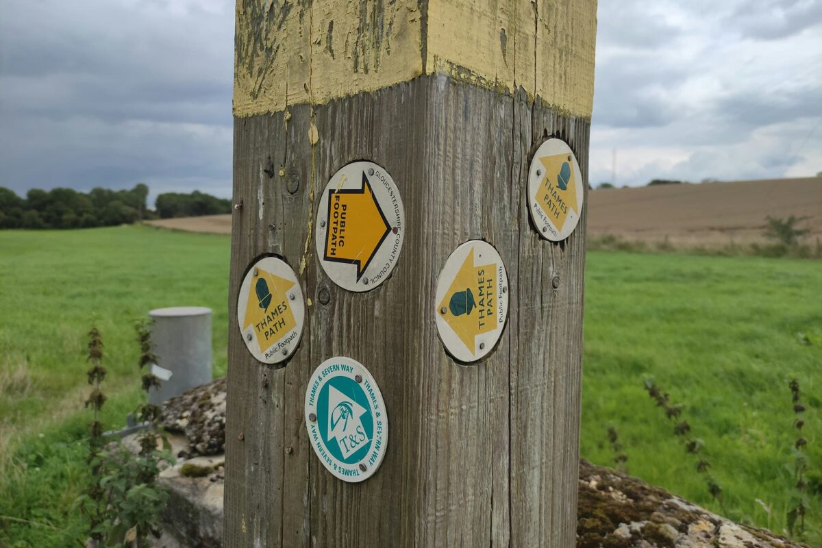
The Thames Path is a long-distance hiking trail in England that follows the river Thames from the Cotswold villages to London, Oxford, and beyond. The trail reveals England’s history at every turn. Plus, you’ll see landmarks such as Hampton Court Palace and the Tower of London, packing a lot of history into your walk. The trail is listed as one of England’s National Trails and is one of the longest river-side walks in the country at almost 300 kilometers.

This trail is known for its accessibility. Whether you’re an experienced hiker or just love a good walk, the Thames Path has something for everyone. It’s easy to reach by public transport, so you can hike it in sections if you want, especially the stages close to the larger cities of London and Oxford.

Profile picture Tiina Gollum

Tiina Golub

Tiina has been running, hiking, and describing trails for over a decade. She grew up in the Baltics, which instilled her with love for forest trails, wild swimming, and foraging. Outside of her day job as a product designer, she regularly competes in endurance running races and enjoys exploring the UK and European trails on foot. You can follow Tiina on Instagram @tiinagolub.

View profile

The Trail

Starting in the village of Kemble, where the Cotswold hills meet the River Thames, the trail begins in a charming landscape. With hills, woodlands, and the river nearby, it sets the perfect mood, almost as if in a fairytale storybook.

As you head downstream, you’ll see historic towns like Oxford and Abingdon, known for their culture and academia. The trail then takes you through more fields, meadows, and woodlands, offering peaceful spots under towering trees. These are the perfect spots for taking a break and soaking it all in (plus a little mid-day nap!).

Closer to London, the Thames Path quickly shifts from rural to urban. You’ll see landmarks like TATE Modern, the Shard, and Tower Bridge as you walk along the urban riverfronts.

Past London, the trail changes up again. The river widens, and marshes and tidal flats come into view, full of birdlife. Watch for flocks of dunlins, curlews poking in the mud, and terns diving for fish. The path ends at the Thames Barrier, a cool site of engineering that shows how nature and human skill can work together.

Stages

There are many ways to break up this long-distance trail into daily sections depending on your level of fitness and travel plans. Here’s an example of an eighteen-days itinerary:

Stage 1:

Kemble – Cricklade, 11 km | 7 mi

Stage 2:

Cricklade – Lechlade, 17 km | 11 mi

Stage 3:

Lechlade – Radcot, 13 km | 8 mi

Stage 4:

Radcot – Newbridge, 17 km | 11 mi

Stage 5:

Newbridge – Oxford, 11 km | 7 mi

Stage 6:

Oxford – Abingdon, 13 km | 8 mi

Stage 7:

Abingdon – Wallingford, 16 km | 10 mi

Stage 8:

Wallingford – Goring-on-Thames, 19 km | 12 mi

Stage 9:

Goring-on-Thames – Henley-on-Thames, 23 km | 14 mi

Stage 10:

Henley-on-Thames – Marlow, 16 km | 10 mi

Stage 11:

Marlow – Maidenhead, 14 km | 9 mi

Stage 12:

Maidenhead – Windsor, 14 km | 9 mi

Stage 13:

Windsor – Staines, 13 km | 8 mi

Stage 14:

Staines – Hampton Court, 23 km | 14 mi

Stage 15:

Hampton Court – Richmond, 20 km | 12.5 mi

Stage 16:

Richmond – Putney Bridge, 26 km | 16 mi

Stage 17:

Putney Bridge – Tower Bridge (Central London), 23 km | 14 mi

Stage 18:

Tower Bridge – the Thames Barrier, 12 km | 7.5 mi

Accommodations

Along the way, you can stay in cozy B&Bs, charming inns, or modern hotels. There are also some camping options if you’re determined to get the most of your time in nature.

In rural areas, you’ll find historic inns and traditional bed-and-breakfasts. As you get closer to places like Oxford and London, there are more luxury options too.

There are also some camping sites along the way, but not for the whole trail.

You can find a list of recommended places to stay along the Thames Path on the National Trails website.

Best time of the year

You can hike The Thames Path year-round. Each season will be a new experience and offer something different. Just be sure to pack the right gear and clothing for whenever you choose to go!

Safety & Gear

The Thames Path is one of the most accessible trails in the UK – it’s reasonably flat, well-signposted, and traverses multiple major urban centers.

If you’re attempting a multi-day trek, plan and share your itinerary and expected return time. Consider bringing a mobile phone or other portable devices for navigation, but be mindful that reception can be inconsistent along certain stretches of the trail, so pack a paper map and pay close attention to the signs.

While the Thames Path welcomes visitors all year round, be especially cautious if hiking in late autumn and winter, or in difficult weather conditions, as stretches of the path can get very muddy and, occasionally, flooded.

Respect any signage or warnings along the path, and be mindful of potential hazards to ensure a pleasant experience for all.

Good to know

You’ll find enough water points in villages and towns along the way, so no need to carry more than the daily supply.

Also be aware that due to its accessibility and proximity to major urban centers, this trail gets very busy, especially in peak season. And, of course, the sections in London and the larger cities will stay busy throughout the year, no matter the season.

Route
Point to point
Highest point
Coombe Hill (slightly off the trail), 260m (853 ft)

Guidebooks

Thames Path guidebook Cicerone

Guidebook Thames Path

View guidebook

Want to submit a trail or make this page more complete?

Comments

Be the first one to comment on this trail!

Reply to this trail

Your email address will not be published. Required fields are marked *

Reply to this trail

Log in to comment on this trail
Always read the disclaimer

Terms of Use: important to all visitors on this website. We strive to publish high quality content and information on this website. However it’s always possible that we’re missing out on some crucial information. In spite of the fact that this route, associated GPS track (GPX and maps) were prepared under diligent research by the specified contributor and/or contributors, the accuracy of such and judgement of the author is not guaranteed. Therefore, hiking-trails.com and contributors are in no way liable for personal injury, damage to personal property, or any other such situation that might happen to individuals hiking or following this route. Should you choose to hike this trail, this is always at your own risk. Check out our guidelines for safety hiking and Leave No Trace principles at the hiking 101 page.

Download GPX

Join the community!

Login or create a FREE account 😊

With an account you can:

Download GPX files

Pin trails to your wishlist

Mark trails as hiked by you

Rate hiking trails

Comment on trails, blogs and gear reviews

Happy trails!
Login

Don't have an account yet? Register here