Logo Aletsch Arena

About the Suspension Bridge Trail

Aletsch Arena
country
Switzerland
length
86 km(53 mi)
Type of trail
Long-distance
difficulty

Difficulty is highly personal. Be aware of the weather conditions as bad weather turns easier trails in difficult trails especially in the mountains.

Moderate
accommodation

Lodging means a mix of hotels, hostels or AirBnB’s.

Lodging
Elevation gain
4830 m(15846 ft)
terrain
Mountains, Forest
remoteness
Some of the time
Show more

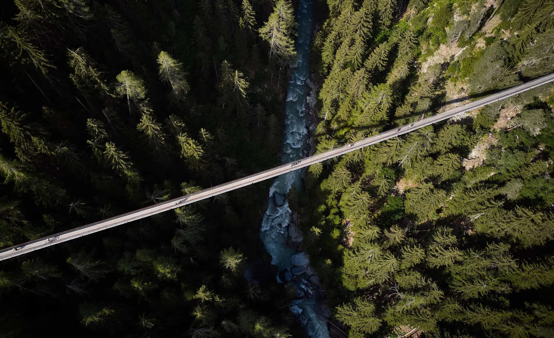
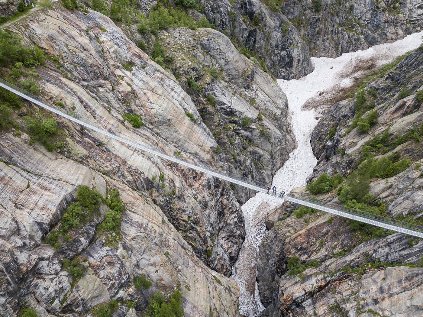
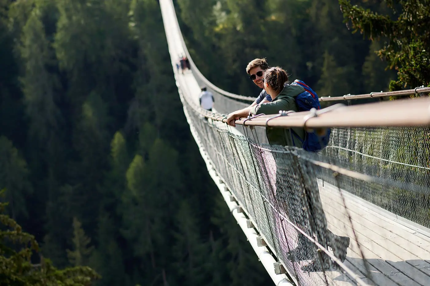
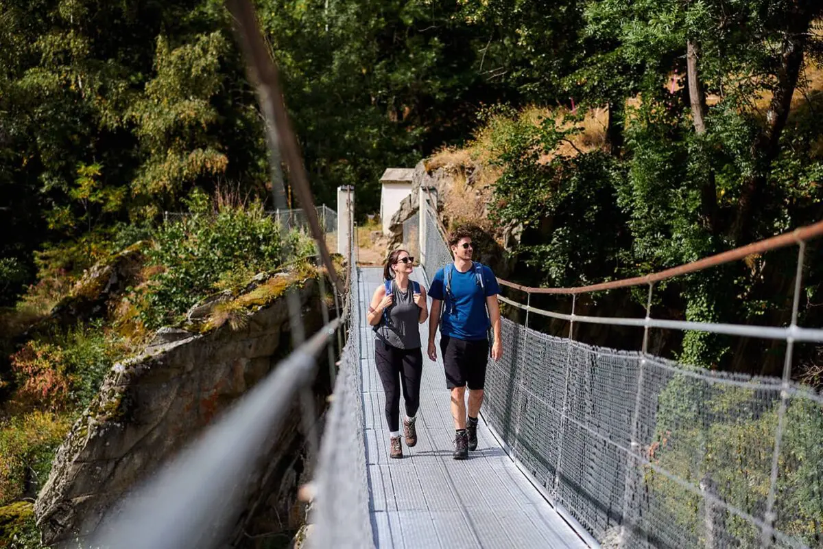
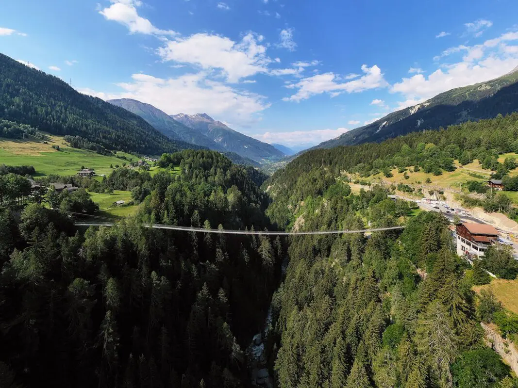
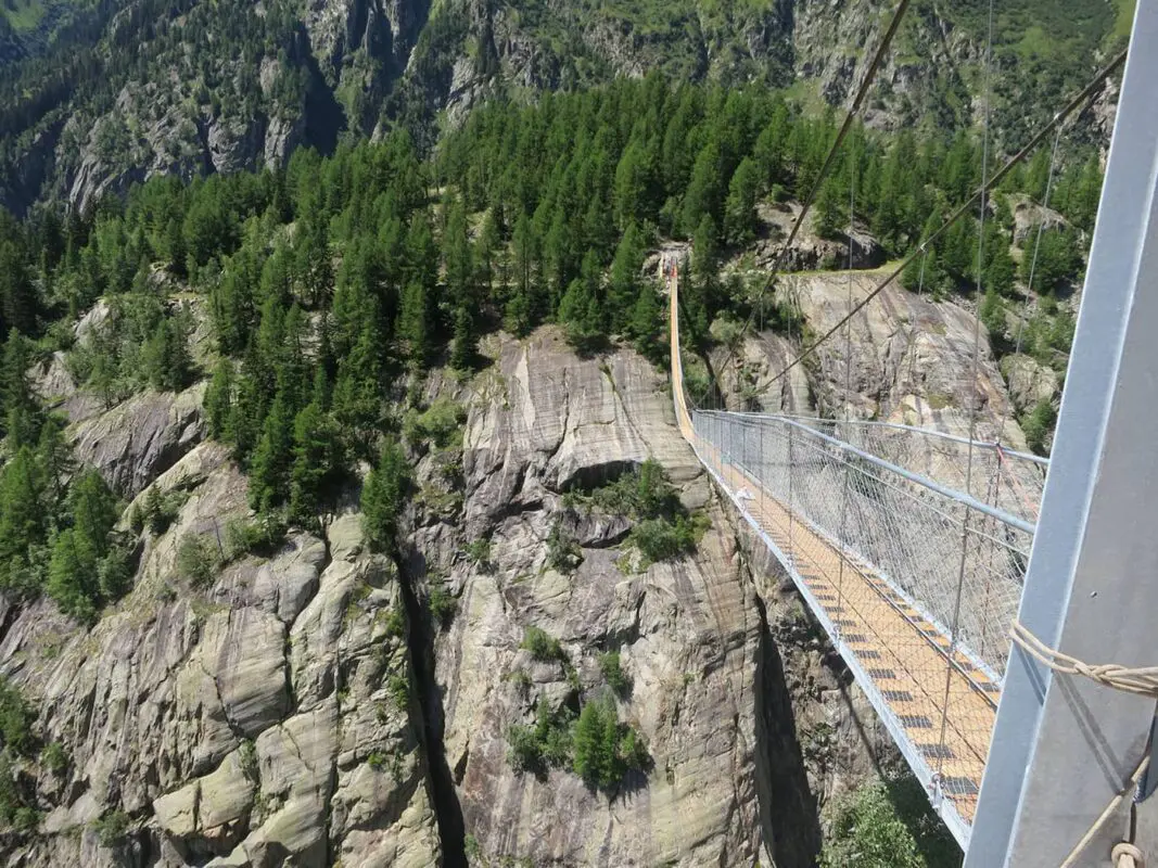
The Suspension Bridge Trail in the Aletsch Arena is a hidden gem through the valleys of Wallis, or Valais in French, in the Swiss Alps. This moderate to difficult trail covers approximately 86 kilometers in six stages, beginning in Bitsch and ending at Landstafel after traversing the several suspension bridges in the region. One of these bridges is the well-known 124-meter-long suspension bridge at Belalp-Riederalp. This suspension bridge stands as an absolute highlight of the Aletsch Arena. Positioned 80 meters above the Massa Gorge, and just before the entrance to the Aletsch Glacier.

The Aletsch Arena is nestled within the Swiss Alps Jungfrau-Aletsch UNESCO World Heritage Site and has an extensive network of 300 kilometers of hiking trails. The trails are for various skill levels, from high-altitude routes to family-friendly paths.

Editor

Elmar Teegelbeckers

Passionate hiker Elmar spends months of his time on the trail. He’s usually on the lookout for hidden gems in one of his favourite countries such as Slovenia, Switzerland and Japan. He founded hiking-trails.com in need for a community and detailed information about the trails. Before this, he worked for the Alpine asscociation in the Netherlands[ (NKBV) but lost his heart to the trails.

With this website and socials, he hopes to shape an inclusive community for hikers all over world. No matter your speed, experience or level, you can get out there to enjoy the trails and connect with the heartwarming hiking community. Life is so much better outside and he hopes to inspire hikers to take their first, or next, step on the trail.

View profile

The Trail

Each stage is about 4 to 6 hours of hiking, which will allow you to fully enjoy a slower pace in this beautiful region and UNESCO World Heritage site. As you know, the trails are well marked in Switzerland and you can find plenty of facilities like restaurants and shops in the villages. You’ll find accommodations in the mostly car-free mountain villages along the Suspension Bridge Trail such as Riederalp and Fiescheralp.

The area is known for everything from the Aletsch Glacier, the longest glacier in the Alps, to ancient stone pine forests that have stood for over a millennium. One of the highlights of the region is the collection of five suspension bridges situated in the Aletsch Goms area.

This is a truly unique hiking trail. The suspension bridges in the Aletsch Arena serve as key connectors across the valleys, linking areas in the rough terrain of the Swiss Alps. These bridges are engineered to cover the area’s gorges, providing access to isolated areas. Every stage ends in a village, some in car-free villages like Fiescheralp and Riederalp, offering a great place to stay before setting out on the next stage again.

Stages

You can hike the Suspension Bridge Trail at your own pace, choosing distances that suit your fitness level. We’ve put the recommended stages together with some points of interest so you can easily adapt the stages for your itinerary. Or just follow these 6 stages, it’s up to you!

Stage 1:

Bitsch – suspension bridge Massegga – Geimen – Blatten – Belalp (Aletschbord), 11.5 km | 7 mi

Stage 2:

Belalp (Aletschbord) – suspension bridge Belalp – Riederalp – Riederfurka – Riederalp, 9.5 km | 6 mi

Stage 3:

Riederalp – Riederfurka – Hohfluh – Moosfluh – Panoramaweg – Märjelensee – Fiescheralp, 17.5 km | 11 mi

Stage 4:

Fiescheralp – Unneres Tälli – Gletscherstube – Märjelenwang – Burghütte – suspension bridge Aspi-Titter – Ried – Bellwald, 14 km | 9 mi

Stage 5:

Bellwald -Fürgangen – suspension bridge Fürgangen-Mühlebach “Goms Bridge” – Mühlebach – Niederwald (Waldweg) – Reckingen, 18 km | 11 mi

Stage 6:

Reckingen – (Waldweg) – Ulrichen – suspension bridge Bodmer-Brücke – Ladstafel, 16.5 km | 10 mi

Accommodations

You can choose a variety of accommodations in the villages along the way. These are the suggested accommodation options at the end of this six-day itinerary.

Overnights per stage

Stage 1:

Belalp

Stage 4:

Bellwald

Stage 5:

Reckingen

Best time of the year

The best time to hike the Suspension Bridge Trail and overall in the Aletsch Arena is undoubtedly from July through late September. This is the best hiking season in the Aletsch Arena because the weather is the most stable. During this time the high-altitude meadows bloom with the flowers, and the trails are mostly snow-free. In June, there might be some snow on the trails, but by July they should be clear. The Aspi-Titter suspension bridge is closed from 1 November to 30 June (winter closure) and cannot be crossed during this time.

Safety & Gear

Before you begin your hike, check the weather forecast and be aware of the trail conditions such as snow. This trail is a moderate difficulty, so it is recommended to have completed some training or other trails in the season before this.

Bring a map and put the GPX on your mobile for navigation. Start with a fully charged mobile phone, and even bring a power bank if you have one. Dress in layers and always pack a hardshell and warmer jacket with you. Choose hiking shoes with a good grip. Make sure to also bring a first-aid kit, extra snacks, and water.

Mountain weather in general can change fast. Be prepared for sudden drops in temperature and unexpected rainfall by starting your day early to avoid being caught by afternoon thunderstorms. Stay on marked trails to minimize environmental impact and reduce the risk of getting lost. Say hi to other hikers and respect wildlife. Leave no trace by packing out all the trash.

Good to know

The trails cover varied terrain including high-altitude trails, rocky paths, and suspension bridges. We advise this only for hikers without fear of heights.

Route
Point to point
Highest point
2569m (8429 ft)

Guidebooks

Logo Aletsch Arena

Aletsch Arena Downloads

View guidebook

Want to submit a trail or make this page more complete?

Comments

Be the first one to comment on this trail!

Reply to this trail

Your email address will not be published. Required fields are marked *

Reply to this trail

Log in to comment on this trail
Always read the disclaimer

Terms of Use: important to all visitors on this website. We strive to publish high quality content and information on this website. However it’s always possible that we’re missing out on some crucial information. In spite of the fact that this route, associated GPS track (GPX and maps) were prepared under diligent research by the specified contributor and/or contributors, the accuracy of such and judgement of the author is not guaranteed. Therefore, hiking-trails.com and contributors are in no way liable for personal injury, damage to personal property, or any other such situation that might happen to individuals hiking or following this route. Should you choose to hike this trail, this is always at your own risk. Check out our guidelines for safety hiking and Leave No Trace principles at the hiking 101 page.

Download GPX

Join the community!

Login or create a FREE account 😊

With an account you can:

Download GPX files

Pin trails to your wishlist

Mark trails as hiked by you

Rate hiking trails

Comment on trails, blogs and gear reviews

Happy trails!
Login

Don't have an account yet? Register here