About the Streek-GR Kempen

country
Belgium
length
253 km(157 mi)
Type of trail
Long-distance
difficulty

Difficulty is highly personal. Be aware of the weather conditions as bad weather turns easier trails in difficult trails especially in the mountains.

Easy
accommodation

Lodging means a mix of hotels, hostels or AirBnB’s.

Lodging, Camping
Elevation gain
750 m(2461 ft)
terrain
Flat, Countryside, Forest
remoteness
Most of the time
Show more

High up north in Belgium, nestled between Antwerp (in the West), the ‘Maasvallei’ (in the East), the ‘Demervallei’ (in the South) and the border of the Netherlands (in the North), lies the region Kempen with its regional trail: the ‘Streek-GR Kempen.’

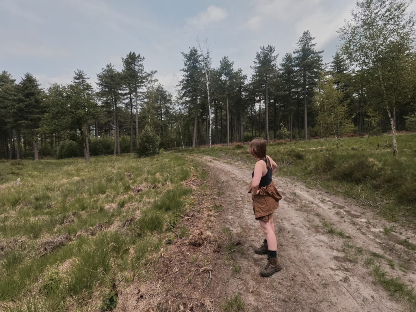
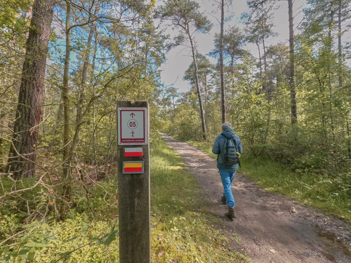
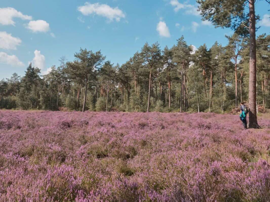
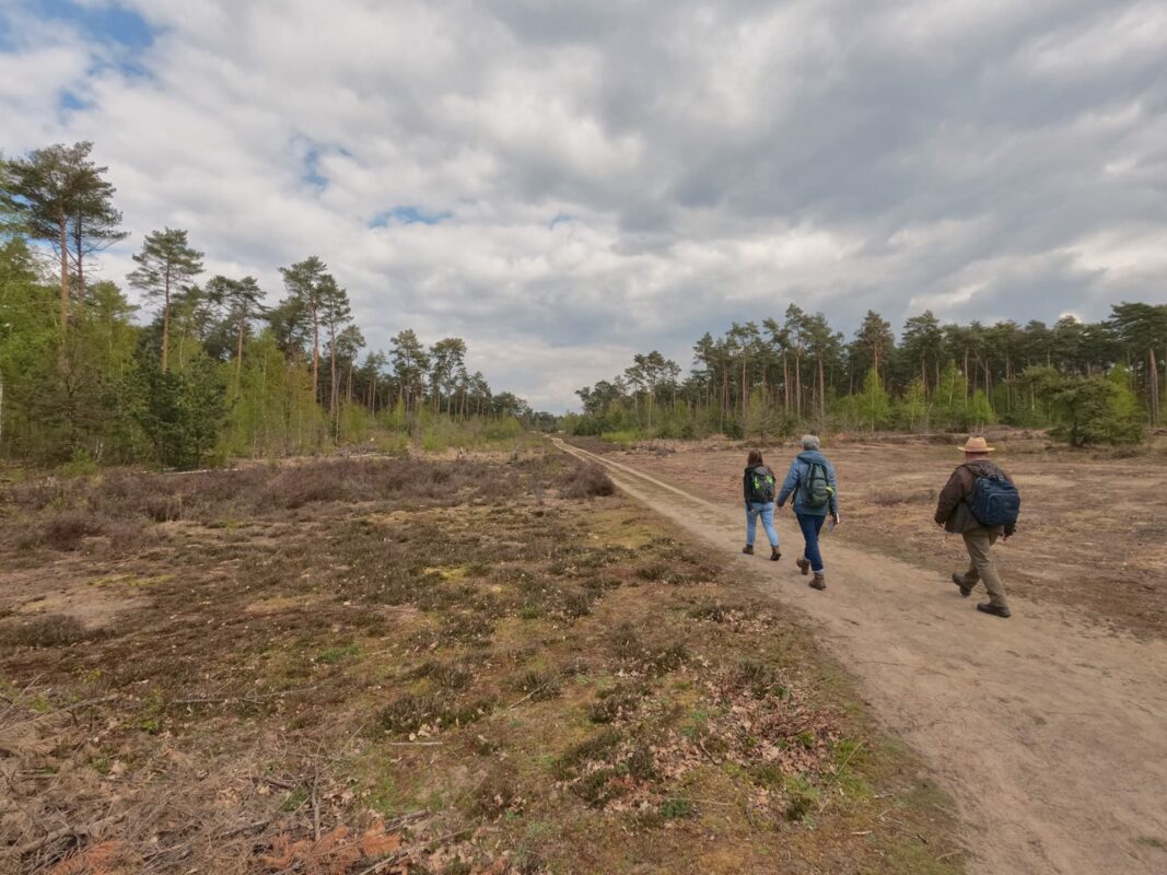
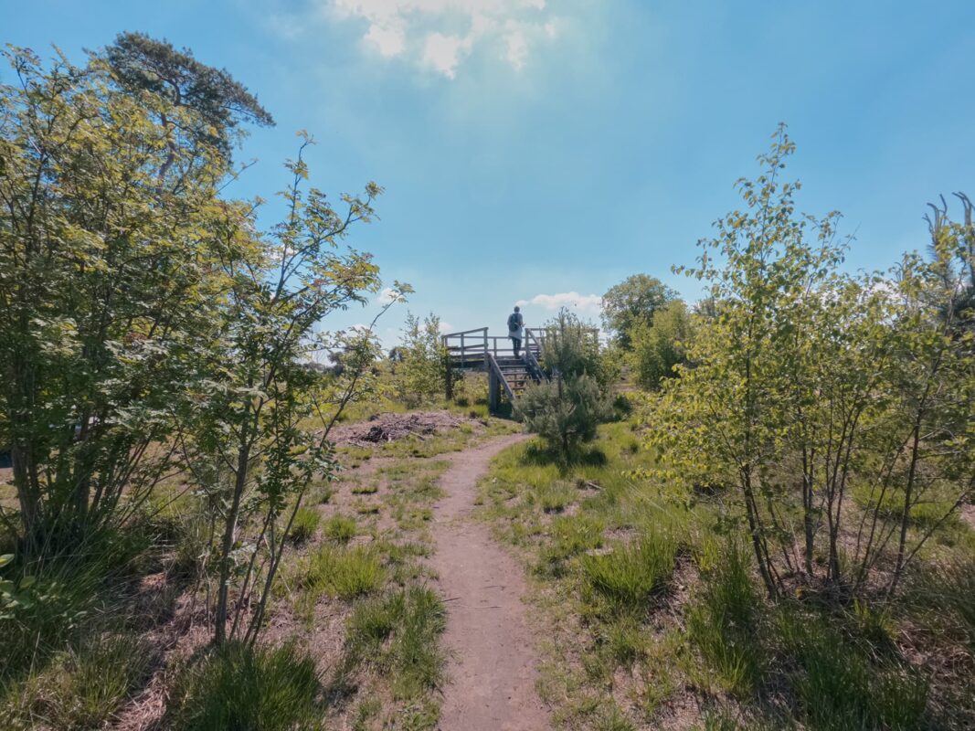
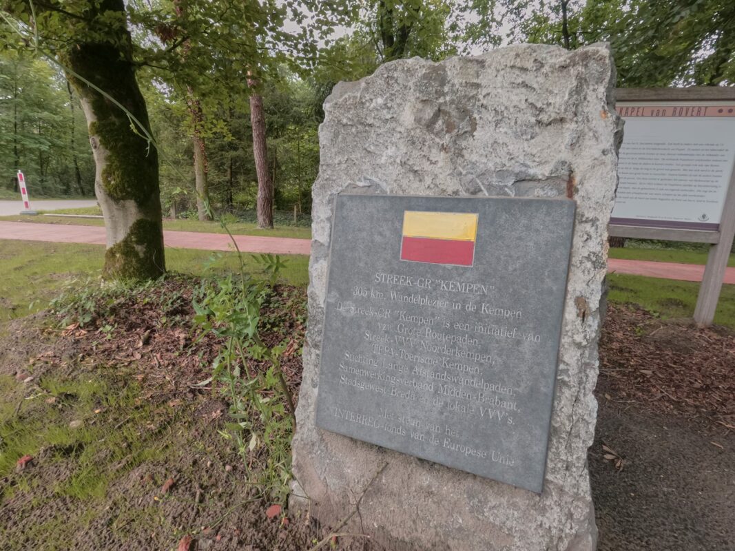
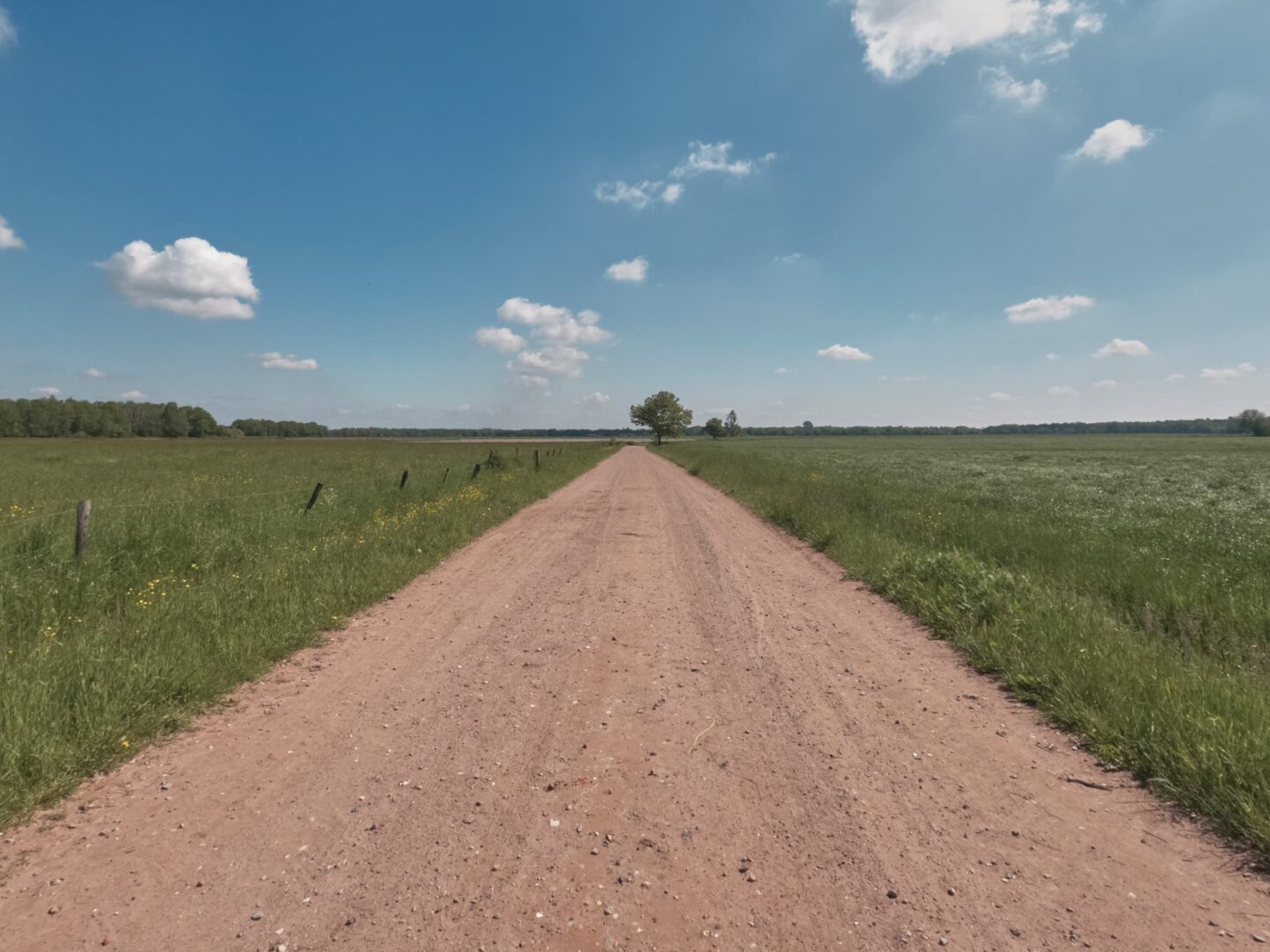
The ‘Streek-GR Kempen’ is with its 253 kilometers the longest regional trail of Flanders and fully covers, as the name indicates, the region ‘Antwerpse Kempen.’ ‘Kempen’ is mostly known for its dry and sandy grounds, however, one will be surprised by the diverse landscape the region has to offer. From blooming purple heather fields and scots pine forests to biodiversity in the fens to wide and ongoing meadows, this trail combines all the unique landscapes in one trek.

A great trail for its accessibility via public transportation, you can also hike the trail on day hikes. We recommend you use public transport to get to the starting and ending points, as well.

Women holding hiking pasport
Author

Hanne Govaerts

Hanne Govaerts is a Belgian outdoors enthusiast. During the week she works a full-time office job but every moment of spare time she tends to spend outdoors, on trail. Her passion for hiking started at the early age of 16, when she impulsively went on a summer camp hiking the Wicklow Way in Ireland. Ever since, her holidays have been filled with hiking trips such as the Matterhorn Trek in Switzerland and the Kumano Kodo Nakahechi Route in Japan. Hanne’s main goal is to hike all the Belgian long-distance trails. With its +/- 10.000 kilometers of trails throughout the country, it’s a challenge that should not be taken lightly. You can follow her hiking adventures on her Instagram account @hannehikes.

View profile

The Trail

‘Streek-GR Kempen’ officially starts in Herentals, due to the practical reason that the GR5 and the GR565 also pass through the city. However, since it is a circular route, the starting point can be chosen to everyone’s liking. Herentals is also considered the cultural capital of the region.

Once departed from Herentals, the trail quickly encounters the first and probably one of the most impressive pine forests of this trek. Not long after, during stage 2, the trail will let you discover the small village of Gierle which is considered a protected heritage. Before entering Turnhout, the trail runs along the ‘Bels Lijntje.’ The ‘Bels Lijntje’ is now a cycling route but used to be a train network running from Turnhout to Tilburg in the Netherlands. Starting from 1990, the use of this network has stopped and the tracks have been broken up.

Turnhout is the largest city the ‘Streek-GR Kempen’ will walk through and it promotes itself as the capital of the region Kempen. Just outside of Turnhout, the trail passes an area full of fens, which is filled with different plants and animals. After passing the fens and a big forest, the trail will cross the border with the Netherlands to pay a visit to the peculiar town of Baarle-Hertog. Baarle-Hertog is a Belgian town, located in the Netherlands. Here the border of the Netherlands and Belgium will literally pass through houses and front doors. Make sure to take a picture of you standing in Belgium and the Netherlands at the same time before heading towards Hoogstraten.

Hoogstraten is internationally known for its strawberries, so it is no surprise that ‘Streek-GR’ Kempen will pass multiple strawberry fields. Make sure to buy a little box of strawberries at a vending machine from a local farm before entering the town itself. After paying a visit to the lovely beguinage and taking in the beautiful sight of the church (often considered the ‘Cathedral of the region Kempen’), the trail will enter Wortel Kolonie, a big forest that is listed as UNESCO World Heritage. Walking further away from Wortel, the ‘Streek-GR Kempen’ will pass the church of Sint-Lenaarts, this church used to be a famous pilgrimage stop on the way to Santiago (St. James’ Way). Before arriving at Herentals again, the trail will treat you to one big and amazing forest in Zoersel. Don’t forget to visit the beguinage of Herentals, which is a perfect quiet and beautiful spot to reflect on your journey before heading home.

Stages

The Streek-GR Kempen is commonly hiked in 11 stages. Because the trek is a circuit, you can begin and end at any stage. However, we recommend Herentals because it is a junction for a few other trails as well, like the GR5 and the GR565.

Stage 1:

Herentals – Tielen, 25 km | 15.5 mi

Stage 2:

Tielen – Turnhout, 26 km | 16 mi

Stage 3:

Turnhout – Ravels, 20 km | 12.5 mi

Stage 4:

Ravels – Poppel, 26 km | 16 mi

Stage 5:

Poppel – Baarle-Hertog, 27 km | 16.7 mi

Stage 6:

Baarle-Hertog – Meersel-Dreef, 20 km | 12.5 mi

Stage 7:

Meersel-Dreef – Hoogstraten, 19 km | 11.8 mi

Stage 8:

Hoogstraten – Rijkevorsel, 19 km | 11.8 mi

Stage 9:

Rijkevorsel – Oostmalle, 20 km | 12.5 mi

Stage 10:

Oostmalle – Pulderbos, 24 km | 15 mi

Stage 11:

Pulderbos – Herentals, 26 km | 16 mi

Accommodations

Since the Streek-GR Kempen passes through lots of towns and isn’t a remote trail, there are plenty of options to stay such as hostels, hotels, B&Bs, and campsites. These last ones are however not usually on the trail. Therefore a stage can become much longer than previously indicated, make sure to take this into account when planning this trail.

Camping

Stage 1: Floreal-Kempen (6 km off trail or take the bus to Tielen)
Stage 2: Turnhouts Vennehutje (1 km off trail)
Stage 3: Camping Baalse Hei (4 km off trail)
Stage 4: Bivakzone Molenheide Poppel (1 km off trail)
Stage 5: Minicamping De Wielewaal (1 km off trail)
Stage 6: Camping de Goudberg (1 km off trail)
Stage 7: Bivakzone Wortel Hoogstraten (1 km off trail)
Stage 8: Camping Breebos (4 km off trail)
Stage 9: Camping Siesta (2 km off trail)
Stage 10: Back 2 Basics (on trail)
Stage 11: Camping De Zeven Geitjes (1.5 km off trail)

Lodging

Stage 1: Hostel Wadi (on trail)
Stage 2: RS10 Turnhout (100m off trail)
Stage 3: B&B El Bayo (4 km off trail)
Stage 4: Kamer 22 Bed & Breakfast (2 km off trail)
Stage 5: Hotel Brasserie Den Engel (on trail)
Stage 6: B&B Strijhoeve (on trail)
Stage 7: Hotel de Jachthoorn (100m off trail)
Stage 8: B&B De Rijcke Rust (1 km off trail)
Stage 9: Aux Charmes du Passé (2 km off trail)
Stage 10: B&B Pura Vista (180m off trail)
Stage 11: Hotel De Zalm (240m off trail)

Best time of the year

Belgium has moderate temperatures year-round. Therefore this trail can be walked any time of year. During the winter, around December until February/March it can be cold and occasionally snowy. During the summer months, from June until September, the temperatures are higher. However, the weather can be unpredictable so one should always be prepared for rain.

Safety & Gear

The ‘Streek-GR Kempen’ is located in a very flat landscape. The trail is not technically or physically demanding. That’s why it’s a perfect trail for beginners. However, do plan the stages to your fitness level. Wear comfortable hiking shoes and a good backpack to avoid any injuries.

The trail is marked in both directions and it’s never far from a village. But do bring your map or Topoguide and the official GPX file to make sure you don’t get lost in the woods when the waymarkings aren’t clear. In case of emergencies, it’s important to know your way back to the nearest village. Not all villages and nature reserves have cell phone service.

Good to know

Due to the accessibility of this trail, one can also hike the trail on day hikes. It is possible to use public transport to get to the starting and ending point.

The trail also passes through lots of villages with plenty of water resources, so you won’t need to worry about carrying days’ worth or filtering.

Route
Circuit
Highest point
42m (138 ft)

Want to submit a trail or make this page more complete?

Comments

Be the first one to comment on this trail!

Reply to this trail

Your email address will not be published. Required fields are marked *

Reply to this trail

Log in to comment on this trail
Always read the disclaimer

Terms of Use: important to all visitors on this website. We strive to publish high quality content and information on this website. However it’s always possible that we’re missing out on some crucial information. In spite of the fact that this route, associated GPS track (GPX and maps) were prepared under diligent research by the specified contributor and/or contributors, the accuracy of such and judgement of the author is not guaranteed. Therefore, hiking-trails.com and contributors are in no way liable for personal injury, damage to personal property, or any other such situation that might happen to individuals hiking or following this route. Should you choose to hike this trail, this is always at your own risk. Check out our guidelines for safety hiking and Leave No Trace principles at the hiking 101 page.

Download GPX

Join the community!

Login or create a FREE account 😊

With an account you can:

Download GPX files

Pin trails to your wishlist

Mark trails as hiked by you

Rate hiking trails

Comment on trails, blogs and gear reviews

Happy trails!
Login

Don't have an account yet? Register here