About the St. Cuthbert’s Way

country
England, Scotland
length
100 km(62 mi)
Type of trail
Long-distance, Pilgrimage
difficulty

Difficulty is highly personal. Be aware of the weather conditions as bad weather turns easier trails in difficult trails especially in the mountains.

Easy
accommodation

Lodging means a mix of hotels, hostels or AirBnB’s.

Lodging
Elevation gain
2000 m(6562 ft)
terrain
Forest, Countryside, Hills
remoteness
Some of the time
Show more

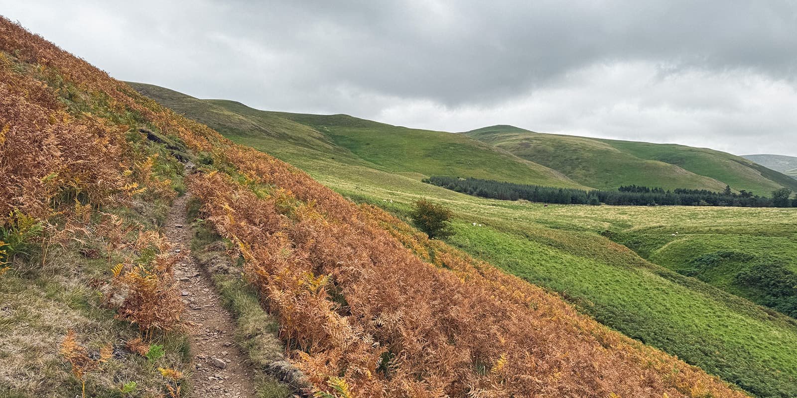
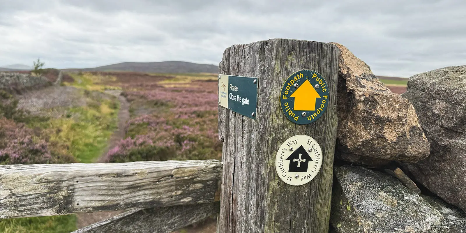
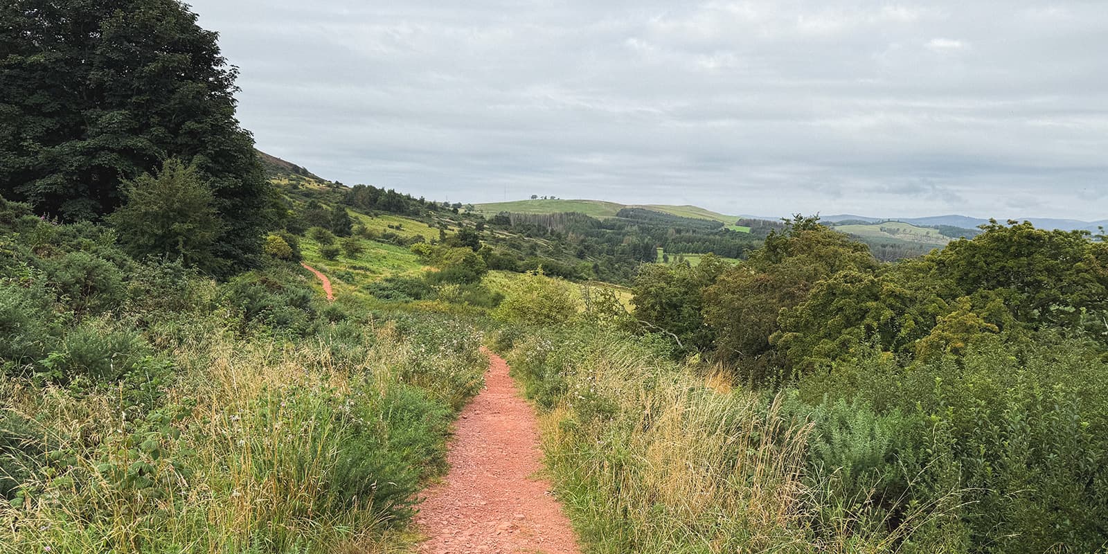
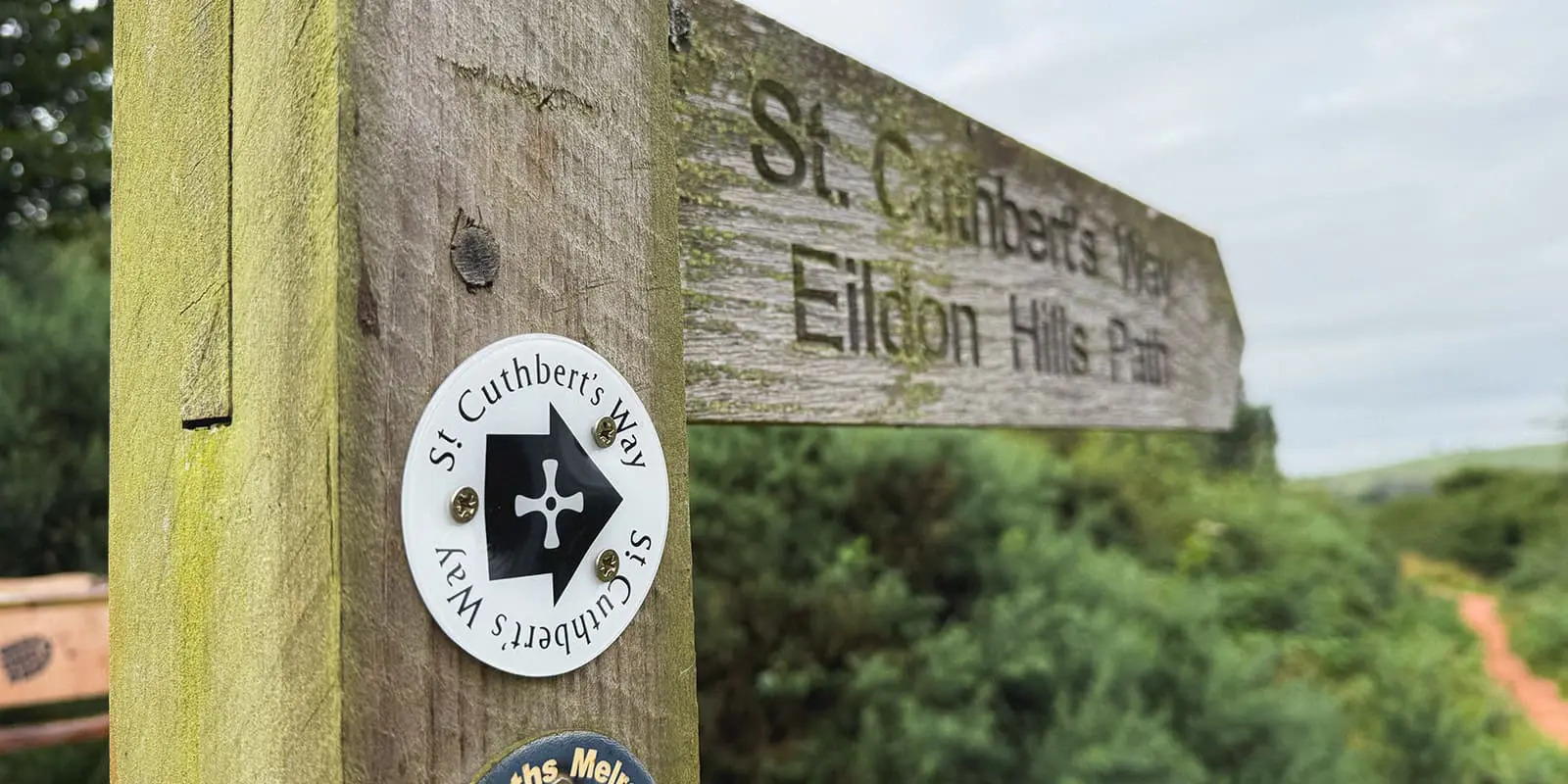
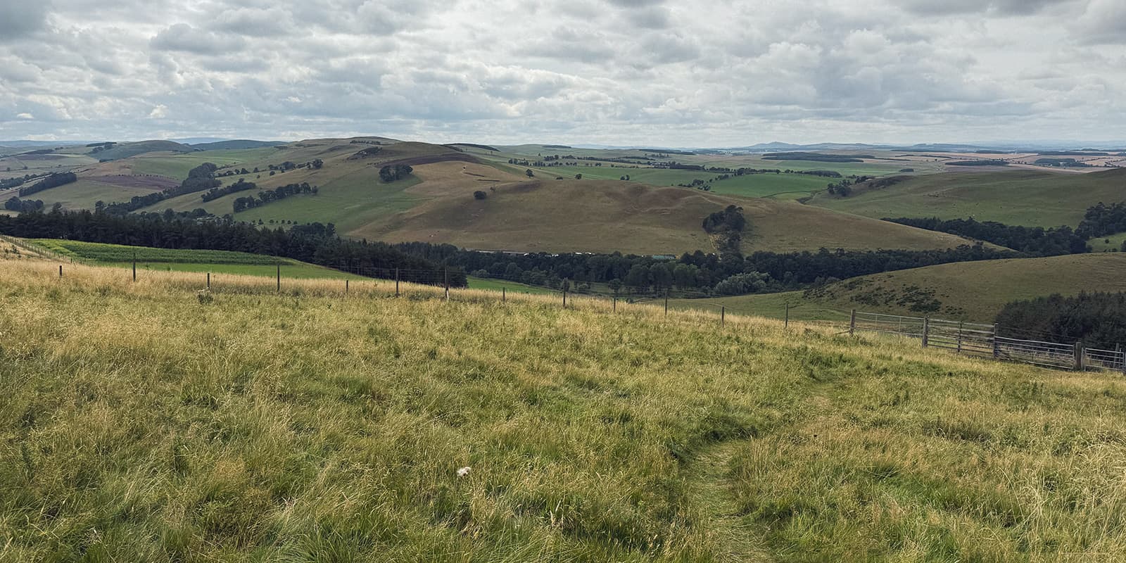
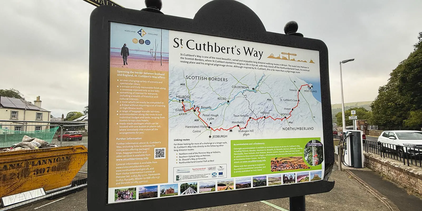
The St. Cuthbert’s Way is a 4-5 day pilgrimage that jumps between England and Scotland as you make your way toward Holy Island. The trek follows the chronological journey of St. Cuthbert, circa 650AD, and ends at his final resting place. You begin in Melrose in the Scottish Borders and make your way to Holy Island on the coast of Northumberland, passing through quaint cottages and enjoying the culture and nature of the area.

Because it dips between England and Scotland, this trail is also listed as one of Scotland’s Great Trails, a high distinction for a country with so much hiking. You’ll sleep in guesthouses and hotels along the way, with a chance to enjoy the UK’s cuisine and hospitality as you go.

women in blue smiling at camera
Editor

Katie Mitchell

After a whirlwind 10 years on the road (and trail!), Katie has hiked the Camino Frances, the Peaks of the Balkans, the Fisherman’s Trail, the Cumbria Way, the Pembrokeshire Way, and more in Europe and the United States. She is an avid trail runner and you can find her either on the trail or in a cafe in a new city, sampling all of their gluten-free treats. You can follow her adventures on Instagram.

View profile

The Trail

Stage one of St Cuthbert’s Way begins at Melrose Abbey and climbs over the Eildon Hills, where you’ll have your first views across the border. The route then keeps going through farmland, woodland, and along the River Tweed. You’ll pass abbeys and Roman roads before reaching Harestanes, where you’ll spend the night. The trail weaves back and forth between Scotland and England, usually hiked west to east, to follow the path St. Cuthbert took chronologically (and to keep the wind at your back!).

Stage two of the St. Cuthbert’s Way goes from Harestanes. You’ll cross the Monteviot Suspension Bridge and follow the River Teviot to Jedfoot before woodland paths lead you past Cessford Castle. After restocking (important!) in Morebattle, you’ll climb Grubbit Law to Wideopen Hill, the trail’s highest point and halfway mark, with fantastic views back to the Eildons, before finishing in Kirk Yetholm for the night.

On stage three, you’ll set off by climbing past Green Humbleton to the Scotland–England border, with a short detour to Eccles Cairn for some final views of the Eildons. From here, you will cross into Northumberland National Park, where the trail moves through valleys, woodland, and the Cheviot foothills. You’ll also pass Yeavering Bell, before descending through heather to Wooler.

Finally, stage four is the longest of the lot, but worth it for the final push! From Wooler, you’ll cross Weetwood Moor and its prehistoric rock carvings, then follow quiet lanes and the Roman Devil’s Causeway to St. Cuthbert’s Cave. Reaching Fenwick, tide times will likely decide your plans: cross the causeway road or follow the Pilgrims Path across the sands to Holy Island. Be sure to check the tidetable for safe crossing times! This will dictate the timing of your day.

Stages

The trail can be hiked in 4 or 5 days, depending on how long you’re willing to be on your feet each day.

4-stage itinerary of the St. Cuthbert’s Way

Stage 1:

Melrose – Harestances, 24 km | 15 mi

Stage 2:

Harestances – Yetholm, 28 km | 17.4 mi

Stage 3:

Yetholm – Wooler, 19.2 km |  11.9 mi

Stage 4:

Wooler – Holy Island, 29 km | 18 mi

Accommodations

You will sleep in hotels or B&Bs as you go, with options in each town. However, since some of the towns are on the smaller side, it’s recommended that you book your sleeping places before you go to be sure you’ll have somewhere to stay.

Best time of the year

The best time of the year to hike the St. Cuthbert’s Way is between June and September. This is when the weather should be the best and driest, and the more seasonal guesthouses and tourist spots will be open. It’s recommended that you check the weather ahead of time, and be prepared for rain and wind, no matter when you go.

Safety & Gear

Because the trail goes between towns and is on the shorter side, this trek is well-suited for beginner long-distance hikers. You’ll still need to prepare by bringing enough snacks (sometimes difficult to stock up in the villages) and packing enough water-carrying containers (at least 2-2.5L). It’s also advised to bring a basic first aid kit in the off-chance of injury, and to bring clothing that is comfortable and weather-resistant.

Two other points of caution: First, for the crossing to Holy Island, you will need to time your day around the tides so you can walk across the causeway at low tide. You can find the link to the tidetables below. Second, please be aware and safe around cows. Most often, these gentle giants do not care about humans. However, there are times that you may find the trail is blocked by a herd of cows or that one stands in your way. In this case, take the long route and detour around the cows. Adding a few more minutes to avoid any confrontation is recommended for your safety.

Difficulty

The trail is easy, with a few steep ascents throughout. However, the trail is overall technically easy and a good choice for beginner long-distance hikers. For more challenge, you can hike the trail in four days, which means longer days on the trail, and likewise for an easier time, you can extend it to five days for a shorter hike each day.

Good to know

The tides dictate the crossing to Holy Island, which can only be attempted at low tide when the causeway is exposed. The tidetables are linked below, and you should plan your hiking accordingly for the final day.

Additionally, be sure to book your hotels in advance to ensure a bed. While there are a few options in each town, the villages are small and may be booked out if you test your luck and show up without a reservation.

route
point-to-point
highest point
341m (1.118 ft)

Guidebooks

St Cuthbert's Way guidebook

St. Cuthbert's Way

View guidebook

Want to submit a trail or make this page more complete?

Always read the disclaimer

Terms of Use: important to all visitors on this website. We strive to publish high quality content and information on this website. However it’s always possible that we’re missing out on some crucial information. In spite of the fact that this route, associated GPS track (GPX and maps) were prepared under diligent research by the specified contributor and/or contributors, the accuracy of such and judgement of the author is not guaranteed. Therefore, hiking-trails.com and contributors are in no way liable for personal injury, damage to personal property, or any other such situation that might happen to individuals hiking or following this route. Should you choose to hike this trail, this is always at your own risk. Check out our guidelines for safety hiking and Leave No Trace principles at the hiking 101 page.

Download GPX

Join the community!

Login or create a FREE account 😊

With an account you can:

Download GPX files

Pin trails to your wishlist

Mark trails as hiked by you

Rate hiking trails

Comment on trails, blogs and gear reviews

Happy trails!
Login

Don't have an account yet? Register here