About the South West Coast Path

country
England
length
1014 km(630 mi)
Type of trail
Long-distance
difficulty

Difficulty is highly personal. Be aware of the weather conditions as bad weather turns easier trails in difficult trails especially in the mountains.

Difficult
accommodation

Lodging means a mix of hotels, hostels or AirBnB’s.

Camping, Lodging
Elevation gain
35301 m(115817 ft)
terrain
Coastal, Countryside, Hills
remoteness
Most of the time
Show more

The South West Coast Path is England’s longest continuous waymarked footpath. It’s named a National Trail and follows the incredible coastline of South West England, passing through the beautiful counties of Somerset, Devon, Cornwall, and Dorset. It stretches from Minehead to Poole, totaling 630 miles/1,013 km, and boasts some of the most breathtaking scenery in the country. Expect to find quaint English fishing villages, beautiful native wildlife, and many of England’s most spectacular beaches.

The trail can be completed as a long-distance hike, or in sections. Many people visit the coast path for day hikes. It’s known as one of the world’s greatest trails and with good reason. Whatever the weather, the South West Coast Path is hard to beat for feeling immersed in nature.

Women standing in mountains with hiking poles
Author

Jess Fellows

Having always been ‘sporty’ but never one to excel in any particular pursuit, Jess loves the simplicity of long distance: you don’t need to be particularly talented or fast at walking, you need only put one foot in front of the other. 

And it’s going the distance that truly tests one’s character. Slowing right down to see the natural world and its magnificence, and truly seeing it. To continuously be navigating new waters, and learning along the way. It’s the sense of freedom and resilience that Jess is consistently hungry for, to witness herself in all manner of experiences and extremes. To trust each tiny step, and to remember the bigger picture will take care of itself.

After a few long distance cycle tours, Jess was supposed to cycle around the world. Having planned and saved for many years, only a global pandemic could be the reason she didn’t go. So in the summer of 2020, craving some transformation and adventure, she decided to shave her head and start walking from her house in Bristol. She would go for 3-4 days at a time and enjoyed a few trips exploring the landscapes around the city and beyond. It was on these hikes that she and her partner started dreaming of bigger hikes for even more nature immersion. The thru hiking obsession had begun so by the summer of 2021 they were ready to take on the UK’s longest footpath along the South West Coast Path. The following summer they decided to return to Turkey to trek the Lycian Way, followed by hiking the GR5 route across the French Alps. After some shorter thru hikes in the UK, Europe and walking in the Himalayas, they are currently preparing for the PCT in 2024.

Jess has type one diabetes, eats a plant based diet and wears barefoot shoes. For work she is a wedding celebrant and yoga teacher on retreats. Check out her website to read more about her offerings and insights on her blog, and follow her PCT journey @uprootlife.

View profile

The Trail

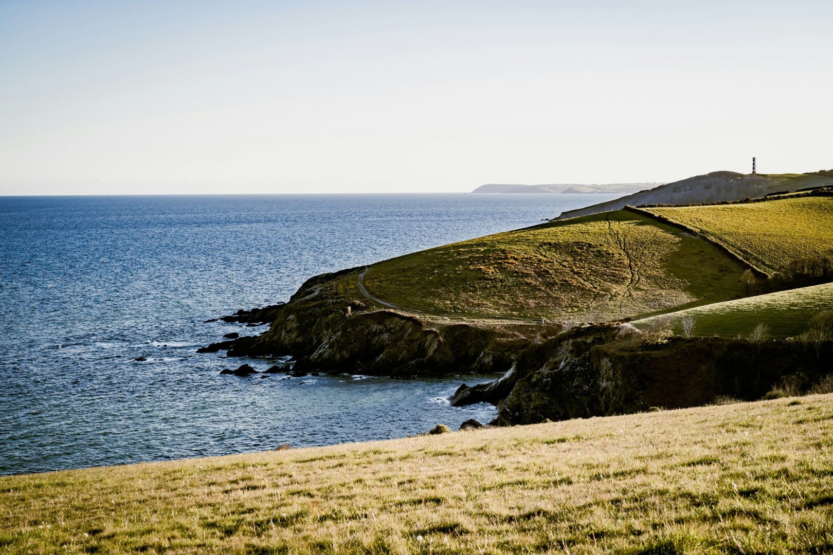
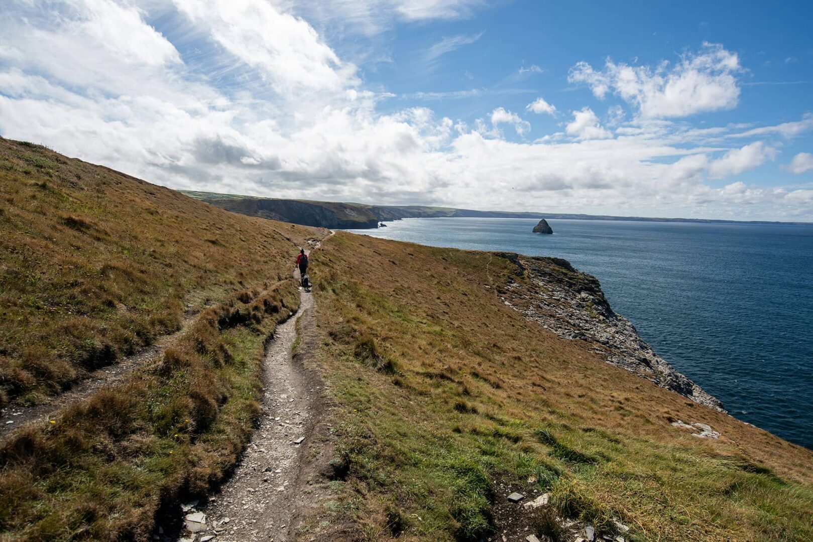
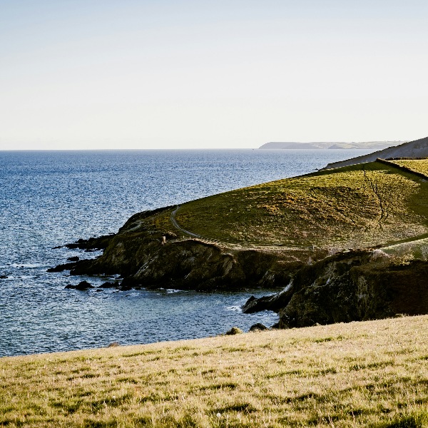
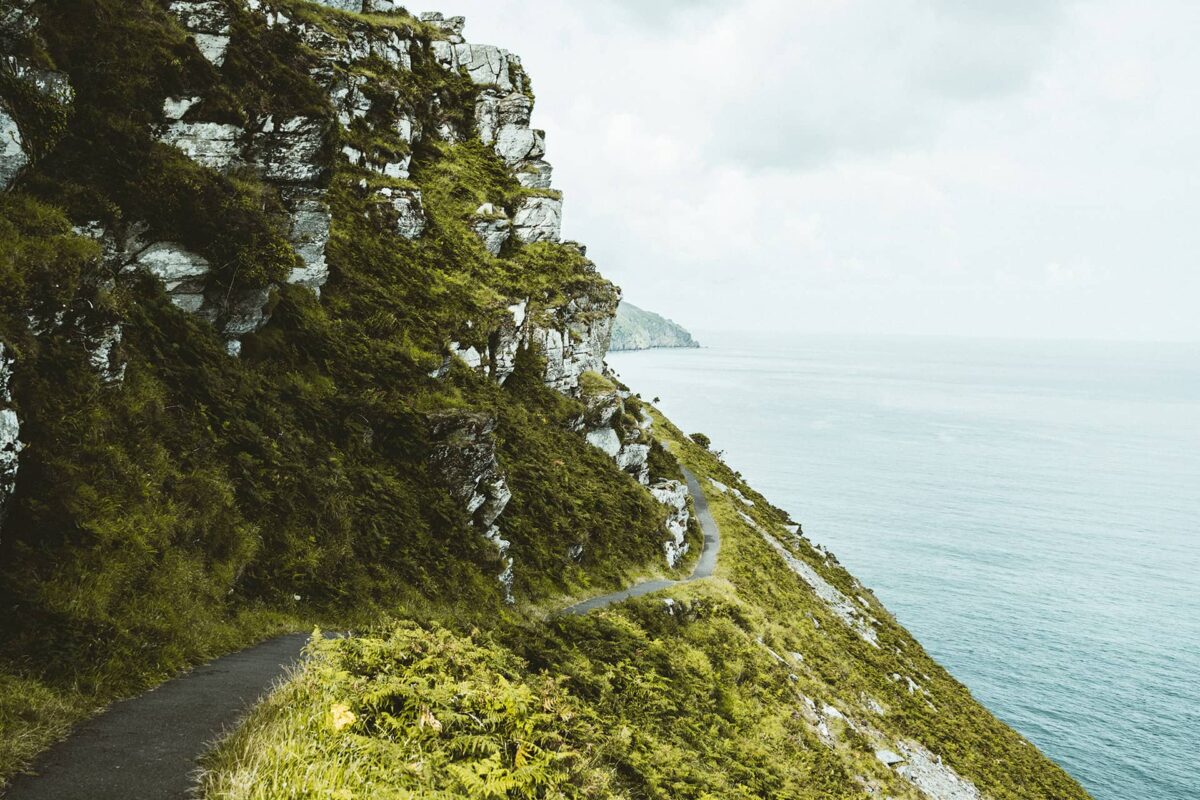
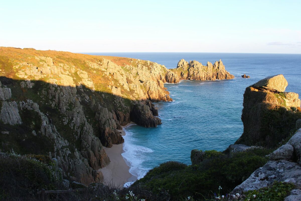
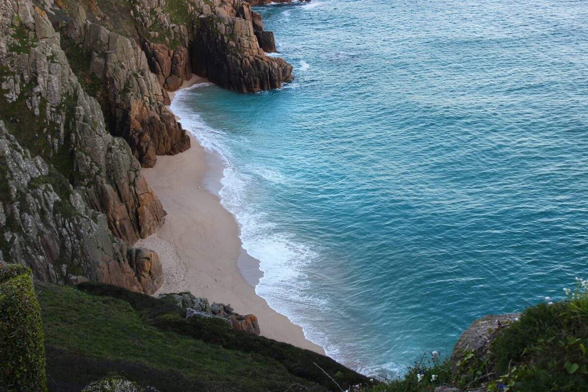
The scenery is remarkable and you’ll witness rock formations gradually change shape and color as you head along the coastline; around every headland a new and impressive vista. The colors of green fields and countryside against the backdrop of the blue sea are vivid, and at certain times of the year, you’ll experience wildflowers: bright yellow gorse and striking purple heather lining the footpath. Hiking along the SWCP is a delight for your senses; the challenge and rewards make this trail an unforgettable trek.

If walking in its entirety, reaching the trailhead of Minehead or Poole (depending on which direction you wish to walk it) is straightforward as both are connected by public transport links. Use Rome to Rio to find out how best to get there from wherever you are.

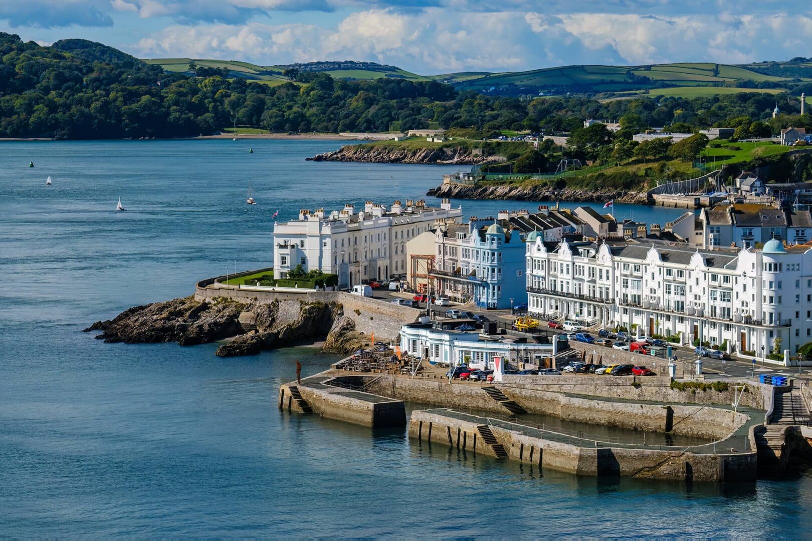
As the coastline is popular with holidaymakers, there are an array of facilities along the route but much of the time, there are days that are more remote where you’ll have the place to yourself.

It’s possible to resupply for food in the towns along the way, and you’re not likely to need to carry more than 4 days of food at any time. There are plenty of shops in towns and places to buy a cooked meal for times when you don’t wish to cook, plus cornish pasties are available almost daily. Water is generally available everywhere, but depending on the weather conditions you may want to carry extra for longer stretches. You will find drinking taps sometimes and can ask at pubs, cafes, accommodations, churches, and even locals themselves at home and everyone is usually happy to help.

The trail is signposted well throughout and you will follow the white ‘acorn’ symbol. Do note that the distances marked on the signposts aren’t always accurate though. The entire trail can be found on Google Maps too should you need to check where you are in cross-reference with GPS. If in doubt, always make sure the sea is on your right (if you’re traveling west to east, that is)!

Many of the day stages will include some difficult and steep sections. It’s been calculated that the total elevation gain of the SWCP equates to hiking up Everest between 4-5 times. Even though you won’t be going higher than 318m above sea level at any one point, you can expect to go up and down 300m regularly, many times throughout the hike and even many times during one day!

Dogs are permitted on the trail should you wish to bring your pet with you (many hikers do!) but bear in mind that they won’t be welcomed on all beaches during the high season. They must be well trained around livestock as you will come into contact with many cows and sheep throughout.

There are tour companies who will arrange luggage and accommodation logistics for you, at a fee. But it is entirely possible to plan and execute a self-supported SWCP thru-hike.

The amount of time you will need to hike the SWCP depends on several factors, including your levels of fitness, how fast or slow you want to experience the trail, and the weather conditions. Typically people finish the trail within 6-8 weeks and allow a handful of rest days, but be prepared to adapt and be flexible to what comes up.

Stages

The South West Coast Path is divided into the following sections:


  • Somerset and Exmoor, 56km | 35 mi
  • North Devon, 145km | 90 mi
  • North Cornwall, 106km | 66 mi
  • West Cornwall, 232km | 144 mi
  • South Cornwall, 122km | 76 mi
  • South Devon, 167km | 104 mi
  • Jurassic Coast, 185km | 115 mi

Accommodations

You’ll need to carry a tent for this trail as sometimes camping will be the only option. However, there are lots of options to stay in lodgings throughout the trip too. There are many hotels, B&Bs, and campsites along the way to cater to different budgets. As the coastline is popular with holidaymakers, there’s an array of accommodation choices. Booking in advance may be required if visiting during the peak summer of school holidays. Be mindful that wild camping is not legal; request permission whenever possible, always respect the land, pitch late, leave early, and leave no trace.

Best time of the year

Summer is the best time for this trail. This is when you’ll have the best chance of good weather when everything is running and open, but it’s also when it’s busiest. Try to avoid school holidays if possible so plan to finish before mid-July. Spring and Autumn could potentially be lovely, but note that not all services will be open. Keep in mind that the weather along the coastline can change quickly and storms can be intense. Be prepared for various conditions.

Safety & Gear

Please thoroughly research the route and check weather conditions, as coastal weather can be unpredictable. Dress appropriately in layers and bring waterproof gear, even on sunny days, as conditions can change rapidly.

Stay on marked trails and avoid venturing too close to cliff edges, as erosion and unstable ground can be risky. Be careful when hiking steep ascents and descents, using walking poles for stability if necessary. Keep a safe distance from wildlife and respect any warning signs or closures along the path.

You can be prepared for emergencies by carrying a fully charged cell phone, map or GPS device, and a basic first aid kit. Tell someone you trust your hiking plans, including your intended route and estimated return time, and check in with them when you finish.

Stay hydrated by drinking plenty of water and replenishing electrolytes, especially on hot days. Pace yourself and take breaks as needed to avoid overheating. Lastly, trust your instincts and know when to turn back if conditions become unsafe.

Good to know

Following the trail will mean taking several ferries during the hike, and many of these stop operating towards the end of October, so be sure to plan your trip before the season finishes, else you’ll need to take taxis/hitch or add on many extra road miles.

If needing to take public transport off trail, many of the towns and bigger villages are connected. To plan your journey, we recommend using Travel Line South West.

Owing to the natural processes of being a coastline trail, the path is fragile in some areas and often at risk of erosion. This is seen especially along the Jurassic coast section. Be extra careful not to walk near the edge or when taking a break on the beach, don’t sit close to the cliffs. Bear in mind that the path may experience erosion and landslides and will therefore require taking a diversion route until it is safe to pass through again. Check for regular updates on safety and closures.

You’ll be able to find water points at pubs, cafes and restaurants, churches, accommodations, and taps. No need to carry extra water or a filter!

Also note that some sections will be busy with day hikers, holidaymakers, and local dog walkers, especially when approaching or leaving the towns. However, some sections will feel extremely remote where you won’t see anyone for hours, up to to a day or so.

Route
Point to point
Highest point
318m (1,043 ft)

Guidebooks

Guidebook South West Coast Path Cicerone

Guidebook South West Coast Path

View guidebook

Want to submit a trail or make this page more complete?

Comments

Be the first one to comment on this trail!

Reply to this trail

Your email address will not be published. Required fields are marked *

Reply to this trail

Log in to comment on this trail
Always read the disclaimer

Terms of Use: important to all visitors on this website. We strive to publish high quality content and information on this website. However it’s always possible that we’re missing out on some crucial information. In spite of the fact that this route, associated GPS track (GPX and maps) were prepared under diligent research by the specified contributor and/or contributors, the accuracy of such and judgement of the author is not guaranteed. Therefore, hiking-trails.com and contributors are in no way liable for personal injury, damage to personal property, or any other such situation that might happen to individuals hiking or following this route. Should you choose to hike this trail, this is always at your own risk. Check out our guidelines for safety hiking and Leave No Trace principles at the hiking 101 page.

Download GPX

Join the community!

Login or create a FREE account 😊

With an account you can:

Download GPX files

Pin trails to your wishlist

Mark trails as hiked by you

Rate hiking trails

Comment on trails, blogs and gear reviews

Happy trails!
Login

Don't have an account yet? Register here