Rating
0 Rate this trail

About the Soča Trail

country
Slovenia
length
25 km(16 mi)
Type of trail
Day hike
difficulty

Difficulty is highly personal. Be aware of the weather conditions as bad weather turns easier trails in difficult trails especially in the mountains.

Easy
accommodation

Lodging means a mix of hotels, hostels or AirBnB’s.

Lodging
Elevation gain
366 m(1201 ft)
terrain
Forest
remoteness
None of the time
Show more

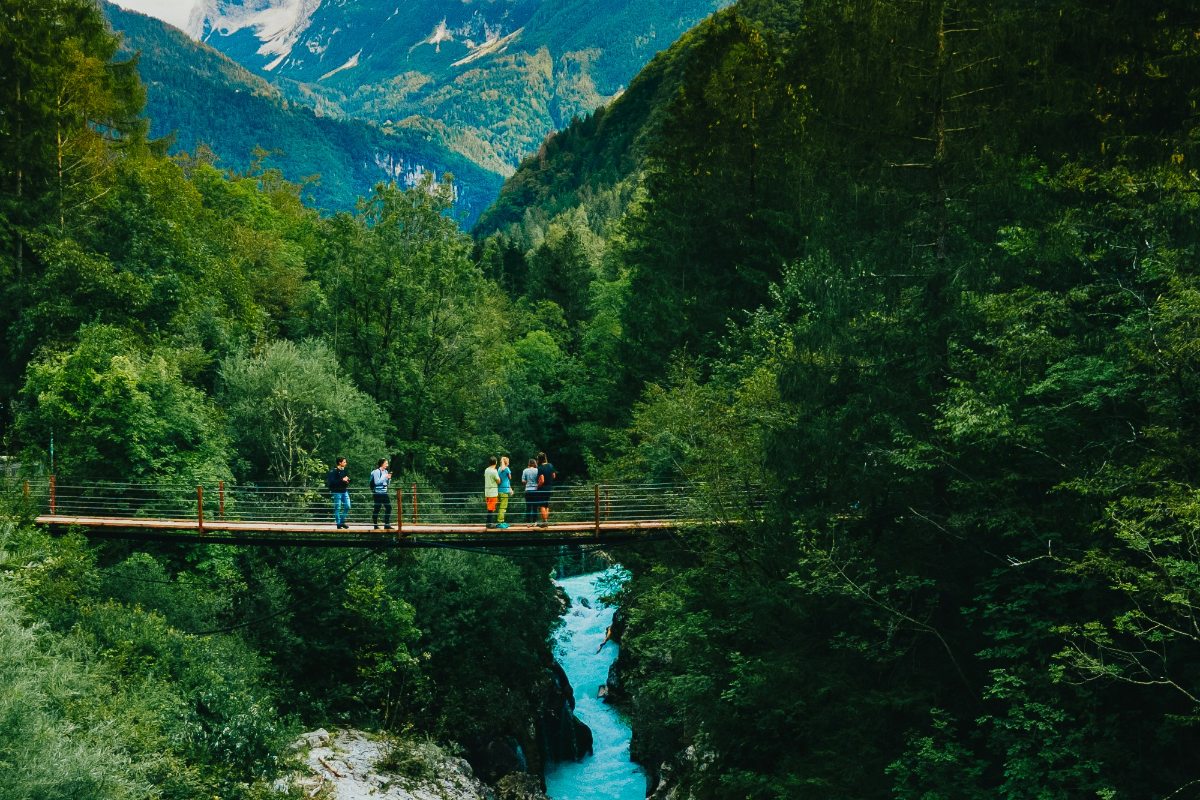
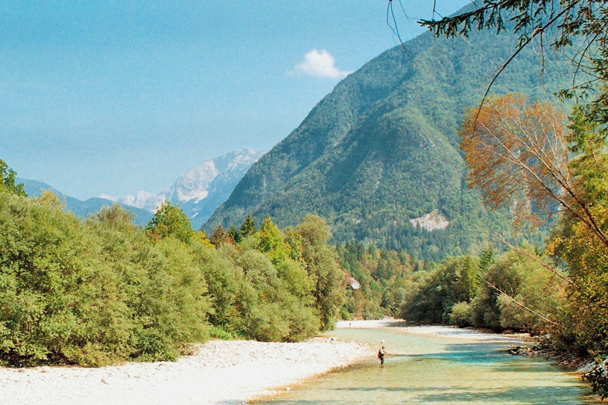
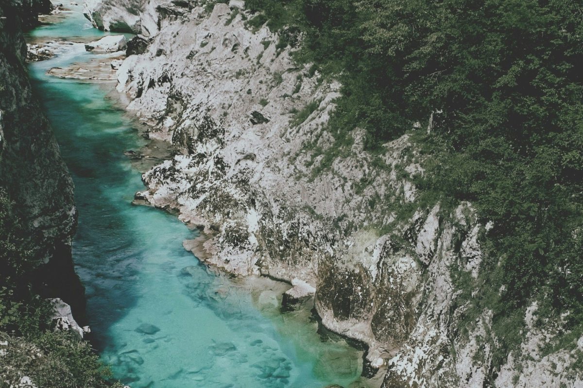
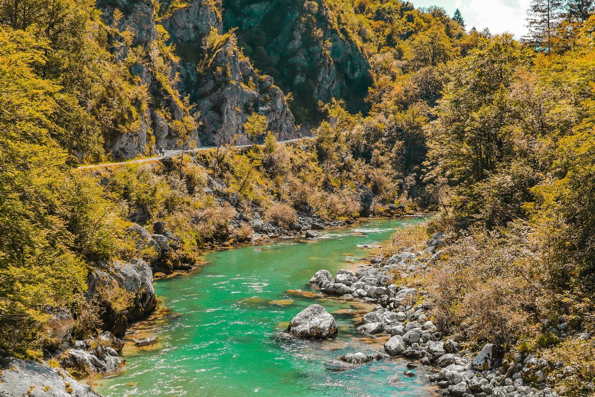
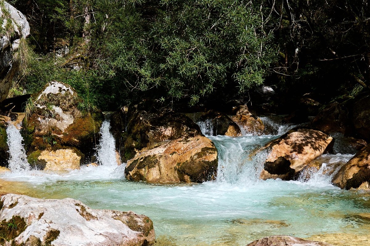
The Soča Trail is a beautiful day hike in the Julian Alps and Triglav National Park. This trail follows the course of the Soča River, known for its turquoise color, which runs through the Julian Alps. This hiking trail takes you through the forests, along gorges, and always along the Soča River.

The trail was the first that was established when they founded Triglav National Park and has informational signs every once and a while to teach about the local history and habitats. The Soča Trail, also known as the Soška Pot in Slovene, follows stage 24 of the Alpe-Adria-Trail from Trenta to Bovec. The trail is located in the Triglav National Park in the Julian Alps of northwestern Slovenia. The Triglav National Park is a natural sanctuary and is well known for its breathtaking landscapes and rich biodiversity. Named after Mount Triglav, the highest peak in Slovenia, 2864 meters tall, it is the only national park in Slovenia and covers an area of approximately 880 square kilometers.

Editor

Elmar Teegelbeckers

Passionate hiker Elmar spends months of his time on the trail. He’s usually on the lookout for hidden gems in one of his favourite countries such as Slovenia, Switzerland and Japan. He founded hiking-trails.com in need for a community and detailed information about the trails. Before this, he worked for the Alpine asscociation in the Netherlands[ (NKBV) but lost his heart to the trails.

With this website and socials, he hopes to shape an inclusive community for hikers all over world. No matter your speed, experience or level, you can get out there to enjoy the trails and connect with the heartwarming hiking community. Life is so much better outside and he hopes to inspire hikers to take their first, or next, step on the trail.

View profile

The Trail

The Soča Trail (Soška Pot) is the first nature trail created in the Triglav National Park and runs along the Soča River from its source to the town of Bovec. It connects the Soča and Trenta valley and is popular for its suspension bridges. The trail is 25 kilometers long and can easily be done in one day. The trail follows the river and will also be close to the road for the majority of the time. With public transport always nearby you can also choose to do only a part of the trail.

The Soča Trail is a small part of the Alpe-Adria-Trail, a thru-hike from the foot of the Grossglockner to Trieste crossing Austria, Slovenia, and Italy. This hike is way longer with 37 stages and approximately 750 kilometers.

The Soča Trail is ideal for beginning hikers or if you want to take it slow and enjoy the beauty of Triglav National Park along the Soča River. Please note that if you want to go all the way to the source of the Soča river, that part of the trail is only for experienced hikers with no fear of heights as it’s partly secured with steel cables. If you don’t want this, just start at the information sign and hike towards Bovec.

Accommodations

If you’re hiking in the Triglav National Park in the Julian Alps, the towns of Bovec and Trenta offer a range of accommodation options for different preferences and budgets. In Bovec, you can choose from cozy guesthouses or family-run B&Bs to hotels with mountain views. In Trenta, the other town, there are also plenty of options from hostels to hotels, and B&Bs. Both places are great basecamps for discovering the area.

Best time of the year

The best time of the year to hike the Soča Trail is from late spring in May to autumn in October, specifically from May to September. During these months, the weather is generally mild and stable, providing ideal conditions for hiking. Note that it can be more crowded on this trail during the summer months and always keep in mind that you’re hiking in the mountains with the chance of thunderstorms and unpredictable rainfall.

Safety & Gear

The trail, though generally rated as easy, features varied terrain that requires sturdy and comfortable hiking shoes. Pack the essentials such as enough water, energy-rich snacks, and a first aid kit. Weather can be unpredictable, so dress in layers and bring a waterproof jacket. Trekking poles can add stability to some sections alongside the trail. Lastly, respect the natural environment by staying on marked trails and carrying out all trash.

Good to know

The Soča Trail is generally rated as an easy hiking trail, making it suitable for most hikers, including families. While the terrain is varied, with some sections having gentle slopes and others more rugged, well-marked paths and frequent signposts make it an enjoyable experience. Note that the path to the source of the Soča is a difficult trail and not a part of the Soča Trail. Hike this part only if you’re experienced and have no fear of heights. A part of the way to the Soča source is equipped with steel cables.

ROUTE
Point-to-point
HIGHEST POINT
900M (2952 FT)

Want to submit a trail or make this page more complete?

Comments

Be the first one to comment on this trail!

Reply to this trail

Your email address will not be published. Required fields are marked *

Reply to this trail

Log in to comment on this trail
Always read the disclaimer

Terms of Use: important to all visitors on this website. We strive to publish high quality content and information on this website. However it’s always possible that we’re missing out on some crucial information. In spite of the fact that this route, associated GPS track (GPX and maps) were prepared under diligent research by the specified contributor and/or contributors, the accuracy of such and judgement of the author is not guaranteed. Therefore, hiking-trails.com and contributors are in no way liable for personal injury, damage to personal property, or any other such situation that might happen to individuals hiking or following this route. Should you choose to hike this trail, this is always at your own risk. Check out our guidelines for safety hiking and Leave No Trace principles at the hiking 101 page.

Download GPX

Join the community!

Login or create a FREE account 😊

With an account you can:

Download GPX files

Pin trails to your wishlist

Mark trails as hiked by you

Rate hiking trails

Comment on trails, blogs and gear reviews

Happy trails!
Login

Don't have an account yet? Register here