countryside in Poland with mountains in background

Small Beskid Trail

Mały Szlak Beskidzki

About the Small Beskid Trail

country
Poland
length
135 km(84 mi)
Type of trail
Long-distance
difficulty

Difficulty is highly personal. Be aware of the weather conditions as bad weather turns easier trails in difficult trails especially in the mountains.

Moderate
accommodation

Lodging means a mix of hotels, hostels or AirBnB’s.

Lodging, Mountain huts, Shelters, Wild camping
Elevation gain
6000 m(19685 ft)
terrain
Mountains, Countryside, Forest, Hills
remoteness
Some of the time
Show more

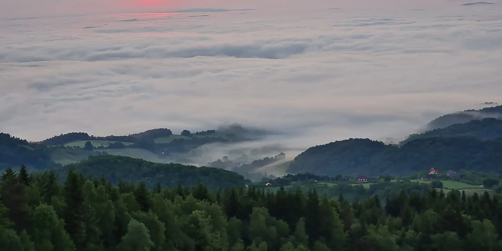
The Small Beskid Trail, or “Mały Szlak Beskidzki” in Polish, is a scenic trekking route located in the Lesser Poland region. Stretching approximately 135 kilometers, it takes you through the landscapes of the Beskid Mountains. This trail offers hikers a less crowded alternative to the more popular routes in the region, making it a great escape for nature lovers.

Historically, the trail was established in the mid-20th century and has been a beloved route for local hikers due to its accessibility and diverse terrain. The path has a blend of forests, hills, and villages, showing the culture of the area. Along the way, you can explore landmarks, such as wooden churches, and enjoy views of the Tatra Mountains on clear days.

jakub & Monica profile picture
Author

Monika & Jakub

Monika & Jakub are a couple from Poland (Kraków) who love hiking! They are also interested in bikepacking, wild camping, and outdoor photography. They specialize in the Dinaric Alps (Balkan countries) and Polish trails. You can follow Jakub & Monika on Instagram @_bry_dzia_ & @de_moniqua

View profile

The Trail

The Small Beskid Trail connects the city of Bielsko-Biała with the peak of Luboń Wielki (1022m). It goes through 3 mountain ranges: Beskid Mały, Beskid Makowski, and Beskid Wyspowy. The trail is marked red and the markings are very visible, so you can hike without frequently checking the map. There is a red dot at the beginning and the end of the trail. The direction of the route does not matter for the difficulty of the walk. The only exception is if you want to start on Luboń Wielki, you need to climb to the peak first. The estimated walking time for the entire trail is about 44 hours, depending on your shape and your style of trekking. Most of the peaks on the trail are in the forests, so there are no views from them. The most panoramic sections are in the beginning and on the last day of the trail.

The trail is not very popular, apart from places that are easily accessible from nearby towns and the areas around popular shelters. On the trail itself, you will meet few people during the day. The trail passes through several towns and villages, but most of the route leads through the forests. There are sections where you walk through the forest for several hours and see nothing but trees and mud in the ruts left by off-road vehicles and bridges, which cause significant damage to several of the most popular sections. From higher points on the trail, the views are nice, but if you see anything, there are always buildings in sight.

The constant presence of human civilization makes it hard to feel like you are on a real mountain trail. For someone who loves long hikes alone with nature, this proximity to civilization might be a disadvantage. However, for someone who is just starting their adventure with the trail, and long-distance hikes, it may turn out to be a huge advantage and give such a sense of security – that if something happens, you can always get help or get to the town easily.

The trail runs through several viewpoints, from which you can see beautiful panoramas. One of such places is Chrobacza Łąka. At the top stands a 35m high steel cross, under which there is a viewing terrace. With good visibility, you can see the Tatras from there – the highest range in the Carpathian chain. The Tatras are the only mountain range in Poland with an alpine character, so you can easily distinguish them from other mountain ranges.

You can access the trail year-round. In winter, there may be snow on the trail. In recent years, climate changes have caused issues in weather forecasting and winters have become very capricious. Sometimes in December, it is possible to walk the trail with dry feet, while in April there can be huge amounts of snow. That is why you need to monitor the weather forecast for a given region before planning your route. The amount of snow therefore depends on what kind of winter the region has. When the snow melts, there is a lot of mud on the trails. And in some places, the path can turn into a stream. If you come across a typical Polish winter, the trail is very beautiful at this time of year. However, you must remember that you may have to devote a few more days to completing it.

Every few hours or so, you will pass various types of lodgings, cottages, or shelters, so if you plan to take this trail lightly, it will not be a problem. There is also no shortage of places for wild camping. The areas are mostly forested, with plenty of flat spots. It does not matter whether it is a tent, hammock, or tarp – finding a place to camp should not be a major problem. If you care about privacy, you should avoid camping on mountain peaks because this is where you’ll have the highest probability of meeting someone there – especially on the weekends. An exception can be made on Potrójna because there is a clearing, large enough to accommodate a lot of tents and it is a nice place for both sunset and sunrise.

Stages

No official stages for this trail.

Accommodations

It is possible to complete the trail without a tent. The trail leads through villages and towns and has a very rich accommodation base. Each night can be spent under a roof – in a guesthouse or a mountain shelter. There are shelters that are open year-round on the trail, where you can also buy food and spend the night (paid):

  • Schronisko Chrobacza Łąka – mountain shelter with rooms and warm meals menu
  • Chatka na Potrójnej – a hut with rooms, no warm food, self-service kitchen available, famous for its blueberry buns
  • Chatka pod Potrójną – possibility to accommodate 15 people/self-service, no bathroom, self-service kitchen
  • Schronisko PTTK Leskowiec – big mountain shelter with rooms, warm traditional dishes, and a bar
  • Schronisko PTTK na Kudłaczach – mountain shelter with rooms, warm food, and a campsite
  • Schronisko PTTK na Luboniu Wielkim – small mountain shelter with rooms, and a buffet menu, there is no bathroom, and the toilet is outside.
  • There is also one free mountain hut called “Bacówka na Wierzbanowskiej Górze.” It is free of charge and open to everyone, so it is worth remembering that in high season, especially on weekends, it may be full.

Best time of the year

If you are going with a tent, aim for the months of June – September. If you intend to sleep in lodgings and in shelters, then you have a wider range of possibilities, you can aim for the months of May to October. If you do not like the heat, aim for May/June or September/October.

Theoretically, it will be easiest to complete the trail in summer, especially if you take a tent with you. Then it is warm and relatively dry, and there will be the least amount of mud on the forest roads. However, the temperature can exceed 30 degrees C (90F), and in such heat, you have to remember to carry more water with you. In spring, temperatures will be lower and there will be the most mud, sometimes there might be frosts and light snowfalls. In autumn, trees change the color of leaves, so this time of the year will undoubtedly have its charm, but you have to take into account that, just like in spring, there can be rapidly changing conditions, icy trails, and frost.

The trail can be completed all year round, but in winter it may be the most difficult. Everything will depend on the weather, there may be a lot of snow, and completing it will not be easy without additional equipment (spikes, crampons, snowshoes, gaiters, etc.). Sometimes during very harsh winters, there may be problems with reaching the shelters, and the shelters themselves may lack electricity or water.

Safety & Gear

The trail is very suitable for people who are just starting their adventure with long-distance trails. There are no dangerous places on the trail. The only threat may be the weather in the mountains, so before setting out, you should check the weather conditions (preferably every day before setting out on the trail). In winter, there may be quite a lot of snow on the trail and the walk may be very demanding.

When it comes to equipment, it is definitely good to have trekking poles with you regardless of the season. When there may be icy conditions, it is worth having crampons/spikes, and in the winter season, gaiters and snowshoes. It is worth installing the RATUNEK application. In the event of an accident, just press the button on your phone’s display three times and the emergency services will be informed about the need to carry out a rescue operation. The application transmits our current location to the services using GPS and the battery level in our phone. The app is free of charge, like all rescue operations in the Polish mountains.

Emergency numbers:

  • 999 – Emergency medical services. The call is answered directly by a medical distributor.
  • 112 – emergency number valid throughout the European Union. After the call, the operator notifies the appropriate services: ambulance, fire brigade, police, water rescue services, etc.
  • +48 601 100 300 GOPR – Mountain Volunteer Emergency Medical Services, emergency services in the Beskid Mountains. Calling for help and rescue operations are free in Poland.

Good to know

On Sundays, shops in Poland are usually closed, only small, private shops may be open, but not always, and the opening hours are not set. Usually, on Sundays, the open ones are open for shorter hours than usual as well.

You’ll find most of the shops on the trail in Krzeszów, Mszana Dolna, and Myślenice, and you will also find cafes and restaurants there. Luboń Wielki is a peak – the difference in height between it and the tourist spa town of Rabka-Zdrój is 600m (1969ft). In this town, you will also find many shops, lodgings and restaurants.

There is access to water along the trail, so you don’t have to worry about it. There are springs and streams on the trail, but there is a possibility that some of them may dry up or become contaminated. Here is a link to an application that marks the springs on the trail.

You can stock up on food and water daily—at stores, shelters, or restaurants. There aren’t many of them, but they are there.

It is worth trying traditional Polish cuisine and snacks. The most famous in the Polish mountains is oscypek, a local smoked cheese made of sheep and cow’s milk. You can buy it in shepherd’s huts, at street markets, and roadside stalls.

Variations:

  • Total ascents direction Bielsko-Biała > Luboń Wielki is 6000m (19685 ft)
  • Total ascents direction Luboń Wielki > Bielko-Biała is 5400m (17716 ft)

Note that Luboń Wielki is a mountain peak – not a town. To get to the top, you have to overcome an elevation of 600m (1969ft) from the town of Rabka-Zdrój. The difference in altitude is therefore apparent.

Route
Point to point
Highest point
1022m (3353 ft)

Want to submit a trail or make this page more complete?

Comments

Be the first one to comment on this trail!

Reply to this trail

Your email address will not be published. Required fields are marked *

Reply to this trail

Log in to comment on this trail
Always read the disclaimer

Terms of Use: important to all visitors on this website. We strive to publish high quality content and information on this website. However it’s always possible that we’re missing out on some crucial information. In spite of the fact that this route, associated GPS track (GPX and maps) were prepared under diligent research by the specified contributor and/or contributors, the accuracy of such and judgement of the author is not guaranteed. Therefore, hiking-trails.com and contributors are in no way liable for personal injury, damage to personal property, or any other such situation that might happen to individuals hiking or following this route. Should you choose to hike this trail, this is always at your own risk. Check out our guidelines for safety hiking and Leave No Trace principles at the hiking 101 page.

Download GPX

Join the community!

Login or create a FREE account 😊

With an account you can:

Download GPX files

Pin trails to your wishlist

Mark trails as hiked by you

Rate hiking trails

Comment on trails, blogs and gear reviews

Happy trails!
Login

Don't have an account yet? Register here