About the Sentier des Adonis

Martigny
country
Switzerland
length
7 km(4 mi)
Type of trail
Day hike
difficulty

Difficulty is highly personal. Be aware of the weather conditions as bad weather turns easier trails in difficult trails especially in the mountains.

Easy
accommodation

Lodging means a mix of hotels, hostels or AirBnB’s.

Lodging
Elevation gain
244 m(801 ft)
terrain
Forest, Hills
remoteness
Some of the time
Show more

The Sentier des Adonis trail, located between Charrat and Saxon, is a hike to see some of the beauty that’s unique to Valais. This route has a gentle gradient and takes you through a mosaic of orchards, vineyards, hillsides, and forests.

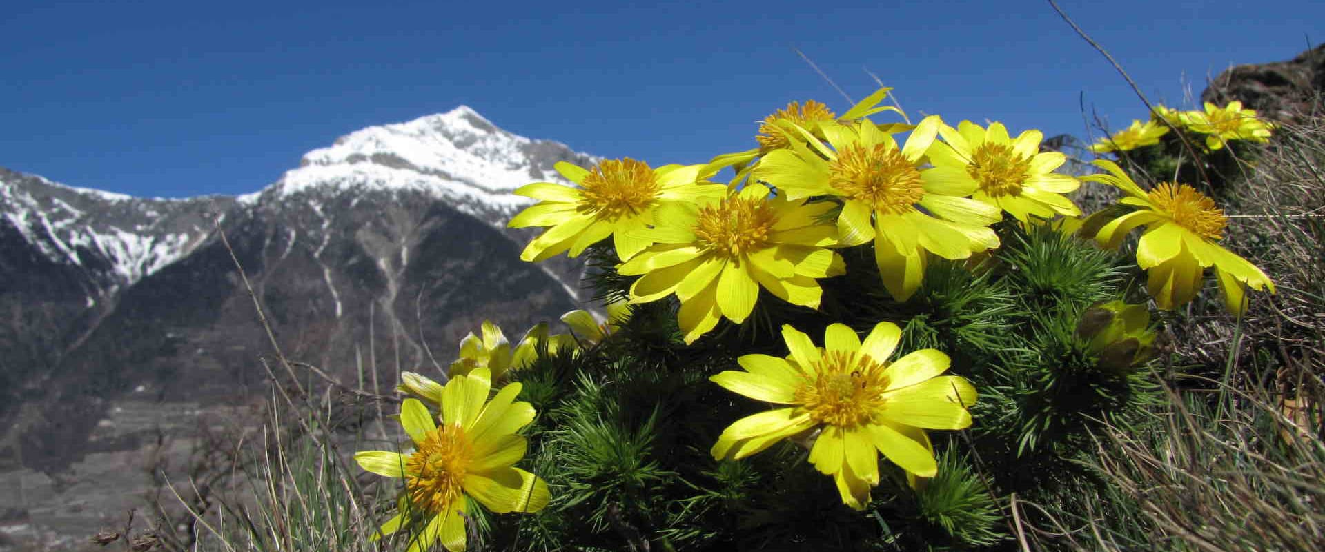
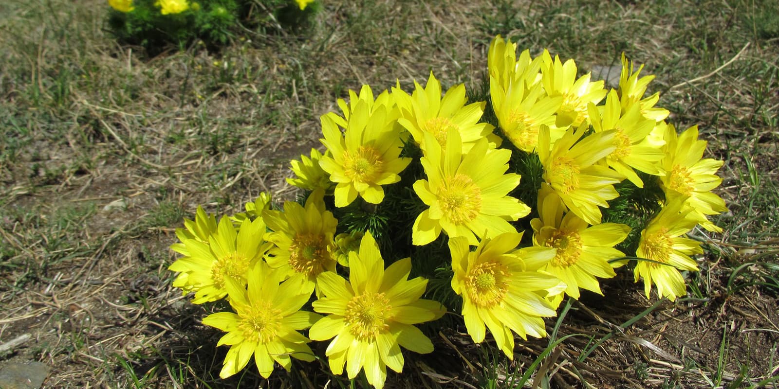
During the hike, you’ll have a chance to see the spring adonis, a rare and protected flower that grows only in this region. The trail is a great setting to observe this plant in its natural habitat while also enjoying views of the surrounding area.

Elmar profile picture
Editor

Elmar Teegelbeckers

Passionate hiker Elmar spends months of his time on the trail. He’s usually on the lookout for hidden gems in one of his favourite countries such as Slovenia, Switzerland and Japan. He founded hiking-trails.com in need for a community and detailed information about the trails. Before this, he worked for the Alpine asscociation in the Netherlands[ (NKBV) but lost his heart to the trails.

Not long ago, Elmar published the book (in Dutch) Hiking Trails – best long-distance trails in Europe. With this book, website and socials, he hopes to inspire and shape an inclusive community for hikers all over world. No matter your speed, experience or level, you can get out there to enjoy the trails and connect with the heartwarming hiking community. Life is so much better outside and he hopes to inspire hikers to take their first, or next, step on the trail.

You can reach Elmar at info@hiking-trails.com.

View profile

The Trail

Information boards along the route will provide information about the local flora and the surrounding ecosystem. Whether you are a nature enthusiast or simply looking for a beautiful walk, the Adonis Trail is an enriching and memorable experience in the heart of the Valais.

The hike starts at the Charrat-Fully train station. During this initial stage, you will walk through the village of Charrat. The climb will be gentle, passing through apricot orchards characteristic of the region.

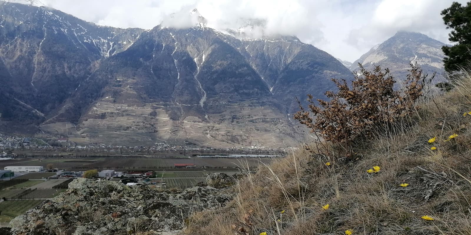
Leaving Charrat, the trail then climbs steeply towards the hill of Vison. This is where it will be possible to see the first bouquets of adonis, especially on the steppe hill. The landscape gradually changes here, allowing you to see more orchards and drier and sparser vegetation.

From here, you’ll now have views of the Rhone Valley and the surrounding mountains. This is the heart of the “Sentier des Adonis,” where you can find the greatest concentration of these golden yellow flowers between the end of March and the beginning of May. The vegetation is characteristic of dry meadows.

The trail then leads you to the Cascade des Barmes, which is a refreshing contrast to the drier landscapes you previously hiked through. This part of the route crosses wooded areas, mainly composed of Scots pines and oaks.

The last stage will take you back to the plain, passing through the famous Saxon apricot orchards. This descent is a beautiful transition between the natural environments of the hillside and the cultivated areas.

Best time of the year

The ideal period is from the end of March to the very beginning of May. This is when the adonis flowers bloom and emerge from the dry grass. Above the village of Charrat, on the steppe hill, appear the first clumps of adonis, which can also be found near the rocky outcrops of the pine forest. If you’re really hoping to catch the flowers in bloom, aim for the middle of the season for the best opportunity.

Safety & Gear

Be warned: the whole adonis plant is poisonous. It contains glycosides that affect the nervous system. These active ingredients give it cardiotonic properties. Due to its high toxicity, its use is strictly discouraged. This is very much a “look, don’t touch” hike.

Bring a first aid kit with you, and lots of water and snacks to stay energized throughout the walk. You’ll also want to wear adequate clothing and hiking shoes that provide support for the rockier areas. Finally, make sure you download the GPX file to your device in case you need to confirm your path.

Difficulty

The Sentier des Adonis is considered a low-difficulty hike, making it accessible to a wide audience, including families. The gentle slopes and well-maintained terrain make it possible to fully enjoy the scenery without requiring prior hiking experience.

Nonetheless, if you want to train a bit for hilly walking, you can try taking daily walks at home, or carrying a full backpack with you throughout the day to adjust to the weight you may carry on the Sentier des Adonis.

Good to know

The trail can be easily accessed from the train station in Charrat, making it convenient for day hikers. The hike takes approximately 1.5 to 2 hours, which means you can complete it within a single day without the need for overnight lodging. However, if you wish to explore the area further or enjoy multiple hikes, you might consider finding accommodation nearby by using www.martigny.com.

The adonis is native to Eurasia. It is present in Valais: at the Follatères in Martigny, in Charrat, Saxon, Riddes, Coor/Nendaz, Bramois, Nax, Agarn, and Tourtemagne. Adonis is protected in Valais. Let us not give in to the temptation of picking. But adonis is not the only interest of this region. Oak, Scots pine, field maple, and cherry occupy the northern side of the hill. In the groves, you may also recognize the barberry, the black elderberry, the common juniper, and the rosehip.

The hike can be done with dogs. If you have a car, parking spaces are available at the train station in the village of Charrat.

route
point-to-point
highest point
577m (1.893 ft)

Want to submit a trail or make this page more complete?

Always read the disclaimer

Terms of Use: important to all visitors on this website. We strive to publish high quality content and information on this website. However it’s always possible that we’re missing out on some crucial information. In spite of the fact that this route, associated GPS track (GPX and maps) were prepared under diligent research by the specified contributor and/or contributors, the accuracy of such and judgement of the author is not guaranteed. Therefore, hiking-trails.com and contributors are in no way liable for personal injury, damage to personal property, or any other such situation that might happen to individuals hiking or following this route. Should you choose to hike this trail, this is always at your own risk. Check out our guidelines for safety hiking and Leave No Trace principles at the hiking 101 page.

Download GPX

Join the community!

Login or create a FREE account 😊

With an account you can:

Download GPX files

Pin trails to your wishlist

Mark trails as hiked by you

Rate hiking trails

Comment on trails, blogs and gear reviews

Happy trails!
Login

Don't have an account yet? Register here