About the SchwarzWeiss Trail

Alps
country
Italy
length
73 km(45 mi)
Type of trail
Long-distance
difficulty

Difficulty is highly personal. Be aware of the weather conditions as bad weather turns easier trails in difficult trails especially in the mountains.

Moderate
accommodation

Lodging means a mix of hotels, hostels or AirBnB’s.

Lodging
Elevation gain
3699 m(12136 ft)
terrain
Forest, Hills, Mountains
remoteness
Most of the time
Show more

The SchwarzWeiss Trail is a new, 6-day long-distance route through South Tyrol, open as of summer 2024. The trail is the perfect way to experience the people and culture of the region as you hike between the many contrasting, “black and white,” elements of the area. You’ll move between mediterranean climates and the Dolomites, wine region and forests, and lakes and summits while staying at beautiful hotels each night and eating the best food in the region.

The beauty of the trail is that it goes through small villages, so you can enjoy the mountains without sacrificing comfort each night. The trail climbs both the Schwarzhorn and Weisshorn with different “side quests” possible once you arrive at your hotel. It also goes past an alm almost every single day, where you can stop for lunch or at least a coffee. It has a few difficult days, but none are very long, so there is always time to stop and enjoy mountain life at its finest.

women in blue smiling at camera
Editor

Katie Mitchell

After a whirlwind of 8 years on the road (and trail!), Katie has hiked the Camino Frances, the Peaks of the Balkans, the Fisherman’s Trail, and extensively in the United States. She is an avid trail runner and now lives in Colorado where she plays in the mountains in her free time. You can follow her adventures on Instagram.

View profile

The Trail

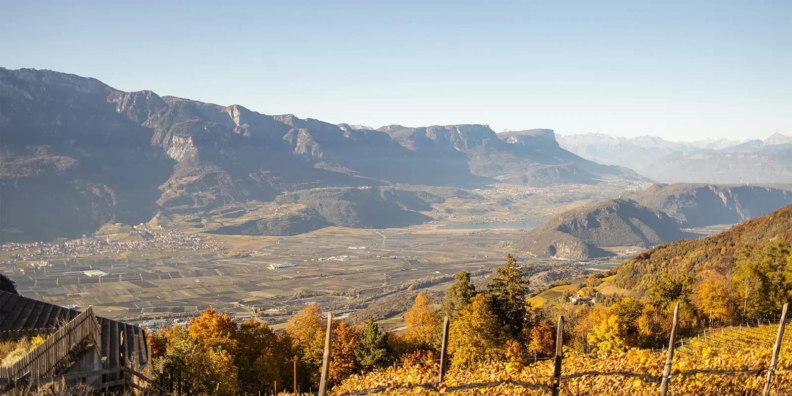
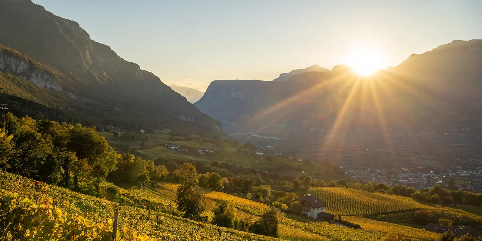
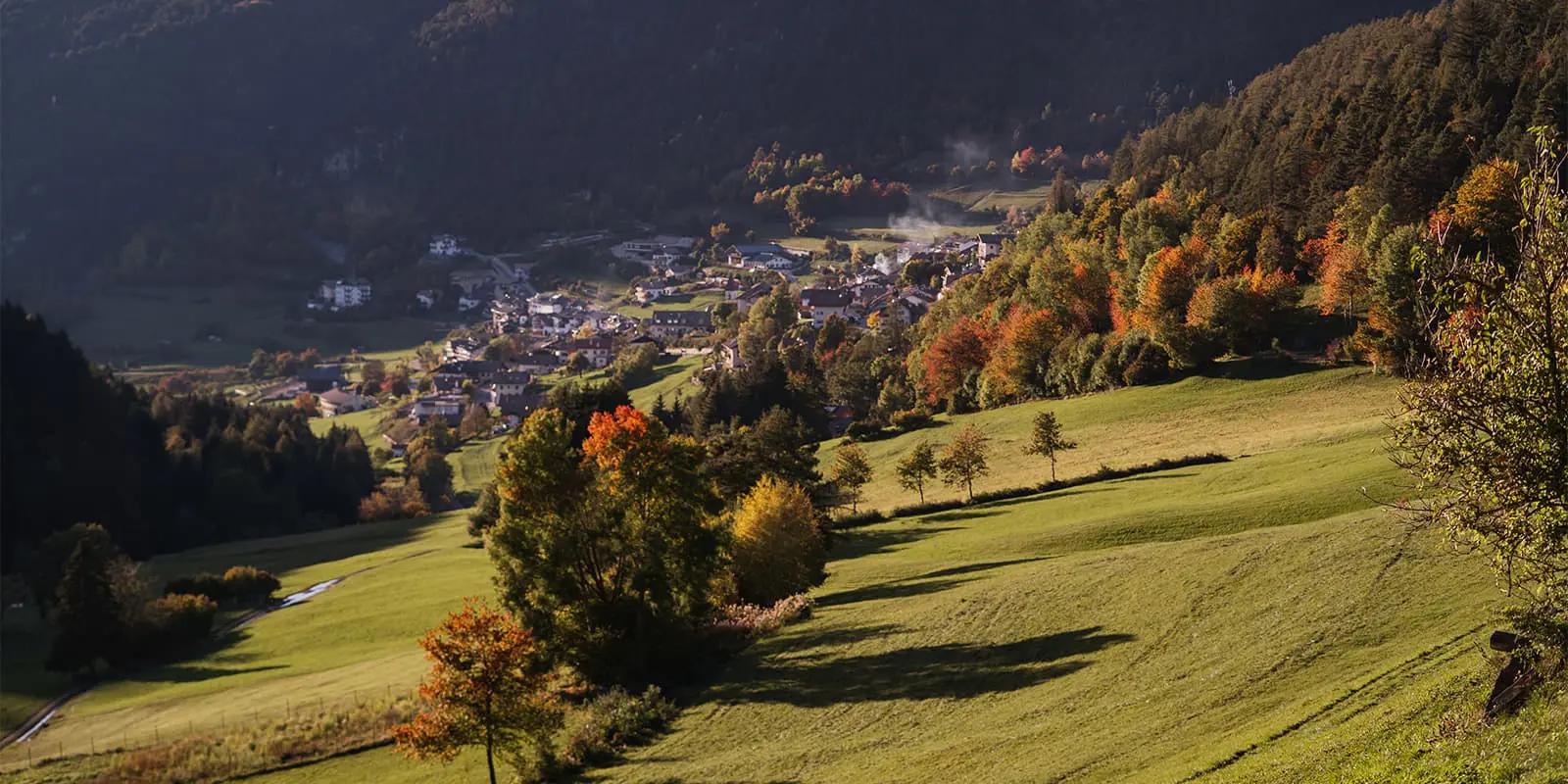
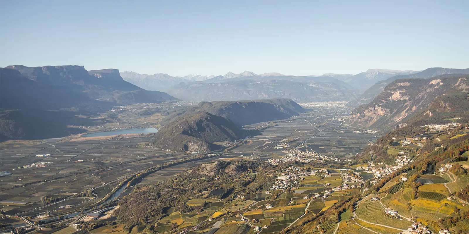
The SchwarzWeiss trail can be hiked in either direction, and overlaps with the E5 and the Pinot Nero trails. It is a loop, so you can begin in any town, although Montan is the biggest and easiest to access. This trail is best hiked slowly, with lots of time to savour the flavors and culture of South Tirol Sueden.

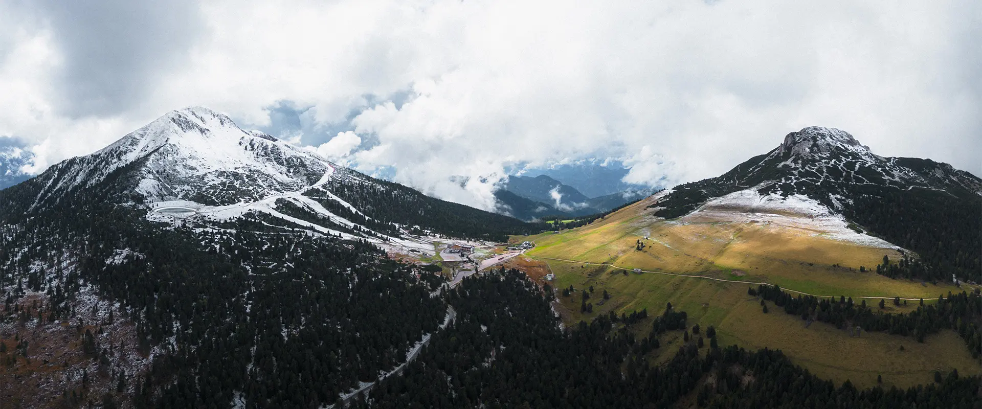
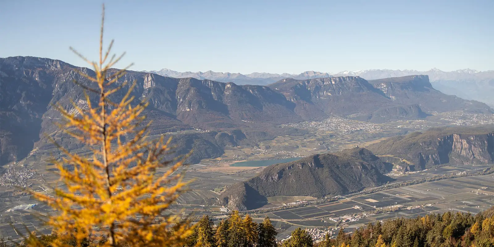
Stage 1 begins by walking from Montan through small vineyards, overlapping with the Pinot Nero trail on the first day. Soon, the real fun begins, and you will hike up 1200 meters on steep hills. Just after the vineyards stop, you’ll pass into the super-protected Parco Naturale Monte Carlo, where the world quiets and you feel immersed in nature. The path can be strenuous and demanding, but 100% worth it for the incredible views of the mountains, villages, and vineyards around you. It is rocky and through forest for the most part on this day, with spontaneous breaks where you’ll see the most amazing scenery. If you’re up for it, take a detour to Dorfner for a tasty lunch!  You end in Gfrill, and if you stay at Pension Fichtenhof, you’ll have award-winning food from their chef and co-owner, Ingrid.

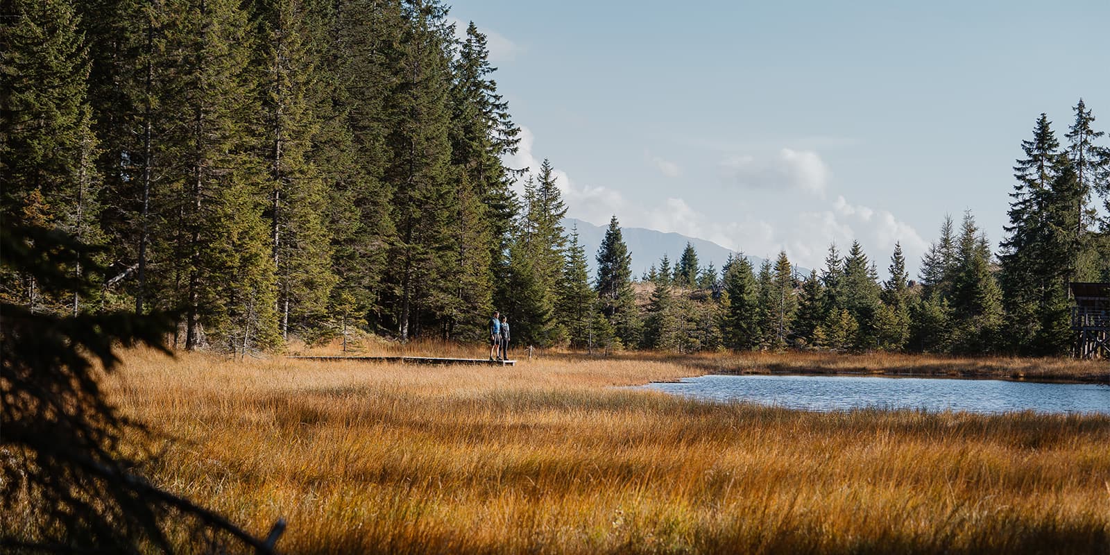
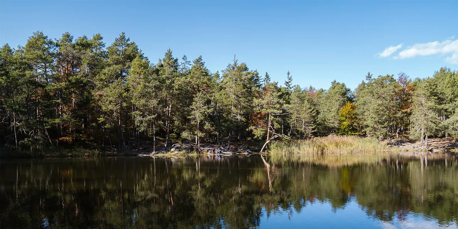
The next stage feels easy after the day prior. There is still 600m uphill, but with more gradual climbs, a welcome treat! You stay in the national park for the majority of the day, which feels very quiet and special. After stopping to admire Lago Bianca and Lago Nero, you can stop for lunch at the Horn Alm, which is very popular with other long-distance hikers. The portions are big, so save your appetite for this delicious mid-day break. From the alm, you will hike down for about 1.5 hours to Altrei, another small mountain town nestled into the hills. Take note that the real beauty of this trail is the people and the culture, so it’s worth taking time to really speak with your hosts. They’re very eager to have an intercultural exchange and share about the unique customs of the region. Once you’re in Altrei, be sure to try some of the lupine coffee or other treats they produce from the flower. We stayed at Hotel Langeshof, where they are especially known for their lupine recipes!

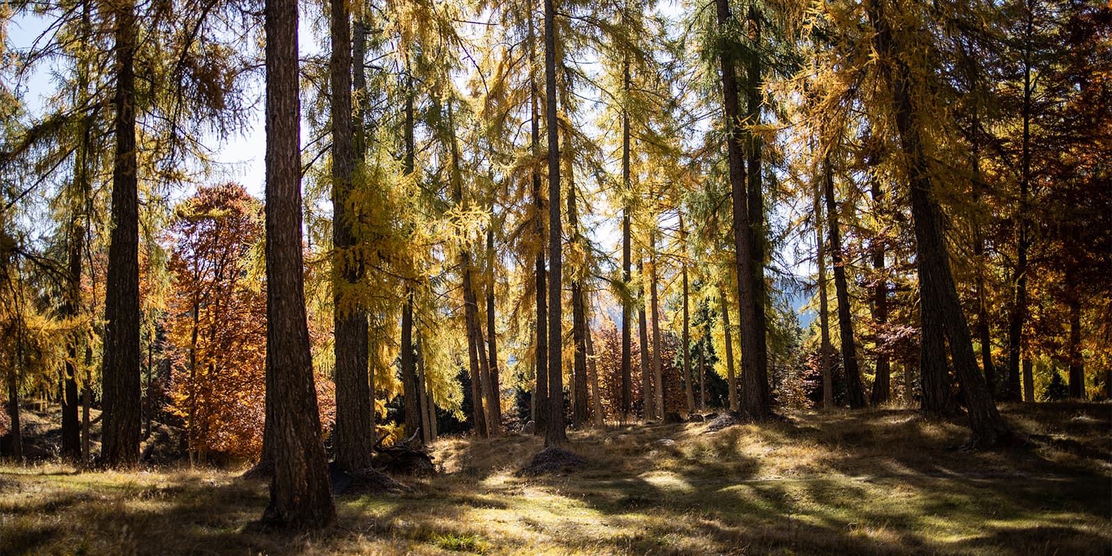
You’ll find that stage three of the SchwarzWeiss Trail is another short day, this time climbing closer to 400 meters. You could combine the second and third stages if you wanted to hike the path in fewer days, as they are both around 3 hours, although the combination of the elevation gain on each day may make it more strenuous. About an hour from Altrei is a cozy alm, the Krabesalm, where you can stop for brunch or lunch. You will hike up from Altrei toward Truden, through the forest and on perfectly maintained stone paths. The paths alone are a great indicator of how much money and the region pours into its trails and tourism infrastructure!

Stage 4 is the most challenging day of the trail, as you will climb 1700 meters over 14.4 km. First, you’ll walk down to the valley from Truden, and then up to the summit of Schwarzhorn before finally ending at a hotel on the saddle between Schwarzhorn and Weisshorn. For the first hour, you’ll descend down well-groomed paths until you reach Kaltenbrunn Fontanefredde in the valley, where you can have a coffee or pick up a snack for your lunch later in the day. From there, it’s time to start climbing. The first ~350 meters are very steep and consist of a lot of scrambling up the hillside. You’ll need good balance for this! From there, the trail becomes more established, but remains steep. It’s a fairly straight shot upward for about 1200 meters. Finally, you will reach a beautiful pass, Leitenspitze, which is a great lunch spot. Then, you’ll get to enjoy hiking on flat ground for a few km before beginning your ascent of Schwarzhorn. This is one of the absolute highlights of the trail! Once you summit the peak, you’ll descend the other side, where you will reach your hotel for the night. There are only two hotel options, so be sure to book ahead of time.

The best way to hike stage five is to wake up for a sunrise summit of Weisshorn before continuing the day. It takes only about an hour to climb, which means it is about 2 hours round-trip. Seeing the sun come up with 360° views is definitely worth an early morning. From there, head back to your hotel for breakfast, pack up, and hit the trail for real! You’ll descend for most of the day, with a chance to break at the Schmiederalm for a coffee or lunch. Again, you’ll have fantastic views of the surrounding mountains, and likely hike next to many cows and sheep as you make your way back to the valley. One of the most unique places to stay in Aldein is Hof im Thal, who are known for their mushroom cultivation and wine cellar, just a bit outside of the town.

The final stage completes the Schwarz Weiss loop and takes you back to Montan. You’ll mostly descend for about 3 hours, with a few well-timed hills throughout the day. As you hike, you’ll feel the transition from mountains to valley as you pass through many vineyards and orchards. Once you reach Montan, try grabbing lunch at The Goldener Löwe to finish in style!

Stages

The stages of the SchwarzWeiss trail can be hiked in either direction, toward Schwarzhorn or toward Weisshorn, and you can begin in any town. However, Montan may be the easiest place to begin, as it is the largest of the villages and has more long-term parking options.

SchwarzWeiss Trail 6-stage itinerary

Stage 1:

Montan – Gfrill, 12 km | 7.5 mi

Stage 2:

Gfrill – Altrei, 12.5 km | 7.7 mi

Stage 3:

Altrei – Truden, 9.6 km | 6 mi

Stage 4:

Truden – Jochgrimm, 14.4 km | 9 mi

Stage 5:

Jochgrimm – Aldein, 18 km | 11.2 mi

Stage 6:

Aldein – Montan, 11 km | 6.8 mi

Accommodations

The beauty of the SchwarzWeiss Trail is that you sleep in villages each night. This means that you can experience the mountains without sacrificing comfort! The hotels along the route all include meals and have options for all dietary needs. Additionally, most of the hotels below have saunas to relax in, just what every hiker wants after a long day on trail.

Accommodations per stage

Stage 2:

Hotel Langeshof

Stage 3:

Hotel Trudnerhof

Stage 5:

Hof im Thal

Best time of the year

The best time of year to hike the SchwarzWeiss Trail is between May and September. While the trail should be clear and accessible from March through October, there may be lingering snow or fresh snow as you hike closer to the off-season. We hiked in late September and experienced the first snow of the season, making it quite slippery in sections without microspikes. Be sure to check the weather forecast before you start your hike and pack appropriately!

South Tyrol Sueden is famous for having 300 days of sunshine, which means you should be okay with the weather while you hike. However, it is known that there are 2 weeks in the year, once in spring and once in fall, with continuous rain for 4+ days. Be sure that you’re not hiking in one of those weeks!

Safety & Gear

This is a very well-connected trail with many exit points if need be. You will pass alms each day while hiking, and have contact with your hotels each night in the villages. However, it is still important to prepare for the SchwarzWeiss Trail by packing appropriately and taking care to understand the undertaking of hiking the trail.

Packing for the SchwarzWeiss Trail should be lightweight, as you will sleep at hotels and have the chance to buy lunch at alms each day. You must bring enough water for the day, as well as hiking clothes that will protect you from the elements: sun, rain, wind, or even snow. It is also a good idea to have hiking shoes with a good grip, as you’ll hike on boulders and rocks at different times. If you’re hiking early in the season or late in the season (March-April or September-October) it will also be a good idea to bring a pair of micro-spikes just in case.

Finally, bringing a basic first aid kit is always a good idea on a hike. Carry the essentials and know how to use them, as well as the local emergency services phone numbers. You should have cell signal throughout the trail for the most part as well.

Difficulty

The SchwarzWeiss trail is rated as a moderate trail because of the balance of difficult and easy terrain. While the climbs can be ranked as difficult to strenuous, there are only two days of difficulty. The other four days are moderate to easy with more gradual climbs and descents. However, the trail should only be attempted with a strong base level of fitness. The climbs from Montan to Gfrill and up Schwarzhorn are strenuous and extremely steep in sections. There is no possibility to skip these without 6+ hours of public transportation, so assess your physical abilities before starting the trail.

Good to know

The trail is very well signposted and overlaps with other trails throughout the week. You’ll find yourself on the E5 on multiple occasions, as well as the Pinot Nero wine trail (this is a fun one!). The SchwarzWeiss Trail is comprised of many pre-existing trails, which means you may not always see trail markers for the SchwarzWeiss, but instead will follow the markers for another trail that overlaps. When referencing the official map, you will see which marker/town direction to look for to follow for the day. Additionally, downloading the GPX will help clear up any confusion. You can hike in the direction of the Schwarzhorn or the Weisshorn, and depending on the direction you hike in, you will follow either the black (Schwarzhorn) or white (Weisshorn) arrows.

The SchwarzWeiss Trail was created to connect you with the local culture and people. While it is also a beautiful trail, the main emphasis is to come away with a feeling for the area. To get the most out of the trail, stop and talk with the people you meet. You’ll see that the region is very special, as there are very few tourists still in South Tyrol Sueden. Locals are curious about tourists and want to talk. You’ll have the feeling that you’re actually having an intercultural exchange, instead of the sometimes common feelings of mass tourism in other mountainous regions.

route
Circuit
highest point
2385m (7824 ft)

Want to submit a trail or make this page more complete?

Always read the disclaimer

Terms of Use: important to all visitors on this website. We strive to publish high quality content and information on this website. However it’s always possible that we’re missing out on some crucial information. In spite of the fact that this route, associated GPS track (GPX and maps) were prepared under diligent research by the specified contributor and/or contributors, the accuracy of such and judgement of the author is not guaranteed. Therefore, hiking-trails.com and contributors are in no way liable for personal injury, damage to personal property, or any other such situation that might happen to individuals hiking or following this route. Should you choose to hike this trail, this is always at your own risk. Check out our guidelines for safety hiking and Leave No Trace principles at the hiking 101 page.

Download GPX

Join the community!

Login or create a FREE account 😊

With an account you can:

Download GPX files

Pin trails to your wishlist

Mark trails as hiked by you

Rate hiking trails

Comment on trails, blogs and gear reviews

Happy trails!
Login

Don't have an account yet? Register here