About the Saas Mountain Hut Tour

Alps
country
Switzerland
length
65 km(40 mi)
Type of trail
Long-distance, Hut to hut
difficulty

Difficulty is highly personal. Be aware of the weather conditions as bad weather turns easier trails in difficult trails especially in the mountains.

Difficult
accommodation

Lodging means a mix of hotels, hostels or AirBnB’s.

Mountain huts
Elevation gain
5186 m(17014 ft)
terrain
Mountains, Forest
remoteness
Most of the time
Show more

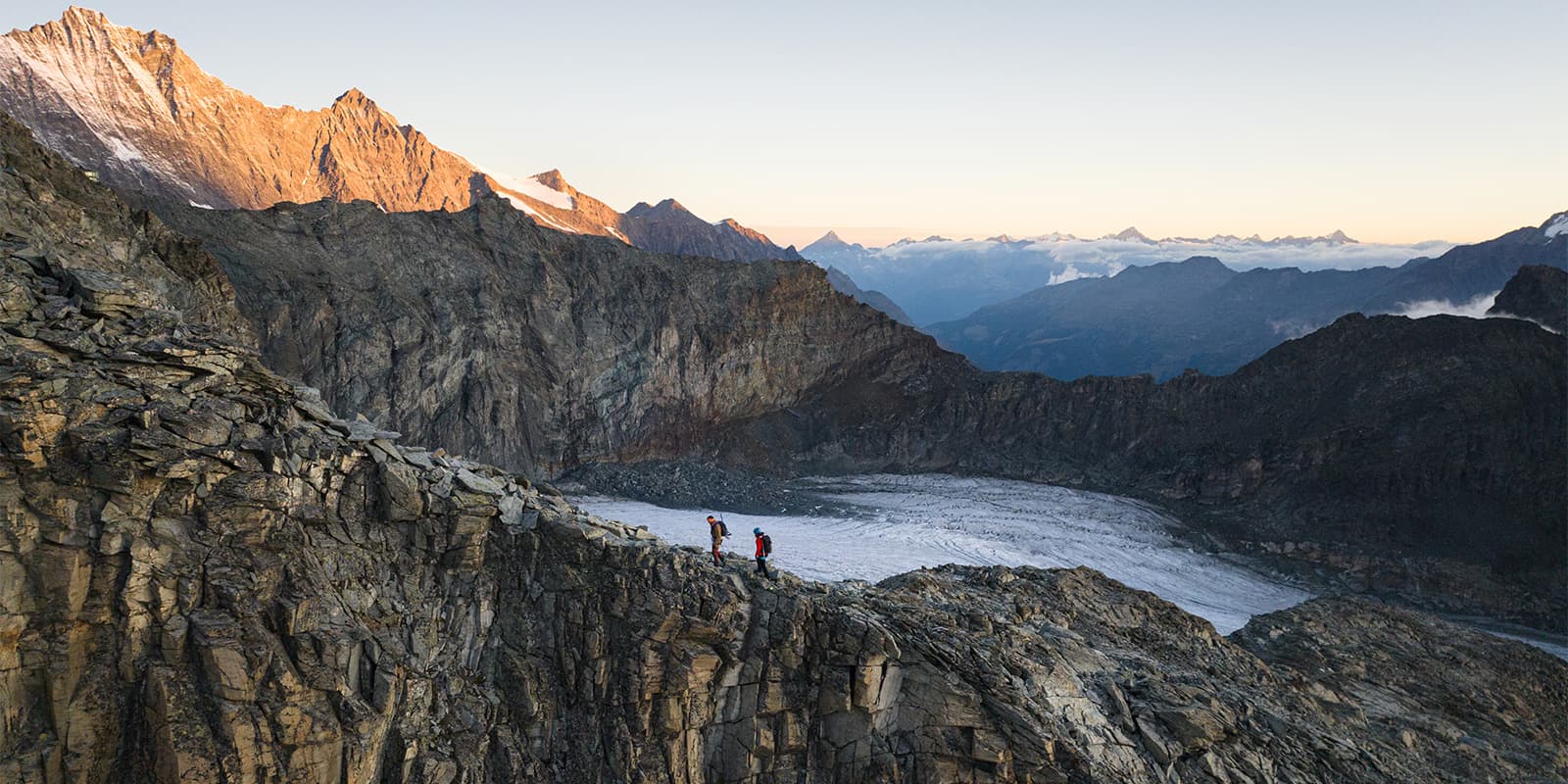
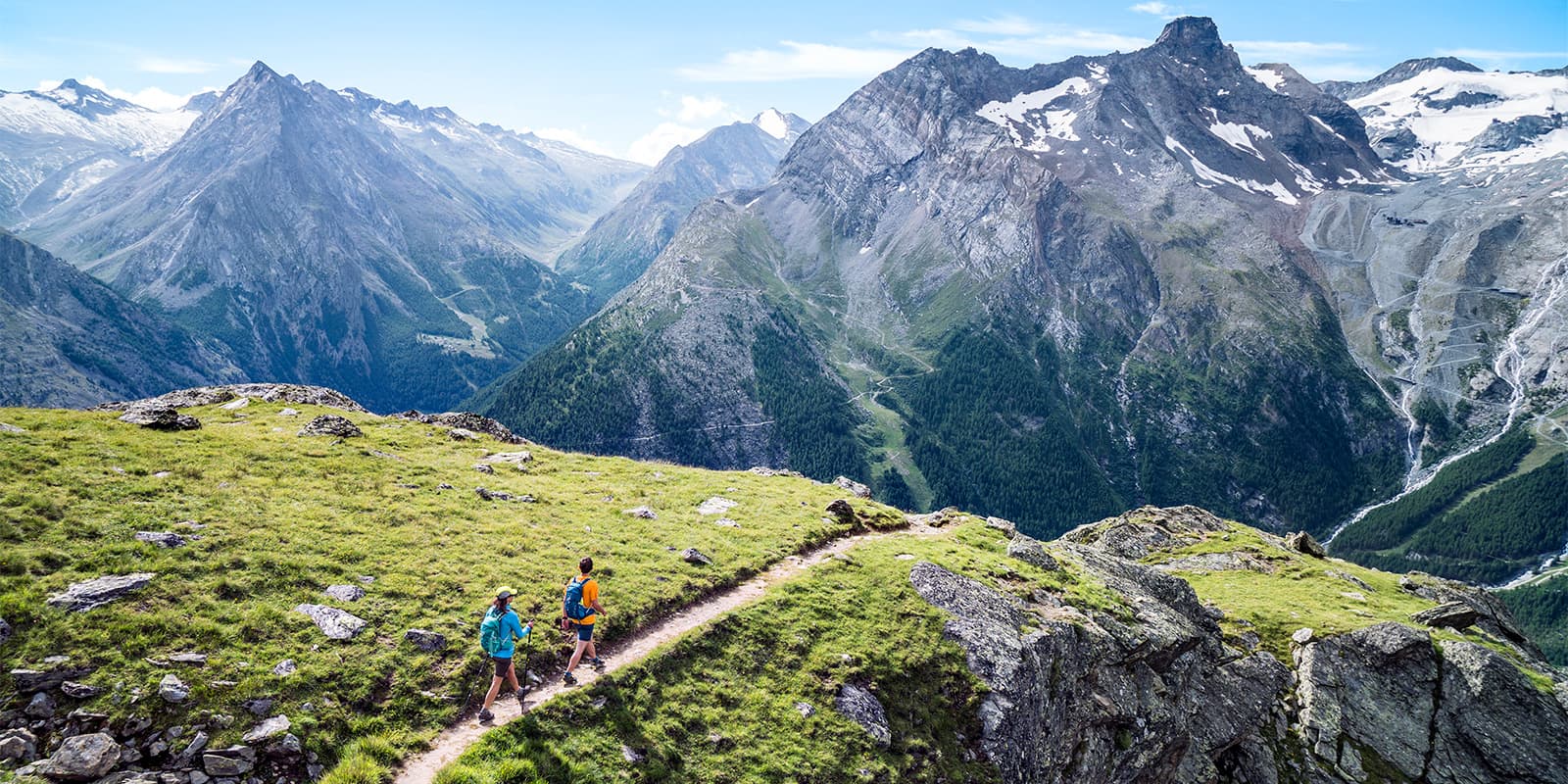
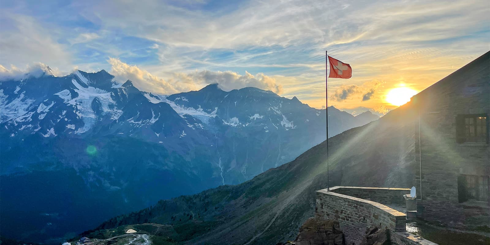
The Saas Mountain Hut Tour takes five days across the Saas Valley. It covers 65.3 kilometers with over 5,000 meters of both ascent and descent. You move from Gspon to Saas-Fee, stopping at four huts along the way: Weissmies, Almageller, Britannia, and Mischabel. This is a loop through high alpine terrain. 

You cross ridgelines, navigate rocky sections, and spend nights in the staffed huts. Each stage runs between 4 and 7 hours, depending on distance and elevation. You will need strong legs, steady footing, and reliable gear. This tour is meant only for experienced hikers who are comfortable in alpine conditions.

Elmar profile picture
Editor

Elmar Teegelbeckers

Passionate hiker Elmar spends months of his time on the trail. He’s usually on the lookout for hidden gems in one of his favourite countries such as Slovenia, Switzerland and Japan. He founded hiking-trails.com in need for a community and detailed information about the trails. Before this, he worked for the Alpine asscociation in the Netherlands[ (NKBV) but lost his heart to the trails.

Not long ago, Elmar published the book (in Dutch) Hiking Trails – best long-distance trails in Europe. With this book, website and socials, he hopes to inspire and shape an inclusive community for hikers all over world. No matter your speed, experience or level, you can get out there to enjoy the trails and connect with the heartwarming hiking community. Life is so much better outside and he hopes to inspire hikers to take their first, or next, step on the trail.

You can reach Elmar at info@hiking-trails.com.

View profile

The Trail

The tour starts in Gspon after you take the cable car up from Stalden. Stage 1 heads to Weissmies Hut, along a steady ridge with long views. You’ll follow the Gsponer Höhenweg above the treeline on this day, and you should have views of the 4000m peaks in the area. On stage 2, you will hike from Weissmies Hut to Almageller Hut. You’ll descend from Weissmies Hut to Kreuzboden, then head south towards Saas-Almagell, passing the ‘Triftgrätji’ ridge with panoramic views.

From the Almageller hut, stage 3 links you to the Britannia Hut. You will descend to Furggstalden via an adventure trail featuring suspension bridges and iron footbridges, then take a chairlift to Saas-Almagell and a postbus to Mattmark dam. From there, you will ascend over the Allalin and Hohlaub glaciers, so it’s best to bring microspikes or crampons. On stage 4, you will go from Britannia to Mischabel Hut, climbing into exposed terrain and ending on a (literal) high note at the Mischabel Hut, which is at 3329m. Finally, stage 5 drops back into Saas-Fee on a direct downhill path. Only 5.5 kilometers, you’ll have a lot of the day left to explore the town of Saas Fee and make your way back to your car.

Stages

The Saas Mountain Hut Tour is split into five stages. While taking five days to hike 65 kilometers may feel excessive to some, it is best to complete this trail within the designated time due to the difficulty of the trail. The T4 rating means that each day can be a strenuous effort, and it’s best to give your body a rest at the end of each day instead of pushing too hard.

5-Day Saas Mountain Hut Tour Itinerary

Stage 1:

Gspon – Weissmies Hut, 15.7 km | 9.8 mi

Stage 2:

Weissmies Hut – Almageller Hut, 12.1 km | 7.5 mi

Stage 3:

Almageller Hut, – Britannia Hut, 20.2 km | 12.6 mi

Stage 4:

Britannia Hut – Mischabel Hut, 13.2 km | 8.2 mi

Stage 5:

Mischabel Hut – Saas Fee, 5.5 km | 3.4 mi

Accommodations

You will sleep in mountain huts each night of this tour. The trail takes you to four different huts in the Saas Fee region that are known for their hospitality and coziness high up in the Alps.

The huts take reservations online or by phone. You’ll want to book early in the season, as they fill up quickly. Each mountain hut offers dorm-style lodging with half-board, where you’ll get dinner and breakfast with your overnight stay. Additionally, Saas-Fee has hotels, guesthouses, and hostels if you want to stay a night before or after the route. Gear rental is available in town, and shops stock the basics you’ll need for the trail.

Mountain huts per stage

Stage 1:

Weissmies Hut

Stage 2:

Almageller Hut

Stage 3:

Britannia Hut

Stage 4:

Mischabel Hut

Best time of the year

The best time of the year to hike the Saas Mountain Hut Tour is between July and September. This is when the snow should be melted and the huts will be open. If you’re not sure about the trail conditions when you want to hike, you can check the trail webcams that the Saas Fee tourism board has posted on their website.

Even though it will be high summer when you hike, you will want to pack properly with layers for colder weather. Once you get into the high alpine, the temperature will drop and you may experience all types of weather patterns.

Safety & Gear

Hiking the Saas Mountain Hut Tour is something you need to prepare for. Because it is a hut-to-hut tour, you won’t have to pack very much in your bag, and we have a hut-to-hut packing list here for inspiration. What you’ll really need to spend time preparing is your physical fitness.

Make sure to train outside before this hike, walking on uneven ground to improve your balance, strengthening your muscles for the climbing, and working on your flexibility for descents. If you’re unsure about your fitness level and want to hike the Saas Mountain Hut Tour, try a “shakeout” hike beforehand to test your abilities. This can be a slightly easier, shorter hike where you can simulate some of the conditions of the trek.

Difficulty

The Saas Mountain Hut Tour is rated as a difficult trail. This is for two reasons. The first reason the trail is rated as so difficult is because of the amount of elevation gain that you will climb over the 65 kilometers of the trail. The second reason is the paths themselves, which are given a difficulty rating of T4.

A T4 rating means that the paths will be harsh, steep alpine trails with some climbing sections, snowfields, steep grassy (slippery) slopes, or potential glacial crossings. This is only to be attempted by experienced hikers who have spent prolonged amounts of time in the mountains in harsh conditions. You don’t want to be caught underprepared in the alpine.

Good to know

You can get to the trailhead by taking a train to Visp, then a PostBus to Stalden. From there, hop on the Gspon cable car. At the end of the hike, you will walk straight into Saas-Fee. You don’t need to shuttle your car or loop back, as local buses will take you right back to Gspon if you left your car there.

Pro tip: the SaastalCard gives you access to PostBuses and some lifts. Weigh out the pricing of a la carte tickets versus the card and most definitely get it if you’re staying a few days after the trail.

Saas Fee has over 350 kilometers of trails and dozens of peaks. If you want a rest day or a shorter walk, stay in Saas-Fee and explore local trails like the Almageller Panorama or the Gletschersee circuit. You can also tack on summit routes or join guided glacier tours if you want to extend the trip.

route
point-to-point
highest point
3329m (10.921 ft)
Water resources
At mountain huts

Want to submit a trail or make this page more complete?

Always read the disclaimer

Terms of Use: important to all visitors on this website. We strive to publish high quality content and information on this website. However it’s always possible that we’re missing out on some crucial information. In spite of the fact that this route, associated GPS track (GPX and maps) were prepared under diligent research by the specified contributor and/or contributors, the accuracy of such and judgement of the author is not guaranteed. Therefore, hiking-trails.com and contributors are in no way liable for personal injury, damage to personal property, or any other such situation that might happen to individuals hiking or following this route. Should you choose to hike this trail, this is always at your own risk. Check out our guidelines for safety hiking and Leave No Trace principles at the hiking 101 page.

Download GPX

Join the community!

Login or create a FREE account 😊

With an account you can:

Download GPX files

Pin trails to your wishlist

Mark trails as hiked by you

Rate hiking trails

Comment on trails, blogs and gear reviews

Happy trails!
Login

Don't have an account yet? Register here