About the Rockwall Trail

country
Canada
length
54 km(34 mi)
Type of trail
Long-distance
difficulty

Difficulty is highly personal. Be aware of the weather conditions as bad weather turns easier trails in difficult trails especially in the mountains.

Moderate
accommodation

Lodging means a mix of hotels, hostels or AirBnB’s.

Camping
Elevation gain
3405 m(11171 ft)
terrain
Mountains, Forest
remoteness
Most of the time
Show more

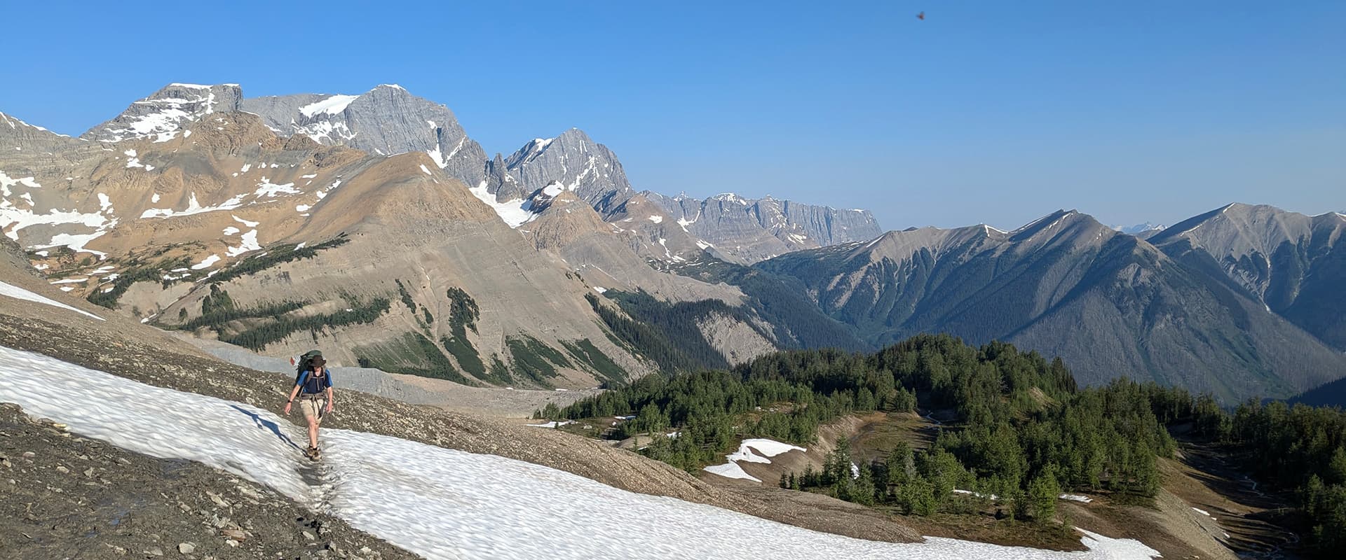
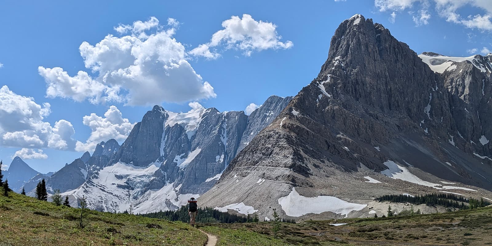
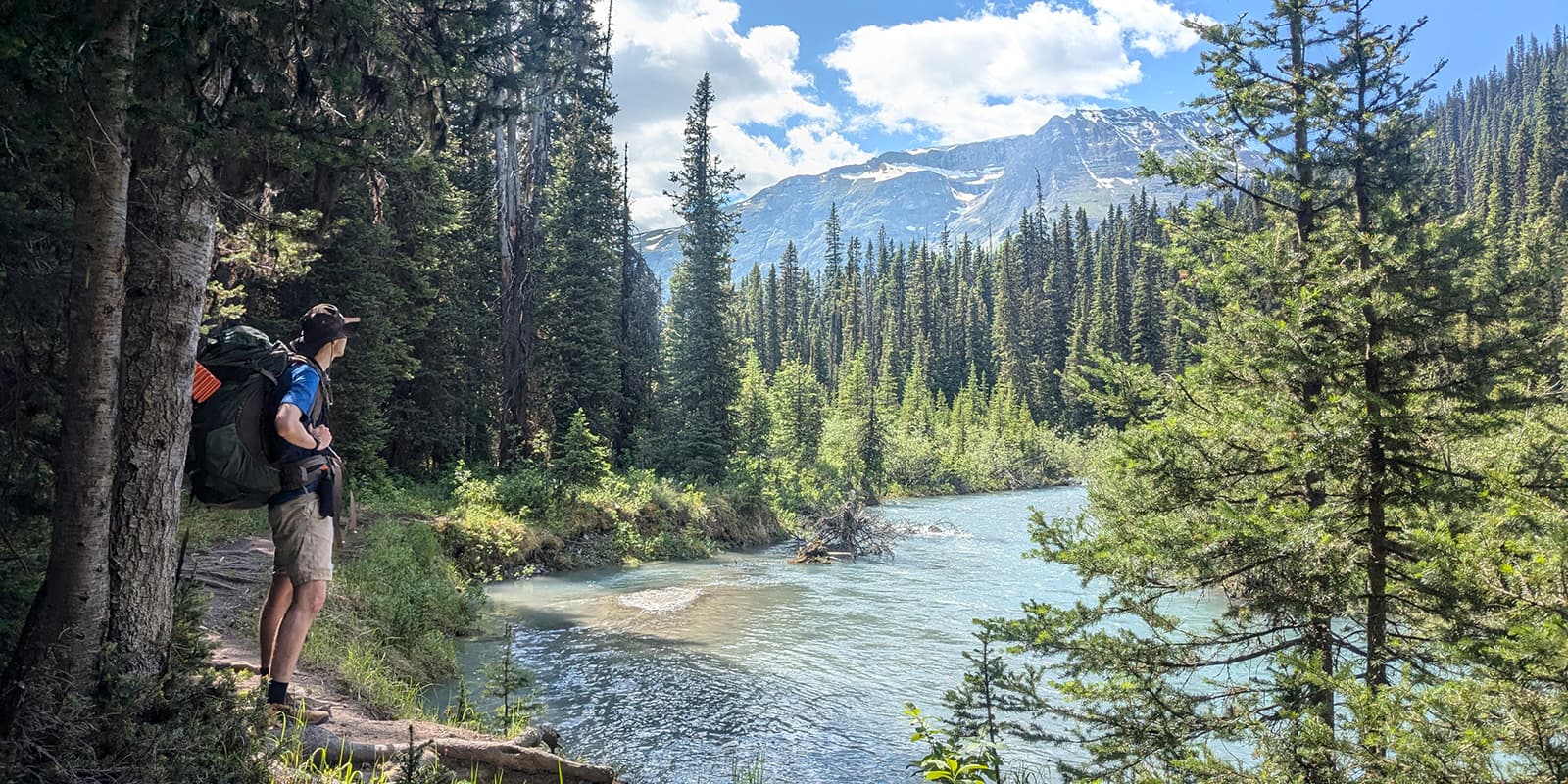
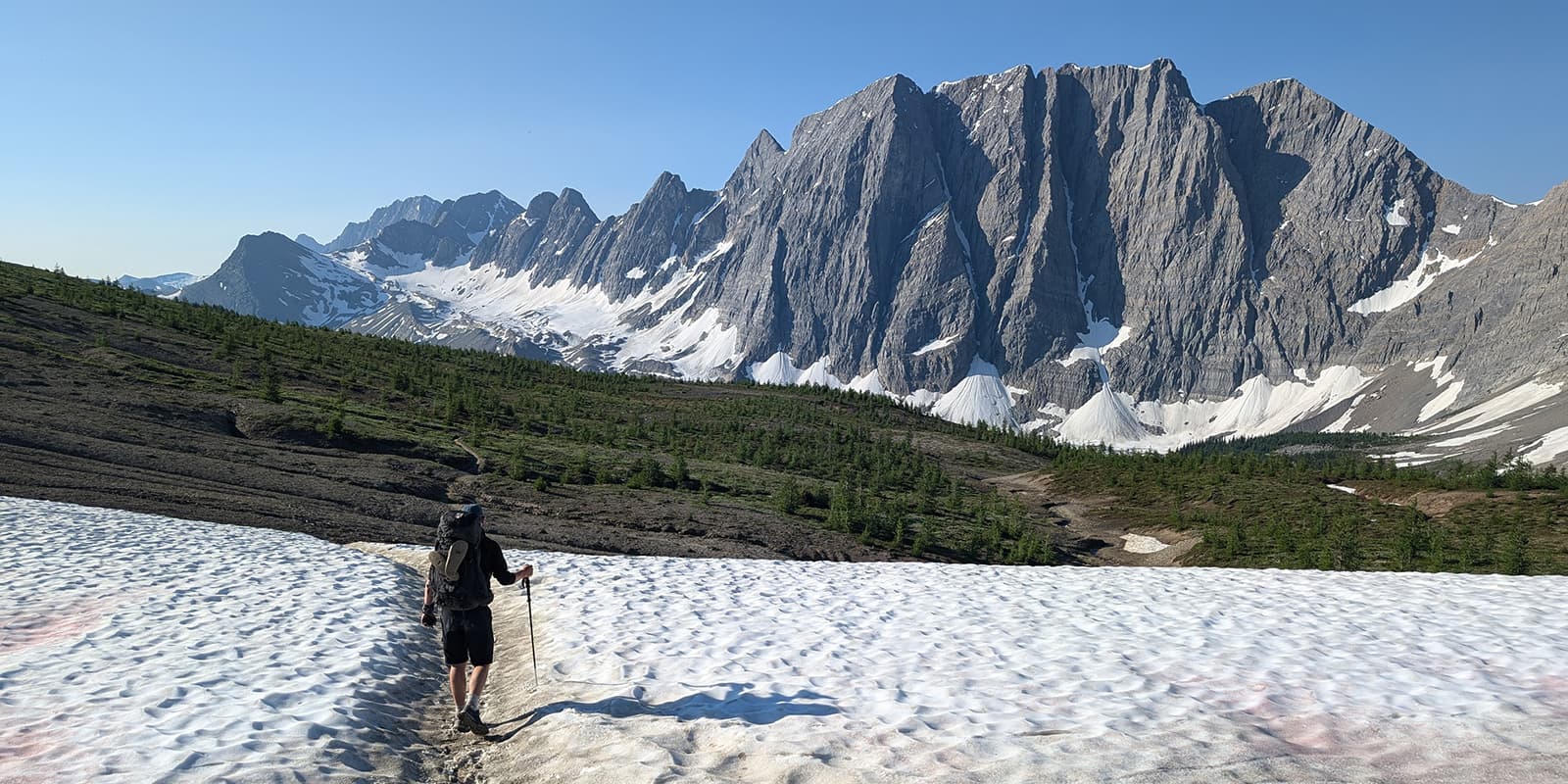
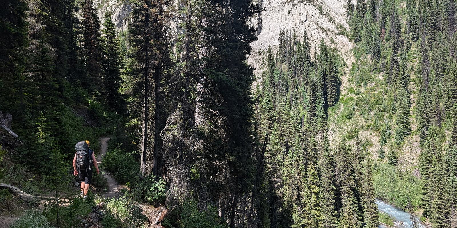
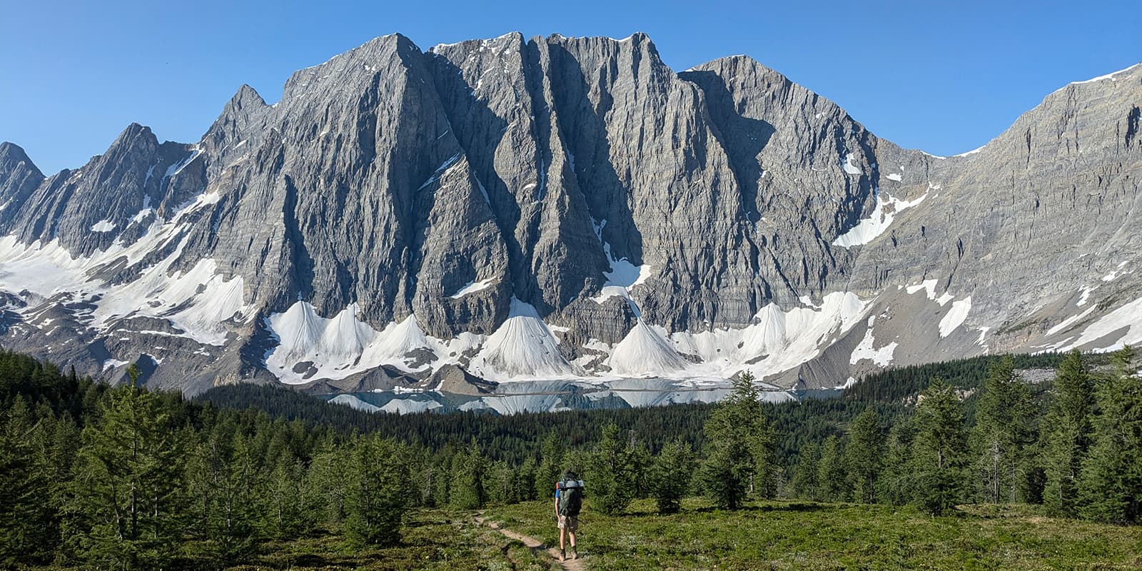
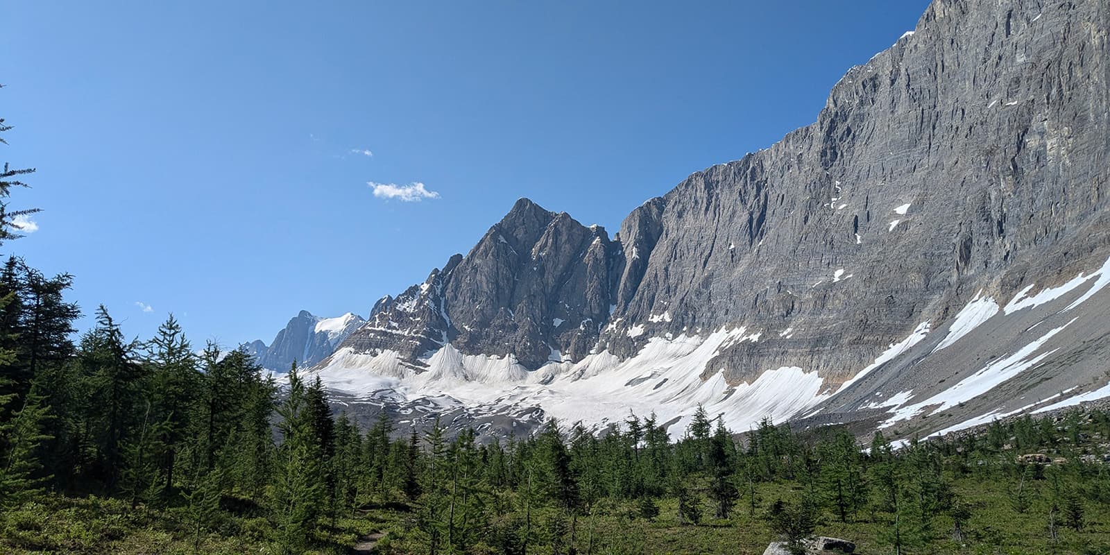
The 54km Rockwall Trail is known for, quite literally, following a huge rock wall! Known for being one of Canada’s best multi-day backpacking trips, it has spectacular landscapes, limestone cliffs, rife wildflowers, lush valleys, and pristine crystal blue alpine lakes, culminating in a step into the true Canadian backcountry. Infrastructure is limited, but excitement and engagement with the wild are embraced.

A Game of Thrones reader told me that the Rockwall itself reminded him of what the Northern Wall should have looked like, and boy did I feel like I had a step into an epic fantasy.

Patrick Gregory profile picture
Author

Patrick Gregory

Pat is a self-proclaimed “covid hiker” and has never turned back. Having kicked off when it was the only available option, he’s since hiked all over the world with a specific love of the Alps and Himalayas. On his list are the cultural trails in Japan and the Jordan trail, but currently residing in Canada is giving him all his hiking needs for now. You can follow Pat on Instagram @pg_tips.

View profile

The Trail

Starting in Paint Pots, the first stage ends at Helmet Falls with the option to split at Ochre Junction. The trail winds up the valley with a foreground of crystal blue rivers, fed from the backdrop of Limestone Peak, Helmet Mountain & Falls. After passing through the pine forests, you end at the delightful Helmet Falls campground, with room for about 15 tents, and an option to hike up to the base of the Rockies’ 11th tallest waterfall if you have the energy left.

The second stage of the Rockwall Trail heads to Tumbling Creek campsite & includes two mountain passes overlooking alpine rivers and meadows. The start includes a gentle ascent but is rewarded with a stunning opening in the forest to see the rock wall in its entirety. The second pass arguably makes this the toughest day but ends with a descent down into the camping quarters. We combined this stage and the following one which made for a doable but taxing day.

The third stage again immediately brings you straight out of the creek with the steepest ascent of the hike but brings you up to another pass with beautiful views down into the valley to follow. This trail continues to steeply wiggle down, on a dusty path ending in head-high wild growth until you reach Numa Creek, a beautiful campsite with a creek through the middle and waist-high wildflowers throughout.

Departing Numa Creek (there’s a pattern here) begins with a reasonably gentle ascent up to Floe Lake with valley views, waterfalls, and more meadows to be found throughout. On reaching the final pass, you’re rewarded with the imposing Floe Peak and an easy run from the rocky pass down to the crystal-blue Floe Lake. If you’re lucky enough to camp here (reservations are very competitive), enjoy a swim and mirror reflections in the morning.

The final stage descends through some forest steeply and then follows the Floe Creek in a notably exposed section, again littered with wildflowers, until you cross the also blue Kootenay River & end at Highway 93.

Stages

These are the stages if you choose to hike the Rockwall Trail from north to south. Note that there are also hikes out to the road (Highway 93) that are parallel to the trail at Tumbling Creek & Numa Creek if you need to shorten your trip.

5-stage itinerary

Stage 1:

Painted Pots Trail Head – Helmet Falls, 14.2 km | 8.8 mi

Stage 2:

Helmet Falls – Tumbling Creek, 12.3 km | 7.6 mi

Stage 3:

Tumbling Creek – Numa Creek, 7.9 km | 4.9 mi

Stage 4:

Numa Creek – Floe Lake, 9.2 km | 5.7 mi

Stage 5:

Floe Lake – Floe Lake Trail Head, 10.5 km | 6.5 mi

Accommodations

When hiking the Rockwall Trail, the only option is pre-booked campsites which are unmanned. All campsites usually need to be booked months in advance, but last-minute options can be found if you have a keen eye out. The beginning and end of the hike have no infrastructure, so come prepared to be self-sufficient for the entirety of the hike. All campsites include toilets, bear canisters, and catering areas. Most campsites have mostly similar camping locations, so no need to leave early to “get a good spot”.

Best time of the year

The best time of the year to hike the Rockwall is from early July until September. As you’re hiking in the mountains, be aware that there might be snowfields in early summer and campsites can only be reserved for July at the earliest.

Keep in mind that the weather in the mountains can change rapidly, and it’s important to be prepared for all conditions, including rain or snow. Always check trail conditions and local weather forecasts. Additionally, consider your hiking experience and skill level, as some trails in the Rockies can be challenging and require proper equipment and experience.

On top of the weather, precautions need to be taken to manage the animals and wildlife in the area – in particular, bears. Be sure to carry your smell-able items in a bear canister, bring bear spray, and a horn or bells.

Safety & Gear

Though unlikely to be a negative encounter, bears, both black and grizzly, are not uncommon in the region – bear spray is a must. Learn how to use it, and ensure you are aware of bear safety practices such as always making noise whilst hiking to avoid surprising a bear.

No food or anything that has an odor can be kept at your campsite – use the bear cans available to you at every site.

Other than that and regular camping equipment, some people might feel more comfortable with some microspikes if it’s looking snowy, but in season this is unlikely – you can use the Rockwall Facebook Group to get reports on the latest conditions.

Wildfires can also be a risk, follow park guidance on this also.

Remember – there are no shops, or any infrastructure on the way or at either end, so you’ll need water purification for creek water, and all the food for the whole trip to be with you from the start.

Good to know

Logistics: This can be a challenge since it’s a one-way hike with no public transport between either end of the trail.

If you hire a car or e-bike you could:

  • Drop it at one end, and hitchhike to the other
  • Rent an extra vehicle, drop at one end
  • Coordinate a lift with fellow hikers on the Rockwall Facebook Group.

If you don’t rent any transport, hitchhike it all!

Booking: Second, book early! The trail is very popular and is often booked out months in advance.

Directionality: We preferred north to south, which means the views get better as you go, and the morning ascents are in the cool forests rather than exposed in the sun.

Safety: Again – wildfires can be a risk, and bears! Top up your knowledge on both of these and follow park guidance.

Water resources: Water is available through natural creeks, no infrastructure is available at all on the route. All water needs purifying.

Route
Point to point
Highest point
2,395m (7,858 ft)

Want to submit a trail or make this page more complete?

Comments

Be the first one to comment on this trail!

Reply to this trail

Your email address will not be published. Required fields are marked *

Reply to this trail

Log in to comment on this trail
Always read the disclaimer

Terms of Use: important to all visitors on this website. We strive to publish high quality content and information on this website. However it’s always possible that we’re missing out on some crucial information. In spite of the fact that this route, associated GPS track (GPX and maps) were prepared under diligent research by the specified contributor and/or contributors, the accuracy of such and judgement of the author is not guaranteed. Therefore, hiking-trails.com and contributors are in no way liable for personal injury, damage to personal property, or any other such situation that might happen to individuals hiking or following this route. Should you choose to hike this trail, this is always at your own risk. Check out our guidelines for safety hiking and Leave No Trace principles at the hiking 101 page.

Download GPX

Join the community!

Login or create a FREE account 😊

With an account you can:

Download GPX files

Pin trails to your wishlist

Mark trails as hiked by you

Rate hiking trails

Comment on trails, blogs and gear reviews

Happy trails!
Login

Don't have an account yet? Register here