Panoramic view of Dolomites mountains on the Ring Friulian trail

Ring of the Friulian Dolomites

Anello delle Dolomiti Friulane

About the Ring of the Friulian Dolomites

Dolomites
country
Italy
length
38 km(24 mi)
Type of trail
Hut to hut, Long-distance
difficulty

Difficulty is highly personal. Be aware of the weather conditions as bad weather turns easier trails in difficult trails especially in the mountains.

Moderate
accommodation

Lodging means a mix of hotels, hostels or AirBnB’s.

Mountain huts, Shelters
Elevation gain
3300 m(10827 ft)
terrain
Mountains, Forest
remoteness
Most of the time
Show more

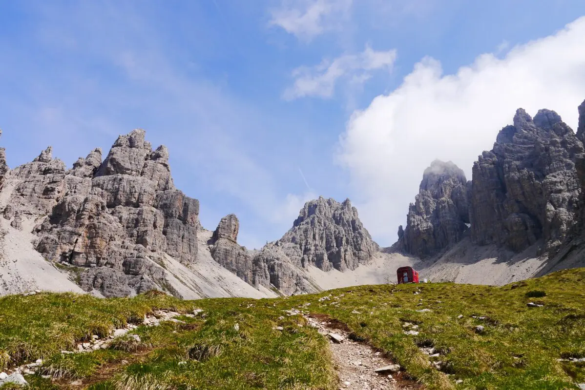
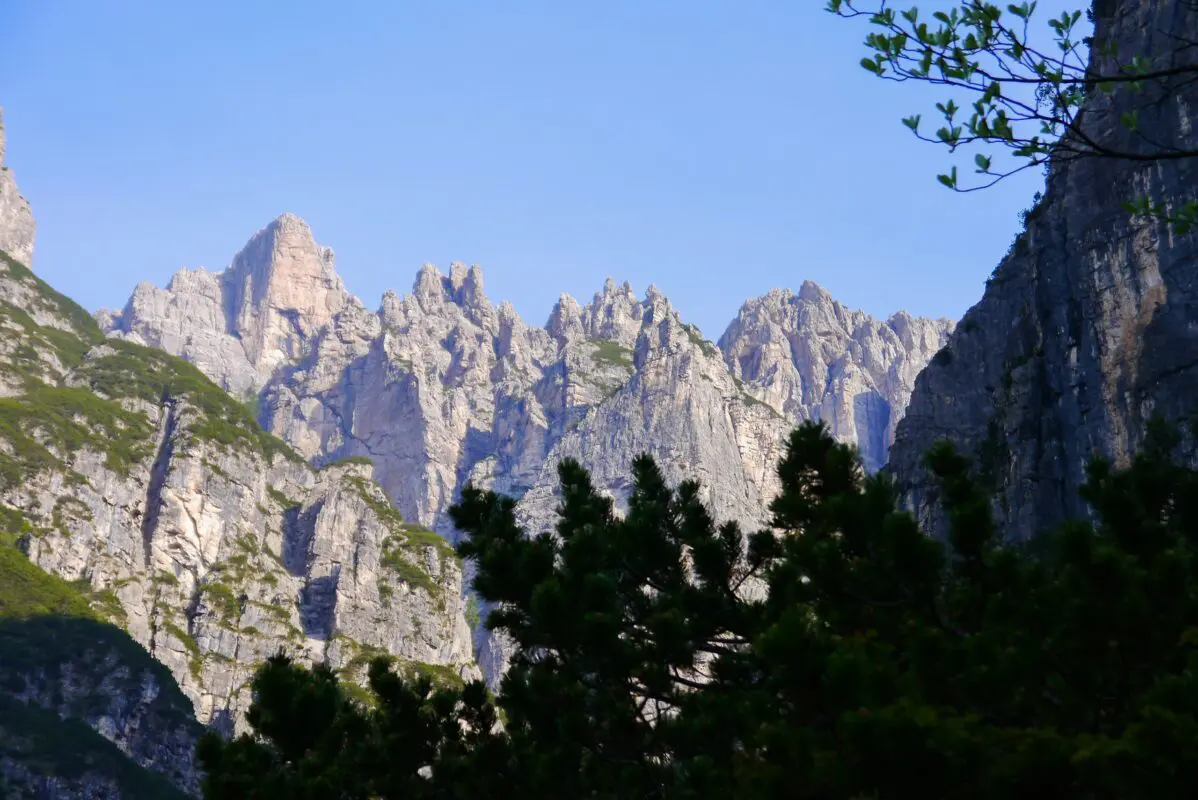
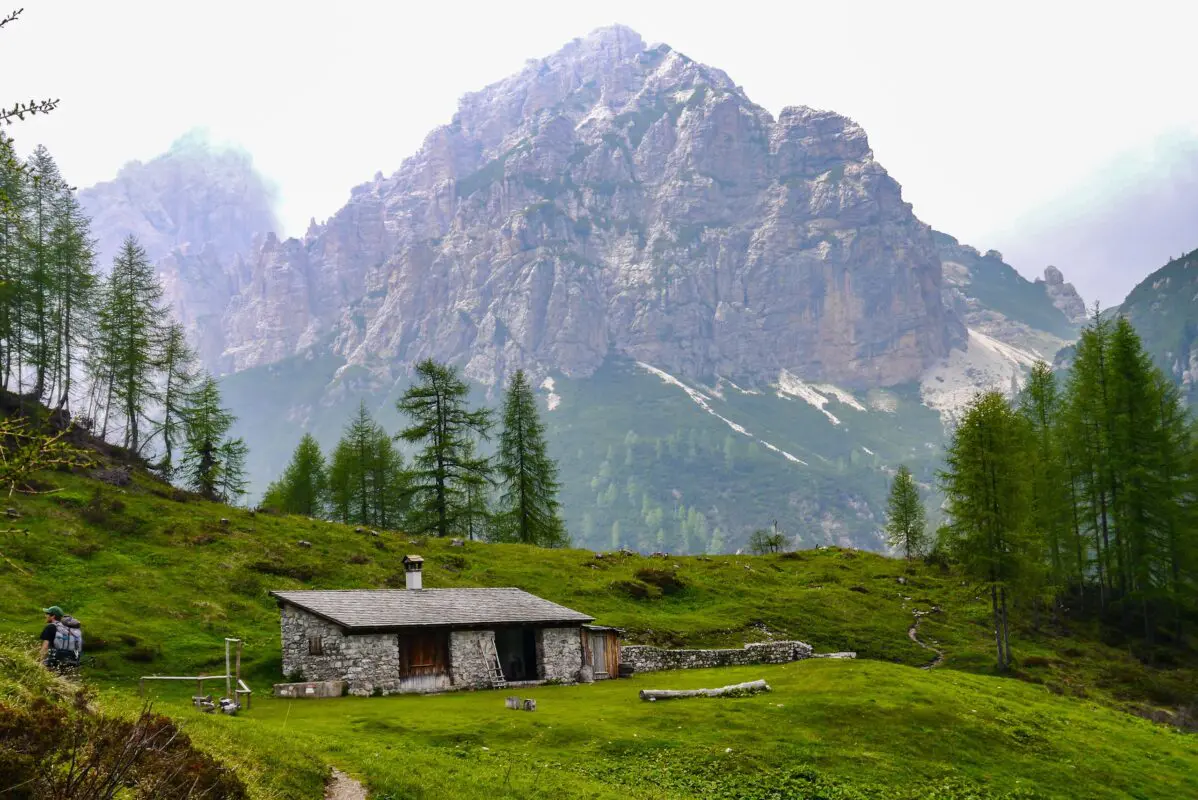
The Friulian Dolomites have been part of the UNESCO Dolomites since 2009, and constitute one of the wildest natural parks to be found in the area. They are characterized by a very distinctive structure: a long series of sharp spires, narrow valleys, and rock pinnacles. 
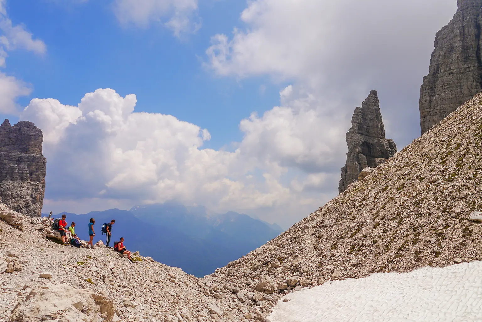
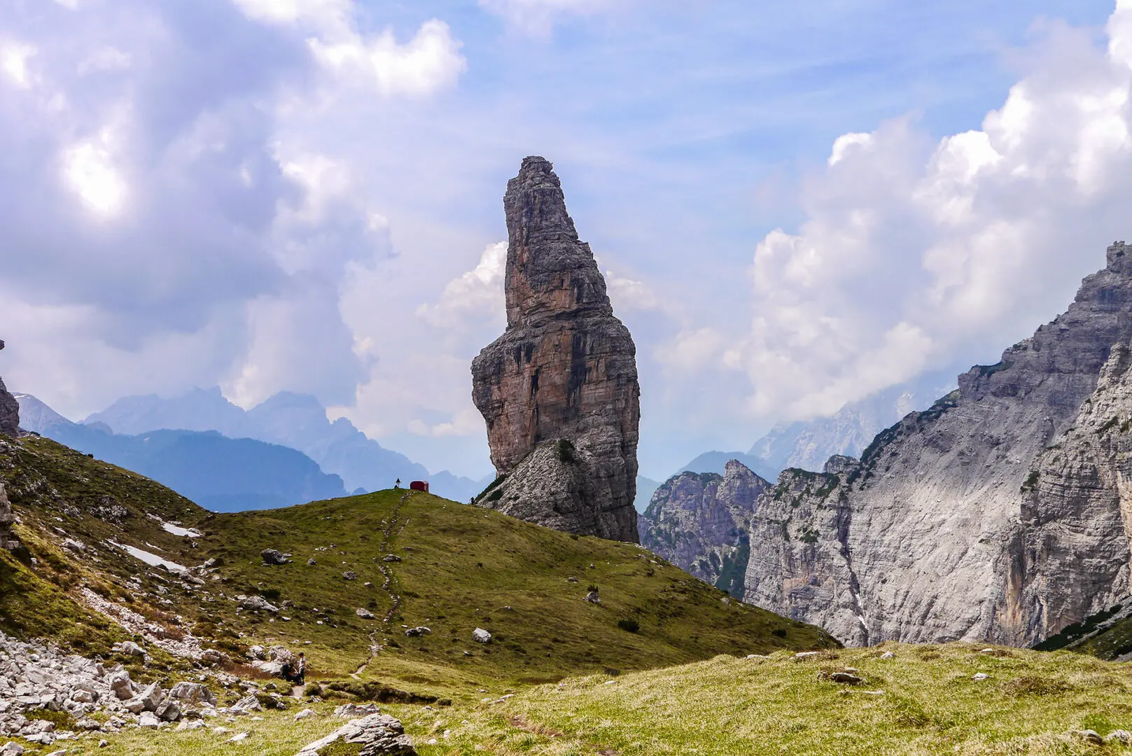
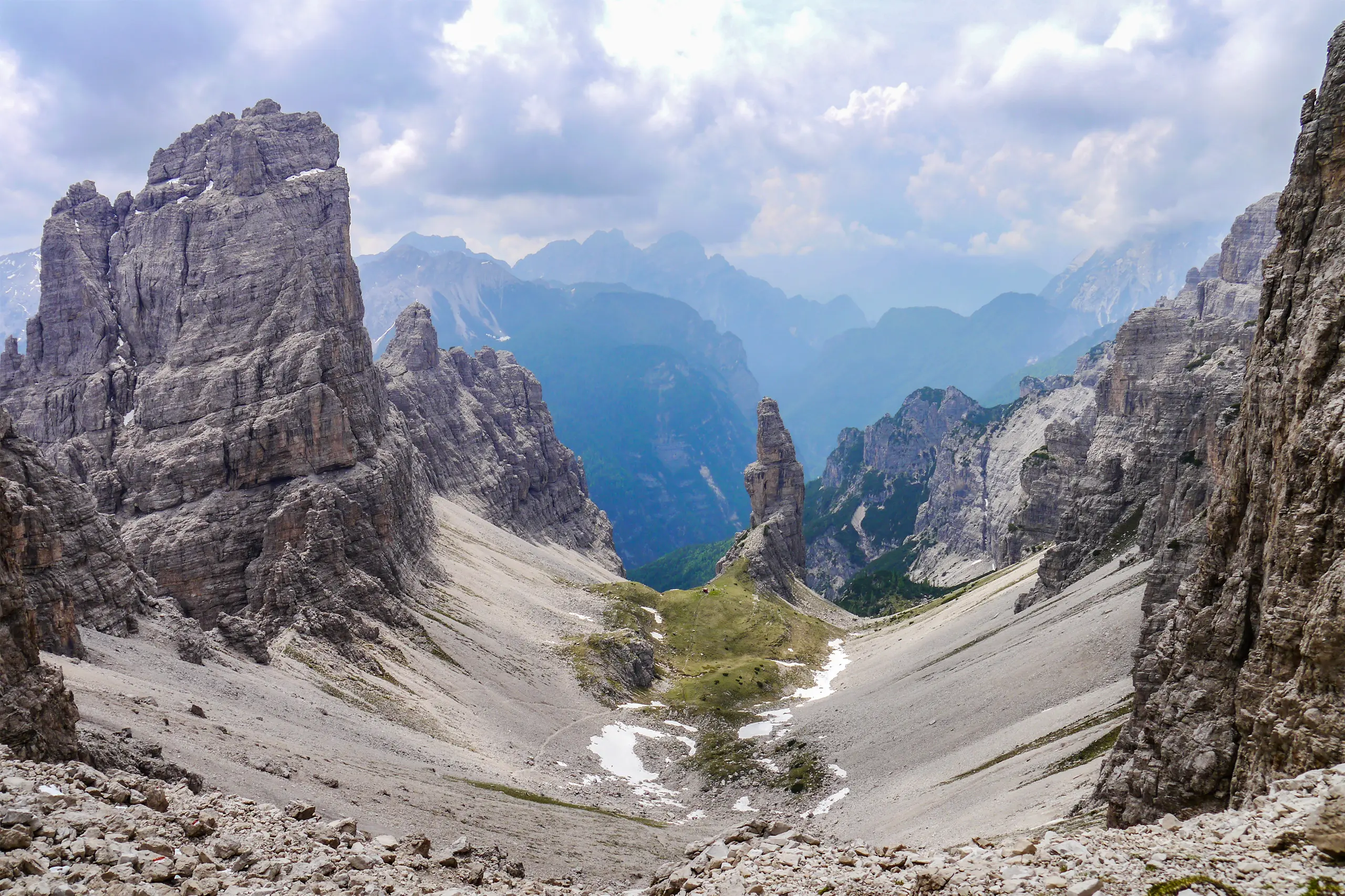
The most famous of these rock structures is the Val Montanaia steeple, known as the Stone Cry. Only here do you encounter a few hikers, while the rest of the way is very wild and uncrowded. This area is almost totally alien to foreign tourism, it is forgotten in the shadow of the better-known Dolomites. Yet it has a charm and beauty that is unlike the rest of the Dolomites.

While the trail is fairly short, it packs a punch with 3300 m in 38 kilometers. The Friuluan Dolomites don’t mess around!

Elisa, profile picture
Author

Elisa

Born in the city, I was always annoyed by the streets crowded with cars, the buildings that hid the sky, and the rush of people. I soon realized that my place was no longer in Padova but in the white rocks of the Dolomites. So I used to spend the week at the University of Forest Sciences, and the weekend exploring the trails of the Wight Mountains because I wanted to get to know them in all their nuances.

It was my parents who took me to the mountains from an early age. They took me to Val di Zoldo, in the winter with skis on my feet and in the summer to walk, but… I hated it! I was annoyed, all I did was ask, “How much longer?” But then I grew up, and I discovered that walking is essential for me. Scouting then taught me about the outdoors and the satisfaction of long treks in tents. The Italian Alpine Club made me discover mountaineering and the world outside Val di Zoldo. But walking was never enough for me, I was hungry for trails, views, and adventures. So I accumulated experience and kilometers, and in 2021 I realized a dream I had cradled for years: in 3 months I crossed the Alps on foot, from Finale Ligure to Trieste, alone and sleeping in a tent!

On this trip, I searched for my way in these mountains, until I realized that there is nothing that gives me greater joy than bringing people up here and watching their astonished expressions in front of so much beauty. So at the end of the trip, I took the course to become an Environmental Hiking Guide, and now I bring people up here, where falling in love is easy.

View profile

The Trail

The area is especially popular with rock climbers, and the loop makes it possible to combine hiking and climbing well, and thus devote a week or more to the exproduction of these wonderful peaks.

Away from the crowded Dolomites, a real hiking raid that in 4 days touches the Giaf, Flaiban-Pacherini, Pordenone and Padua refuges, traversing at high altitude the beautiful and wild valleys of the Pramaggiore, Monfalconi, Spalti di Toro and Cridola groups, with numerous possibilities for variants of varying difficulty and commitment and even alpine climbs to the peaks. You can start from any of the Refuges indicated; we recommend the traverse in a clockwise direction.

For this hut-to-hut trek, it is good to possess good stamina to overcome a thousand meters while carrying a backpack in single-day elevation gains. Doing the loop as proposed does not require mountaineering or via ferrata equipment; some confidence on narrow and uneasy scree and trails is sufficient (easier variants are possible, however). We recommend 5 or 6 days to walk the entire loop (including arrival and departure day).

The refuges are family-run and offer typical cuisine with carefully prepared dishes and generous portions. The managers will be happy to give all necessary information to hikers, and there is also the possibility of using the Friulian Dolomites Park nature guides.

Stages

The Ring of the Friulian Dolomites is a tiny but mighty trail. The 38 kilometers are divided into 4 sections, each with its own beauties and challenges. You’ll have plenty of time to chill and enjoy your afternoons, or have a leisurely morning.

Stages of the ring

Stage 1:

Rifugio Giaf – Rifugio Flaiban-Pacherini, 12 km | 7.5 mi

Stage 2:

Rifugio Flaiban-Pacherini – Rifugio Pordenone, 8 km | 5 mi

Stage 3:

Rifugio Pordenone – Rifugio Padova, 10 km | 6 mi

Stage 4:

Rifugio Padova – Rifugio Giaf, 8 km | 5 mi

Accommodations

During this hike, you will spend the night in typical Alpine ‘refuges.’ These huts are structures for hikers, offering rest and refreshments to those who tackle long hikes. Do not expect luxury hotels! They are spartan facilities, but the hospitality of the managers, the beautiful views, and the good food will make you love your break.

The rooms are shared, as are the bathrooms. Showers are not always available, water is a precious commodity. You must bring a sheet bag for the night, and slippers. The average cost is 65 to 75 euros per night, including overnight stay, dinner, and breakfast. Don’t forget, before you leave, to take a sandwich with you for lunch! Reservations are compulsory, and best made in advance. The food is simple but tasty, don’t forget to try the typical frico!

There are also many bivouacs along and around the trail. Bivouacs in the Alps are always open, unmanaged facilities where anyone can find shelter. At high altitudes, they are red tin barrels with spartan mattresses inside. Other times they are nice little houses with comfortable beds and a stove for warmth. If you will be using these structures, treat them with the utmost respect, leaving them tidy and clean, restoring the supply of wood you will be using, and not abandoning garbage.

Accommodations per stage

Stage 1:

Rifugio Flaiban-Pacherini

Stage 2:

Rifugio Pordenone

Stage 3:

Rifugio Padova

Best time of the year

The best time of the year to hike in the Dolomites is undoubtedly in summer and early September. As you’re hiking in the mountains be aware that there might be snowfields in early summer and there might be early snowfalls in late summer and early autumn.

Generally, the hiking season in the European Alps is limited to the summer months when the weather is milder and the snow has melted, making the trails accessible.

Keep in mind that the weather in the high mountains can change rapidly, and it’s essential to be prepared for various conditions, including sudden rain or snow showers. Always check trail conditions, and local weather forecasts before embarking on a high-alpine hike. Additionally, consider your hiking experience and skill level, as some trails in the high Dolomites can be challenging and require proper equipment and experience.

Rifugios are usually open from mid-June to mid-September.

Safety & Gear

Try to do some research before you get to the trailhead, like the trail’s difficulty, length, elevation gain, and terrain.  Consider your physical and mental strength for difficult hikes and train accordingly!

You can research using HIKING-TRAILS.com, but also using guidebooks, hikers who hiked this trail already, and local hiking organizations.

We recommend sharing your itinerary with someone you trust, including the day you think you’ll finish hiking. Additionally, beware of shifting weather. The mountains can be unpredictable, so it’s best to check the forecast each day before you head out.

Familiarize yourself with the map and carry navigation tools such as a compass or GPS device to avoid getting lost.

Invest in the right hiking gear, including comfortable, supportive footwear, proper hiking clothing, such as warm base layers and a hardshell rain jacket, hiking poles, a well-fitted backpack, and essential equipment like maps, GPS devices (when needed), and a first-aid kit. Check out our comprehensive gear list for long-distance trails like this.

Respect the principles of Leave No Trace by minimizing your impact on the environment. Stick to designated trails, pack out all trash, and show respect for wildlife and natural habitats.

Good to know

Regarding remoteness, the trail is not crowded. Only in the section from the Pordenone hut to the Val Montanaia steeple are there often many people, mostly Italians.

Route
Circuit
Highest point
2333m (7654 ft)
Water
At mountain huts

Want to submit a trail or make this page more complete?

Comments

Be the first one to comment on this trail!

Reply to this trail

Your email address will not be published. Required fields are marked *

Reply to this trail

Log in to comment on this trail
Always read the disclaimer

Terms of Use: important to all visitors on this website. We strive to publish high quality content and information on this website. However it’s always possible that we’re missing out on some crucial information. In spite of the fact that this route, associated GPS track (GPX and maps) were prepared under diligent research by the specified contributor and/or contributors, the accuracy of such and judgement of the author is not guaranteed. Therefore, hiking-trails.com and contributors are in no way liable for personal injury, damage to personal property, or any other such situation that might happen to individuals hiking or following this route. Should you choose to hike this trail, this is always at your own risk. Check out our guidelines for safety hiking and Leave No Trace principles at the hiking 101 page.

Download GPX

Join the community!

Login or create a FREE account 😊

With an account you can:

Download GPX files

Pin trails to your wishlist

Mark trails as hiked by you

Rate hiking trails

Comment on trails, blogs and gear reviews

Happy trails!
Login

Don't have an account yet? Register here