About the Porta del Cel

Catalonia
country
Spain, Andorra, France
length
65 km(40 mi)
Type of trail
Long-distance, Hut to hut
difficulty

Difficulty is highly personal. Be aware of the weather conditions as bad weather turns easier trails in difficult trails especially in the mountains.

Difficult
accommodation

Lodging means a mix of hotels, hostels or AirBnB’s.

Mountain huts, Lodging
Elevation gain
5500 m(18045 ft)
terrain
Mountains
remoteness
Most of the time
Show more

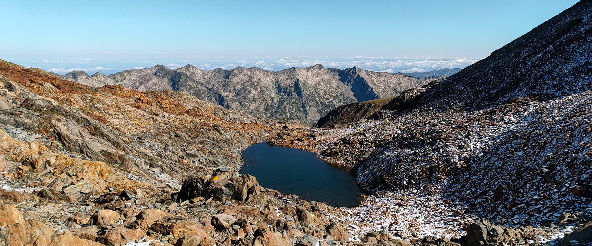
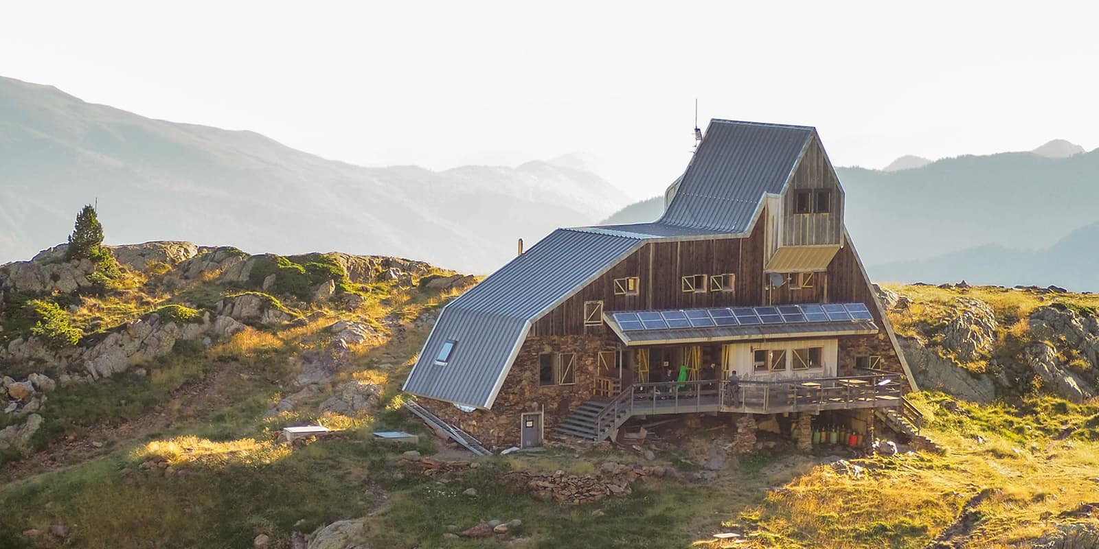
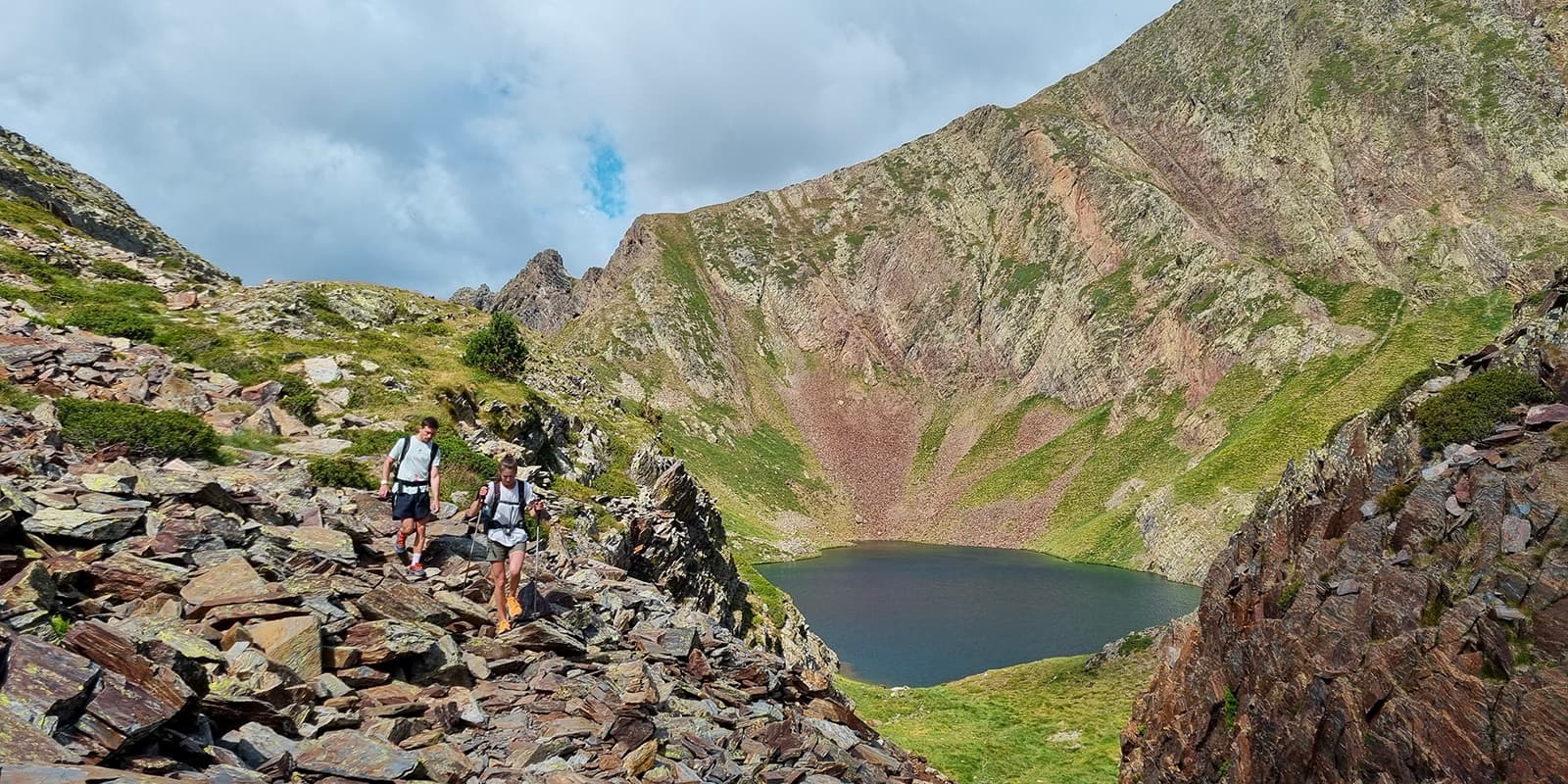
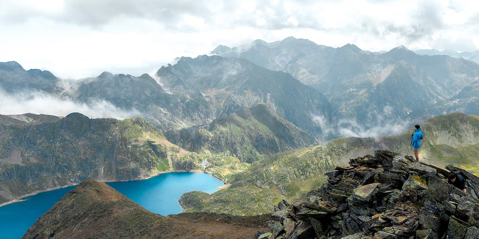
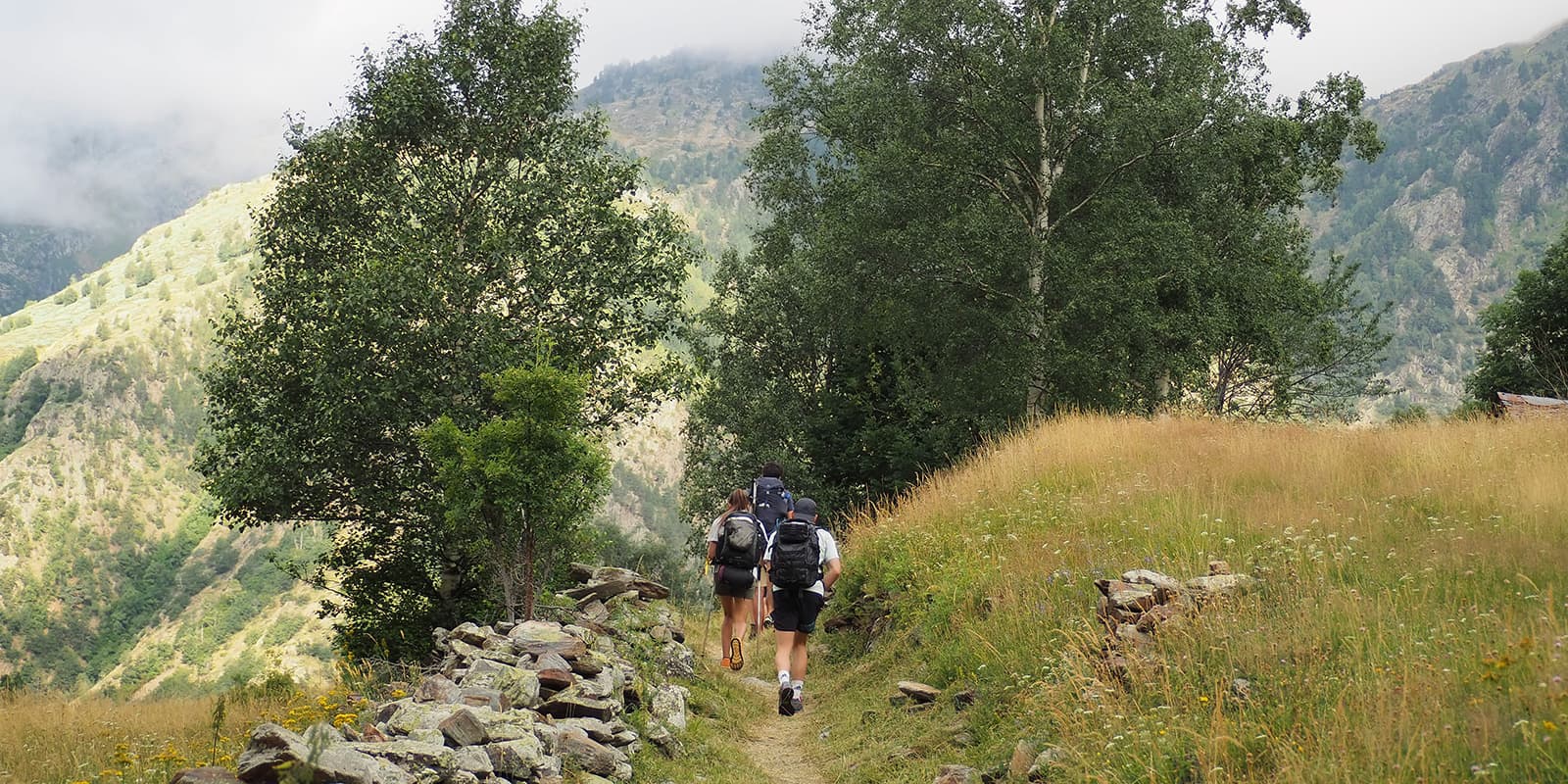
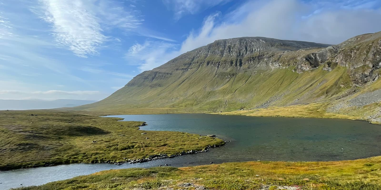
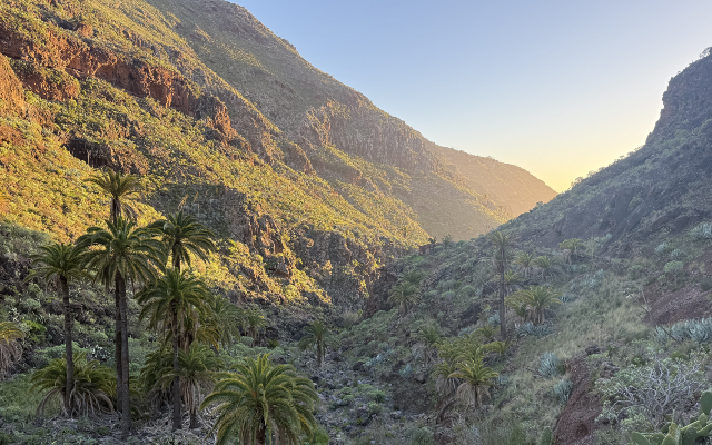
The Porta del Cel is a 65-kilometer (40 mi) hut-to-hut hiking trail through the Pyrenean Park of the Three Nations (Catalonia, France, and Andorra). In 4-5 days you will get to climb the highest peaks of Catalonia and France. The trail offers a spectacular landscape with high mountains as well as lakes and unique flora and fauna.

One week on this trail is the perfect way to escape into nature while seeing an ecology that is distinctive to this region. You will also have the opportunity to experience how these three cultures blend and differ from one another as you walk between the countries.

Merle profile picture

Merle Wünderling

Merle is an outdoor enthusiast who’s passionate about hiking, rock climbing, mental health, and sustainability. Born in Germany but at home in the world, she’s hiked trails in New Zealand (Abel Tasman Coast Track, Kepler Track), Europe (Rota Vicentina/ Fishermen’s Trail, Tour du Mont Blanc, GR20 Corse, Kungsleden… ), and the Balkans (Peaks of the Balkans). Over the years she became a bit of a nerd, constantly improving her gear for upcoming hikes, such as GR11 Spain, Tour des Ecrins, Te Araroa, and the Transcaucasian Trail.

You can follow Merle on Instagram @merlewunderkind.

View profile

The Trail

The first stage is rather short and can theoretically be combined with the second stage. It starts in the town of Tavascan. On the way to the first refuge, the Graus Camping, a narrow path follows a river, crosses a bridge, and will lead you over meadows gently uphill.

The second stage, from Graus Camping to the Certascan refuge, includes a climb up the Certascan peak. First of all, the path ascends through a forest, past the Noarre huts steadily up to the Pleta de Guerossos. It follows and crosses a river before it reaches the Blau del Mig Lake. Next, it comes to the Certascan pass, ridge, and peak. From here, there is a direct path down to the Certascan refuge. Otherwise, you can continue all the way to the Certascan Lake, the largest lake in the Pyrenees, before you head over to the Certascan refuge.

The next day has some spectacular views to offer. It starts with a descent from the Certascan refuge to a small lake followed by a climb up to the Llurri pass. From there, it descends further down to the Romedo lakes before it climbs up again to the Port de l’Artiga. The following descent deposits you in a valley. After having crossed this, it leads up a marked ravine and to the Montestaure Lake. A steep slope then takes you down to the Picou Estela pass. A second pass will help you cross the river on the way to the Pinet refuge.

On the way from the Pinet Refuge to the Vallferrera Refuge, you have to cross a small glacier and climb up to the highest point of the whole trail: Pica d’Estats 3,143M (10311 ft).

The last stage begins with a descent from the Vallferrera hut. You cross the river again and then ascend through a forest to the Basello hut. From there, the route continues uphill past Lake Baborte and the Baborte hut to the Sellente Pass. There is another descent, followed by a steep ascent to the Coll de la Llacuna. The subsequent Roca Cigalera rewards you with a panoramic view over the entire trail. From now on, the trail descends slowly but surely. Via the ridge and the Cabana de la Ribera all the way back to the starting point in Tavascan.

Stages

The Porta del Cel is usually hiked in 5 stages. Stages 1 and 2 could theoretically be combined.

Porta del Cel 5-stage itinerary

Stage 1:

Tavascan – Graus Camping, 4.2 km | 2.6 mi

Stage 2:

Graus Camping – Certascan Refuge, 12.5 km | 7.8 mi

Stage 3:

Certascan Refuge – Pinet Refuge, 13 km |  8.1 mi

Stage 4:

Pinet Refuge – Vallferrera Refuge, 12.6 km | 7.8 mi

Stage 5:

Vallferrera Refuge – Tavascan, 19 km | 11.8 mi

Accommodations

There are 4 mountain huts along the way. Make sure to book your accommodation in advance, especially during the peak summer months. July and August are very busy months, which means that these huts are likely to book up very early. If you want more solitude for this trek, consider hiking in the shoulder seasons, either at the beginning or end of the period that the huts are open. You can find more information about the mountain huts on the official trail website.

Porta del Cel accommodations

Stage 1:

Graus Camping

Stage 2:

Certascan Refuge

Stage 3:

Pinet Refuge

Stage 4:

Vallferrera Refuge

Stage 5:

Tavascan (lodging)

Best time of the year

The best time to hike the Porta del Cel is from June to September. Be aware that until the mid/end of July crampons, poles, and even an ice axe might be necessary. Hiking in snowy conditions should only be attempted by people with previous experience and training. Call the huts ahead of time to learn about the conditions of the trail to prepare properly.

Safety & Gear

Porta del Cel is a challenging hike that requires experience in alpine terrain, surefootedness, and proper equipment.

You’ll want to bring the right gear, especially if you’re facing snow conditions on the trek. This includes shoes with good grip, micro-spikes, winter gear, an ice axe if necessary, and an emergency kit. Check out our comprehensive gear list for long-distance trails for more ideas.

For a trail like this, it is imperative that you share your plans with another person before heading into the mountains. Send your itinerary to someone who can look after it, and check in with them if you have to switch plans on the go.

The weather in the high mountains can change rapidly. Always check the trail conditions and local weather forecasts, and be prepared for all conditions. This includes rain, sun, or snow. Also, pay attention to the warming of the day and the resulting increase in the risk of thunderstorms or avalanche danger. If conditions are uncertain, alter your itinerary!

Difficulty

The Porta del Cel is a challenging hike. The trail includes demanding stages with large elevation changes and technical passes. Therefore, a good level of fitness and some previous hiking experience are required.

Glacier crossings should not be attempted light-heartedly and require a level of expertise in snow and avalanche safety. Additionally, the daily elevation gain and loss is challenging and should be properly trained for before attempting.

Good to know

The starting point in Tavascan (when coming from Spain) or Pinet (when coming from France or elsewhere in Europe) can be reached by public transport or car.

From Spain (Barcelona, Lleida), take a bus to Llavorsí and Tavascan. There is also a free public car park in Tavascan.

From France, take a train to Tarascon. From there take a taxi or hitchhike to Auzat. There is a free public car park in Artigue.

route
Circuit
highest point
3.143m (10.311 ft)

Want to submit a trail or make this page more complete?

Always read the disclaimer

Terms of Use: important to all visitors on this website. We strive to publish high quality content and information on this website. However it’s always possible that we’re missing out on some crucial information. In spite of the fact that this route, associated GPS track (GPX and maps) were prepared under diligent research by the specified contributor and/or contributors, the accuracy of such and judgement of the author is not guaranteed. Therefore, hiking-trails.com and contributors are in no way liable for personal injury, damage to personal property, or any other such situation that might happen to individuals hiking or following this route. Should you choose to hike this trail, this is always at your own risk. Check out our guidelines for safety hiking and Leave No Trace principles at the hiking 101 page.

Download GPX

Join the community!

Login or create a FREE account 😊

With an account you can:

Download GPX files

Pin trails to your wishlist

Mark trails as hiked by you

Rate hiking trails

Comment on trails, blogs and gear reviews

Happy trails!
Login

Don't have an account yet? Register here