About the Peaks of the Balkans

Balkan
country
Albania, Kosovo, Montenegro
length
192 km(119 mi)
Type of trail
Long-distance
difficulty

Difficulty is highly personal. Be aware of the weather conditions as bad weather turns easier trails in difficult trails especially in the mountains.

Moderate
accommodation

Lodging means a mix of hotels, hostels or AirBnB’s.

Lodging, Camping
Elevation gain
10250 m(33629 ft)
terrain
Mountains
remoteness
Some of the time
Show more

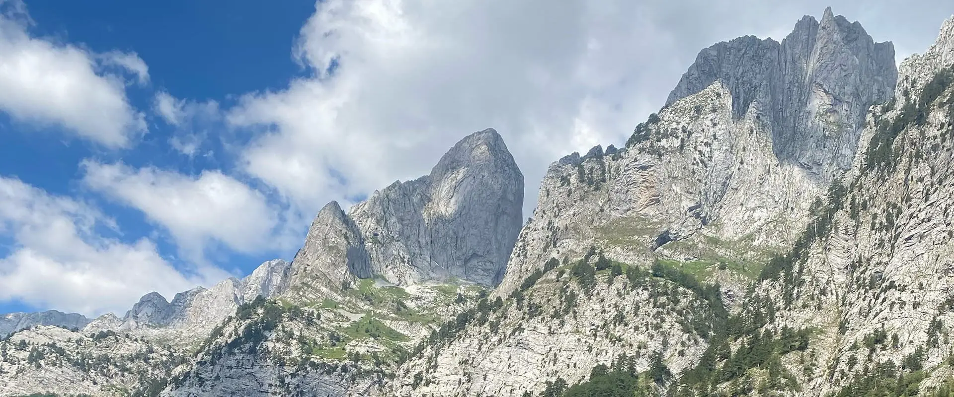
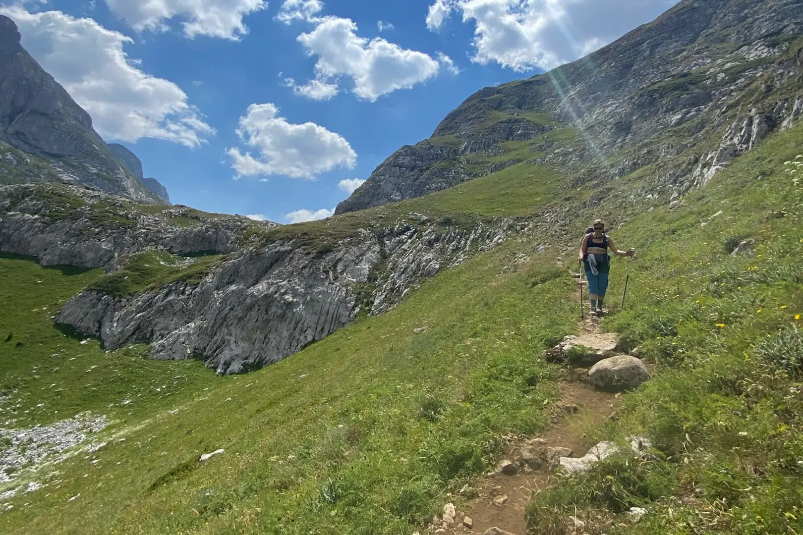
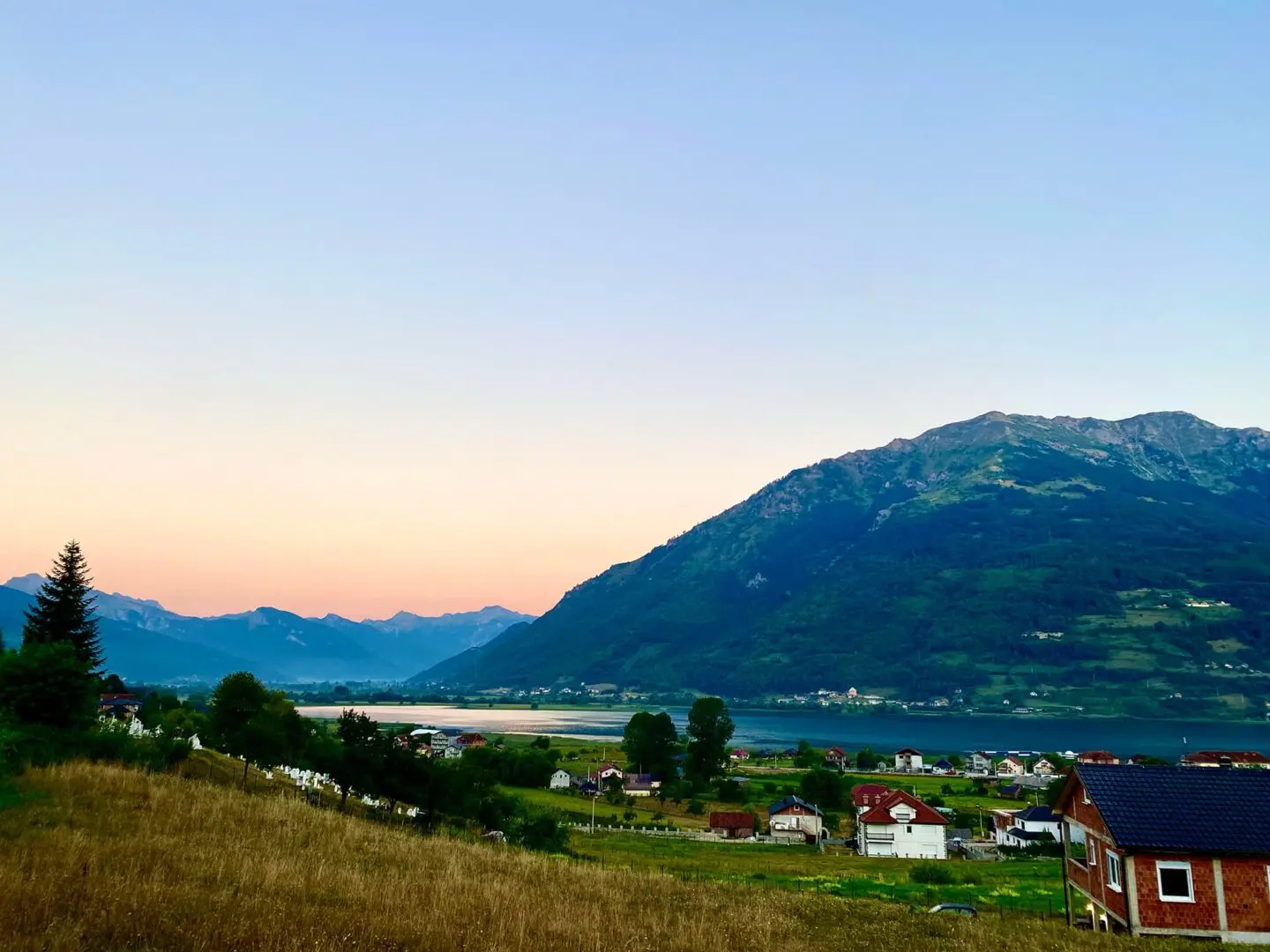
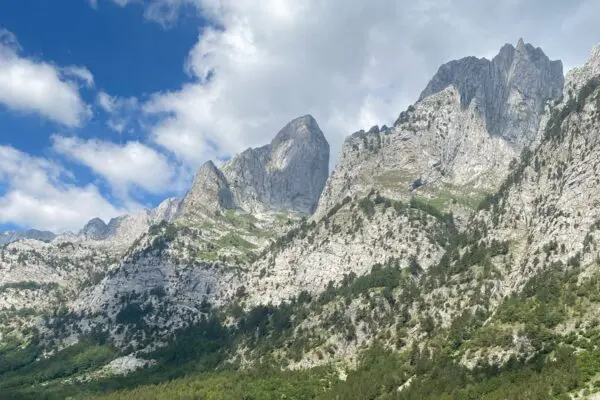
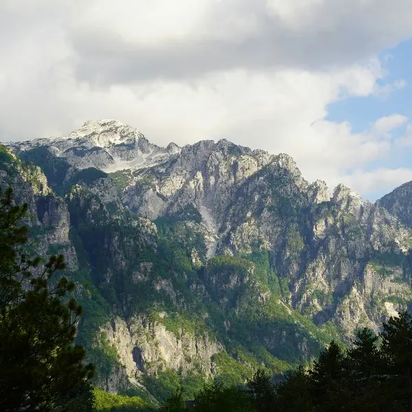
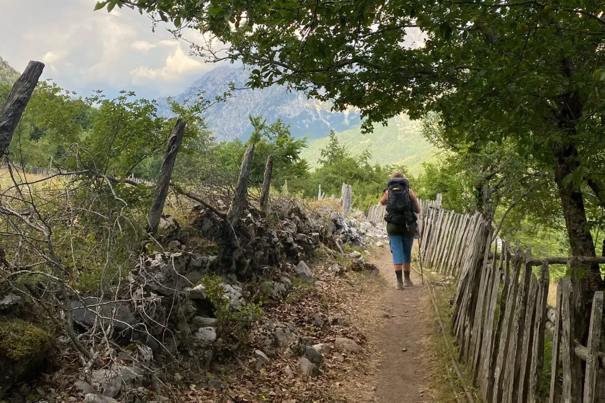
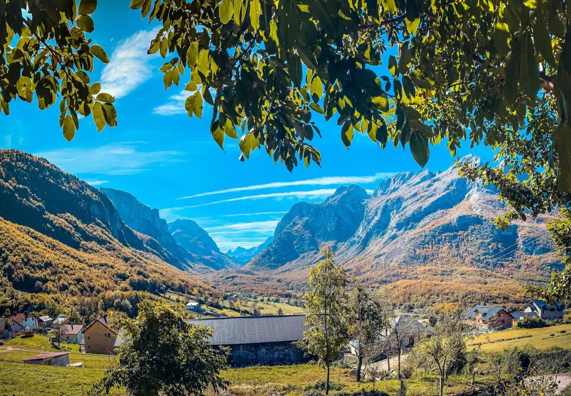
The Peaks of the Balkans Trail spans three countries: Albania, Kosovo, and Montenegro. This 192-kilometer trail is an immersive experience of the region’s beauty, landscapes, and cultures.

The trail has its roots in ancient trade routes that connected communities across the Balkan Peninsula. Over time, these routes became vital paths for cultural exchange, as people journeyed through the “Accursed” mountains that define the region. In the 21st century, efforts to promote sustainable tourism and foster cross-border cooperation led to the development of the modern trail. Launched in 2009, the trail was established through a collaboration between local communities, NGOs, and government agencies in the three countries.


women in blue smiling at camera
Editor

Katie Mitchell

After a whirlwind of 8 years on the road (and trail!), Katie has hiked the Camino Frances, the Peaks of the Balkans, the Fisherman’s Trail, and extensively in the United States. She is an avid trail runner and now lives in Colorado where she plays in the mountains in her free time. You can follow her adventures on Instagram.

View profile

The Trail

Because it is a circuit, you can start in any of the three countries. Most people tend to begin in Albania for ease of access, but we started in Plav, Montenegro.

Albania

If you start in Albania, you’ll likely begin in Theth, a charming village boasting stunning views of the towering Balkan peaks. From there, you will traverse ancient paths and shepherd trails, ascending to heights of nearly 2300 meters. You immediately start to climb 1000 meters up to Valbona Pass, only to descend 700 meters immediately afterward. It is fair to say that this is a good sneak peek of the rest of the trail. Along the way, encounters with remote villages and breathtaking vistas punctuate the journey, offering a glimpse into the untamed beauty of the Balkans.

This is one of the most touristy sections of the trail, for its easier access and because it’s possible to hike the Valbone pass as a day hike.

Kosovo

Entering Kosovo, the landscape shifts, presenting steep ascents and descents amidst majestic peaks. The trail meanders through picturesque valleys and mountain passes, providing opportunities for rest and camaraderie with fellow hikers. Kosovo is the least developed of the three regions, although at points, the most picturesque. You’ll see villages that seem like they’re from fairytales and stop to sip raki (the locally fermented liquor) at shops on the side of the trail.

The Kosovo sections of the trail have a bad reputation, and I understand why. There’s less infrastructure for the trail in Kosovo, and a lot more road than trail. But I do have to say, it was worth it for the views. I may argue that the days in Kosovo reaped the highest rewards where views are concerned.

Montenegro

In Montenegro, hikers are greeted by crystal-clear lakes and dense forests, setting the stage for the final stretch of the trek. Conquering Bor Peak and navigating rugged terrain, you will make your way back to Theth, where the Adriatic Coast beckons as a fitting conclusion to the journey.

Beyond its physical challenges, the Peaks of the Balkans Trail embodies a spirit of unity and economic empowerment. By traversing this trail, hikers support local economies and forge connections between nations, contributing to the region’s growth and development.

Stages

The Peaks of the Balkans is usually hiked in 10 stages, although it is possible to combine stages for a fast-packing version of the trek.

Stage 1:

Plav – Vusanje (Montenegro), 27.5 km | 17 mi

Stage 2:

Vusanje (Montenegro) – Theth (Albania), 21.3 km | 13.2 mi

Stage 3:

Theth – Valbona (Albania), 19.5 km | 12 mi

Stage 4:

Valbona – Ceremi (Albania), 14 km | 8.6 mi

Stage 5:

Ceremi – Doberdol (Albania), 15.5 km | 9.6 mi

Stage 6:

Doberdol (Albania) – Milishevc (Kosovo), 23 km | 14.2 mi

Stage 7:

Milishevc – Reke e Allages (Kosovo), 16 km | 10 mi

Stage 8:

Reke e Allages – Drelaj (Kosovo), 10 km | 6 mi

Stage 9:

Restaurant Te Liqeni (Kosovo) – Babino Polje (Montenegro), 16 km | 10 mi

Stage 10:

Babino Polje – Plav (Montenegro), 20 km | 12.5 mi

Accommodations

Most of the time, you’ll end up at a guesthouse, either sleeping inside or pitching your tent on their land. Wild camping is permitted outside of the national parks, however, this is not much of the trail! Almost all guesthouses will let you pitch your tent on their property for a small fee (around 5 euros).

At most guesthouses, you pay a flat rate for your bed and dinner, breakfast, and a packed lunch. Talk about a great deal! You’ll likely end up in a private room or the occasional dorm (we only had 2 dorms in 11 days).

Be aware though, because the trail is increasing in popularity, you’ll need to book your accommodations ahead of time. The only place where it was easy for us to find last-minute bookings was in Kosovo. Otherwise, we used Booking.com to find guesthouses along the trail.

I knew people who camped the whole way, and they seemed happy with their decision! The only problem was food. Because there were so few places to replenish, the campers ended up either paying the guesthouses for meals or carrying extra heavy packs with provisions. While there are a few markets along the way (Plav, Theth, Valbonë), we loaded up on most of our snacks before the hike.

Lodging recommendations

Stage 1:

Plav – Guesthouse Hana

Stage 2:

Vusanje – Guesthouse Kollata

Stage 3:

Theth – Shpella Guesthouse Theth

Stage 4:

Valbona – Guesthouse Skender Selimaj

Stage 5:

Ceremi – Gocaj (Goçi)

Stage 6:

Doberdol – Guesthouse Bashkimi

Stage 7:

Milishevc – Bujtina – Guesthouse LOJZA

Stage 8:

Reke e Allages – Ariu Guesthouse

Stage 9:

Liqenat – Restaurant Te Liqeni

Stage 10:

Babino Polje – Triangle Woodhouse

Stage 11:

Plav – Guesthouse Hana

Best time of the year

The best time of year to hike the PoB is from June to September when the snow has melted. We hiked in August and found the weather to be perfect, and edging on chilly in the evenings.

Keep in mind that the weather in the high mountains can change rapidly, so it’s important to be prepared for various conditions, including sudden rain or snow showers. Always check trail conditions, and local weather forecasts before embarking on a high-alpine hike! Additionally, consider your hiking experience and skill level, as this trail can be challenging at points.

Safety & Gear

Peaks of the Balkans is a trek that’s become quite popular, thus you’ll see a lot of people along the way. Nonetheless, be sure to research the trail ahead of time and prepare yourself physically and mentally, because it’s 10 days straight of over 1000m elevation gain.

If there are storms or extreme weather warnings, please take a 0 day and wait it out. It’s better than being caught in dangerous conditions that can be life-threatening.

On that thread, be sure to top off your water, at least 2 liters, every day and bring enough snacks. Most guesthouses will also pack you a lunch, but you’ll be burning a lot of calories while you’re on the trail so a little extra fuel will be a welcome boost.

To avoid the trail becoming littered, practice Leave No Trace and clean up after yourself. Say hi to fellow hikers and locals alike, and try to learn a few words of Montenegrin and Albanian if you can!

Good to know

The trail is becoming increasingly busy with tour groups completing the Balkans Trail, a 5-day version of the PoB. You’ll see groups of 5-40 people, so get ready to wave and say “hi!” until your voice is hoarse. Because of these groups, most of the Albania and Montenegro sections had a lot of foot traffic, and the Kosovo section was almost empty. In Kosovo, we knew of six people who were hiking on roughly our same schedule, compared to the ~ 100 we were encountering in earlier sections.

There are enough water points at the guesthouses, restaurants, and villages along the way, so you won’t need to filter water.

Route
Circuit
Highest point
2,290m (7513 ft)

Guidebooks

cover guidebook

Peaks of the Balkans Trail

View guidebook

Want to submit a trail or make this page more complete?

Comments

Be the first one to comment on this trail!

Reply to this trail

Your email address will not be published. Required fields are marked *

Reply to this trail

Log in to comment on this trail
Always read the disclaimer

Terms of Use: important to all visitors on this website. We strive to publish high quality content and information on this website. However it’s always possible that we’re missing out on some crucial information. In spite of the fact that this route, associated GPS track (GPX and maps) were prepared under diligent research by the specified contributor and/or contributors, the accuracy of such and judgement of the author is not guaranteed. Therefore, hiking-trails.com and contributors are in no way liable for personal injury, damage to personal property, or any other such situation that might happen to individuals hiking or following this route. Should you choose to hike this trail, this is always at your own risk. Check out our guidelines for safety hiking and Leave No Trace principles at the hiking 101 page.

Download GPX

Join the community!

Login or create a FREE account 😊

With an account you can:

Download GPX files

Pin trails to your wishlist

Mark trails as hiked by you

Rate hiking trails

Comment on trails, blogs and gear reviews

Happy trails!
Login

Don't have an account yet? Register here