About the Patagonia O-Circuit

Patagonia
country
Chile
length
140 km(87 mi)
Type of trail
Long-distance
difficulty

Difficulty is highly personal. Be aware of the weather conditions as bad weather turns easier trails in difficult trails especially in the mountains.

Moderate
accommodation

Lodging means a mix of hotels, hostels or AirBnB’s.

Lodging, Camping
Elevation gain
4971 m(16309 ft)
terrain
Mountains
remoteness
Some of the time
Show more

The Patagonia O-Circuit in Torres del Paine is a bucketlist trek for many people, long-distance hikers and new hikers alike. This week-long trek will take you through diverse ecosystems where you’ll see endangered wildlife, bushwhack through plains and wetlands, camp on glaciers, and cross suspension bridges over gushing waterfalls. The best part? You’ll have stunning views the entire time.

Over 140km, you will loop around Torres del Paine National Park and cross the John Garner Pass, trek along the Grey Glacier, and climb the famous Las Torres towers. It is also possible to complete a shorter version in the park, the W-Trek, which is 88km and completed in about 4 days. However, the O-Circuit will still overlap the W-Trek and will add onto it another 4 days in the back side of the park. I highly recommend just hiking the O if you already journeyed all the way down that far south!

women in blue smiling at camera
Editor

Katie Mitchell

After a whirlwind of 8 years on the road (and trail!), Katie has hiked the Camino Frances, the Peaks of the Balkans, the Fisherman’s Trail, and extensively in the United States. She is an avid trail runner and now lives in Colorado where she plays in the mountains in her free time. You can follow her adventures on Instagram.

View profile

The Trail

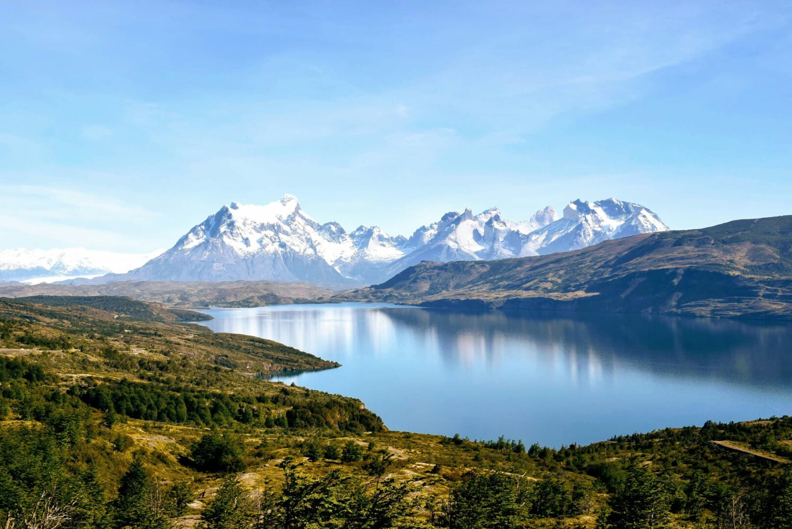
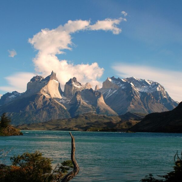
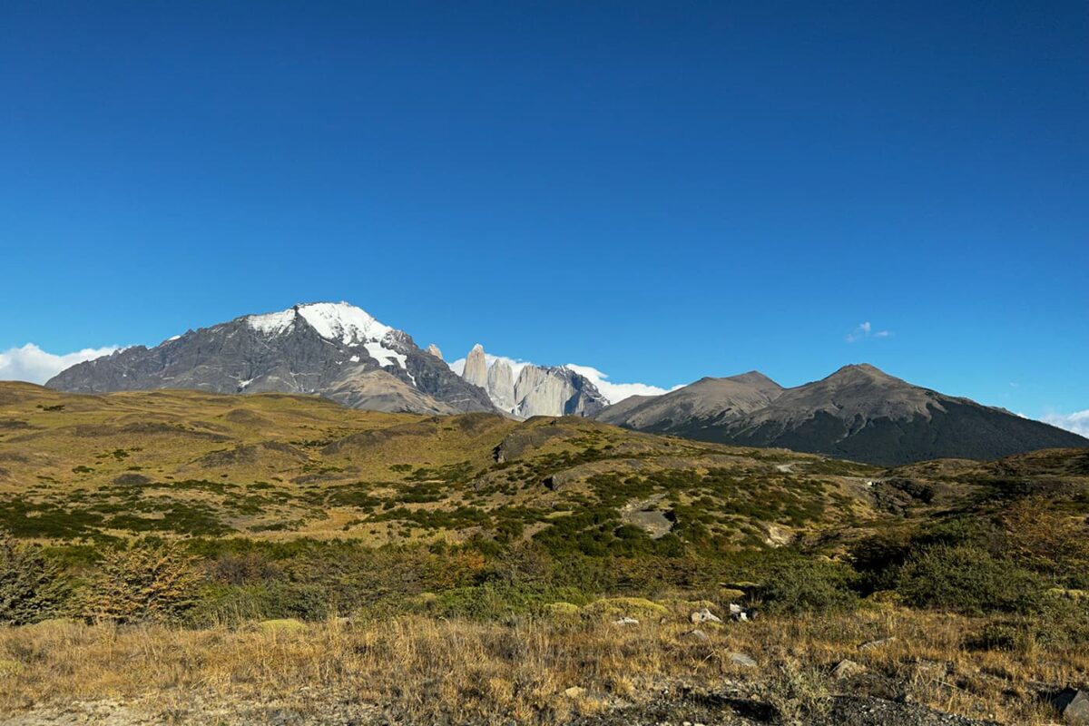
On the first day of the Patagonia O-Circuit, you begin at Central, where you’ll be dropped off by bus from the nearest town, Puerto Natales. From here, you’ll be able to see your first glance at the famous Torres as you meander through the golden plains. Keep an eye out for cows and guanacos, which are plenty in this section!

Stage one is unique in its desert environment, so make sure to enjoy your time here before the trail begins to ascend into glacial trekking.

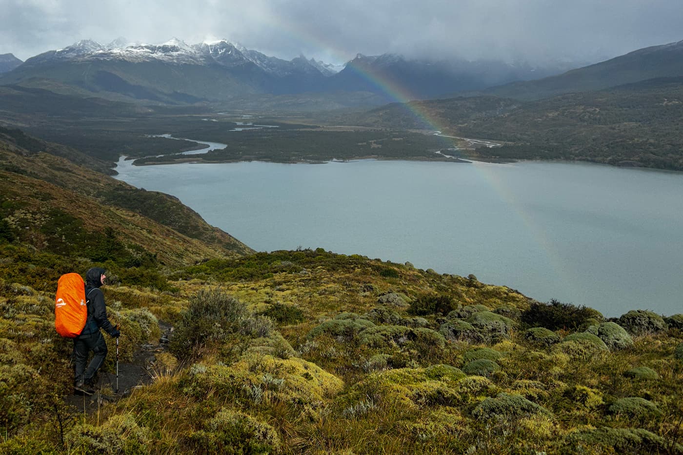
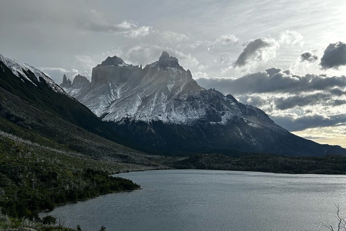
After a cozy night camping in Seron, you’ll want to throw on your hat and gloves because you’ll head into glacier land! The day begins with a steep 300m climb to see turquoise lakes and the beginnings of the mountains you’ll tackle over the next few days. From here, you will descend into a valley that will be shimmering with rainbows if you’re lucky. Be wary, the wind really picks up here, so bring trekking poles for stability.

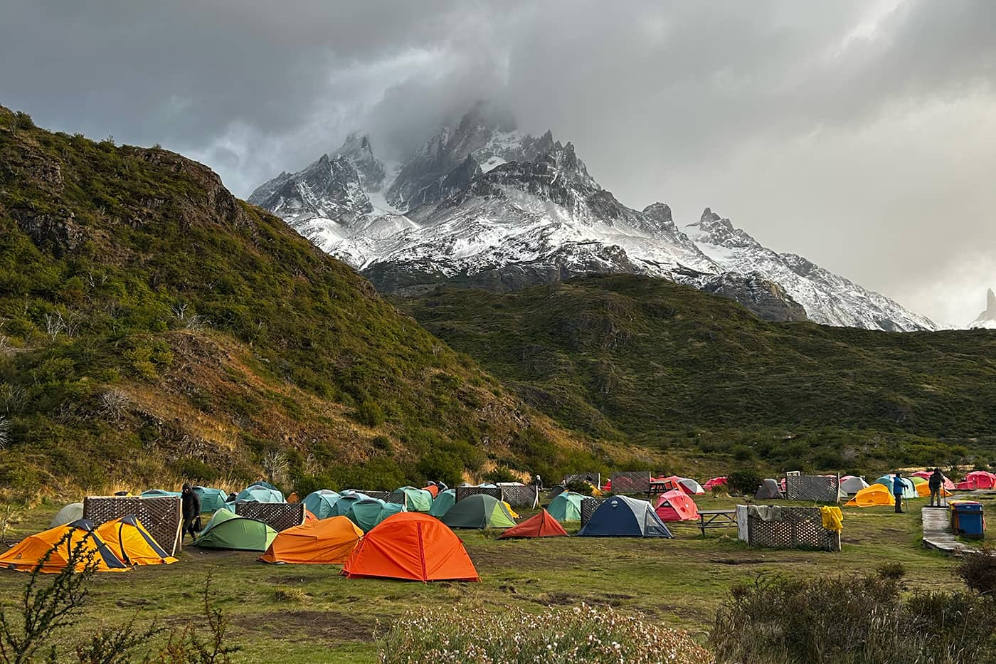
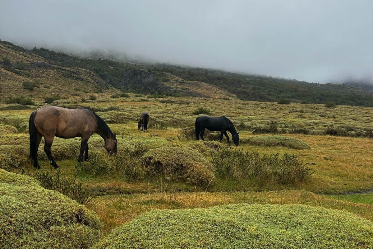
The day continues into wetlands, where you’ll balance on boardwalks to get to camp. Planet Dickson is the last stop for a mini-market, hot water, and trash for the next two days, so it’s important to take advantage of the amenities! And keep an eye out for hungry horses wandering through your campsite.

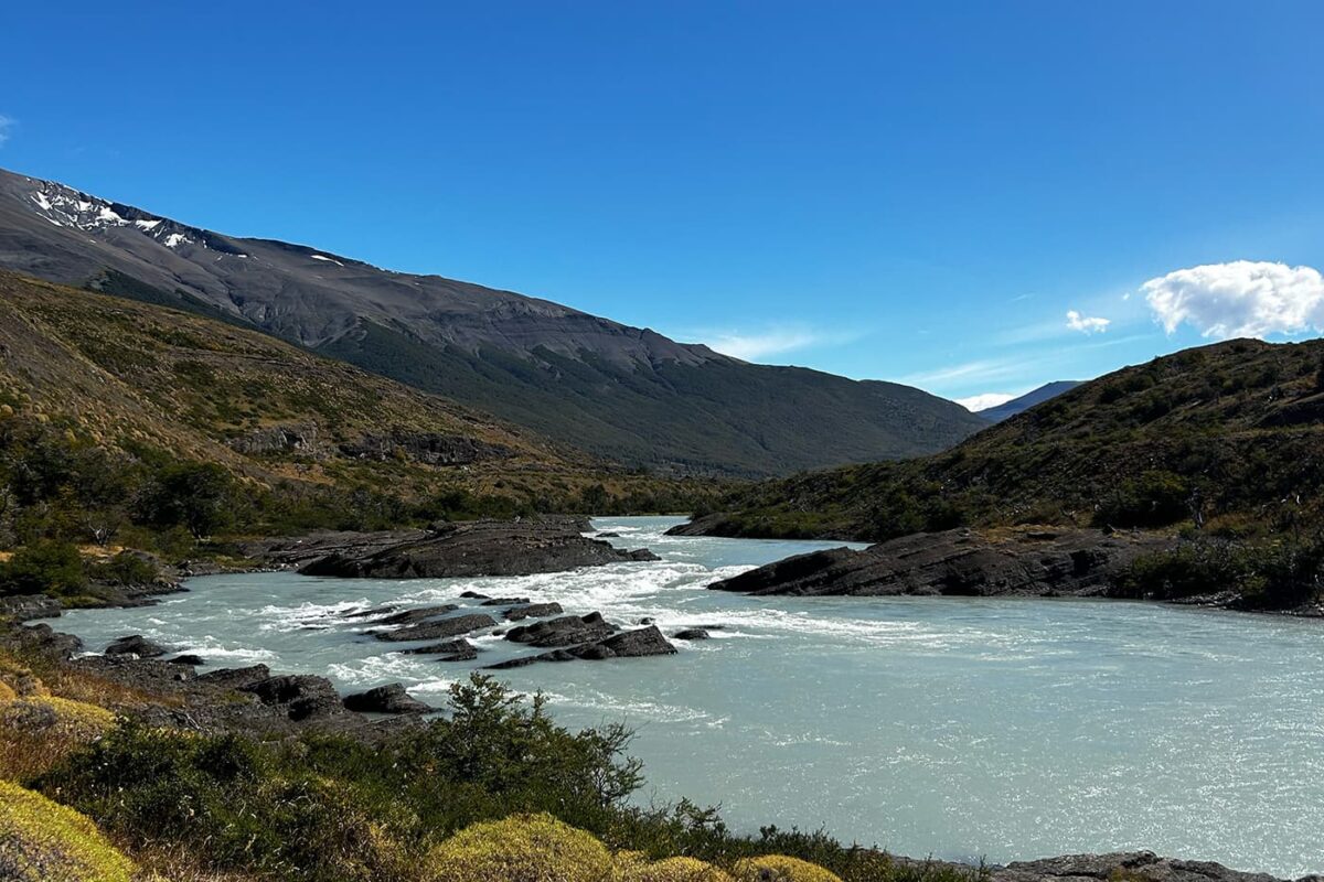
Stage three really embodies a lot of Patagonian trekking: it’s full of squelching mud. If you had an idea of keeping your shoes clean or dry on this trek, forget it! Here, you’ll squish through forest floors and over rivers at a mellow pace for most of the day.

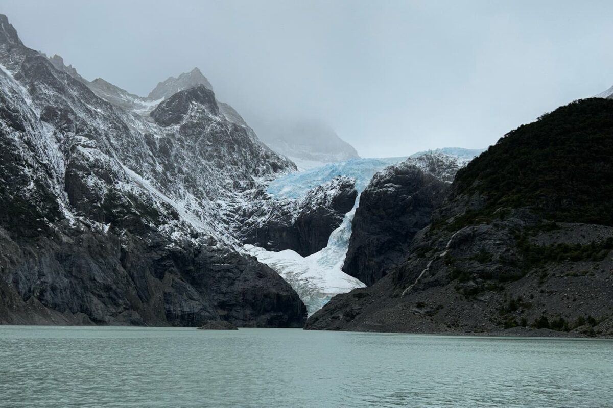
But in the last two kilometers of the third stage, you’ll begin the glacier hiking. Here, the mud is swapped for rocky, snowy ground and the wind will begin to bite. As you near camp, you’ll climb a ridge and see the glacier that’ll keep you cool at night: Glaciar los Perros. Camp Los Perros has no hot water or trash, so you need to pack out what you bring in from here. Try and have a low-waste day, because in the morning you’ll be embarking on the largest pass of the trek and don’t want to carry unnecessary weight!

Stage four of the Patagonia O-Circuit is a special kind of beast. For the first few hours, you will climb roughly 1000m over John Gardner Pass. In a direct ascent, you’ll pop through the tree line within the first 30 minutes and begin switchbacking your way up the mountain range. Check with rangers the night before you climb for visibility reports. In March, the trail was mostly obscured by snow flurries and the winds reached gusts of 80km/h.

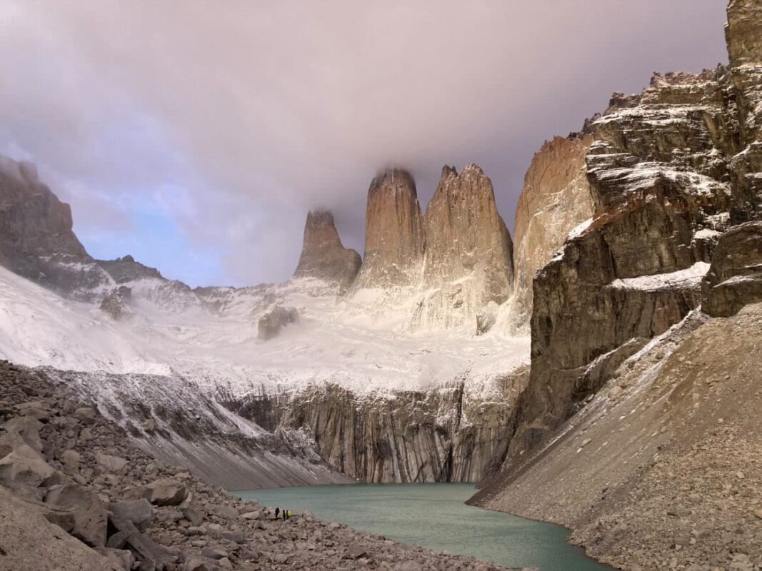
Once you reach the pass, you’ll be rewarded with views of Glacier Grey, a magnificent glacier that fills the crevasses of the park. Once you spend a few minutes admiring the view, it will be time to descend down, down, down. After about an hour and a half of muddy sliding down the mountain, you’ll arrive at the Camp Paso check-in station to make sure you made it off the mountain safely. From here it’s another 5 hours of descent.

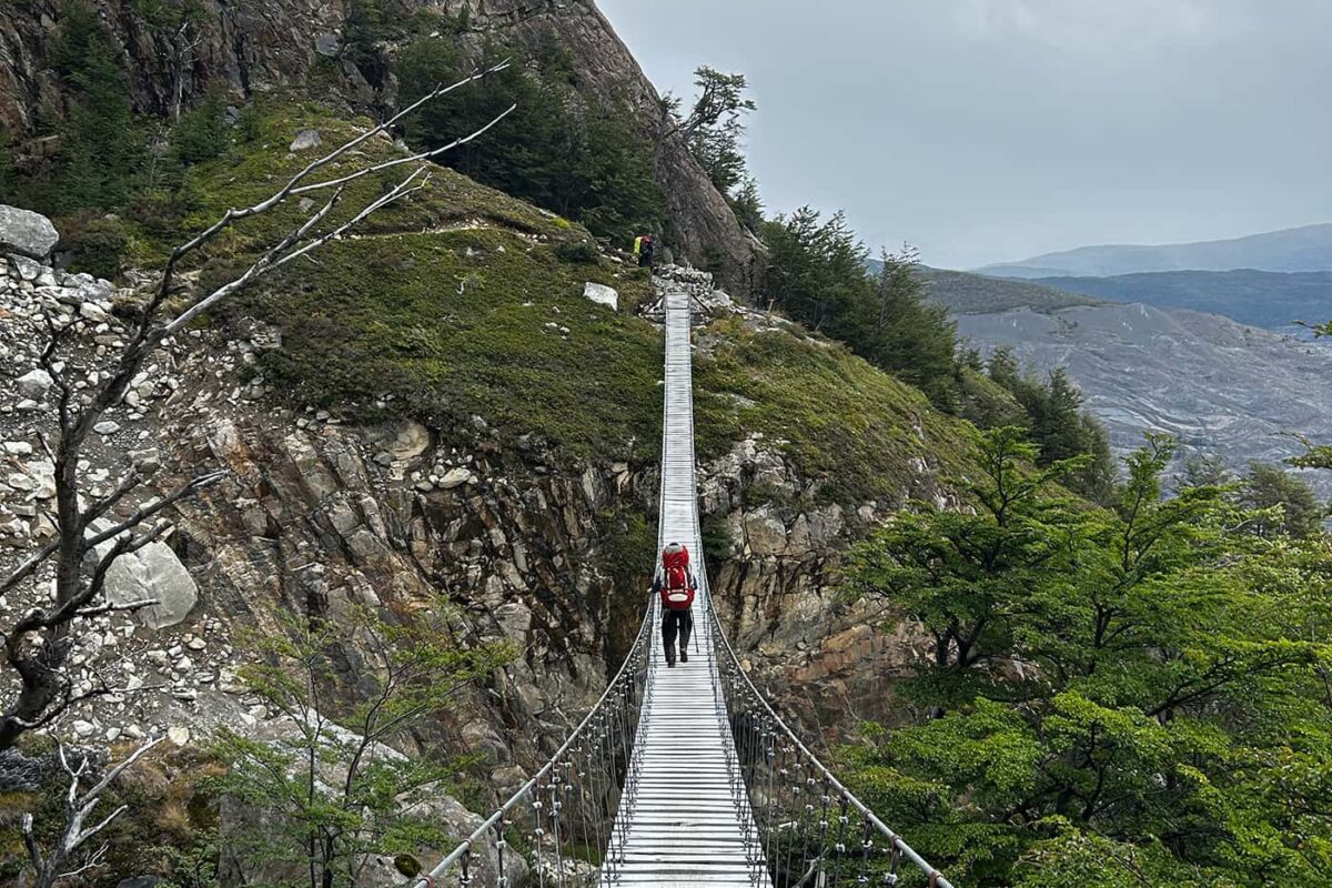
One of the special elements of this section is the suspension bridges. You’ll cross over three bridges on your approach to Camp Grey, and all of them offer views over stunning waterfalls.

Once you arrive at Camp Grey, you’ll now be overlapping with the W-Trek. The W is a four-day version of the trek through the park and traverses the south section of the loop. The trail will become busier on these sections, so make sure to have your campsites booked far in advance!

From Grey to Paine Grande, the day is seemingly easy in elevation, which will give your muscles time to rest after the pass the day before. However, it’s not without its own challenges. This stage is very exposed, so you’ll be in direct contact with the wind for the majority of it. Most of the day, you’ll trek alongside Lago Grey and find icebergs floating between the tugboats that import food to the regugios. When you arrive at Paine Grande, prepare to be pampered with views. Even on the cloudiest day, the water on Lago Pehoé will sparkle. This section reminds many folks of Scandinavia with its plunging, forested mountains into the lakes.

As previously stated, the W can become quite busy. So two options for accommodation are only 2km apart: Frances and Cuernos. Both are beautiful, well-equipped sites, it just depends on where you can find a reservation since they fill up fast. Before you reach those, though, you’ll have the option to climb to some viewpoints, or “miradors” in Spanish. Drop off your pack at the Italiano check-in station at the base and begin the intense climb to the Mirador Frances and Mirador Britannica. You’ll have clear views of Valle Frances and some epic glacier time from these. Our team even saw a few avalanches while up there! Plan your day well, because the miradors on this section can add up to 11km to your trek.

Once you finish the miradors, you’ll head to wherever you booked for the night. From there, you’ll have some options for how you want to finish the trek. If you plan it so, the next day could be your last on the Patagonia O-Circuit. You will still have the final Mirador Torres del Paine, but if you sleep at Central, you can leave your packs there for the final ascent and take the bus back to Puerto Natales when you finish. If you sleep at Chileno, on the mountain, you’ll still need to carry your pack back to Central for the next day when you leave.

This section is fairly easygoing, and if you have clear visibility, you’ll enjoy views of Lago Nordenskjöld the entire way. Bask in the accomplishment of facing the elements of Patagonia for a week and start dreaming of the gorgeous towers you’ll see the next morning!

Las Torres is what most people think of when they imagine Patagonia. Most people opt to wake up at 4 am for a sunrise view of these amazing towers to beat the day-trip crowds. The night before hiking, make sure to ask rangers for the conditions report so you make sure you have the best chance of seeing them! Some days the mirador is closed due to weather, so you may need to be flexible with your plans. If you push hard, the ascent can take as few as 2.5 hours, and about 2 hours to descend. But if you decide to take your time, plan for closer to 3.5 hours on the ascent and 3 hours to descend.

If you decide to camp the whole way and choose not to purchase meals at the lodges, it makes this trail a bit more difficult. You’ll then be carrying all of your food for 8 days and camp gear with you.

Nonetheless, the trail itself isn’t too strenuous. There is one day that I classify as properly tough, from Camp Los Perros to Camp Grey, when you climb Garner Pass, but the rest of the stages are easy to intermediate.

The one thing that can add or subtract from the difficulty levels is the weather. Late February/early March was a bit too late in the season for sunshine, and we had wind and downpours most days. In my eyes, this added to the “Patagonia experience,” until I saw photos of how clear the trail had been only a month before! It seems like the sweet spot is between December and January for sunshine. We also had almost white-out conditions when climbing Garner Pass with almost no visibility, so the weather can really affect your hike.

Stages

Stage 1:

Puerto Natales – Camp Seron, 19.5 km | 12 mi

Stage 2:

Camp Seron – Camp Dickson, 19 km | 11.8 mi

Stage 3:

Camp Dickson – Camp Los Perros, 11.5 km | 7 mi

Stage 4:

Camp Los Perros – Camp Grey, 15 km | 9.3 mi

Stage 5:

Camp Grey – Camp Paine Grande, 14.5 km | 9 mi

Stage 6:

Camp Paine Grande – Camp Cuernos, 23.7 km | 14.7 mi

Stage 7:

Camp Cuernos – Camp Torres, 16.8 km | 10.5 mi

Stage 8:

Camp Torres – Puerto Natales, 18 km | 11.2 mi

(Las Torres climb: additional 5-6 hours)

Accommodations

Because of the popularity of the Patagonia O-Circuit, it’s imperative to book all accommodations 5-6 months in advance. Wild camping is prohibited in the park, so you have the option to either book a campsite or a bed in the lodges. The lodges are all between 18-22 KM from one another, so it’s an easy progression between them with the day’s hiking. Two companies own the lodges, and booking can be a bit messy, so make sure to plan out your stages in advance before making reservations.

There are two companies that own all of the campsites in Torres del Paine, Las Torres and Vertice. You have the option to book each night on their respective websites, or you can pay a little more and have a tour agency book the full trek for you. It’s a bit of a headache booking it on separate websites, so it may be worth paying the fee for someone else to take care of it.

Best time of the year

As I mentioned above, the weather can really make or break this trek. The best time to hike the Patagonia O-Circuit is late November to late January. Any earlier or later than this and you may have snow and rain for the majority of your trek. In these months, you should have more sunshine and visibility the whole time. However, you will have wind no matter when you go. Patagonia is famous for it! Because of this, you’ll be happy if you have a hardshell jacket or at least a windbreaker to wear each day.

Safety & Gear

The Patagonia O-Circuit is a relatively safe trek. Because it is so busy, there’s a lot of infrastructure in place to keep you protected. However, it is still important that you do your homework and prepare before you hit the trail. When you’re in the more remote parts of the park like on Garner Pass, there isn’t much space for a rescue crew, so you’ll need to be self-sufficient. Bring a first aid kit and a warm sleep system to avoid any injury or hypothermia if it’s wet and near freezing while you’re out. Additionally, you’ll want to pack at least 2 liters of water each day, along with enough snacks and electrolytes.

Because you’ll need to book everything so far in advance, you’ll have a detailed itinerary for each day. It’s smart to send this to someone you trust and check in with them if something changes.

Good to know

Food

There are many options for food on the Patagonia O-Circuit. You can either opt to bring your own for the whole trail, pay for meals at the lodges (book ahead of time), or buy groceries at the reception desk markets (usually a few shelves with pasta and beans). There’s always an option for buying drinks and they will always have clean water to cook with and drink. It’s up to you how much you want to carry and how much you want to spend! This is a great example of “hike your own hike.”

You’ll also have access to cooking shelters and tables at each campsite, even if you don’t decide to buy a food package.

Trail Traffic

The Patagonia O-Circuit is not a trail for folks who are trying to escape into nature. It’s quite busy, even though technically there is crowd control based on how many spaces there are at each lodge (many). You will run into the same people every day.

In the first half of the O, the silver lining is that all traffic runs the same way. However, once you reach the W section, the traffic will begin to flow both ways and the trails will become much busier. Take this as an opportunity to meet people from all over the world and hear their stories.

Route
Circuit
Highest point
1241m (4071 ft)
Water resources
water points at lodges

Guidebooks

cover guidebook

Torres del Paine

View guidebook

Want to submit a trail or make this page more complete?

Comments

Be the first one to comment on this trail!

Reply to this trail

Your email address will not be published. Required fields are marked *

Reply to this trail

Log in to comment on this trail
Always read the disclaimer

Terms of Use: important to all visitors on this website. We strive to publish high quality content and information on this website. However it’s always possible that we’re missing out on some crucial information. In spite of the fact that this route, associated GPS track (GPX and maps) were prepared under diligent research by the specified contributor and/or contributors, the accuracy of such and judgement of the author is not guaranteed. Therefore, hiking-trails.com and contributors are in no way liable for personal injury, damage to personal property, or any other such situation that might happen to individuals hiking or following this route. Should you choose to hike this trail, this is always at your own risk. Check out our guidelines for safety hiking and Leave No Trace principles at the hiking 101 page.

Download GPX

Join the community!

Login or create a FREE account 😊

With an account you can:

Download GPX files

Pin trails to your wishlist

Mark trails as hiked by you

Rate hiking trails

Comment on trails, blogs and gear reviews

Happy trails!
Login

Don't have an account yet? Register here