About the Pacific Crest Trail

country
United States
length
4265 km(2650 mi)
Type of trail
Thru-hike, Long-distance
difficulty

Difficulty is highly personal. Be aware of the weather conditions as bad weather turns easier trails in difficult trails especially in the mountains.

Strenuous
accommodation

Lodging means a mix of hotels, hostels or AirBnB’s.

Wild camping, Camping, Lodging
Elevation gain
128000 m(419948 ft)
terrain
Mountains, Desert, Forest, Hills
remoteness
Most of the time
Show more

The Pacific Crest Trail is one of the most epic treks worldwide. Dozens of books, YouTube movies, and blogs have been created to honor this epic thru-hike. The famous movie production Wild with Reese Witherspoon has motivated many aspiring thru-hikers to go wander in the woods for 6 months. The Pacific Crest Trail intrigues both young and old, and for good reason.

Established in 1968, the trail attracts thousands of adventurers each year, drawn by its rugged beauty and sense of adventure. Hiking the PCT requires careful planning, luck with the lottery system, physical endurance, and mental resilience as you navigate through extreme weather and wilderness. But it’s through these hardships that you’ll make memories and friends to last a lifetime.

man and women posing for camera
Author

Ilse & Ryan Brown

Ilse was born in Belgium but lost her heart – literally – to North America. She has hiked the Great Divide Trail and part of the Pacific Crest Trail. Somewhere on the PCT, she met her husband Ryan. Together, they have hiked trails in Sweden and Portugal. After a year on the road, they are back in Belgium, saving up money for future adventures. You can follow Ilse on Instagram.

View profile

The Trail

The iconic trail crosses the states of Washington, Oregon, and California. It is a National Scenic Trail, meaning that it is largely protected by law. It showcases the Californian desert’s beauty, the Sierra Nevada’s ruggedness, the forests and blue lakes of Oregon, and volcanic peaks in the Cascade Range. In total, the trail spans 2,650 miles (4,265 kilometers) from Mexico to Canada.

Most people hike the trail south to north (NOBO or northbound) and hike from March-May until June-September. It is possible to go north to south, or SOBO, starting from the Canadian border, however, your weather window will be a bit smaller. It does offer more solace and a quieter hiking experience.

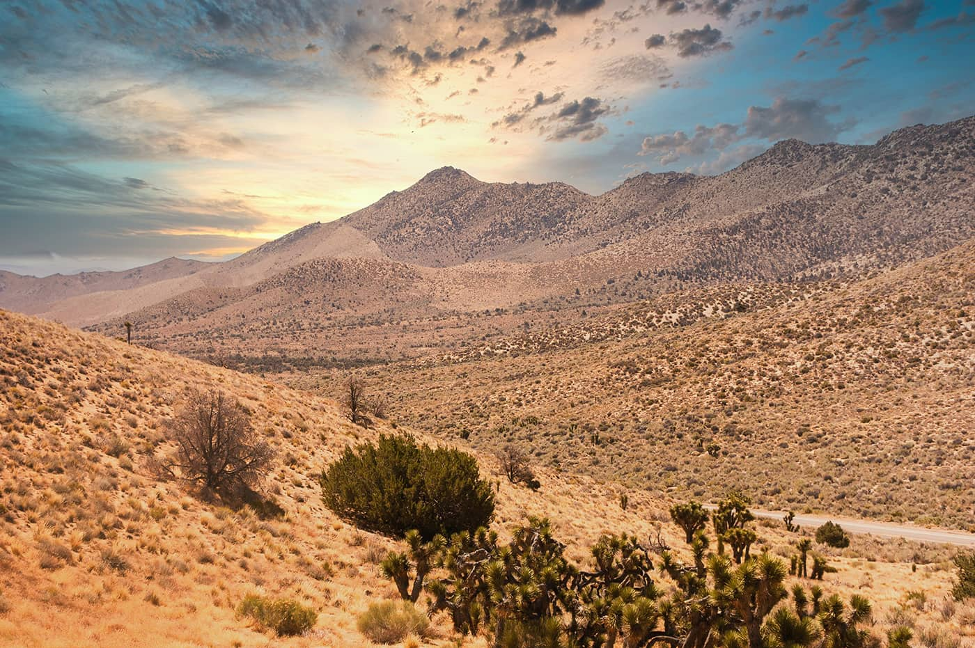
The first stage is through Southern California. This section begins at the Mexican border in Campo and extends to Kennedy Meadows, covering approximately 700 miles (1125km). This stage has arid desert terrain with temperatures that can soar above 100°F (37°C) during the day and drop significantly at night. The trail winds through the Laguna Mountains, San Jacinto Mountains, and the San Bernardino Mountains. Water sources are sparse and unreliable, which means you need to plan carefully and will often be carrying multiple days worth of water.

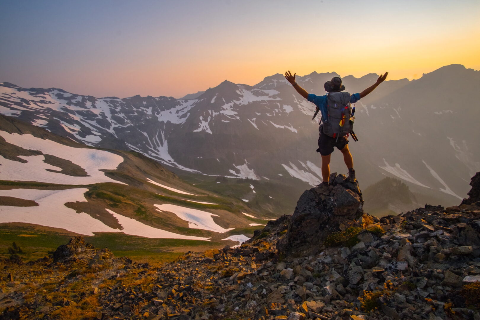
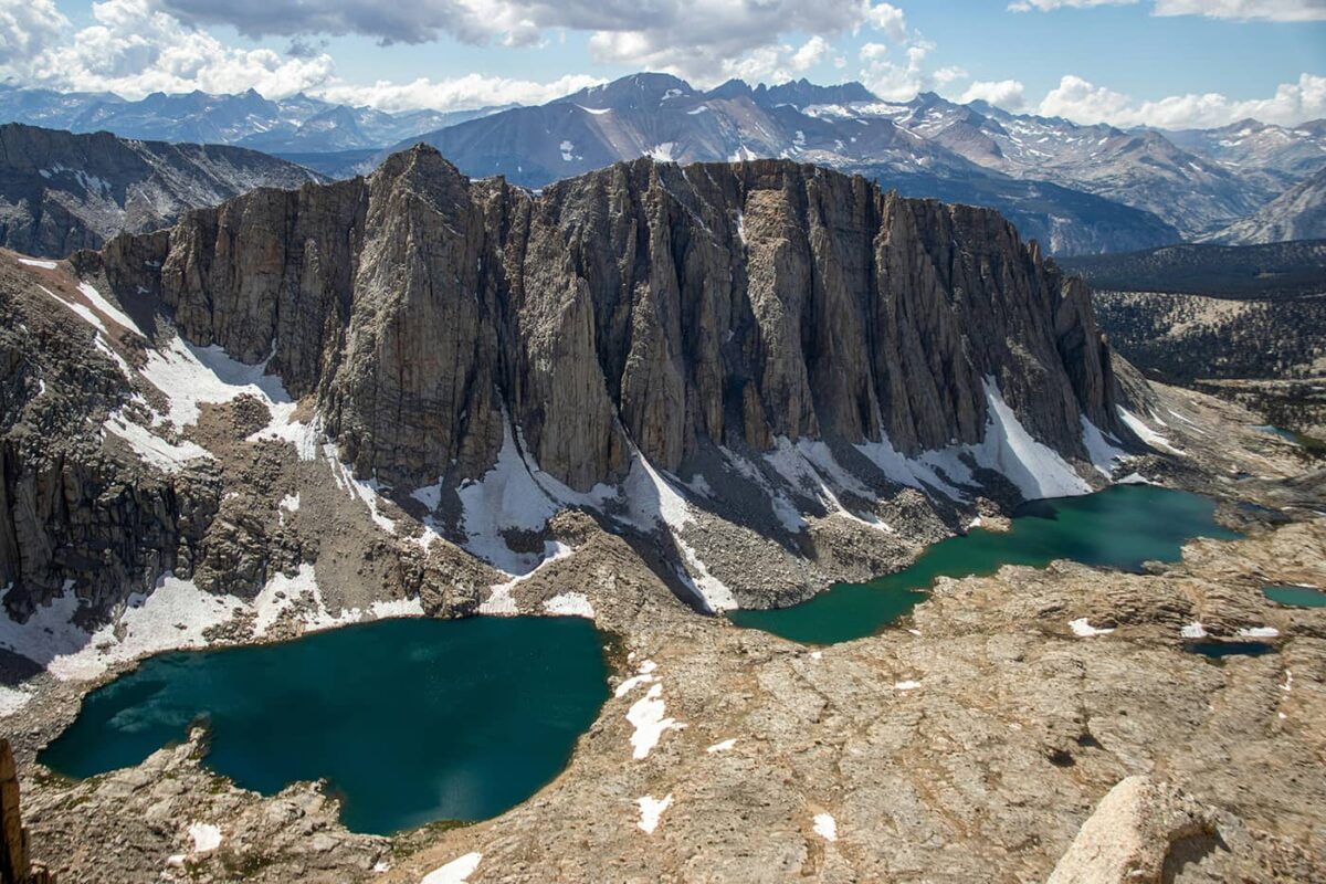
The next stage is from Kennedy Meadows to Tuolumne Meadows in Central California. Stretching roughly 400 miles (640km), this section takes hikers through the heart of the Sierra Nevada. Now you’ll start to climb into the high Sierras, where you’ll find alpine scenery, clear mountain lakes, and passes such as Forester Pass (13,153 ft/4000m), the highest point on the PCT. You’ll pass through Sequoia and Kings Canyon National Parks, John Muir Wilderness, and Yosemite National Park. You’ll have to hike across numerous snowfields and potentially dangerous stream crossings early in the season. Many people have had to skip this section and complete it later in the season if the snow is too heavy, so this is something to be aware of each year!

Covering about 600 miles, the next stage through Northern California extends from Yosemite’s Tuolumne Meadows to the Oregon border. The trail ranges from the volcanic landscapes of Lassen Volcanic National Park to the forests of the Marble Mountains and Trinity Alps Wilderness. The trail also passes through the Northern Sierra, the Cascade Range, and the Siskiyou Mountains. This section includes significant climbs and descents, but the weather is way more temperate and predictable compared to the high Sierras.

The Oregon stage of the PCT is approximately 450 miles (725km) and is known for its more moderate terrain, which allows for faster hiking. The trail goes along the Cascade Range, passing by several volcanic peaks, including Mount Hood and the Three Sisters. Dense forests, alpine lakes, and lava fields are common at this stage. Water sources are generally plentiful, and the trail is well-maintained. This section is also famous for the “Oregon Skyline Trail” and the lush greenery of the Willamette National Forest. Crater Lake is also a major highlight!

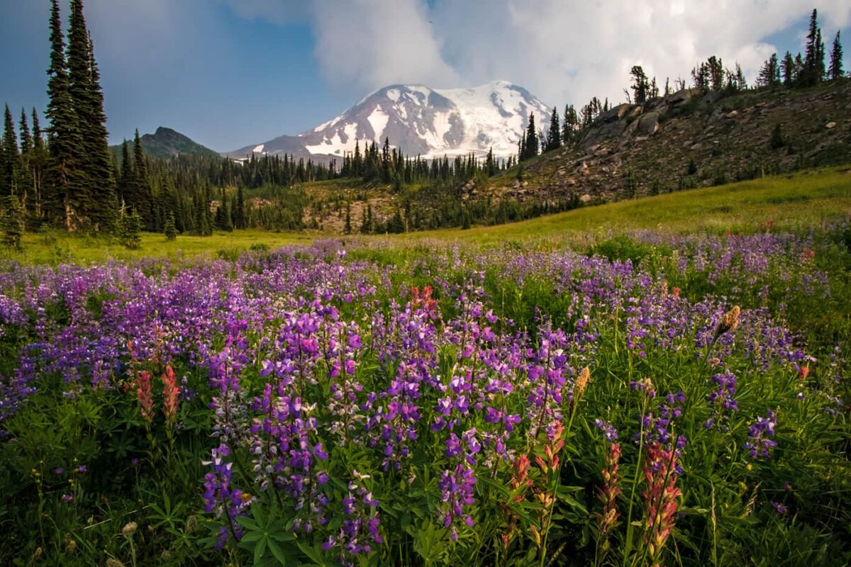
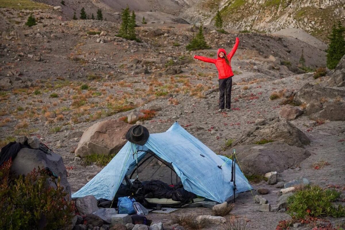
The final stage of the PCT runs for about 500 miles (800km) from the Bridge of the Gods on the Columbia River to the Canadian border. Washington’s segment is known for its challenging terrain, frequent elevation changes, and fluctuating weather conditions. The trail goes along the North Cascades, offering incredible vistas, alpine lakes, and jagged peaks. Key areas include Mount Rainier National Park, Goat Rocks Wilderness, and the North Cascades National Park. You may find more snowfields and potentially rough weather here even in late summer. After months of hiking, you’ll finally end the trail with a remote and beautiful stretch through the Pasayten Wilderness before reaching the northern terminus at the Canadian border.

Stages

There are a bit too many stages to describe for the Pacific Crest Trail. But we can break down the trail in five different sections, crossing the three states California, Oregon and Washington all the way from the southern border with Mexico until the northern border with Canada.


Sections Pacific Crest Trail 

  • Southern California, 1126 km | 700 mi
  • Central California, 804 km | 500 mi
  • Northern California, 804 km | 500 mi
  • Oregon, 732 km | 455 mi
  • Washington, 812 km | 505 mi

Accommodations

You will need to bring a good tent on this hike. Because of the long distances and remote wilderness areas, accommodation places are far and few between. There are no mountain huts in most areas, apart from one or two exceptions, meaning that you will have to camp most of the time. There are plenty of campsites to be found. Please do not make any new campsites to respect the fragile environment.

Whenever you’re in town in between sections, it is possible to stay indoors and sleep in a hostel, motel, or hotel. Prices can vary from $50 to $150 – depending on whether you are staying in an expensive mountain hotel or a cheap roadside motel. Staying overnight in hiker hostels and sharing a dorm can be an effective way to lower the costs significantly. Sometimes, camping in town is also an option. Support the locals! All PCT towns are extremely hiker-friendly and will go out of their way to accommodate and support PCT hikers. Make sure to repay the favor and respect the town’s rules and regulations.

Best time of the year

The best time of the year to hike the Pacific Crest Trail depends on which direction you want to follow. Most hikers start NOBO and will therefore try to end the hike around August or September at the latest. The weather window is relatively short. First, you will want to be out of the Californian desert before it gets too hot, so March and April are popular start dates.

Next, it is pivotal to travel through the famous Sierras after the snowpack has lowered. This also means, however, that after the snow melts, the rivers and rapids are dangerously high. Plus, some snow fields linger throughout summer, so crampons and an ice axe are a must.

Keep in mind that the weather in the high mountains can change rapidly, and it’s essential to be prepared for various conditions, including sudden rain or snow showers. Always check trail conditions, and local weather forecasts before starting your stage.

Safety & Gear

When planning this hike it’s essential to consider several key factors to guarantee a secure outdoor adventure. Since the PCT is a long-distance hike that takes you through different ecosystems and all types of weather, it is essential to come prepared! Sunscreen, hat, gloves, umbrella, rain gear, and base layers are all essential parts of your clothing system. You will face relentless sun and possibly extreme cold and wind. You can experience weeks of non-stop rain or 40° sun. Do a shakedown hike before you leave to make sure you know and understand the gear you are carrying. Are you prepared for all circumstances?

Share your rough itinerary with your family or friends, including emergency contact information.

Staying properly hydrated and nourished is essential. Ensure you have a good supply of water and energy-rich snacks to maintain your energy levels and prevent dehydration and exhaustion.

Invest in the right hiking gear, including comfortable, supportive footwear, proper hiking clothing, such as warm base layers and a hardshell rain jacket, hiking poles, a well-fitted backpack, and essential equipment like maps, GPS devices, and a first-aid kit. We’ve made special gear list for thru-hikers.

Respect the principles of Leave No Trace by minimizing your impact on the environment. Stick to designated trails, pack out all trash, and show respect for wildlife and natural habitats.

Good to know

The Pacific Crest Trail is only growing in popularity, due to popular culture (the movie “Wild”), YouTube, and social media. Please take care of the environment and leave no trace when hiking or camping. Overuse of these fragile trails can lead to their destruction. Always take your garbage with you, don’t disturb the wildlife or plants, don’t make new campsites and make no fires! The PCT has been plagued by horrible wildfires – often instigated by hikers – and too many parts of the trail have been burned down due to recklessness.

You’ll need to apply for permits for the PCT. If you’re section hiking, you’ll need to apply for individual permits depending on your section (sometimes they aren’t necessary, but always check!). For thru-hikers planning to hike over 500 miles, you’ll need to apply for a permit with the Pacific Crest Trail Association. These can be a bit tricky to obtain, so make sure to plan ahead and apply for the designated permit release days (2 per year).

Water resources: In Oregon and Washington there are plenty of rivers, streams, and waterfalls to drink from. Bring a water filtration device. In the desert in California, water is sparse. This involves long water carries and asking trail angels for water caches in the desert. Don’t underestimate the need for hydration and take this seriously – hikers can get into trouble when there is no water source available.

Remoteness: The PCT is quite remote and far removed from roads or towns. Food carries vary between 3 days to 10 days in the Sierras. Sometimes you cross a backcountry road, but often there is no traffic. If you cross a road, you may want to hitch to the nearest town for a resupply of food.

Route
Point to point
Highest point
2600m (8530 ft)

Want to submit a trail or make this page more complete?

Comments

Be the first one to comment on this trail!

Reply to this trail

Your email address will not be published. Required fields are marked *

Reply to this trail

Log in to comment on this trail
Always read the disclaimer

Terms of Use: important to all visitors on this website. We strive to publish high quality content and information on this website. However it’s always possible that we’re missing out on some crucial information. In spite of the fact that this route, associated GPS track (GPX and maps) were prepared under diligent research by the specified contributor and/or contributors, the accuracy of such and judgement of the author is not guaranteed. Therefore, hiking-trails.com and contributors are in no way liable for personal injury, damage to personal property, or any other such situation that might happen to individuals hiking or following this route. Should you choose to hike this trail, this is always at your own risk. Check out our guidelines for safety hiking and Leave No Trace principles at the hiking 101 page.

Download GPX

Join the community!

Login or create a FREE account 😊

With an account you can:

Download GPX files

Pin trails to your wishlist

Mark trails as hiked by you

Rate hiking trails

Comment on trails, blogs and gear reviews

Happy trails!
Login

Don't have an account yet? Register here