man hiking on Ortler hohenweg

Ortler High Mountain Trail

Ortler Höhenweg

About the Ortler High Mountain Trail

Alps
country
Italy
length
119 km(74 mi)
Type of trail
Hut to hut, Long-distance
difficulty

Difficulty is highly personal. Be aware of the weather conditions as bad weather turns easier trails in difficult trails especially in the mountains.

Strenuous
accommodation

Lodging means a mix of hotels, hostels or AirBnB’s.

Mountain huts, Lodging
Elevation gain
8126 m(26660 ft)
terrain
Mountains
remoteness
Some of the time
Show more

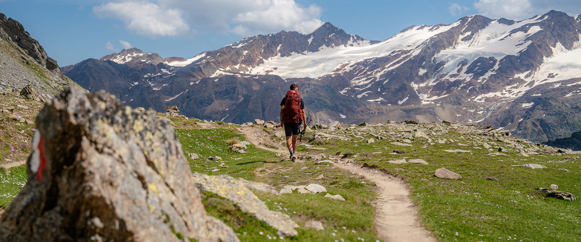
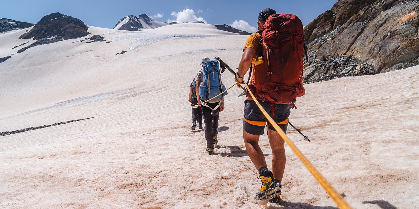
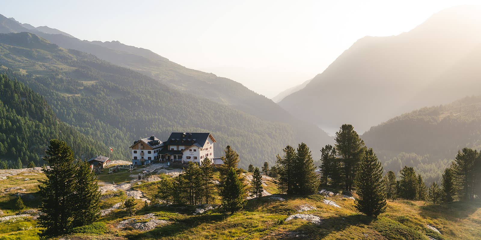
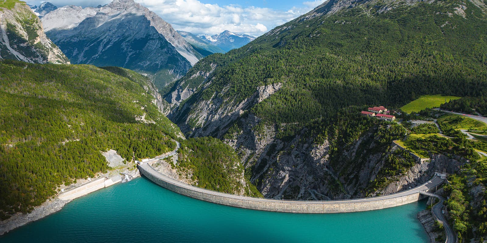
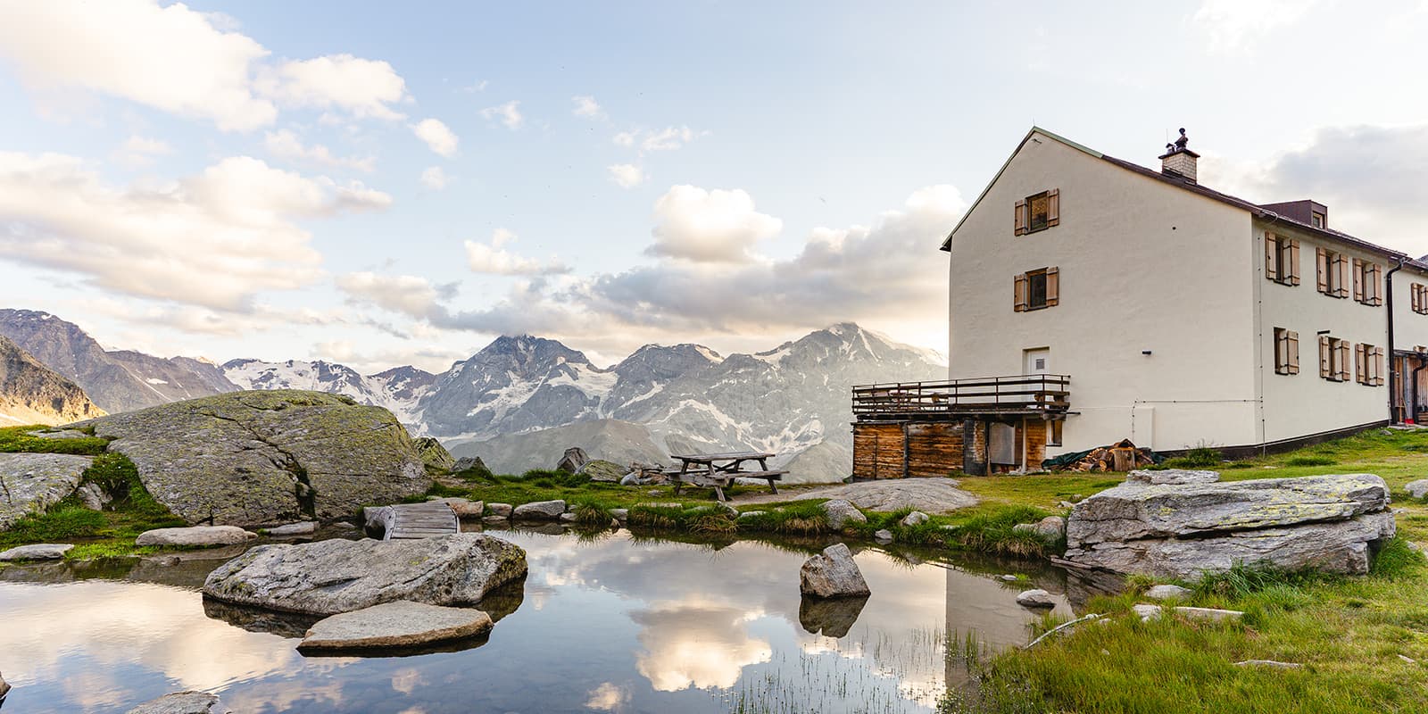
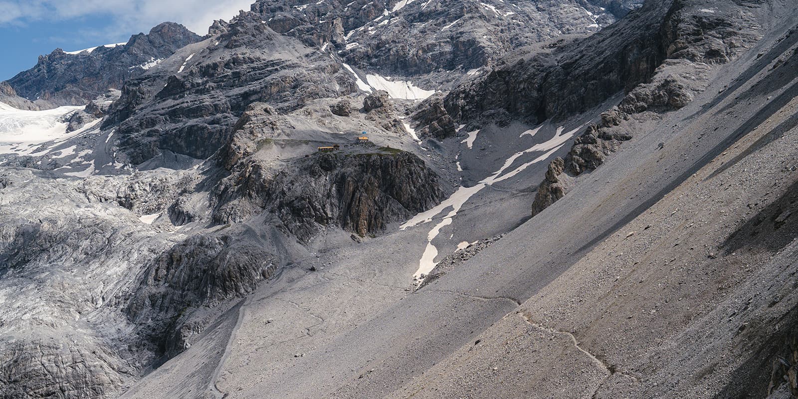
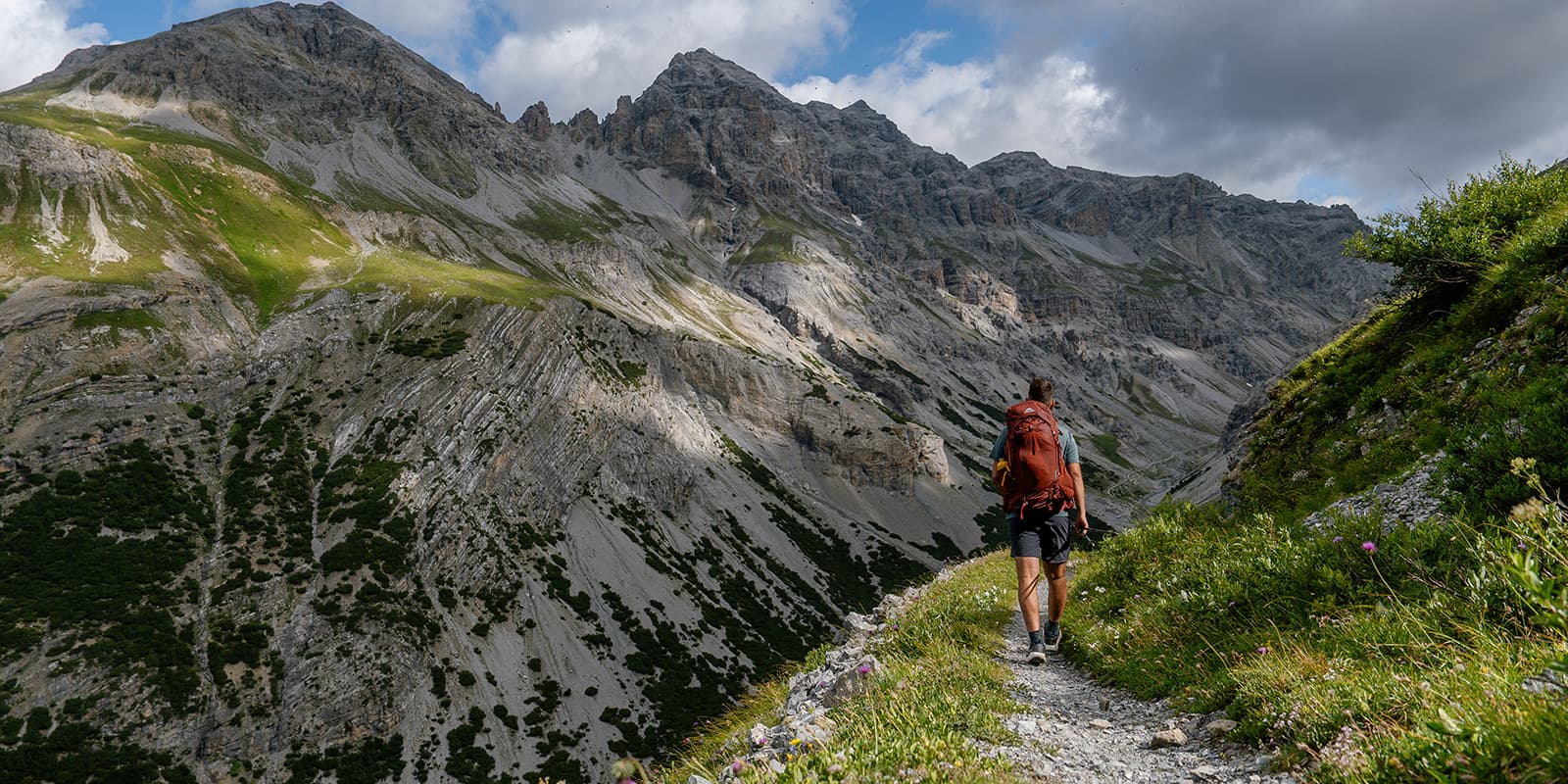
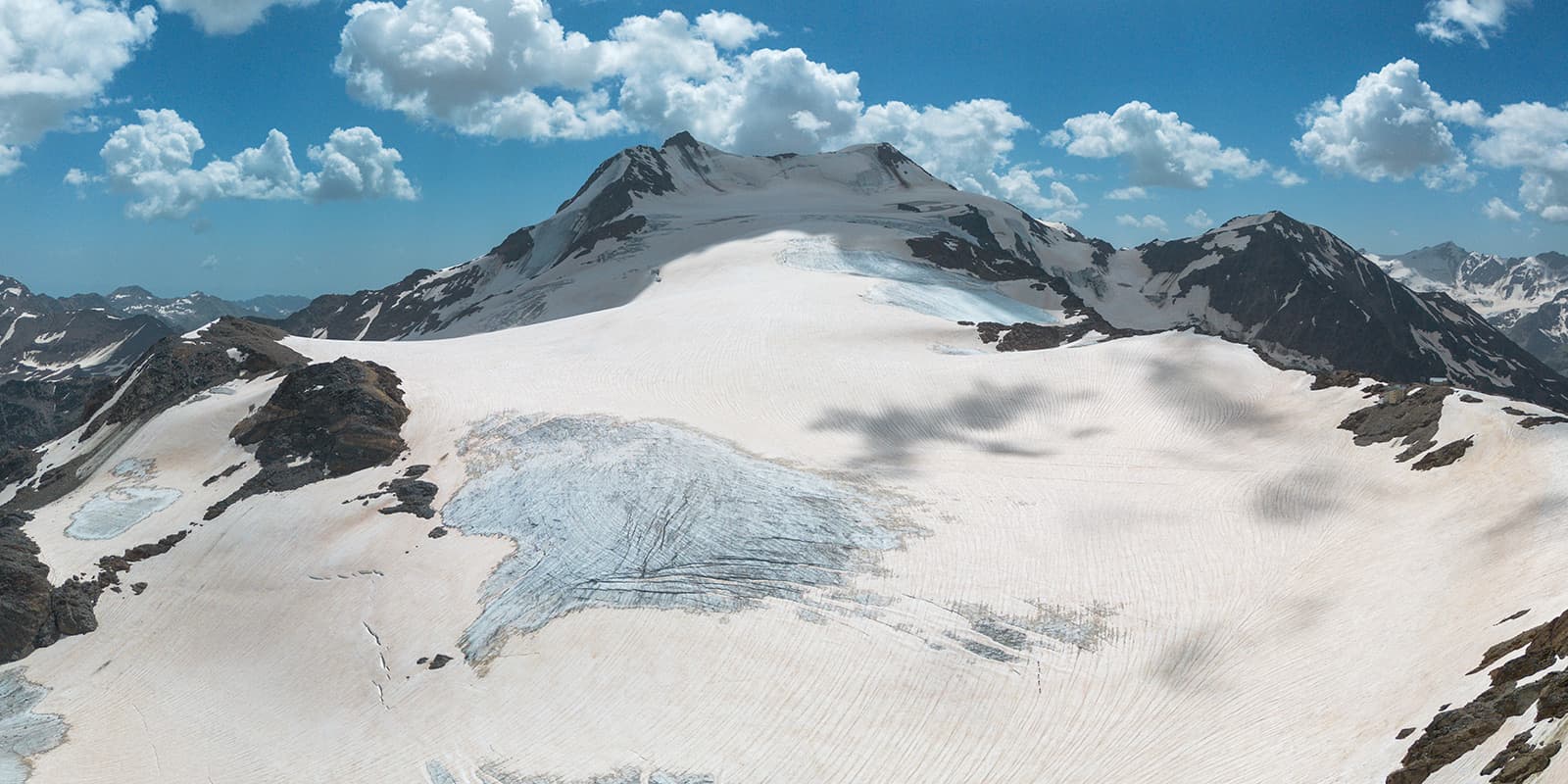
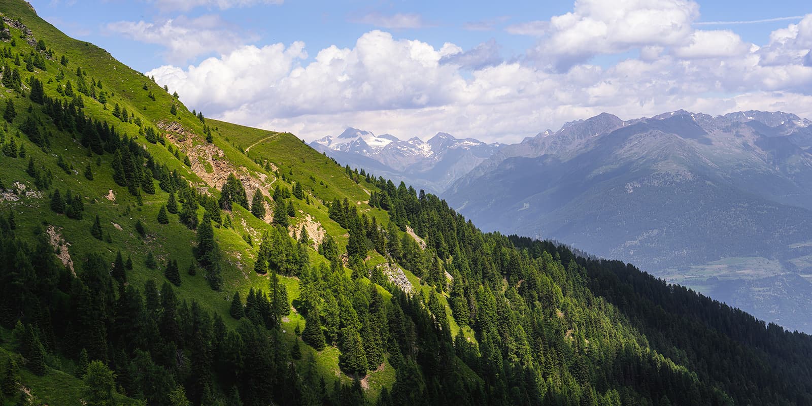
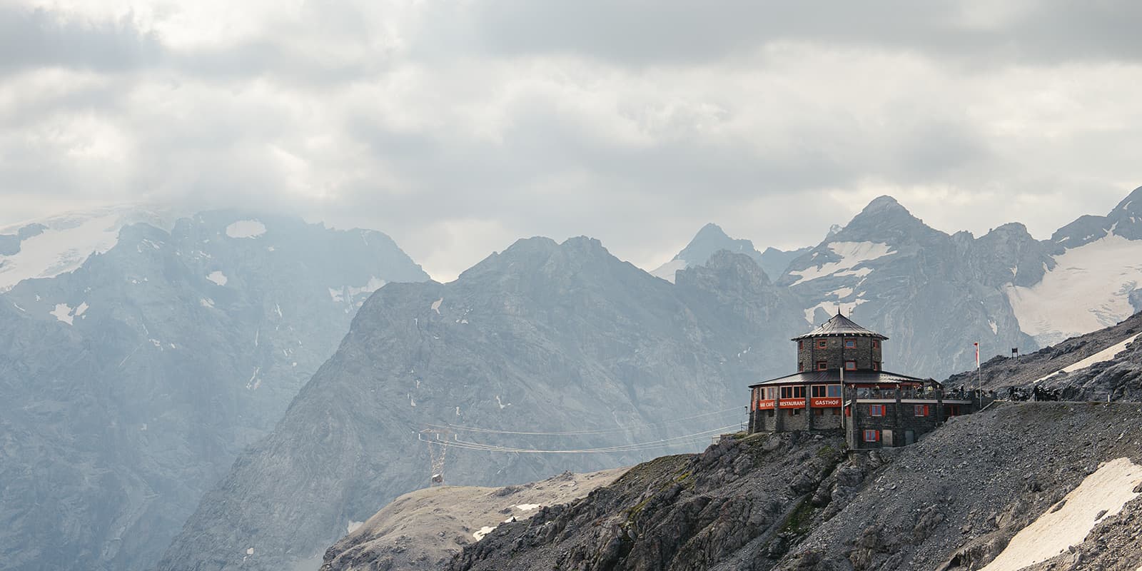
The Ortler High Mountain Trail is a spectacular high-altitude hut-to-hut tour around the Ortler Group in Stelvio National Park, covering 119.5 kilometers. Otherwise known as the Ortler Höhenweg or Ortler Hohenrunde in German, the trail is challenging even for experienced hikers with its 8,126 meters of elevation gain, sections reaching over 3,000 meters in altitude and glacial terrain.

The Ortler High Mountain Trail was established to provide access to some of the Alps’ most scenic views, as it takes you through both South Tyrol and Lombardy. Historically, the trail area has been significant for its mountainous landscapes and is popular among people looking for alpine experiences. The views alone make it worth the difficulty, as it has a panoramic view of the many Ortler glaciers and views on one of the most majestic peaks in the Alps.

Elmar profile picture
Editor

Elmar Teegelbeckers

Passionate hiker Elmar spends months of his time on the trail. He’s usually on the lookout for hidden gems in one of his favourite countries such as Slovenia, Switzerland and Japan. He founded hiking-trails.com in need for a community and detailed information about the trails. Before this, he worked for the Alpine asscociation in the Netherlands[ (NKBV) but lost his heart to the trails.

Not long ago, Elmar published the book (in Dutch) Hiking Trails – best long-distance trails in Europe. With this book, website and socials, he hopes to inspire and shape an inclusive community for hikers all over world. No matter your speed, experience or level, you can get out there to enjoy the trails and connect with the heartwarming hiking community. Life is so much better outside and he hopes to inspire hikers to take their first, or next, step on the trail.

You can reach Elmar at info@hiking-trails.com.

View profile

The Trail

The trail is divided into seven stages, each day its own challenges and landschapes. You’ll start by hiking from the Stelvio Pass, mostly famous among bikers to Stilfs, a small cozy town in the valley. This stage involves an 18.5-kilometer, mostly descending, taking about 7.5 hours. In that time, you’ll descend over 1800 meters. Talk about a big first day! Then on stage two, from Stelvio to the Düsseldorfer Hütte, it’s a big climb again with nearly 1800 meters over 17 kilometers. This section can take eight or nine hours and has incredible views of the alpine surroundings.

Stage three is a bit shorter, 14 kilometer from the Düsseldorfer Hütte to the Zufall Hütte. It takes about eight hours and is currently impacted by trail closures. Make sure you visit the local trail page to check the trail conditions and alternative trails to Zufall. The owners of the Düsseldorfer Hütte know the conditions the best and it’s highly recommended to ask them for advice.

Next day will be your biggest day on the Ortler High Mountain Trail, from Zufall to Rifugio Pizzini, you’ll cover 11.5 kilometers over 6.5 hours, crossing 1,000 meters of elevation gain, and most spectacular, crossing a glacier. After leaving the hut you’ll climb towards the Eissee Pass from where the glacier crossing starts. Be sure to have all your glacier equipment with you and you have the experience to cross glaciers. If not, hire a guide who will bring the gear and guide you safely over the glacier. The glacier crossing ends at the Casati hut (which is closed since 2004) and from there it’s a short steep descent to Pizzini in (you’re now in Lombardy) and look back on a magical day.

A longer day awaits you on stage 5 with a 20.5-kilometer day, when you’ll descend over 2,300 meters. It should take about 8.5 hours from the Pizzini Hut to Sant’Antonio. It’s longer, but the trails are a bit less tecnical then the last days.

Hiking from Sant’Antonio to Lake Cancano on stage six, you will end by the dam and sleep at the Rifugio Monte Scale which is a bit more luxurious then the previous mountain huts. By this point you’ll either feel fit and trained from being in the alpine for almost a week, or ready for a long sleep when you arrive (or both!). Finally, you’ll leave Lake Cancano and head back to Stelvio Pass in a strenuous last push 22-kilometer hike with significant ascents and descents. Once you get back to Stelvio Pass, it will be time to celebrate a perfect week in the mountains with a cold beer!

Stages

Because the trail is a loop starting at Stelvio Pass, you’ll also need to factor in time to arrive at the pass. If you want to start the trail from a town you can easily start in Stilfs and end at Stilfs again.

7-day itinerary

Stage 1:

Stelvio Pass – Stilfs, 18.5 km | 11.5 mi

Stage 2:

Stilfs – Düsseldorfer Hut, 17 km | 10.6 mi

Stage 3:

Düsseldorfer Hut – Zufall Hut, 14 km | 8.7 mi

Stage 4:

Zufall Hut – Pizzini Hut, 11.5 km | 7.2 mi

Stage 5:

Pizzini Hut – Sant’Antonio, 20.4 km | 12.7 mi

Stage 6:

Sant’Antonio – Lake Cancano, 16 km | 10 mi

Stage 7:

Lake Cancano – Stelvio Pass, 22 km | 13.7 mi

Accommodations

Along the Ortler High Mountain Trail, you’ll stay in mountain huts and accommodations. To book the huts, you’ll need to reserve your beds a few months in advance. This is a popular region for hut-to-hut tours, which means that they fill up fast, especially the most popular ones like the Zufall Hut and the Rifugio Monte Scale.

If you start at the Stelvio Pass, a great accommodation to sleep on your arrival day before you start the trail is the Tibet Hütte.

Find the recommended accommodations below, if you only wish to sleep in Mountain huts, we can suggest to start in Stilfs so you’ll overnight for 6 days in a mountian hut.

Overnight stage 1: Düsseldorfer Hütte
Overnight stage 2: Zufall Hütte
Overnight stage 3: Pizzini Hütte / Rifigio Pizzini
Overnight stage 4: Rifugio  Campo
Overnight stage 5: Rifugio Monte Scale
Overnight stage 6: Rifugio Alpino Tibet Hütte

Overnights for the original stages

Stage 1:

Hotel Sonne

Stage 3:

Zufall Hutte

Stage 5:

Albergo Zebru Sant’Antonio (search on Google)

Best time of the year

The ideal time to hike the Ortler High Mountain Trail is between the end of June and September. During these months, the weather is mild, the huts are open, and the trail offers clear visibility, making it perfect for enjoying the panoramic mountain views. Note that this is an high-alpine mountain trail and you can expects lots of snowfields even during the summer.

Safety & Gear

Hiking the Ortler Hohenrunde will demand a good preparation and fitness. The high altitude and challenging terrain mean you need to have surefootedness and proper equipment, including good hiking shoes, weatherproof clothing, and glacier gear for stage 4. Since some parts of the trail are remote, you should carry a first-aid kit, sufficient food, and water. Hiring a mountain guide is recommended, especially for less experienced hikers, for the trail section that crosses the glacier and other technical sections. You’ll also need to check weather forecasts and trail conditions each morning before starting, as the weather can shift quickly in the alpine

Good to know

The Ortler High Mountain trail is one of the most renowned high altitude trails in Europe. Circling around the massive Ortler peak in 7-days is an incredible journey, only for experienced hikers.

Important! 

On stage 4 from this trek, you’ll cross a glacier. This is a difficult crossing and only recommended for hikers with alpine experience and proper glacier equipment such as crampons, ice axe, rope, harness and so on. If you don’t have the equipment, never go on the glacier. You can always hire a mountain guide only for the glacier crossing, or for the whole trek. The mountain guide will bring all the necessery equipment.

Kind of trail
Circuit
Highest point
3258M (10,688 FT)

Want to submit a trail or make this page more complete?

Comments

Be the first one to comment on this trail!

Reply to this trail

Your email address will not be published. Required fields are marked *

Reply to this trail

Log in to comment on this trail
Always read the disclaimer

Terms of Use: important to all visitors on this website. We strive to publish high quality content and information on this website. However it’s always possible that we’re missing out on some crucial information. In spite of the fact that this route, associated GPS track (GPX and maps) were prepared under diligent research by the specified contributor and/or contributors, the accuracy of such and judgement of the author is not guaranteed. Therefore, hiking-trails.com and contributors are in no way liable for personal injury, damage to personal property, or any other such situation that might happen to individuals hiking or following this route. Should you choose to hike this trail, this is always at your own risk. Check out our guidelines for safety hiking and Leave No Trace principles at the hiking 101 page.

Download GPX

Join the community!

Login or create a FREE account 😊

With an account you can:

Download GPX files

Pin trails to your wishlist

Mark trails as hiked by you

Rate hiking trails

Comment on trails, blogs and gear reviews

Happy trails!
Login

Don't have an account yet? Register here