About the Omine Okugakemichi

country
Japan
length
105 km(65 mi)
Type of trail
Pilgrimage, Long-distance
difficulty

Difficulty is highly personal. Be aware of the weather conditions as bad weather turns easier trails in difficult trails especially in the mountains.

Difficult
accommodation

Lodging means a mix of hotels, hostels or AirBnB’s.

Mountain huts, Shelters, Wild camping
Elevation gain
7693 m(25240 ft)
terrain
Mountains, Forest
remoteness
Most of the time
Show more

The Omine Okugakemichi is one of the six Kumano Kodo pilgrimage routes, found between the prefectures of Nara and Wakayama. Of the six routes, Omine Okugakemichi is the most difficult one, as it involves very technical terrain in certain sections.

The Kumano Kodo is a network of ancient pilgrimage routes located in Japan’s Kii Peninsula, a UNESCO World Heritage site. These trails have been walked for over a thousand years by emperors, samurai, and pilgrims seeking spiritual enlightenment. The paths connect the Three Grand Shrines of Kumano, Kumano Hongu Taisha, Kumano Nachi Taisha, and Kumano Hayatama Taisha—leading hikers through forests, mountain passes remote villages giving a perfect adventure in the beautiful nature and culture of Japan.

All the areas of Kumano Kodo represent how the old Japanese Shinto religion (worship of nature), merged with Buddhism when it arrived from China and the Korean peninsula. Thus on these pilgrimage routes, one can see how the current Japanese religious belief system developed.

Ryan Grech
Author

Ryan Grech

Ryan Grech was born in Malta, a country with no mountains and only a few natural areas. He grew up climbing and hiking the short trails of Malta. Since a young age, he was always drawn to the mountains whenever he traveled. His favorite mountain range is the European Alps. You can follow Ryan on Instagram @grechryan.

View profile

The Trail

You’ll start by passing the Kansai region and through the Kii Mountains further south. The highlights of this stage are the temple at the peak of Mount Omine, the area around Misen Hut (especially the sunrise), Mount Hakkyogatake (the highest peak in the Kii Mountain range), and Mount Shakagatake. Along the route, there are 75 Nabiki (Shinto shrines) and sacred areas for Shugendo practitioners.

The hike is usually done starting at Yoshino and ending in Hongu, however, it can be done in both directions. It originated during the final years of the Asuka period (634-701) in Japan, when the founder of Shugendo En no Ozunu, also known as En no Gyoja, opened a religious center in the Omine mountain range and the route started being used as a pilgrimage and as training for Shugendo monks and followers.

Stage one, going from the Yoshino train station, you’ll want to start with a visit to the information center, as they can provide some last-minute information and register you for hiking the trail. The trail goes straight up from the start and continues gaining altitude until the top of Mount Omine. The first 5-6 kilometers are on roads and you’ll pass several huts throughout the middle section. Before reaching the huts below Mount Omine, there are sheltered areas where you can set camp. It is recommended to start as early as possible so that you can take breaks and rest on day one. From the top of Omine, sometimes it is possible to see Mt. Fuji if the weather is clear.

Throughout the hike, there are several steep up-and-down sections, and even though on day two you’re mostly climbing, it is no exception. The second day starts at the top of Mount Omine and finishes near the top of Mount Misen, at Misen hut. The views on the second day are breathtaking and at night if the sky is clear, stargazing is a great option.

After leaving the Misen Hut on stage three, there will be little to no human contact for the next 2 days, so getting a water refill at the hut is highly recommended, it costs 100 Yen for 1 liter. Immediately after leaving the hut, you’ll hike down into a Valley between Misen Mountain and Hakkyogatake, and then the route summits Hakkyogatake. From here wildlife is more common, from deer, mountain goats, boars, and snakes, to the possibility of bears.

After passing Shakagatake (one of the most technical ascents and descents of the route, from this point the route will be mainly losing elevation), you can stop for the night at Jinsennoshuku (Blue hut near a temple – when I visited in June 2024, it was slightly damaged from the inside, not sure about the current condition). This will be where you sleep if you plan to do the route in 6 days, which is recommended. However, if you’re hoping to finish in 5 days, it is recommended to keep going to Jikyo no Shuku. This section should not be underestimated, as it passes from the top of 10 low peaks of the Kii Mountains and you’ll need to push hard with few breaks to make it to the hut before dark. Near Jikyo no Shuku (400 meters off course) you can refill your water from a stream, and the hut has the facilities to boil it.

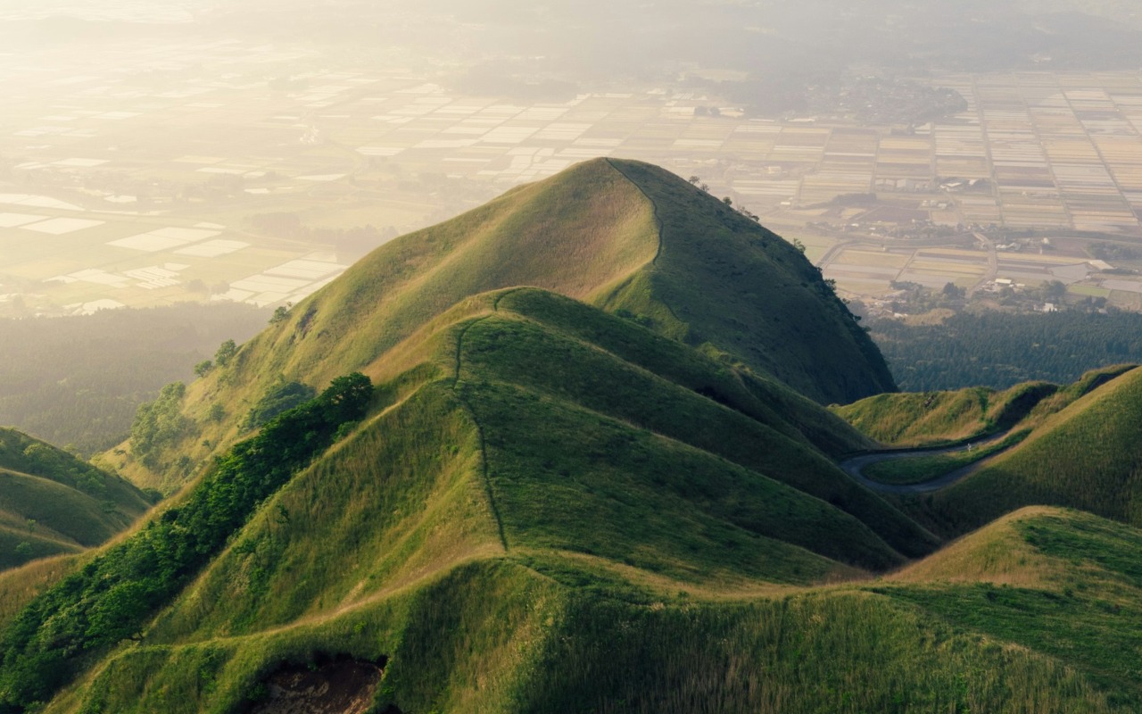
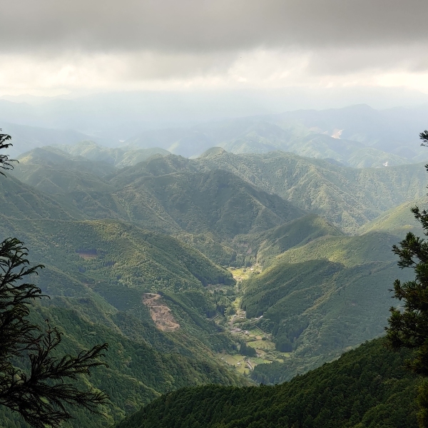
The two best spots to take a rest are at the peak of Hakkyogatake and Shakagatake, where you can enjoy the best views of the surrounding area.

After Jikyo no Shuku (1,052m), there are long sections of dense forests now that the elevation is lower than the first three days. During the first 10 kilometers of the day, you’ll pass the last two huts available on the trail. From this point forward only some sections for wild camping are available and getting a water refill is challenging.

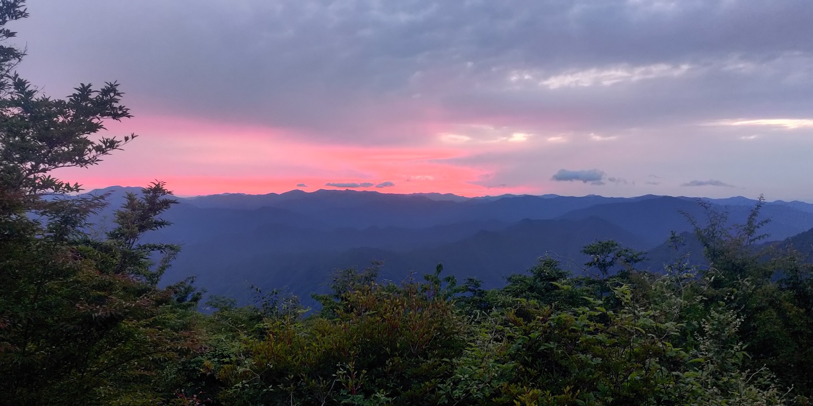
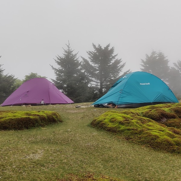
A great area to set up camp is close to the Observation tower before Tamaki Shrine. The sunset and views from the Observation tower are amazing.

On the last day, the first checkpoint is Mt.Tamaki, which is just 2 kilometers in, and then the second checkpoint is Tamaki Shrine just below the mountain on the other side. This is a great place for a final water refill.

Onward from Tamaki Shrine, the route is mainly in forested areas up until Hongu. When you arrive in Hongu, you’ll see the big Tori Gate and the beautiful sight of the village on the other side of the river. After this point, there are still a few small hills for 3.5 kilometers and then the route goes down next to the river and crosses over a bridge, the last section is 1.5 kilometers on the road in the village towards Kumano Hongu Taisha Shrine.

Stages

The route can be done in 5-8 days. An example itinerary for a 5-day you can find below.

Omine Okugakemichi itinerary

Stage 1:

Yoshino – Omine peak, 22 km | 13.7 mi

Stage 2:

Omine Peak – Misen Hut, 18.7 km | 11.6 mi

Stage 3:

Misen hut –  Jikyo no Shuku, 22.6 km | 14 mi

Stage 4:

Jikyo no Shuku – Tamakiyama Observation Deck, 22.7 km | 14 mi

Stage 5:

Tamakiyama Observation Deck – Taisha Hongu Shrine, 22.3 km | 13.9 mi

Accommodations

Manned huts are only found on Mount Omine (¥8,000 – ¥12,000 per night) just below the temple and on Mount Misen (¥7,000 for a futon inside or you can camp next to the hut at ¥1,000 PP, contact number for booking: 090-2223-1332), both require booking in advance.

For the rest of the hike, there are only wild camping spots, unmanned huts (some require a donation of ¥1,000-¥3,000 depending on the group taking care of them), and very few sheltered areas for setting up tents. Both in Hongu and Yoshino before starting or upon finishing the hike, you can book accommodation at an Onsen, as these are very popular in both villages.

The huts en route don’t have websites and can only be contacted via phone. The unmanned huts are taken care of by different groups and don’t require a booking.

The huts below the temple at Mount Omine and on top of Mount Misen might provide food and a water refill, however it is very important to carry enough food and water during the hike. These should be prepared before arriving in Yoshino or Hongu, depending on where you start, as both these villages’ mini-markets have a limited selection.

Hiking the route north to south after passing Misen Hut, there are only unreliable streams to refill water. Directly on the route to Tamaki Shrine, the only spot for a refill is just slightly off-trail near Jikyo No Shuku (400 meters off the trail). The other streams may be either unreliable or far off the main path, with many of the streams requiring to walk down in elevation for 20-30 minutes and back up to the main path. Going north from Hongu after passing the Tamaki Shrine there is the same issue. Carrying a water filtration system or water sterilization pills is highly recommended.

Accomodations Omine Okugakemichi

Stage 1:

Omine peak (stay at one several huts below the temple)

Stage 2:

Misen Hut (should be booked in advance, camping is also available next to the hut)

Stage 3:

Jikyo no Shuku (unmanned hut)

Stage 4:

Wild camping next to the Tamakiyama Observation Deck

Best time of the year

The best time to hike the Omine Okugakemichi route of the Kumano Kodo is during spring (March to May) and autumn (September to November), when the weather is mild, and the landscapes are at their most beautiful. In spring, hikers can enjoy the vibrant cherry blossoms and pleasant temperatures, while autumn brings stunning foliage with cooler, comfortable conditions. These seasons offer the ideal balance for tackling this rugged pilgrimage route. Summer is typically too hot and humid, with the risk of heavy rain, and winter can be cold with snow, making the trail more challenging.

Safety & Gear

In the area, bears and boars are very common, especially in recent years. A bear bell is recommended, and you can easily buy one once you arrive in Japan. Other animals might also cause harm, like giant hornets and poisonous snakes.

The route is marked with pink strings along the way. However, there are some areas where it would be easy to get lost if you don’t have a map or a GPS. Please do not attempt this trail in bad weather or with a bad forecast, as certain sections involve climbing and scrambling to the peak of mountains, with exposure over very slippery terrain.

Hiking poles are highly recommended for balance and to avoid knee strains.

Due to ticks and other insects in the area, together with sections of dense grass in the forests, it is highly recommended to wear clothes that will cover your legs and arms. Carrying insect repellent is also recommended.

Cell phone service is very limited and thus one might want to carry a satellite device or GPS tracker.

Good to know

The temple at the top of Mount Omine still bans women from entering the grounds, so any women attempting the route should go around Mount Omine. The route is slightly longer but with less elevation can be found on YapMap.

Even though UNESCO recognizes it as a world heritage pilgrimage, the official Kumano Travel organization hasn’t published much information about the hike, and the certificate for Kumano Kodo is not provided for this hike. This is because they don’t want to encourage inexperienced hikers to do it, as there is no easy way to exit in case of an emergency.

There is very little cell service along the hike, and you likely will not see many people either. Be ready for a solitary hike!

Want to submit a trail or make this page more complete?

Comments

Be the first one to comment on this trail!

Reply to this trail

Your email address will not be published. Required fields are marked *

Reply to this trail

Log in to comment on this trail
Always read the disclaimer

Terms of Use: important to all visitors on this website. We strive to publish high quality content and information on this website. However it’s always possible that we’re missing out on some crucial information. In spite of the fact that this route, associated GPS track (GPX and maps) were prepared under diligent research by the specified contributor and/or contributors, the accuracy of such and judgement of the author is not guaranteed. Therefore, hiking-trails.com and contributors are in no way liable for personal injury, damage to personal property, or any other such situation that might happen to individuals hiking or following this route. Should you choose to hike this trail, this is always at your own risk. Check out our guidelines for safety hiking and Leave No Trace principles at the hiking 101 page.

Download GPX

Join the community!

Login or create a FREE account 😊

With an account you can:

Download GPX files

Pin trails to your wishlist

Mark trails as hiked by you

Rate hiking trails

Comment on trails, blogs and gear reviews

Happy trails!
Login

Don't have an account yet? Register here